Harlem is a city in Columbia County, Georgia, United States. It is part of the Augusta metropolitan area. The population was 2,666 at the 2010 census, up from 1,814 in 2000. This city was named after the neighborhood in the borough of Manhattan. Harlem is the birthplace of comedian Oliver Hardy; the annual Harlem Oliver Hardy Festival is held on the first Saturday each October on Main Street in his honor.
| Name: | Harlem city |
|---|---|
| LSAD Code: | 25 |
| LSAD Description: | city (suffix) |
| State: | Georgia |
| County: | Columbia County |
| Elevation: | 554 ft (169 m) |
| Total Area: | 6.60 sq mi (17.11 km²) |
| Land Area: | 6.59 sq mi (17.06 km²) |
| Water Area: | 0.02 sq mi (0.04 km²) |
| Total Population: | 3,571 |
| Population Density: | 542.05/sq mi (209.28/km²) |
| ZIP code: | 30814 |
| Area code: | 706 |
| FIPS code: | 1336696 |
| GNISfeature ID: | 0331913 |
| Website: | harlemga.org |
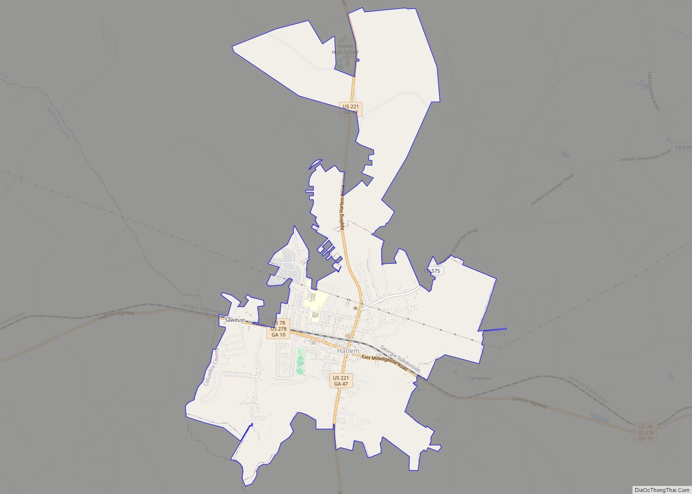
Online Interactive Map
Click on ![]() to view map in "full screen" mode.
to view map in "full screen" mode.
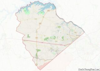
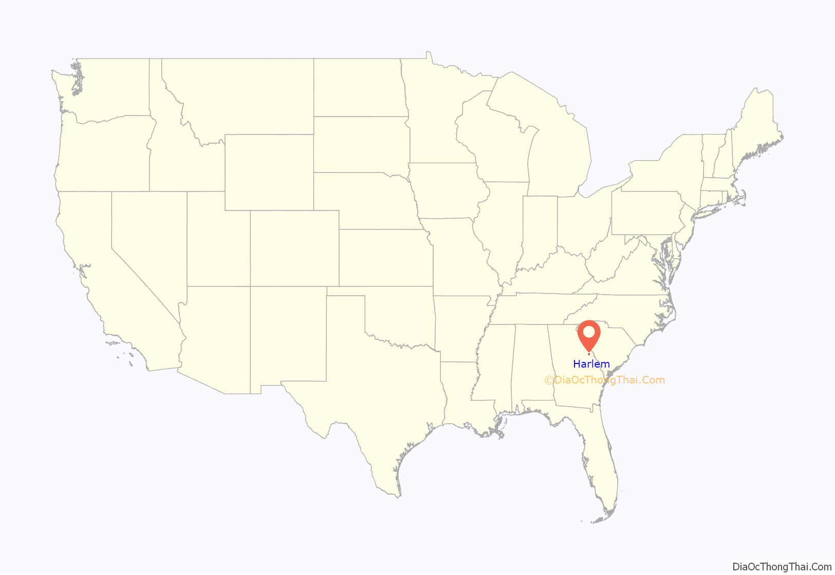
Harlem location map. Where is Harlem city?
History
From the building of the Georgia Railroad which passes through town until at least the 1860s, Harlem was known as Saw Dust. The town is twinned with Ulverston in England, the birthplace of Stan Laurel, the partner of Oliver Hardy.
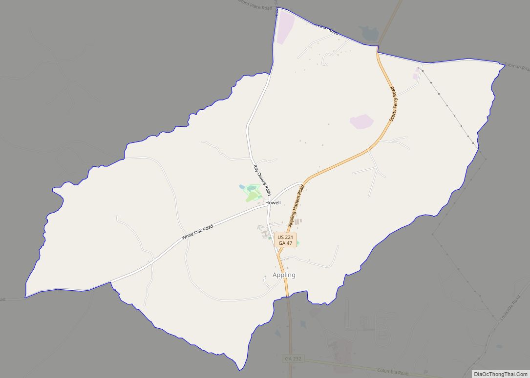
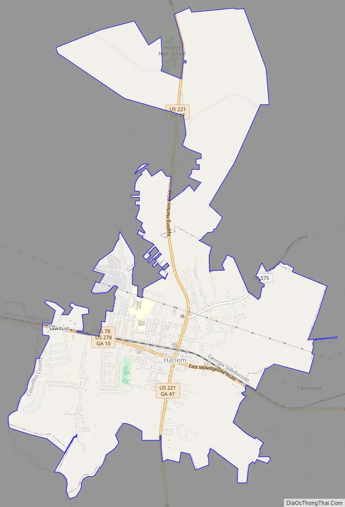
Harlem Road Map
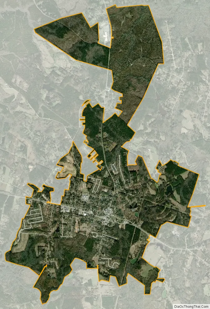
Harlem city Satellite Map
Geography
Harlem is located in southern Columbia County at 33°25′1″N 82°18′50″W / 33.41694°N 82.31389°W / 33.41694; -82.31389 (33.416822, -82.313762), with its western boundary following the McDuffie County line. U.S. Routes 78 and 278 pass through the center of town, leading east 23 miles (37 km) to downtown Augusta and west 12 miles (19 km) to Thomson. U.S. Route 221 crosses US 78/278 in the center of town, leading north 5 miles (8 km) to Interstate 20 and 21 miles (34 km) to the South Carolina border, and south 16 miles (26 km) to Wrens.
According to the United States Census Bureau, Harlem has a total area of 4.5 square miles (11.7 km), of which 0.02 square miles (0.04 km), or 0.36%, is water.
See also
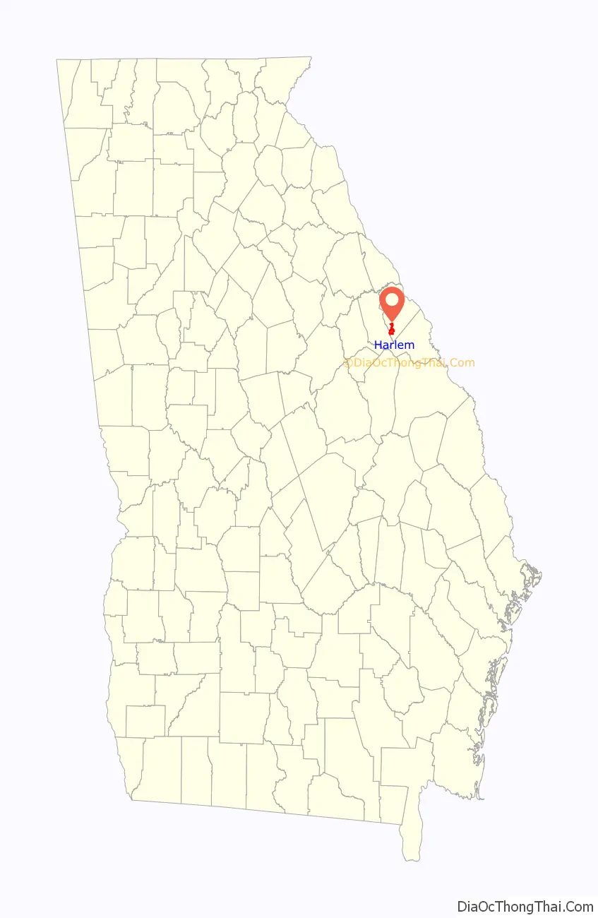
Map of Georgia State and its subdivision:- Appling
- Atkinson
- Bacon
- Baker
- Baldwin
- Banks
- Barrow
- Bartow
- Ben Hill
- Berrien
- Bibb
- Bleckley
- Brantley
- Brooks
- Bryan
- Bulloch
- Burke
- Butts
- Calhoun
- Camden
- Candler
- Carroll
- Catoosa
- Charlton
- Chatham
- Chattahoochee
- Chattooga
- Cherokee
- Clarke
- Clay
- Clayton
- Clinch
- Cobb
- Coffee
- Colquitt
- Columbia
- Cook
- Coweta
- Crawford
- Crisp
- Dade
- Dawson
- Decatur
- DeKalb
- Dodge
- Dooly
- Dougherty
- Douglas
- Early
- Echols
- Effingham
- Elbert
- Emanuel
- Evans
- Fannin
- Fayette
- Floyd
- Forsyth
- Franklin
- Fulton
- Gilmer
- Glascock
- Glynn
- Gordon
- Grady
- Greene
- Gwinnett
- Habersham
- Hall
- Hancock
- Haralson
- Harris
- Hart
- Heard
- Henry
- Houston
- Irwin
- Jackson
- Jasper
- Jeff Davis
- Jefferson
- Jenkins
- Johnson
- Jones
- Lamar
- Lanier
- Laurens
- Lee
- Liberty
- Lincoln
- Long
- Lowndes
- Lumpkin
- Macon
- Madison
- Marion
- McDuffie
- McIntosh
- Meriwether
- Miller
- Mitchell
- Monroe
- Montgomery
- Morgan
- Murray
- Muscogee
- Newton
- Oconee
- Oglethorpe
- Paulding
- Peach
- Pickens
- Pierce
- Pike
- Polk
- Pulaski
- Putnam
- Quitman
- Rabun
- Randolph
- Richmond
- Rockdale
- Schley
- Screven
- Seminole
- Spalding
- Stephens
- Stewart
- Sumter
- Talbot
- Taliaferro
- Tattnall
- Taylor
- Telfair
- Terrell
- Thomas
- Tift
- Toombs
- Towns
- Treutlen
- Troup
- Turner
- Twiggs
- Union
- Upson
- Walker
- Walton
- Ware
- Warren
- Washington
- Wayne
- Webster
- Wheeler
- White
- Whitfield
- Wilcox
- Wilkes
- Wilkinson
- Worth
- Alabama
- Alaska
- Arizona
- Arkansas
- California
- Colorado
- Connecticut
- Delaware
- District of Columbia
- Florida
- Georgia
- Hawaii
- Idaho
- Illinois
- Indiana
- Iowa
- Kansas
- Kentucky
- Louisiana
- Maine
- Maryland
- Massachusetts
- Michigan
- Minnesota
- Mississippi
- Missouri
- Montana
- Nebraska
- Nevada
- New Hampshire
- New Jersey
- New Mexico
- New York
- North Carolina
- North Dakota
- Ohio
- Oklahoma
- Oregon
- Pennsylvania
- Rhode Island
- South Carolina
- South Dakota
- Tennessee
- Texas
- Utah
- Vermont
- Virginia
- Washington
- West Virginia
- Wisconsin
- Wyoming