Martinez (/ˌmɑːrtɪˈnɛz/ MAR-TI-NEZ) is a census-designated place (CDP) in Columbia County, Georgia, United States. It is a northwestern suburb of Augusta and is part of the Augusta, Georgia metropolitan area. The population was 34,535 at the 2020 census.
| Name: | Martinez CDP |
|---|---|
| LSAD Code: | 57 |
| LSAD Description: | CDP (suffix) |
| State: | Georgia |
| County: | Columbia County |
| Elevation: | 361 ft (110 m) |
| Total Area: | 14.62 sq mi (37.86 km²) |
| Land Area: | 14.51 sq mi (37.57 km²) |
| Water Area: | 0.11 sq mi (0.29 km²) |
| Total Population: | 34,535 |
| Population Density: | 2,380.74/sq mi (919.22/km²) |
| ZIP code: | 30907 |
| Area code: | 706 |
| FIPS code: | 1350036 |
| GNISfeature ID: | 0332326 |
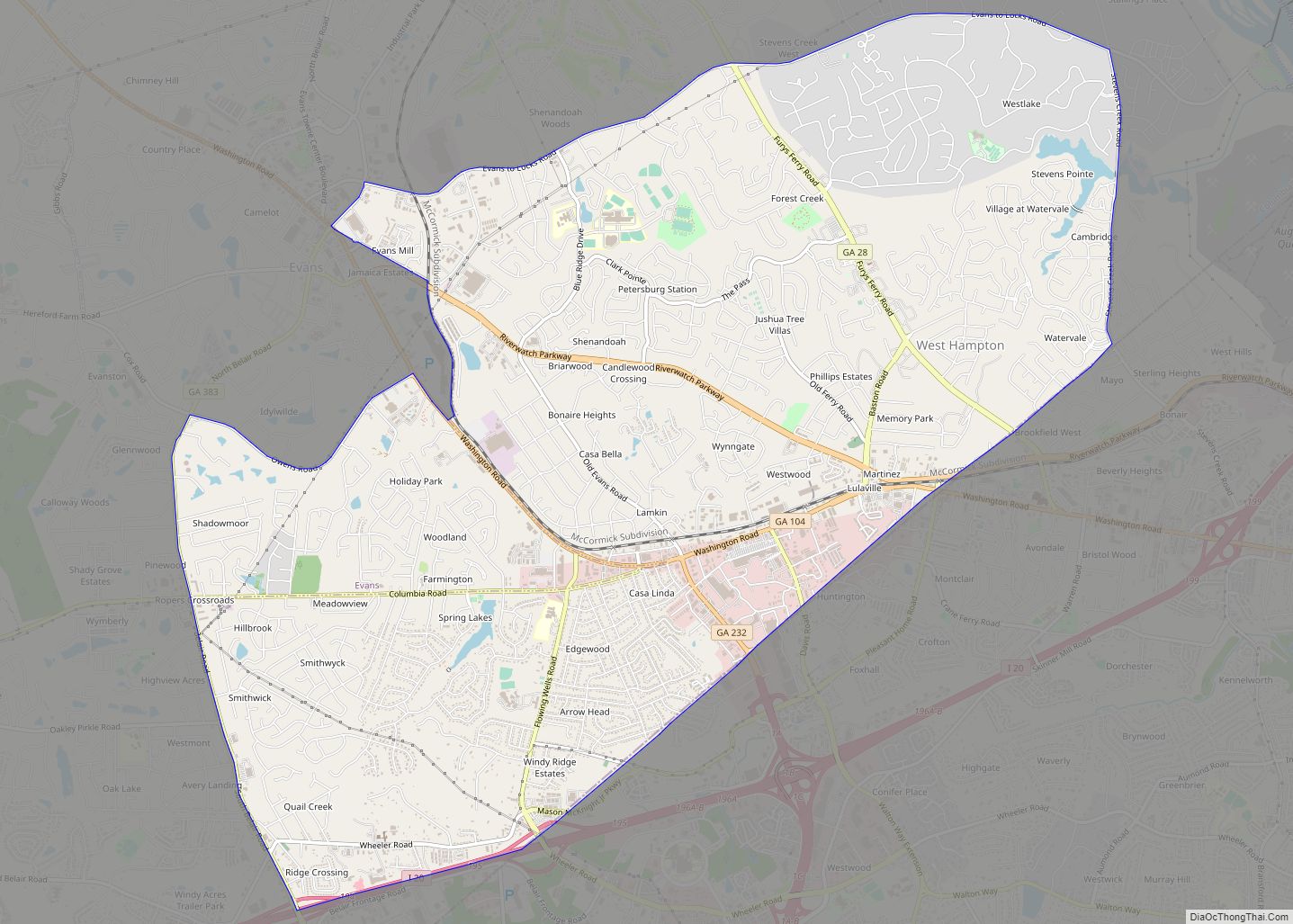
Online Interactive Map
Click on ![]() to view map in "full screen" mode.
to view map in "full screen" mode.
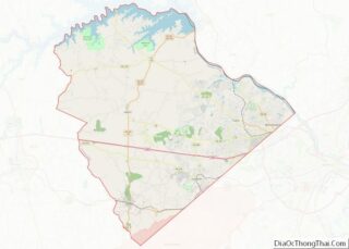
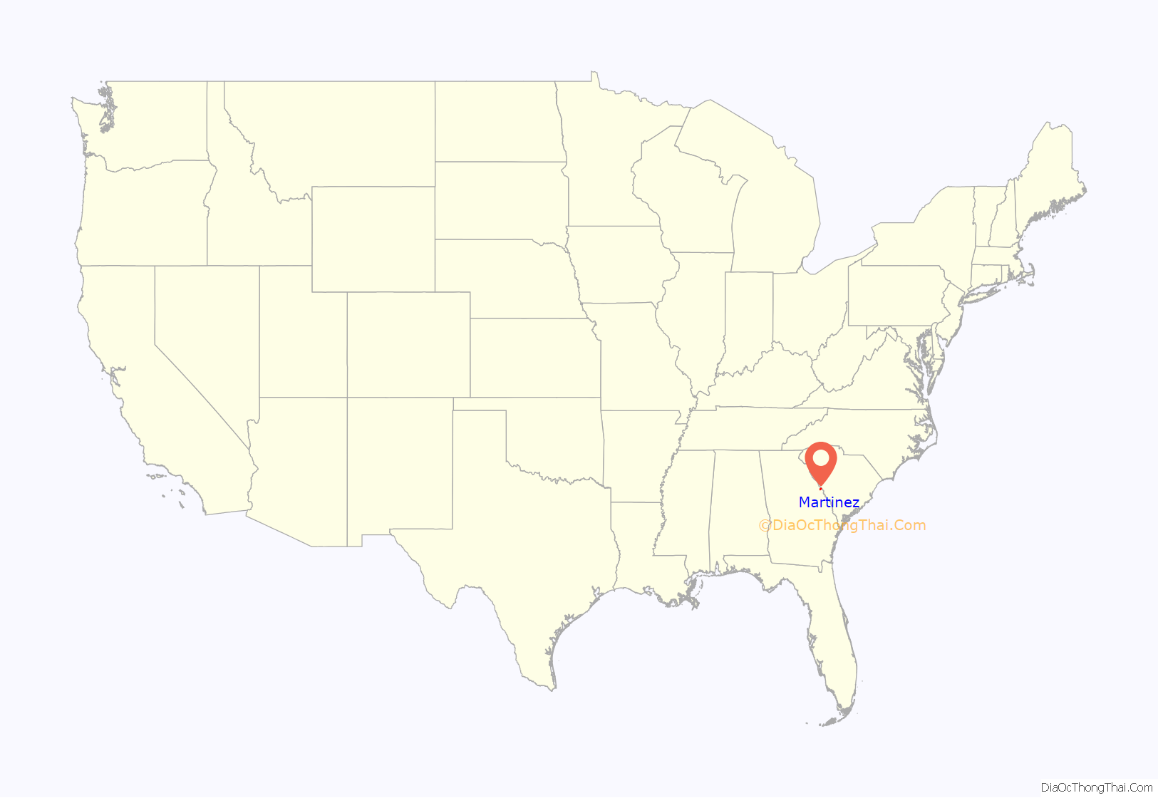
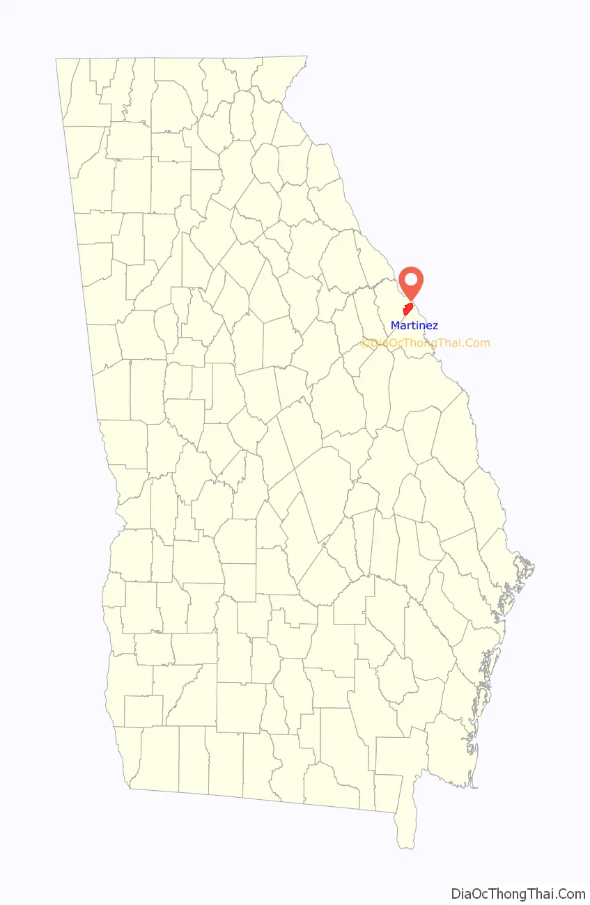
Martinez location map. Where is Martinez CDP?
History
The founder was José Martínez y Saldivar, a wealthy man from Cuba. He bought a plantation in Columbia County in 1869 and named it El Cordero Rancho (“The Lamb Ranch”). He wanted to be an American soldier. He ended up having four daughters who married very wealthy men, one being a Dr. Perrin who died around 1940. El Cordero Ranch is now only 20 acres (8.1 ha) in size. His old home (hacienda) and several buildings, barns and a water tower original to the property still stand at 3654 Old Ferry Road.
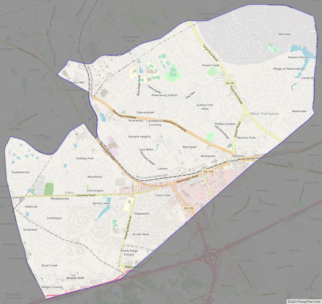
Martinez Road Map
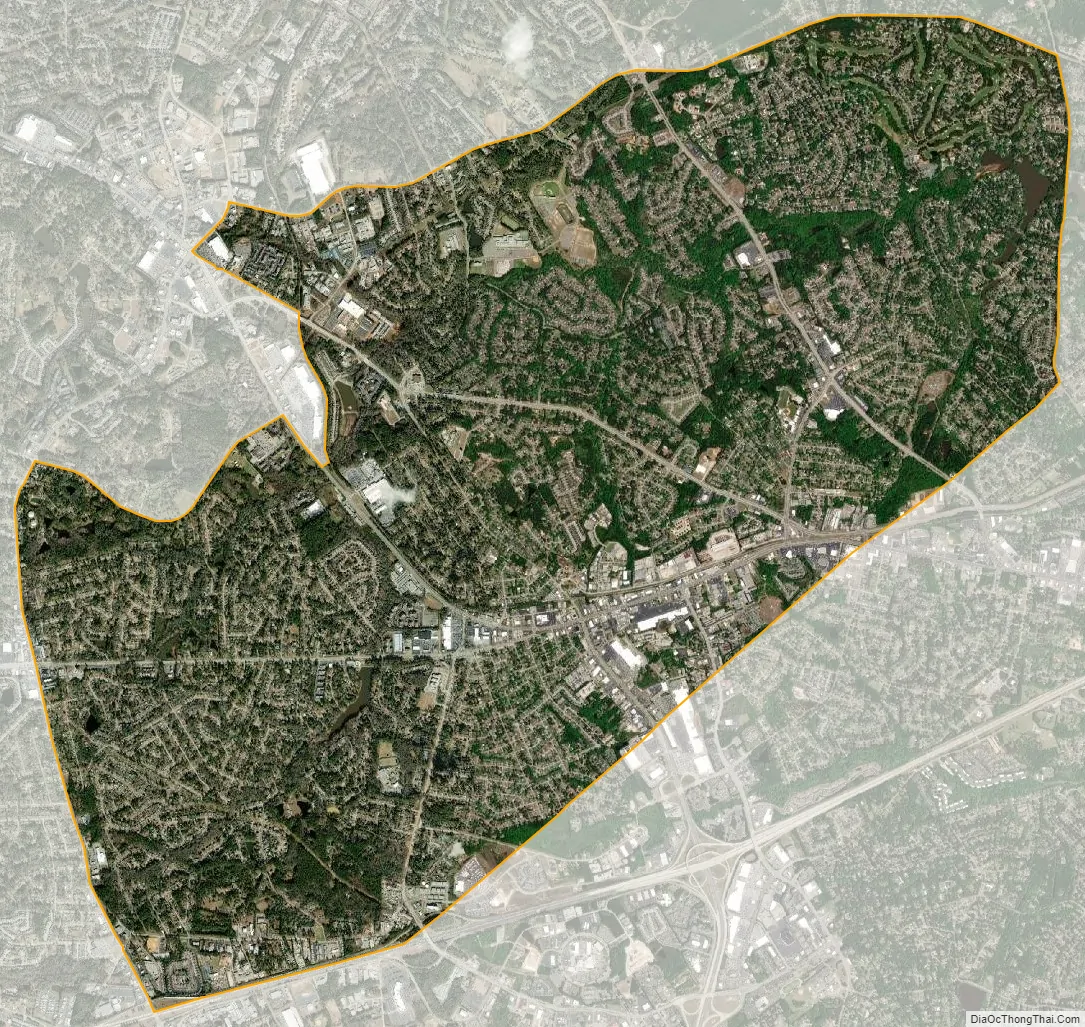
Martinez city Satellite Map
Geography
Martinez is located in eastern Columbia County at 33°30′58″N 82°6′0″W / 33.51611°N 82.10000°W / 33.51611; -82.10000 (33.516089, -82.100024). It is bordered to the southeast by the city of Augusta in Richmond County. To the north and northwest is the CDP of Evans. Interstate 20 forms the short southern boundary of Martinez, with access from Exits 194 (Georgia State Route 383/South Belair Road) and 195 (Wheeler Road).
According to the United States Census Bureau, the CDP has a total area of 14.6 square miles (37.9 km), of which 14.5 square miles (37.6 km) is land and 0.12 square miles (0.3 km), or 0.76%, is water.
Martinez has an elevation of 361 feet (110 m) above sea level, about 200 feet (61 m) higher than downtown Augusta. The areas of the CDP closest to the Richmond County line tend to be relatively flat, while land further west is hillier. Trees in Martinez are seen mainly in the subdivisions, as the main roads are crowded with businesses. They include pine, oak, sweet gum, hickory, and a variety of other species.
See also
Map of Georgia State and its subdivision:- Appling
- Atkinson
- Bacon
- Baker
- Baldwin
- Banks
- Barrow
- Bartow
- Ben Hill
- Berrien
- Bibb
- Bleckley
- Brantley
- Brooks
- Bryan
- Bulloch
- Burke
- Butts
- Calhoun
- Camden
- Candler
- Carroll
- Catoosa
- Charlton
- Chatham
- Chattahoochee
- Chattooga
- Cherokee
- Clarke
- Clay
- Clayton
- Clinch
- Cobb
- Coffee
- Colquitt
- Columbia
- Cook
- Coweta
- Crawford
- Crisp
- Dade
- Dawson
- Decatur
- DeKalb
- Dodge
- Dooly
- Dougherty
- Douglas
- Early
- Echols
- Effingham
- Elbert
- Emanuel
- Evans
- Fannin
- Fayette
- Floyd
- Forsyth
- Franklin
- Fulton
- Gilmer
- Glascock
- Glynn
- Gordon
- Grady
- Greene
- Gwinnett
- Habersham
- Hall
- Hancock
- Haralson
- Harris
- Hart
- Heard
- Henry
- Houston
- Irwin
- Jackson
- Jasper
- Jeff Davis
- Jefferson
- Jenkins
- Johnson
- Jones
- Lamar
- Lanier
- Laurens
- Lee
- Liberty
- Lincoln
- Long
- Lowndes
- Lumpkin
- Macon
- Madison
- Marion
- McDuffie
- McIntosh
- Meriwether
- Miller
- Mitchell
- Monroe
- Montgomery
- Morgan
- Murray
- Muscogee
- Newton
- Oconee
- Oglethorpe
- Paulding
- Peach
- Pickens
- Pierce
- Pike
- Polk
- Pulaski
- Putnam
- Quitman
- Rabun
- Randolph
- Richmond
- Rockdale
- Schley
- Screven
- Seminole
- Spalding
- Stephens
- Stewart
- Sumter
- Talbot
- Taliaferro
- Tattnall
- Taylor
- Telfair
- Terrell
- Thomas
- Tift
- Toombs
- Towns
- Treutlen
- Troup
- Turner
- Twiggs
- Union
- Upson
- Walker
- Walton
- Ware
- Warren
- Washington
- Wayne
- Webster
- Wheeler
- White
- Whitfield
- Wilcox
- Wilkes
- Wilkinson
- Worth
- Alabama
- Alaska
- Arizona
- Arkansas
- California
- Colorado
- Connecticut
- Delaware
- District of Columbia
- Florida
- Georgia
- Hawaii
- Idaho
- Illinois
- Indiana
- Iowa
- Kansas
- Kentucky
- Louisiana
- Maine
- Maryland
- Massachusetts
- Michigan
- Minnesota
- Mississippi
- Missouri
- Montana
- Nebraska
- Nevada
- New Hampshire
- New Jersey
- New Mexico
- New York
- North Carolina
- North Dakota
- Ohio
- Oklahoma
- Oregon
- Pennsylvania
- Rhode Island
- South Carolina
- South Dakota
- Tennessee
- Texas
- Utah
- Vermont
- Virginia
- Washington
- West Virginia
- Wisconsin
- Wyoming