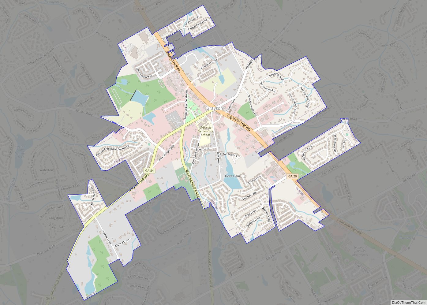
Grayson is a city in Gwinnett County, Georgia, United States. The 2020 estimated population of Grayson, GA is 4740 people. The population was 2,666 at the 2010 census, up from 765 in 2000.
| Name: | Grayson city |
|---|---|
| LSAD Code: | 25 |
| LSAD Description: | city (suffix) |
| State: | Georgia |
| County: | Gwinnett County |
| Elevation: | 1,079 ft (329 m) |
| Total Area: | 2.57 sq mi (6.66 km²) |
| Land Area: | 2.51 sq mi (6.50 km²) |
| Water Area: | 0.06 sq mi (0.16 km²) |
| Total Population: | 4,730 |
| Population Density: | 1,884.46/sq mi (727.70/km²) |
| ZIP code: | 30017 |
| Area code: | 770 |
| FIPS code: | 1334596 |
| GNISfeature ID: | 2403733 |
| Website: | www.cityofgrayson.org |
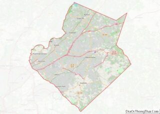
Online Interactive Map
Click on ![]() to view map in "full screen" mode.
to view map in "full screen" mode.
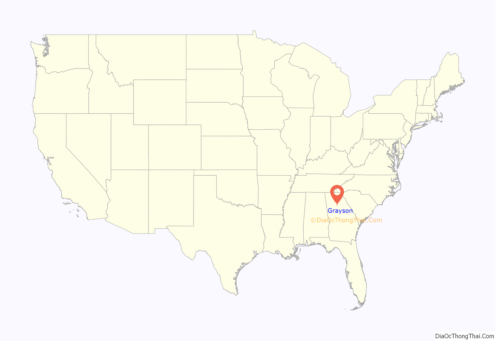
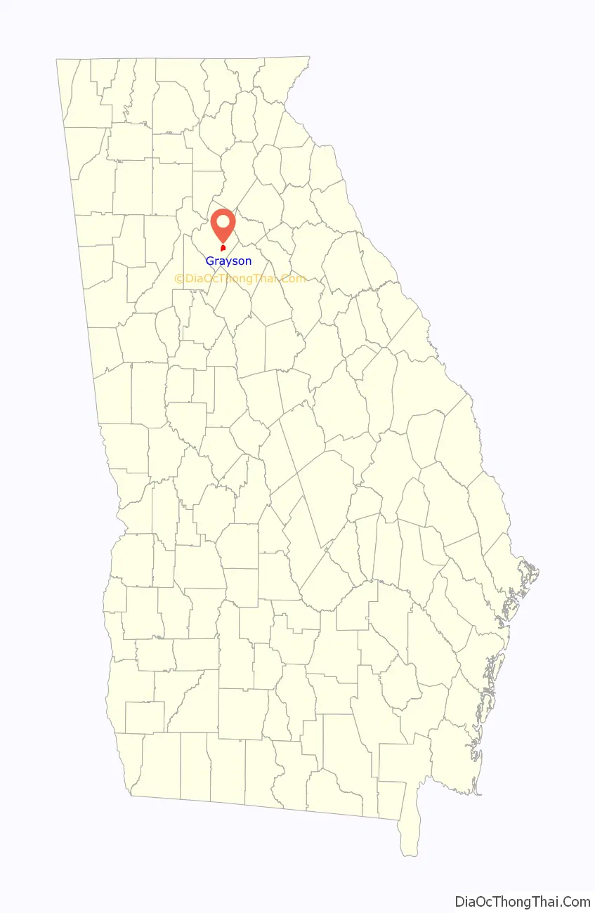
Grayson location map. Where is Grayson city?
History
The city of Grayson was first called Trip. In 1901, John Ellery Jacobs, the postmaster and civic leader, wrote to the post office department requesting that Trip, Georgia be changed to Berkley, Georgia. On December 6, 1901, the General Assembly of Georgia approved an act to incorporate the town and change the name. Shortly after, Ellery Jacobs was notified that there was already a Berkley, Georgia. He then suggested Graymount (because there was a clear view of Stone Mountain), but it was also taken. He then suggested the name of Grayson, Georgia.
Grayson Road Map
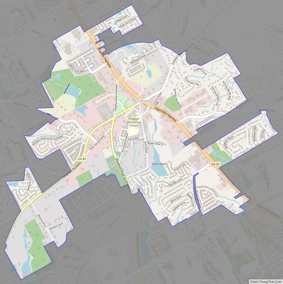
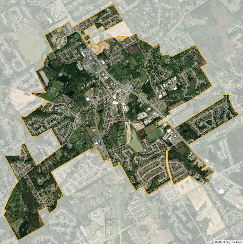
Grayson city Satellite Map
Geography
Grayson is located southeast of the center of Gwinnett County at 33°53′36″N 83°57′20″W / 33.89333°N 83.95556°W / 33.89333; -83.95556 (33.893306, -83.955420). Georgia State Route 20 is the main highway through town, leading north 5 miles (8 km) into Lawrenceville, the county seat, and southeast five miles to Loganville. Georgia State Route 84 (Grayson Parkway) leads southwest five miles to Snellville. According to the United States Census Bureau, the city has a total area of 2.53 square miles (6.55 km), of which 2.47 square miles (6.40 km) is land and 0.06 square miles (0.15 km), or 2.30%, is water.
Grayson suffered a damaging tornado on June 27, 1994, killing a 10-year-old girl. The city has been benefitting from exurban growth in eastern Gwinnett County, especially in the late 1990s and through the 2000s.
See also
Map of Georgia State and its subdivision:- Appling
- Atkinson
- Bacon
- Baker
- Baldwin
- Banks
- Barrow
- Bartow
- Ben Hill
- Berrien
- Bibb
- Bleckley
- Brantley
- Brooks
- Bryan
- Bulloch
- Burke
- Butts
- Calhoun
- Camden
- Candler
- Carroll
- Catoosa
- Charlton
- Chatham
- Chattahoochee
- Chattooga
- Cherokee
- Clarke
- Clay
- Clayton
- Clinch
- Cobb
- Coffee
- Colquitt
- Columbia
- Cook
- Coweta
- Crawford
- Crisp
- Dade
- Dawson
- Decatur
- DeKalb
- Dodge
- Dooly
- Dougherty
- Douglas
- Early
- Echols
- Effingham
- Elbert
- Emanuel
- Evans
- Fannin
- Fayette
- Floyd
- Forsyth
- Franklin
- Fulton
- Gilmer
- Glascock
- Glynn
- Gordon
- Grady
- Greene
- Gwinnett
- Habersham
- Hall
- Hancock
- Haralson
- Harris
- Hart
- Heard
- Henry
- Houston
- Irwin
- Jackson
- Jasper
- Jeff Davis
- Jefferson
- Jenkins
- Johnson
- Jones
- Lamar
- Lanier
- Laurens
- Lee
- Liberty
- Lincoln
- Long
- Lowndes
- Lumpkin
- Macon
- Madison
- Marion
- McDuffie
- McIntosh
- Meriwether
- Miller
- Mitchell
- Monroe
- Montgomery
- Morgan
- Murray
- Muscogee
- Newton
- Oconee
- Oglethorpe
- Paulding
- Peach
- Pickens
- Pierce
- Pike
- Polk
- Pulaski
- Putnam
- Quitman
- Rabun
- Randolph
- Richmond
- Rockdale
- Schley
- Screven
- Seminole
- Spalding
- Stephens
- Stewart
- Sumter
- Talbot
- Taliaferro
- Tattnall
- Taylor
- Telfair
- Terrell
- Thomas
- Tift
- Toombs
- Towns
- Treutlen
- Troup
- Turner
- Twiggs
- Union
- Upson
- Walker
- Walton
- Ware
- Warren
- Washington
- Wayne
- Webster
- Wheeler
- White
- Whitfield
- Wilcox
- Wilkes
- Wilkinson
- Worth
- Alabama
- Alaska
- Arizona
- Arkansas
- California
- Colorado
- Connecticut
- Delaware
- District of Columbia
- Florida
- Georgia
- Hawaii
- Idaho
- Illinois
- Indiana
- Iowa
- Kansas
- Kentucky
- Louisiana
- Maine
- Maryland
- Massachusetts
- Michigan
- Minnesota
- Mississippi
- Missouri
- Montana
- Nebraska
- Nevada
- New Hampshire
- New Jersey
- New Mexico
- New York
- North Carolina
- North Dakota
- Ohio
- Oklahoma
- Oregon
- Pennsylvania
- Rhode Island
- South Carolina
- South Dakota
- Tennessee
- Texas
- Utah
- Vermont
- Virginia
- Washington
- West Virginia
- Wisconsin
- Wyoming