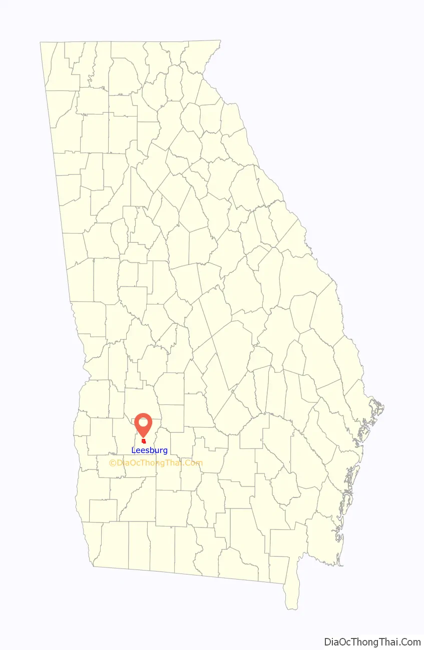
Leesburg is a city in Lee County, Georgia, United States. The population was 3,480 at the 2020 census, up from 2,896 at the 2010 census. The city is the county seat of Lee County and is part of the Albany, Georgia Metropolitan Statistical Area.
| Name: | Leesburg city |
|---|---|
| LSAD Code: | 25 |
| LSAD Description: | city (suffix) |
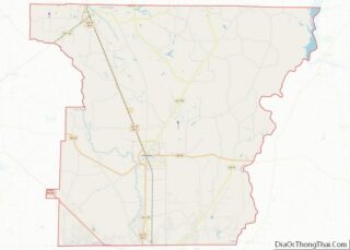
| State: | Georgia |
| County: | Lee County |
| Elevation: | 259 ft (79 m) |
| Total Area: | 4.96 sq mi (12.86 km²) |
| Land Area: | 4.91 sq mi (12.72 km²) |
| Water Area: | 0.05 sq mi (0.14 km²) |
| Total Population: | 3,480 |
| Population Density: | 708.47/sq mi (273.52/km²) |
| ZIP code: | 31763 |
| Area code: | 229 |
| FIPS code: | 1345768 |
| GNISfeature ID: | 0356352 |
| Website: | cityofleesburgga.com |
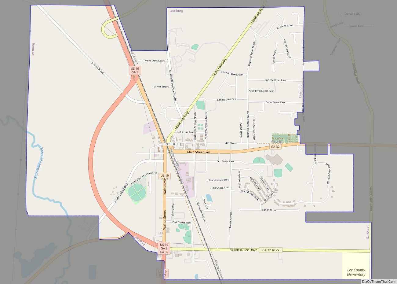
Online Interactive Map
Click on ![]() to view map in "full screen" mode.
to view map in "full screen" mode.
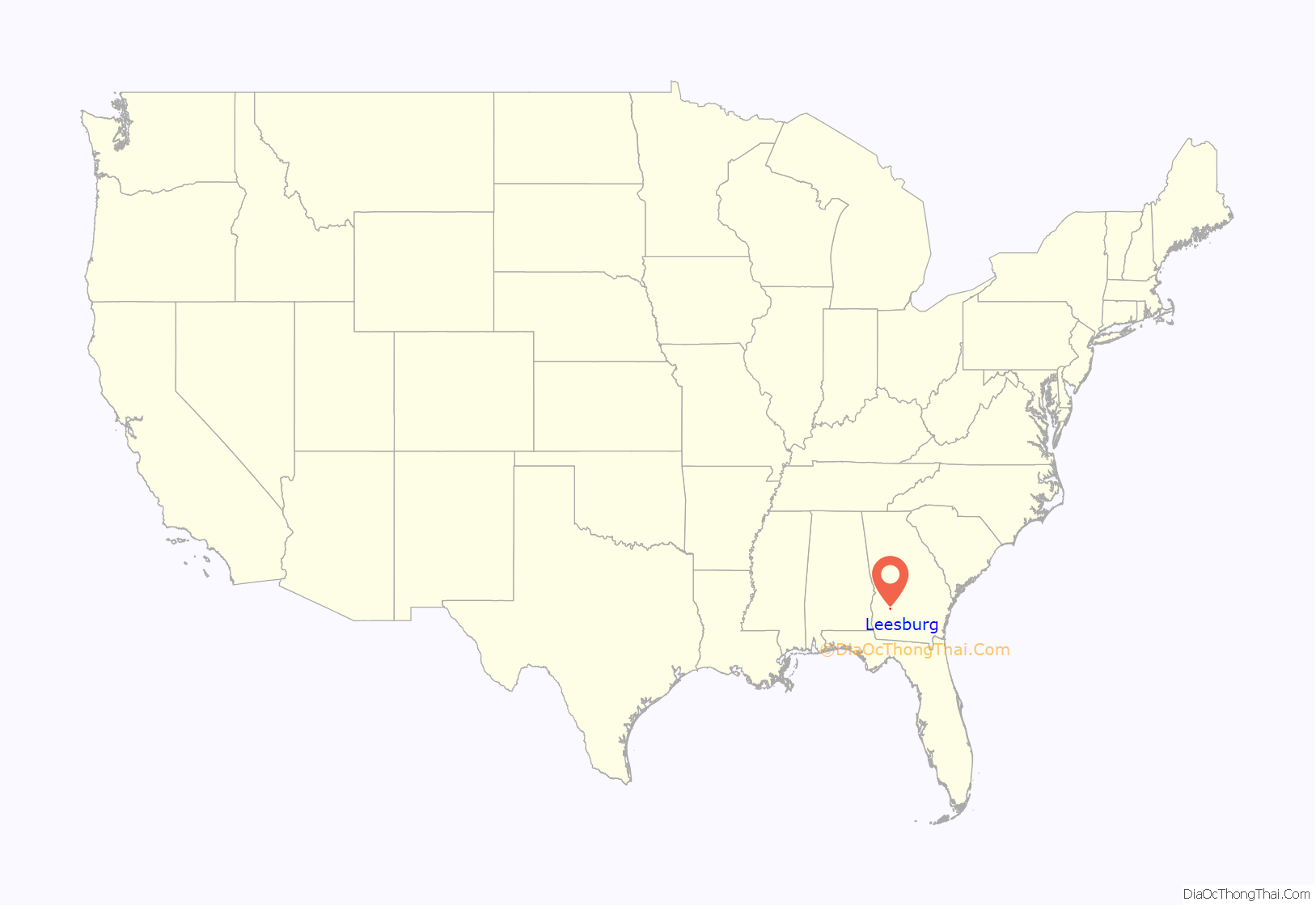
Leesburg location map. Where is Leesburg city?
History
Leesburg, originally known as “Wooten Station”, was founded in 1870 as the Central of Georgia Railway arrived in the area. In 1872, the town was renamed “Wooten”, and the seat was transferred from Starksville. In 1874, the town was incorporated and renamed again to its present form of Leesburg.
Leesburg is the site of the Leesburg Stockade incident, in which a group of African-American teenage and pre-teen girls were arrested for protesting racial segregation in Americus, Georgia, and were imprisoned without charges for 45 days in poor conditions in the Lee County Public Works building.
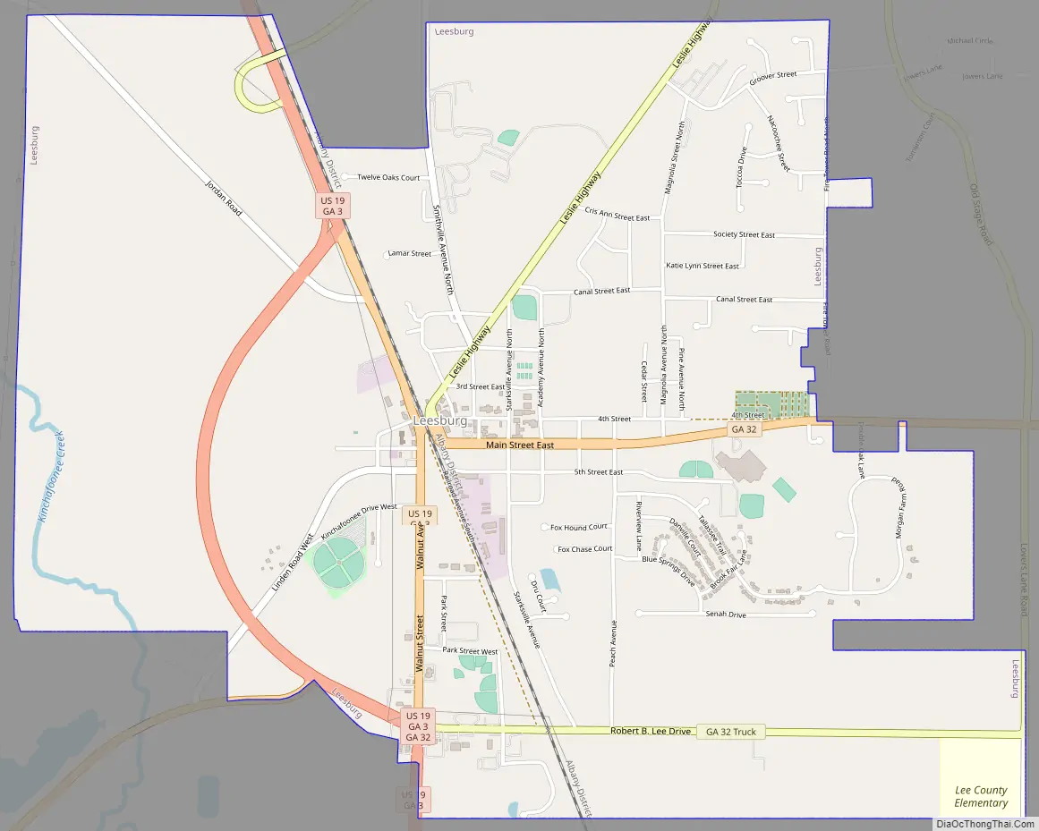
Leesburg Road Map
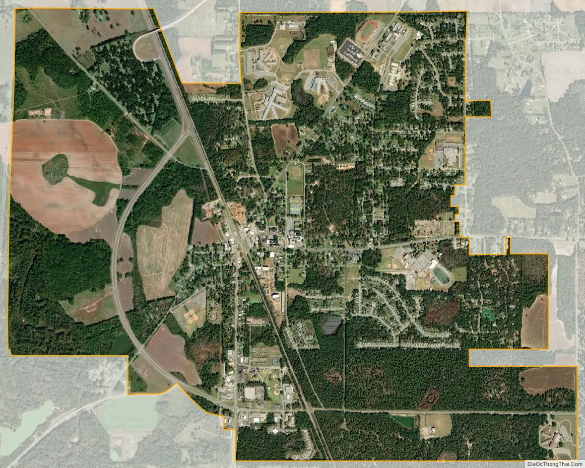
Leesburg city Satellite Map
Geography
Leesburg is in south-central Lee County. U.S. Route 19 passes through the city, leading north 26 miles (42 km) to Americus and south 11 miles (18 km) to Albany. State Route 32 is Leesburg’s Main Street; it leads east 32 miles (51 km) to Ashburn and west 18 miles (29 km) to Dawson. State Route 195 leads northeast from Leesburg 17 miles (27 km) to Leslie.
According to the United States Census Bureau, Leesburg has a total area of 5.0 square miles (12.9 km), of which 0.05 square miles (0.14 km), or 1.06%, are water. Kinchafoonee Creek flows through a western corner of the city; it leads south to the Flint River, part of the Apalachicola River watershed.
See also
Map of Georgia State and its subdivision:- Appling
- Atkinson
- Bacon
- Baker
- Baldwin
- Banks
- Barrow
- Bartow
- Ben Hill
- Berrien
- Bibb
- Bleckley
- Brantley
- Brooks
- Bryan
- Bulloch
- Burke
- Butts
- Calhoun
- Camden
- Candler
- Carroll
- Catoosa
- Charlton
- Chatham
- Chattahoochee
- Chattooga
- Cherokee
- Clarke
- Clay
- Clayton
- Clinch
- Cobb
- Coffee
- Colquitt
- Columbia
- Cook
- Coweta
- Crawford
- Crisp
- Dade
- Dawson
- Decatur
- DeKalb
- Dodge
- Dooly
- Dougherty
- Douglas
- Early
- Echols
- Effingham
- Elbert
- Emanuel
- Evans
- Fannin
- Fayette
- Floyd
- Forsyth
- Franklin
- Fulton
- Gilmer
- Glascock
- Glynn
- Gordon
- Grady
- Greene
- Gwinnett
- Habersham
- Hall
- Hancock
- Haralson
- Harris
- Hart
- Heard
- Henry
- Houston
- Irwin
- Jackson
- Jasper
- Jeff Davis
- Jefferson
- Jenkins
- Johnson
- Jones
- Lamar
- Lanier
- Laurens
- Lee
- Liberty
- Lincoln
- Long
- Lowndes
- Lumpkin
- Macon
- Madison
- Marion
- McDuffie
- McIntosh
- Meriwether
- Miller
- Mitchell
- Monroe
- Montgomery
- Morgan
- Murray
- Muscogee
- Newton
- Oconee
- Oglethorpe
- Paulding
- Peach
- Pickens
- Pierce
- Pike
- Polk
- Pulaski
- Putnam
- Quitman
- Rabun
- Randolph
- Richmond
- Rockdale
- Schley
- Screven
- Seminole
- Spalding
- Stephens
- Stewart
- Sumter
- Talbot
- Taliaferro
- Tattnall
- Taylor
- Telfair
- Terrell
- Thomas
- Tift
- Toombs
- Towns
- Treutlen
- Troup
- Turner
- Twiggs
- Union
- Upson
- Walker
- Walton
- Ware
- Warren
- Washington
- Wayne
- Webster
- Wheeler
- White
- Whitfield
- Wilcox
- Wilkes
- Wilkinson
- Worth
- Alabama
- Alaska
- Arizona
- Arkansas
- California
- Colorado
- Connecticut
- Delaware
- District of Columbia
- Florida
- Georgia
- Hawaii
- Idaho
- Illinois
- Indiana
- Iowa
- Kansas
- Kentucky
- Louisiana
- Maine
- Maryland
- Massachusetts
- Michigan
- Minnesota
- Mississippi
- Missouri
- Montana
- Nebraska
- Nevada
- New Hampshire
- New Jersey
- New Mexico
- New York
- North Carolina
- North Dakota
- Ohio
- Oklahoma
- Oregon
- Pennsylvania
- Rhode Island
- South Carolina
- South Dakota
- Tennessee
- Texas
- Utah
- Vermont
- Virginia
- Washington
- West Virginia
- Wisconsin
- Wyoming