Pine Lake is the smallest city in DeKalb County, Georgia, United States. The population was 752 at the 2020 census.
| Name: | Pine Lake city |
|---|---|
| LSAD Code: | 25 |
| LSAD Description: | city (suffix) |
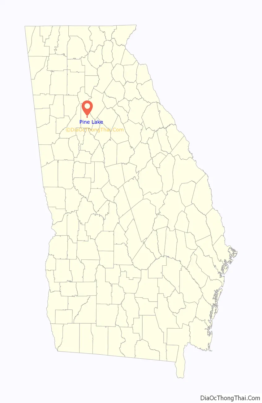
| State: | Georgia |
| County: | DeKalb County |
| Elevation: | 948 ft (289 m) |
| Total Area: | 0.25 sq mi (0.66 km²) |
| Land Area: | 0.24 sq mi (0.61 km²) |
| Water Area: | 0.02 sq mi (0.04 km²) |
| Total Population: | 752 |
| Population Density: | 3,173.00/sq mi (1,223.94/km²) |
| ZIP code: | 30072 |
| Area code: | 404 |
| FIPS code: | 1361040 |
| GNISfeature ID: | 0332672 |
| Website: | pinelakega.net |
Online Interactive Map
Click on ![]() to view map in "full screen" mode.
to view map in "full screen" mode.
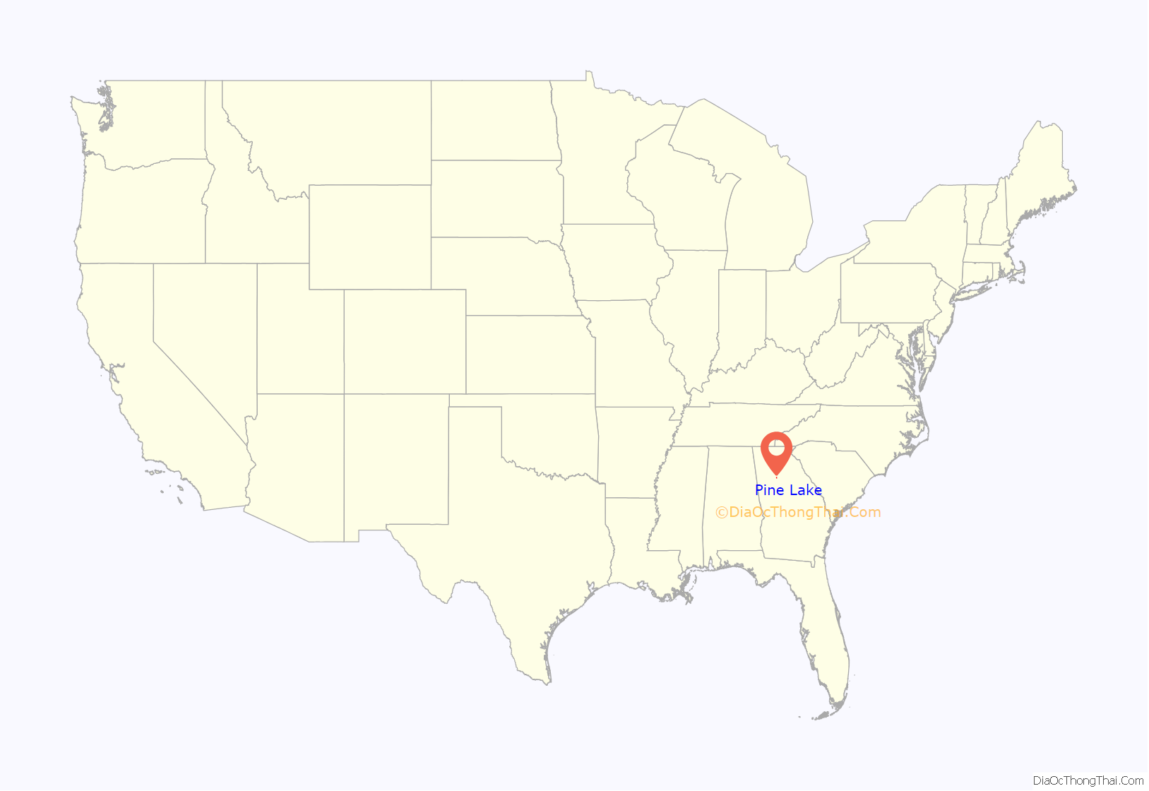
Pine Lake location map. Where is Pine Lake city?
History
Pine Lake was established as a city in December 1937, after a short life as a summer retreat run by the Pine Woods Corporation. The corporation sold lots around a small fishing lake to Atlantans who lived in (then) faraway areas like Buckhead for use as a weekend retreat. The 20′ x 100′ lots sold for $69, and the advertisement for lots directed people “from Decatur down the [unpaved] Rockbridge Road East.” Many homeowners continued to use their property as a weekend getaway long after the city incorporated. Prior to development, Pine Lake was a portion of a farm. The lake was formerly a widened region of Snapfinger Creek, and the valley that encompasses much of the town was where corn was grown. The lake was dammed by the Army Corps of Engineers as erosion and flood control, prior to the official FDR lake projects.
Pine Lake Road Map
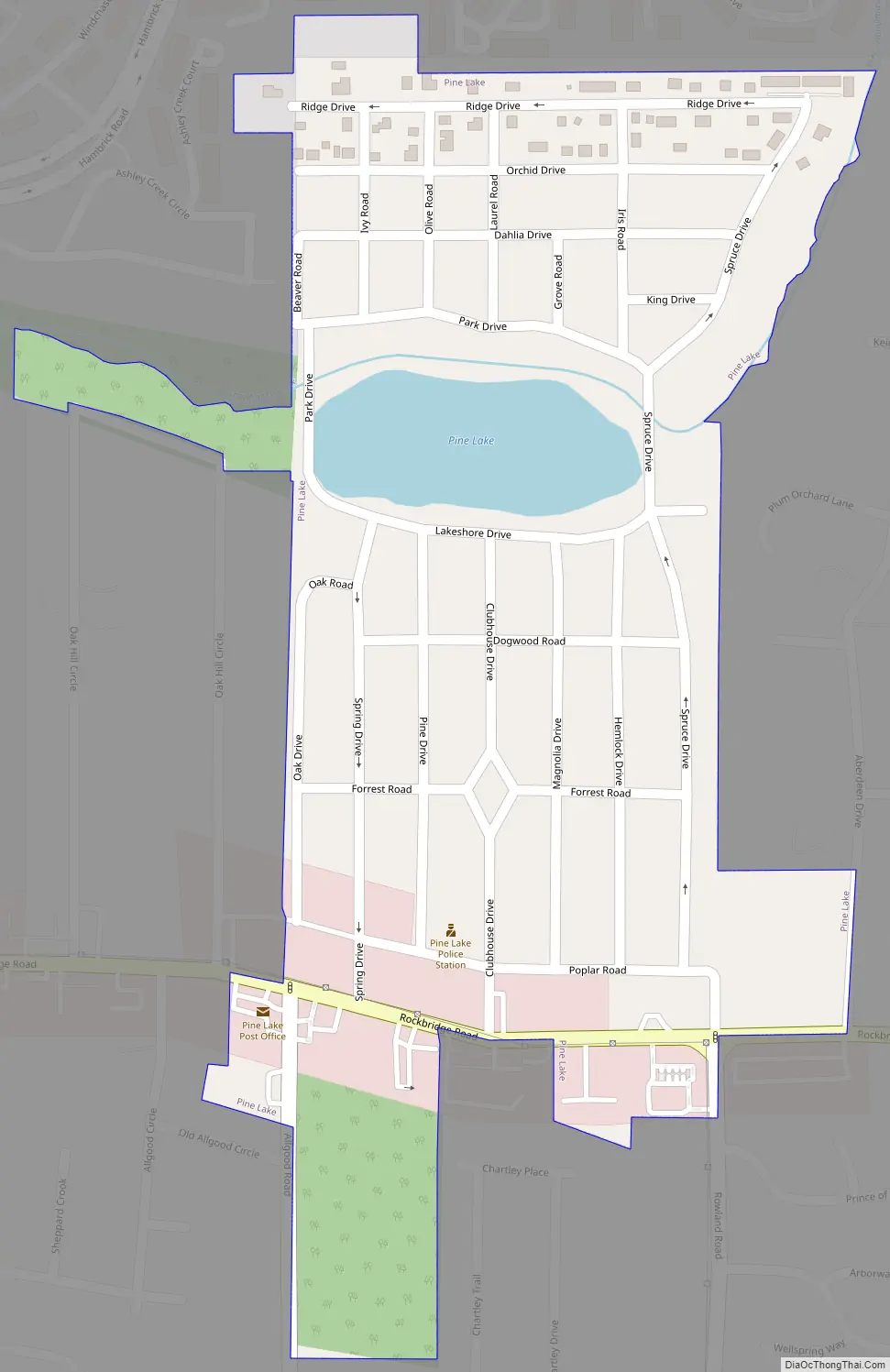
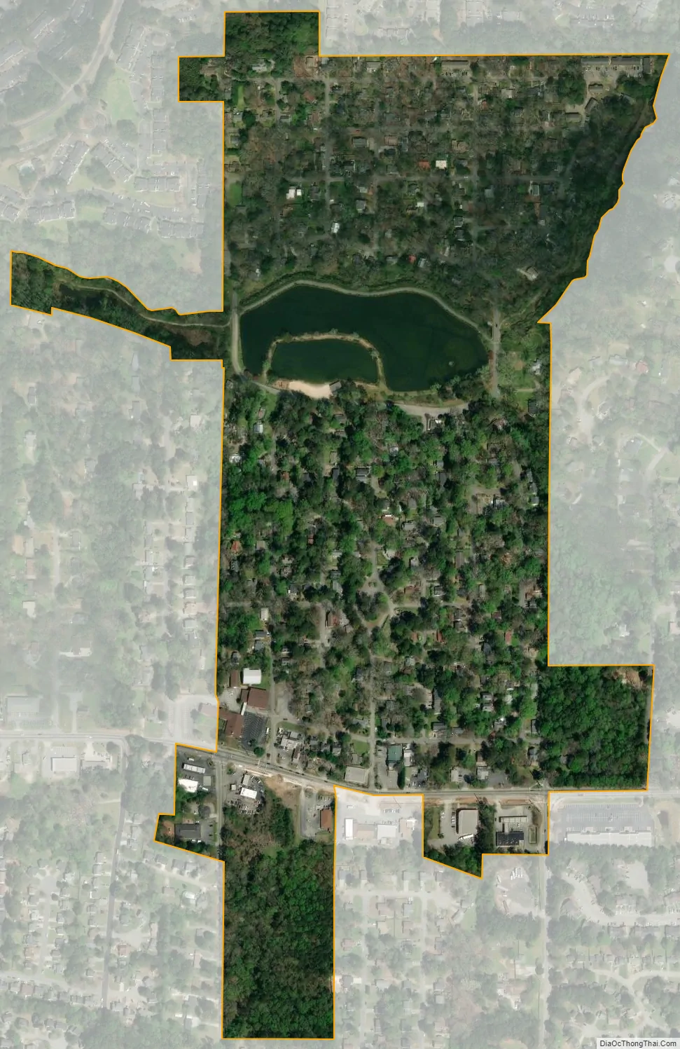
Pine Lake city Satellite Map
Geography
Pine Lake is located at 33°47′29″N 84°12′23″W / 33.79139°N 84.20639°W / 33.79139; -84.20639 (33.791505, -84.206428). According to the United States Census Bureau, the city has a total area of 0.2 square miles (0.52 km), of which 0.2 square miles (0.52 km) is land and 5.00% is water.
See also
Map of Georgia State and its subdivision:- Appling
- Atkinson
- Bacon
- Baker
- Baldwin
- Banks
- Barrow
- Bartow
- Ben Hill
- Berrien
- Bibb
- Bleckley
- Brantley
- Brooks
- Bryan
- Bulloch
- Burke
- Butts
- Calhoun
- Camden
- Candler
- Carroll
- Catoosa
- Charlton
- Chatham
- Chattahoochee
- Chattooga
- Cherokee
- Clarke
- Clay
- Clayton
- Clinch
- Cobb
- Coffee
- Colquitt
- Columbia
- Cook
- Coweta
- Crawford
- Crisp
- Dade
- Dawson
- Decatur
- DeKalb
- Dodge
- Dooly
- Dougherty
- Douglas
- Early
- Echols
- Effingham
- Elbert
- Emanuel
- Evans
- Fannin
- Fayette
- Floyd
- Forsyth
- Franklin
- Fulton
- Gilmer
- Glascock
- Glynn
- Gordon
- Grady
- Greene
- Gwinnett
- Habersham
- Hall
- Hancock
- Haralson
- Harris
- Hart
- Heard
- Henry
- Houston
- Irwin
- Jackson
- Jasper
- Jeff Davis
- Jefferson
- Jenkins
- Johnson
- Jones
- Lamar
- Lanier
- Laurens
- Lee
- Liberty
- Lincoln
- Long
- Lowndes
- Lumpkin
- Macon
- Madison
- Marion
- McDuffie
- McIntosh
- Meriwether
- Miller
- Mitchell
- Monroe
- Montgomery
- Morgan
- Murray
- Muscogee
- Newton
- Oconee
- Oglethorpe
- Paulding
- Peach
- Pickens
- Pierce
- Pike
- Polk
- Pulaski
- Putnam
- Quitman
- Rabun
- Randolph
- Richmond
- Rockdale
- Schley
- Screven
- Seminole
- Spalding
- Stephens
- Stewart
- Sumter
- Talbot
- Taliaferro
- Tattnall
- Taylor
- Telfair
- Terrell
- Thomas
- Tift
- Toombs
- Towns
- Treutlen
- Troup
- Turner
- Twiggs
- Union
- Upson
- Walker
- Walton
- Ware
- Warren
- Washington
- Wayne
- Webster
- Wheeler
- White
- Whitfield
- Wilcox
- Wilkes
- Wilkinson
- Worth
- Alabama
- Alaska
- Arizona
- Arkansas
- California
- Colorado
- Connecticut
- Delaware
- District of Columbia
- Florida
- Georgia
- Hawaii
- Idaho
- Illinois
- Indiana
- Iowa
- Kansas
- Kentucky
- Louisiana
- Maine
- Maryland
- Massachusetts
- Michigan
- Minnesota
- Mississippi
- Missouri
- Montana
- Nebraska
- Nevada
- New Hampshire
- New Jersey
- New Mexico
- New York
- North Carolina
- North Dakota
- Ohio
- Oklahoma
- Oregon
- Pennsylvania
- Rhode Island
- South Carolina
- South Dakota
- Tennessee
- Texas
- Utah
- Vermont
- Virginia
- Washington
- West Virginia
- Wisconsin
- Wyoming