Suwanee is a city in Gwinnett County and a part of the Atlanta metropolitan area in the U.S. state of Georgia. As of the 2010 census, the population was 15,355; this had grown to an estimated 20,907 as of 2019.
Portions of Forsyth and Fulton counties also have Suwanee and its ZIP Code (30024) as a mailing address.
| Name: | Suwanee city |
|---|---|
| LSAD Code: | 25 |
| LSAD Description: | city (suffix) |
| State: | Georgia |
| County: | Gwinnett County |
| Elevation: | 1,004 ft (306 m) |
| Total Area: | 11.07 sq mi (28.66 km²) |
| Land Area: | 10.99 sq mi (28.46 km²) |
| Water Area: | 0.08 sq mi (0.20 km²) |
| Total Population: | 20,786 |
| Population Density: | 1,891.53/sq mi (730.29/km²) |
| ZIP code: | 30024 |
| Area code: | 770 |
| FIPS code: | 1374936 |
| GNISfeature ID: | 2405551 |
| Website: | www.suwanee.com |
Online Interactive Map
Click on ![]() to view map in "full screen" mode.
to view map in "full screen" mode.
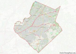
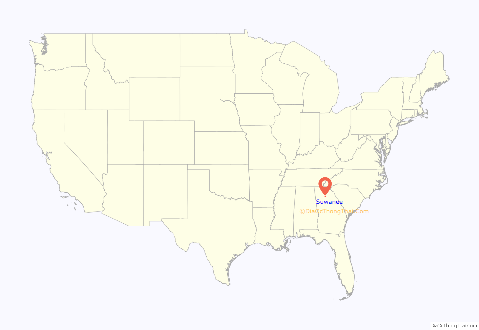
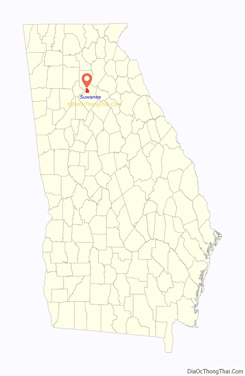
Suwanee location map. Where is Suwanee city?
History
Early history
Suwanee, as did most towns in Georgia, started out as a Native American village. It was built on the Chattahoochee River, where societies flourished. The city of Suwanee itself was established and officially recognized by the U.S. government in 1837 upon the erection of a post office. In 1871, the Georgia Air Line Railroad was built through Suwanee, and in 1880 the Rhodes House hotel was built to house passengers of the railroad. This was instrumental in bringing people through the town and helped to generate trade and economic activity. In 1881, a fire burned down all of the buildings on Main Street except for one. From 1880 to 1920, the population saw almost no increase, shifting from 216 people to 241 over the course of 40 years. As of 2015, the population of Suwanee was over 18,000
Recent history
Beginning in 1933 and ending in 1936, the now heavily traveled Buford Highway was constructed through Suwanee. In 1960, Interstate 85 was built to extend to just south of Suwanee, where it ended at the time. Throughout the last 100 years, several primary education schools have opened in Suwanee, including North Gwinnett High School and Suwanee Elementary School. The first known date for Suwanee High School was 1880, when it was a one-room school house. The first city hall was built in the early 1960s, and the second city hall was built in 1997. In 2005, Town Center was constructed and finished in 2009, at which time the city hall moved to it, where it currently resides. In 2003, Suwanee was named a City of Excellence by the Georgia Municipal Association and Trend Magazine. In 2017, Suwanee was recognized as a Green Community by the Atlanta Regional Commission (ARC) certified at the bronze level for the city’s commitment to environmental stewardship and their leadership in sustainability practices.
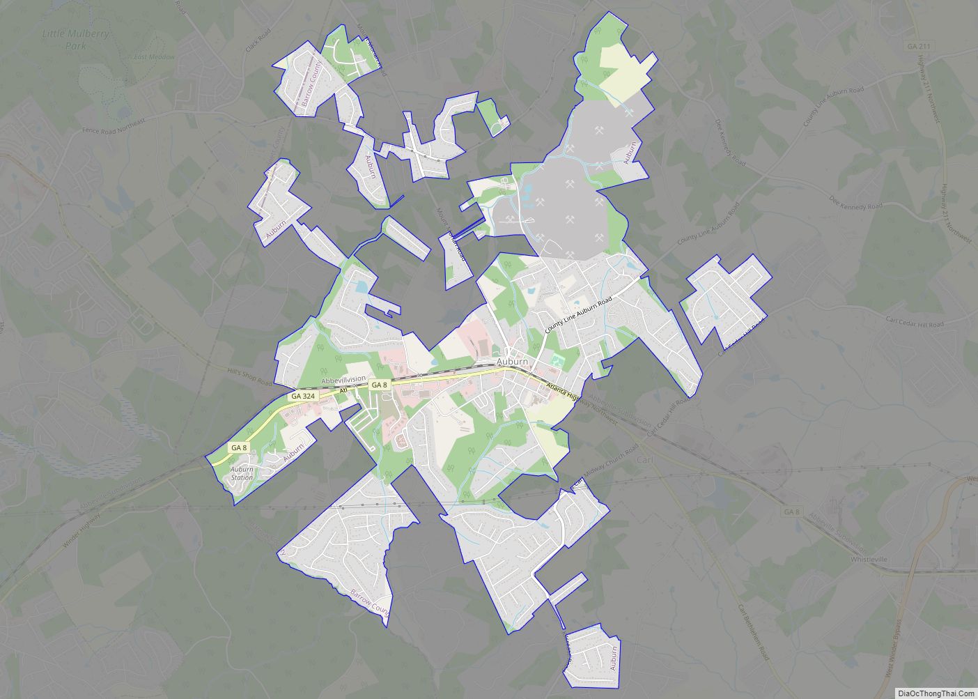
Suwanee Road Map
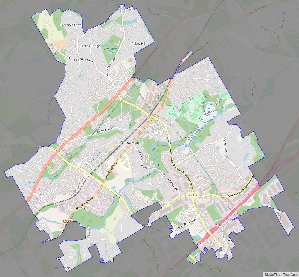
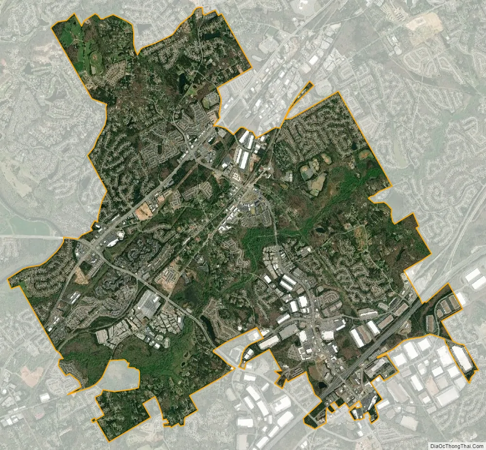
Suwanee city Satellite Map
Geography
Suwanee is located in northern Gwinnett County and southwestern Forsyth County. It is bordered to the northeast by the city of Sugar Hill, to the southwest by the city of Duluth, and on the west by the Chattahoochee River, which serves as the Fulton County border, and across which is the city of Johns Creek.
According to the United States Census Bureau, Suwanee has a total area of 11.0 square miles (28.4 km), of which 10.9 square miles (28.2 km) is land and 0.1 square miles (0.2 km), or 0.70%, is water.
There are multiple areas with Suwanee postal addresses that are in unincorporated Gwinnett County and in unincorporated Forsyth County; those areas are not in the Suwanee corporate limits.
Climate
Suwanee has a humid subtropical climate (Köppen climate classification Cfa), with mild winters and hot, humid summers.
See also
Map of Georgia State and its subdivision:- Appling
- Atkinson
- Bacon
- Baker
- Baldwin
- Banks
- Barrow
- Bartow
- Ben Hill
- Berrien
- Bibb
- Bleckley
- Brantley
- Brooks
- Bryan
- Bulloch
- Burke
- Butts
- Calhoun
- Camden
- Candler
- Carroll
- Catoosa
- Charlton
- Chatham
- Chattahoochee
- Chattooga
- Cherokee
- Clarke
- Clay
- Clayton
- Clinch
- Cobb
- Coffee
- Colquitt
- Columbia
- Cook
- Coweta
- Crawford
- Crisp
- Dade
- Dawson
- Decatur
- DeKalb
- Dodge
- Dooly
- Dougherty
- Douglas
- Early
- Echols
- Effingham
- Elbert
- Emanuel
- Evans
- Fannin
- Fayette
- Floyd
- Forsyth
- Franklin
- Fulton
- Gilmer
- Glascock
- Glynn
- Gordon
- Grady
- Greene
- Gwinnett
- Habersham
- Hall
- Hancock
- Haralson
- Harris
- Hart
- Heard
- Henry
- Houston
- Irwin
- Jackson
- Jasper
- Jeff Davis
- Jefferson
- Jenkins
- Johnson
- Jones
- Lamar
- Lanier
- Laurens
- Lee
- Liberty
- Lincoln
- Long
- Lowndes
- Lumpkin
- Macon
- Madison
- Marion
- McDuffie
- McIntosh
- Meriwether
- Miller
- Mitchell
- Monroe
- Montgomery
- Morgan
- Murray
- Muscogee
- Newton
- Oconee
- Oglethorpe
- Paulding
- Peach
- Pickens
- Pierce
- Pike
- Polk
- Pulaski
- Putnam
- Quitman
- Rabun
- Randolph
- Richmond
- Rockdale
- Schley
- Screven
- Seminole
- Spalding
- Stephens
- Stewart
- Sumter
- Talbot
- Taliaferro
- Tattnall
- Taylor
- Telfair
- Terrell
- Thomas
- Tift
- Toombs
- Towns
- Treutlen
- Troup
- Turner
- Twiggs
- Union
- Upson
- Walker
- Walton
- Ware
- Warren
- Washington
- Wayne
- Webster
- Wheeler
- White
- Whitfield
- Wilcox
- Wilkes
- Wilkinson
- Worth
- Alabama
- Alaska
- Arizona
- Arkansas
- California
- Colorado
- Connecticut
- Delaware
- District of Columbia
- Florida
- Georgia
- Hawaii
- Idaho
- Illinois
- Indiana
- Iowa
- Kansas
- Kentucky
- Louisiana
- Maine
- Maryland
- Massachusetts
- Michigan
- Minnesota
- Mississippi
- Missouri
- Montana
- Nebraska
- Nevada
- New Hampshire
- New Jersey
- New Mexico
- New York
- North Carolina
- North Dakota
- Ohio
- Oklahoma
- Oregon
- Pennsylvania
- Rhode Island
- South Carolina
- South Dakota
- Tennessee
- Texas
- Utah
- Vermont
- Virginia
- Washington
- West Virginia
- Wisconsin
- Wyoming