Waleska (/wɔːˈlɛskə/ waw-LES-kə) is a city in Cherokee County, Georgia, United States. The population was 644 at the 2010 census.
| Name: | Waleska city |
|---|---|
| LSAD Code: | 25 |
| LSAD Description: | city (suffix) |
| State: | Georgia |
| County: | Cherokee County |
| Elevation: | 1,109 ft (338 m) |
| Total Area: | 1.59 sq mi (4.11 km²) |
| Land Area: | 1.58 sq mi (4.09 km²) |
| Water Area: | 0.01 sq mi (0.02 km²) |
| Total Population: | 921 |
| Population Density: | 583.28/sq mi (225.16/km²) |
| ZIP code: | 30183 |
| Area code: | 770/678/470 |
| FIPS code: | 1379948 |
| GNISfeature ID: | 0333342 |
| Website: | cityofwaleska.com |
Online Interactive Map
Click on ![]() to view map in "full screen" mode.
to view map in "full screen" mode.
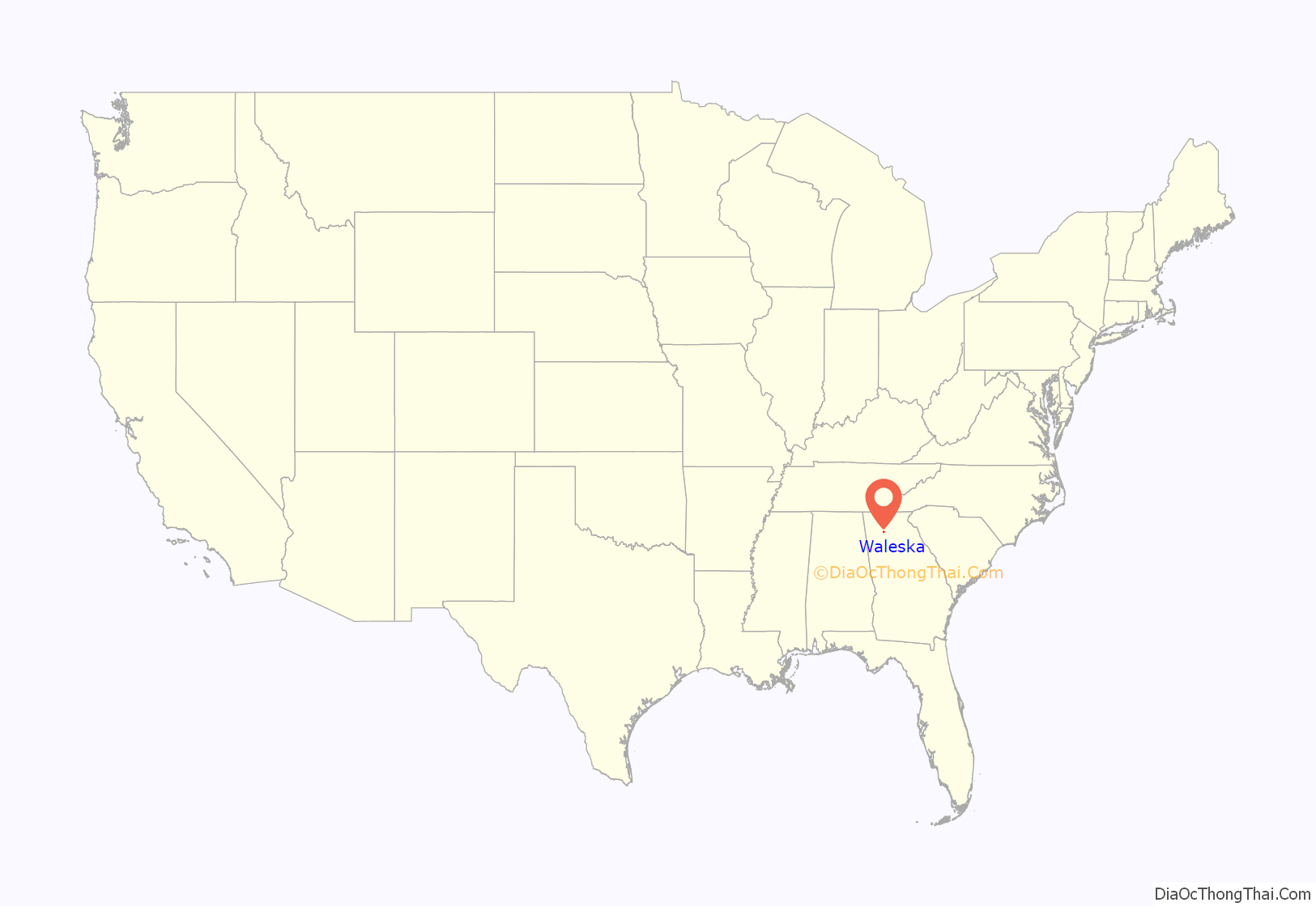
Waleska location map. Where is Waleska city?
History
The first white settlement in the Waleska area began in the early 1830s. Among these first pioneer settlers were the Reinhardt, Heard and Rhyne families, who moved into the region looking for fresh, fertile farm land. At first, these settlers lived among the Cherokee population already established in the area, but by 1838 all of the Cherokee had been forced westward to Oklahoma in the U.S. government relocation movement known as the Trail of Tears.
Early settler Lewis W. Reinhardt established a church in 1834 in the settlement known as Reinhardt Chapel and befriended many of the native Cherokee population. When the Trail of Tears forced the movement of Warluskee, the daughter of a local Cherokee chief and friend of Reinhardt’s, westward, he named this settlement in her honor (see Funk Heritage Center below).
In 1883, Augustus M. Reinhardt, an Atlanta lawyer, former Confederate captain, and son of one of the founders of Waleska, along with his brother-in-law, former Civil War Lieutenant-Colonel John J. A. Sharp, founded Reinhardt Academy in Waleska for the impoverished children of Cherokee County. This school eventually became Reinhardt University.
The city was officially incorporated in 1889, over 50 years after the establishment of the original farming settlement.
While industry in Waleska’s past has included tobacco farming, manufacturing, some mineral development, lumbering, and agriculture, which are both still active in the area, the chief “industry” of the town is and has always been Reinhardt University.
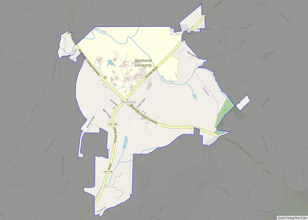
Waleska Road Map
Waleska city Satellite Map
Geography
Waleska is located in northwestern Cherokee County at 34°19′5″N 84°33′11″W / 34.31806°N 84.55306°W / 34.31806; -84.55306 (34.317968, -84.552951). State Routes 140 and 108 intersect in the center of town. SR 140 leads southeast 7 miles (11 km) to Canton, the county seat, and west 25 miles (40 km) to Adairsville. SR 108 leads northeast 13 miles (21 km) to Tate and southwest 23 miles (37 km) to Cartersville.
According to the United States Census Bureau, Waleska has a total area of 1.5 square miles (3.8 km), of which 0.008 square miles (0.02 km), or 0.51%, is water.
See also
Map of Georgia State and its subdivision:- Appling
- Atkinson
- Bacon
- Baker
- Baldwin
- Banks
- Barrow
- Bartow
- Ben Hill
- Berrien
- Bibb
- Bleckley
- Brantley
- Brooks
- Bryan
- Bulloch
- Burke
- Butts
- Calhoun
- Camden
- Candler
- Carroll
- Catoosa
- Charlton
- Chatham
- Chattahoochee
- Chattooga
- Cherokee
- Clarke
- Clay
- Clayton
- Clinch
- Cobb
- Coffee
- Colquitt
- Columbia
- Cook
- Coweta
- Crawford
- Crisp
- Dade
- Dawson
- Decatur
- DeKalb
- Dodge
- Dooly
- Dougherty
- Douglas
- Early
- Echols
- Effingham
- Elbert
- Emanuel
- Evans
- Fannin
- Fayette
- Floyd
- Forsyth
- Franklin
- Fulton
- Gilmer
- Glascock
- Glynn
- Gordon
- Grady
- Greene
- Gwinnett
- Habersham
- Hall
- Hancock
- Haralson
- Harris
- Hart
- Heard
- Henry
- Houston
- Irwin
- Jackson
- Jasper
- Jeff Davis
- Jefferson
- Jenkins
- Johnson
- Jones
- Lamar
- Lanier
- Laurens
- Lee
- Liberty
- Lincoln
- Long
- Lowndes
- Lumpkin
- Macon
- Madison
- Marion
- McDuffie
- McIntosh
- Meriwether
- Miller
- Mitchell
- Monroe
- Montgomery
- Morgan
- Murray
- Muscogee
- Newton
- Oconee
- Oglethorpe
- Paulding
- Peach
- Pickens
- Pierce
- Pike
- Polk
- Pulaski
- Putnam
- Quitman
- Rabun
- Randolph
- Richmond
- Rockdale
- Schley
- Screven
- Seminole
- Spalding
- Stephens
- Stewart
- Sumter
- Talbot
- Taliaferro
- Tattnall
- Taylor
- Telfair
- Terrell
- Thomas
- Tift
- Toombs
- Towns
- Treutlen
- Troup
- Turner
- Twiggs
- Union
- Upson
- Walker
- Walton
- Ware
- Warren
- Washington
- Wayne
- Webster
- Wheeler
- White
- Whitfield
- Wilcox
- Wilkes
- Wilkinson
- Worth
- Alabama
- Alaska
- Arizona
- Arkansas
- California
- Colorado
- Connecticut
- Delaware
- District of Columbia
- Florida
- Georgia
- Hawaii
- Idaho
- Illinois
- Indiana
- Iowa
- Kansas
- Kentucky
- Louisiana
- Maine
- Maryland
- Massachusetts
- Michigan
- Minnesota
- Mississippi
- Missouri
- Montana
- Nebraska
- Nevada
- New Hampshire
- New Jersey
- New Mexico
- New York
- North Carolina
- North Dakota
- Ohio
- Oklahoma
- Oregon
- Pennsylvania
- Rhode Island
- South Carolina
- South Dakota
- Tennessee
- Texas
- Utah
- Vermont
- Virginia
- Washington
- West Virginia
- Wisconsin
- Wyoming
