Warm Springs is a city in Meriwether County, Georgia, United States. The population was 465 at the 2020 census.
| Name: | Warm Springs city |
|---|---|
| LSAD Code: | 25 |
| LSAD Description: | city (suffix) |
| State: | Georgia |
| County: | Meriwether County |
| Elevation: | 930 ft (280 m) |
| Total Area: | 1.53 sq mi (3.98 km²) |
| Land Area: | 1.50 sq mi (3.89 km²) |
| Water Area: | 0.03 sq mi (0.09 km²) |
| Total Population: | 465 |
| Population Density: | 309.79/sq mi (119.62/km²) |
| ZIP code: | 31830 |
| Area code: | 706 |
| FIPS code: | 1380480 |
| GNISfeature ID: | 0324851 |
| Website: | warmspringsga.com |
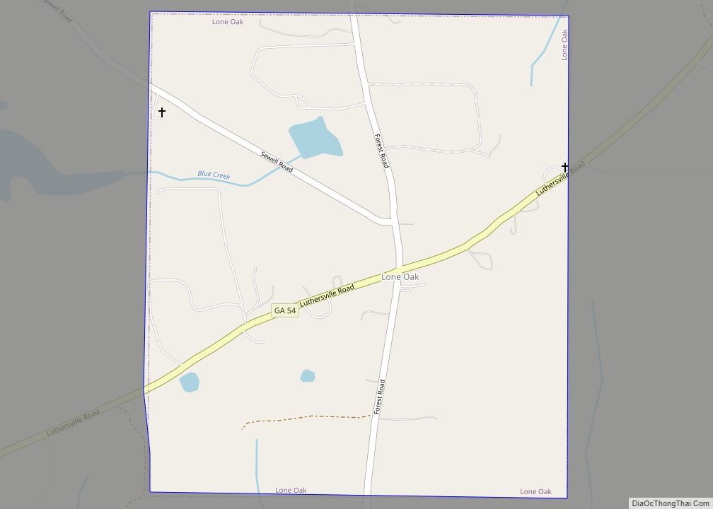
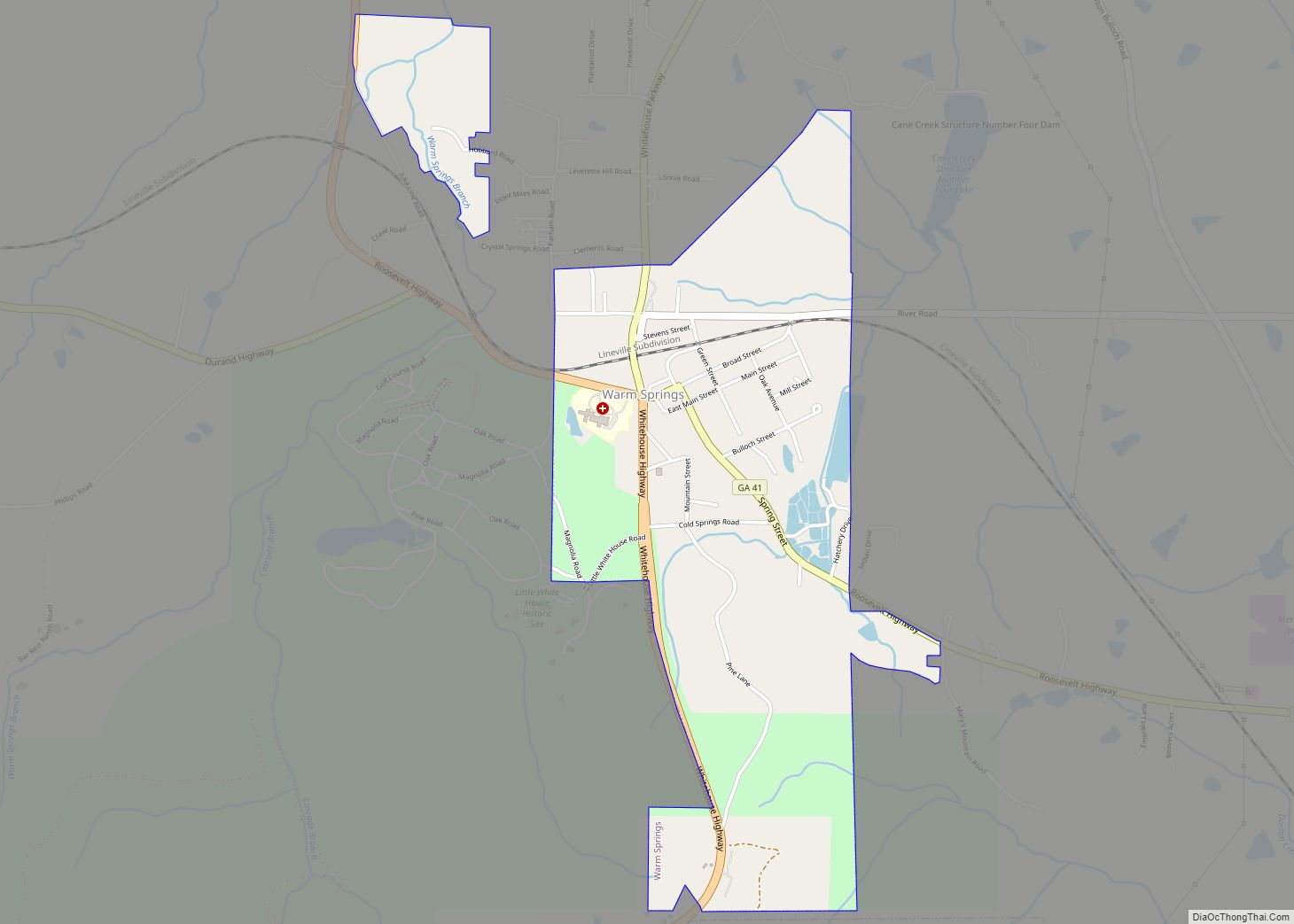
Online Interactive Map
Click on ![]() to view map in "full screen" mode.
to view map in "full screen" mode.
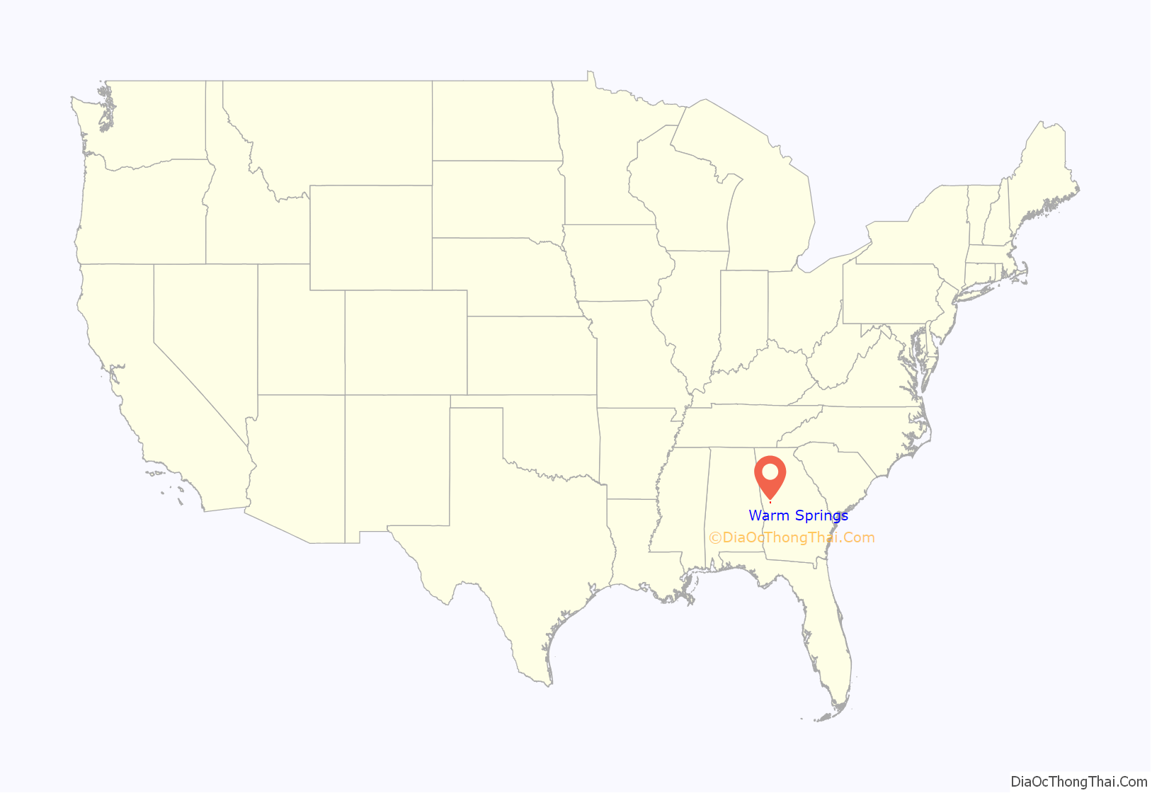
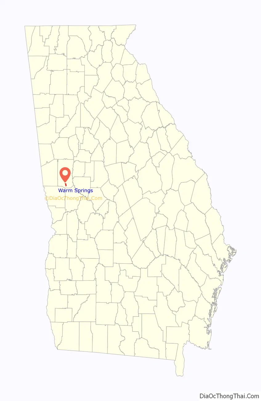
Warm Springs location map. Where is Warm Springs city?
History
Warm Springs, originally named “Bullochville” (after the Bulloch family, which began after Stephen Bullock moved to Meriwether County in 1806 from Edgecombe County, North Carolina), first came to prominence in the 19th century as a spa town, because of its mineral springs which flow constantly at nearly 90 °F (32 °C). Residents of Georgia, particularly Savannah, began spending vacations at Bullochville in the late 18th century as a way to escape yellow fever, finding the number of warm springs in the vicinity of Bullochville very attractive. In the late 19th century traveling to the warm springs was a way to escape the city (in this case Atlanta) for a short while. Traveling by railroad to Durand, visitors would then go to Bullochville, 6 miles (10 km) away. One of the places benefiting from this was the Meriwether Inn. Once the automobile became popular in the early 20th century, tourists began going elsewhere, starting the decline of the inn.
In 1921, Franklin Roosevelt contracted a paralytic illness, diagnosed at the time as poliomyelitis (later thought in a 2003 peer-reviewed retrospective study to be Guillain–Barré syndrome). He tried to regain strength in his legs by bathing and exercising in the warm water. His first time in Warm Springs was October 1924. He went to a resort in the town whose attraction was a permanent 88 °F (31 °C) natural spring. He was a constant visitor for two decades, and renamed the town from Bullochville to Warm Springs.
Roosevelt had a cottage built in 1932 that became famous as the Little White House, where he vacationed while president, because of his illness. He died there in 1945, and the home is now a public museum.
The town is still home to the Roosevelt Warm Springs Institute for Rehabilitation (Roosevelt’s former polio hospital), which remains a world-renowned comprehensive rehabilitation center including a physical rehabilitation hospital and vocational rehabilitation unit. Economist Thomas M. Humphrey was one of the children treated for polio at the institute during the 1940s. The springs are not available for public use as a bath/spa resort, but they are used by the Roosevelt Institute for therapeutic purposes.
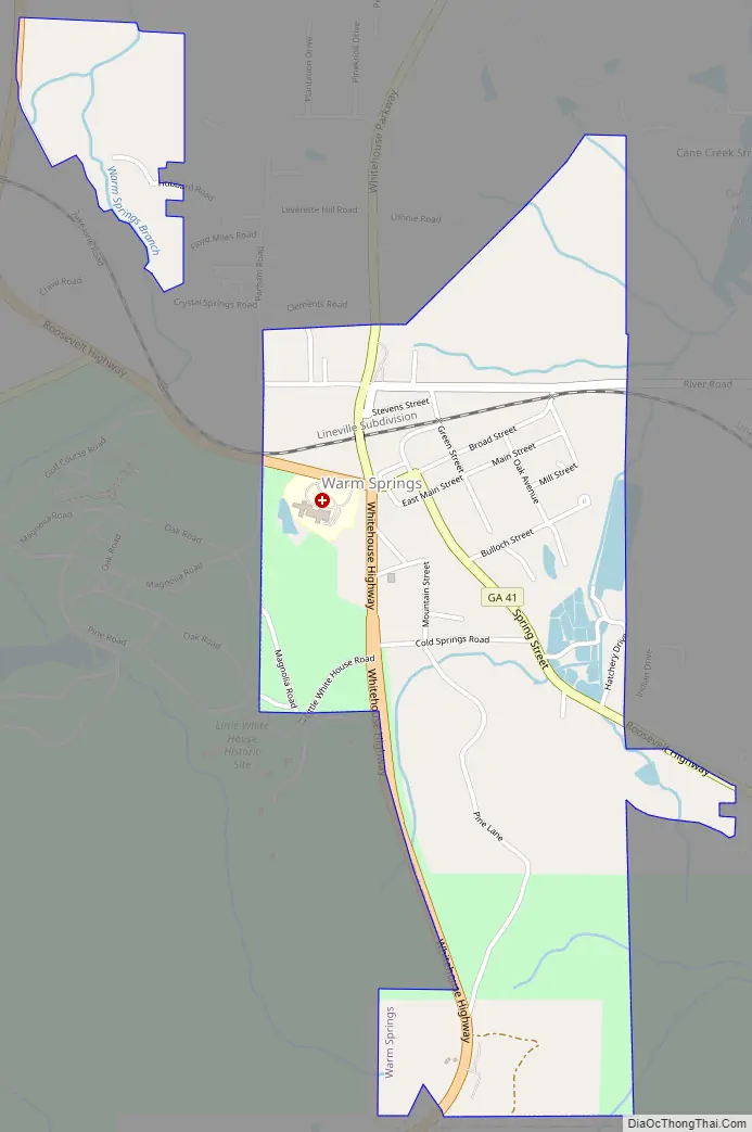
Warm Springs Road Map
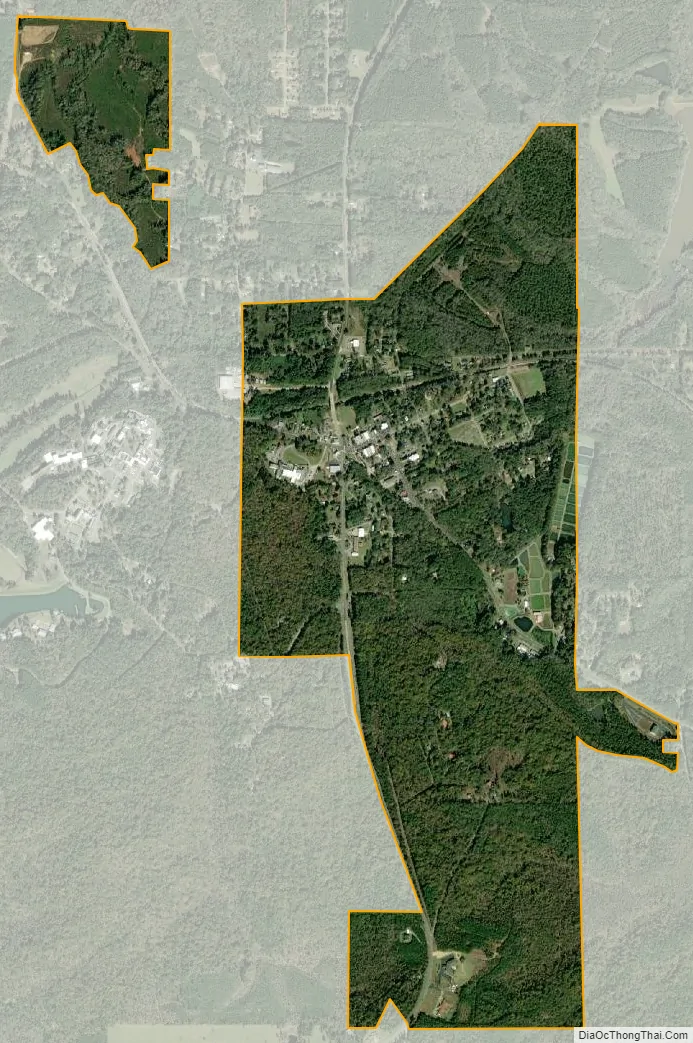
Warm Springs city Satellite Map
Geography
Warm Springs is located in southern Meriwether County at 32°53′19″N 84°40′48″W / 32.88861°N 84.68000°W / 32.88861; -84.68000 (32.888689, −84.680089). It is bordered to the south by Talbot County and to the west by F. D. Roosevelt State Park, including the Little White House. Pine Mountain rises to an elevation of 1,340 feet (410 m) south of the city, about 400 feet (120 m) higher than the city center.
U.S. Route 27 Alternate passes through the center of Warm Springs, leading north 10 miles (16 km) to Greenville, the Meriwether county seat, and southwest 39 miles (63 km) to Columbus. Georgia State Route 41 leads southeast 4 miles (6 km) to Manchester, the largest city in Meriwether County, while State Route 85 leads northeast 9 miles (14 km) to Woodbury.
According to the United States Census Bureau, Warm Springs has a total area of 1.5 square miles (3.9 km), of which 0.03 square miles (0.08 km), or 2.21%, are water. Warm Springs Branch and Cold Branch drain the area around the city center, both flowing north to Cane Creek, an east-flowing tributary of the Flint River. The southern, rural part of the city on Pine Mountain drains east to Pigeon Creek, another tributary of the Flint.
See also
Map of Georgia State and its subdivision:- Appling
- Atkinson
- Bacon
- Baker
- Baldwin
- Banks
- Barrow
- Bartow
- Ben Hill
- Berrien
- Bibb
- Bleckley
- Brantley
- Brooks
- Bryan
- Bulloch
- Burke
- Butts
- Calhoun
- Camden
- Candler
- Carroll
- Catoosa
- Charlton
- Chatham
- Chattahoochee
- Chattooga
- Cherokee
- Clarke
- Clay
- Clayton
- Clinch
- Cobb
- Coffee
- Colquitt
- Columbia
- Cook
- Coweta
- Crawford
- Crisp
- Dade
- Dawson
- Decatur
- DeKalb
- Dodge
- Dooly
- Dougherty
- Douglas
- Early
- Echols
- Effingham
- Elbert
- Emanuel
- Evans
- Fannin
- Fayette
- Floyd
- Forsyth
- Franklin
- Fulton
- Gilmer
- Glascock
- Glynn
- Gordon
- Grady
- Greene
- Gwinnett
- Habersham
- Hall
- Hancock
- Haralson
- Harris
- Hart
- Heard
- Henry
- Houston
- Irwin
- Jackson
- Jasper
- Jeff Davis
- Jefferson
- Jenkins
- Johnson
- Jones
- Lamar
- Lanier
- Laurens
- Lee
- Liberty
- Lincoln
- Long
- Lowndes
- Lumpkin
- Macon
- Madison
- Marion
- McDuffie
- McIntosh
- Meriwether
- Miller
- Mitchell
- Monroe
- Montgomery
- Morgan
- Murray
- Muscogee
- Newton
- Oconee
- Oglethorpe
- Paulding
- Peach
- Pickens
- Pierce
- Pike
- Polk
- Pulaski
- Putnam
- Quitman
- Rabun
- Randolph
- Richmond
- Rockdale
- Schley
- Screven
- Seminole
- Spalding
- Stephens
- Stewart
- Sumter
- Talbot
- Taliaferro
- Tattnall
- Taylor
- Telfair
- Terrell
- Thomas
- Tift
- Toombs
- Towns
- Treutlen
- Troup
- Turner
- Twiggs
- Union
- Upson
- Walker
- Walton
- Ware
- Warren
- Washington
- Wayne
- Webster
- Wheeler
- White
- Whitfield
- Wilcox
- Wilkes
- Wilkinson
- Worth
- Alabama
- Alaska
- Arizona
- Arkansas
- California
- Colorado
- Connecticut
- Delaware
- District of Columbia
- Florida
- Georgia
- Hawaii
- Idaho
- Illinois
- Indiana
- Iowa
- Kansas
- Kentucky
- Louisiana
- Maine
- Maryland
- Massachusetts
- Michigan
- Minnesota
- Mississippi
- Missouri
- Montana
- Nebraska
- Nevada
- New Hampshire
- New Jersey
- New Mexico
- New York
- North Carolina
- North Dakota
- Ohio
- Oklahoma
- Oregon
- Pennsylvania
- Rhode Island
- South Carolina
- South Dakota
- Tennessee
- Texas
- Utah
- Vermont
- Virginia
- Washington
- West Virginia
- Wisconsin
- Wyoming