Woodbury is a city in Meriwether County, Georgia, United States. The population was 908 at the 2020 census.
| Name: | Woodbury city |
|---|---|
| LSAD Code: | 25 |
| LSAD Description: | city (suffix) |
| State: | Georgia |
| County: | Meriwether County |
| Elevation: | 827 ft (252 m) |
| Total Area: | 2.10 sq mi (5.44 km²) |
| Land Area: | 2.07 sq mi (5.36 km²) |
| Water Area: | 0.03 sq mi (0.08 km²) |
| Total Population: | 908 |
| Population Density: | 438.86/sq mi (169.47/km²) |
| ZIP code: | 30293 |
| Area code: | 706 |
| FIPS code: | 1383896 |
| GNISfeature ID: | 0333457 |
| Website: | www.cityofwoodburyga.gov |
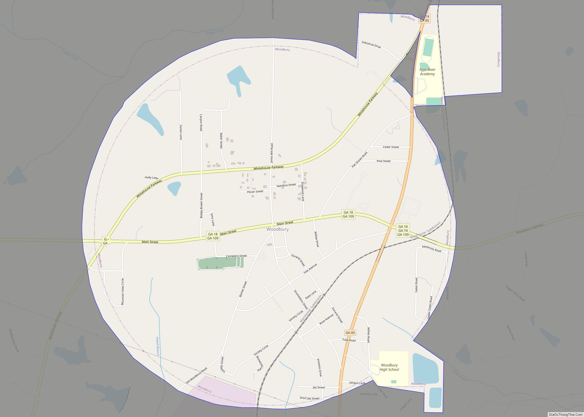
Online Interactive Map
Click on ![]() to view map in "full screen" mode.
to view map in "full screen" mode.
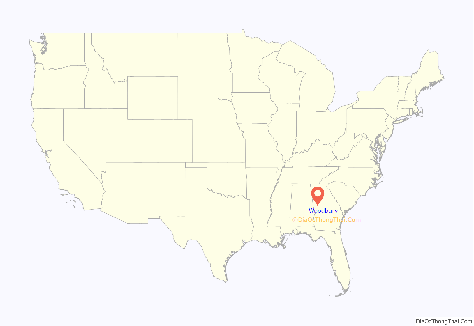
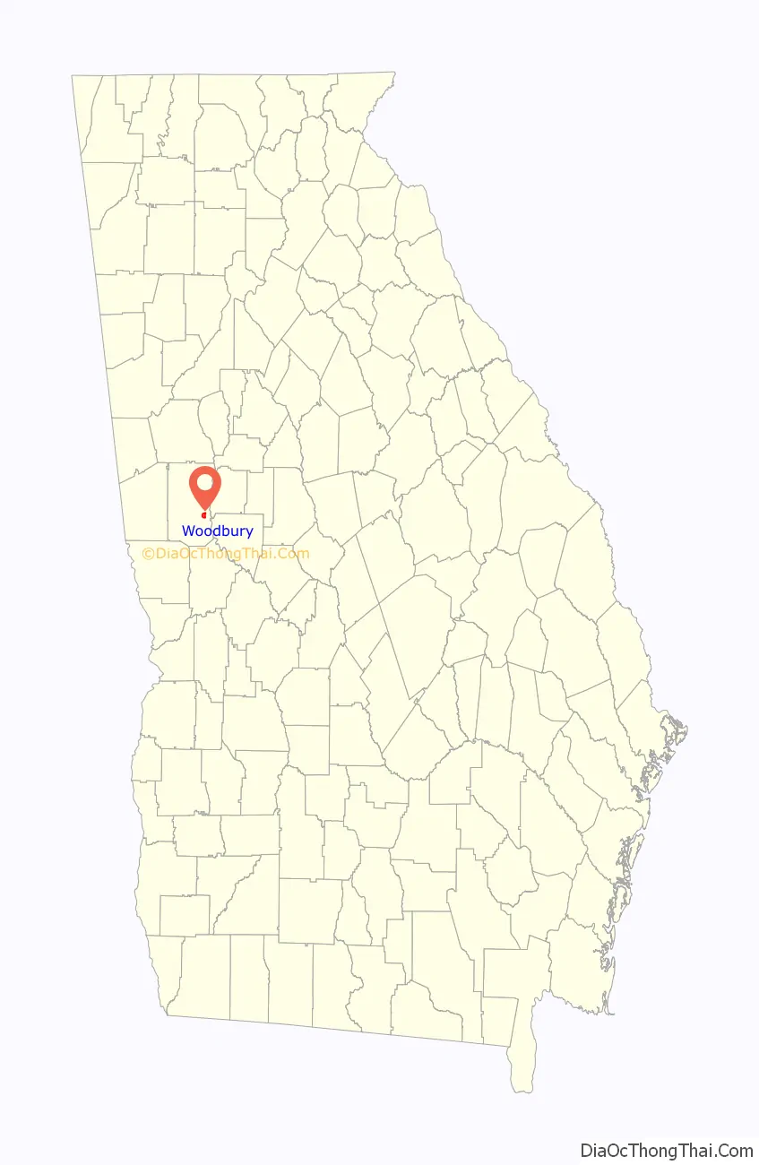
Woodbury location map. Where is Woodbury city?
History
The Georgia General Assembly incorporated Woodbury in 1913. The community most likely was named after Levi Woodbury (1789–1851), American justice on the United States Supreme Court.
Woodbury Road Map
Woodbury city Satellite Map

Geography
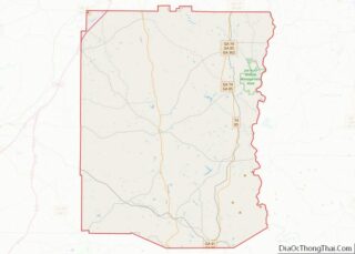
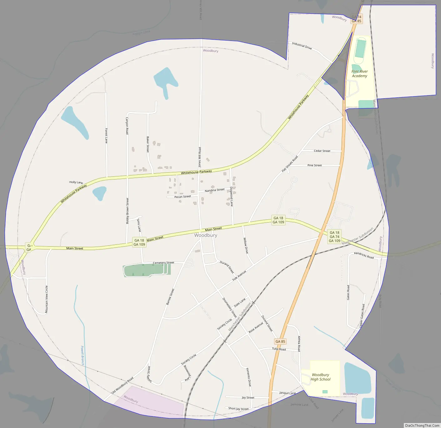
Woodbury is located in southeastern Meriwether County at 32°58′50″N 84°34′52″W / 32.98056°N 84.58111°W / 32.98056; -84.58111 (32.980588, -84.580979). Georgia State Routes 18, 74, 85, and 109 pass through the city. Route 18 leads northwest 8 miles (13 km) to Greenville, the county seat, and northeast 19 miles (31 km) to Zebulon. Route 74 goes east out of Woodbury with Route 18 but leads southeast 19 miles (31 km) to Thomaston; to the north Route 74 leads 8 miles (13 km) to Gay. Route 85 goes north to Gay with Route 74 but also leads south 10 miles (16 km) to Manchester. Route 85 Alternate runs through the north side of Woodbury and leads southwest 9 miles (14 km) to Warm Springs. Route 109 follows Route 18 both northwest and east out of Woodbury but leads east 28 miles (45 km) to Barnesville.
According to the United States Census Bureau, Woodbury has a total area of 2.1 square miles (5.4 km), of which 0.03 square miles (0.08 km), or 1.43%, are water. The Flint River passes 3 miles (5 km) east of the city, and Pine Mountain rises three miles to the south.
See also
Map of Georgia State and its subdivision:- Appling
- Atkinson
- Bacon
- Baker
- Baldwin
- Banks
- Barrow
- Bartow
- Ben Hill
- Berrien
- Bibb
- Bleckley
- Brantley
- Brooks
- Bryan
- Bulloch
- Burke
- Butts
- Calhoun
- Camden
- Candler
- Carroll
- Catoosa
- Charlton
- Chatham
- Chattahoochee
- Chattooga
- Cherokee
- Clarke
- Clay
- Clayton
- Clinch
- Cobb
- Coffee
- Colquitt
- Columbia
- Cook
- Coweta
- Crawford
- Crisp
- Dade
- Dawson
- Decatur
- DeKalb
- Dodge
- Dooly
- Dougherty
- Douglas
- Early
- Echols
- Effingham
- Elbert
- Emanuel
- Evans
- Fannin
- Fayette
- Floyd
- Forsyth
- Franklin
- Fulton
- Gilmer
- Glascock
- Glynn
- Gordon
- Grady
- Greene
- Gwinnett
- Habersham
- Hall
- Hancock
- Haralson
- Harris
- Hart
- Heard
- Henry
- Houston
- Irwin
- Jackson
- Jasper
- Jeff Davis
- Jefferson
- Jenkins
- Johnson
- Jones
- Lamar
- Lanier
- Laurens
- Lee
- Liberty
- Lincoln
- Long
- Lowndes
- Lumpkin
- Macon
- Madison
- Marion
- McDuffie
- McIntosh
- Meriwether
- Miller
- Mitchell
- Monroe
- Montgomery
- Morgan
- Murray
- Muscogee
- Newton
- Oconee
- Oglethorpe
- Paulding
- Peach
- Pickens
- Pierce
- Pike
- Polk
- Pulaski
- Putnam
- Quitman
- Rabun
- Randolph
- Richmond
- Rockdale
- Schley
- Screven
- Seminole
- Spalding
- Stephens
- Stewart
- Sumter
- Talbot
- Taliaferro
- Tattnall
- Taylor
- Telfair
- Terrell
- Thomas
- Tift
- Toombs
- Towns
- Treutlen
- Troup
- Turner
- Twiggs
- Union
- Upson
- Walker
- Walton
- Ware
- Warren
- Washington
- Wayne
- Webster
- Wheeler
- White
- Whitfield
- Wilcox
- Wilkes
- Wilkinson
- Worth
- Alabama
- Alaska
- Arizona
- Arkansas
- California
- Colorado
- Connecticut
- Delaware
- District of Columbia
- Florida
- Georgia
- Hawaii
- Idaho
- Illinois
- Indiana
- Iowa
- Kansas
- Kentucky
- Louisiana
- Maine
- Maryland
- Massachusetts
- Michigan
- Minnesota
- Mississippi
- Missouri
- Montana
- Nebraska
- Nevada
- New Hampshire
- New Jersey
- New Mexico
- New York
- North Carolina
- North Dakota
- Ohio
- Oklahoma
- Oregon
- Pennsylvania
- Rhode Island
- South Carolina
- South Dakota
- Tennessee
- Texas
- Utah
- Vermont
- Virginia
- Washington
- West Virginia
- Wisconsin
- Wyoming