Buford is a city in Gwinnett and Hall counties in the U.S. state of Georgia. As of the 2020 census, the city had a population of 17,144. Most of the city is in Gwinnett County, which is part of the Atlanta-Sandy Springs-Marietta Metropolitan Statistical Area. The northern sliver of the city is in Hall County, which comprises the Gainesville, Georgia Metropolitan Statistical Area and is part of the larger Atlanta-Athens-Clarke-Sandy Springs Combined Statistical Area.
The city was founded in 1872 after a railroad was built in the area connecting Charlotte, North Carolina, with Atlanta. Buford was named after Algernon Sidney Buford, who at the time was president of the Atlanta and Richmond Air-Line Railway. The city’s leather industry, led by the Bona Allen Company, as well as its location as a railway stop, caused the population to expand during the early 1900s until after the Great Depression had ended.
The city operates its own school district, the Buford City School District, and has been the birthplace and home of several musicians and athletes. Various tourist locations, including museums and community centers, the largest mall in the state of Georgia, the Mall of Georgia, and Lake Lanier Islands are in the Buford region.
| Name: | Buford city |
|---|---|
| LSAD Code: | 25 |
| LSAD Description: | city (suffix) |
| State: | Georgia |
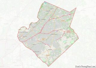
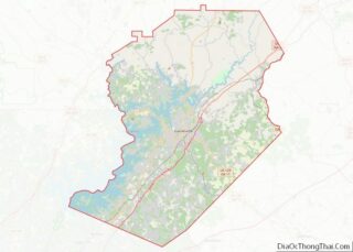
| County: | Gwinnett County, Hall County |
| Elevation: | 1,053 ft (321 m) |
| Total Area: | 18.22 sq mi (47.18 km²) |
| Land Area: | 18.13 sq mi (46.96 km²) |
| Water Area: | 0.09 sq mi (0.22 km²) |
| Total Population: | 17,144 |
| Population Density: | 945.46/sq mi (365.05/km²) |
| ZIP code: | 30515, 30518, 30519 |
| Area code: | 770, 678 |
| FIPS code: | 1311784 |
| GNISfeature ID: | 2403950 |
| Website: | www.cityofbuford.com |
Online Interactive Map
Click on ![]() to view map in "full screen" mode.
to view map in "full screen" mode.
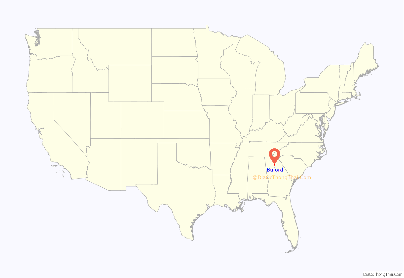
Buford location map. Where is Buford city?
History
Buford appears in historical records beginning in the early 19th century. The area that is now Buford was originally part of Cherokee territory. Despite the treaty in 1817 that ceded the territory to the United States and Gwinnett County’s legislative establishment in 1818, the area was still largely inhabited by the Cherokee until the 1830s. The first non-Native Americans moved to the Buford area in the late 1820s or early 1830s, although the Buford area was not largely settled by them until the 1860s.
During the post-Civil War construction of the extended Richmond and Danville Railroad System in 1865, railroad stockholders Thomas Garner and Larkin Smith purchased land around the railroad’s right-of-way and began developing the city of Buford. The city was named after Algernon Sidney Buford, who was president of the Atlanta and Richmond Air-Line Railway during the railroad’s construction. The town began rapidly expanding around the railway after its completion in 1871, and it was incorporated as the Town of Buford on August 24, 1872, and renamed the City of Buford in 1896.
In the late 1800s and early 1900s Buford became widely known for its leather production, becoming prominently associated with the leather industry and earning the nickname “The Leather City”. Buford became a large producer of leather products, including saddles, horse collars, bridles, and shoes. Buford’s leather industry began with a leatherworker named R.H. Allen opening a harness shop and tannery in 1868, three years before the completion of the railway and the founding of Buford. R.H. Allen’s brother Bona Allen moved to Buford from Rome, Georgia, in 1872 and founded the Bona Allen Company the following year. The leather industry quickly became the city’s largest industry despite setbacks from several fires, including a fire in 1903 that destroyed the buildings of several businesses and a fire in 1906 that destroyed a straw storehouse and nearly destroyed the city’s harness and horse collar factory.
Bona Allen saddles were available through the Sears mail order catalog, and many Hollywood actors used saddles made by the Bona Allen Company, including cowboy actors Gene Autry, the cast of Bonanza, and Roy Rogers, who used a Bona Allen saddle on his horse Trigger. A statue of Roy Rogers and a Bona Allen saddle-maker saddling Trigger is located in downtown Buford. The Bona Allen Company thrived during the Great Depression in the 1930s, likely as a result of the Depression forcing farmers to choose horses over expensive tractors, thereby increasing the demand for saddles, collars, bridles, and other leather products.
The Bona Allen Company constructed Tannery Row in downtown Buford as a shoe factory in 1919. After a brief employee strike the shoe factory was closed in 1942, although it was briefly reopened by the request of the federal government during World War II to make footwear for the military. Afterwards, the factory closed in 1945. In 2003 Tannery Row became home to the Tannery Row Artist Colony, which houses galleries and studios for artists.
After the Great Depression the use of horses for farming decreased and tractors took their place, and the Bona Allen Company steadily downsized until the tannery was eventually sold to the Tandy Corporation in 1968. Buford’s leather industry ended after the tannery experienced a fire in 1981, when the Tandy Corporation decided not to rebuild the tannery and closed the facility.
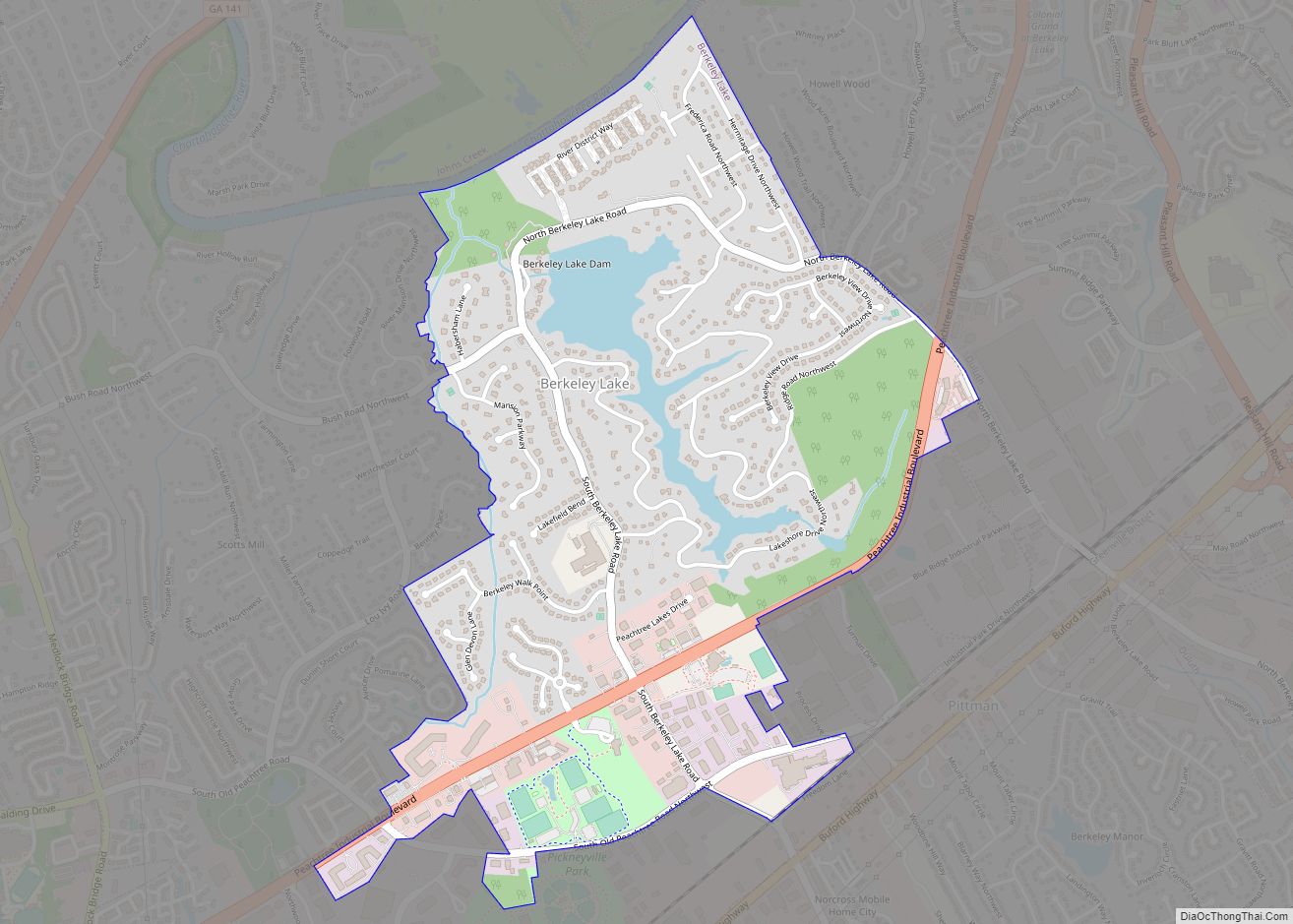
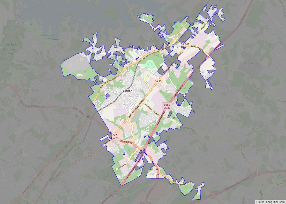
Buford Road Map
Buford city Satellite Map
Geography
Buford is located in both northern Gwinnett County in northern Georgia, with a small portion extending north into Hall County. The city is a suburb within the Atlanta metropolitan area. According to the United States Census Bureau, as of 2010 the city has a total land area of 17.09 square miles (44.26 km), of which 17.01 square miles (44.06 km) is land and 0.08 square miles (0.20 km), or 0.44%, is water. The city’s elevation is 1,183 feet (361 m).
Buford’s city limits are 4.5 miles (7.2 km) west of the Eastern Continental Divide. Ridge Road, part of which uses Buford as a mailing address, runs along the Eastern Continental Divide, although the road itself is outside the city limits. Buford’s primary water supply comes from Lake Lanier an impoundment on the Chattahoochee River.
Climate
The climate of Buford, as with most of the southeastern United States, is humid subtropical (Cfa) according to the Köppen classification, with four seasons including hot, humid summers and cool winters. July is generally the warmest month of the year with an average high of around 87 °F (31 °C). The coldest month is January which has an average high of around 50 °F (10 °C). The highest recorded temperature was 107 °F (42 °C) in 1952, while the lowest recorded temperature was −8 °F (−22 °C) in 1985.
Buford receives rainfall distributed fairly evenly throughout the year as typical of southeastern U.S. cities, with February on average having the highest average precipitation at 5.3 inches (130 mm), and April typically being the driest month with 3.7 inches (94 mm).
See also
Map of Georgia State and its subdivision:- Appling
- Atkinson
- Bacon
- Baker
- Baldwin
- Banks
- Barrow
- Bartow
- Ben Hill
- Berrien
- Bibb
- Bleckley
- Brantley
- Brooks
- Bryan
- Bulloch
- Burke
- Butts
- Calhoun
- Camden
- Candler
- Carroll
- Catoosa
- Charlton
- Chatham
- Chattahoochee
- Chattooga
- Cherokee
- Clarke
- Clay
- Clayton
- Clinch
- Cobb
- Coffee
- Colquitt
- Columbia
- Cook
- Coweta
- Crawford
- Crisp
- Dade
- Dawson
- Decatur
- DeKalb
- Dodge
- Dooly
- Dougherty
- Douglas
- Early
- Echols
- Effingham
- Elbert
- Emanuel
- Evans
- Fannin
- Fayette
- Floyd
- Forsyth
- Franklin
- Fulton
- Gilmer
- Glascock
- Glynn
- Gordon
- Grady
- Greene
- Gwinnett
- Habersham
- Hall
- Hancock
- Haralson
- Harris
- Hart
- Heard
- Henry
- Houston
- Irwin
- Jackson
- Jasper
- Jeff Davis
- Jefferson
- Jenkins
- Johnson
- Jones
- Lamar
- Lanier
- Laurens
- Lee
- Liberty
- Lincoln
- Long
- Lowndes
- Lumpkin
- Macon
- Madison
- Marion
- McDuffie
- McIntosh
- Meriwether
- Miller
- Mitchell
- Monroe
- Montgomery
- Morgan
- Murray
- Muscogee
- Newton
- Oconee
- Oglethorpe
- Paulding
- Peach
- Pickens
- Pierce
- Pike
- Polk
- Pulaski
- Putnam
- Quitman
- Rabun
- Randolph
- Richmond
- Rockdale
- Schley
- Screven
- Seminole
- Spalding
- Stephens
- Stewart
- Sumter
- Talbot
- Taliaferro
- Tattnall
- Taylor
- Telfair
- Terrell
- Thomas
- Tift
- Toombs
- Towns
- Treutlen
- Troup
- Turner
- Twiggs
- Union
- Upson
- Walker
- Walton
- Ware
- Warren
- Washington
- Wayne
- Webster
- Wheeler
- White
- Whitfield
- Wilcox
- Wilkes
- Wilkinson
- Worth
- Alabama
- Alaska
- Arizona
- Arkansas
- California
- Colorado
- Connecticut
- Delaware
- District of Columbia
- Florida
- Georgia
- Hawaii
- Idaho
- Illinois
- Indiana
- Iowa
- Kansas
- Kentucky
- Louisiana
- Maine
- Maryland
- Massachusetts
- Michigan
- Minnesota
- Mississippi
- Missouri
- Montana
- Nebraska
- Nevada
- New Hampshire
- New Jersey
- New Mexico
- New York
- North Carolina
- North Dakota
- Ohio
- Oklahoma
- Oregon
- Pennsylvania
- Rhode Island
- South Carolina
- South Dakota
- Tennessee
- Texas
- Utah
- Vermont
- Virginia
- Washington
- West Virginia
- Wisconsin
- Wyoming
