Jakin is a city in Early County, Georgia, United States. Incorporated in 1895, Jakin’s population was 155 at the 2010 census.
| Name: | Jakin city |
|---|---|
| LSAD Code: | 25 |
| LSAD Description: | city (suffix) |
| State: | Georgia |
| County: | Early County |
| Elevation: | 144 ft (44 m) |
| Total Area: | 1.24 sq mi (3.21 km²) |
| Land Area: | 1.24 sq mi (3.21 km²) |
| Water Area: | 0.00 sq mi (0.00 km²) |
| Total Population: | 131 |
| Population Density: | 105.65/sq mi (40.78/km²) |
| ZIP code: | 31761, 39861 |
| Area code: | 229 |
| FIPS code: | 1341792 |
| GNISfeature ID: | 0316032 |
| Website: | www.ircusa.com/jakin/ |
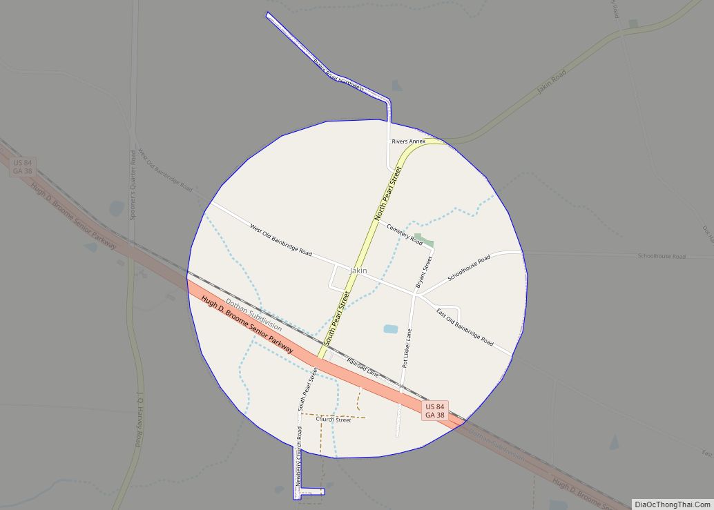
Online Interactive Map
Click on ![]() to view map in "full screen" mode.
to view map in "full screen" mode.
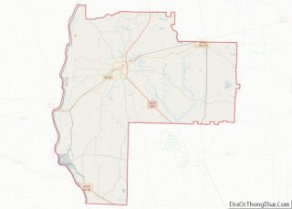
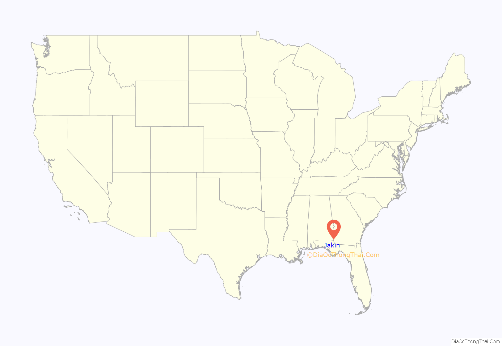
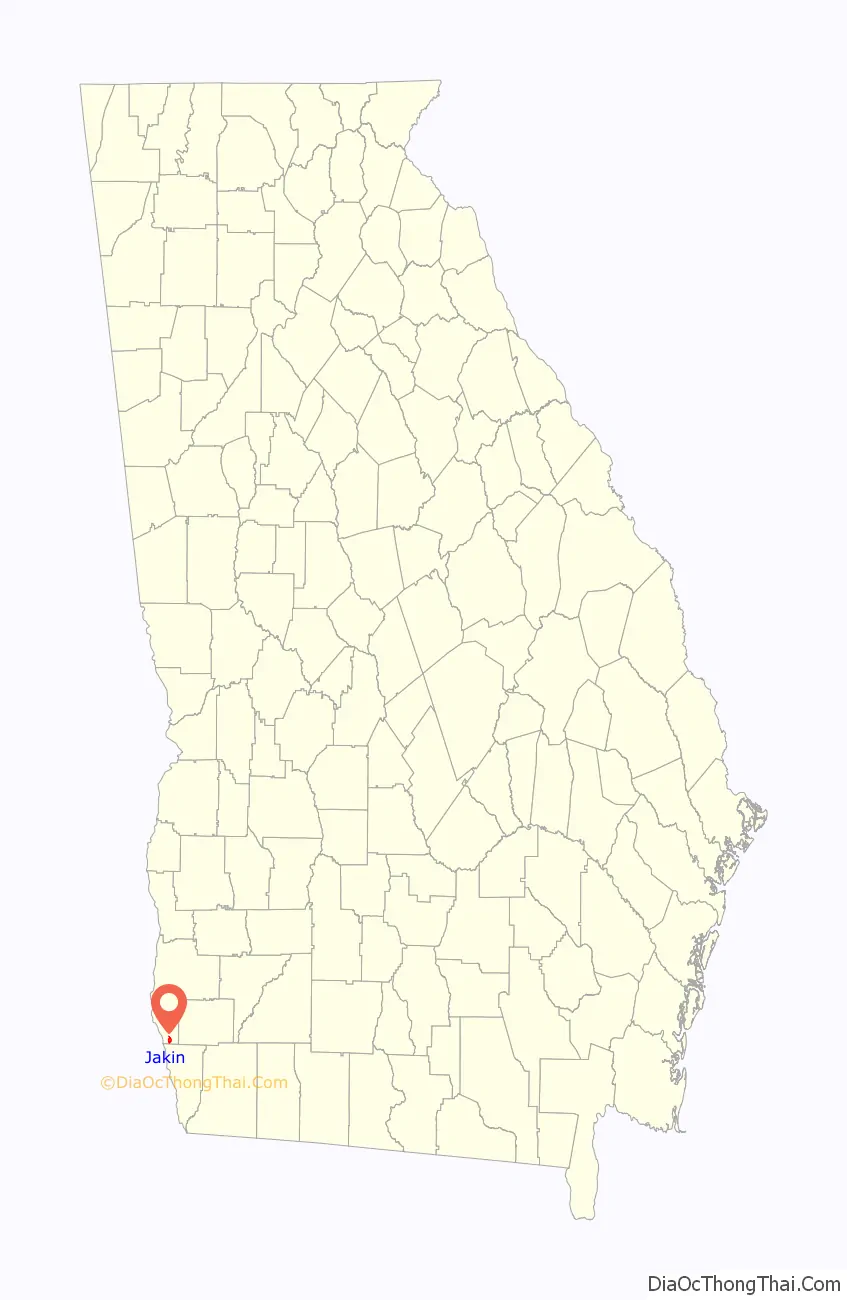
Jakin location map. Where is Jakin city?
History
Early County was created by an act of the General Assembly on December 15, 1818. Land lots of 250 acres (1.0 km) surveyed in 1819 and 1820 were distributed by the state in lotteries. Jakin is in the 26th land district in the southernmost end of the county.
As early as 1817 settlers began moving into the area and began to build on the old Indian paths along the river. These old paths became the Old River Road in 1820 and a post road by the mid 1820s. The post riders were often harassed by Indians. As the forests along the river were cleared, large plantations and fine frame homes began to appear. The Chattahoochee River, 3 miles (5 km) to the west, was the main source of transportation, bearing downstream huge square-cut timbers to Apalachicola, Florida, for ship building and turpentine for export, and bearing cotton upstream to the cotton mills in Columbus. In 1821 the Armstrong and Attaway Company built the first cotton gin at nearby Saffold Navy Yard.
The first families established here were the Allens, Rambos, Donalsons, Harrells, Shewmakes, Saffolds, Johnsons, Hayes, Gibsons, Crawfords, and Moodys. In 1828 a road was made from Blakely to Bainbridge on which settled the Hodges, Warrens, Minters, Easoms and Perrys. These families pioneered what became Jakin.
In May 1878 C.A. Minter, a physician, purchased three lots, roughly 750 acres (3.0 km) of land, for $10 and a shotgun. The first mayor of Jakin, James Morris “Major” Bivings, named the town “Jakin” after one of the columns of Solomon’s temple.
In addition to small farm agriculture, Jakin’s early economic growth resulted from turpentine. The unspoiled longleaf pine forests were prime resources, first for turpentine then lumber. Bivings and his partner, James W. Duke of Chicago, founded the Duke and Bivings Lumber Company complete with housing, commissary and post office. Bivings served as the first postmaster. On January 3, 1898, the Flowers Company purchased the lumber mill for $20,000. In addition to machines, buildings and materials, the purchase included 160 acres (0.6 km) of land and a railway. According to published town history, an estimated 1,000 workers were employed by the mill. In 1903 Jakin’s population was 2,000. World War I and deforestation led to the closure of the lumber mill in 1918.
Agriculture served as Jakin’s main industry until 1963, with Great Northern Nekoosa’s purchase of a family-owned lumber mill which later became Great Southern Paper, which also ran a plywood mill in nearby Cedar Springs. Great Southern Paper was acquired by Georgia-Pacific in 1990. In 2005 GP was acquired by the privately held Koch Industries. Despite changing ownership, the mill has operated continuously.
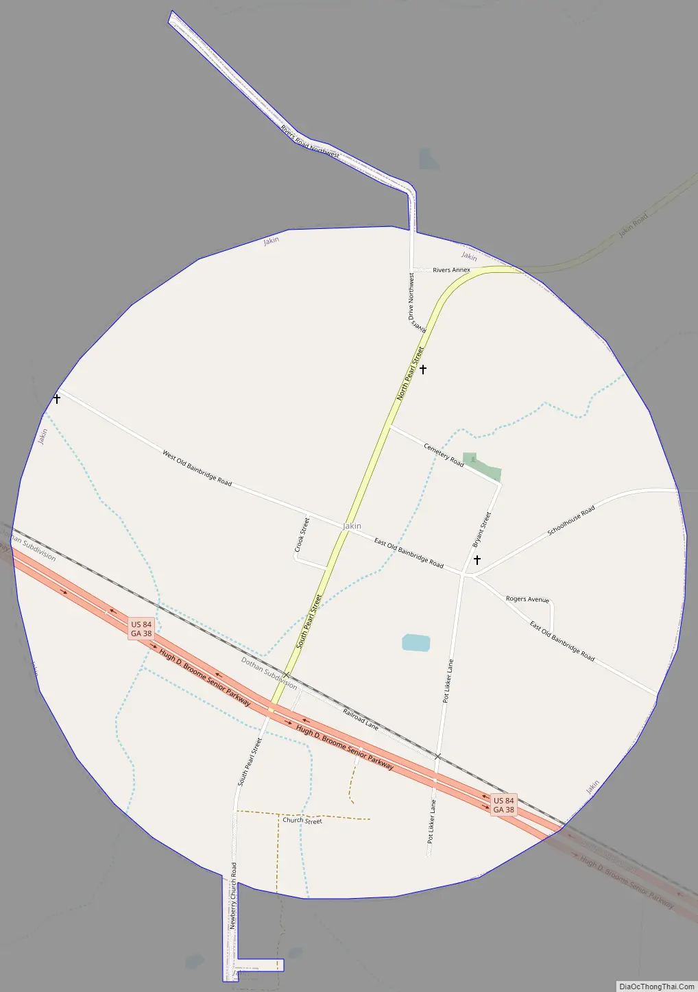
Jakin Road Map
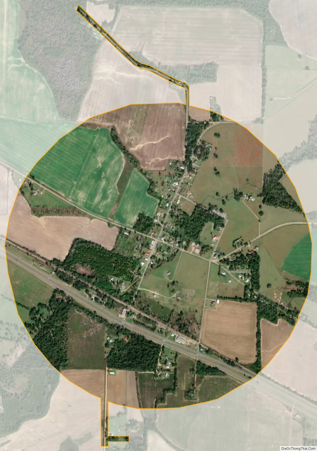
Jakin city Satellite Map
Geography
Jakin is located in southern Early County at 31°5′26″N 84°58′59″W / 31.09056°N 84.98306°W / 31.09056; -84.98306 (31.090574, -84.983179). U.S. Route 84 passes through the southern part of the town, leading southeast 7 miles (11 km) to Donalsonville and northwest 26 miles (42 km) to Dothan, Alabama. Blakely, the Early County seat, is 21 miles (34 km) to the north via Jakin Road.
According to the United States Census Bureau, Jakin has a total area of 1.2 square miles (3.2 km), all land.
See also
Map of Georgia State and its subdivision:- Appling
- Atkinson
- Bacon
- Baker
- Baldwin
- Banks
- Barrow
- Bartow
- Ben Hill
- Berrien
- Bibb
- Bleckley
- Brantley
- Brooks
- Bryan
- Bulloch
- Burke
- Butts
- Calhoun
- Camden
- Candler
- Carroll
- Catoosa
- Charlton
- Chatham
- Chattahoochee
- Chattooga
- Cherokee
- Clarke
- Clay
- Clayton
- Clinch
- Cobb
- Coffee
- Colquitt
- Columbia
- Cook
- Coweta
- Crawford
- Crisp
- Dade
- Dawson
- Decatur
- DeKalb
- Dodge
- Dooly
- Dougherty
- Douglas
- Early
- Echols
- Effingham
- Elbert
- Emanuel
- Evans
- Fannin
- Fayette
- Floyd
- Forsyth
- Franklin
- Fulton
- Gilmer
- Glascock
- Glynn
- Gordon
- Grady
- Greene
- Gwinnett
- Habersham
- Hall
- Hancock
- Haralson
- Harris
- Hart
- Heard
- Henry
- Houston
- Irwin
- Jackson
- Jasper
- Jeff Davis
- Jefferson
- Jenkins
- Johnson
- Jones
- Lamar
- Lanier
- Laurens
- Lee
- Liberty
- Lincoln
- Long
- Lowndes
- Lumpkin
- Macon
- Madison
- Marion
- McDuffie
- McIntosh
- Meriwether
- Miller
- Mitchell
- Monroe
- Montgomery
- Morgan
- Murray
- Muscogee
- Newton
- Oconee
- Oglethorpe
- Paulding
- Peach
- Pickens
- Pierce
- Pike
- Polk
- Pulaski
- Putnam
- Quitman
- Rabun
- Randolph
- Richmond
- Rockdale
- Schley
- Screven
- Seminole
- Spalding
- Stephens
- Stewart
- Sumter
- Talbot
- Taliaferro
- Tattnall
- Taylor
- Telfair
- Terrell
- Thomas
- Tift
- Toombs
- Towns
- Treutlen
- Troup
- Turner
- Twiggs
- Union
- Upson
- Walker
- Walton
- Ware
- Warren
- Washington
- Wayne
- Webster
- Wheeler
- White
- Whitfield
- Wilcox
- Wilkes
- Wilkinson
- Worth
- Alabama
- Alaska
- Arizona
- Arkansas
- California
- Colorado
- Connecticut
- Delaware
- District of Columbia
- Florida
- Georgia
- Hawaii
- Idaho
- Illinois
- Indiana
- Iowa
- Kansas
- Kentucky
- Louisiana
- Maine
- Maryland
- Massachusetts
- Michigan
- Minnesota
- Mississippi
- Missouri
- Montana
- Nebraska
- Nevada
- New Hampshire
- New Jersey
- New Mexico
- New York
- North Carolina
- North Dakota
- Ohio
- Oklahoma
- Oregon
- Pennsylvania
- Rhode Island
- South Carolina
- South Dakota
- Tennessee
- Texas
- Utah
- Vermont
- Virginia
- Washington
- West Virginia
- Wisconsin
- Wyoming