Lithonia (/lɪˈθoʊniə/, lith-OH-nee-ə; AAVE: /laɪ-/) is a city in eastern DeKalb County, Georgia, United States. The city’s population was 2,662 at the 2020 census. Lithonia is in the Atlanta metropolitan area.
“Lithonia” means “city/town of stone”. Lithonia is in the heart of the Georgian granite-quarrying and viewing region, hence the name of the town, from the Greek lithos, for “stone”. The huge nearby Stone Mountain is composed of granite, while the Lithonia gneiss is a form of metamorphic rock. The Stone Mountain granite is younger than, and has intruded the Lithonia gneiss. The area has a history of rock quarries. The mines were served by the Georgia Railroad and Atlanta, Stone Mountain & Lithonia Railway. Some of the rock quarries have been converted to parkland, and the rail lines to rail-trail.
Lithonia is one of the gateways to the Arabia Mountain National Heritage Area, which is largely contained inside Stonecrest, GA.
| Name: | Lithonia city |
|---|---|
| LSAD Code: | 25 |
| LSAD Description: | city (suffix) |
| State: | Georgia |
| County: | DeKalb County |
| Elevation: | 925 ft (282 m) |
| Total Area: | 0.93 sq mi (2.41 km²) |
| Land Area: | 0.93 sq mi (2.40 km²) |
| Water Area: | 0.00 sq mi (0.00 km²) |
| Total Population: | 2,662 |
| Population Density: | 2,868.53/sq mi (1,107.78/km²) |
| ZIP code: | 30038, 30058 |
| Area code: | 770, [678] |
| FIPS code: | 1346860 |
| GNISfeature ID: | 0325978 |
| Website: | cityoflithoniaga.org |
Online Interactive Map
Click on ![]() to view map in "full screen" mode.
to view map in "full screen" mode.
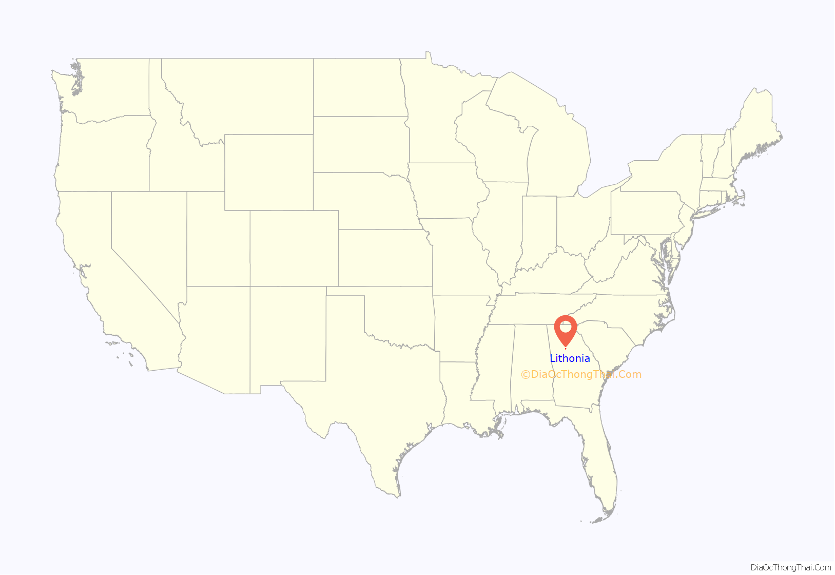
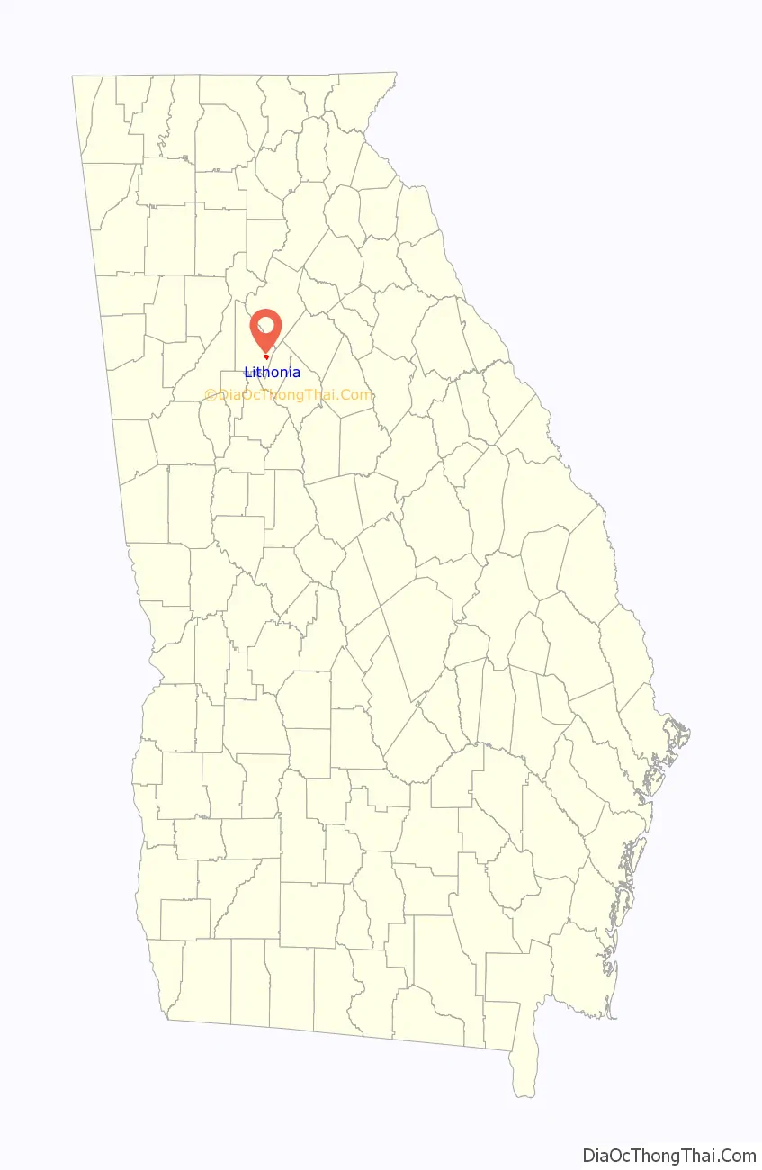
Lithonia location map. Where is Lithonia city?
History
In 1805, Lithonia began as a small crossroads settlement of farmers. The town grew with the coming of the Atlanta Augusta Railroad in 1845, which allowed the granite quarrying industry in the area to flourish.
Lithonia is the birthplace of the Lithonia Lighting company, one of North America’s largest manufacturers of commercial, institutional, industrial and residential light fixtures, which was founded in the city in 1946 but moved to nearby Conyers in the 1950s.
New Birth Missionary Baptist Church, a megachurch which is known for many high-profile funerals, is located in Stonecrest, GA, near Lithonia.
Lithonia Road Map
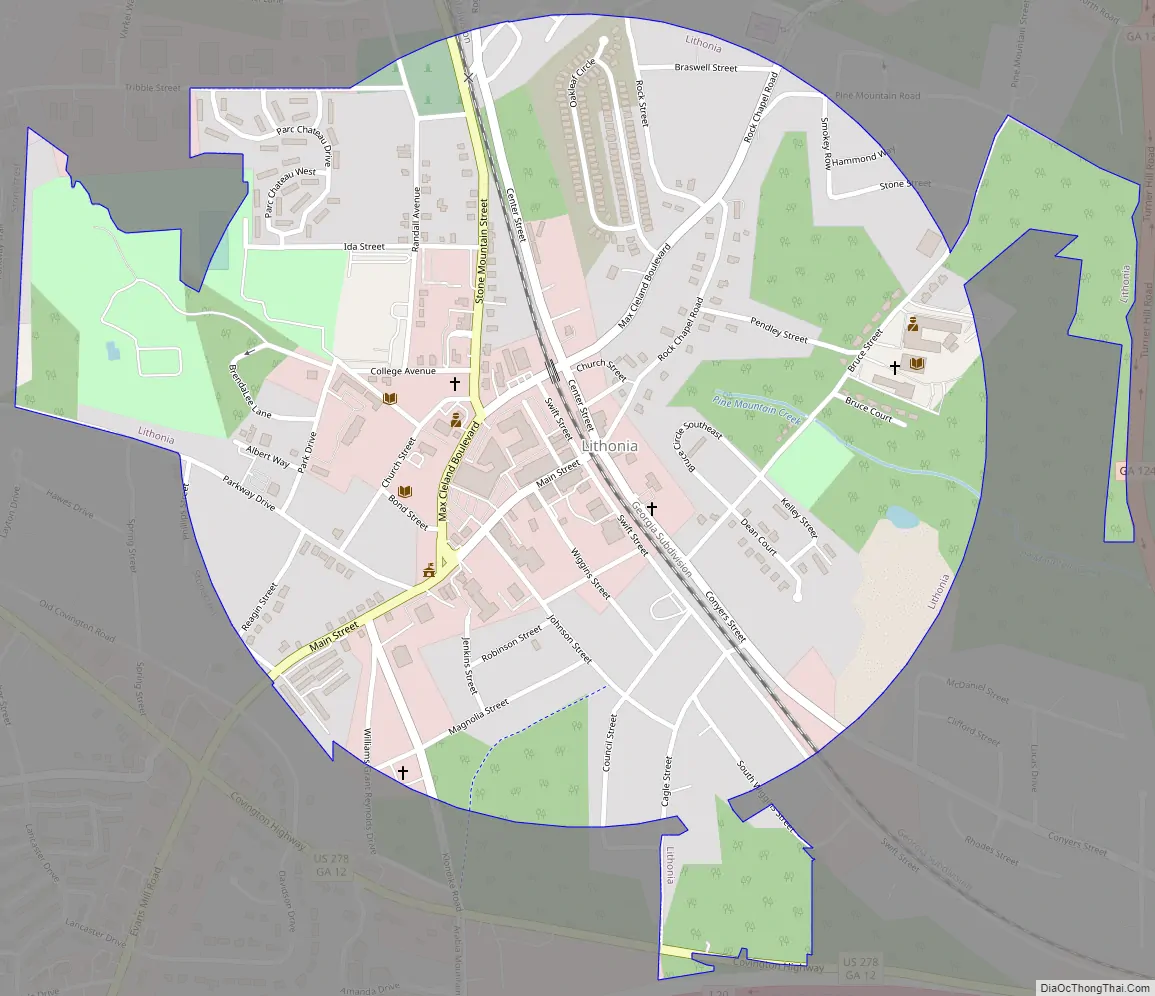
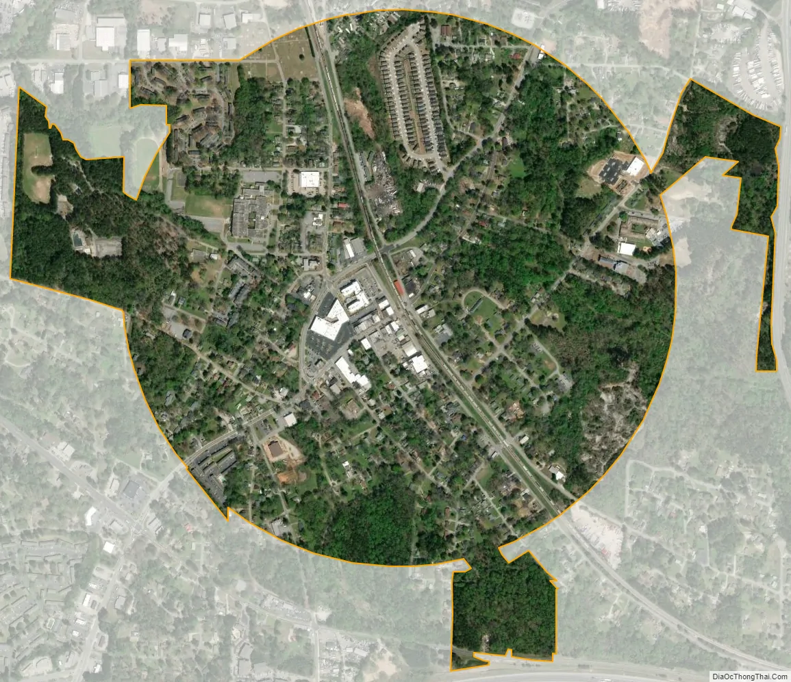
Lithonia city Satellite Map
Geography
Lithonia is located in southeastern DeKalb County at 33°42′46″N 84°6′21″W / 33.71278°N 84.10583°W / 33.71278; -84.10583 (33.712658, -84.105897). Interstate 20 passes just south of the community, with access from Exits 74 and 75. Lithonia is 18 miles (29 km) east of the center of Atlanta. Some areas in extreme southern Gwinnett County use a Lithonia postal address near the county line.
According to the United States Census Bureau, the city has a total area of 0.89 square miles (2.3 km), all land.
See also
Map of Georgia State and its subdivision:- Appling
- Atkinson
- Bacon
- Baker
- Baldwin
- Banks
- Barrow
- Bartow
- Ben Hill
- Berrien
- Bibb
- Bleckley
- Brantley
- Brooks
- Bryan
- Bulloch
- Burke
- Butts
- Calhoun
- Camden
- Candler
- Carroll
- Catoosa
- Charlton
- Chatham
- Chattahoochee
- Chattooga
- Cherokee
- Clarke
- Clay
- Clayton
- Clinch
- Cobb
- Coffee
- Colquitt
- Columbia
- Cook
- Coweta
- Crawford
- Crisp
- Dade
- Dawson
- Decatur
- DeKalb
- Dodge
- Dooly
- Dougherty
- Douglas
- Early
- Echols
- Effingham
- Elbert
- Emanuel
- Evans
- Fannin
- Fayette
- Floyd
- Forsyth
- Franklin
- Fulton
- Gilmer
- Glascock
- Glynn
- Gordon
- Grady
- Greene
- Gwinnett
- Habersham
- Hall
- Hancock
- Haralson
- Harris
- Hart
- Heard
- Henry
- Houston
- Irwin
- Jackson
- Jasper
- Jeff Davis
- Jefferson
- Jenkins
- Johnson
- Jones
- Lamar
- Lanier
- Laurens
- Lee
- Liberty
- Lincoln
- Long
- Lowndes
- Lumpkin
- Macon
- Madison
- Marion
- McDuffie
- McIntosh
- Meriwether
- Miller
- Mitchell
- Monroe
- Montgomery
- Morgan
- Murray
- Muscogee
- Newton
- Oconee
- Oglethorpe
- Paulding
- Peach
- Pickens
- Pierce
- Pike
- Polk
- Pulaski
- Putnam
- Quitman
- Rabun
- Randolph
- Richmond
- Rockdale
- Schley
- Screven
- Seminole
- Spalding
- Stephens
- Stewart
- Sumter
- Talbot
- Taliaferro
- Tattnall
- Taylor
- Telfair
- Terrell
- Thomas
- Tift
- Toombs
- Towns
- Treutlen
- Troup
- Turner
- Twiggs
- Union
- Upson
- Walker
- Walton
- Ware
- Warren
- Washington
- Wayne
- Webster
- Wheeler
- White
- Whitfield
- Wilcox
- Wilkes
- Wilkinson
- Worth
- Alabama
- Alaska
- Arizona
- Arkansas
- California
- Colorado
- Connecticut
- Delaware
- District of Columbia
- Florida
- Georgia
- Hawaii
- Idaho
- Illinois
- Indiana
- Iowa
- Kansas
- Kentucky
- Louisiana
- Maine
- Maryland
- Massachusetts
- Michigan
- Minnesota
- Mississippi
- Missouri
- Montana
- Nebraska
- Nevada
- New Hampshire
- New Jersey
- New Mexico
- New York
- North Carolina
- North Dakota
- Ohio
- Oklahoma
- Oregon
- Pennsylvania
- Rhode Island
- South Carolina
- South Dakota
- Tennessee
- Texas
- Utah
- Vermont
- Virginia
- Washington
- West Virginia
- Wisconsin
- Wyoming