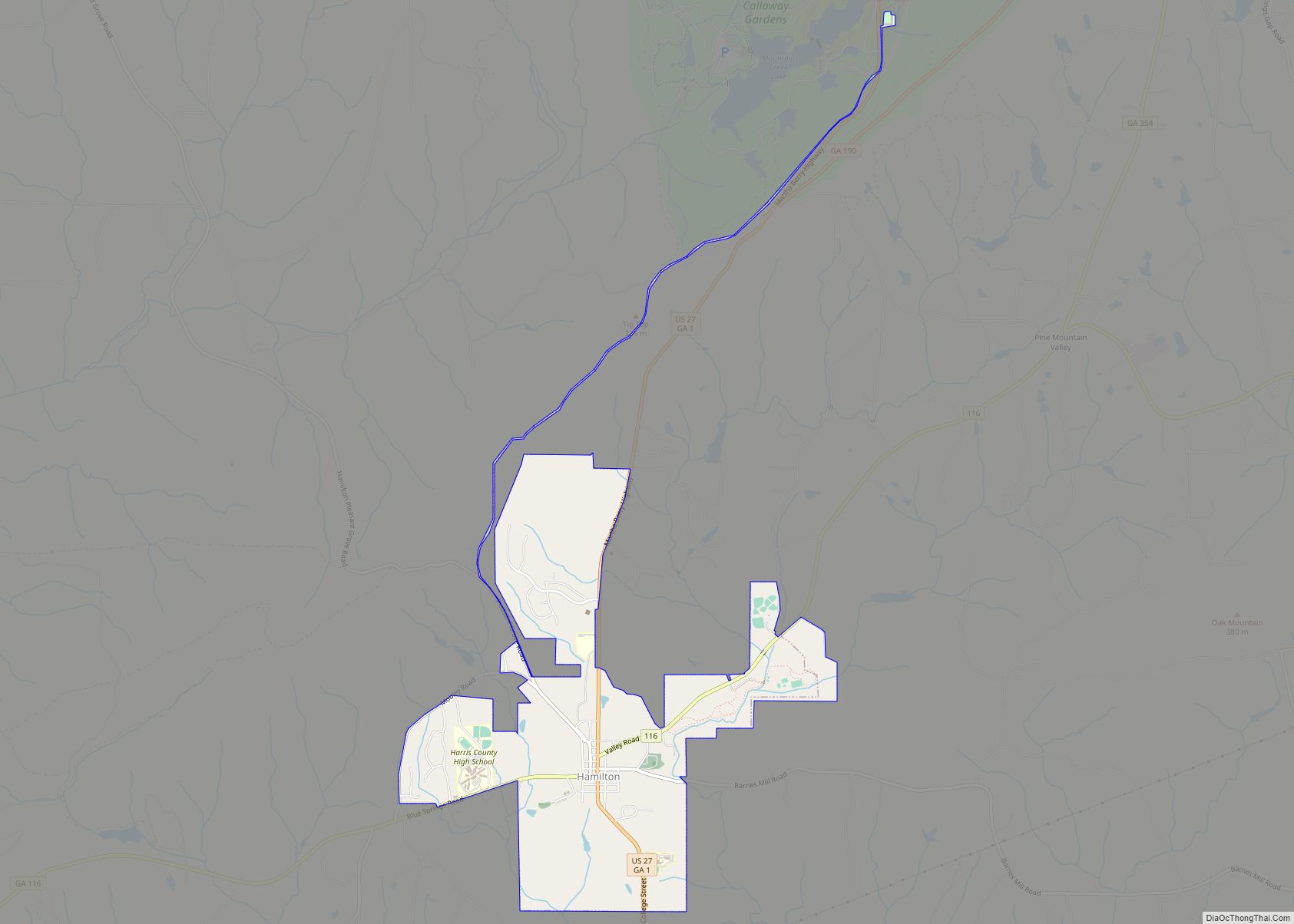
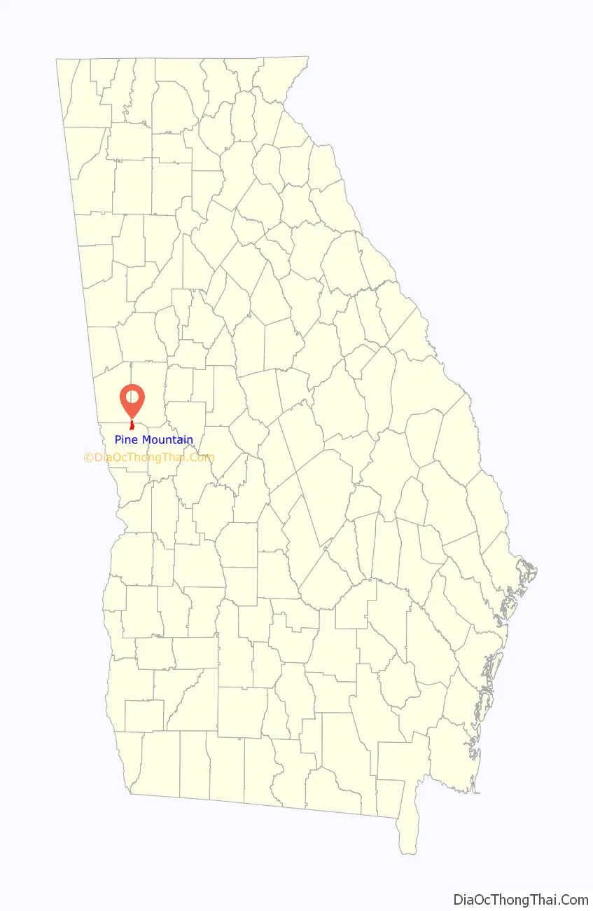
Pine Mountain is a town in Harris and Meriwether counties in the U.S. state of Georgia. As of the 2020 census it had a population of 1,216.
The Harris County portion of Pine Mountain is part of the Columbus, GA-AL Metropolitan Statistical Area, while the small portion that extends into Meriwether County is part of the Atlanta–Sandy Springs–Roswell Metropolitan Statistical Area.
| Name: | Pine Mountain town |
|---|---|
| LSAD Code: | 43 |
| LSAD Description: | town (suffix) |
| State: | Georgia |
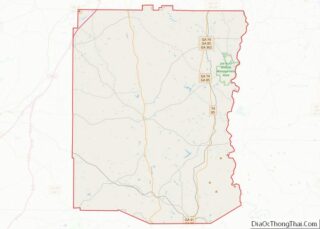
| County: | Harris County, Meriwether County |
| Elevation: | 922 ft (281 m) |
| Total Area: | 3.18 sq mi (8.24 km²) |
| Land Area: | 3.08 sq mi (7.97 km²) |
| Water Area: | 0.10 sq mi (0.27 km²) |
| Total Population: | 1,216 |
| Population Density: | 395.06/sq mi (152.51/km²) |
| ZIP code: | 31822 |
| Area code: | 706 |
| FIPS code: | 1361124 |
| GNISfeature ID: | 356471 |
| Website: | pinemountainga.org |
Online Interactive Map
Click on ![]() to view map in "full screen" mode.
to view map in "full screen" mode.
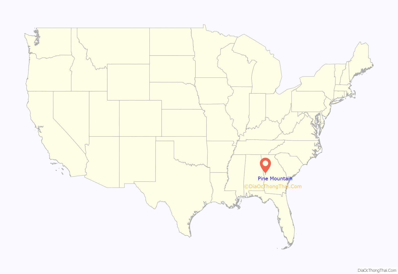
Pine Mountain location map. Where is Pine Mountain town?
History
The town began in 1882 when the railroad spread to Pine Mountain from Columbus, and until 1958, the community was known as “Chipley”. The name was changed to “Pine Mountain” due to the existence of Callaway Gardens.
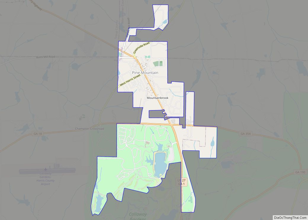
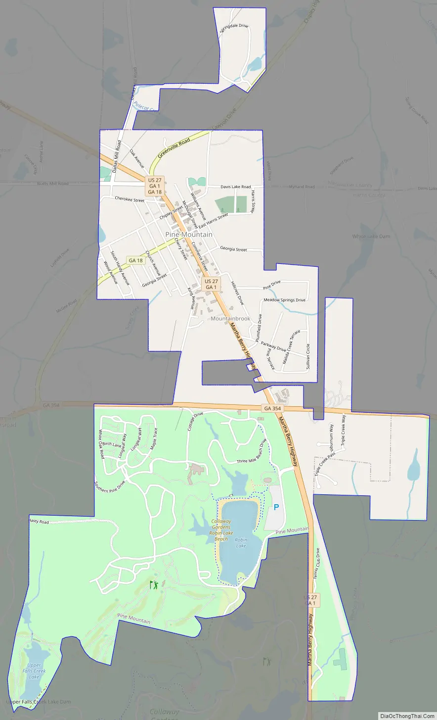
Pine Mountain Road Map
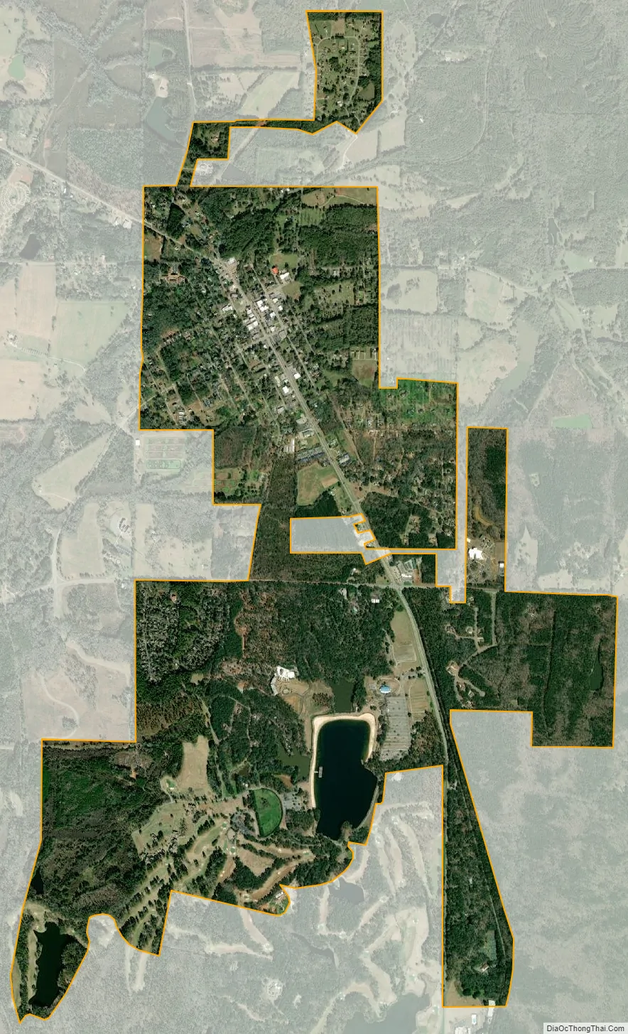
Pine Mountain city Satellite Map
Geography
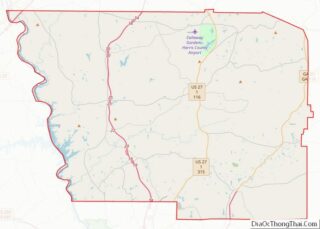
Pine Mountain is located in northeastern Harris County, with a small portion extending north into the southwestern corner of Meriwether County. The town is located along U.S. Route 27, which runs north to south through the town, leading northwest 17 miles (27 km) to LaGrange and south 8 miles (13 km) to Hamilton, the Harris County seat. Georgia State Route 18 and Georgia State Route 354 intersect U.S. Route 27 in the town limits. Route 18 leads west 20 miles (32 km) to West Point and northeast 16 miles (26 km) to Greenville. Atlanta is 78 miles (126 km) by road to the northeast, and Columbus is 33 miles (53 km) to the southwest. The town is located at the northern base of the Pine Mountain Range.
According to the United States Census Bureau, the town has a total area of 3.2 square miles (8.3 km), of which 0.1 square miles (0.3 km), or 3.30%, are water.
See also
Map of Georgia State and its subdivision:- Appling
- Atkinson
- Bacon
- Baker
- Baldwin
- Banks
- Barrow
- Bartow
- Ben Hill
- Berrien
- Bibb
- Bleckley
- Brantley
- Brooks
- Bryan
- Bulloch
- Burke
- Butts
- Calhoun
- Camden
- Candler
- Carroll
- Catoosa
- Charlton
- Chatham
- Chattahoochee
- Chattooga
- Cherokee
- Clarke
- Clay
- Clayton
- Clinch
- Cobb
- Coffee
- Colquitt
- Columbia
- Cook
- Coweta
- Crawford
- Crisp
- Dade
- Dawson
- Decatur
- DeKalb
- Dodge
- Dooly
- Dougherty
- Douglas
- Early
- Echols
- Effingham
- Elbert
- Emanuel
- Evans
- Fannin
- Fayette
- Floyd
- Forsyth
- Franklin
- Fulton
- Gilmer
- Glascock
- Glynn
- Gordon
- Grady
- Greene
- Gwinnett
- Habersham
- Hall
- Hancock
- Haralson
- Harris
- Hart
- Heard
- Henry
- Houston
- Irwin
- Jackson
- Jasper
- Jeff Davis
- Jefferson
- Jenkins
- Johnson
- Jones
- Lamar
- Lanier
- Laurens
- Lee
- Liberty
- Lincoln
- Long
- Lowndes
- Lumpkin
- Macon
- Madison
- Marion
- McDuffie
- McIntosh
- Meriwether
- Miller
- Mitchell
- Monroe
- Montgomery
- Morgan
- Murray
- Muscogee
- Newton
- Oconee
- Oglethorpe
- Paulding
- Peach
- Pickens
- Pierce
- Pike
- Polk
- Pulaski
- Putnam
- Quitman
- Rabun
- Randolph
- Richmond
- Rockdale
- Schley
- Screven
- Seminole
- Spalding
- Stephens
- Stewart
- Sumter
- Talbot
- Taliaferro
- Tattnall
- Taylor
- Telfair
- Terrell
- Thomas
- Tift
- Toombs
- Towns
- Treutlen
- Troup
- Turner
- Twiggs
- Union
- Upson
- Walker
- Walton
- Ware
- Warren
- Washington
- Wayne
- Webster
- Wheeler
- White
- Whitfield
- Wilcox
- Wilkes
- Wilkinson
- Worth
- Alabama
- Alaska
- Arizona
- Arkansas
- California
- Colorado
- Connecticut
- Delaware
- District of Columbia
- Florida
- Georgia
- Hawaii
- Idaho
- Illinois
- Indiana
- Iowa
- Kansas
- Kentucky
- Louisiana
- Maine
- Maryland
- Massachusetts
- Michigan
- Minnesota
- Mississippi
- Missouri
- Montana
- Nebraska
- Nevada
- New Hampshire
- New Jersey
- New Mexico
- New York
- North Carolina
- North Dakota
- Ohio
- Oklahoma
- Oregon
- Pennsylvania
- Rhode Island
- South Carolina
- South Dakota
- Tennessee
- Texas
- Utah
- Vermont
- Virginia
- Washington
- West Virginia
- Wisconsin
- Wyoming