Tucker is a city located in DeKalb County, Georgia, United States, located near Atlanta and was originally settled in the 1820s, and later developed as a railroad community in 1892. According to the 2016 United States Census Bureau annual estimate of resident population, it has a population of 35,322. In a November 2015 referendum, by a 3:1 margin (73.94%), voters approved incorporating Tucker into a city. In March 2016, Tucker residents elected the city’s first mayor and city council.
| Name: | Tucker city |
|---|---|
| LSAD Code: | 25 |
| LSAD Description: | city (suffix) |
| State: | Georgia |
| County: | DeKalb County |
| Elevation: | 1,122 ft (342 m) |
| Total Area: | 20.34 sq mi (52.67 km²) |
| Land Area: | 20.20 sq mi (52.33 km²) |
| Water Area: | 0.13 sq mi (0.34 km²) |
| Total Population: | 37,005 |
| Population Density: | 1,831.57/sq mi (707.16/km²) |
| ZIP code: | 30084 & 30085 |
| Area code: | 404, 770, 678 |
| FIPS code: | 1377652 |
| GNISfeature ID: | 0333270 |
| Website: | http://tuckerga.gov/ |
Online Interactive Map
Click on ![]() to view map in "full screen" mode.
to view map in "full screen" mode.
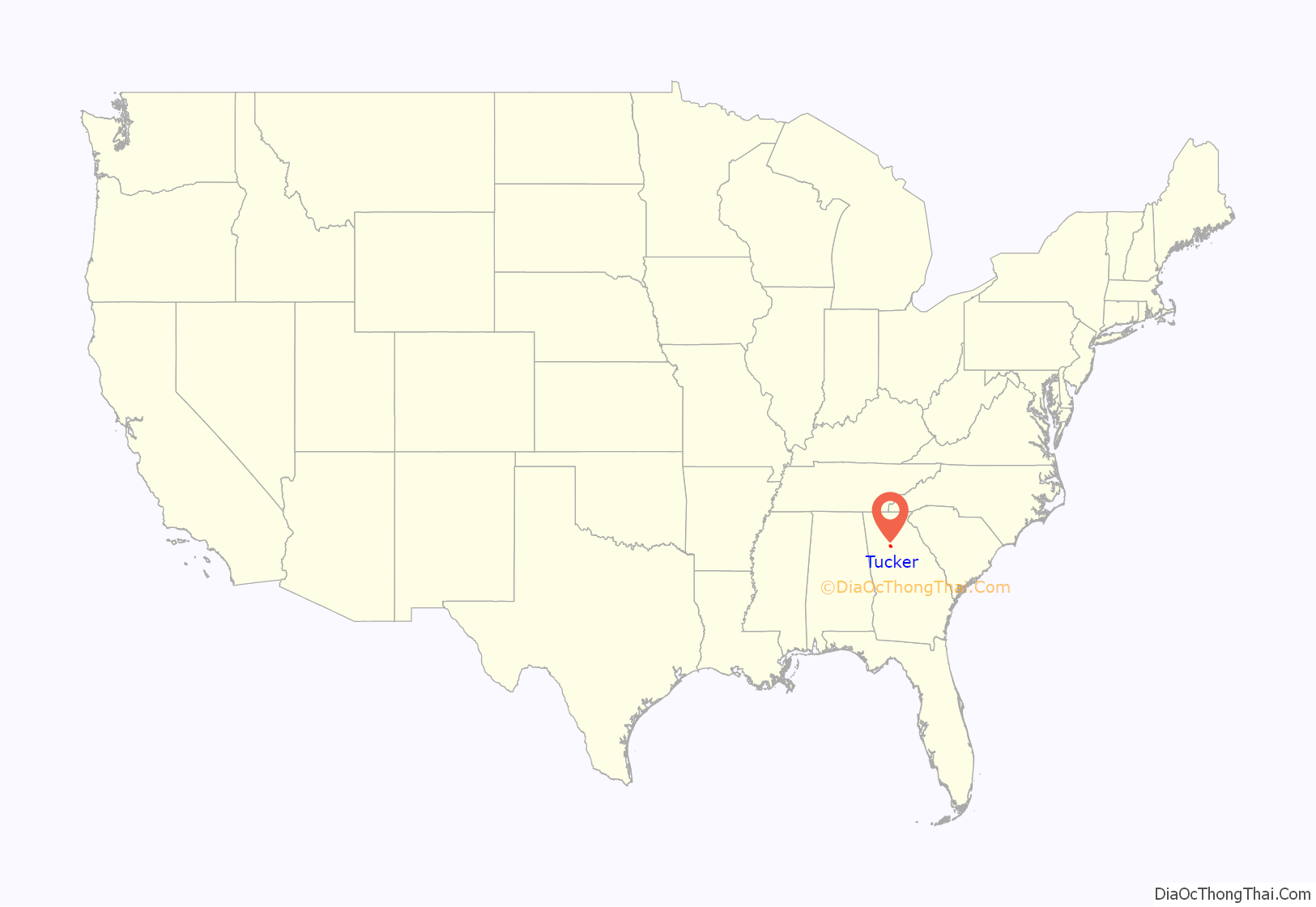
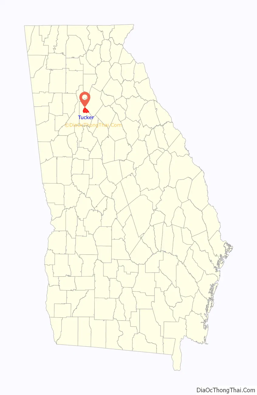
Tucker location map. Where is Tucker city?
History
Settlers
The 1821 Georgia Land Lottery opened portions of state land for settlement between the Flint and Ocmulgee rivers, including present-day DeKalb County. The Muscogee (Creek) Nation ceded the land to the United States in January of that year, and drawings for lots measuring 202.5 acres (81.9 ha) each began in May in Milledgeville, the state capital until 1868. The land grant fee was $19.00.
In 1821, the area that would become Tucker was in Militia District 572 in Henry County. The state created DeKalb County on December 9, 1822, and District 572 became DeKalb’s 18th District, or the Brownings District, reportedly named for Andrew Browning.
Among the thirty cemeteries within a 4-mile (6 km) radius of Main Street, approximately 30 graves belong to individuals born in the 18th century, four of whom are Revolutionary War soldiers. Twelve graves belong to Confederate soldiers.
Civil War
In spite of DeKalb County delegates voting against secession from the United States, Georgia joined the Confederacy and seceded from the Union in 1861. The full reality of that decision marched into Tucker in July 1864. Union soldiers camped at Henderson’s Mill, used the Brownings Court, one of the few buildings in the area they did not burn, dismantled the railroad to Stone Mountain, and formed the left wing of Sherman’s advance to Atlanta.
Railroad
In 1886 the Georgia, Carolina and Northern Railway received a charter to build a new rail line between Monroe, North Carolina, and Atlanta. Prior to the project’s completion, the company leased the road to the Seaboard Air Line Railroad system, a collection of regional railroads headquartered in North Carolina eager to extend its reach to Atlanta.
Seaboard built depots at a number of small villages, often little more than a crossroads, and named them for railroad company officials. The depot at Jug Tavern, for example, was named for Seaboard’s general manager, John H. Winder. The stop at Bryan was named in honor of the system’s general superintendent, Lilburn Meyers. Although the origin of the name is unknown, it is possible that the next stop, in the Brownings District, may have been named for Rufus S. Tucker, a director and major shareholder in several Seaboard system railroads. At the DeKalb County Centennial Celebration in 1922, Charles Murphey Candler stated that Tucker a “prosperous and promising village on the Seaboard Air Line Railway . . . was named in honor of Capt. Tucker, an official of the Seaboard Air Railway.” Some residents attribute the name to a local family with the surname Tucker.
The first train steamed into the new Tucker station on Sunday, April 24, 1892. Originating in Elberton with a final destination of the Atlanta suburb of Inman Park — a four-hour trip — the Seaboard train consisted of two cars carrying 150 passengers and a baggage car. Two months later the US Postal Service appointed Alpheus G. Chewning first Postmaster of the Tucker Post office. Rural Free Delivery began on March 2, 1903.
On Saturday, July 1, 1967, the Seaboard Air Line Railroad merged with the Atlantic Coast Line to form Seaboard Coast Line Railroad. In 1983 The line became Seaboard System and merged with the Chesapeake & Ohio, Baltimore & Ohio and the Western Maryland in 1986 Chessie System to form current railroad operator, CSXT. Although no longer a train stop for passengers, the Tucker depot is currently a CSX field office for track repair and signal maintenance.
Tucker, at 1,117 feet (340 m) feet above sea level, is the highest point of elevation on the railroad line between Atlanta and Richmond, Virginia.
Twentieth century
Following World War II, Tucker began a steady transition from an agricultural community to a mixed industrial, retail, and residential area. The strength of a county-wide water system extending into Tucker by the 1950s, and the post war establishment of nearby employers in other areas of the county including the Centers for Disease Control and Prevention in 1947, General Motors in Doraville, Kraft Foods in Decatur, and the growth of Emory University, brought new residents to Tucker from across the nation. Descendants of early settlers subdivided and sold family land for neighborhoods and shopping plazas. Local community leaders opened Tucker Federal Savings and Loan, created a youth football league, and by the 1960s newspapers identified Tucker as “DeKalb’s Area of Golden Opportunity.” The post–World War II baby boom drove the growth of DeKalb County schools and with the affordability of the car, the expansion of the highway system, and inexpensive fuel, Tucker became an ideal location to call home.
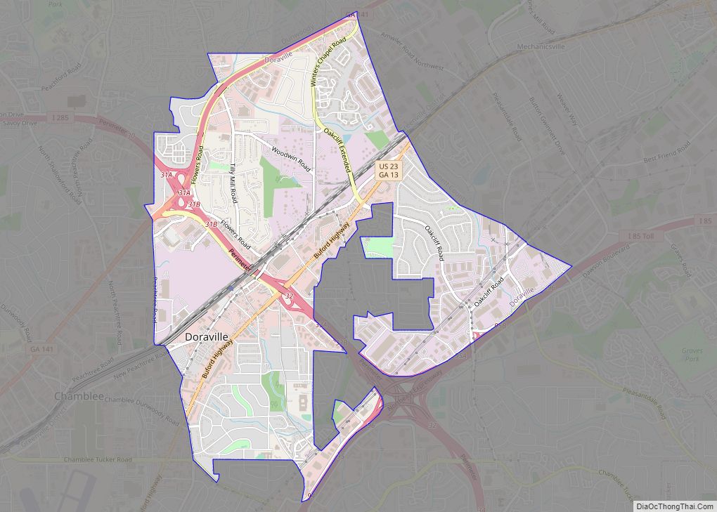
Tucker Road Map

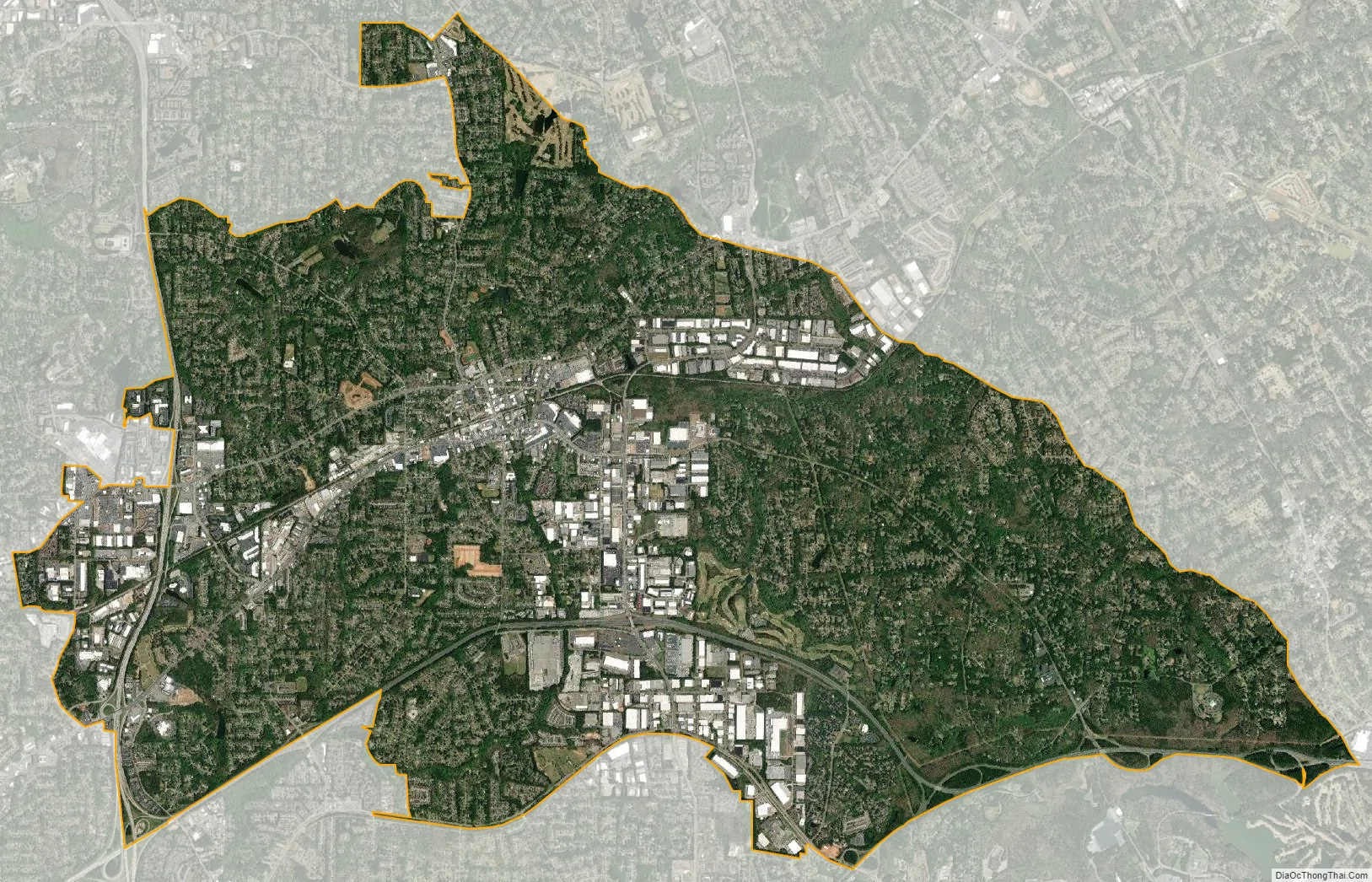
Tucker city Satellite Map
Geography
Tucker is located in northeastern DeKalb County at 33°51′6″N 84°13′17″W / 33.85167°N 84.22139°W / 33.85167; -84.22139 (33.851736, -84.221524), approximately 15 miles (24 km) northeast of downtown Atlanta. According to the United States Census Bureau, the CDP has a total area of 12.1 square miles (31 km), of which 12.0 square miles (31 km) is land and 0.1 square miles (0.26 km), or 0.83%, is water.
The Eastern Continental Divide cuts through Tucker, along Chamblee-Tucker Road to LaVista Road and continuing south towards Mountain Industrial Boulevard. Water falling to the west of this line flows towards the Chattahoochee River and the Gulf of Mexico. Water falling to the east of this line flows towards the Atlantic Ocean through the Ocmulgee River.
Topography
Tucker is in the state’s Piedmont geologic region, composed of igneous and metamorphic rocks resulting from 300 to 600 million year old sediments that were subjected to high temperatures and pressures and re-exposed roughly 250 to 300 million years ago. Rocks typical of the region include schist, amphibolite, gneiss, migmatite, and granite.
Over a dozen creeks originate in Tucker including Burnt Fork Creek, South Fork Peachtree Creek, Camp Creek, and Henderson Mill Creek. Prior to the widespread accessibility of electricity and indoor plumbing, several were used as mill ponds or dammed for baptism. From 1906 until its demise in the 1940s, Burnt Fort Creek was the primary tributary for the Decatur Waterworks.
Surrounding municipalities
Climate
Tucker’s climate, typical of a humid subtropical climate, features mild winters and hot summers. In spite of moderate conditions compared to communities in many other states, Tucker has occasional extreme weather. The record high is 110 °F (43 °C), recorded on July 8, 1927, and the record low, January 21, 1985, −10 °F (−23 °C).
See also
Map of Georgia State and its subdivision:- Appling
- Atkinson
- Bacon
- Baker
- Baldwin
- Banks
- Barrow
- Bartow
- Ben Hill
- Berrien
- Bibb
- Bleckley
- Brantley
- Brooks
- Bryan
- Bulloch
- Burke
- Butts
- Calhoun
- Camden
- Candler
- Carroll
- Catoosa
- Charlton
- Chatham
- Chattahoochee
- Chattooga
- Cherokee
- Clarke
- Clay
- Clayton
- Clinch
- Cobb
- Coffee
- Colquitt
- Columbia
- Cook
- Coweta
- Crawford
- Crisp
- Dade
- Dawson
- Decatur
- DeKalb
- Dodge
- Dooly
- Dougherty
- Douglas
- Early
- Echols
- Effingham
- Elbert
- Emanuel
- Evans
- Fannin
- Fayette
- Floyd
- Forsyth
- Franklin
- Fulton
- Gilmer
- Glascock
- Glynn
- Gordon
- Grady
- Greene
- Gwinnett
- Habersham
- Hall
- Hancock
- Haralson
- Harris
- Hart
- Heard
- Henry
- Houston
- Irwin
- Jackson
- Jasper
- Jeff Davis
- Jefferson
- Jenkins
- Johnson
- Jones
- Lamar
- Lanier
- Laurens
- Lee
- Liberty
- Lincoln
- Long
- Lowndes
- Lumpkin
- Macon
- Madison
- Marion
- McDuffie
- McIntosh
- Meriwether
- Miller
- Mitchell
- Monroe
- Montgomery
- Morgan
- Murray
- Muscogee
- Newton
- Oconee
- Oglethorpe
- Paulding
- Peach
- Pickens
- Pierce
- Pike
- Polk
- Pulaski
- Putnam
- Quitman
- Rabun
- Randolph
- Richmond
- Rockdale
- Schley
- Screven
- Seminole
- Spalding
- Stephens
- Stewart
- Sumter
- Talbot
- Taliaferro
- Tattnall
- Taylor
- Telfair
- Terrell
- Thomas
- Tift
- Toombs
- Towns
- Treutlen
- Troup
- Turner
- Twiggs
- Union
- Upson
- Walker
- Walton
- Ware
- Warren
- Washington
- Wayne
- Webster
- Wheeler
- White
- Whitfield
- Wilcox
- Wilkes
- Wilkinson
- Worth
- Alabama
- Alaska
- Arizona
- Arkansas
- California
- Colorado
- Connecticut
- Delaware
- District of Columbia
- Florida
- Georgia
- Hawaii
- Idaho
- Illinois
- Indiana
- Iowa
- Kansas
- Kentucky
- Louisiana
- Maine
- Maryland
- Massachusetts
- Michigan
- Minnesota
- Mississippi
- Missouri
- Montana
- Nebraska
- Nevada
- New Hampshire
- New Jersey
- New Mexico
- New York
- North Carolina
- North Dakota
- Ohio
- Oklahoma
- Oregon
- Pennsylvania
- Rhode Island
- South Carolina
- South Dakota
- Tennessee
- Texas
- Utah
- Vermont
- Virginia
- Washington
- West Virginia
- Wisconsin
- Wyoming