Snellville is a city in Gwinnett County, Georgia, United States, east of Atlanta. Its population was 18,242 at the 2010 census. It is a developed exurb of Atlanta and a part of the Atlanta metropolitan area, and is located roughly 33 miles east of downtown Atlanta via US 78 and Interstate 285.
| Name: | Snellville city |
|---|---|
| LSAD Code: | 25 |
| LSAD Description: | city (suffix) |
| State: | Georgia |
| County: | Gwinnett County |
| Incorporated: | 1923 |
| Elevation: | 1,037 ft (316 m) |
| Total Area: | 10.60 sq mi (27.46 km²) |
| Land Area: | 10.47 sq mi (27.12 km²) |
| Water Area: | 0.13 sq mi (0.34 km²) |
| Total Population: | 20,573 |
| Population Density: | 1,964.76/sq mi (758.61/km²) |
| Area code: | 770 |
| FIPS code: | 1371604 |
| GNISfeature ID: | 2405480 |
| Website: | www.snellville.org |
Online Interactive Map
Click on ![]() to view map in "full screen" mode.
to view map in "full screen" mode.
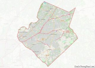
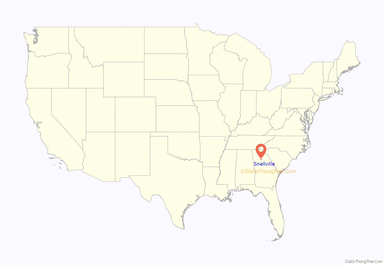
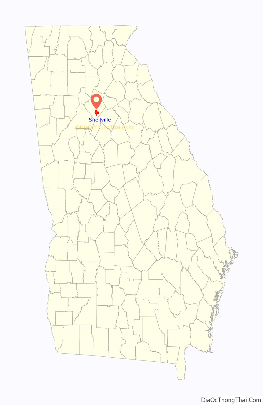
Snellville location map. Where is Snellville city?
History
English settlers
In 1874, Thomas Snell and James Sawyer, 17-year-old friends from London, secretly planned a voyage to the New World. On March 18, James Sawyer and his brother, Charles, left England. However, Snell’s parents, having learned of the plan, would not allow him to leave, thus delaying his departure. The Sawyer brothers arrived in New York City on April 1, and after a few weeks, headed toward Athens, Georgia, and then to Madison County, where they stayed and worked on a farm for $10 a month. Snell did eventually follow his friends to New York and made his way south to meet them. The three then made their way through Jefferson and Lawrenceville. Shortly after Snell’s arrival, Charles left for Pennsylvania, later returning to the South and settling in Alabama, where he went into the turpentine business. James had gone also, in search of his brother, leaving Snell to work on the farm of A. A. Dyer.
Unable to find his brother, James Sawyer returned to New York and began work on a farm near the Hudson River area until his 21st birthday in 1878, when he returned to England to claim his inheritance. Shortly following, in August 1879, he returned to Americus, Georgia, and then Gwinnett County. Once in Gwinnett County, Sawyer found Snell in the small settlement then known as New London, near Stone Mountain. In the homestead that Snell now referred to as Snellville, the two built a small wood-frame building and started a business together, Snell and Sawyer’s Store, similar to the one in which they were employed in London. As was common in small mill towns of the time, they printed store money with the trade value and Snell’s likeness on the front that regular customers could use to purchase goods. By the end of 1879, the business was prospering and catering to customers from the neighboring towns of Lawrenceville and Loganville. Travelers bought supplies at “Snell and Sawyer’s” and often spent the night in the nearby oak groves, as the trip was too great for one day’s travel. When New London officially became Snellville is unknown, but the location of the partners’ store was referred to as Snellville in their advertising, and the young town began to show a promising future.
The partnership later dissolved, and Sawyer kept the old store, building granite stone above and around the old frame and then disassembling the wood frame from within. Snell built a new store of granite. In 1883, Sawyer built a home and married Emma Webb, of the historic Snellville Webb family, on November 15. Sawyer opened Snellville’s first post office in 1885 and served as postmaster from the back of his store.
Snell died at age 39 in 1896 due to complications following an appendicitis operation. He was buried in Brownlee Mountain, presently known as Nob Hill, and was later reburied in nearby Lithonia.
Initially forced into partial retirement due to failing eyesight, Sawyer later lost his sight completely. After that time, the store was owned and operated by various merchants. It was eventually destroyed in 1960 and replaced by a service station. James Sawyer died in 1948 at age 91 and is buried in the Baptist Cemetery (now Snellville Historical Cemetery).
City beginnings
The City of Snellville received its charter from the General Assembly of the State of Georgia in 1923.
Recent times
As of the 2010 census, Snellville’s population was 18,242 and included 7,069 housing units. Snellville’s political system now includes a mayor and five council members. There are over 100 employees working for the city of Snellville, which operates from five departments: Administration, Parks and Recreation, Planning and Development, Public Safety, and Public Works. The city limits have grown to 10.6 square miles (27.4 km), and 14 houses of worship are located within the city limits.
In early November 2000, then-Mayor Brett Harrell began negotiating a land swap to transform an abandoned supermarket into a municipal complex and the now-former City Hall into part of a church campus. The old Kroger in the Oakland Village Shopping Center on US 78 across from Snellville United Methodist Church and City Hall was just one of several dead or dying shopping centers plaguing Snellville. Abandoned big-box stores had become enough of an eyesore to make them a major issue in the 1999 city elections. Harrell had campaigned on a platform that included efforts to revitalize vacant retail space.
The project was not without its opponents. Among the concerned were tenants of the half-occupied Oakland Village Shopping Center that the city would take over, and who would be forced to relocate. The city council voted unanimously that November to proceed with the exploration of a potential land swap. There was concern that timing could become an issue and kill the deal in the early stages. The owner of the shopping center wanted to sell his property by the end of 2000, while the city council decided to take no action for a six-month period. Some citizens expressed concerns about the project at the city council meeting and asked for the deal to be put to a referendum.
On March 5, 2001, the city held its first public hearing on the land swap. Over 100 citizens attended the meeting to support the idea, while more than a dozen showed up to oppose it. A few cited a recent $79,000 roof job on City Hall, and the fact that the swap would benefit the church more than the city, as reasons to back out of the deal.
On March 26, 2001, the city council met to vote on the land swap proposal. At this meeting, the citizens were given a few specifics of the deal. According to the Council, the Oakland Village Shopping Center was worth $2,700,000, and the current City Hall was worth $2,300,000. Councilman Jerry Oberholtzer estimated that renovation of the shopping center for city use would be in the $2,500,000 range. He also estimated that to renovate City Hall for future needs would run the city the same cost. More opponents than supporters spoke at the meeting, and a few senior citizens presented a petition against relocating their center which was part of the land swap plan. The City Council voted 3–1 in favor of the swap; Councilman Troy Carter was the only dissenting vote.
As preparation for the swap began, the city hit a snag in June 2001, when a possibility arose of perchloroethylene soil contamination from an old dry cleaner site in the Oakland Village Shopping Center. The Georgia Department of Natural Resources Environmental Protection Division responded that even in the event of contamination, a clean-up may not be required if no one lives close enough to the site or no one is using the ground water in the area. The city did discover the use of a well by a private citizen within a one-mile (1.6 km) radius of the site. This citizen, Harold “Cotton” Willams, refused a $25,000 deal from the Methodist Church to cap the well. In response, the city began exploring a local ordinance banning the construction of new wells and closing any existing ones. The city council voted on June 25 to adopt the ordinance but still allow the use of the well for irrigation. The city council also decided to include the realignment of Oak Road and Henry Clower Boulevard at U.S. 78 in the land swap project.
In July 2001, the land swap hit another snag. A lawyer representing the Nash family of Snellville filed a lawsuit claiming the city could not trade one of the parcels because the city did not own it. The Nash family contended it owned the approximately 1-acre (4,000 m) tract and the unused building sitting on it. In 1935, Horace J. Nash deeded the building to the Georgia Rural Rehabilitation Corporation for use as a vocational center. The building was used to train unemployed workers during and after the Great Depression. Later, the city used the site for a jail, a senior center and an agricultural building. Most recently, the building housed Recorder’s Court. Attorney Bill Crecelius said the Nash family had let Snellville use the building for decades without complaint. This issue was resolved when the city presented documents verifying its ownership of the title to the building as well as title insurance.
In July 2003, the last piece of a $6,700,000 building plan for the project fell into place. The Snellville City Council approved funding for a multipurpose complex combining municipal functions and police services, plus offering a public gathering spot. In a 4–2 vote, the council approved certificates of participation, a series of leases that are to be renewed annually until they are paid off in 20 years. The leases, with an interest rate of slightly more than 4 percent, will cost the city about $10 million when they are paid off in two decades. Mayor Brett Harrell, Mayor Pro Tempore Melvin Everson and council members Jerry Oberholtzer and Deborah Rich voted for the funding program. Council members Robert Jenkins and Mike Smith cast dissenting votes. In the final plan, the land swap would include an 8-acre (32,000 m) project encompassing a new City Hall, police department, senior center and public forum area.
Groundbreaking for the new city hall began in March 2004 with the demolition of the Oakland Village Shopping Center. Hogan Construction Group of Norcross was awarded the $7,400,000 contract to construct both the new City Hall and new Senior Center. The original completion date was pushed back because of poor weather conditions. Crews also had to blast granite under the building foundation, further delaying the project and adding $200,000 to the cost.
On March 12, 2006, the city officially dedicated the new City Hall, located at the corner of Oak Road and Main Street East (US 78). Mayor Jerry Oberholtzer was quoted that arriving at the dedication day took “five years, four elections, three architectural firms, and two lawsuits”. The city hopes to one day expand the complex by adding a parking deck and a new public safety annex.
On August 13, 2007, the city council awarded a $52,000 contract to Smithco Construction of Gainesville to demolish and remove the remaining piece of the old Oakland Village Shopping Center. The area has now been converted into an open green space.
Former Mayor Tom Witts had been under close watch since 2013 for alleged tax evasion, owing tens of thousands of dollars in state taxes. On September 7, 2017, Witts was indicted on 66 counts, included allegations that he “consistently underreported income and over-reported deductions” on tax returns; that he used more than half of his 2015 mayoral campaign funds on expenses like cruises, plane tickets, and adult-entertainment websites, and that Witts’ company completed multiple jobs for the city of Snellville, a violation of state law. Witts’ original sentence was reduced due to poor health, reducing any jail time to house arrest. Mayor Pro Tem Barbara Bender was to be sworn in as mayor until an election can be called.
Towne Center
In February 2011, the City of Snellville hired engineering firm Clark, Patterson and Lee in conjunction with renowned urban-planning firm Duany Plater-Zyberk & Company to begin the process of planning a new town center for the suburban community. A weekend-long design charrette was held to engage the community in the process. The plan that emerged from this visioning process provides a new town green and shopping district, bordered by neighborhoods that incorporate a variety of housing types. The plan takes into account the Continuous Flow Intersection that had previously been planned by the Georgia Department of Transportation. A key element of the new town design is a system of bridges and tunnels that create a more walkable city.
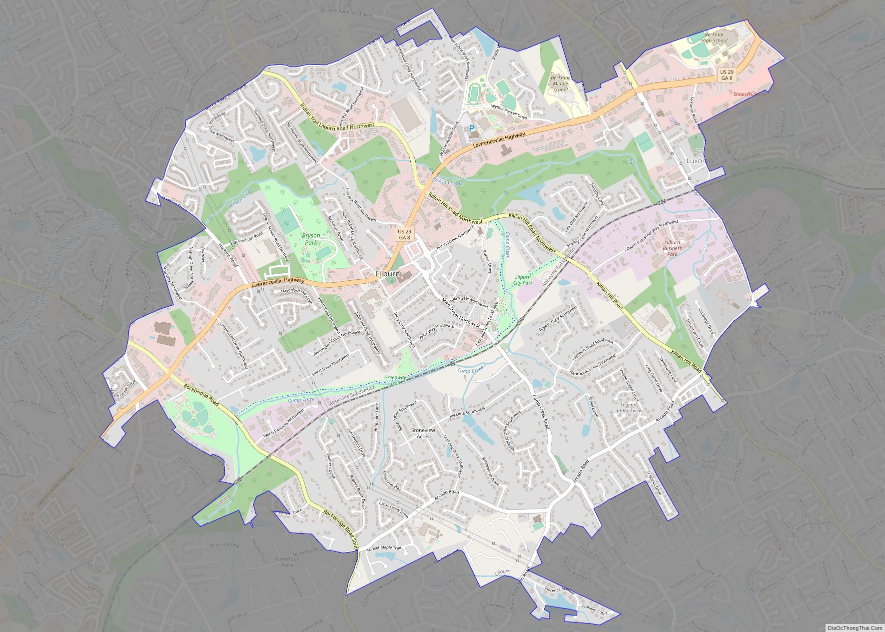
Snellville Road Map
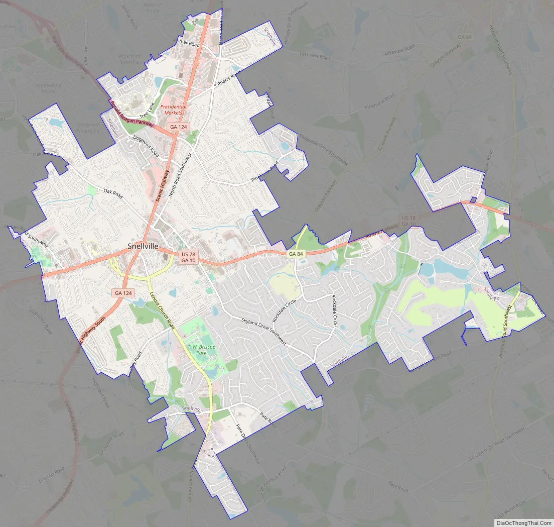
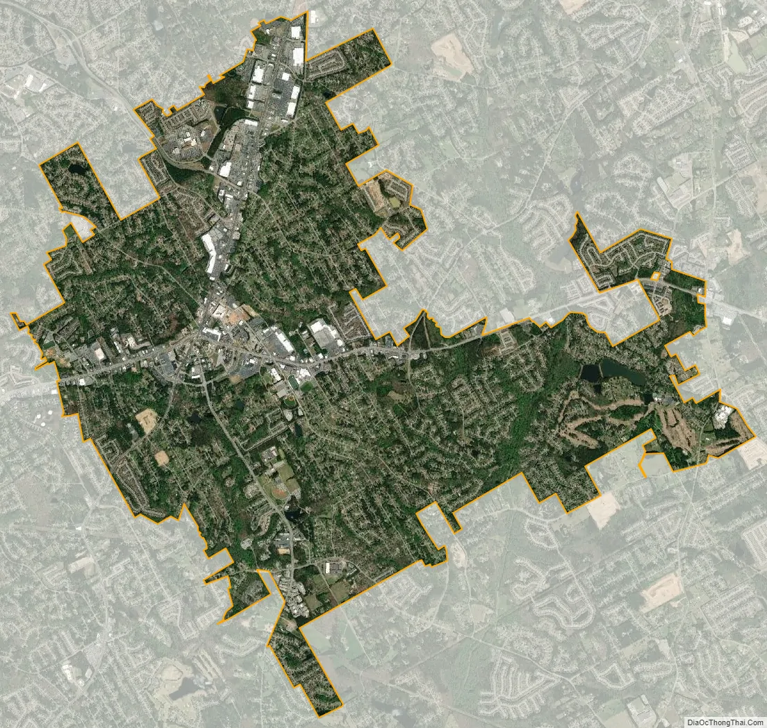
Snellville city Satellite Map
Geography
Snellville is located in southern Gwinnett County. U.S. Route 78 runs through the center of the city, leading west 25 miles (40 km) to downtown Atlanta and east 19 miles (31 km) to Monroe. Georgia State Route 124 crosses US 78 in the center of Snellville, leading north 7 miles (11 km) to Lawrenceville and south 13 miles (21 km) to Lithonia. Some unincorporated areas in the eastern edge of DeKalb County and western Rockdale County have a Snellville mailing address, but are not a part of the City of Snellville.
According to the United States Census Bureau, Snellville has a total area of 10.6 square miles (27.4 km), of which 10.5 square miles (27.1 km) is land and 0.1 square miles (0.3 km), or 1.22%, is water.
Climate
Snellville (along with the rest of the Atlanta metropolitan area) has a humid subtropical climate according to the Köppen classification, with generally hot, humid summers and mild winters by the standards of most of the U.S.
Compared to most large cities around the world at approximately the same latitude (33°39′), such as Beirut, Casablanca, Dallas, Los Angeles, and Phoenix, Snellville has lower average winter temperatures. The primary reason for this is that the North American continent extends into high latitudes that allows systems to form and move eastward and southward without obstruction by major mountain ranges. Other factors include Snellville’s distance from large bodies of water; its higher elevation, which can lead to rapid weather changes; prevailing wind patterns; and extensive tree cover, which reduces the urban heat island effect (an advantage during summer).
In the winter, weather systems sweeping south from Canada, through the Midwest, bring temperatures that can reach below 25 °Fahrenheit (−3.9 °Celsius) a few times a year. The lowest temperature recorded in the city is −9 °F (−22 °C), reached on February 13, 1899. It also reached −7 °F (−22 °C) twice and −8 °F (−22 °C) once in Atlanta in the 1980s and 1990s. An average year sees frost on 48 days; snowfall, which occurs most years, averages 2 inches (5 centimeters) annually. The greatest single accumulation of snow was 10 inches (25 centimeters), on January 23, 1940. A more prominent issue in winter are the frequent ice storms that can cause more problems than snow; the most severe such storm may have occurred on January 7, 1973. Also during winter, warm air sometimes flows from the Gulf of Mexico, raising temperatures as high as 75 °F (24 °C).
Though summers are humid, actual temperatures are lower than they may feel, with afternoon highs peaking at about 90 °F (32 °C) in late July. Temperatures rarely reach 100 °F (38 °C), which, during the last 30 years, was recorded in 1980, 1983, 1986, 1993, 1995, 2000, and 2007. The highest temperature recorded in the city is 105 °F (40.6 °C), reached on July 13 and 17, 1980.
Like the rest of the Southeastern U.S., the Atlanta metropolitan area experiences abundant rainfall, which is relatively evenly distributed throughout the year. Average annual rainfall is 50.5 inches (127 centimeters); the only other major U.S. cities with greater rainfall are Miami, Florida, and New Orleans, Louisiana.
Parks
Thomas W. Briscoe Park consists of 87 developed acres (100 total acres), just south of the city center on Lenora Church Road. The park hosts numerous activities for youth and seniors including summer camp, swim lessons, soccer and senior trips.
Lenora Park and Disc Golf Course encompasses 112 acres (0.45 km) of land on Lenora Church Road.
South Gwinnett Athletic Association consists of six baseball and softball fields, one football field, and 40,000 square feet of indoor sporting rink use for roller hockey, volleyball, indoor soccer, and lacrosse.
See also
Map of Georgia State and its subdivision:- Appling
- Atkinson
- Bacon
- Baker
- Baldwin
- Banks
- Barrow
- Bartow
- Ben Hill
- Berrien
- Bibb
- Bleckley
- Brantley
- Brooks
- Bryan
- Bulloch
- Burke
- Butts
- Calhoun
- Camden
- Candler
- Carroll
- Catoosa
- Charlton
- Chatham
- Chattahoochee
- Chattooga
- Cherokee
- Clarke
- Clay
- Clayton
- Clinch
- Cobb
- Coffee
- Colquitt
- Columbia
- Cook
- Coweta
- Crawford
- Crisp
- Dade
- Dawson
- Decatur
- DeKalb
- Dodge
- Dooly
- Dougherty
- Douglas
- Early
- Echols
- Effingham
- Elbert
- Emanuel
- Evans
- Fannin
- Fayette
- Floyd
- Forsyth
- Franklin
- Fulton
- Gilmer
- Glascock
- Glynn
- Gordon
- Grady
- Greene
- Gwinnett
- Habersham
- Hall
- Hancock
- Haralson
- Harris
- Hart
- Heard
- Henry
- Houston
- Irwin
- Jackson
- Jasper
- Jeff Davis
- Jefferson
- Jenkins
- Johnson
- Jones
- Lamar
- Lanier
- Laurens
- Lee
- Liberty
- Lincoln
- Long
- Lowndes
- Lumpkin
- Macon
- Madison
- Marion
- McDuffie
- McIntosh
- Meriwether
- Miller
- Mitchell
- Monroe
- Montgomery
- Morgan
- Murray
- Muscogee
- Newton
- Oconee
- Oglethorpe
- Paulding
- Peach
- Pickens
- Pierce
- Pike
- Polk
- Pulaski
- Putnam
- Quitman
- Rabun
- Randolph
- Richmond
- Rockdale
- Schley
- Screven
- Seminole
- Spalding
- Stephens
- Stewart
- Sumter
- Talbot
- Taliaferro
- Tattnall
- Taylor
- Telfair
- Terrell
- Thomas
- Tift
- Toombs
- Towns
- Treutlen
- Troup
- Turner
- Twiggs
- Union
- Upson
- Walker
- Walton
- Ware
- Warren
- Washington
- Wayne
- Webster
- Wheeler
- White
- Whitfield
- Wilcox
- Wilkes
- Wilkinson
- Worth
- Alabama
- Alaska
- Arizona
- Arkansas
- California
- Colorado
- Connecticut
- Delaware
- District of Columbia
- Florida
- Georgia
- Hawaii
- Idaho
- Illinois
- Indiana
- Iowa
- Kansas
- Kentucky
- Louisiana
- Maine
- Maryland
- Massachusetts
- Michigan
- Minnesota
- Mississippi
- Missouri
- Montana
- Nebraska
- Nevada
- New Hampshire
- New Jersey
- New Mexico
- New York
- North Carolina
- North Dakota
- Ohio
- Oklahoma
- Oregon
- Pennsylvania
- Rhode Island
- South Carolina
- South Dakota
- Tennessee
- Texas
- Utah
- Vermont
- Virginia
- Washington
- West Virginia
- Wisconsin
- Wyoming