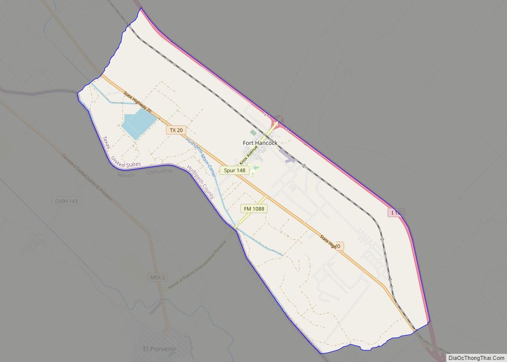
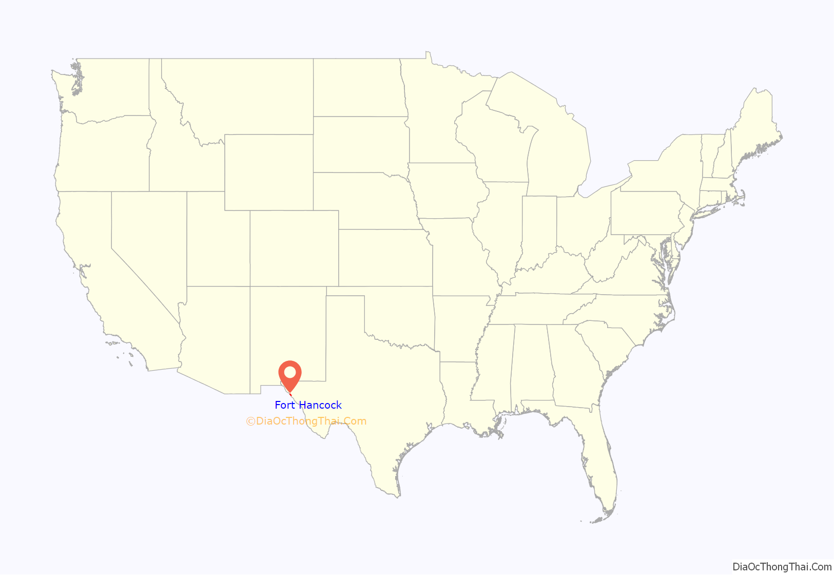
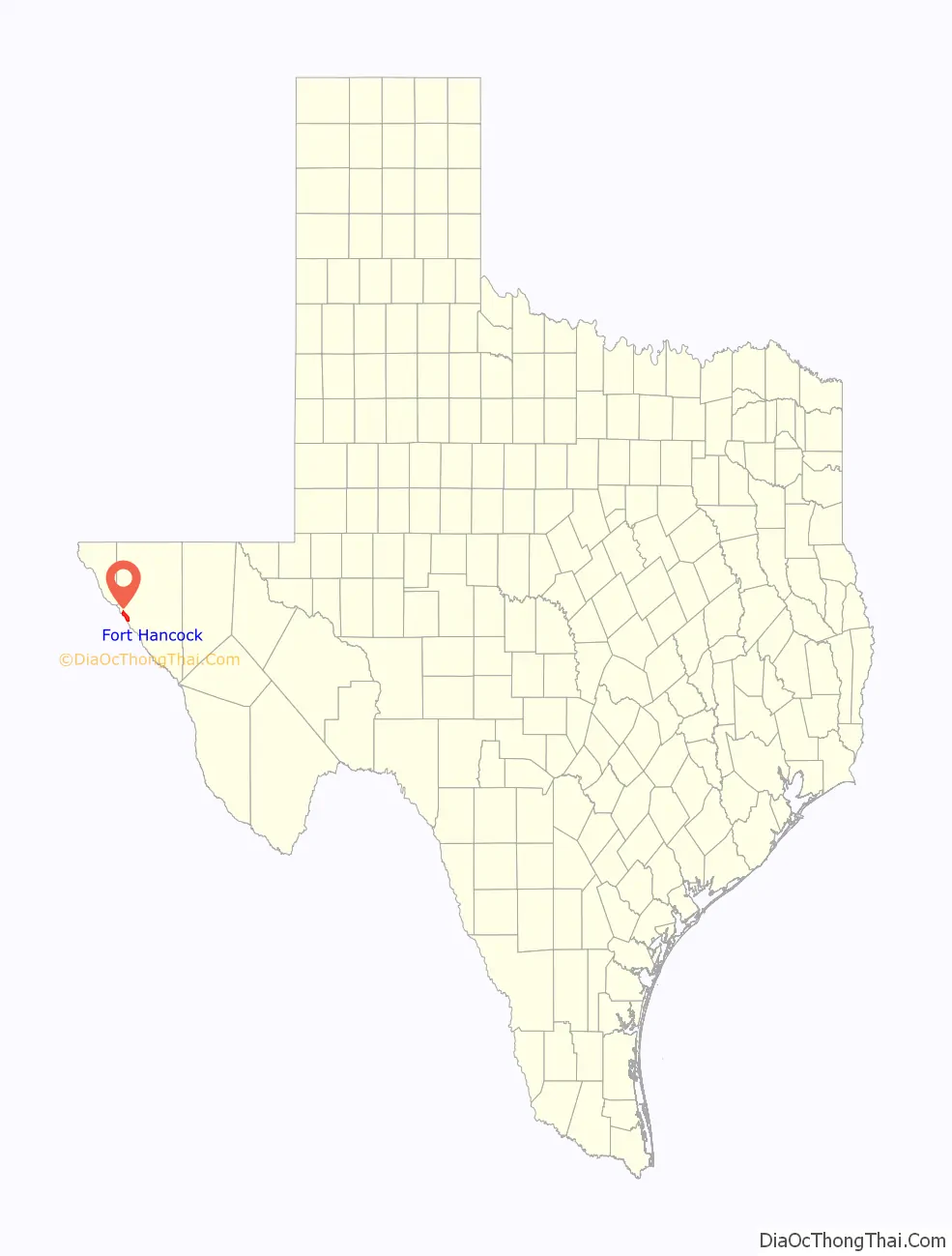
Fort Hancock is an unincorporated community and census-designated place (CDP) in Hudspeth County, Texas, United States. Its population was 1,213 at the 2020: DEC Redistricting Data.
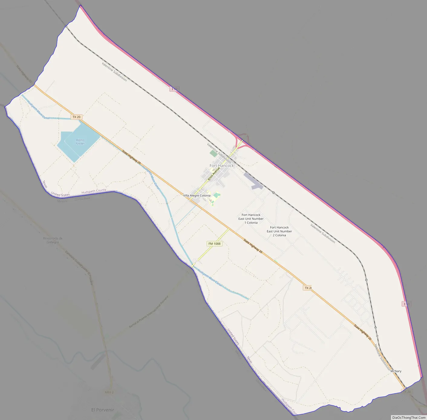
Fort Hancock is situated on the Mexico–United States border, across from El Porvenir, Chihuahua. The Fort Hancock–El Porvenir International Bridge connects the two communities, and the Fort Hancock Port of Entry is located on the Texas side.
Texas State Highway 20 and the Union Pacific Railroad run through the town.
| Name: | Fort Hancock CDP |
|---|---|
| LSAD Code: | 57 |
| LSAD Description: | CDP (suffix) |
| State: | Texas |
| County: | Hudspeth County |
| Elevation: | 3,579 ft (1,091 m) |
| Total Area: | 19.2 sq mi (49.7 km²) |
| Land Area: | 19.0 sq mi (49.1 km²) |
| Water Area: | 0.3 sq mi (0.7 km²) |
| Total Population: | 1,750 |
| Population Density: | 92/sq mi (35.7/km²) |
| ZIP code: | 79839 |
| Area code: | 915 |
| FIPS code: | 4826724 |
| GNISfeature ID: | 1357587 |
Online Interactive Map
Click on ![]() to view map in "full screen" mode.
to view map in "full screen" mode.
Fort Hancock location map. Where is Fort Hancock CDP?
History
Camp Rice and Fort Hancock
Fort Hancock began as a military establishment named Camp Rice in 1882, along the San Antonio-El Paso Road. Camp Rice had formerly been located at Fort Quitman, and had been established by troops of the 10th U.S. Cavalry “buffalo soldiers”. Camp Rice did not grow after moving to this community, and rarely hosted more than 60 men. It was renamed Fort Hancock in 1886 after the death of General Winfield Scott Hancock, a hero of the Battle of Gettysburg. The fort was damaged in a flood that year, but rebuilt. It was damaged again by fires in 1889, then abandoned in 1895. The remains of the old fort are located in a cotton field about 1.5 miles (2.4 km) west of present-day Fort Hancock.
Town of Fort Hancock
A post office was established in 1886, with Albert Warren as postmaster. In 1887, a new railroad depot was built at Fort Hancock, and by 1890, a town had grown up around it and had a population of 200, a general store, a hotel, and a meat market.
By 1914, the population of the town had dropped to 50, though by 1940, it had increased to 500.
Federal troops were sent to Fort Hancock in 1918 to contain Mexican “bandits and outlaws” operating along the border. The bandits were suspected of being directed by German agents.
In 1995, a 13-year-old Ricardo Soto “trying to get toys for Christmas” fired three rifle shots at a semitrailer traveling along nearby Interstate 10, hoping to blow out a tire so the truck would spill its load. He instead hit the driver of a pickup truck, Alberto Tarango, fatally wounding him. The man succumbed to his injuries two days later.
Officials in Fort Hancock raised the speed limit to 80 miles per hour (130 km/h) in 2006 along their portion of Interstate 10, making it the highest speed limit in the country.
In 2006, CNN did a feature story about Fort Hancock, highlighting the close relationship between families living on the US and Mexican sides of the border. In the introduction, it described how “illegal immigrants risk their lives to cross the border, but not in Fort Hancock, Texas. A casual stroll across the foot bridge gets you in there.” In an interview with Hudspeth County Deputy Sheriff Mike Doyal, he described the border as “just an open footway traffic for people coming across”, and showed one of the four unguarded foot bridges that connect Fort Hancock to Mexico. Doyal spoke fondly of his Mexican neighbors, saying “those are not the people that we have a problem with, because I’m going to make it real clear that some of those people on the other side are some of the nicest people you would ever want to meet in your life.” CNN described Fort Hancock as “a timeless place”, adding, “for people who live here, the border barely exists. We found these Mexican cattle ranchers moving their herd along the river. A few times the cows [sic] would move into the U.S., the buckaroos rode across the dried-out river and collected their animals.”
The quiescent community described by CNN in 2006 had changed significantly by 2010 when residents became increasingly concerned that violence associated with the Mexican drug trade would spill across the border. In one instance, Deputy Sheriff Doyal announced to townspeople: “We just got word that the cartel has threatened to kill children in schools across the border unless parents paid 5000 pesos.” The county’s sheriff, Arvin West, cautioned farmers to arm themselves.
The newly erected Mexico–United States barrier is not a continuous wall, but rather a segmented one, at places no more than a fence. This has led many unauthorized migrants to traverse the barrier on the Mexican side in search of a break; breaks are often in remote desert areas like Fort Hancock. This “funnel effect” has contributed to the deaths of thousands of unauthorized migrants, who are frequently found dead in the hot Texas sun. Journalist Joseph J. Kolb interviewed local rancher Lupe Dempsey, who described how “on her doorstep was a 25-year-old man named Juan who, thirsty and disoriented, told how he’d become lost after illegally crossing the border and had wandered the desert in 110-degree heat.” Kolb added, “His story was not unique to Dempsey and others in this West Texas town, where the 18-foot-high U.S. border fence ends abruptly, giving way to a few strands of barbed wire.”
Fort Hancock Road Map
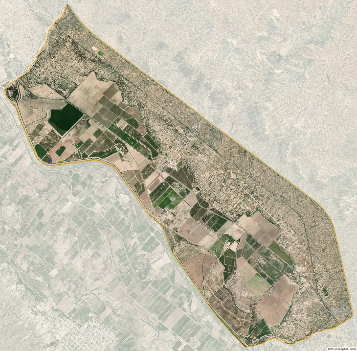
Fort Hancock city Satellite Map
Geography
The Fort Hancock CDP is in southwestern Hudspeth County, bordered to the southwest by the Rio Grande and to the northeast by Interstate 10, with access from exits 68, 72, and 78. I-10 leads northwest 52 miles (84 km) to El Paso and east 67 miles (108 km) to Van Horn. According to the United States Census Bureau, the CDP has a total area of 19.2 square miles (49.7 km), of which 19.0 square miles (49.1 km) are land and 0.3 sq mi (0.7 km), or 1.33%, are covered by water.
See also
Map of Texas State and its subdivision:- Anderson
- Andrews
- Angelina
- Aransas
- Archer
- Armstrong
- Atascosa
- Austin
- Bailey
- Bandera
- Bastrop
- Baylor
- Bee
- Bell
- Bexar
- Blanco
- Borden
- Bosque
- Bowie
- Brazoria
- Brazos
- Brewster
- Briscoe
- Brooks
- Brown
- Burleson
- Burnet
- Caldwell
- Calhoun
- Callahan
- Cameron
- Camp
- Carson
- Cass
- Castro
- Chambers
- Cherokee
- Childress
- Clay
- Cochran
- Coke
- Coleman
- Collin
- Collingsworth
- Colorado
- Comal
- Comanche
- Concho
- Cooke
- Coryell
- Cottle
- Crane
- Crockett
- Crosby
- Culberson
- Dallam
- Dallas
- Dawson
- Deaf Smith
- Delta
- Denton
- Dewitt
- Dickens
- Dimmit
- Donley
- Duval
- Eastland
- Ector
- Edwards
- El Paso
- Ellis
- Erath
- Falls
- Fannin
- Fayette
- Fisher
- Floyd
- Foard
- Fort Bend
- Franklin
- Freestone
- Frio
- Gaines
- Galveston
- Garza
- Gillespie
- Glasscock
- Goliad
- Gonzales
- Gray
- Grayson
- Gregg
- Grimes
- Guadalupe
- Hale
- Hall
- Hamilton
- Hansford
- Hardeman
- Hardin
- Harris
- Harrison
- Hartley
- Haskell
- Hays
- Hemphill
- Henderson
- Hidalgo
- Hill
- Hockley
- Hood
- Hopkins
- Houston
- Howard
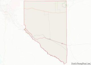
- Hudspeth
- Hunt
- Hutchinson
- Irion
- Jack
- Jackson
- Jasper
- Jeff Davis
- Jefferson
- Jim Hogg
- Jim Wells
- Johnson
- Jones
- Karnes
- Kaufman
- Kendall
- Kenedy
- Kent
- Kerr
- Kimble
- King
- Kinney
- Kleberg
- Knox
- La Salle
- Lamar
- Lamb
- Lampasas
- Lavaca
- Lee
- Leon
- Liberty
- Limestone
- Lipscomb
- Live Oak
- Llano
- Loving
- Lubbock
- Lynn
- Madison
- Marion
- Martin
- Mason
- Matagorda
- Maverick
- McCulloch
- McLennan
- McMullen
- Medina
- Menard
- Midland
- Milam
- Mills
- Mitchell
- Montague
- Montgomery
- Moore
- Morris
- Motley
- Nacogdoches
- Navarro
- Newton
- Nolan
- Nueces
- Ochiltree
- Oldham
- Orange
- Palo Pinto
- Panola
- Parker
- Parmer
- Pecos
- Polk
- Potter
- Presidio
- Rains
- Randall
- Reagan
- Real
- Red River
- Reeves
- Refugio
- Roberts
- Robertson
- Rockwall
- Runnels
- Rusk
- Sabine
- San Augustine
- San Jacinto
- San Patricio
- San Saba
- Schleicher
- Scurry
- Shackelford
- Shelby
- Sherman
- Smith
- Somervell
- Starr
- Stephens
- Sterling
- Stonewall
- Sutton
- Swisher
- Tarrant
- Taylor
- Terrell
- Terry
- Throckmorton
- Titus
- Tom Green
- Travis
- Trinity
- Tyler
- Upshur
- Upton
- Uvalde
- Val Verde
- Van Zandt
- Victoria
- Walker
- Waller
- Ward
- Washington
- Webb
- Wharton
- Wheeler
- Wichita
- Wilbarger
- Willacy
- Williamson
- Wilson
- Winkler
- Wise
- Wood
- Yoakum
- Young
- Zapata
- Zavala
- Alabama
- Alaska
- Arizona
- Arkansas
- California
- Colorado
- Connecticut
- Delaware
- District of Columbia
- Florida
- Georgia
- Hawaii
- Idaho
- Illinois
- Indiana
- Iowa
- Kansas
- Kentucky
- Louisiana
- Maine
- Maryland
- Massachusetts
- Michigan
- Minnesota
- Mississippi
- Missouri
- Montana
- Nebraska
- Nevada
- New Hampshire
- New Jersey
- New Mexico
- New York
- North Carolina
- North Dakota
- Ohio
- Oklahoma
- Oregon
- Pennsylvania
- Rhode Island
- South Carolina
- South Dakota
- Tennessee
- Texas
- Utah
- Vermont
- Virginia
- Washington
- West Virginia
- Wisconsin
- Wyoming