Fort Stockton is a city in and the county seat of Pecos County, Texas, United States. It is located on Interstate 10, future Interstate 14, U.S. Highways 67, 285, and 385, and the Santa Fe Railroad, 329 mi (529 km) northwest of San Antonio and 240 mi (390 km) southeast of El Paso. Its population was 8,283 at the 2010 census.
| Name: | Fort Stockton city |
|---|---|
| LSAD Code: | 25 |
| LSAD Description: | city (suffix) |
| State: | Texas |
| County: | Pecos County |
| Elevation: | 2,972 ft (906 m) |
| Total Area: | 5.55 sq mi (14.37 km²) |
| Land Area: | 5.55 sq mi (14.37 km²) |
| Water Area: | 0.00 sq mi (0.00 km²) |
| Total Population: | 8,283 |
| Population Density: | 1,517.57/sq mi (585.96/km²) |
| ZIP code: | 79735 |
| Area code: | 432 |
| FIPS code: | 4826808 |
| GNISfeature ID: | 1357597 |
| Website: | http://cityoffortstockton.com |
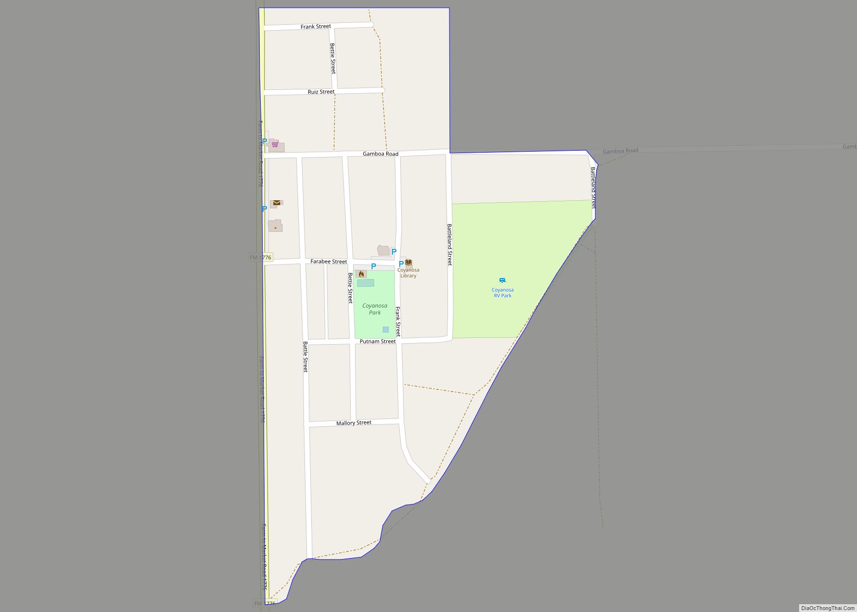
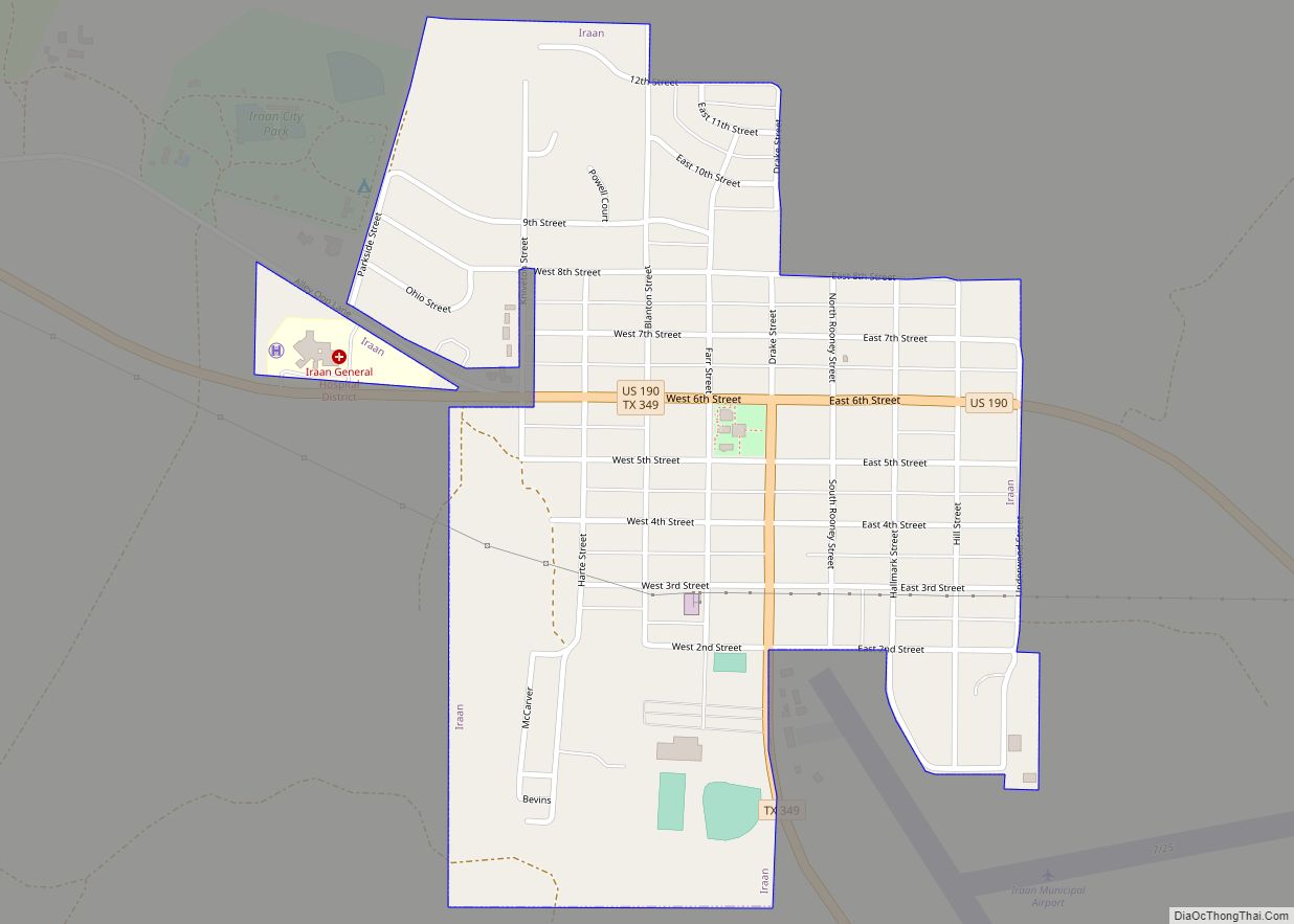
Online Interactive Map
Click on ![]() to view map in "full screen" mode.
to view map in "full screen" mode.
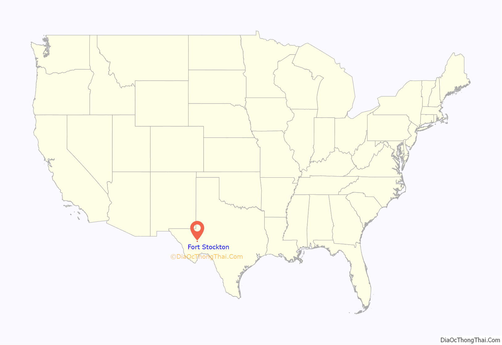
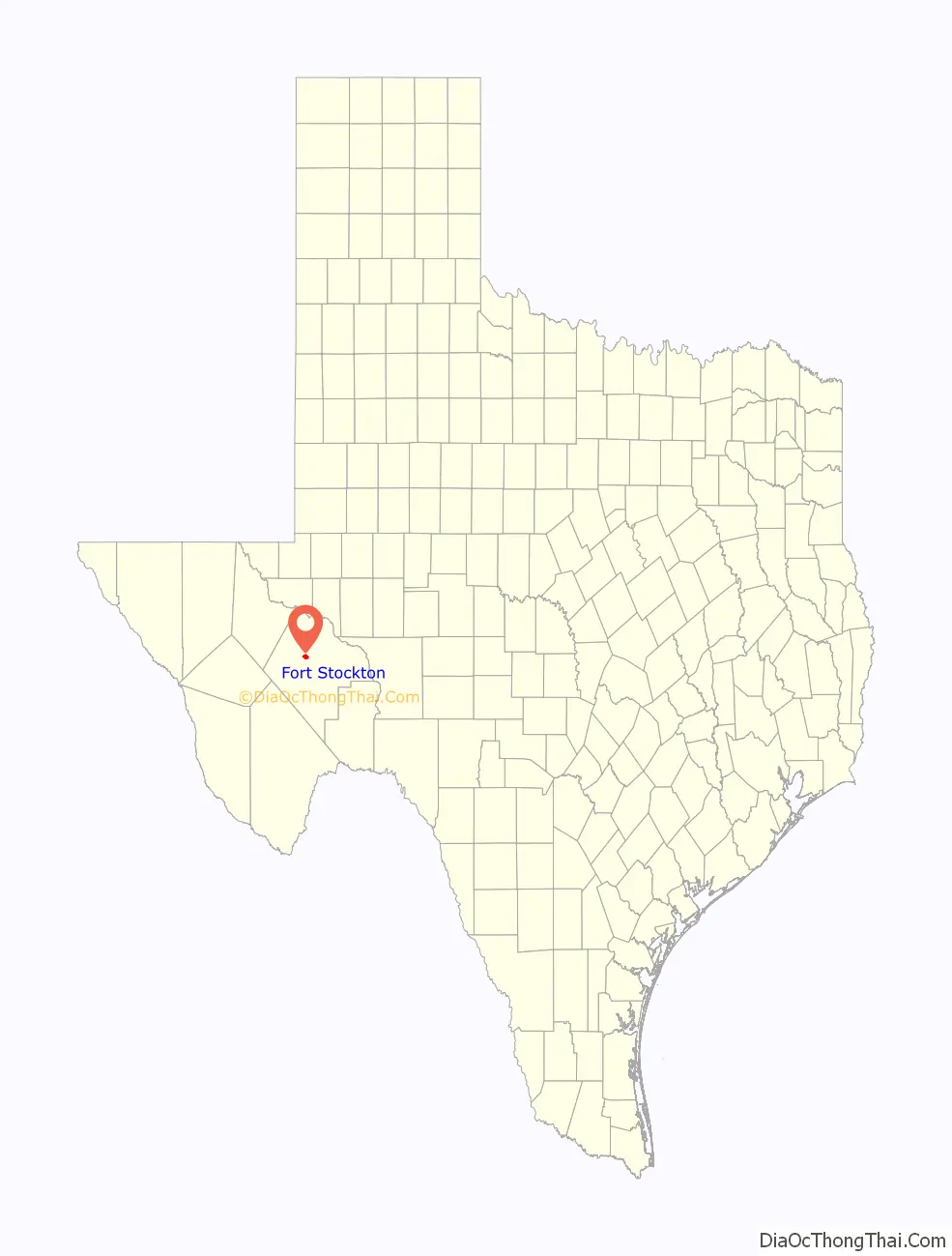
Fort Stockton location map. Where is Fort Stockton city?
History
Fort Lancaster sent 1st Infantry Co. H “to take post” along Comanche Springs on 12 April 1859. Fort Stockton (named Camp Stockton until 1860) grew up around Comanche Springs, one of the largest sources of spring water in Texas. The fort was named for First Lieutenant Edward Dorsey Stockton of the US 1st infantry, who died in San Antonio on March 13, 1857. Comanche Springs was a favorite rest stop on the Great Comanche Trail to Chihuahua, San Antonio-El Paso Road, and the Butterfield Overland Mail route. On October 2, 1859, the well-known journalist and author (and future Union spy) Albert D. Richardson passed through Camp Stockton, which he described as “a military post of three or four edifices with pearly, misty mountains in the background.”
In 1861, the fort was garrisoned by 39 men of Company C, 8th Infantry, under the command of Capt. Arthur Tracy Lee, who evacuated the fort by April. The Confederates took possession of the fort on 9 May by Charles L. Pyron at the outbreak of the Civil War, but soon turned command over to Capt. William C. Adams. With the failure of John Baylor’s invasion of New Mexico, a general Confederate evacuation of West Texas occurred in 1862.
In 1867, the Army rebuilt the fort on a larger and more permanent basis. Other forts in the frontier fort system were Forts Griffin, Concho, Belknap, Chadbourne, Richardson, Davis, Bliss, McKavett, Clark, McIntosh, Inge, and Phantom Hill in Texas, and Fort Sill in Oklahoma. “Subposts or intermediate stations” also were used, including Bothwick’s Station on Salt Creek between Fort Richardson and Fort Belknap, Camp Wichita near Buffalo Springs between Fort Richardson and Red River Station, and Mountain Pass between Fort Concho and Fort Griffin.
On 21 July 1867, Fort Stockton was reoccupied by Companies A, B, E, and K of the 9th U.S. Cavalry Regiment, buffalo soldiers under the command of General Edward Hatch, while a new fort was built one-half mile north of the first post, on the west side of the creek. Major James F. Wade took command of Troops A, B, D, and E, 9th Cavalry, and Company G, 41st Infantry, on 2 Oct. 1868. Lt. Col. Wesley Merritt assumed command of Companies A and D, 9th Cavalry, G, 24th Infantry, and K, 25th Infantry in Feb. 1871. Major Zenas Randall Bliss assumed command on 15 May 1872. Troops B, G, and L, 10th Cavalry, and Companies A and I, 1st Infantry, under Lt. Col. J.F. Wade, were stationed at the fort when the Army decided to abandon it in 1882. Major George A. Purington was the last commander when the Army finally left on 27 June 1886.
San Antonio entrepreneurs were convinced the water from the nearby Comanche and Leon Springs could be used for irrigation. They purchased large tracts of land for agricultural development. In 1868, Peter Gallagher bought the land that included the military garrison and Comanche Springs, platted 160 acres (65 ha) for a town site named Saint Gaul, and established two stores at Comanche Springs. Later, Gallagher and John James purchased 5,500 acres (2,200 ha) along Comanche Creek. By 1870, the Saint Gaul region had a population of 420 civilians, predominantly Irish, German, and Mexican Catholics who had come by way of San Antonio. The first church in Saint Gaul was Catholic. When Pecos County was organized in 1875, Saint Gaul became the county seat. The name, however, was never popular with the citizens, and on August 13, 1881, it was changed officially to Fort Stockton.
By 1870, some settlers were using the water from the Pecos River for irrigation. Seven years later, irrigated farmland comprised 7,000 acres (2,800 ha), and by 1945, the total reached 12,900 acres (5,200 ha). In 1951, Clayton Williams Sr. and other “pump farmers” west of town drilled irrigation wells that tapped into the aquifer that fed Comanche Springs. A lawsuit was filed by the Pecos County Water District #1, and 108 families who depended on the flow from the springs, to stop the pumping (Pecos County Water District #1 v. Clayton Williams et al.). On June 21, 1954, the Texas Court of Civil Appeals ruled in favor of Clayton Williams, et al. by upholding “the rule of capture”, agreeing with the landmark 1904 Texas Supreme Court decision that groundwater was “too mysterious to regulate”. The Texas Supreme Court affirmed the decision. By the late 1950s, Comanche Springs was dry due to the pumping. This ruling established what is known as “the rule of capture” and has regulated groundwater in Texas since. In his book, The Springs of Texas, author Gunnar Brune called the destruction of Comanche Springs, “the most spectacular example of man’s abuse of nature.” After the military post was abandoned on June 30, 1886, and both the Texas and Pacific and the Southern Pacific railroads had bypassed it, Fort Stockton experienced a decline. By then, however, it was rapidly becoming the center for an extensive sheep- and cattle-ranching industry, and in 1926, the opening of the nearby Yates Oil Field brought on an economic boom. Fort Stockton was served by the Kansas City, Mexico and Orient Railway.
Since the 1920s, Fort Stockton has experienced the economic boom-bust cycle of the petroleum industry. As of 2012, Fort Stockton is in a state of economic expansion as oilfield drilling and production has increased.
Fort Stockton is 100 mi (160 km) southwest of Midland International Airport. The town is within driving distance of the Big Bend country, including Big Bend National Park, 137 mi (220 km), and the Big Bend Ranch State Park, 171 mi (275 km), as well as the scenery of numerous day-drive locations in the area.
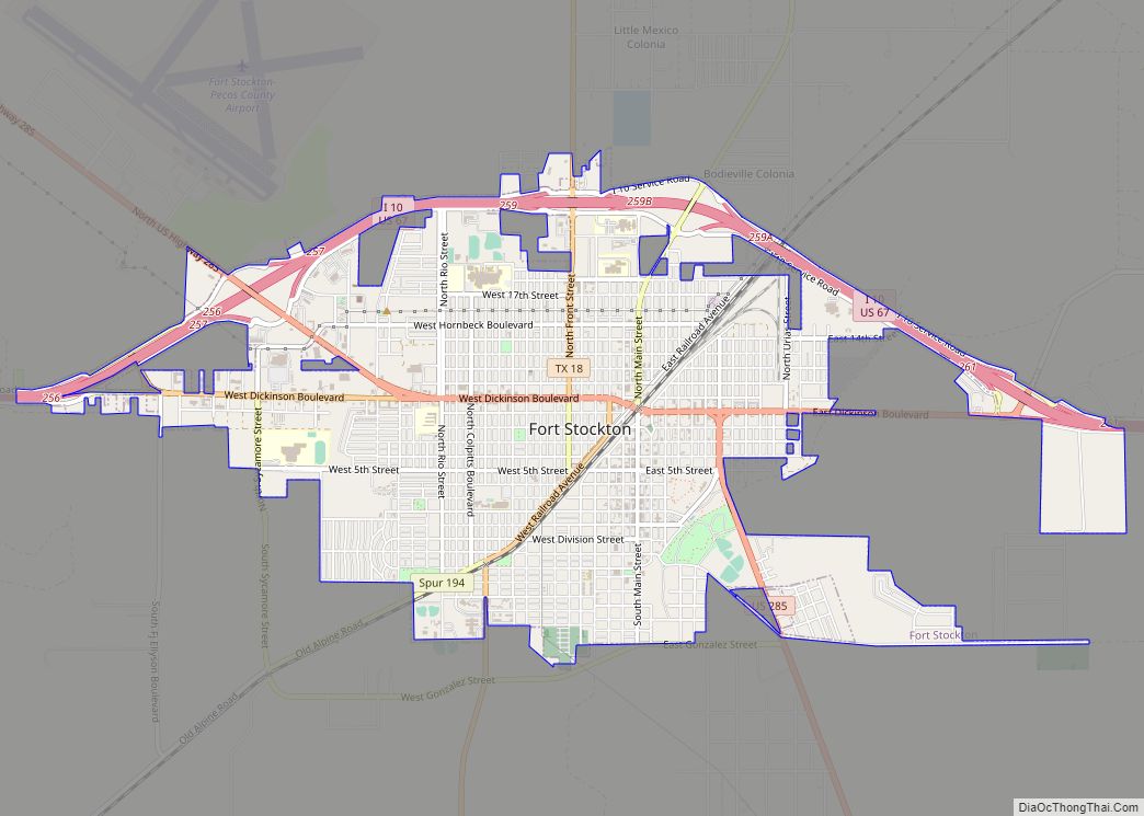
Fort Stockton Road Map
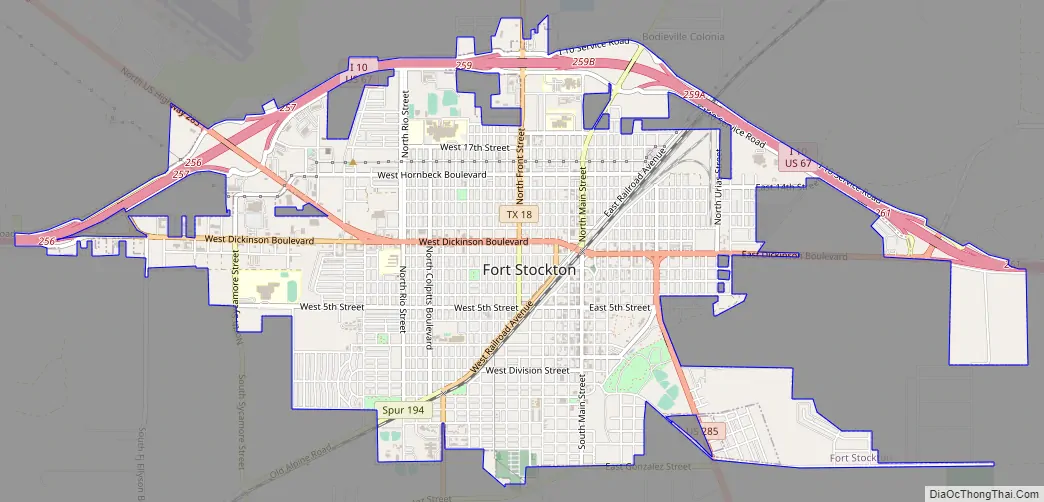
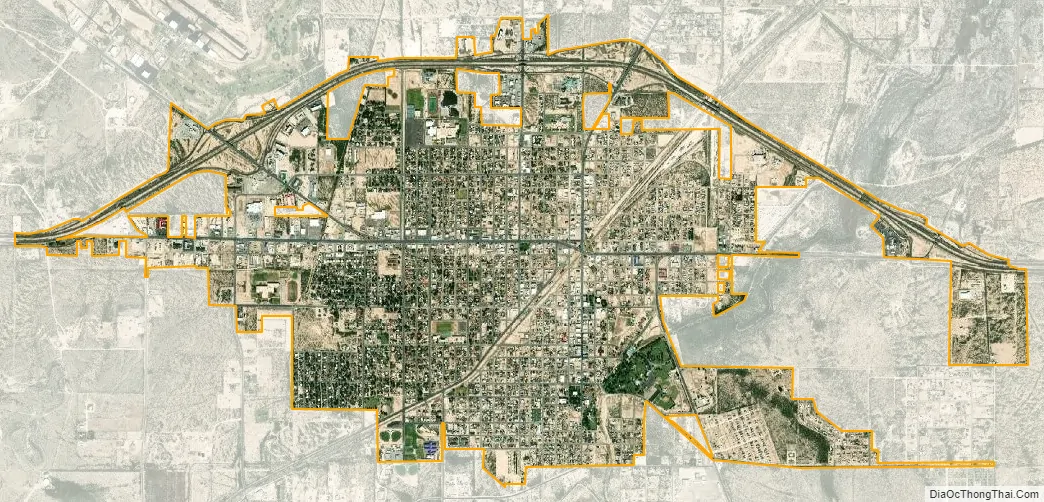
Fort Stockton city Satellite Map
Geography
According to the United States Census Bureau, the city has a total area of 5.1 square miles (13 km), all land.
See also
Map of Texas State and its subdivision:- Anderson
- Andrews
- Angelina
- Aransas
- Archer
- Armstrong
- Atascosa
- Austin
- Bailey
- Bandera
- Bastrop
- Baylor
- Bee
- Bell
- Bexar
- Blanco
- Borden
- Bosque
- Bowie
- Brazoria
- Brazos
- Brewster
- Briscoe
- Brooks
- Brown
- Burleson
- Burnet
- Caldwell
- Calhoun
- Callahan
- Cameron
- Camp
- Carson
- Cass
- Castro
- Chambers
- Cherokee
- Childress
- Clay
- Cochran
- Coke
- Coleman
- Collin
- Collingsworth
- Colorado
- Comal
- Comanche
- Concho
- Cooke
- Coryell
- Cottle
- Crane
- Crockett
- Crosby
- Culberson
- Dallam
- Dallas
- Dawson
- Deaf Smith
- Delta
- Denton
- Dewitt
- Dickens
- Dimmit
- Donley
- Duval
- Eastland
- Ector
- Edwards
- El Paso
- Ellis
- Erath
- Falls
- Fannin
- Fayette
- Fisher
- Floyd
- Foard
- Fort Bend
- Franklin
- Freestone
- Frio
- Gaines
- Galveston
- Garza
- Gillespie
- Glasscock
- Goliad
- Gonzales
- Gray
- Grayson
- Gregg
- Grimes
- Guadalupe
- Hale
- Hall
- Hamilton
- Hansford
- Hardeman
- Hardin
- Harris
- Harrison
- Hartley
- Haskell
- Hays
- Hemphill
- Henderson
- Hidalgo
- Hill
- Hockley
- Hood
- Hopkins
- Houston
- Howard
- Hudspeth
- Hunt
- Hutchinson
- Irion
- Jack
- Jackson
- Jasper
- Jeff Davis
- Jefferson
- Jim Hogg
- Jim Wells
- Johnson
- Jones
- Karnes
- Kaufman
- Kendall
- Kenedy
- Kent
- Kerr
- Kimble
- King
- Kinney
- Kleberg
- Knox
- La Salle
- Lamar
- Lamb
- Lampasas
- Lavaca
- Lee
- Leon
- Liberty
- Limestone
- Lipscomb
- Live Oak
- Llano
- Loving
- Lubbock
- Lynn
- Madison
- Marion
- Martin
- Mason
- Matagorda
- Maverick
- McCulloch
- McLennan
- McMullen
- Medina
- Menard
- Midland
- Milam
- Mills
- Mitchell
- Montague
- Montgomery
- Moore
- Morris
- Motley
- Nacogdoches
- Navarro
- Newton
- Nolan
- Nueces
- Ochiltree
- Oldham
- Orange
- Palo Pinto
- Panola
- Parker
- Parmer
- Pecos
- Polk
- Potter
- Presidio
- Rains
- Randall
- Reagan
- Real
- Red River
- Reeves
- Refugio
- Roberts
- Robertson
- Rockwall
- Runnels
- Rusk
- Sabine
- San Augustine
- San Jacinto
- San Patricio
- San Saba
- Schleicher
- Scurry
- Shackelford
- Shelby
- Sherman
- Smith
- Somervell
- Starr
- Stephens
- Sterling
- Stonewall
- Sutton
- Swisher
- Tarrant
- Taylor
- Terrell
- Terry
- Throckmorton
- Titus
- Tom Green
- Travis
- Trinity
- Tyler
- Upshur
- Upton
- Uvalde
- Val Verde
- Van Zandt
- Victoria
- Walker
- Waller
- Ward
- Washington
- Webb
- Wharton
- Wheeler
- Wichita
- Wilbarger
- Willacy
- Williamson
- Wilson
- Winkler
- Wise
- Wood
- Yoakum
- Young
- Zapata
- Zavala
- Alabama
- Alaska
- Arizona
- Arkansas
- California
- Colorado
- Connecticut
- Delaware
- District of Columbia
- Florida
- Georgia
- Hawaii
- Idaho
- Illinois
- Indiana
- Iowa
- Kansas
- Kentucky
- Louisiana
- Maine
- Maryland
- Massachusetts
- Michigan
- Minnesota
- Mississippi
- Missouri
- Montana
- Nebraska
- Nevada
- New Hampshire
- New Jersey
- New Mexico
- New York
- North Carolina
- North Dakota
- Ohio
- Oklahoma
- Oregon
- Pennsylvania
- Rhode Island
- South Carolina
- South Dakota
- Tennessee
- Texas
- Utah
- Vermont
- Virginia
- Washington
- West Virginia
- Wisconsin
- Wyoming