Alpine (/ˈælpaɪn/ AL-pyne) is a city and the county seat of Brewster County, Texas, United States. The population was 5,905 at the 2010 census. The town has an elevation of 4,475 feet (1,364 m), and the surrounding mountain peaks are over 1 mile (1.6 km) above sea level. The university, hospital, library, and retail make Alpine the center of the sprawling 12,000 square miles (3,108,000 ha) but wide open Big Bend area (combined population 12,500) including Brewster, Presidio, and Jeff Davis counties.
| Name: | Alpine city |
|---|---|
| LSAD Code: | 25 |
| LSAD Description: | city (suffix) |
| State: | Texas |
| County: | Brewster County |
| Elevation: | 4,475 ft (1,364 m) |
| Total Area: | 4.80 sq mi (12.44 km²) |
| Land Area: | 4.80 sq mi (12.43 km²) |
| Water Area: | 0.00 sq mi (0.00 km²) |
| Total Population: | 5,905 |
| Population Density: | 1,245.99/sq mi (481.09/km²) |
| ZIP code: | 79830-79832 |
| Area code: | 432 |
| FIPS code: | 4802104 |
| GNISfeature ID: | 1377837 |
| Website: | cityofalpine.com |
Online Interactive Map
Click on ![]() to view map in "full screen" mode.
to view map in "full screen" mode.
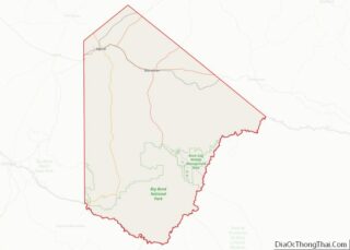
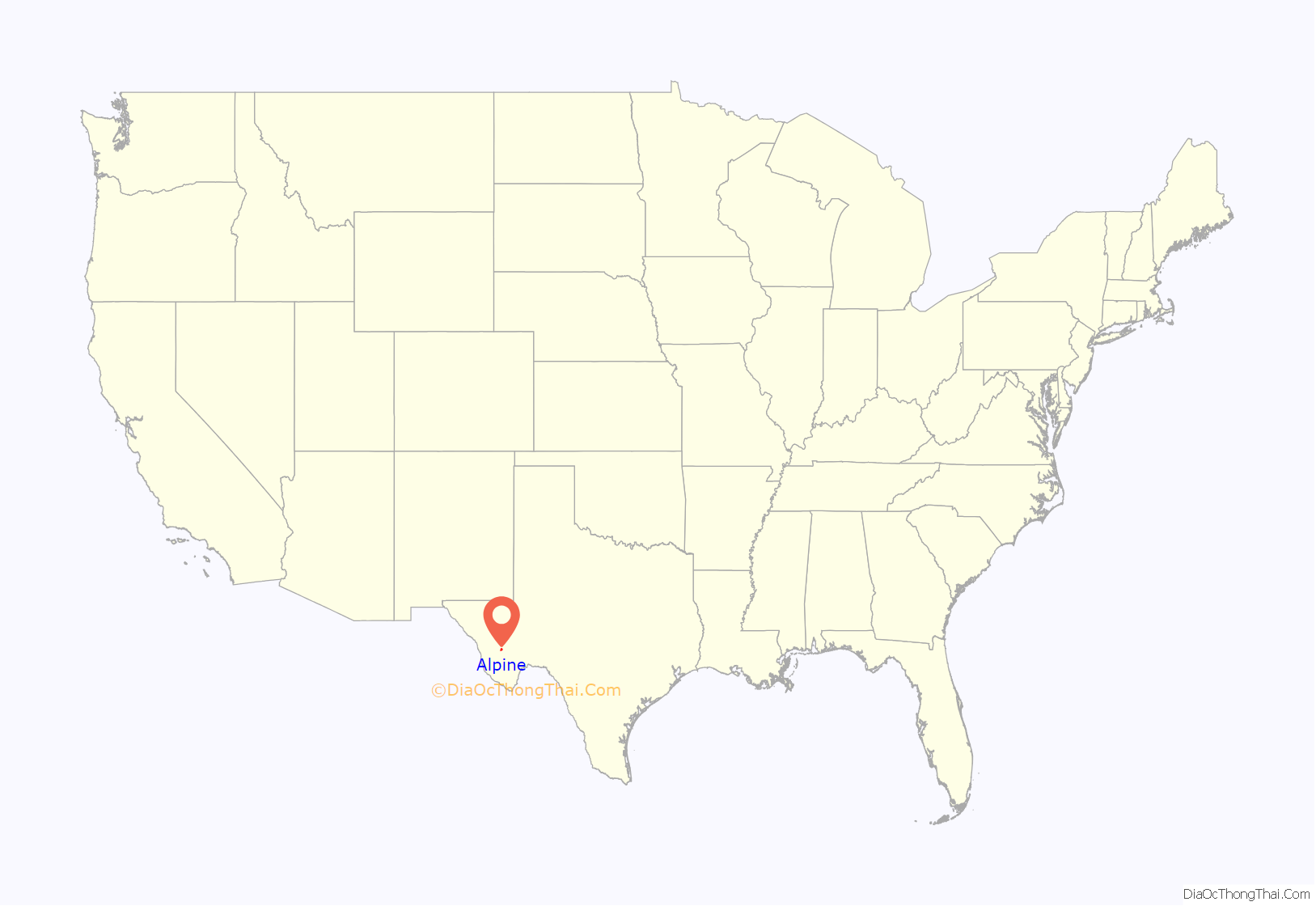
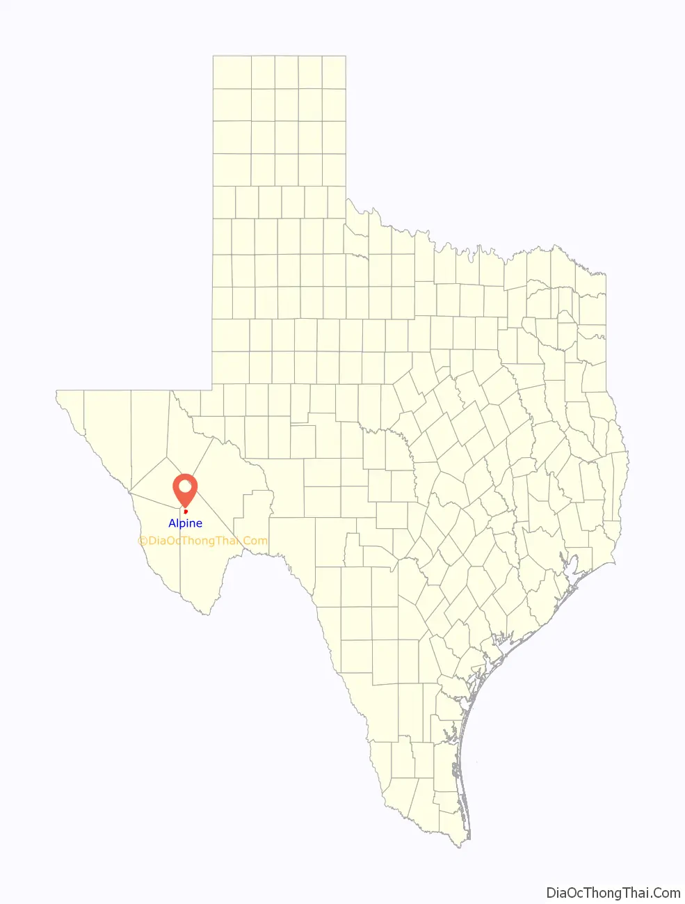
Alpine location map. Where is Alpine city?
History
The area had been a campsite for cattlemen tending their herds between 1878 and the spring of 1882, when a town of tents was created by railroad workers and their families. Because the section of the railroad was called Osborne, that was the name of the small community for a brief time. The railroad needed access to water from springs owned by brothers named Daniel and Thomas Murphy, so it entered into an agreement with the Murphys to change the name of the section and settlement to Murphyville in exchange for a contract to use the spring. In November 1883, the Murphys registered a plat for the town of Murphyville with the county clerk of Presidio County.
The town’s name was changed to Alpine on February 3, 1888, following a petition by its residents. At this time, a description of the town mentioned a dozen houses, three saloons, a hotel and rooming house, a livery stable, a butcher shop, and a drugstore, which also housed the post office.
Alpine grew very slowly until Sul Ross State Normal College (now Sul Ross State University) was opened in 1920. The development of Big Bend National Park in the 1930s and ’40s spurred further growth. The population was estimated at only 396 in 1904, but by 1927, it had risen to 3,000. The 1950 census reported Alpine’s population at 5,256, and a high of roughly 6,200 was reached by 1976. In 1990, the population was down to 5,637. In 2000, the population grew modestly to 5,786 and 5,905 by 2010.
The Holland Hotel, built during a brief mercury mining boom, was designed by Henry Trost, a distinguished regional architect. Today, it helps to anchor a traditional downtown of early 20th-century buildings still occupied by family-owned retailers and restaurants.
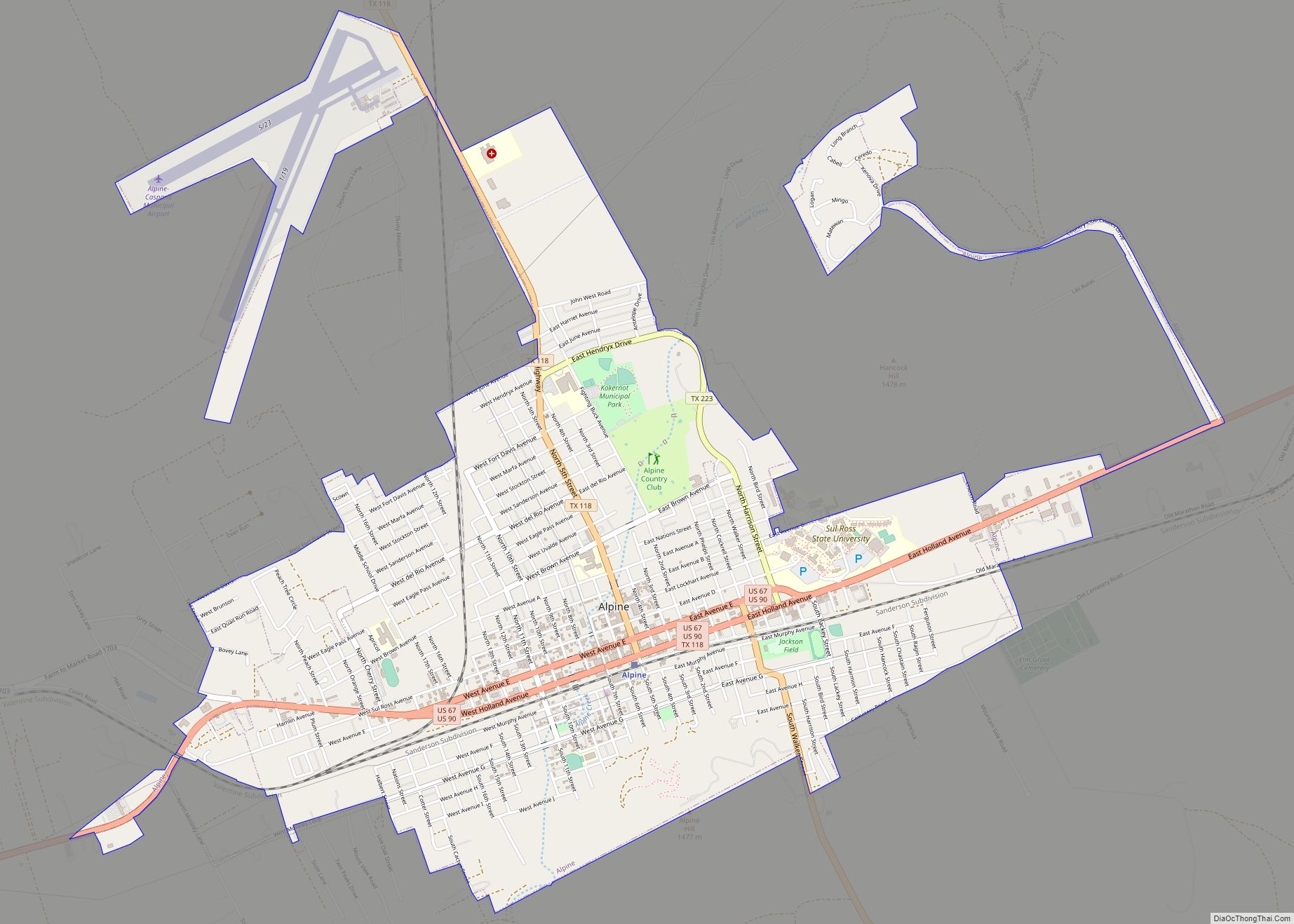
Alpine Road Map
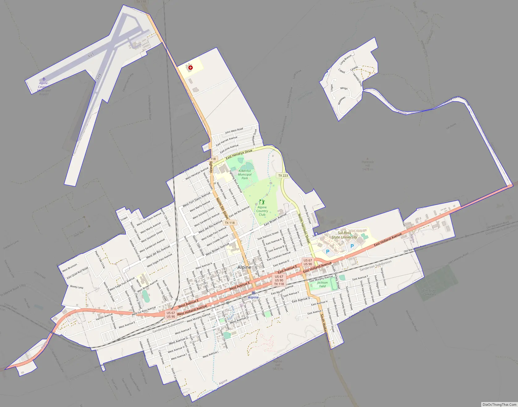
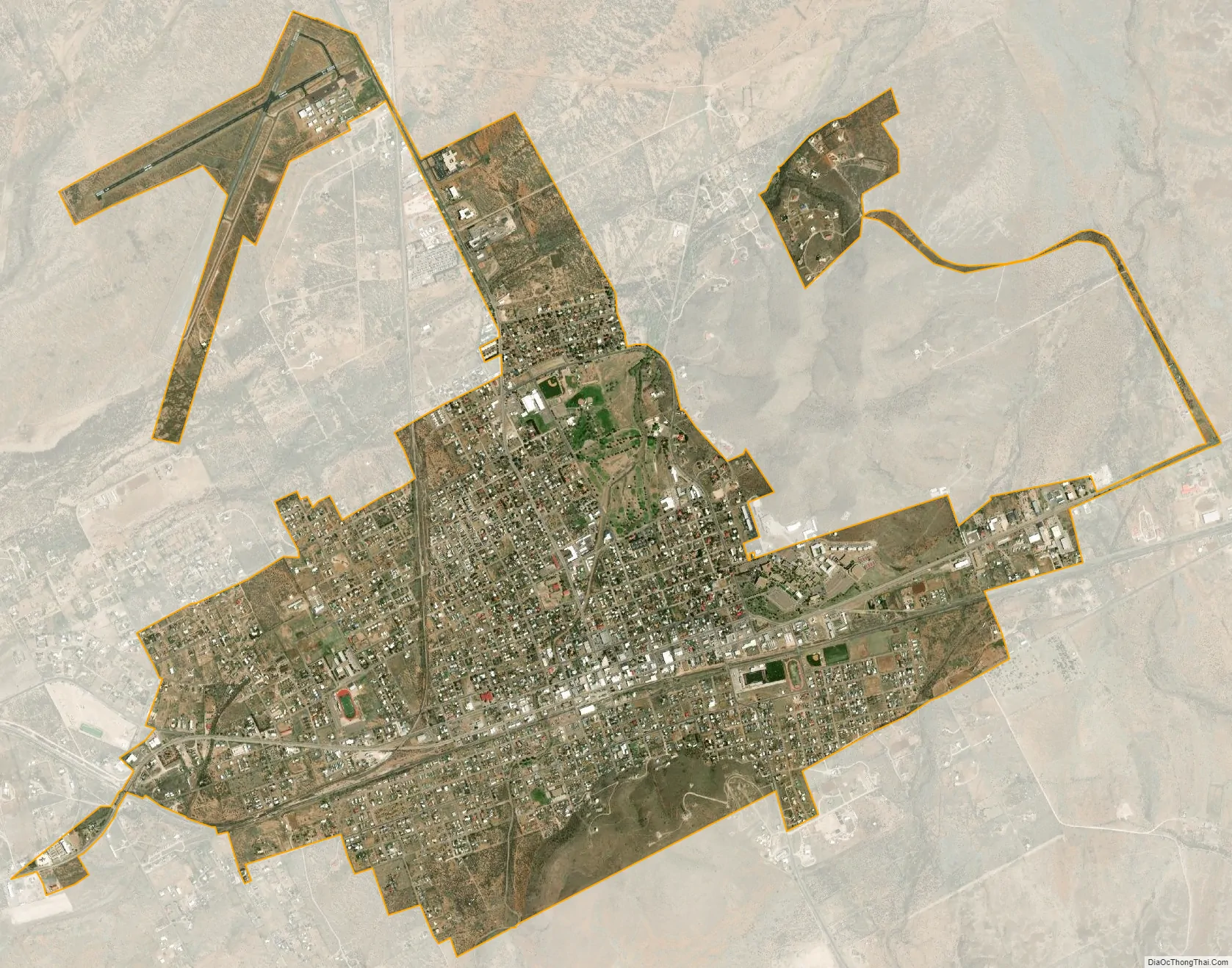
Alpine city Satellite Map
Geography
The town sits on a high plateau, in the Chihuahua Desert, with the Davis Mountains to the north and the Chisos Mountains to the south. Outcrops of ancient volcanic rocks spread to the northwest. Other layers of rocks have been exposed over time as the mountains were forced up and then eroded. The high elevation cools the desert air in the evenings.
Alpine is located on U.S. Route 90 about 26 miles (42 km) east of Marfa and 31 miles west of Marathon.
According to the United States Census Bureau, the city has a total area of 4.7 square miles (12.1 km), all land.
See also
Map of Texas State and its subdivision:- Anderson
- Andrews
- Angelina
- Aransas
- Archer
- Armstrong
- Atascosa
- Austin
- Bailey
- Bandera
- Bastrop
- Baylor
- Bee
- Bell
- Bexar
- Blanco
- Borden
- Bosque
- Bowie
- Brazoria
- Brazos
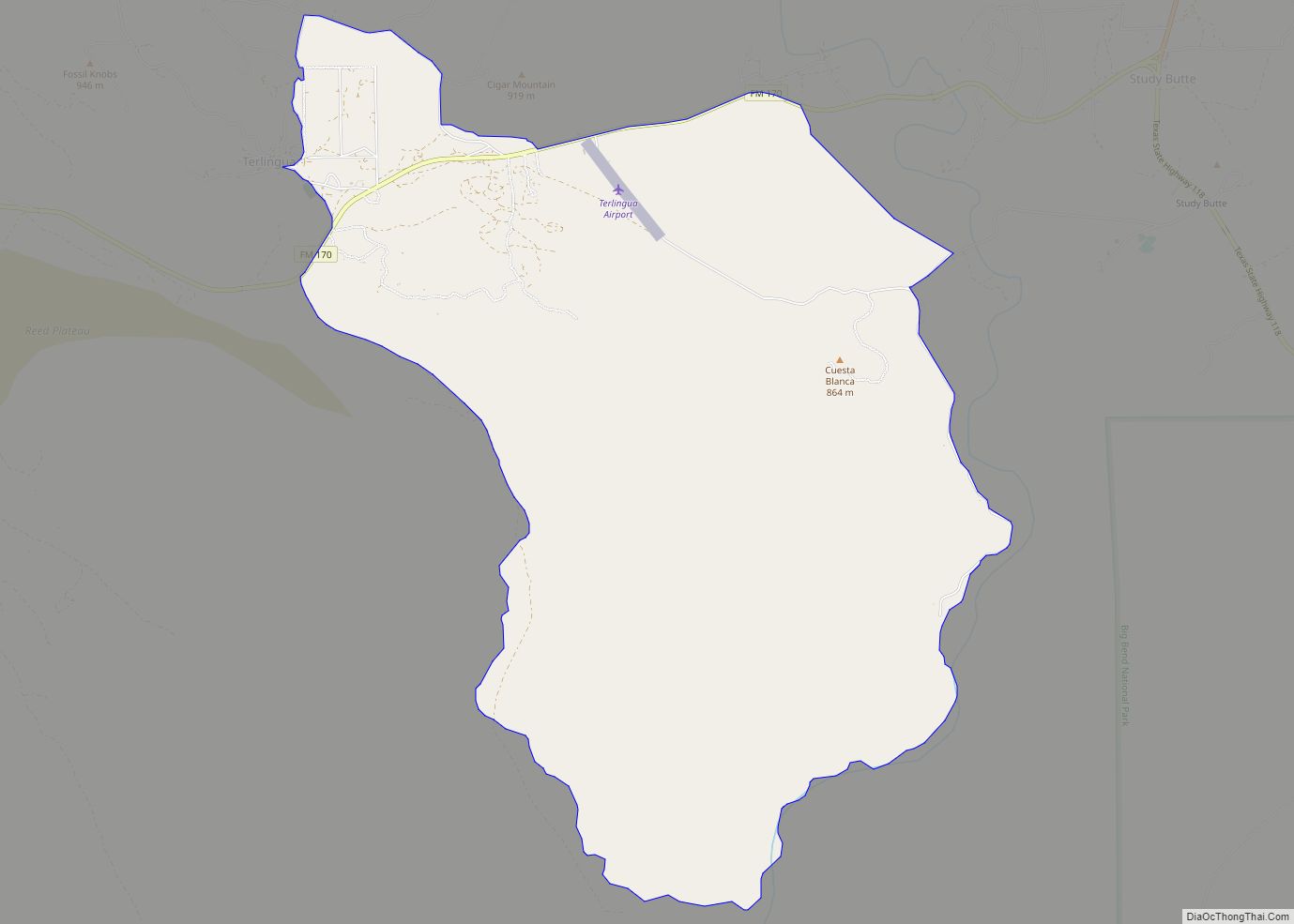
- Brewster
- Briscoe
- Brooks
- Brown
- Burleson
- Burnet
- Caldwell
- Calhoun
- Callahan
- Cameron
- Camp
- Carson
- Cass
- Castro
- Chambers
- Cherokee
- Childress
- Clay
- Cochran
- Coke
- Coleman
- Collin
- Collingsworth
- Colorado
- Comal
- Comanche
- Concho
- Cooke
- Coryell
- Cottle
- Crane
- Crockett
- Crosby
- Culberson
- Dallam
- Dallas
- Dawson
- Deaf Smith
- Delta
- Denton
- Dewitt
- Dickens
- Dimmit
- Donley
- Duval
- Eastland
- Ector
- Edwards
- El Paso
- Ellis
- Erath
- Falls
- Fannin
- Fayette
- Fisher
- Floyd
- Foard
- Fort Bend
- Franklin
- Freestone
- Frio
- Gaines
- Galveston
- Garza
- Gillespie
- Glasscock
- Goliad
- Gonzales
- Gray
- Grayson
- Gregg
- Grimes
- Guadalupe
- Hale
- Hall
- Hamilton
- Hansford
- Hardeman
- Hardin
- Harris
- Harrison
- Hartley
- Haskell
- Hays
- Hemphill
- Henderson
- Hidalgo
- Hill
- Hockley
- Hood
- Hopkins
- Houston
- Howard
- Hudspeth
- Hunt
- Hutchinson
- Irion
- Jack
- Jackson
- Jasper
- Jeff Davis
- Jefferson
- Jim Hogg
- Jim Wells
- Johnson
- Jones
- Karnes
- Kaufman
- Kendall
- Kenedy
- Kent
- Kerr
- Kimble
- King
- Kinney
- Kleberg
- Knox
- La Salle
- Lamar
- Lamb
- Lampasas
- Lavaca
- Lee
- Leon
- Liberty
- Limestone
- Lipscomb
- Live Oak
- Llano
- Loving
- Lubbock
- Lynn
- Madison
- Marion
- Martin
- Mason
- Matagorda
- Maverick
- McCulloch
- McLennan
- McMullen
- Medina
- Menard
- Midland
- Milam
- Mills
- Mitchell
- Montague
- Montgomery
- Moore
- Morris
- Motley
- Nacogdoches
- Navarro
- Newton
- Nolan
- Nueces
- Ochiltree
- Oldham
- Orange
- Palo Pinto
- Panola
- Parker
- Parmer
- Pecos
- Polk
- Potter
- Presidio
- Rains
- Randall
- Reagan
- Real
- Red River
- Reeves
- Refugio
- Roberts
- Robertson
- Rockwall
- Runnels
- Rusk
- Sabine
- San Augustine
- San Jacinto
- San Patricio
- San Saba
- Schleicher
- Scurry
- Shackelford
- Shelby
- Sherman
- Smith
- Somervell
- Starr
- Stephens
- Sterling
- Stonewall
- Sutton
- Swisher
- Tarrant
- Taylor
- Terrell
- Terry
- Throckmorton
- Titus
- Tom Green
- Travis
- Trinity
- Tyler
- Upshur
- Upton
- Uvalde
- Val Verde
- Van Zandt
- Victoria
- Walker
- Waller
- Ward
- Washington
- Webb
- Wharton
- Wheeler
- Wichita
- Wilbarger
- Willacy
- Williamson
- Wilson
- Winkler
- Wise
- Wood
- Yoakum
- Young
- Zapata
- Zavala
- Alabama
- Alaska
- Arizona
- Arkansas
- California
- Colorado
- Connecticut
- Delaware
- District of Columbia
- Florida
- Georgia
- Hawaii
- Idaho
- Illinois
- Indiana
- Iowa
- Kansas
- Kentucky
- Louisiana
- Maine
- Maryland
- Massachusetts
- Michigan
- Minnesota
- Mississippi
- Missouri
- Montana
- Nebraska
- Nevada
- New Hampshire
- New Jersey
- New Mexico
- New York
- North Carolina
- North Dakota
- Ohio
- Oklahoma
- Oregon
- Pennsylvania
- Rhode Island
- South Carolina
- South Dakota
- Tennessee
- Texas
- Utah
- Vermont
- Virginia
- Washington
- West Virginia
- Wisconsin
- Wyoming