| Name: | Guadalupe County |
|---|---|
| FIPS code: | 48-187 |
| State: | Texas |
| Founded: | 1846 |
| Named for: | Guadalupe River |
| Seat: | Seguin |
| Largest city: | New Braunfels |
| Total Area: | 715 sq mi (1,850 km²) |
| Land Area: | 711 sq mi (1,840 km²) |
| Total Population: | 172,706 |
| Population Density: | 240/sq mi (93/km²) |
| Time zone: | UTC−6 (Central) |
| Summer Time Zone (DST): | UTC−5 (CDT) |
| Website: | www.co.guadalupe.tx.us |
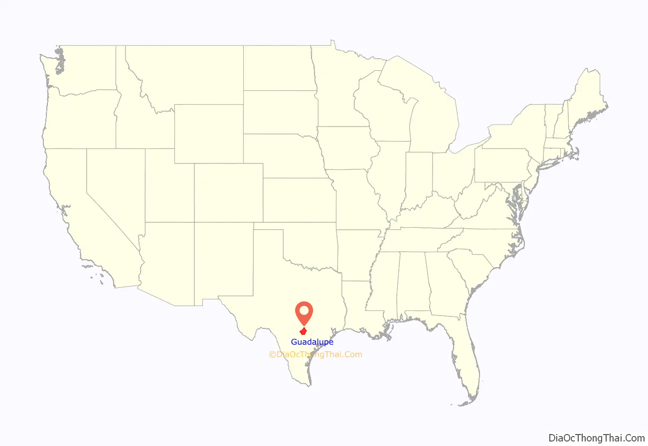
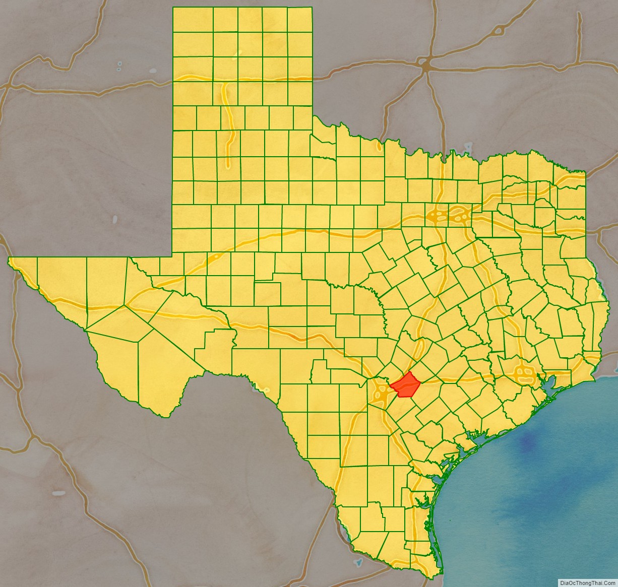
Guadalupe County location map. Where is Guadalupe County?
History
Indigenous paleo-Indian hunter-gatherers were the first inhabitants of the area, thousands of years before European colonization. Later, historic Indian tribes settled in the area, including Tonkawa, Karankawa, Kickapoo, Lipan Apache, and Comanche.
In 1689, Alonso de Leon named the Guadalupe River in honor of Our Lady of Guadalupe.
In 1806, French army officer José de la Baume, who later joined the Spanish army, was rewarded for his services to Spain with title to 27,000 acres (11,000 ha) of Texas land, the original El Capote Ranch. The grant was reaffirmed by the Republic of Mexico after it achieved independence.
Following Mexico‘s independence from Spain, Anglo-Americans from the United States settled in Texas in 1821, and claimed Mexican citizenship. In 1825, Guadalupe County was part of Green DeWitt’s petition for a land grant to establish a colony in Texas, which was approved by the Mexican government. From 1827 to 1835, 22 families settled the area as part of DeWitt’s colony.
Following Texas’ gaining independence from Mexico (1836), 33 Gonzales Rangers and Republic veterans established Seguin. Founded as Walnut Springs in 1838, the settlement’s name was changed to Seguin the next year to honor Juan Nepomuceno Seguín, who had fought for independence.
In 1840, the Virginian Michael Erskine acquired the El Capote Ranch for use as a cattle ranch. In 1842, the Republic of Texas organized Guadalupe County as a judicial county. The Texas Supreme Court declared judicial counties to be unconstitutional. In 1845, Prince Carl of Solms-Braunfels secured title to 1,265 acres (512 ha) of the Veramendi grant in the northern part of the former judicial county.
Following the annexation of Texas by the United States (1845), Prussian immigrant August Wilhelm Schumann arrived on the Texas coast aboard the SS Franziska in 1846, and purchased 188 acres (76 ha) in Guadalupe County. Shortly thereafter, the state legislature established the present county from parts of Bexar and Gonzales Counties.
In 1846, during the war between the United States and Mexico, a wagon train of German immigrant settlers bought Guadalupe land from August Schumann. The following year, the town of Schumannsville was established by German immigrants and named after him. Numerous German immigrants entered Texas at Galveston following the revolutions of 1848 in German states, settling in Guadalupe County and central Texas. After their own struggles, they tended to oppose slavery.
The last Indian raid into the area was made by the Kickapoo in 1855.
By 1860, 1,748 slaves of African descent were in the county, generally brought in from the South by slaveholder migrants. In 1861, the people of the county voted 314–22 in favor of secession from the Union. Guadalupe County sent several troops to fight for the Confederate States Army. Following the end of the Civil War and the emancipation of the slaves (1865), a Freedmen’s Bureau office opened in 1866 in Seguin to supervise work contracts between former slaves and area farmers. Together, German Americans and African Americans joined the Republican Party, leading Guadalupe County to be a reliably Republican one into the 20th century, even after the state disfranchisement of African Americans in 1901 by imposition of a poll tax.
By 1876, the Galveston, Harrisburg and San Antonio Railway reached Seguin. It was completed as far as San Antonio the following year. By 1880, ethnic Germans accounted for 40% of the county population. Tenant farming and sharecropping accounted for the operation of 25% of the county’s farms. By 1910, immigrants from Mexico accounted for about 11% of the country’s population.
In 1929, oil was discovered at the Darst Creek oilfield. By 1930, tenant farming and sharecropping comprised 64% of the county’s farms.
Over the next five decades, the economy changed markedly, as the area became more urbanized and less dependent on agriculture. By 1982, professional and related services, manufacturing, and wholesale and retail trade involved nearly 60% of the workforce in the area.
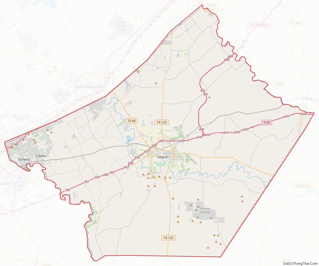
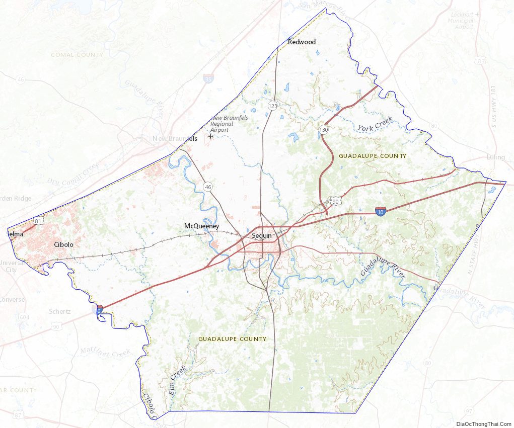
Guadalupe County Road Map
Geography
According to the U.S. Census Bureau, the county has a total area of 715 square miles (1,850 km), of which 711 square miles (1,840 km) are land and 3.5 square miles (9.1 km) (0.5%) are covered by water.
Major highways
- Interstate 10
- Interstate 35
- U.S. Highway 90
U.S. Highway 90 Alternate- State Highway 46
- State Highway 123
- State Highway 130
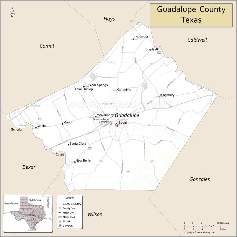
Adjacent counties
- Hays County (north)
- Caldwell County (northeast)
- Gonzales County (southeast)
- Wilson County (south)
- Bexar County (southwest)
- Comal County (northwest)
Guadalupe County Topographic Map
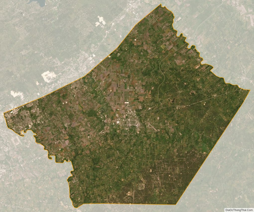
Guadalupe County Satellite Map
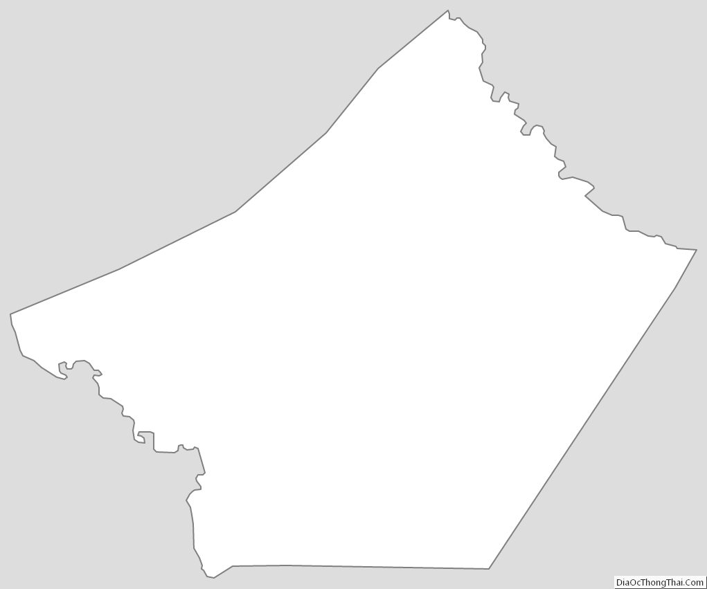
Guadalupe County Outline Map
See also
Map of Texas State and its subdivision:- Anderson
- Andrews
- Angelina
- Aransas
- Archer
- Armstrong
- Atascosa
- Austin
- Bailey
- Bandera
- Bastrop
- Baylor
- Bee
- Bell
- Bexar
- Blanco
- Borden
- Bosque
- Bowie
- Brazoria
- Brazos
- Brewster
- Briscoe
- Brooks
- Brown
- Burleson
- Burnet
- Caldwell
- Calhoun
- Callahan
- Cameron
- Camp
- Carson
- Cass
- Castro
- Chambers
- Cherokee
- Childress
- Clay
- Cochran
- Coke
- Coleman
- Collin
- Collingsworth
- Colorado
- Comal
- Comanche
- Concho
- Cooke
- Coryell
- Cottle
- Crane
- Crockett
- Crosby
- Culberson
- Dallam
- Dallas
- Dawson
- Deaf Smith
- Delta
- Denton
- Dewitt
- Dickens
- Dimmit
- Donley
- Duval
- Eastland
- Ector
- Edwards
- El Paso
- Ellis
- Erath
- Falls
- Fannin
- Fayette
- Fisher
- Floyd
- Foard
- Fort Bend
- Franklin
- Freestone
- Frio
- Gaines
- Galveston
- Garza
- Gillespie
- Glasscock
- Goliad
- Gonzales
- Gray
- Grayson
- Gregg
- Grimes
- Guadalupe
- Hale
- Hall
- Hamilton
- Hansford
- Hardeman
- Hardin
- Harris
- Harrison
- Hartley
- Haskell
- Hays
- Hemphill
- Henderson
- Hidalgo
- Hill
- Hockley
- Hood
- Hopkins
- Houston
- Howard
- Hudspeth
- Hunt
- Hutchinson
- Irion
- Jack
- Jackson
- Jasper
- Jeff Davis
- Jefferson
- Jim Hogg
- Jim Wells
- Johnson
- Jones
- Karnes
- Kaufman
- Kendall
- Kenedy
- Kent
- Kerr
- Kimble
- King
- Kinney
- Kleberg
- Knox
- La Salle
- Lamar
- Lamb
- Lampasas
- Lavaca
- Lee
- Leon
- Liberty
- Limestone
- Lipscomb
- Live Oak
- Llano
- Loving
- Lubbock
- Lynn
- Madison
- Marion
- Martin
- Mason
- Matagorda
- Maverick
- McCulloch
- McLennan
- McMullen
- Medina
- Menard
- Midland
- Milam
- Mills
- Mitchell
- Montague
- Montgomery
- Moore
- Morris
- Motley
- Nacogdoches
- Navarro
- Newton
- Nolan
- Nueces
- Ochiltree
- Oldham
- Orange
- Palo Pinto
- Panola
- Parker
- Parmer
- Pecos
- Polk
- Potter
- Presidio
- Rains
- Randall
- Reagan
- Real
- Red River
- Reeves
- Refugio
- Roberts
- Robertson
- Rockwall
- Runnels
- Rusk
- Sabine
- San Augustine
- San Jacinto
- San Patricio
- San Saba
- Schleicher
- Scurry
- Shackelford
- Shelby
- Sherman
- Smith
- Somervell
- Starr
- Stephens
- Sterling
- Stonewall
- Sutton
- Swisher
- Tarrant
- Taylor
- Terrell
- Terry
- Throckmorton
- Titus
- Tom Green
- Travis
- Trinity
- Tyler
- Upshur
- Upton
- Uvalde
- Val Verde
- Van Zandt
- Victoria
- Walker
- Waller
- Ward
- Washington
- Webb
- Wharton
- Wheeler
- Wichita
- Wilbarger
- Willacy
- Williamson
- Wilson
- Winkler
- Wise
- Wood
- Yoakum
- Young
- Zapata
- Zavala
- Alabama
- Alaska
- Arizona
- Arkansas
- California
- Colorado
- Connecticut
- Delaware
- District of Columbia
- Florida
- Georgia
- Hawaii
- Idaho
- Illinois
- Indiana
- Iowa
- Kansas
- Kentucky
- Louisiana
- Maine
- Maryland
- Massachusetts
- Michigan
- Minnesota
- Mississippi
- Missouri
- Montana
- Nebraska
- Nevada
- New Hampshire
- New Jersey
- New Mexico
- New York
- North Carolina
- North Dakota
- Ohio
- Oklahoma
- Oregon
- Pennsylvania
- Rhode Island
- South Carolina
- South Dakota
- Tennessee
- Texas
- Utah
- Vermont
- Virginia
- Washington
- West Virginia
- Wisconsin
- Wyoming