| Name: | Scurry County |
|---|---|
| FIPS code: | 48-415 |
| State: | Texas |
| Founded: | 1884 |
| Named for: | William Read Scurry |
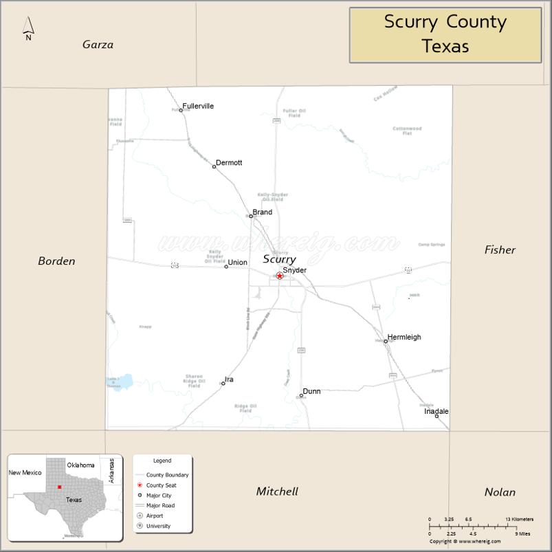
| Seat: | Snyder |
| Largest city: | Snyder |
| Total Area: | 908 sq mi (2,350 km²) |
| Land Area: | 905 sq mi (2,340 km²) |
| Total Population: | 16,932 |
| Population Density: | 19/sq mi (7.2/km²) |
| Time zone: | UTC−6 (Central) |
| Summer Time Zone (DST): | UTC−5 (CDT) |
| Website: | www.co.scurry.tx.us |
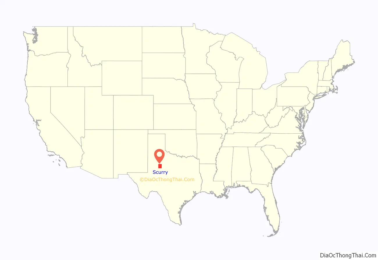
Scurry County location map. Where is Scurry County?
History
This county, lying directly north of Mitchell County, was created in 1876, and was organized June 28, 1884. It was named for William Read Scurry, lawyer and Confederate Army general. Until 1909, it was without railroad facilities, and the nearest shipping points were Colorado City to the south and still later the railroad towns in Fisher County to the east.
The first railroad was the Roscoe, Snyder and Pacific Railway, built from Roscoe on the Texas & Pacific in Nolan County, to Snyder, the county seat of Scurry County, about 1909, and subsequently extended to Fluvanna, also in Scurry County. In 1911, the Texico-Coleman division of the Santa Fe system was built through the county, giving it a trunk line of railway. Development has been particularly rapid during the early 1900s.
Some of the important pioneer facts concerning Scurry County are found in a sketch of W.H. Snyder, after whom the county seat town was named. In 1877, he opened a trading camp in the county, hauling lumber on wagons from Dallas to build his store and also hauling a good portion of his goods from the same place. He used what was known as trail wagons, with seven yoke of oxen to a team, each wagon having a capacity of 50,000 pounds. Mr. Snyder erected a house in Scurry County and began dealing in general merchandise and supplies for buffalo hunters. Other parties moved into the same locality, and that was the beginning of the town of Snyder.
In 1882, Mr. Snyder laid out the town, and two years later, it became the county seat. Snyder has had an enterprising citizenship, and 10 years later had an independent school district and four churches, and was an important center for trade.
Its importance has greatly increased since the coming of the railway, and in 1910, its population was 2,154. Other towns have sprung up along the railway, the most important of which is Fluvanna, at the terminus of the Roscoe, Snyder & Pacific, and Hermleigh.”
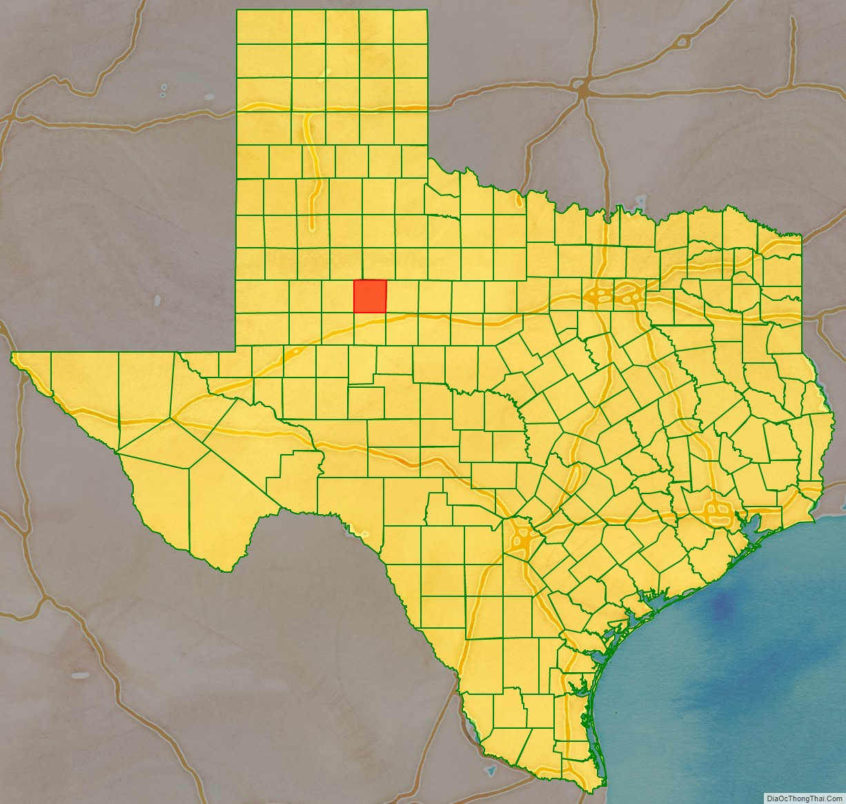
Scurry County Road Map
Geography
According to the U.S. Census Bureau, the county has a total area of 908 square miles (2,350 km), of which 905 square miles (2,340 km) are land and 2.1 square miles (5.4 km) (0.2%) are covered by water.
Since 1952, Lake J. B. Thomas has operated in Scurry County covering up to 7,282 acres when filled to the morning glory spillway at elevation of 2,258 ft above sea level.
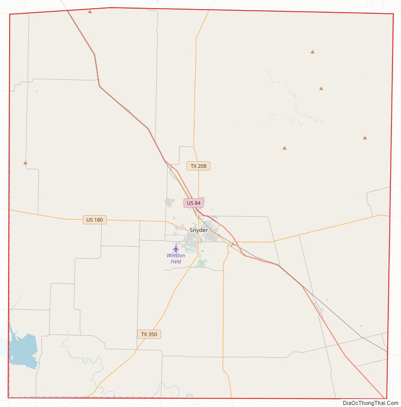
Major highways
- U.S. Highway 84
- U.S. Highway 180
- State Highway 208
- State Highway 350
Adjacent counties
- Kent County (north)
- Fisher County (east)
- Mitchell County (south)
- Borden County (west)
- Garza County (northwest)
Scurry County Topographic Map

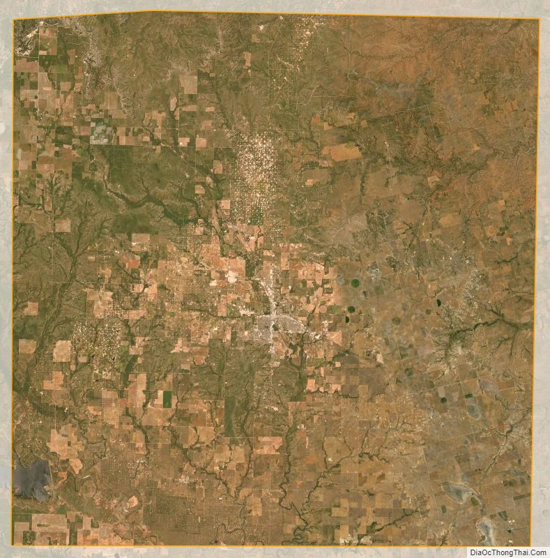
Scurry County Satellite Map
Scurry County Outline Map

See also
Map of Texas State and its subdivision:- Anderson
- Andrews
- Angelina
- Aransas
- Archer
- Armstrong
- Atascosa
- Austin
- Bailey
- Bandera
- Bastrop
- Baylor
- Bee
- Bell
- Bexar
- Blanco
- Borden
- Bosque
- Bowie
- Brazoria
- Brazos
- Brewster
- Briscoe
- Brooks
- Brown
- Burleson
- Burnet
- Caldwell
- Calhoun
- Callahan
- Cameron
- Camp
- Carson
- Cass
- Castro
- Chambers
- Cherokee
- Childress
- Clay
- Cochran
- Coke
- Coleman
- Collin
- Collingsworth
- Colorado
- Comal
- Comanche
- Concho
- Cooke
- Coryell
- Cottle
- Crane
- Crockett
- Crosby
- Culberson
- Dallam
- Dallas
- Dawson
- Deaf Smith
- Delta
- Denton
- Dewitt
- Dickens
- Dimmit
- Donley
- Duval
- Eastland
- Ector
- Edwards
- El Paso
- Ellis
- Erath
- Falls
- Fannin
- Fayette
- Fisher
- Floyd
- Foard
- Fort Bend
- Franklin
- Freestone
- Frio
- Gaines
- Galveston
- Garza
- Gillespie
- Glasscock
- Goliad
- Gonzales
- Gray
- Grayson
- Gregg
- Grimes
- Guadalupe
- Hale
- Hall
- Hamilton
- Hansford
- Hardeman
- Hardin
- Harris
- Harrison
- Hartley
- Haskell
- Hays
- Hemphill
- Henderson
- Hidalgo
- Hill
- Hockley
- Hood
- Hopkins
- Houston
- Howard
- Hudspeth
- Hunt
- Hutchinson
- Irion
- Jack
- Jackson
- Jasper
- Jeff Davis
- Jefferson
- Jim Hogg
- Jim Wells
- Johnson
- Jones
- Karnes
- Kaufman
- Kendall
- Kenedy
- Kent
- Kerr
- Kimble
- King
- Kinney
- Kleberg
- Knox
- La Salle
- Lamar
- Lamb
- Lampasas
- Lavaca
- Lee
- Leon
- Liberty
- Limestone
- Lipscomb
- Live Oak
- Llano
- Loving
- Lubbock
- Lynn
- Madison
- Marion
- Martin
- Mason
- Matagorda
- Maverick
- McCulloch
- McLennan
- McMullen
- Medina
- Menard
- Midland
- Milam
- Mills
- Mitchell
- Montague
- Montgomery
- Moore
- Morris
- Motley
- Nacogdoches
- Navarro
- Newton
- Nolan
- Nueces
- Ochiltree
- Oldham
- Orange
- Palo Pinto
- Panola
- Parker
- Parmer
- Pecos
- Polk
- Potter
- Presidio
- Rains
- Randall
- Reagan
- Real
- Red River
- Reeves
- Refugio
- Roberts
- Robertson
- Rockwall
- Runnels
- Rusk
- Sabine
- San Augustine
- San Jacinto
- San Patricio
- San Saba
- Schleicher
- Scurry
- Shackelford
- Shelby
- Sherman
- Smith
- Somervell
- Starr
- Stephens
- Sterling
- Stonewall
- Sutton
- Swisher
- Tarrant
- Taylor
- Terrell
- Terry
- Throckmorton
- Titus
- Tom Green
- Travis
- Trinity
- Tyler
- Upshur
- Upton
- Uvalde
- Val Verde
- Van Zandt
- Victoria
- Walker
- Waller
- Ward
- Washington
- Webb
- Wharton
- Wheeler
- Wichita
- Wilbarger
- Willacy
- Williamson
- Wilson
- Winkler
- Wise
- Wood
- Yoakum
- Young
- Zapata
- Zavala
- Alabama
- Alaska
- Arizona
- Arkansas
- California
- Colorado
- Connecticut
- Delaware
- District of Columbia
- Florida
- Georgia
- Hawaii
- Idaho
- Illinois
- Indiana
- Iowa
- Kansas
- Kentucky
- Louisiana
- Maine
- Maryland
- Massachusetts
- Michigan
- Minnesota
- Mississippi
- Missouri
- Montana
- Nebraska
- Nevada
- New Hampshire
- New Jersey
- New Mexico
- New York
- North Carolina
- North Dakota
- Ohio
- Oklahoma
- Oregon
- Pennsylvania
- Rhode Island
- South Carolina
- South Dakota
- Tennessee
- Texas
- Utah
- Vermont
- Virginia
- Washington
- West Virginia
- Wisconsin
- Wyoming