Hermleigh is a census-designated place (CDP) in Scurry County, Texas, United States.
Hermleigh lies on U.S. Route 84, ninety-six miles southeast of Lubbock, and has population of 345 people at the 2010 census.
A destructive low-end EF2 tornado struck the northwestern side of town on May 1, 2022, damaging or destroying mobile homes while also damaging a home, a garage, trailers, and vehicles.
| Name: | Hermleigh CDP |
|---|---|
| LSAD Code: | 57 |
| LSAD Description: | CDP (suffix) |
| State: | Texas |
| County: | Scurry County |
| Elevation: | 2,441 ft (744 m) |
| Total Area: | 9.1 sq mi (23.5 km²) |
| Land Area: | 9.1 sq mi (23.5 km²) |
| Water Area: | 0.0 sq mi (0.0 km²) |
| Total Population: | 345 |
| Population Density: | 38/sq mi (15/km²) |
| ZIP code: | 79526 |
| Area code: | 325 |
| FIPS code: | 4833356 |
| GNISfeature ID: | 1337647 |
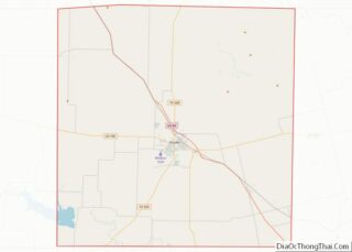
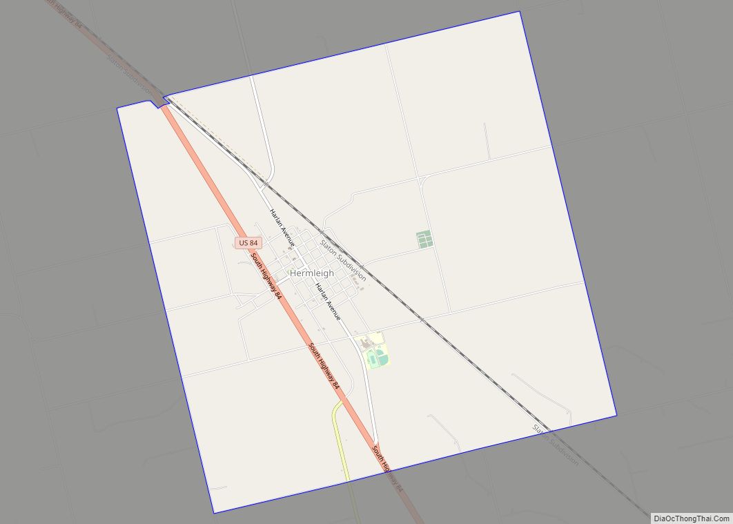
Online Interactive Map
Click on ![]() to view map in "full screen" mode.
to view map in "full screen" mode.
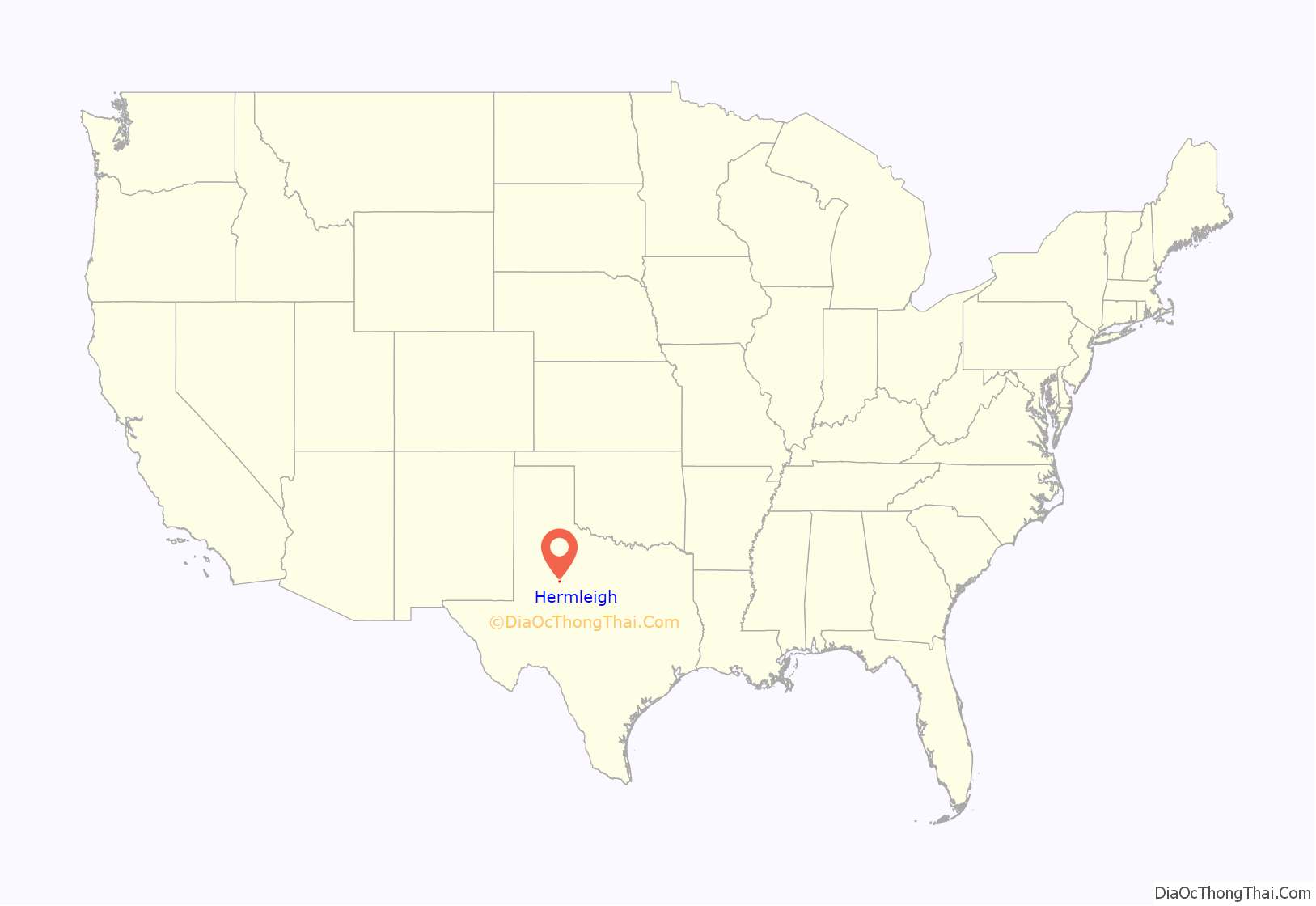
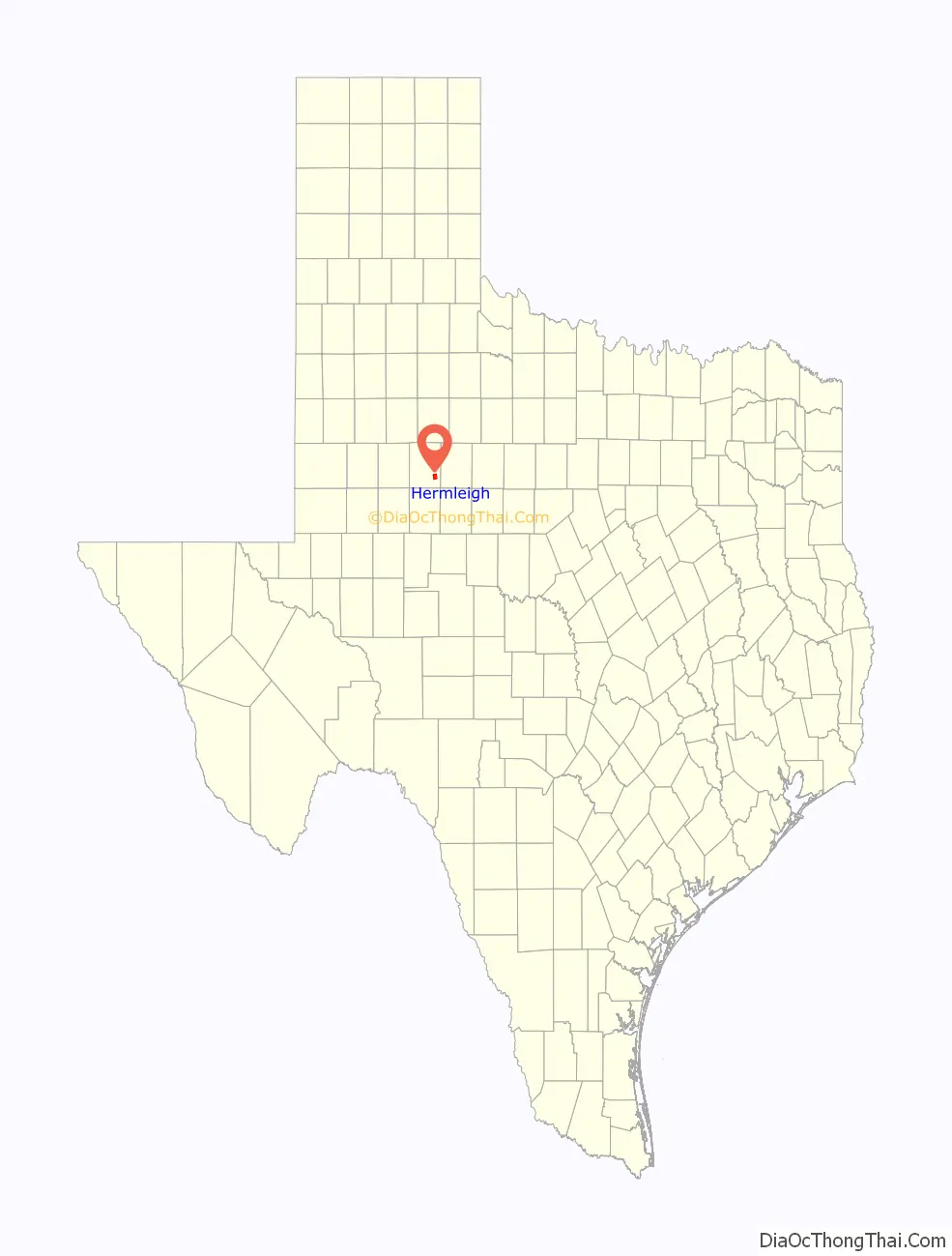
Hermleigh location map. Where is Hermleigh CDP?
History
Hermleigh’s history begins in 1907 when a townsite was surveyed on land donated by two men named R. C. Herm and Harry W. Harlin near the small community of Wheat. Citizens chose to name their new community “Hermlin” (an amalgam of the surnames of the two landowners) but this name was rejected by postal officials as being too close to the nearby town of Hamlin, potentially causing confusion between the two communities. The compromise of “Hermleigh” was settled upon, and the post office opened shortly thereafter. The Roscoe, Snyder and Pacific Railway was built through the new community, and residents of Wheat began to relocate to Hermleigh.
In 1911 the Santa Fe Railroad reached the community, and Hermleigh developed into a shipping point and trading center for local ranchers and cotton farmers. A school opened to serve area students in 1913, and by the late 1910s the community had its own newspaper (the Hermleigh Herald). Hermleigh briefly changed its name in the late 1910s to Foch to honor the French field marshal and World War I hero Ferdinand Foch, but reverted to the original name shortly thereafter and continued to flourish until the early 1930s, when the effects of the Great Depression brought an end to Hermleigh’s growth.
Though adversely effected by the Depression, Hermleigh remained stable throughout most of the twentieth century and by 1980 was home to over 700 residents. By 1990, however, the population had fallen dramatically to approximately 200 and some of the remaining businesses closed down. The community inexplicably rebounded during the 1990s, with the population reaching 393 by the 2000 Census.
Hermleigh is the hometown of former head coach of the Baylor Bears football program, Grant Teaff.
The most expensive pig ever sold was owned by a Hermleigh resident. Jefferey Roemisch of Hermleigh sold his cross-breed barrow named “Bud” for a record-breaking $56,000 in 1983 to a man named Bud Olson and his partner, Phil Bonzio.
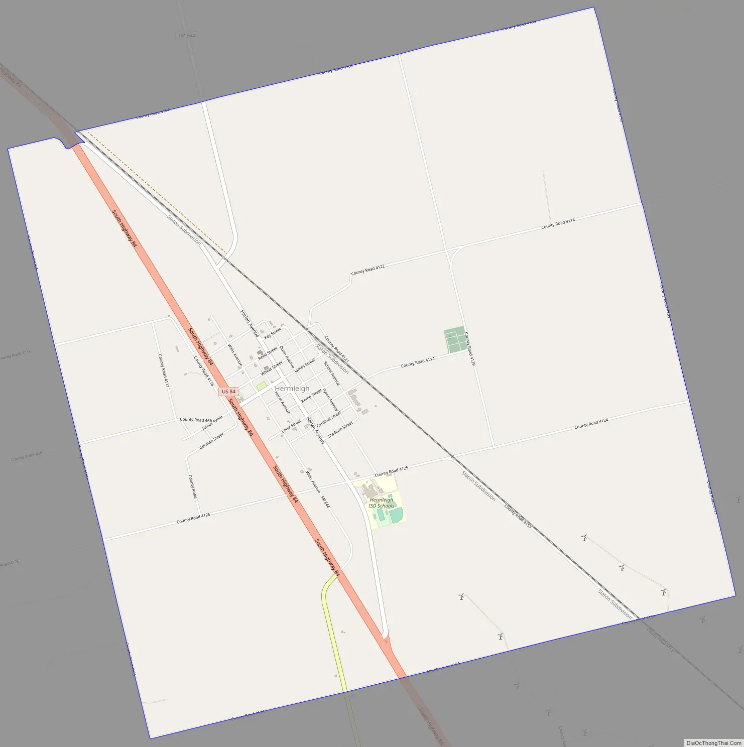
Hermleigh Road Map
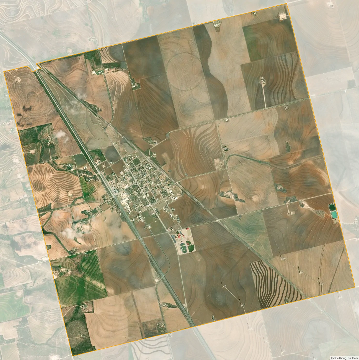
Hermleigh city Satellite Map
Geography
Hermleigh is located at 32°38′5″N 100°45′34″W / 32.63472°N 100.75944°W / 32.63472; -100.75944 (32.634619, -100.759336).
According to the United States Census Bureau, the CDP has a total area of 9.1 square miles (23.5 km), all of it land.
See also
Map of Texas State and its subdivision:- Anderson
- Andrews
- Angelina
- Aransas
- Archer
- Armstrong
- Atascosa
- Austin
- Bailey
- Bandera
- Bastrop
- Baylor
- Bee
- Bell
- Bexar
- Blanco
- Borden
- Bosque
- Bowie
- Brazoria
- Brazos
- Brewster
- Briscoe
- Brooks
- Brown
- Burleson
- Burnet
- Caldwell
- Calhoun
- Callahan
- Cameron
- Camp
- Carson
- Cass
- Castro
- Chambers
- Cherokee
- Childress
- Clay
- Cochran
- Coke
- Coleman
- Collin
- Collingsworth
- Colorado
- Comal
- Comanche
- Concho
- Cooke
- Coryell
- Cottle
- Crane
- Crockett
- Crosby
- Culberson
- Dallam
- Dallas
- Dawson
- Deaf Smith
- Delta
- Denton
- Dewitt
- Dickens
- Dimmit
- Donley
- Duval
- Eastland
- Ector
- Edwards
- El Paso
- Ellis
- Erath
- Falls
- Fannin
- Fayette
- Fisher
- Floyd
- Foard
- Fort Bend
- Franklin
- Freestone
- Frio
- Gaines
- Galveston
- Garza
- Gillespie
- Glasscock
- Goliad
- Gonzales
- Gray
- Grayson
- Gregg
- Grimes
- Guadalupe
- Hale
- Hall
- Hamilton
- Hansford
- Hardeman
- Hardin
- Harris
- Harrison
- Hartley
- Haskell
- Hays
- Hemphill
- Henderson
- Hidalgo
- Hill
- Hockley
- Hood
- Hopkins
- Houston
- Howard
- Hudspeth
- Hunt
- Hutchinson
- Irion
- Jack
- Jackson
- Jasper
- Jeff Davis
- Jefferson
- Jim Hogg
- Jim Wells
- Johnson
- Jones
- Karnes
- Kaufman
- Kendall
- Kenedy
- Kent
- Kerr
- Kimble
- King
- Kinney
- Kleberg
- Knox
- La Salle
- Lamar
- Lamb
- Lampasas
- Lavaca
- Lee
- Leon
- Liberty
- Limestone
- Lipscomb
- Live Oak
- Llano
- Loving
- Lubbock
- Lynn
- Madison
- Marion
- Martin
- Mason
- Matagorda
- Maverick
- McCulloch
- McLennan
- McMullen
- Medina
- Menard
- Midland
- Milam
- Mills
- Mitchell
- Montague
- Montgomery
- Moore
- Morris
- Motley
- Nacogdoches
- Navarro
- Newton
- Nolan
- Nueces
- Ochiltree
- Oldham
- Orange
- Palo Pinto
- Panola
- Parker
- Parmer
- Pecos
- Polk
- Potter
- Presidio
- Rains
- Randall
- Reagan
- Real
- Red River
- Reeves
- Refugio
- Roberts
- Robertson
- Rockwall
- Runnels
- Rusk
- Sabine
- San Augustine
- San Jacinto
- San Patricio
- San Saba
- Schleicher
- Scurry
- Shackelford
- Shelby
- Sherman
- Smith
- Somervell
- Starr
- Stephens
- Sterling
- Stonewall
- Sutton
- Swisher
- Tarrant
- Taylor
- Terrell
- Terry
- Throckmorton
- Titus
- Tom Green
- Travis
- Trinity
- Tyler
- Upshur
- Upton
- Uvalde
- Val Verde
- Van Zandt
- Victoria
- Walker
- Waller
- Ward
- Washington
- Webb
- Wharton
- Wheeler
- Wichita
- Wilbarger
- Willacy
- Williamson
- Wilson
- Winkler
- Wise
- Wood
- Yoakum
- Young
- Zapata
- Zavala
- Alabama
- Alaska
- Arizona
- Arkansas
- California
- Colorado
- Connecticut
- Delaware
- District of Columbia
- Florida
- Georgia
- Hawaii
- Idaho
- Illinois
- Indiana
- Iowa
- Kansas
- Kentucky
- Louisiana
- Maine
- Maryland
- Massachusetts
- Michigan
- Minnesota
- Mississippi
- Missouri
- Montana
- Nebraska
- Nevada
- New Hampshire
- New Jersey
- New Mexico
- New York
- North Carolina
- North Dakota
- Ohio
- Oklahoma
- Oregon
- Pennsylvania
- Rhode Island
- South Carolina
- South Dakota
- Tennessee
- Texas
- Utah
- Vermont
- Virginia
- Washington
- West Virginia
- Wisconsin
- Wyoming