Hebbronville (/ˈhɛbrənvɪl/ HEB-rən-vil) is a census-designated place (CDP) in and the county seat of Jim Hogg County, Texas, United States. The population was 4,558 at the 2010 census. In 1918, Helen Sewel Harbison became the first woman in Texas to cast a ballot, two years before the implementation of the Nineteenth Amendment to the United States Constitution.
The Colegio Altamirano, founded by settlers of Spanish ancestry who wanted their children to learn Spanish culture, was an institution in Hebbronville from 1897 until its closing in 1958.
| Name: | Hebbronville CDP |
|---|---|
| LSAD Code: | 57 |
| LSAD Description: | CDP (suffix) |
| State: | Texas |
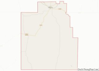
| County: | Jim Hogg County |
| Elevation: | 548 ft (167 m) |
| Total Area: | 6.3 sq mi (16.2 km²) |
| Land Area: | 6.3 sq mi (16.2 km²) |
| Water Area: | 0.0 sq mi (0.0 km²) |
| Total Population: | 4,558 |
| Population Density: | 728/sq mi (281.1/km²) |
| ZIP code: | 78361 |
| Area code: | 361 |
| FIPS code: | 4833008 |
| GNISfeature ID: | 1337545 |
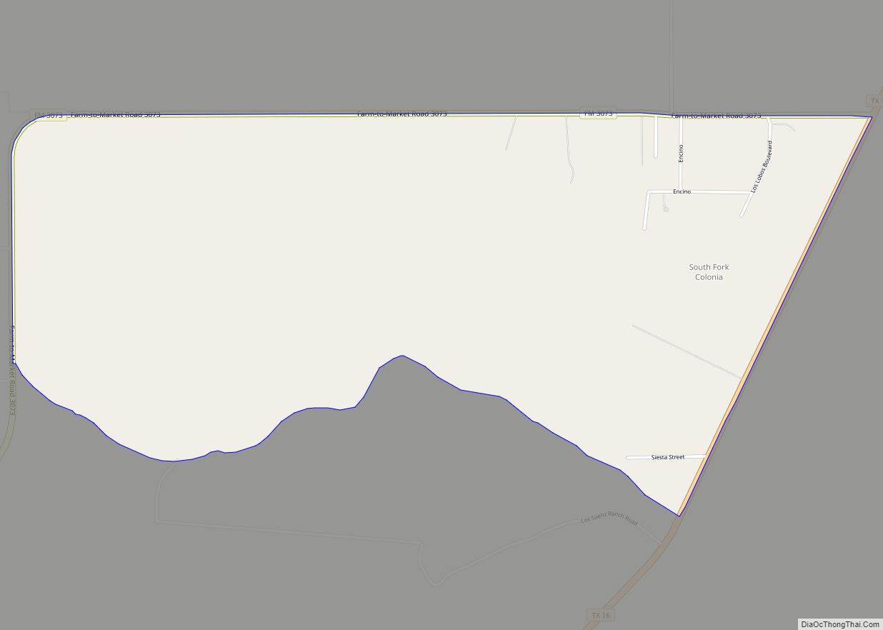
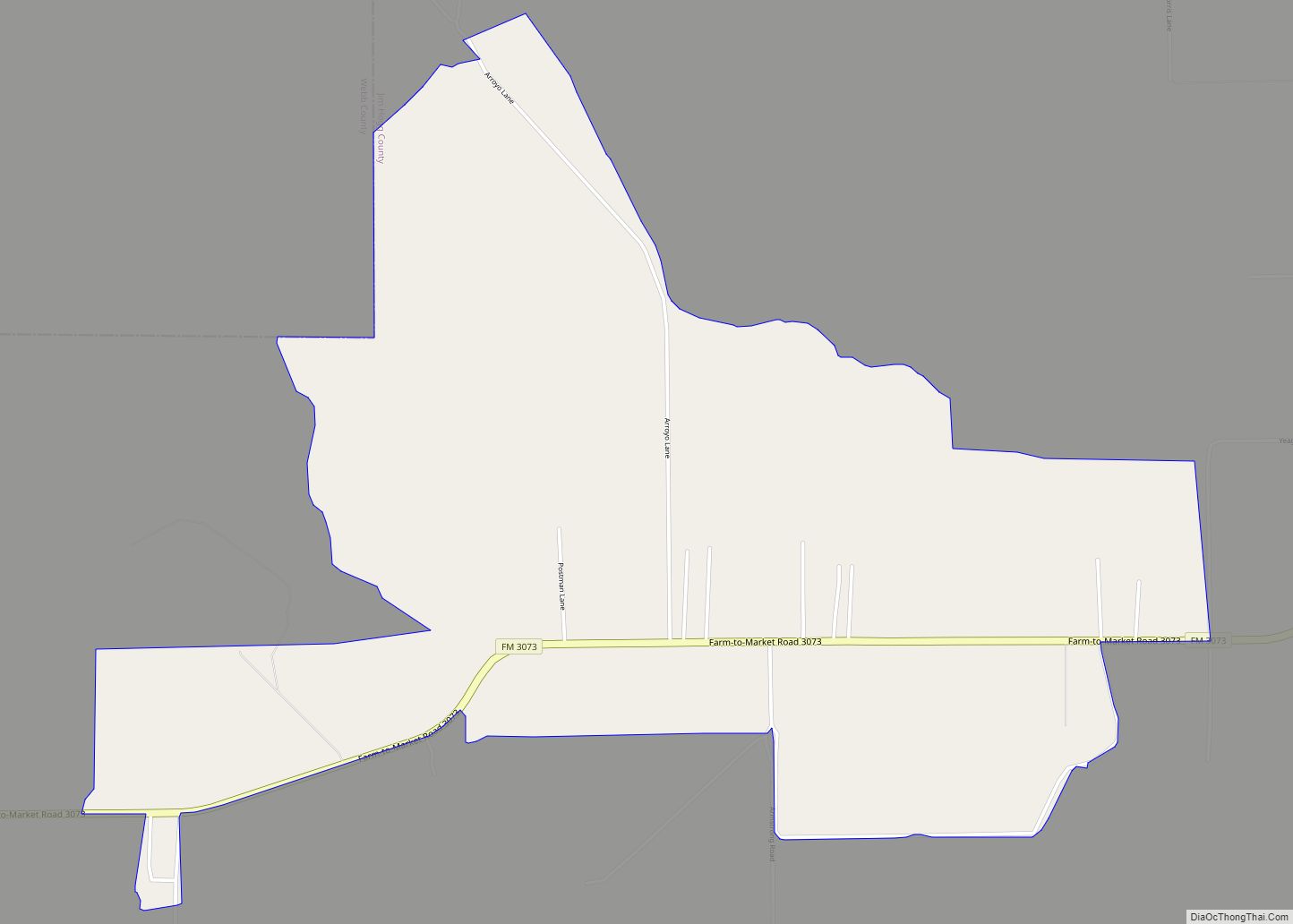
Online Interactive Map
Click on ![]() to view map in "full screen" mode.
to view map in "full screen" mode.
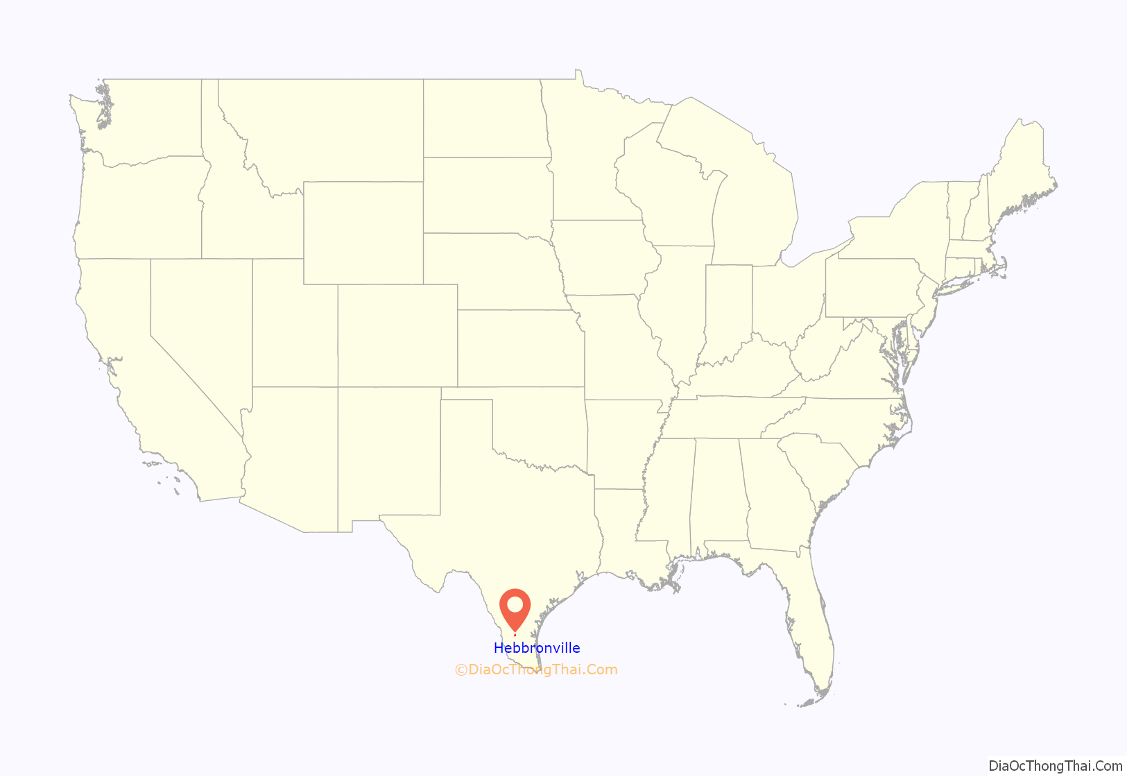
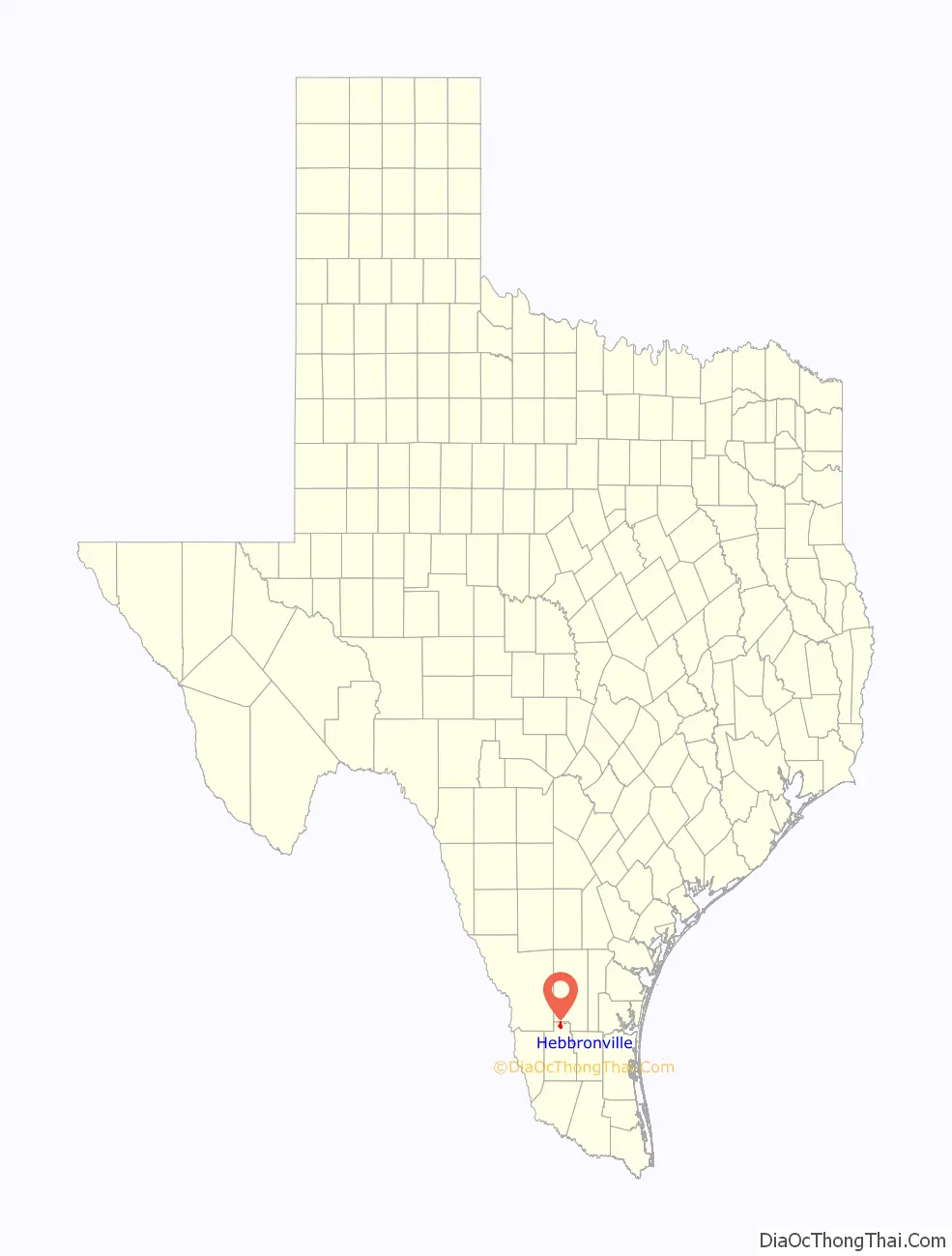
Hebbronville location map. Where is Hebbronville CDP?
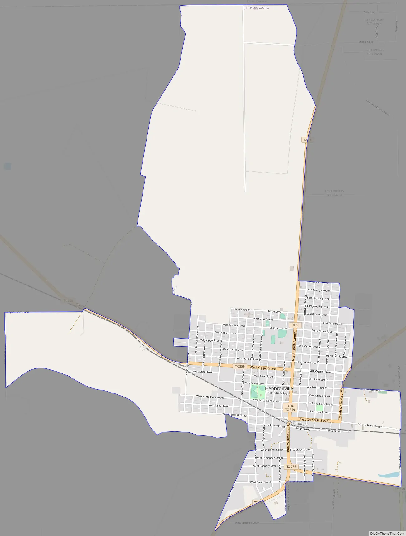
Hebbronville Road Map
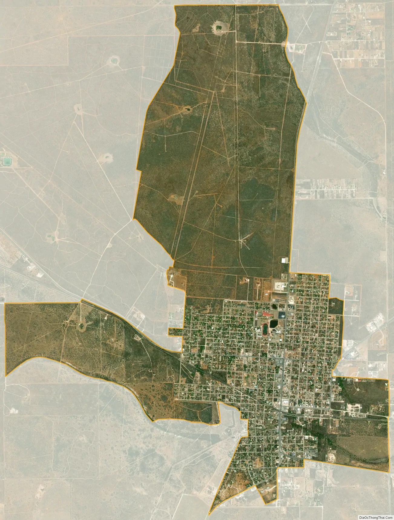
Hebbronville city Satellite Map
Geography
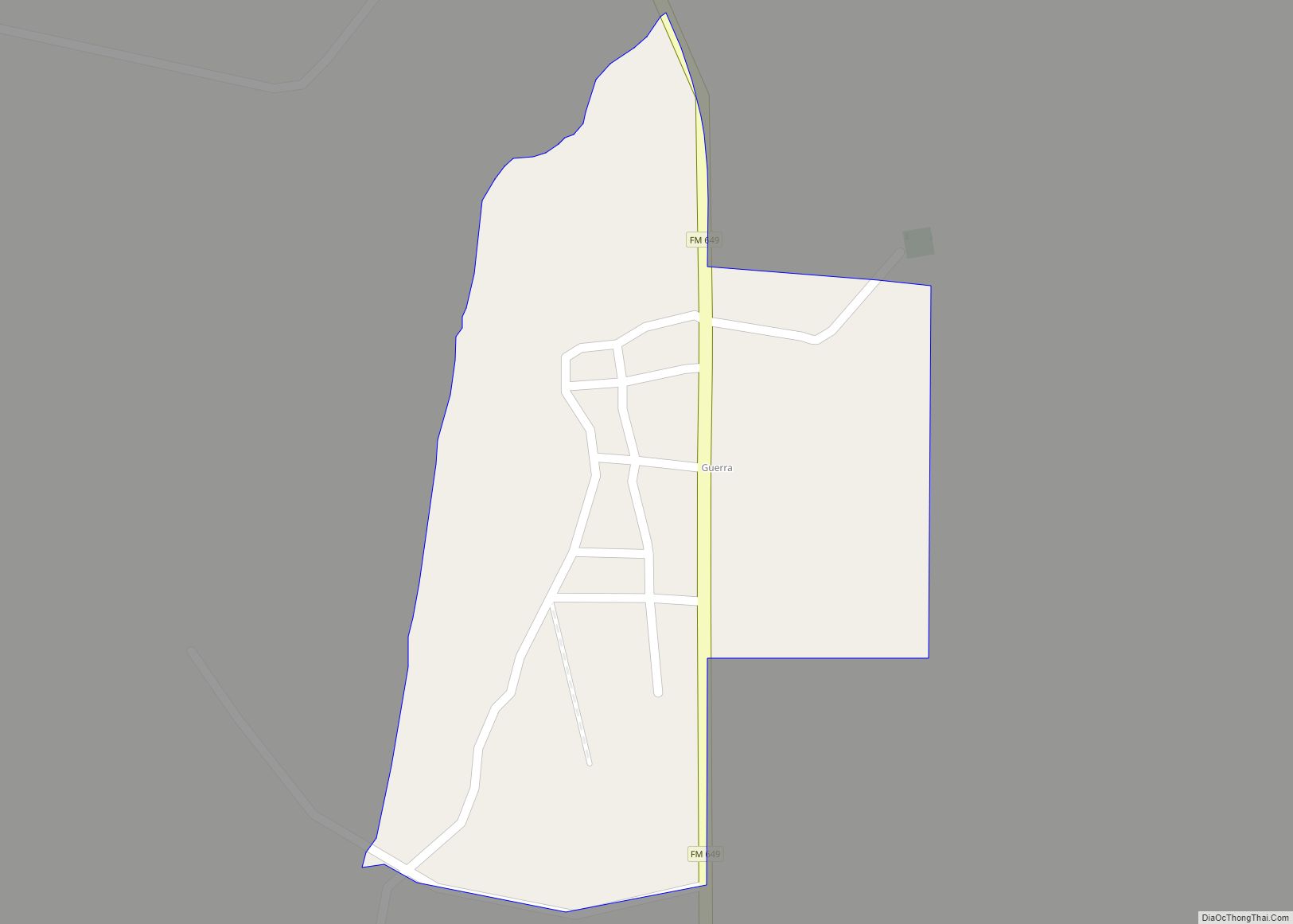
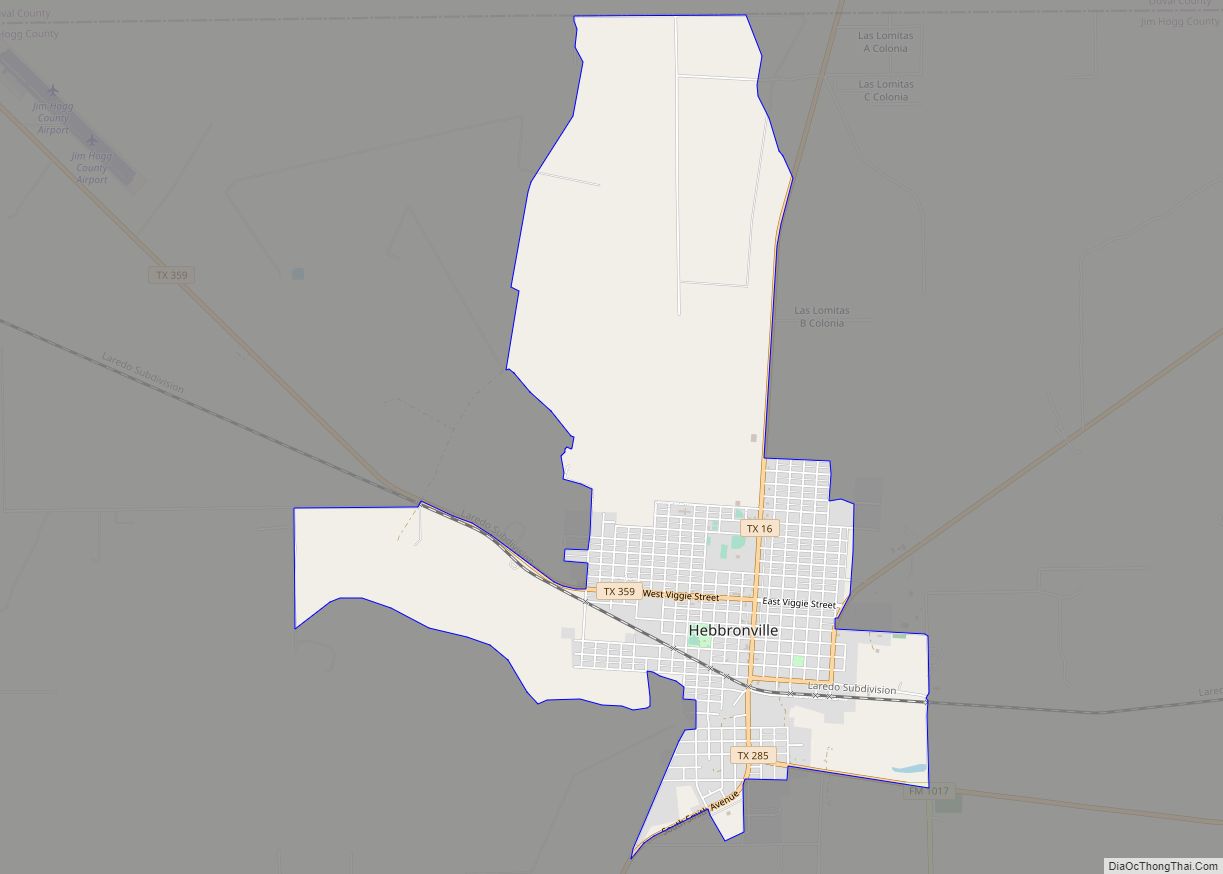
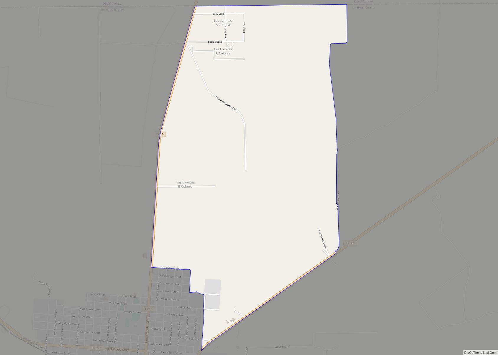
Hebbronville is located in northern Jim Hogg County at 27°18′41″N 98°40′52″W / 27.31139°N 98.68111°W / 27.31139; -98.68111 (27.311259, -98.680998). It is bordered to the east by Las Lomitas and to the north by Duval County.
Texas State Highway 16 (Smith Avenue) passes through the center of town, leading north 40 miles (64 km) to Freer and southwest 51 miles (82 km) to Zapata. Texas State Highway 359 (Viggie Street) leads northwest 56 miles (90 km) to Laredo and northeast 53 miles (85 km) to Alice, while Texas State Highway 285 leads east 34 miles (55 km) to Falfurrias.
According to the United States Census Bureau, the Hebbronville CDP has a total area of 6.3 square miles (16.2 km), all of it land.
Climate
Hebbronville has a borderline humid subtropical climate (Köppen climate classification Cfa)/hot semi-arid climate (Köppen BSh). Summers are very hot and humid: 152 afternoons each year top 90 °F or 32.2 °C, with 27.6 afternoons reaching 100 °F or 37.8 °C and during the summer of 2009 eleven afternoons topped 110 °F or 43.3 °C. During July and August combined, all but three mornings stay above 68 °F or 20 °C and seven mornings per year stay above 77 °F or 25 °C, with as many as forty mornings staying over this temperature during 1998. The hottest temperature on record has been 118 °F (47.8 °C) on July 9, 2009, and the hottest minimum 88 °F (31.1 °C) on September 30, 2009, followed by 87 °F (30.6 °C) the following day.
During the summer, rain is not common, but when a Gulf of Mexico hurricane moves inland it can be very heavy. From September 11 to 13, 1971, a total of 14.10 inches (358.1 mm) fell over three days from such a system, 14.73 inches (374.1 mm) in four days from September 20 to 23 of 1967, and 6.00 inches (152.4 mm) fell on August 27 and 28, 1909. In contrast, no measurable precipitation fell in Hebbronville from June 10 to September 7 of 1921.
Temperatures decline slowly during the “fall” season, remaining hot through until the end of October, by which time most danger of flooding from a remnant hurricane has passed. The winter months are warm and usually dry, although occasionally an easterly flow will produce substantial rainfall. Three substantial storms in February and March 1923 produced a total of 11.06 inches (280.9 mm), and the ten-day period from December 13 to 22 of 1991 saw 7.13 inches or 181.1 millimetres of rainfall; however, only 1.71 inches or 43.4 millimetres fell between October 1970 and the end of March 1971. Frosts do occasionally occur during the winter – 9.9 mornings fall to or below freezing during an average winter – but measurable snow has fallen in Hebbronville only three times in 112 years – on March 10, 1932, on January 20, 1940 during South Texas’ coolest month on record, and on Christmas Day of 2004 when 5 inches or 0.13 metres fell in a famous “White Christmas”.
Since 1905 the wettest calendar year has been 1995 with 42.75 inches (1,085.8 mm) and the driest 1996 with 11.52 inches (292.6 mm), whilst September 1967 has proved the wettest month with 19.35 inches (491.5 mm). The wettest single day has been September 12, 1971 with 9.40 inches (238.8 mm).
See also
Map of Texas State and its subdivision:- Anderson
- Andrews
- Angelina
- Aransas
- Archer
- Armstrong
- Atascosa
- Austin
- Bailey
- Bandera
- Bastrop
- Baylor
- Bee
- Bell
- Bexar
- Blanco
- Borden
- Bosque
- Bowie
- Brazoria
- Brazos
- Brewster
- Briscoe
- Brooks
- Brown
- Burleson
- Burnet
- Caldwell
- Calhoun
- Callahan
- Cameron
- Camp
- Carson
- Cass
- Castro
- Chambers
- Cherokee
- Childress
- Clay
- Cochran
- Coke
- Coleman
- Collin
- Collingsworth
- Colorado
- Comal
- Comanche
- Concho
- Cooke
- Coryell
- Cottle
- Crane
- Crockett
- Crosby
- Culberson
- Dallam
- Dallas
- Dawson
- Deaf Smith
- Delta
- Denton
- Dewitt
- Dickens
- Dimmit
- Donley
- Duval
- Eastland
- Ector
- Edwards
- El Paso
- Ellis
- Erath
- Falls
- Fannin
- Fayette
- Fisher
- Floyd
- Foard
- Fort Bend
- Franklin
- Freestone
- Frio
- Gaines
- Galveston
- Garza
- Gillespie
- Glasscock
- Goliad
- Gonzales
- Gray
- Grayson
- Gregg
- Grimes
- Guadalupe
- Hale
- Hall
- Hamilton
- Hansford
- Hardeman
- Hardin
- Harris
- Harrison
- Hartley
- Haskell
- Hays
- Hemphill
- Henderson
- Hidalgo
- Hill
- Hockley
- Hood
- Hopkins
- Houston
- Howard
- Hudspeth
- Hunt
- Hutchinson
- Irion
- Jack
- Jackson
- Jasper
- Jeff Davis
- Jefferson
- Jim Hogg
- Jim Wells
- Johnson
- Jones
- Karnes
- Kaufman
- Kendall
- Kenedy
- Kent
- Kerr
- Kimble
- King
- Kinney
- Kleberg
- Knox
- La Salle
- Lamar
- Lamb
- Lampasas
- Lavaca
- Lee
- Leon
- Liberty
- Limestone
- Lipscomb
- Live Oak
- Llano
- Loving
- Lubbock
- Lynn
- Madison
- Marion
- Martin
- Mason
- Matagorda
- Maverick
- McCulloch
- McLennan
- McMullen
- Medina
- Menard
- Midland
- Milam
- Mills
- Mitchell
- Montague
- Montgomery
- Moore
- Morris
- Motley
- Nacogdoches
- Navarro
- Newton
- Nolan
- Nueces
- Ochiltree
- Oldham
- Orange
- Palo Pinto
- Panola
- Parker
- Parmer
- Pecos
- Polk
- Potter
- Presidio
- Rains
- Randall
- Reagan
- Real
- Red River
- Reeves
- Refugio
- Roberts
- Robertson
- Rockwall
- Runnels
- Rusk
- Sabine
- San Augustine
- San Jacinto
- San Patricio
- San Saba
- Schleicher
- Scurry
- Shackelford
- Shelby
- Sherman
- Smith
- Somervell
- Starr
- Stephens
- Sterling
- Stonewall
- Sutton
- Swisher
- Tarrant
- Taylor
- Terrell
- Terry
- Throckmorton
- Titus
- Tom Green
- Travis
- Trinity
- Tyler
- Upshur
- Upton
- Uvalde
- Val Verde
- Van Zandt
- Victoria
- Walker
- Waller
- Ward
- Washington
- Webb
- Wharton
- Wheeler
- Wichita
- Wilbarger
- Willacy
- Williamson
- Wilson
- Winkler
- Wise
- Wood
- Yoakum
- Young
- Zapata
- Zavala
- Alabama
- Alaska
- Arizona
- Arkansas
- California
- Colorado
- Connecticut
- Delaware
- District of Columbia
- Florida
- Georgia
- Hawaii
- Idaho
- Illinois
- Indiana
- Iowa
- Kansas
- Kentucky
- Louisiana
- Maine
- Maryland
- Massachusetts
- Michigan
- Minnesota
- Mississippi
- Missouri
- Montana
- Nebraska
- Nevada
- New Hampshire
- New Jersey
- New Mexico
- New York
- North Carolina
- North Dakota
- Ohio
- Oklahoma
- Oregon
- Pennsylvania
- Rhode Island
- South Carolina
- South Dakota
- Tennessee
- Texas
- Utah
- Vermont
- Virginia
- Washington
- West Virginia
- Wisconsin
- Wyoming