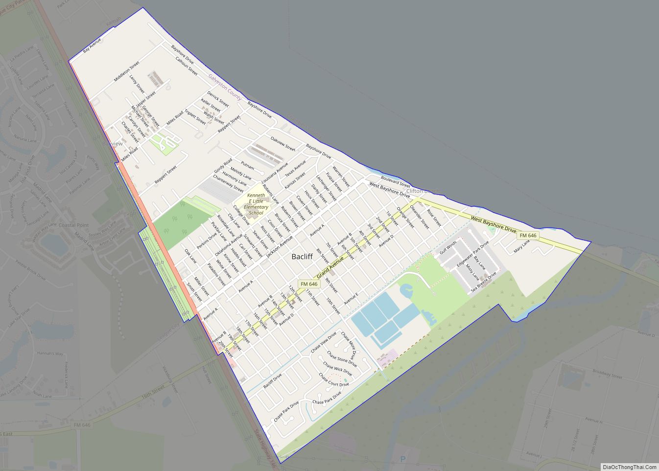
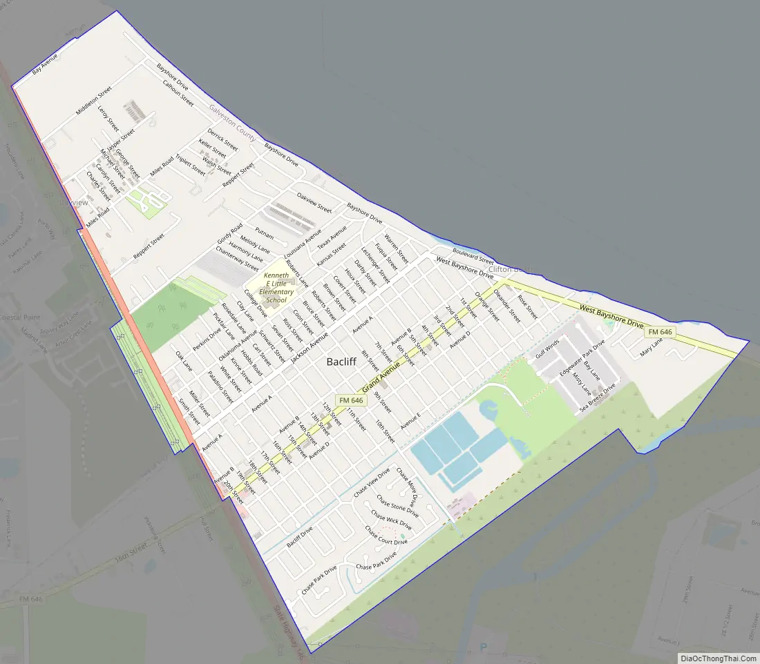
Bacliff is a census-designated place (CDP) in north-central Galveston County, Texas, United States, 16 miles (26 km) northwest of Galveston. The population was 8,619 at the 2010 census. Bacliff, originally called Clifton-by-the-Sea, began as a seaside resort town. Located on the western shore of Galveston Bay, Bacliff, along with San Leon and Bayview, are the largest unincorporated communities on the Galveston County mainland.
The Bacliff CDP is home to the Kenneth E. Little Elementary school and Bayshore Park, created from land donated by Texas Genco.
| Name: | Bacliff CDP |
|---|---|
| LSAD Code: | 57 |
| LSAD Description: | CDP (suffix) |
| State: | Texas |
| County: | Galveston County |
| Elevation: | 16 ft (5 m) |
| Total Area: | 2.7 sq mi (7.0 km²) |
| Land Area: | 2.5 sq mi (6.6 km²) |
| Water Area: | 0.2 sq mi (0.4 km²) |
| Total Population: | 8,619 |
| Population Density: | 3,200/sq mi (1,200/km²) |
| ZIP code: | 77518 |
| Area code: | 281 |
| FIPS code: | 4805180 |
| GNISfeature ID: | 1329909 |
Online Interactive Map
Click on ![]() to view map in "full screen" mode.
to view map in "full screen" mode.
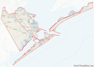
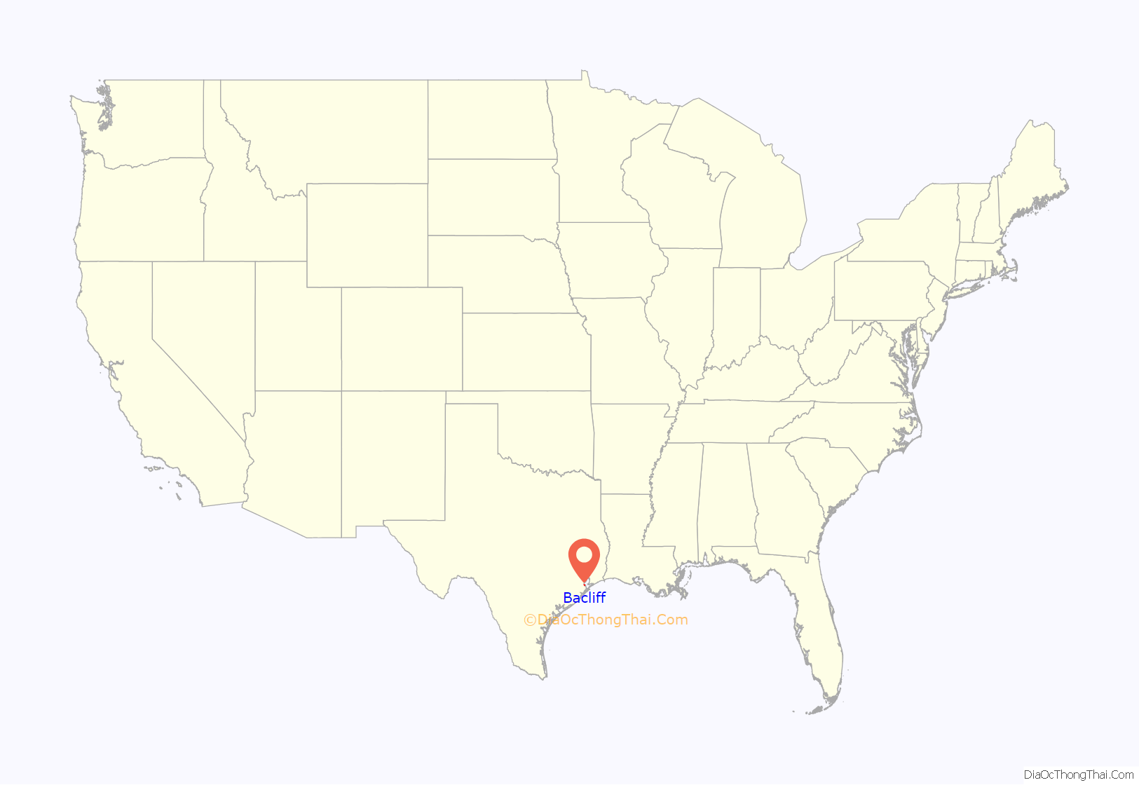
Bacliff location map. Where is Bacliff CDP?

History
Bacliff was established in 1910 by local landowners G.C. Perkins and W.Y. Fuqua as Clifton-by-the Sea. The area was developed as a seaside weekend resort, and included parks, hotels, summer homes, and a bathhouse and open air pavilion built on a pier over the water. Telephone service came to Clifton-by-the-Sea in 1913, and Grand Avenue (FM 646) became the main street. Hurricanes, Galveston‘s recovery after the Hurricane of 1900, and rapid transportation diminished Clifton-by-the-Sea’s popularity.
The hurricane of 1915 destroyed many of the improvements to the area, but by 1924 the bathhouse and pavilion had been restored and summer residents returned to the community. A fire destroyed the pavilion in 1929 and it was rebuilt and hosted numerous summer concerts by both the Galveston and Houston orchestras. The hurricane of 1943 caused major damage to the area and the bathhouse and pavilion were not rebuilt.
In 1933, Clifton-by-the-Sea was home to 50 residents and 2 businesses, and from 1940 to 1949 it was home to 100 residents and 4 businesses. After World War II the area expanded as it became home for workers of the nearby petrochemical plants. The expansion of the area required the establishment of a post office in 1948. The U.S. Postal Service refused to allow the name Clifton-by-the-Sea to be used due to its length, and the name Clifton was already in use by another Texas town, so the residents chose the same name as the subdivision at the center of business, Bay Cliff, as a replacement. However, the name was misspelled on the postal paperwork as Bacliff. The new name had only seven letters so it was admissible.
“Gator” Miller, former publisher of the Seabreeze, said that in the 1950s the Galveston Daily News bought a large parcel of land and awarded free lots to subscribers; people who canceled subscriptions lost their homesites, which were given to other subscribers. Miller said that this resulted in confused titles and a lack of large business; Miller said that a retailer would not wish to buy land in Bacliff and then discover that an individual claimed title to the land.
In 1964, Houston Lighting and Power began construction on two 450 MW electric generating units in Bacliff as part of the company’s Project Enterprise expansion. The units were of supercritical boiler design, which was then a new technology. The power plant, originally known as the Bacliff Plant, was renamed the P. H. Robinson plant, in honor of company president Perk H. Robinson.
In the 1970s and 1980s there was a dispute over the valuation of the power plant between HL&P and the Dickinson Independent School District (DISD). In 1979 HL&P said the plant was worth $238 million but DISD’s board of equalization said it was worth over $242 million. A legal dispute ensued between the two agencies.
During the 1980s, three (3) measures to incorporate the Bacliff area failed by wide margins. In April 1985, residents of Bacliff, Bayview, and San Leon considered an incorporation proposal to become the City of Bayshore. Judge Ray Holbrook signed an order for the election to take place on April 6, 1985, freeing the area, which had a population of 11,000, from the extraterritorial jurisdiction of League City and Texas City. Residents rejected the incorporation proposal. The vote was tallied with 1,268 against and 399 in favor. Proponents wanted a local police force and the ability to pass ordinances. Opponents said that the tax base was too small to support municipal services including police and road and drainage improvements.
By 1986, the community became a bedroom community for workers commuting to jobs in the area; during that year the Bacliff community had 4,851 residents and 19 businesses.
In 1986, residents in Bacliff and Bayview considered incorporating into a general law city. Supporters said that incorporation would establish more local control over affairs, an area police department, and the ability to pass ordinances. Opponents said that the area’s tax base could not sufficiently support municipal service, including police protection and road and drainage improvements. At the time the area of 3.6 square miles (9.3 km) considering incorporation had 7,000 people. Galveston County Judge Ray Holbrook signed an order setting the date of the election as Saturday, August 9, 1986, and releasing the area from the extraterritorial jurisdiction of Kemah, League City, and Texas City. In 1986, the Bacliff and Bayview area received water and sewer services from two municipal utility districts; if the incorporation measure had passed the districts would have likely remained. Donna Maples, vice president of the Bacliff-Bayview Community Association, supported the incorporation measure. The officials overseeing the election described turnout as “heavy.” Officials announced that the incorporation proposal failed on a 770 to 163 count.
In 2000, in Bacliff there were 6,692 people organized into 2,523 households. That year Bacliff and San Leon formed a nine member board to prepare the communities for incorporation. At that time Bacliff and San Leon had a combined population of 10,000. The board was to have three members from the Bacliff area, three members from the San Leon area, and three at large members. It was prompted after the City of Texas City suddenly annexed several commercial parcels along Texas State Highway 146 between Kemah and Dickinson Bayou in the year 2000. The board hoped to convince Texas City to reverse the annexation.
In 2003, the P. H. Robinson power plant was mothballed by Texas Genco. The plant was mothballed due to the proliferation of newer gas-fired merchant plants in Texas. Robinson Units 1-4 had 2,213 MW. The plant was decommissioned in 2009 and demolished in 2012. In 2013, NRG began construction on a 6 unit electrical generation “peaking plant”. This plant was placed in service on June 1, 2017
After Hurricane Ike hit Texas in September 2008, Galveston County officials offered a debris removal program to residents in unincorporated areas, including Bacliff. Flooding from hurricane Ike was minimized due in part to Bacliff’s relatively high elevation of 16 feet.
In 2017, in Bacliff there were 10,925 people organized into 3,004 households.
Bacliff Road Map
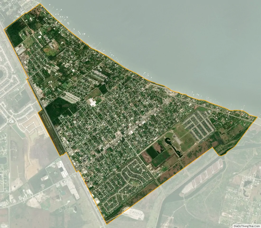
Bacliff city Satellite Map
Geography
Bacliff is a Census class code U5, populated area located at 29° 30′ 24″ N, 94° 59′ 31″ W.
According to the United States Census Bureau, the CDP has a total area of 2.7 square miles (7.0 km), of which 2.5 square miles (6.6 km) is land and 0.15 square miles (0.4 km), or 5.85%, is water. Bacliff is east of League City, 3 miles (4.8 km) south of Kemah, 16 miles (26 km) northeast of Galveston, and 36 miles (58 km) southeast of Downtown Houston. Most of the area is along the Galveston Bay, east of Texas State Highway 146.
The Bacliff, San Leon, and Bayview communities form the “Bayshore” area.
See also
Map of Texas State and its subdivision:- Anderson
- Andrews
- Angelina
- Aransas
- Archer
- Armstrong
- Atascosa
- Austin
- Bailey
- Bandera
- Bastrop
- Baylor
- Bee
- Bell
- Bexar
- Blanco
- Borden
- Bosque
- Bowie
- Brazoria
- Brazos
- Brewster
- Briscoe
- Brooks
- Brown
- Burleson
- Burnet
- Caldwell
- Calhoun
- Callahan
- Cameron
- Camp
- Carson
- Cass
- Castro
- Chambers
- Cherokee
- Childress
- Clay
- Cochran
- Coke
- Coleman
- Collin
- Collingsworth
- Colorado
- Comal
- Comanche
- Concho
- Cooke
- Coryell
- Cottle
- Crane
- Crockett
- Crosby
- Culberson
- Dallam
- Dallas
- Dawson
- Deaf Smith
- Delta
- Denton
- Dewitt
- Dickens
- Dimmit
- Donley
- Duval
- Eastland
- Ector
- Edwards
- El Paso
- Ellis
- Erath
- Falls
- Fannin
- Fayette
- Fisher
- Floyd
- Foard
- Fort Bend
- Franklin
- Freestone
- Frio
- Gaines
- Galveston
- Garza
- Gillespie
- Glasscock
- Goliad
- Gonzales
- Gray
- Grayson
- Gregg
- Grimes
- Guadalupe
- Hale
- Hall
- Hamilton
- Hansford
- Hardeman
- Hardin
- Harris
- Harrison
- Hartley
- Haskell
- Hays
- Hemphill
- Henderson
- Hidalgo
- Hill
- Hockley
- Hood
- Hopkins
- Houston
- Howard
- Hudspeth
- Hunt
- Hutchinson
- Irion
- Jack
- Jackson
- Jasper
- Jeff Davis
- Jefferson
- Jim Hogg
- Jim Wells
- Johnson
- Jones
- Karnes
- Kaufman
- Kendall
- Kenedy
- Kent
- Kerr
- Kimble
- King
- Kinney
- Kleberg
- Knox
- La Salle
- Lamar
- Lamb
- Lampasas
- Lavaca
- Lee
- Leon
- Liberty
- Limestone
- Lipscomb
- Live Oak
- Llano
- Loving
- Lubbock
- Lynn
- Madison
- Marion
- Martin
- Mason
- Matagorda
- Maverick
- McCulloch
- McLennan
- McMullen
- Medina
- Menard
- Midland
- Milam
- Mills
- Mitchell
- Montague
- Montgomery
- Moore
- Morris
- Motley
- Nacogdoches
- Navarro
- Newton
- Nolan
- Nueces
- Ochiltree
- Oldham
- Orange
- Palo Pinto
- Panola
- Parker
- Parmer
- Pecos
- Polk
- Potter
- Presidio
- Rains
- Randall
- Reagan
- Real
- Red River
- Reeves
- Refugio
- Roberts
- Robertson
- Rockwall
- Runnels
- Rusk
- Sabine
- San Augustine
- San Jacinto
- San Patricio
- San Saba
- Schleicher
- Scurry
- Shackelford
- Shelby
- Sherman
- Smith
- Somervell
- Starr
- Stephens
- Sterling
- Stonewall
- Sutton
- Swisher
- Tarrant
- Taylor
- Terrell
- Terry
- Throckmorton
- Titus
- Tom Green
- Travis
- Trinity
- Tyler
- Upshur
- Upton
- Uvalde
- Val Verde
- Van Zandt
- Victoria
- Walker
- Waller
- Ward
- Washington
- Webb
- Wharton
- Wheeler
- Wichita
- Wilbarger
- Willacy
- Williamson
- Wilson
- Winkler
- Wise
- Wood
- Yoakum
- Young
- Zapata
- Zavala
- Alabama
- Alaska
- Arizona
- Arkansas
- California
- Colorado
- Connecticut
- Delaware
- District of Columbia
- Florida
- Georgia
- Hawaii
- Idaho
- Illinois
- Indiana
- Iowa
- Kansas
- Kentucky
- Louisiana
- Maine
- Maryland
- Massachusetts
- Michigan
- Minnesota
- Mississippi
- Missouri
- Montana
- Nebraska
- Nevada
- New Hampshire
- New Jersey
- New Mexico
- New York
- North Carolina
- North Dakota
- Ohio
- Oklahoma
- Oregon
- Pennsylvania
- Rhode Island
- South Carolina
- South Dakota
- Tennessee
- Texas
- Utah
- Vermont
- Virginia
- Washington
- West Virginia
- Wisconsin
- Wyoming