Fredericksburg (German: Friedrichsberg) is the seat of Gillespie County, in the U.S. state of Texas. As of the 2010 Census, this city had a population of 10,530.
Fredericksburg was founded in 1846 and named after Prince Frederick of Prussia. Old-time German residents often referred to Fredericksburg as Fritztown, a nickname that is still used in some businesses. It is approximately eighty miles west from Greater Austin. This city is also notable as the home of Texas German, a dialect spoken by the first generations of German settlers who initially refused to learn English. Fredericksburg shares many cultural characteristics with New Braunfels, which had been established by Prince Carl of Solms-Braunfels the previous year. Fredericksburg is the birthplace of Fleet Admiral Chester Nimitz. It is the sister city of Montabaur, Germany. On October 14, 1970, the Fredericksburg Historic District was added to the National Register of Historic Places in Texas.
| Name: | Fredericksburg city |
|---|---|
| LSAD Code: | 25 |
| LSAD Description: | city (suffix) |
| State: | Texas |
| County: | Gillespie County |
| Elevation: | 1,693 ft (516 m) |
| Total Area: | 9.25 sq mi (23.95 km²) |
| Land Area: | 9.19 sq mi (23.81 km²) |
| Water Area: | 0.05 sq mi (0.14 km²) |
| Total Population: | 10,530 |
| Population Density: | 1,250.52/sq mi (482.84/km²) |
| ZIP code: | 78624 |
| Area code: | 830 |
| FIPS code: | 4827348 |
| GNISfeature ID: | 1336174 |
| Website: | www.fbgtx.org |
Online Interactive Map
Click on ![]() to view map in "full screen" mode.
to view map in "full screen" mode.
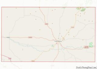
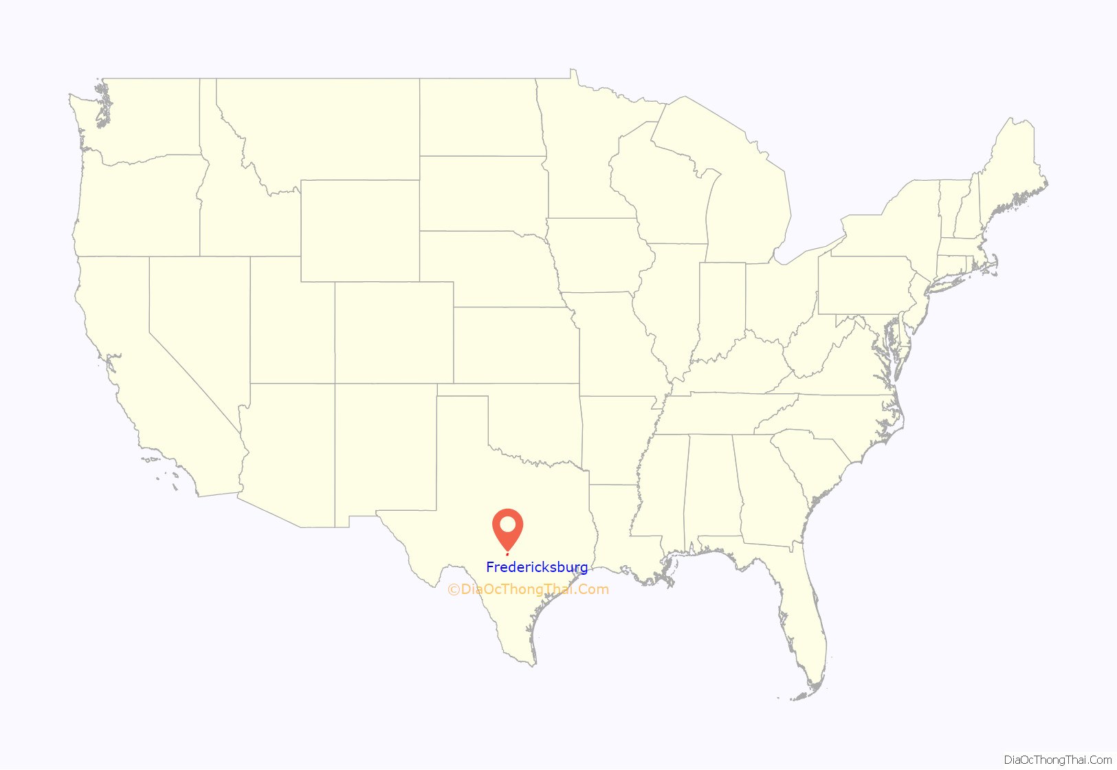
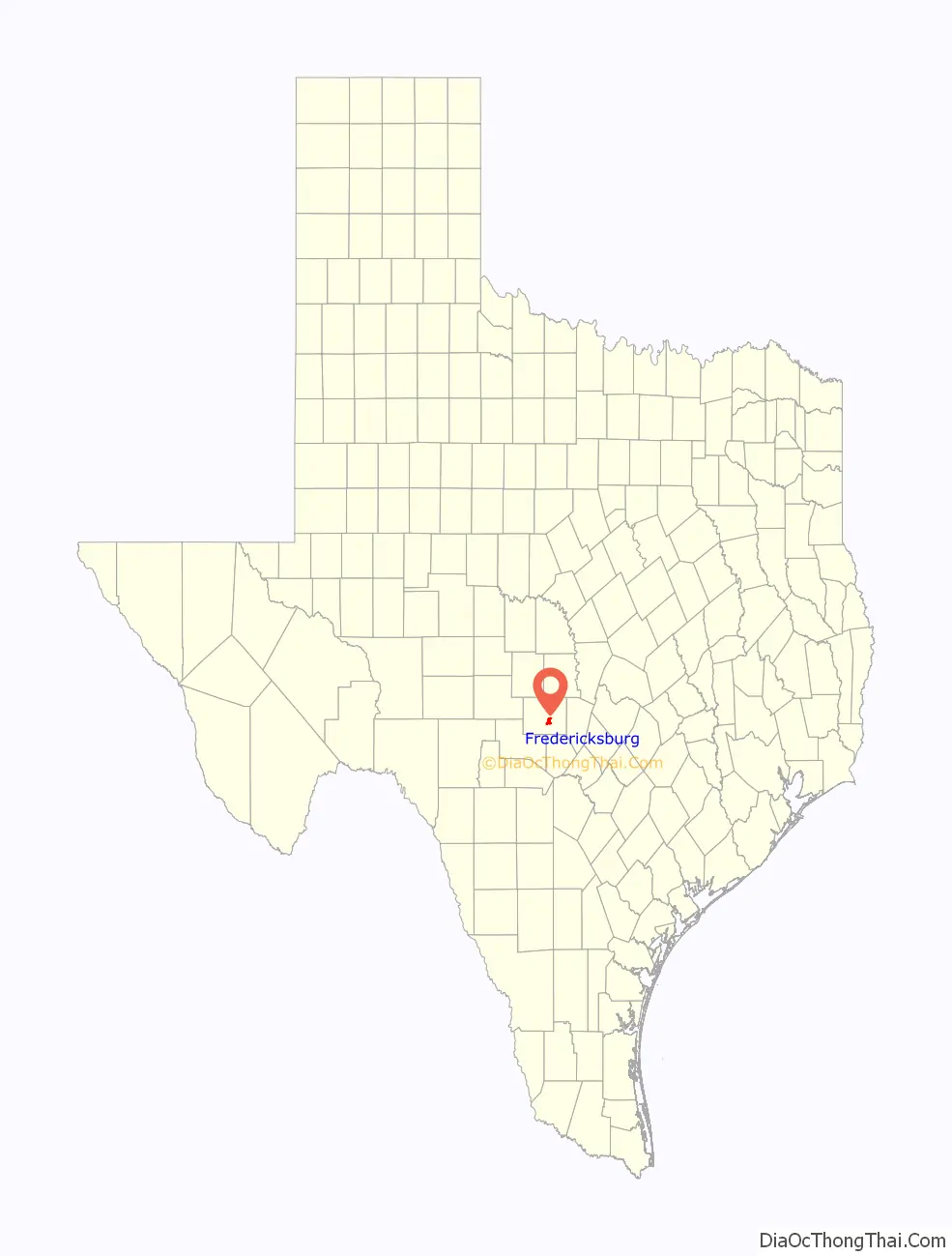
Fredericksburg location map. Where is Fredericksburg city?
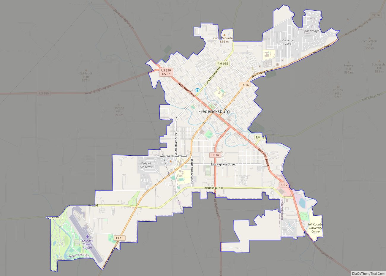
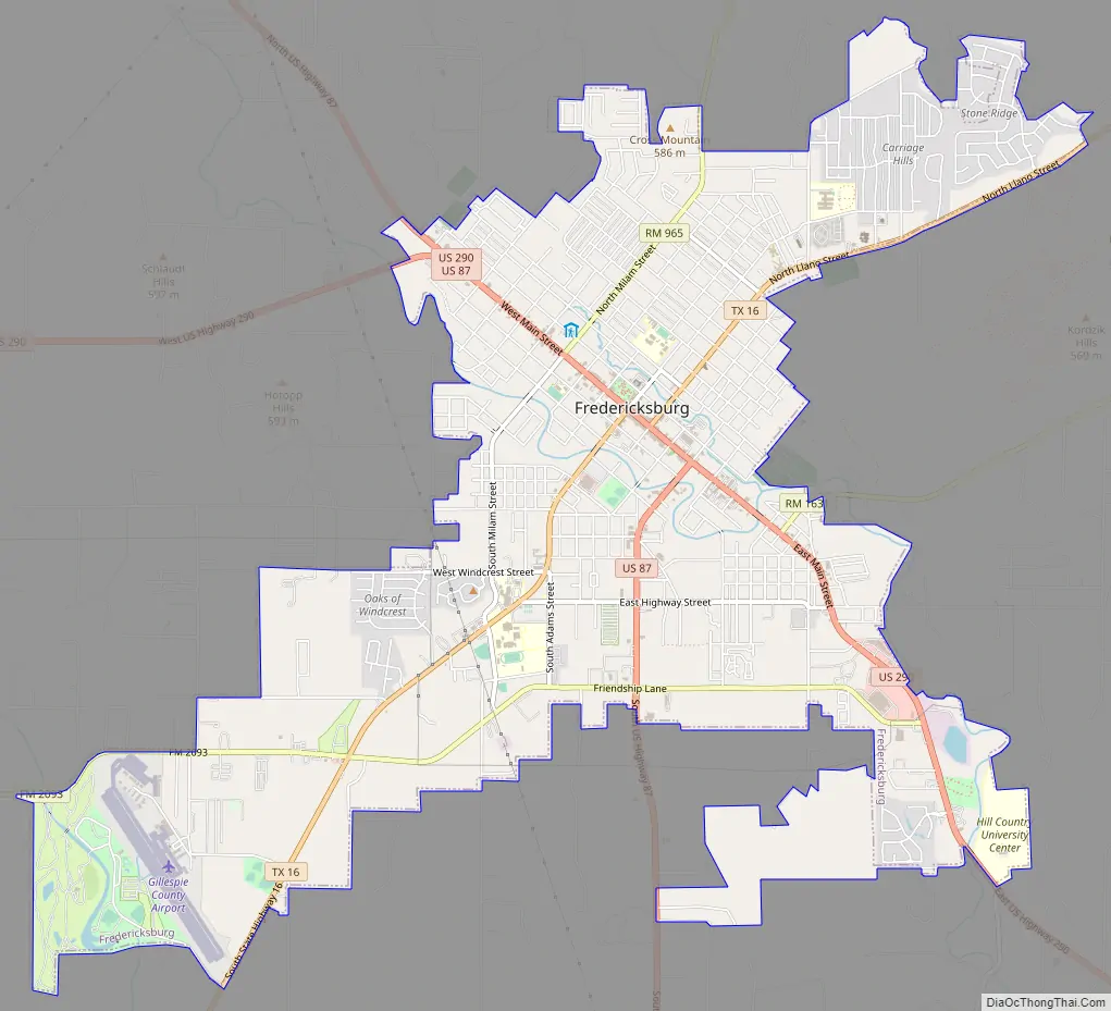
Fredericksburg Road Map
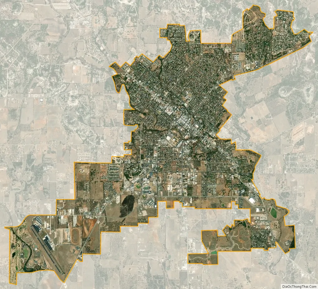
Fredericksburg city Satellite Map
Geography
Fredericksburg is located east of the center of Gillespie County at 30°16′27″N 98°52′19″W / 30.274058°N 98.871822°W / 30.274058; -98.871822 (30.274058, −98.871822). It is 70 miles (110 km) north of San Antonio and 78 miles (126 km) west of Austin.
According to the United States Census Bureau, the city has a total area of 22.3 square kilometres (8.6 sq mi), of which 22.2 square kilometres (8.6 sq mi) are land and 0.12 km (0.05 sq mi), or 0.55%, is covered by water.
Enchanted Rock
Enchanted Rock is a geographical landmark 27 km (17 mi) north of Fredericksburg in Llano County. The rock is a huge, pink granite exfoliation dome that rises 425 ft (130 m) above the surrounding land, has a summit elevation of 1,825 ft (556 m) above sea level, and covers 640 acres (260 ha). Enchanted Rock offers 8.4 miles of hiking trails, camping, picnicking, rock climbing, and other outdoor activities. It is one of the largest batholiths (underground rock formation uncovered by erosion) in the United States, and was declared a National Natural Landmark in 1970. In 1994, the State of Texas opened it as Enchanted Rock State Natural Area after adding facilities. The same year, Enchanted Rock was added to the National Register of Historic Places.
Balanced Rock
Balanced Rock was a famous local landmark that perched atop Bear Mountain 16 km (10 mi) north of Fredericksburg. The natural wonder stone pillar, precariously balanced on its small tip. It fell prey to vandals, who dynamited it off its base in April 1986.
Cross Mountain
The first known record of Cross Mountain (elevation 584 m (1,916 ft)) was in 1847 by Dr. Ferdinand von Roemer. Native Americans used the location to signal each other about intrusions into their territory. The area was part of settler Dr. John Christian Durst’s 10-acre (4.0 ha) allotment. Durst found a timber cross on the mountain, indicating that Spanish missionaries had once used the site. Durst named the place “Kreuzberg” or Cross Mountain. In 1849, Father George Menzel erected a new cross. In 1946, St. Mary’s Catholic Church erected a metal and concrete cross. The mountain has been used both for the Easter Fires pageant and for Easter sunrise services. It was designated a Recorded Texas Historic Landmark 1976.
See also
Map of Texas State and its subdivision:- Anderson
- Andrews
- Angelina
- Aransas
- Archer
- Armstrong
- Atascosa
- Austin
- Bailey
- Bandera
- Bastrop
- Baylor
- Bee
- Bell
- Bexar
- Blanco
- Borden
- Bosque
- Bowie
- Brazoria
- Brazos
- Brewster
- Briscoe
- Brooks
- Brown
- Burleson
- Burnet
- Caldwell
- Calhoun
- Callahan
- Cameron
- Camp
- Carson
- Cass
- Castro
- Chambers
- Cherokee
- Childress
- Clay
- Cochran
- Coke
- Coleman
- Collin
- Collingsworth
- Colorado
- Comal
- Comanche
- Concho
- Cooke
- Coryell
- Cottle
- Crane
- Crockett
- Crosby
- Culberson
- Dallam
- Dallas
- Dawson
- Deaf Smith
- Delta
- Denton
- Dewitt
- Dickens
- Dimmit
- Donley
- Duval
- Eastland
- Ector
- Edwards
- El Paso
- Ellis
- Erath
- Falls
- Fannin
- Fayette
- Fisher
- Floyd
- Foard
- Fort Bend
- Franklin
- Freestone
- Frio
- Gaines
- Galveston
- Garza
- Gillespie
- Glasscock
- Goliad
- Gonzales
- Gray
- Grayson
- Gregg
- Grimes
- Guadalupe
- Hale
- Hall
- Hamilton
- Hansford
- Hardeman
- Hardin
- Harris
- Harrison
- Hartley
- Haskell
- Hays
- Hemphill
- Henderson
- Hidalgo
- Hill
- Hockley
- Hood
- Hopkins
- Houston
- Howard
- Hudspeth
- Hunt
- Hutchinson
- Irion
- Jack
- Jackson
- Jasper
- Jeff Davis
- Jefferson
- Jim Hogg
- Jim Wells
- Johnson
- Jones
- Karnes
- Kaufman
- Kendall
- Kenedy
- Kent
- Kerr
- Kimble
- King
- Kinney
- Kleberg
- Knox
- La Salle
- Lamar
- Lamb
- Lampasas
- Lavaca
- Lee
- Leon
- Liberty
- Limestone
- Lipscomb
- Live Oak
- Llano
- Loving
- Lubbock
- Lynn
- Madison
- Marion
- Martin
- Mason
- Matagorda
- Maverick
- McCulloch
- McLennan
- McMullen
- Medina
- Menard
- Midland
- Milam
- Mills
- Mitchell
- Montague
- Montgomery
- Moore
- Morris
- Motley
- Nacogdoches
- Navarro
- Newton
- Nolan
- Nueces
- Ochiltree
- Oldham
- Orange
- Palo Pinto
- Panola
- Parker
- Parmer
- Pecos
- Polk
- Potter
- Presidio
- Rains
- Randall
- Reagan
- Real
- Red River
- Reeves
- Refugio
- Roberts
- Robertson
- Rockwall
- Runnels
- Rusk
- Sabine
- San Augustine
- San Jacinto
- San Patricio
- San Saba
- Schleicher
- Scurry
- Shackelford
- Shelby
- Sherman
- Smith
- Somervell
- Starr
- Stephens
- Sterling
- Stonewall
- Sutton
- Swisher
- Tarrant
- Taylor
- Terrell
- Terry
- Throckmorton
- Titus
- Tom Green
- Travis
- Trinity
- Tyler
- Upshur
- Upton
- Uvalde
- Val Verde
- Van Zandt
- Victoria
- Walker
- Waller
- Ward
- Washington
- Webb
- Wharton
- Wheeler
- Wichita
- Wilbarger
- Willacy
- Williamson
- Wilson
- Winkler
- Wise
- Wood
- Yoakum
- Young
- Zapata
- Zavala
- Alabama
- Alaska
- Arizona
- Arkansas
- California
- Colorado
- Connecticut
- Delaware
- District of Columbia
- Florida
- Georgia
- Hawaii
- Idaho
- Illinois
- Indiana
- Iowa
- Kansas
- Kentucky
- Louisiana
- Maine
- Maryland
- Massachusetts
- Michigan
- Minnesota
- Mississippi
- Missouri
- Montana
- Nebraska
- Nevada
- New Hampshire
- New Jersey
- New Mexico
- New York
- North Carolina
- North Dakota
- Ohio
- Oklahoma
- Oregon
- Pennsylvania
- Rhode Island
- South Carolina
- South Dakota
- Tennessee
- Texas
- Utah
- Vermont
- Virginia
- Washington
- West Virginia
- Wisconsin
- Wyoming