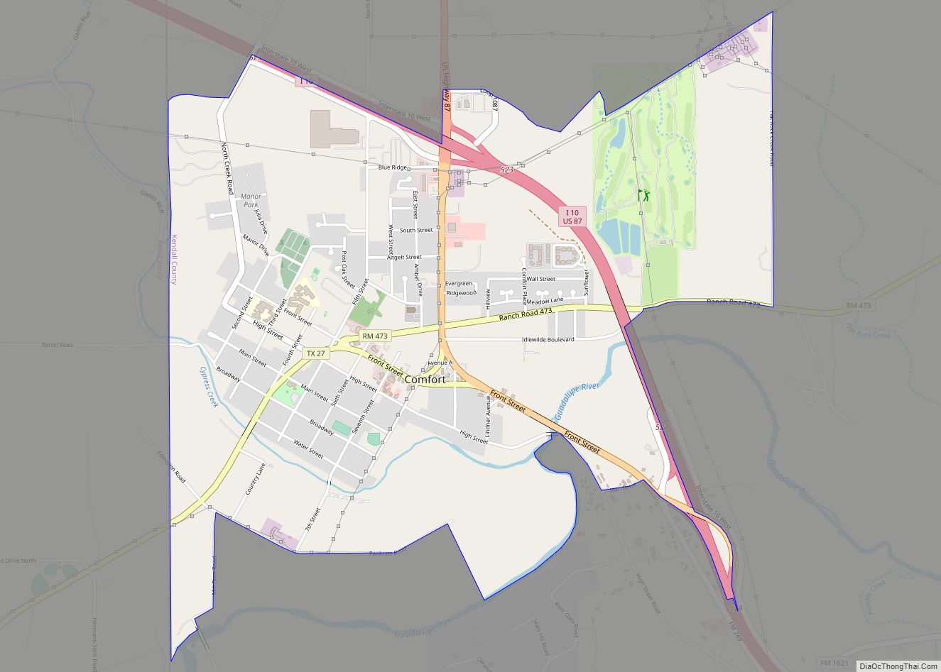
Comfort is an unincorporated community and census-designated place (CDP) in Kendall County, Texas, United States. As of the 2010 census it had a population of 2,363. Comfort was founded by German emigrants on the western end of the Texas-German belt. Many residents of the town today are descendants of those same Germans. Comfort is known for its German Heritage and large ranches outside of town.
| Name: | Comfort CDP |
|---|---|
| LSAD Code: | 57 |
| LSAD Description: | CDP (suffix) |
| State: | Texas |
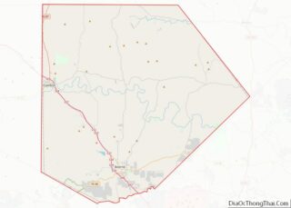
| County: | Kendall County |
| Elevation: | 1,427 ft (435 m) |
| Total Area: | 3.24 sq mi (8.38 km²) |
| Land Area: | 3.23 sq mi (8.36 km²) |
| Water Area: | 0.008 sq mi (0.02 km²) |
| Total Population: | 2,363 |
| Population Density: | 732/sq mi (282.7/km²) |
| ZIP code: | 78013 |
| Area code: | 830 |
| FIPS code: | 4816228 |
| GNISfeature ID: | 1333183 |
Online Interactive Map
Click on ![]() to view map in "full screen" mode.
to view map in "full screen" mode.
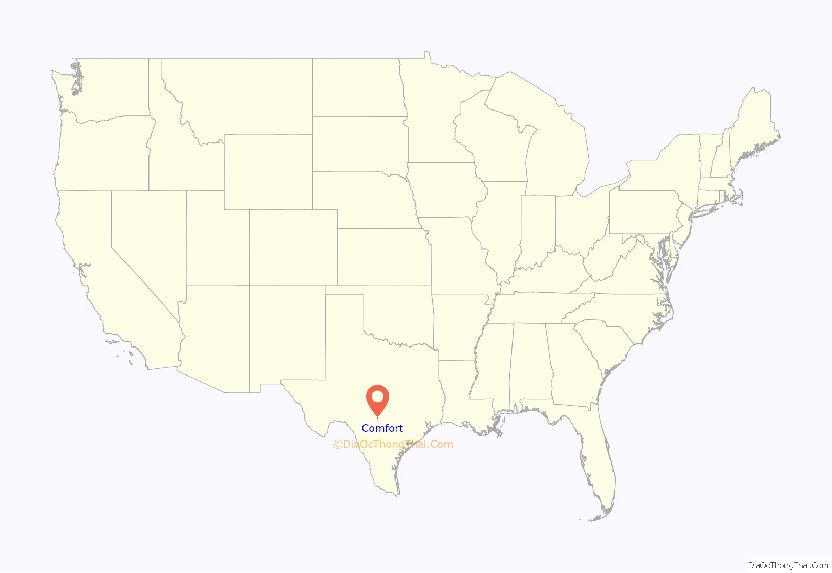
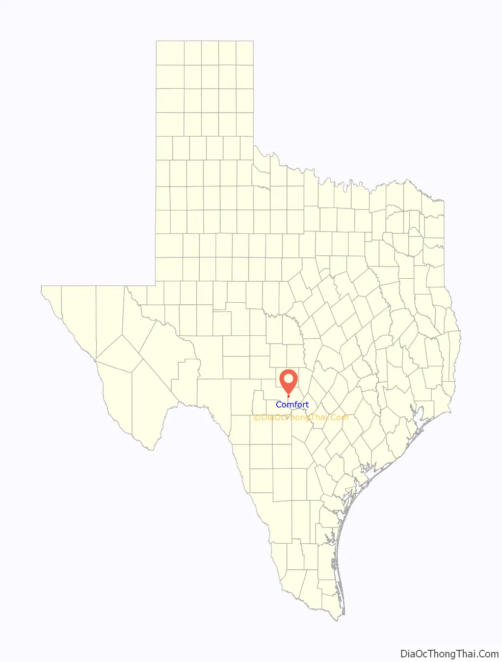
Comfort location map. Where is Comfort CDP?
History
Comfort was established in 1854 by German immigrants, who were Freethinkers and abolitionists. Ernst Hermann Altgelt, at the age of 22, is credited with surveying and measuring the lots that would later be sold to the incoming German immigrants. He stayed and married Emma (Murck) Altgelt, and they raised their nine children in the township of Comfort. Fritz and Betty Holekamp built the first house in Comfort, having started construction before Comfort’s official founding on September 3, 1854. The first churches were not established in Comfort until 1900. After some controversy, a cenotaph honoring “the Founding Freethinkers” was dedicated on November 2, 2002.
The downtown area is possibly one of the most well-preserved historic business districts in Texas. There are well over 100 structures in the area dating back to the 19th century, and seven of them were designed by the noted architect Alfred Giles. Mr. Giles lived in San Antonio, and he would ride horses, the stagecoach, and later the train to check his building sites in Comfort. Most of the population today is composed of descendants of those original pioneer families of the 1850s and the 1860s.
Comfort is also known for a tragic event that took place during the American Civil War. The Treue der Union Monument (“Loyalty to the Union”) was dedicated in honor of 35 men who died at the Battle of the Nueces, which took place because they opposed the state’s secession from the Union. The German settlers were killed on their way to Mexico during the Civil War. They were attacked by Confederate forces near Brackettville on August 10, 1862. The bodies were not buried, and the bones were retrieved and placed here in 1865. The monument was erected in 1866.
In 1918, Albert Steves erected a Hygieostatic Bat Roost on his family farm in Comfort. This roost was built to attract bats in an effort to control mosquito populations by natural means. It was originally researched and developed by Dr. Charles Agustus Rosenheimer Campbell of San Antonio. The idea was to use bats against malaria-carrying mosquitos. At one time, there were sixteen bat roosts built in the United States and Europe, of which only two sites now remain — one in Comfort and one in the Florida Keys.
Darmstadt Society of Forty
Some of the early settlers in Comfort migrated from the collapsed Fisher–Miller Land Grant experimental colonies of the Darmstadt Society of Forty.
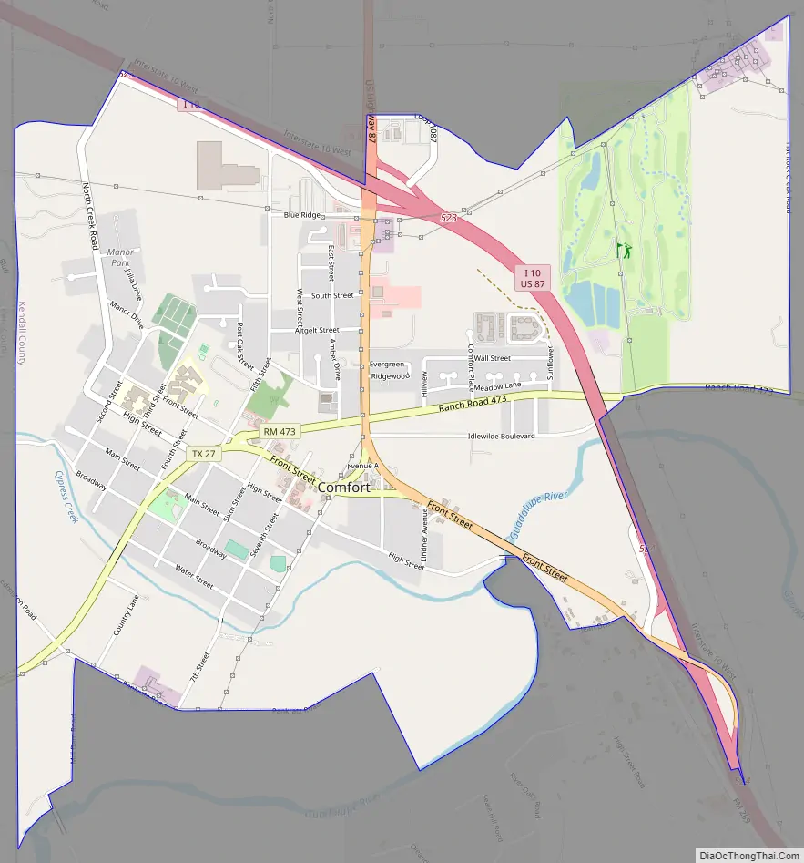
Comfort Road Map
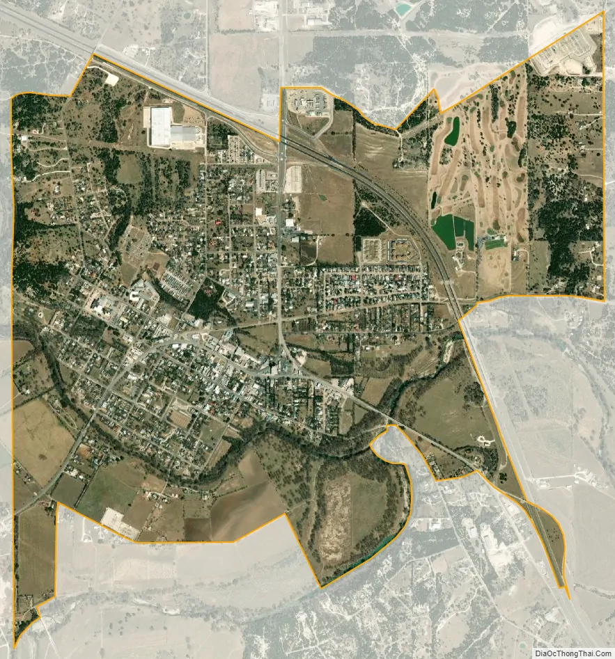
Comfort city Satellite Map
Geography
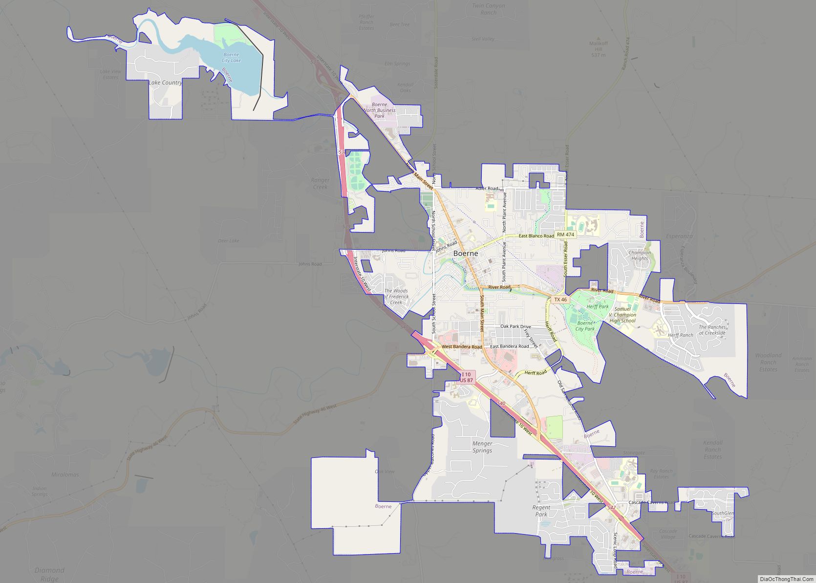
Comfort is bordered to the west by Kerr County. It is 18 miles (29 km) southeast of Kerrville, 16 miles (26 km) northwest of Boerne, and 48 miles (77 km) northwest of Downtown San Antonio. The town is at the junction of Interstate 10 and U.S. Route 87.
According to the United States Census Bureau, the Comfort CDP has a total area of 3.2 square miles (8.4 km), of which 0.01 square miles (0.02 km), or 0.27%, are water. The community sits on the north side of Cypress Creek where it joins the Guadalupe River.
Climate
The climate in this area is characterized by hot, humid summers and generally mild to cool winters. According to the Köppen Climate Classification system, Comfort has a humid subtropical climate, abbreviated “Cfa” on climate maps.
See also
Map of Texas State and its subdivision:- Anderson
- Andrews
- Angelina
- Aransas
- Archer
- Armstrong
- Atascosa
- Austin
- Bailey
- Bandera
- Bastrop
- Baylor
- Bee
- Bell
- Bexar
- Blanco
- Borden
- Bosque
- Bowie
- Brazoria
- Brazos
- Brewster
- Briscoe
- Brooks
- Brown
- Burleson
- Burnet
- Caldwell
- Calhoun
- Callahan
- Cameron
- Camp
- Carson
- Cass
- Castro
- Chambers
- Cherokee
- Childress
- Clay
- Cochran
- Coke
- Coleman
- Collin
- Collingsworth
- Colorado
- Comal
- Comanche
- Concho
- Cooke
- Coryell
- Cottle
- Crane
- Crockett
- Crosby
- Culberson
- Dallam
- Dallas
- Dawson
- Deaf Smith
- Delta
- Denton
- Dewitt
- Dickens
- Dimmit
- Donley
- Duval
- Eastland
- Ector
- Edwards
- El Paso
- Ellis
- Erath
- Falls
- Fannin
- Fayette
- Fisher
- Floyd
- Foard
- Fort Bend
- Franklin
- Freestone
- Frio
- Gaines
- Galveston
- Garza
- Gillespie
- Glasscock
- Goliad
- Gonzales
- Gray
- Grayson
- Gregg
- Grimes
- Guadalupe
- Hale
- Hall
- Hamilton
- Hansford
- Hardeman
- Hardin
- Harris
- Harrison
- Hartley
- Haskell
- Hays
- Hemphill
- Henderson
- Hidalgo
- Hill
- Hockley
- Hood
- Hopkins
- Houston
- Howard
- Hudspeth
- Hunt
- Hutchinson
- Irion
- Jack
- Jackson
- Jasper
- Jeff Davis
- Jefferson
- Jim Hogg
- Jim Wells
- Johnson
- Jones
- Karnes
- Kaufman
- Kendall
- Kenedy
- Kent
- Kerr
- Kimble
- King
- Kinney
- Kleberg
- Knox
- La Salle
- Lamar
- Lamb
- Lampasas
- Lavaca
- Lee
- Leon
- Liberty
- Limestone
- Lipscomb
- Live Oak
- Llano
- Loving
- Lubbock
- Lynn
- Madison
- Marion
- Martin
- Mason
- Matagorda
- Maverick
- McCulloch
- McLennan
- McMullen
- Medina
- Menard
- Midland
- Milam
- Mills
- Mitchell
- Montague
- Montgomery
- Moore
- Morris
- Motley
- Nacogdoches
- Navarro
- Newton
- Nolan
- Nueces
- Ochiltree
- Oldham
- Orange
- Palo Pinto
- Panola
- Parker
- Parmer
- Pecos
- Polk
- Potter
- Presidio
- Rains
- Randall
- Reagan
- Real
- Red River
- Reeves
- Refugio
- Roberts
- Robertson
- Rockwall
- Runnels
- Rusk
- Sabine
- San Augustine
- San Jacinto
- San Patricio
- San Saba
- Schleicher
- Scurry
- Shackelford
- Shelby
- Sherman
- Smith
- Somervell
- Starr
- Stephens
- Sterling
- Stonewall
- Sutton
- Swisher
- Tarrant
- Taylor
- Terrell
- Terry
- Throckmorton
- Titus
- Tom Green
- Travis
- Trinity
- Tyler
- Upshur
- Upton
- Uvalde
- Val Verde
- Van Zandt
- Victoria
- Walker
- Waller
- Ward
- Washington
- Webb
- Wharton
- Wheeler
- Wichita
- Wilbarger
- Willacy
- Williamson
- Wilson
- Winkler
- Wise
- Wood
- Yoakum
- Young
- Zapata
- Zavala
- Alabama
- Alaska
- Arizona
- Arkansas
- California
- Colorado
- Connecticut
- Delaware
- District of Columbia
- Florida
- Georgia
- Hawaii
- Idaho
- Illinois
- Indiana
- Iowa
- Kansas
- Kentucky
- Louisiana
- Maine
- Maryland
- Massachusetts
- Michigan
- Minnesota
- Mississippi
- Missouri
- Montana
- Nebraska
- Nevada
- New Hampshire
- New Jersey
- New Mexico
- New York
- North Carolina
- North Dakota
- Ohio
- Oklahoma
- Oregon
- Pennsylvania
- Rhode Island
- South Carolina
- South Dakota
- Tennessee
- Texas
- Utah
- Vermont
- Virginia
- Washington
- West Virginia
- Wisconsin
- Wyoming