Wichita Falls (/ˈwɪtʃɪtɑː/ WITCH-i-tah) is a city in and the seat of government of Wichita County, Texas, United States. It is the principal city of the Wichita Falls metropolitan statistical area, which encompasses all of Archer, Clay, and Wichita counties. According to the 2010 census, it had a population of 104,553, making it the 38th-most populous city in Texas. In addition, its central business district is 5 miles (8 km) from Sheppard Air Force Base, which is home to the Air Force’s largest technical training wing and the Euro-NATO Joint Jet Pilot Training program, the world’s only multinationally staffed and managed flying training program chartered to produce combat pilots for both USAF and NATO.
The city is home to the Newby-McMahon Building (otherwise known as the “world’s littlest skyscraper”), constructed downtown in 1919 and featured in Robert Ripley’s Ripley’s Believe It or Not!.
| Name: | Wichita Falls city |
|---|---|
| LSAD Code: | 25 |
| LSAD Description: | city (suffix) |
| State: | Texas |
| County: | Wichita County |
| Elevation: | 948 ft (289 m) |
| Land Area: | 72.01 sq mi (186.51 km²) |
| Water Area: | 0.02 sq mi (0.06 km²) |
| Population Density: | 1,453.73/sq mi (561.28/km²) |
| ZIP code: | 76301-11 |
| Area code: | 940 |
| FIPS code: | 4879000 |
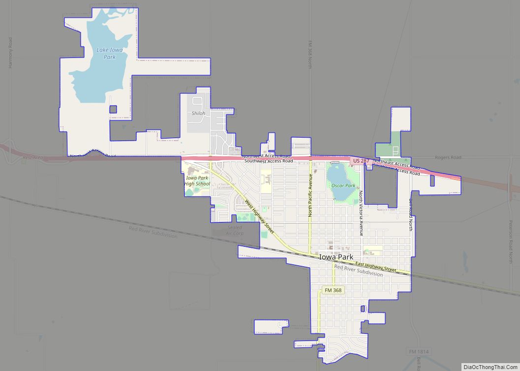
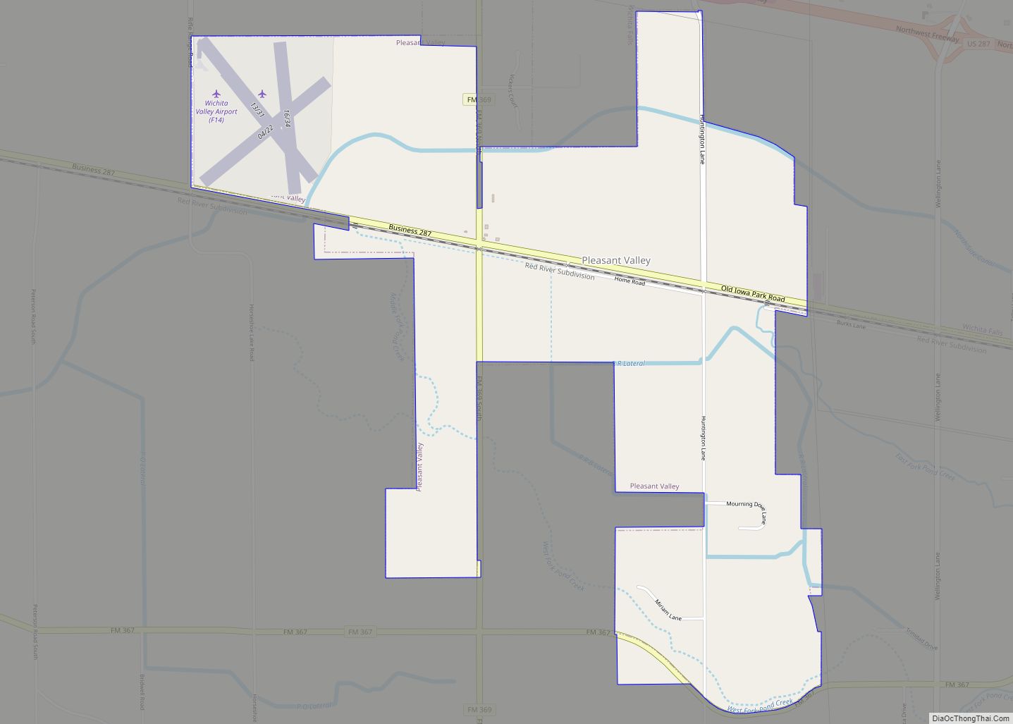
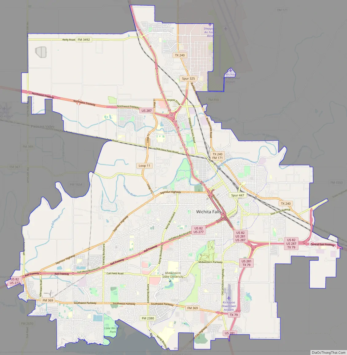
Online Interactive Map
Click on ![]() to view map in "full screen" mode.
to view map in "full screen" mode.
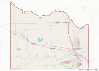
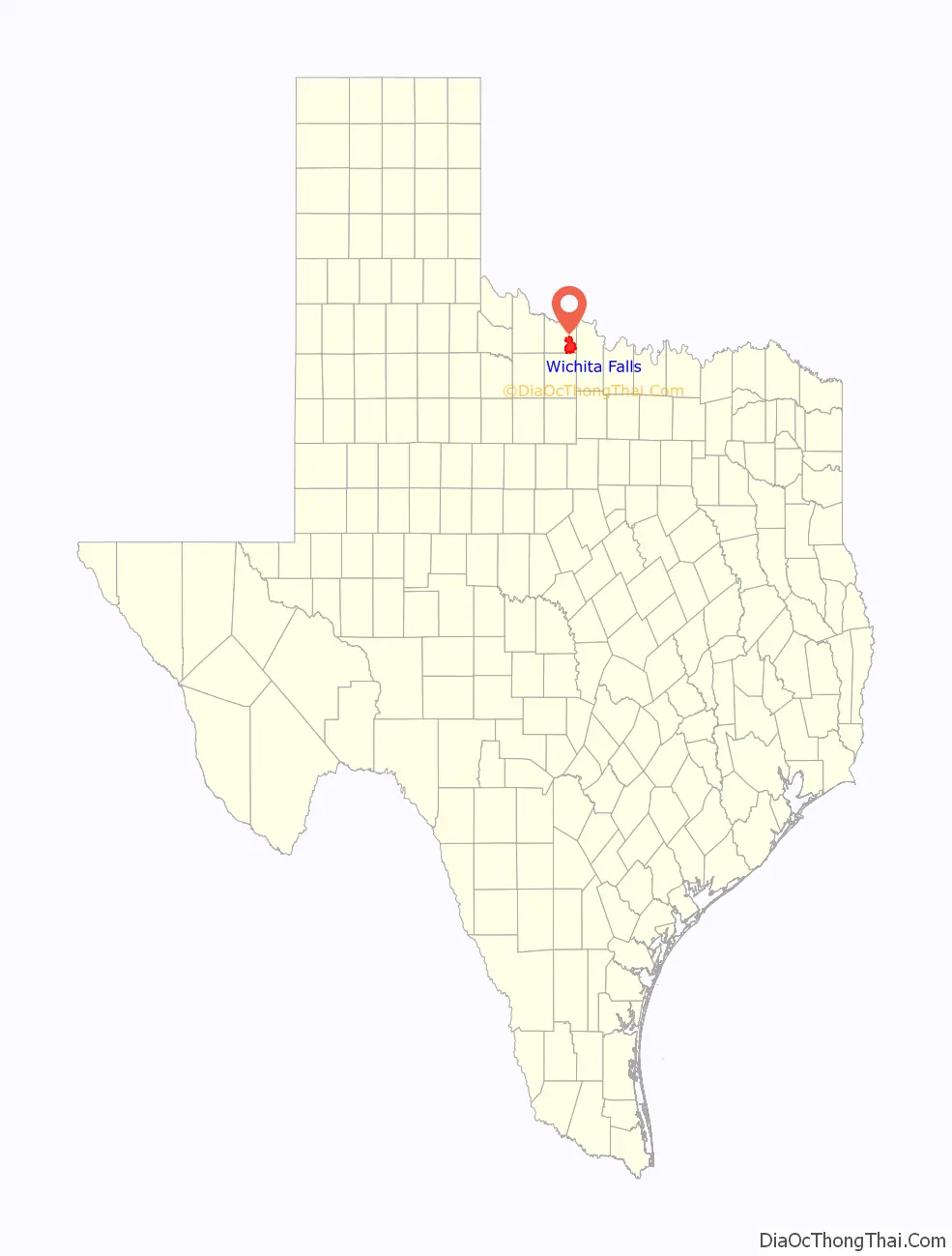
Wichita Falls location map. Where is Wichita Falls city?

History
The Choctaw Native Americans settled the area in the early 1800s from their native Mississippi area once Americans displaced them after the Treaty of Dancing Rabbit Creek. The treaty was signed and proclaimed in 1830-1831. As late as 1841, a large Indian settlement was present in the area that is now the city of Wichita Falls.
American settlers arrived in the 1860s, mainly as cattle ranchers. The city was named Wichita Falls on September 27, 1876, as the Wichita River runs through the area and there was a waterfall in the river’s course in 1876. Just ten years later in 1886, a flood destroyed the original waterfall on the Wichita River for which the city was named. After nearly 100 years of visitors wanting to visit the no longer existing falls, the city built an artificial waterfall beside the river in Lucy Park. The recreated falls are 54 ft (16 m) high and recirculate at 3,500 gallons per minute. They are visible to south-bound traffic on Interstate 44.
On the day the city was named in 1876, a sale of town lots was held at what is now the corner of Seventh and Ohio Streets – the birthplace of the city. The Fort Worth & Denver City Railway arrived in September 1882, the same year the city became the county seat of Wichita County. The city grew westwards from the original FW&DC train depot which was located at the northwest corner of Seventh Street and the FW&DC. This area is now referred to as the Depot Square Historic District, which has been declared a Texas Historic Landmark.
The early history of Wichita Falls well into the 20th century also rests on the work of two entrepreneurs, Joseph A. Kemp and his brother-in-law, Frank Kell. Kemp and Kell were pioneers in food processing and retailing, flour milling, railroads, cattle, banking, and oil.
Downtown Wichita Falls was the city’s main shopping area for many years. Those shops lost ground to the creation of new shopping centers throughout the city beginning with Parker Square in 1953 and other similar developments during the 1960s and 1970s, culminating with the opening of Sikes Senter Mall in 1974. The city has been seeking funding to rebuild and restore the downtown area since 2010.
Wichita Falls was once home to offices of several oil companies and related industries, along with oil refineries operated by the Continental Oil Company (now ConocoPhillips) until 1952 and Panhandle Oil Company American Petrofina until 1965. Both firms continued to use a portion of their former refineries as gasoline/oil terminal facilities for many years.
1964 tornado
A devastating tornado hit the north and northwest portions of Wichita Falls along with Sheppard Air Force Base during the afternoon of April 3, 1964 (later referred to as “Black Friday”). As the first violent tornado on record to hit the Wichita Falls area, it left seven dead and more than 100 injured. Additionally, the tornado caused roughly $15 million in property damage with about 225 homes destroyed and another 250 damaged. It was rated F5, the highest rating on the Fujita scale, but it is overshadowed by the 1979 tornado.
1979 tornado
An F4 tornado struck the heavily populated southern sections of Wichita Falls in the late afternoon on Tuesday, April 10, 1979 (known as “Terrible Tuesday”). It was part of an outbreak that produced 30 tornadoes around the region. Despite having nearly an hour’s advance warning that severe weather was imminent, 42 people were killed (including 25 in vehicles) and 1,800 were injured because it arrived just as many people were driving home from work. It left 20,000 people homeless and caused $400 million in damage, a U.S. record not topped by an individual tornado until the F5 Moore–Oklahoma City tornado of May 3, 1999.
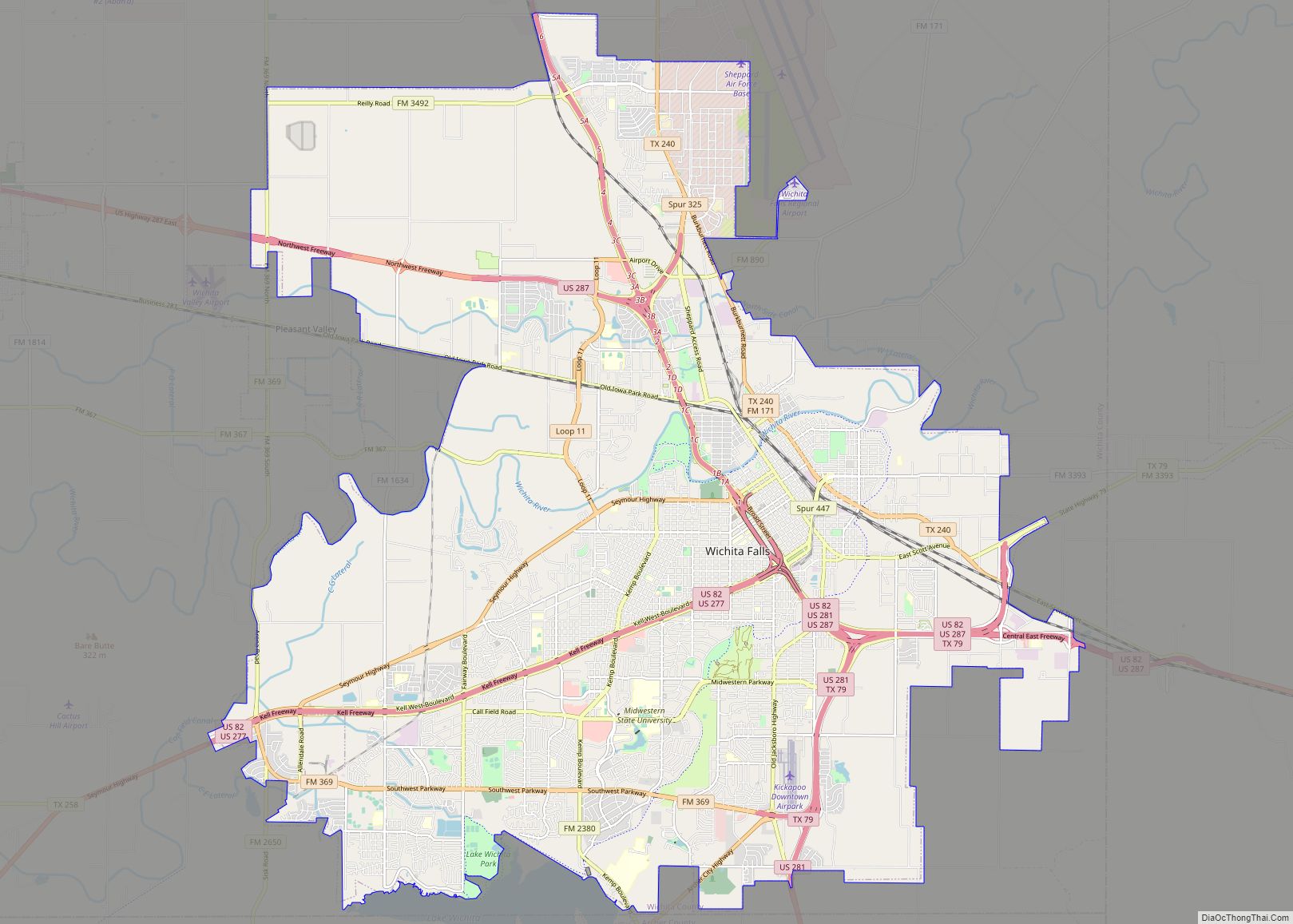
Wichita Falls Road Map
Wichita Falls city Satellite Map

Geography
Wichita Falls is about 15 miles (24 km) south of the border with Oklahoma, 115 mi (185 km) northwest of Fort Worth, and 140 mi (230 km) southwest of Oklahoma City. According to the United States Census Bureau, the city has a total area of 70.71 square miles (183.1 km), of which 70.69 square miles (183.1 km) are land and 0.02 square miles (0.052 km) (0.03%) is covered by water.
Wichita Falls experiences a humid subtropical climate (Köppen climate classification Cfa), featuring long, very hot and humid summers, and cool winters. The city has some of the highest summer daily maximum temperatures in the entire U.S. outside of the Desert Southwest. Temperatures have hit 100 °F (38 °C) as early as March 27 and as late as October 17, but more typically reach that level on 28 days annually, with 102 days of 90 °F (32 °C) or higher annually; the average window for the latter mark is April 9–October 10. However, 59 to 60 nights of freezing lows occur, and an average of 4.8 days where the high does not rise above freezing. The monthly daily average temperature ranges from 42.0 °F (5.6 °C) in January to 84.4 °F (29.1 °C) in July. The record low temperature is −12 °F (−24 °C) on January 4, 1947. The highest recorded temperature is 117 °F (47 °C) on June 28, 1980. Snowfall is sporadic and averages 4.1 in (10 cm) per season, while rainfall is typically greatest in early summer.
From 2010 through 2013 Wichita Falls, along with a large portion of the south-central US, experienced a persistent drought. In September 2011, Wichita Falls became the first Texas city to have 100 days of 100 °F (38 °C) or higher within one year. On every day from June 22 to August 12, the temperature reached 100 °F or higher, and from May 27 to September 3, the temperature reached 90 °F or higher. In addition, the all-time warm daily minimum of 88 °F (31 °C) was set on July 26, and June, July, and August of that year were all the hottest on record.
During the 2015 Texas–Oklahoma floods, Wichita Falls broke its all-time record for the wettest month, with 17.00 inches of rain recorded in May 2015.
Notes:
- ^ The previous record was 79 in 1980.
See also
Map of Texas State and its subdivision:- Anderson
- Andrews
- Angelina
- Aransas
- Archer
- Armstrong
- Atascosa
- Austin
- Bailey
- Bandera
- Bastrop
- Baylor
- Bee
- Bell
- Bexar
- Blanco
- Borden
- Bosque
- Bowie
- Brazoria
- Brazos
- Brewster
- Briscoe
- Brooks
- Brown
- Burleson
- Burnet
- Caldwell
- Calhoun
- Callahan
- Cameron
- Camp
- Carson
- Cass
- Castro
- Chambers
- Cherokee
- Childress
- Clay
- Cochran
- Coke
- Coleman
- Collin
- Collingsworth
- Colorado
- Comal
- Comanche
- Concho
- Cooke
- Coryell
- Cottle
- Crane
- Crockett
- Crosby
- Culberson
- Dallam
- Dallas
- Dawson
- Deaf Smith
- Delta
- Denton
- Dewitt
- Dickens
- Dimmit
- Donley
- Duval
- Eastland
- Ector
- Edwards
- El Paso
- Ellis
- Erath
- Falls
- Fannin
- Fayette
- Fisher
- Floyd
- Foard
- Fort Bend
- Franklin
- Freestone
- Frio
- Gaines
- Galveston
- Garza
- Gillespie
- Glasscock
- Goliad
- Gonzales
- Gray
- Grayson
- Gregg
- Grimes
- Guadalupe
- Hale
- Hall
- Hamilton
- Hansford
- Hardeman
- Hardin
- Harris
- Harrison
- Hartley
- Haskell
- Hays
- Hemphill
- Henderson
- Hidalgo
- Hill
- Hockley
- Hood
- Hopkins
- Houston
- Howard
- Hudspeth
- Hunt
- Hutchinson
- Irion
- Jack
- Jackson
- Jasper
- Jeff Davis
- Jefferson
- Jim Hogg
- Jim Wells
- Johnson
- Jones
- Karnes
- Kaufman
- Kendall
- Kenedy
- Kent
- Kerr
- Kimble
- King
- Kinney
- Kleberg
- Knox
- La Salle
- Lamar
- Lamb
- Lampasas
- Lavaca
- Lee
- Leon
- Liberty
- Limestone
- Lipscomb
- Live Oak
- Llano
- Loving
- Lubbock
- Lynn
- Madison
- Marion
- Martin
- Mason
- Matagorda
- Maverick
- McCulloch
- McLennan
- McMullen
- Medina
- Menard
- Midland
- Milam
- Mills
- Mitchell
- Montague
- Montgomery
- Moore
- Morris
- Motley
- Nacogdoches
- Navarro
- Newton
- Nolan
- Nueces
- Ochiltree
- Oldham
- Orange
- Palo Pinto
- Panola
- Parker
- Parmer
- Pecos
- Polk
- Potter
- Presidio
- Rains
- Randall
- Reagan
- Real
- Red River
- Reeves
- Refugio
- Roberts
- Robertson
- Rockwall
- Runnels
- Rusk
- Sabine
- San Augustine
- San Jacinto
- San Patricio
- San Saba
- Schleicher
- Scurry
- Shackelford
- Shelby
- Sherman
- Smith
- Somervell
- Starr
- Stephens
- Sterling
- Stonewall
- Sutton
- Swisher
- Tarrant
- Taylor
- Terrell
- Terry
- Throckmorton
- Titus
- Tom Green
- Travis
- Trinity
- Tyler
- Upshur
- Upton
- Uvalde
- Val Verde
- Van Zandt
- Victoria
- Walker
- Waller
- Ward
- Washington
- Webb
- Wharton
- Wheeler
- Wichita
- Wilbarger
- Willacy
- Williamson
- Wilson
- Winkler
- Wise
- Wood
- Yoakum
- Young
- Zapata
- Zavala
- Alabama
- Alaska
- Arizona
- Arkansas
- California
- Colorado
- Connecticut
- Delaware
- District of Columbia
- Florida
- Georgia
- Hawaii
- Idaho
- Illinois
- Indiana
- Iowa
- Kansas
- Kentucky
- Louisiana
- Maine
- Maryland
- Massachusetts
- Michigan
- Minnesota
- Mississippi
- Missouri
- Montana
- Nebraska
- Nevada
- New Hampshire
- New Jersey
- New Mexico
- New York
- North Carolina
- North Dakota
- Ohio
- Oklahoma
- Oregon
- Pennsylvania
- Rhode Island
- South Carolina
- South Dakota
- Tennessee
- Texas
- Utah
- Vermont
- Virginia
- Washington
- West Virginia
- Wisconsin
- Wyoming