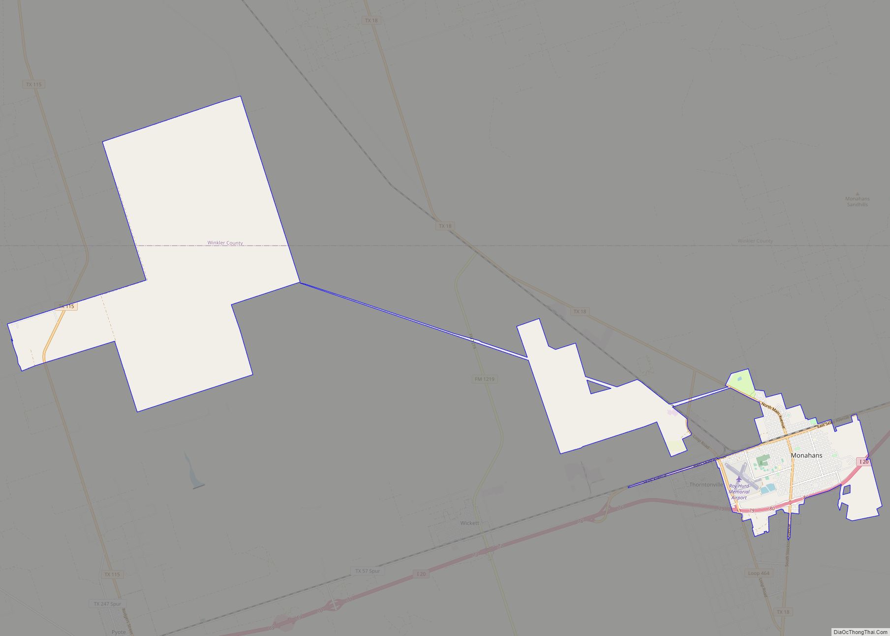
Monahans is a city in and the county seat of Ward County, Texas, United States. A very small portion of the city extends into Winkler County. The population was 6,953 at the 2010 census. In 2018, the population was estimated at 7,669.
| Name: | Monahans city |
|---|---|
| LSAD Code: | 25 |
| LSAD Description: | city (suffix) |
| State: | Texas |
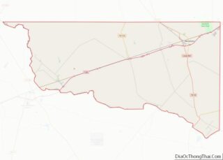
| County: | Ward County, Winkler County |
| Elevation: | 2,621 ft (799 m) |
| Total Area: | 28.93 sq mi (74.93 km²) |
| Land Area: | 28.92 sq mi (74.90 km²) |
| Water Area: | 0.01 sq mi (0.03 km²) |
| Total Population: | 6,953 |
| Population Density: | 270.26/sq mi (104.35/km²) |
| ZIP code: | 79756 |
| Area code: | 432 |
| FIPS code: | 4848936 |
| GNISfeature ID: | 1363045 |
| Website: | www.cityofmonahans.org |
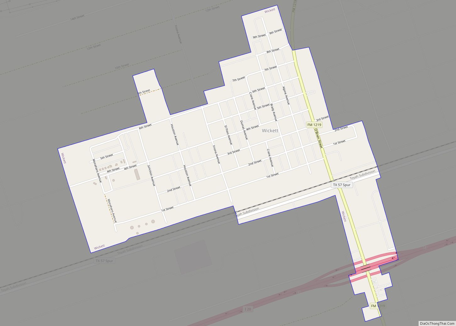
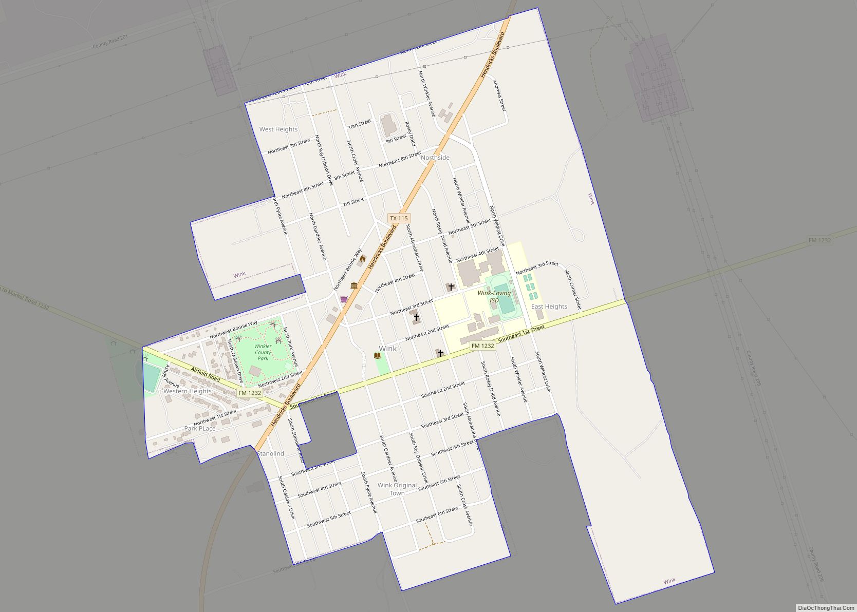
Online Interactive Map
Click on ![]() to view map in "full screen" mode.
to view map in "full screen" mode.
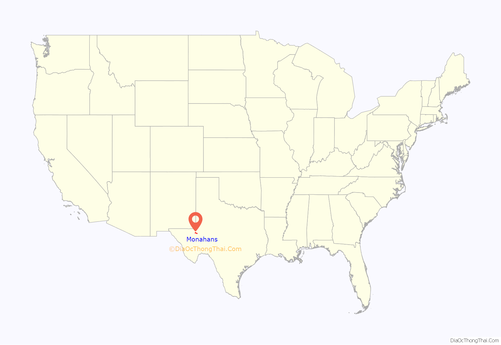
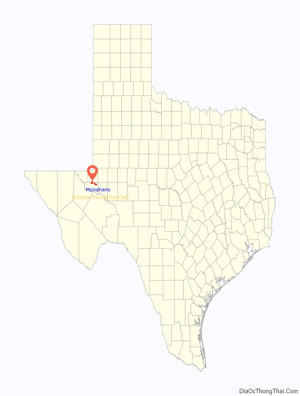
Monahans location map. Where is Monahans city?
History
The Permian Basin, home to Monahans and Midland-Odessa combined statistical area, is 250 miles (400 km) wide and 300 miles (480 km) long; Monahans is “The Center of the Permian Basin”. The basin was formed during the Permian period, the final portion of the Paleozoic era. At the time, it was an ocean filled with abundant aquatic life.
In 1583, Spanish explorer Antonio de Espejo crossed this area on his way through present-day New Mexico. The Indians in the Monahans region were called vaqueros by these Spanish explorers because they hunted the “hump-backed cattle” or bison. Records of Spanish exploring the Los Medanos (the sand dunes) outside Monahans can be traced to the early 1770s.
Located in a region where native Comanches, Mescalero, and Lipan Apache Indians once roamed, Monahans’ history as a community extends back to the late 1880s with the expansion of the Texas and Pacific Railway across the South Plains. For the few people living in West Texas, the building of a transcontinental railroad through the area meant the arrival of civilization. In the summer of 1881, Texas and Pacific Railroad contracted with surveyor John Thomas Monahan, who discovered that the lack of water for the laying crew and their animals would slow down construction of the rail. Monahan’s digging of a water well produced an abundance of good water (250,000 US gal (950,000 L) a day) and was instrumental in the success of the city. Prior to this solution, water had to be hauled to the area from Big Spring, Texas.
The availability of cheap land encouraged settlers to form a small community on the track known as Monahans Well. When oil was discovered in the area in 1926, though, the community changed directions. Oil discovery brought people of many occupations and of varied interests to Monahans. The local economy began to change from an agricultural to an industrial economy.
In June 1994, a temperature of 120 °F was recorded in Monahans, a still-standing record-holder for highest-ever Texan temperature.
Monahans Sandhills State Park
Thousands of tourists each year visit Monahans Sandhills State Park near Monahans. Sand surfing and sand football games can be seen year round, but particularly between March and November. Monahans Sandhills State Park is host to many family picnics and youth activities. The park is also a site for weddings.
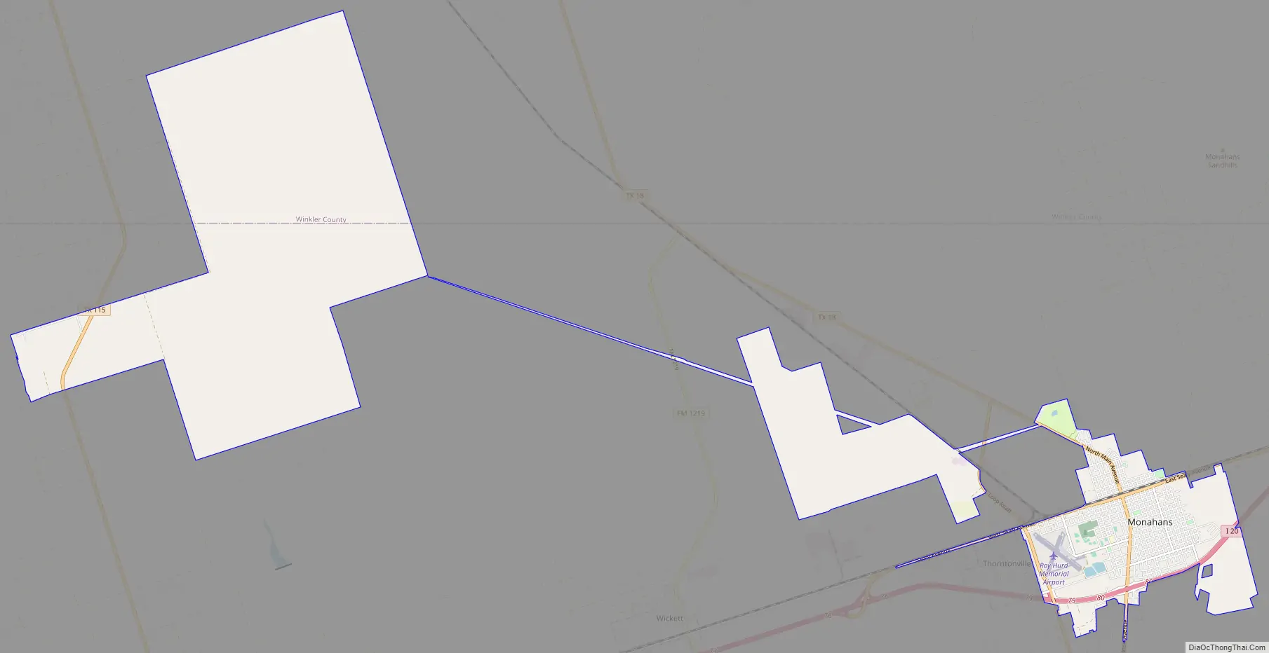
Monahans Road Map
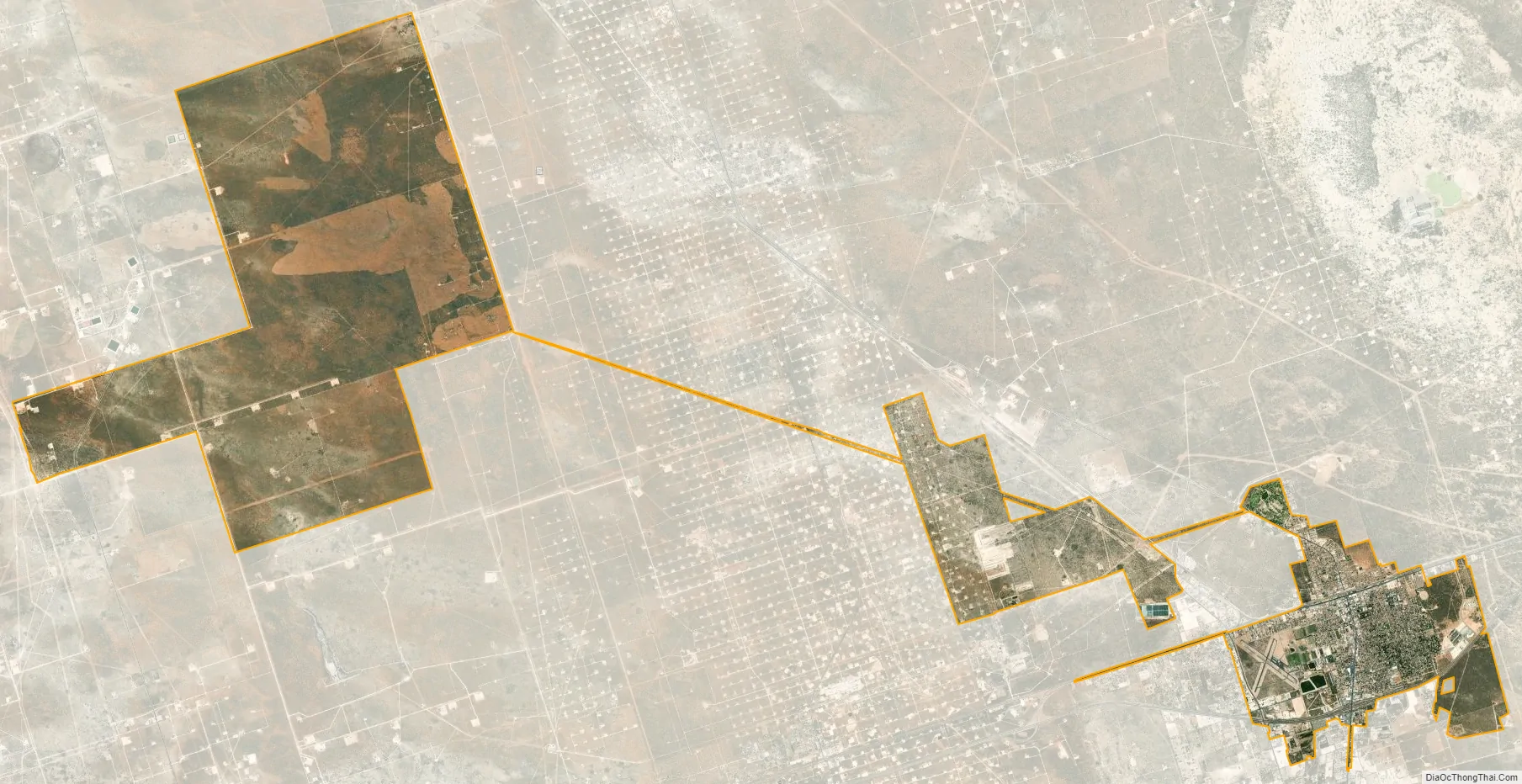
Monahans city Satellite Map
Geography
Climate
See also
Map of Texas State and its subdivision:- Anderson
- Andrews
- Angelina
- Aransas
- Archer
- Armstrong
- Atascosa
- Austin
- Bailey
- Bandera
- Bastrop
- Baylor
- Bee
- Bell
- Bexar
- Blanco
- Borden
- Bosque
- Bowie
- Brazoria
- Brazos
- Brewster
- Briscoe
- Brooks
- Brown
- Burleson
- Burnet
- Caldwell
- Calhoun
- Callahan
- Cameron
- Camp
- Carson
- Cass
- Castro
- Chambers
- Cherokee
- Childress
- Clay
- Cochran
- Coke
- Coleman
- Collin
- Collingsworth
- Colorado
- Comal
- Comanche
- Concho
- Cooke
- Coryell
- Cottle
- Crane
- Crockett
- Crosby
- Culberson
- Dallam
- Dallas
- Dawson
- Deaf Smith
- Delta
- Denton
- Dewitt
- Dickens
- Dimmit
- Donley
- Duval
- Eastland
- Ector
- Edwards
- El Paso
- Ellis
- Erath
- Falls
- Fannin
- Fayette
- Fisher
- Floyd
- Foard
- Fort Bend
- Franklin
- Freestone
- Frio
- Gaines
- Galveston
- Garza
- Gillespie
- Glasscock
- Goliad
- Gonzales
- Gray
- Grayson
- Gregg
- Grimes
- Guadalupe
- Hale
- Hall
- Hamilton
- Hansford
- Hardeman
- Hardin
- Harris
- Harrison
- Hartley
- Haskell
- Hays
- Hemphill
- Henderson
- Hidalgo
- Hill
- Hockley
- Hood
- Hopkins
- Houston
- Howard
- Hudspeth
- Hunt
- Hutchinson
- Irion
- Jack
- Jackson
- Jasper
- Jeff Davis
- Jefferson
- Jim Hogg
- Jim Wells
- Johnson
- Jones
- Karnes
- Kaufman
- Kendall
- Kenedy
- Kent
- Kerr
- Kimble
- King
- Kinney
- Kleberg
- Knox
- La Salle
- Lamar
- Lamb
- Lampasas
- Lavaca
- Lee
- Leon
- Liberty
- Limestone
- Lipscomb
- Live Oak
- Llano
- Loving
- Lubbock
- Lynn
- Madison
- Marion
- Martin
- Mason
- Matagorda
- Maverick
- McCulloch
- McLennan
- McMullen
- Medina
- Menard
- Midland
- Milam
- Mills
- Mitchell
- Montague
- Montgomery
- Moore
- Morris
- Motley
- Nacogdoches
- Navarro
- Newton
- Nolan
- Nueces
- Ochiltree
- Oldham
- Orange
- Palo Pinto
- Panola
- Parker
- Parmer
- Pecos
- Polk
- Potter
- Presidio
- Rains
- Randall
- Reagan
- Real
- Red River
- Reeves
- Refugio
- Roberts
- Robertson
- Rockwall
- Runnels
- Rusk
- Sabine
- San Augustine
- San Jacinto
- San Patricio
- San Saba
- Schleicher
- Scurry
- Shackelford
- Shelby
- Sherman
- Smith
- Somervell
- Starr
- Stephens
- Sterling
- Stonewall
- Sutton
- Swisher
- Tarrant
- Taylor
- Terrell
- Terry
- Throckmorton
- Titus
- Tom Green
- Travis
- Trinity
- Tyler
- Upshur
- Upton
- Uvalde
- Val Verde
- Van Zandt
- Victoria
- Walker
- Waller
- Ward
- Washington
- Webb
- Wharton
- Wheeler
- Wichita
- Wilbarger
- Willacy
- Williamson
- Wilson
- Winkler
- Wise
- Wood
- Yoakum
- Young
- Zapata
- Zavala
- Alabama
- Alaska
- Arizona
- Arkansas
- California
- Colorado
- Connecticut
- Delaware
- District of Columbia
- Florida
- Georgia
- Hawaii
- Idaho
- Illinois
- Indiana
- Iowa
- Kansas
- Kentucky
- Louisiana
- Maine
- Maryland
- Massachusetts
- Michigan
- Minnesota
- Mississippi
- Missouri
- Montana
- Nebraska
- Nevada
- New Hampshire
- New Jersey
- New Mexico
- New York
- North Carolina
- North Dakota
- Ohio
- Oklahoma
- Oregon
- Pennsylvania
- Rhode Island
- South Carolina
- South Dakota
- Tennessee
- Texas
- Utah
- Vermont
- Virginia
- Washington
- West Virginia
- Wisconsin
- Wyoming