Tyler is a city in the U.S. state of Texas. It is the seat of government of Smith County, and the largest city in Northeast Texas. With a 2020 census population of 105,995, Tyler was the 33rd most populous city in Texas and 299th in the United States. It is the principal city of the Greater Tyler metropolitan statistical area, which is the 198th most populous metropolitan area in the U.S. and 16th in Texas after Waco and the College Station–Bryan areas, with a population of 233,479 in 2020.
The city is named for John Tyler, the tenth President of the United States. In 1985, the international Adopt-a-Highway movement began in Tyler. After appeals from local Texas Department of Transportation officials, the local Civitan International chapter adopted a two-mile (three kilometer) stretch of U.S. Route 69 to maintain. Drivers and other motorists traveling on this segment of U.S. 69 (between Tyler and nearby Lindale) will see brown road signs that read, “First Adopt-A-Highway in the World”.
Tyler is known as the “Rose Capital of America” (also the “Rose City” and the “Rose Capital of the World”), a nickname it earned from a long history of rose production, cultivation, and processing. It is home to the largest rose garden in the United States, a 14-acre public garden complex that has over 38,000 rose bushes of at least 500 different varieties. The Tyler Rose Garden Center is also home to the annual Texas Rose Festival which attracts thousands of tourists each October.
As Northeast Texas and Smith County’s major economic, educational, financial, medical and cultural hub, Tyler is host to more than 20,000 higher-education students; the University of Texas at Tyler; a university health science center; and regional hospital systems. It is also the headquarters for Brookshire Grocery Company, Cavender’s, Southside Bank, and Synthesizers.com. Other corporations with major presence within the city and surrounding area include AT&T, T-Mobile US, Cricket Wireless and Metro by T-Mobile, Chase Bank, BBVA, Best Buy, and Walmart. Tyler is also home to the Caldwell Zoo and Broadway Square Mall.
| Name: | Tyler city |
|---|---|
| LSAD Code: | 25 |
| LSAD Description: | city (suffix) |
| State: | Texas |
| County: | Smith County |
| Founded: | 1846 |
| Elevation: | 544 ft (165 m) |
| Land Area: | 57.45 sq mi (148.81 km²) |
| Water Area: | 0.52 sq mi (1.34 km²) |
| Population Density: | 1,862.10/sq mi (718.95/km²) |
| ZIP code: | 757xx |
| Area code: | 430, 903 |
| FIPS code: | 4874144 |
| GNISfeature ID: | 1348998 |
| Website: | www.cityoftyler.org |
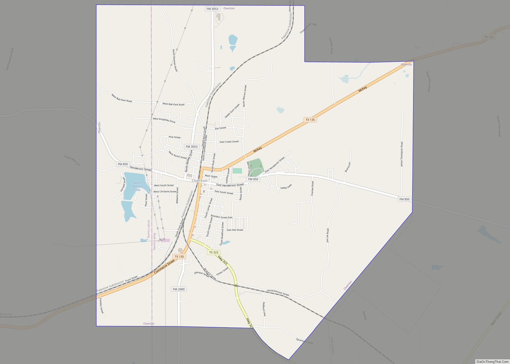
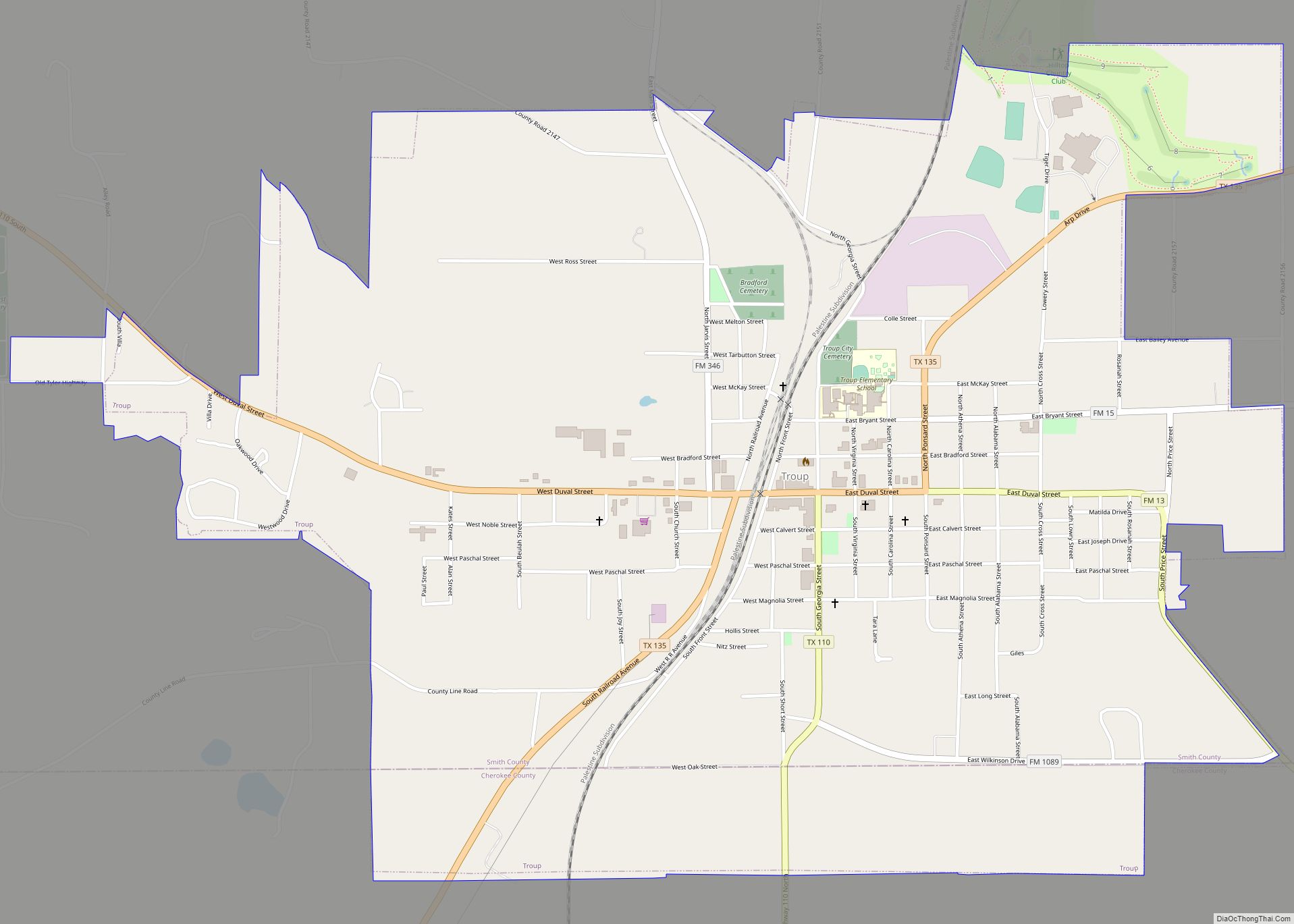
Online Interactive Map
Click on ![]() to view map in "full screen" mode.
to view map in "full screen" mode.
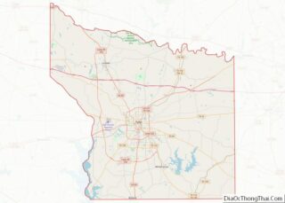
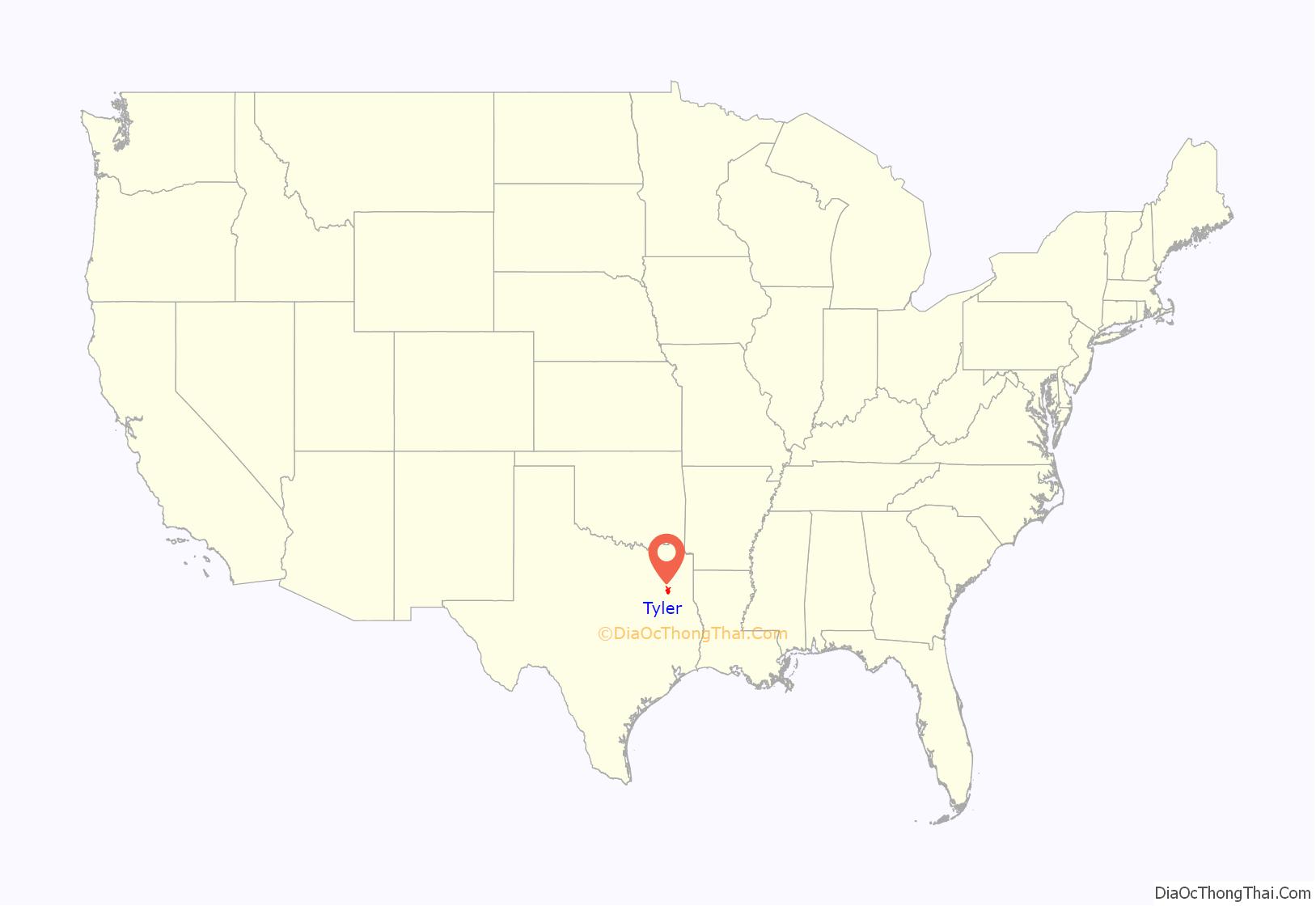
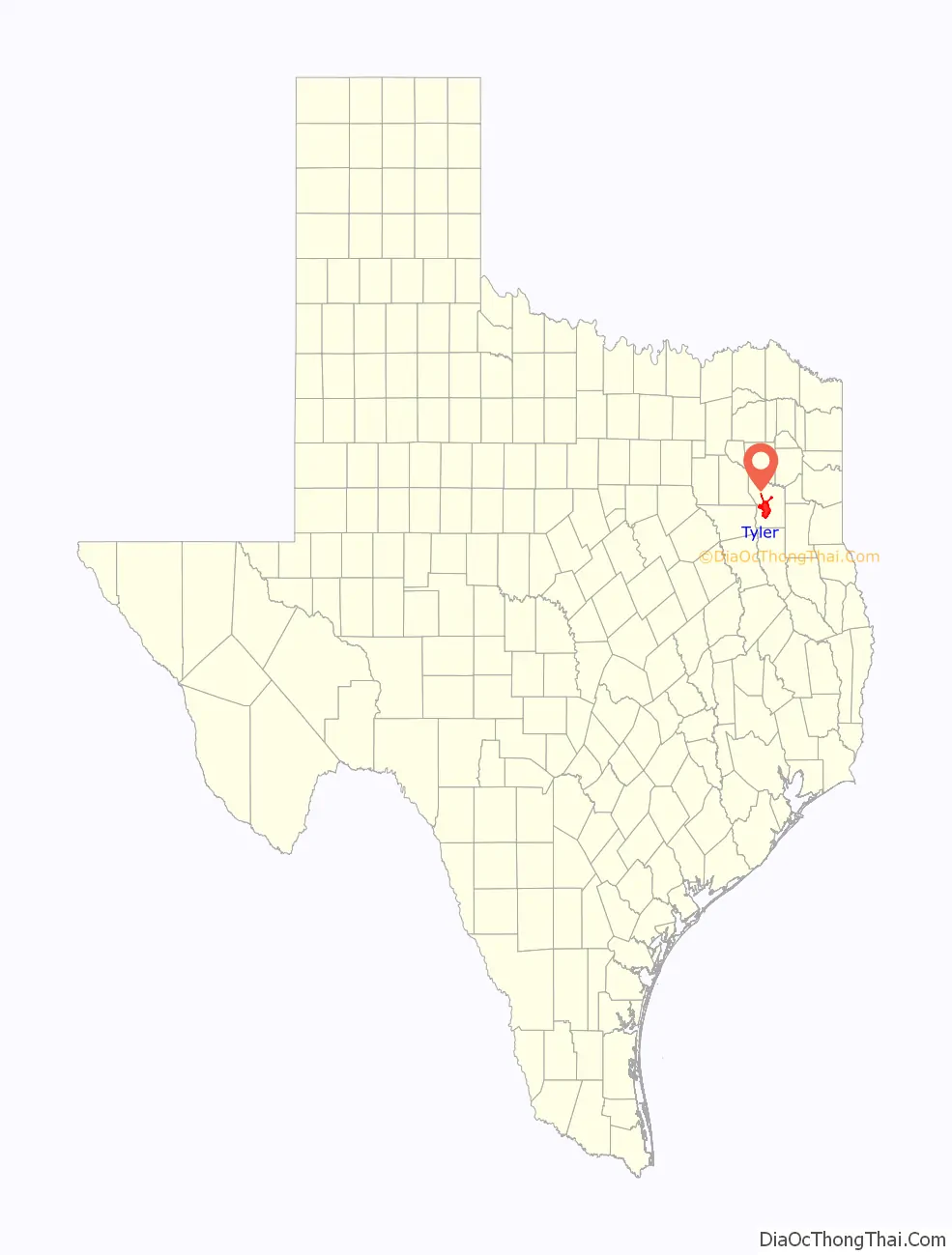
Tyler location map. Where is Tyler city?
History
Legal recognition of Tyler was initiated by an act of the state legislature on 11 April 1846. The Texas government created Smith County and authorized a county seat.
The first plat designated a 28-block town site centered by a main square within a 100-acre (40 ha; 0.16 sq mi) tract acquired by Smith County on 6 February 1847. The new town was named for President John Tyler, who advocated for the annexation of Texas by the United States. A log building on the square’s north side served as a courthouse and public meeting hall until a brick courthouse displaced it in 1852. On 29 January 1850, Tyler was incorporated. Early religious and social institutions included the First Baptist church and a Methodist church, a Masonic lodge and an Odd Fellows lodge, and Tyler’s first newspaper.
Though Tyler’s early economy from 1847–1873 was based on agriculture, it was also well-diversified during this period. Logging was a second major industry, while complementary manufacturing included metalworking, milling wood, and leather tanning. As the seat of Smith County, the town also benefited from government activity. The local agricultural economy relied on slave labor before the Civil War. In 1860, the population of enslaved people in Smith County was 4,982, the 4th most in east Texas.
By 1860, Tyler held over 1,000 enslaved persons, which represented 35 percent of the town’s population. There was strong support for secession and the Confederacy within Tyler, as a high percentage of its residents voted for secession and many of its men joined the Confederate Army. The town was secure enough for the Confederate States of America to establish the largest ordinance plant in Texas. In 1870, Bonner and Williams established Tyler’s first bank. Though both the Texas and Pacific Railroad and the International Railroad (Texas) eschewed routes through Tyler, the town gained an important rail connection when the Houston and Great Northern built a branch line in 1874.
Toward the end of the nineteenth century, fruit orchards emerged as an important business in the regional economy. Eighty percent of the county’s agricultural revenue derived from cotton as it persisted as the dominant crop in the first decades of the twentieth century. Peaches were the principal fruit crop as the county fruit tree inventory surpassed one million by 1900. Disease struck the peach trees, though, and local farmers moved toward growing roses by the 1920s. Twenty years later, most of the U.S. rose supply originated in the Tyler area.
On 29 October 1895, an African American suspect named Robert Henry Hillard was burned at the stake in the Smith County Courthouse Square for the alleged murder of a nineteen-year-old white woman. Denied a trial and due process, Hillard was taken from law enforcement personnel by a white mob. Hillard’s executioners were never punished. Later, two entrepreneurs combined photographs from the actual lynching with others staged with actors and sold the 16-image production as a stereographic set. One of the original sets sits in the United States Library of Congress.
In 1912, Dan Davis, an African-American man suspected of attacking a sixteen-year-old white girl named Carrie Johnson, was burned at the stake in the Smith County Courthouse Square.
In 1971, the University of Texas system established the University of Texas at Tyler and Broadway Square Mall opened in 1975. By 1980, the population grew to 70,508 and the Roman Catholic Diocese of Tyler and East Texas Islamic Society were established in the following years.
During the 2010 East Texas church burnings, two Tyler churches were destroyed, and historic preservation city planning began in 2016 as the population increased and the city continued development.
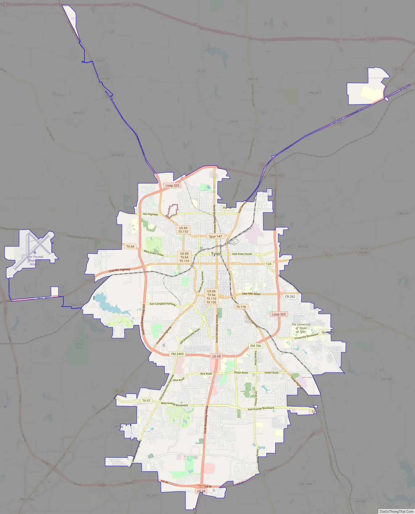
Tyler Road Map
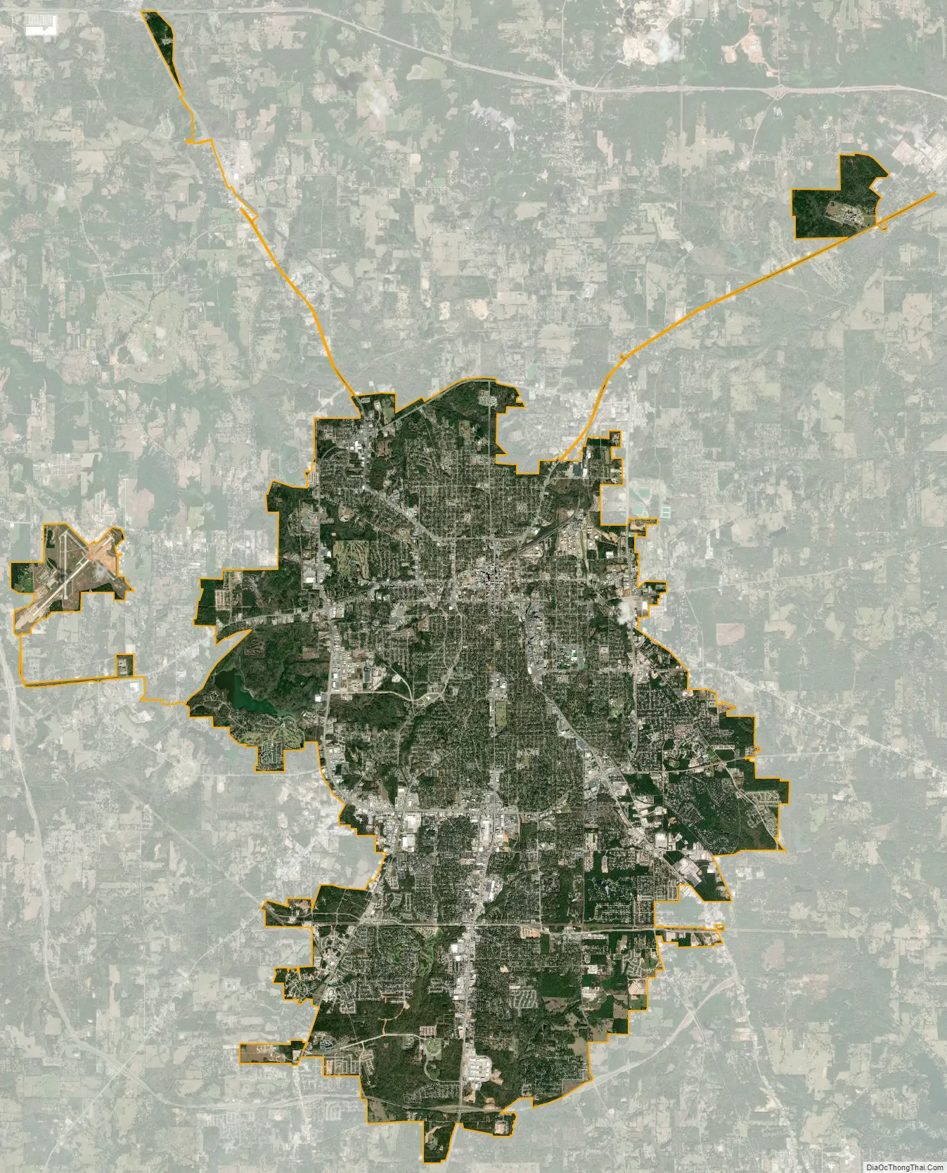
Tyler city Satellite Map
Geography
The city of Tyler is in the Southern United States, in Northeast Texas. It is sometimes considered part of the wider Ark-La-Tex region where Arkansas, Louisiana, and Texas meet. Tyler is located at 32°21′03″N 95°18′02″W / 32.35083°N 95.30056°W / 32.35083; -95.30056 and is 544 ft (166 m) above sea level. The city is approximately 38 mi (61 km) from Longview; 61 mi (98 km) from Marshall; 100 mi (160 km) from Dallas; 132 mi (212 km) from Texarkana; 230 mi (370 km) from the state capital of Austin; and 98 mi (158 km) from Shreveport, Louisiana.
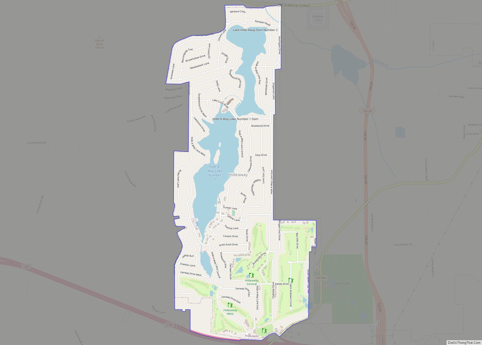
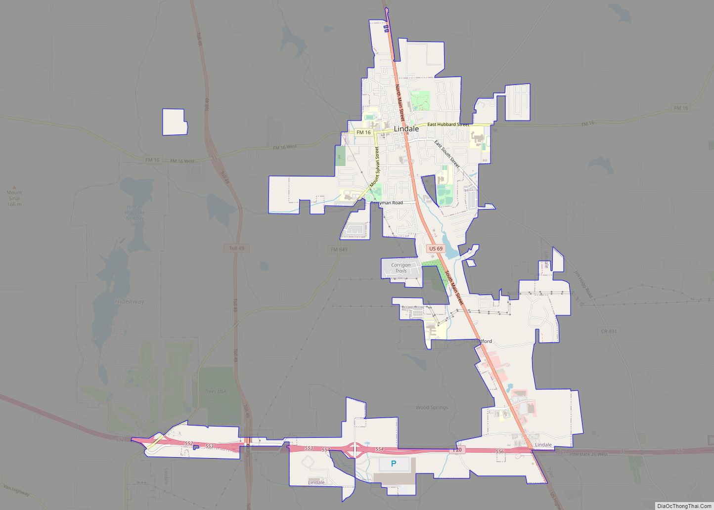
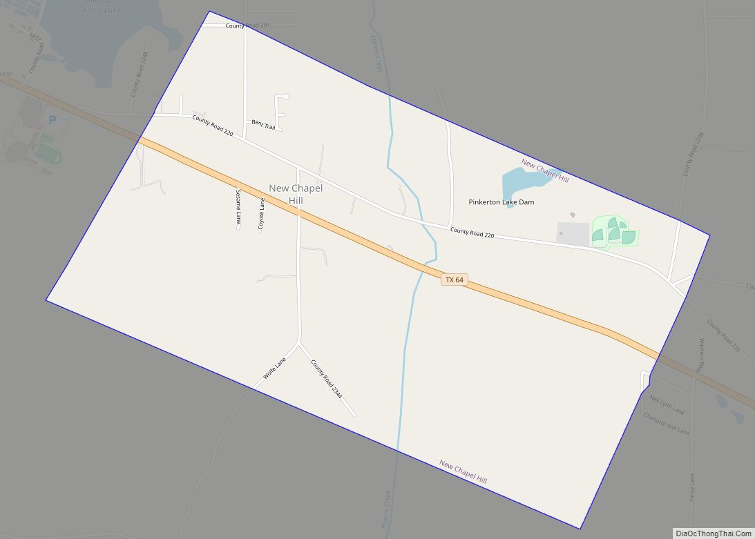
Tyler is the seat of government of Smith County, and is surrounded by many suburban communities, including Whitehouse, Lindale, New Chapel Hill, Bullard, Edom, Brownsboro, Kilgore, Flint, and Chandler. According to the United States Census Bureau, the city has an area of 57.97 sq mi (150.1 km), of which 57.45 sq mi (148.8 km) is land and 0.52 sq mi (1.3 km) is covered by water. Tyler is the principal city of the Greater Tyler metropolitan area, and a principal city in the Tyler–Longview area, a conurbation of the Tyler and Longview metropolitan and combined statistical areas.
Cityscape
Tyler has a modest skyline and downtown area. Downtown architecture features the Art Deco and neoclassical styles, many dating from the 19th and early 20th centuries. Modernist- and postmodernist-era structures are also present throughout the cityscape.
Central Tyler is anchored by Brick Streets Historic District and Charnwood Residential Historic District, areas characterized by dense retail, restaurants, nightlife, and historic landmarks. Brick Streets Historic District is the largest geographic area of Tyler. It encompasses 29 blocks and primarily consists of buildings constructed in the 1900s. The district area is predominantly residential though it sometimes serves as a mix-use district. Brick Streets Historic District has brick-paved streets and stone-lined drainage channels. Nearby, Charnwood is Tyler’s first historic district. It comprises 12 blocks of late 19th and early 20th century architecture.
Climate
Tyler experiences weather typical of East Texas. The region is located in the humid subtropical climate typical of the American South.
Severe thunderstorms with heavy rain, hail, damaging winds and tornadoes occur in the area during the spring and summer months. Summer months are hot and humid, with maximum temperatures exceeding 90 °F (32 °C) an average of 91 days per year, with high to very high relative average humidity.
The record high temperature for Tyler is 115 °F (46 °C), which occurred in 2011. The record low for Tyler is −3 °F (−19 °C), which occurred on 18 January 1930 and again on 16 February 2021 during the February 2021 North American cold wave.
See also
Map of Texas State and its subdivision:- Anderson
- Andrews
- Angelina
- Aransas
- Archer
- Armstrong
- Atascosa
- Austin
- Bailey
- Bandera
- Bastrop
- Baylor
- Bee
- Bell
- Bexar
- Blanco
- Borden
- Bosque
- Bowie
- Brazoria
- Brazos
- Brewster
- Briscoe
- Brooks
- Brown
- Burleson
- Burnet
- Caldwell
- Calhoun
- Callahan
- Cameron
- Camp
- Carson
- Cass
- Castro
- Chambers
- Cherokee
- Childress
- Clay
- Cochran
- Coke
- Coleman
- Collin
- Collingsworth
- Colorado
- Comal
- Comanche
- Concho
- Cooke
- Coryell
- Cottle
- Crane
- Crockett
- Crosby
- Culberson
- Dallam
- Dallas
- Dawson
- Deaf Smith
- Delta
- Denton
- Dewitt
- Dickens
- Dimmit
- Donley
- Duval
- Eastland
- Ector
- Edwards
- El Paso
- Ellis
- Erath
- Falls
- Fannin
- Fayette
- Fisher
- Floyd
- Foard
- Fort Bend
- Franklin
- Freestone
- Frio
- Gaines
- Galveston
- Garza
- Gillespie
- Glasscock
- Goliad
- Gonzales
- Gray
- Grayson
- Gregg
- Grimes
- Guadalupe
- Hale
- Hall
- Hamilton
- Hansford
- Hardeman
- Hardin
- Harris
- Harrison
- Hartley
- Haskell
- Hays
- Hemphill
- Henderson
- Hidalgo
- Hill
- Hockley
- Hood
- Hopkins
- Houston
- Howard
- Hudspeth
- Hunt
- Hutchinson
- Irion
- Jack
- Jackson
- Jasper
- Jeff Davis
- Jefferson
- Jim Hogg
- Jim Wells
- Johnson
- Jones
- Karnes
- Kaufman
- Kendall
- Kenedy
- Kent
- Kerr
- Kimble
- King
- Kinney
- Kleberg
- Knox
- La Salle
- Lamar
- Lamb
- Lampasas
- Lavaca
- Lee
- Leon
- Liberty
- Limestone
- Lipscomb
- Live Oak
- Llano
- Loving
- Lubbock
- Lynn
- Madison
- Marion
- Martin
- Mason
- Matagorda
- Maverick
- McCulloch
- McLennan
- McMullen
- Medina
- Menard
- Midland
- Milam
- Mills
- Mitchell
- Montague
- Montgomery
- Moore
- Morris
- Motley
- Nacogdoches
- Navarro
- Newton
- Nolan
- Nueces
- Ochiltree
- Oldham
- Orange
- Palo Pinto
- Panola
- Parker
- Parmer
- Pecos
- Polk
- Potter
- Presidio
- Rains
- Randall
- Reagan
- Real
- Red River
- Reeves
- Refugio
- Roberts
- Robertson
- Rockwall
- Runnels
- Rusk
- Sabine
- San Augustine
- San Jacinto
- San Patricio
- San Saba
- Schleicher
- Scurry
- Shackelford
- Shelby
- Sherman
- Smith
- Somervell
- Starr
- Stephens
- Sterling
- Stonewall
- Sutton
- Swisher
- Tarrant
- Taylor
- Terrell
- Terry
- Throckmorton
- Titus
- Tom Green
- Travis
- Trinity
- Tyler
- Upshur
- Upton
- Uvalde
- Val Verde
- Van Zandt
- Victoria
- Walker
- Waller
- Ward
- Washington
- Webb
- Wharton
- Wheeler
- Wichita
- Wilbarger
- Willacy
- Williamson
- Wilson
- Winkler
- Wise
- Wood
- Yoakum
- Young
- Zapata
- Zavala
- Alabama
- Alaska
- Arizona
- Arkansas
- California
- Colorado
- Connecticut
- Delaware
- District of Columbia
- Florida
- Georgia
- Hawaii
- Idaho
- Illinois
- Indiana
- Iowa
- Kansas
- Kentucky
- Louisiana
- Maine
- Maryland
- Massachusetts
- Michigan
- Minnesota
- Mississippi
- Missouri
- Montana
- Nebraska
- Nevada
- New Hampshire
- New Jersey
- New Mexico
- New York
- North Carolina
- North Dakota
- Ohio
- Oklahoma
- Oregon
- Pennsylvania
- Rhode Island
- South Carolina
- South Dakota
- Tennessee
- Texas
- Utah
- Vermont
- Virginia
- Washington
- West Virginia
- Wisconsin
- Wyoming