Whitehouse is a city in Smith County, Texas, United States. The population was 7,660 in the 2010 census, and 8,257 in 2020. It is part of the Tyler, Texas, metropolitan statistical area.
| Name: | Whitehouse city |
|---|---|
| LSAD Code: | 25 |
| LSAD Description: | city (suffix) |
| State: | Texas |
| County: | Smith County |
| Elevation: | 479 ft (146 m) |
| Total Area: | 5.56 sq mi (14.39 km²) |
| Land Area: | 5.50 sq mi (14.23 km²) |
| Water Area: | 0.06 sq mi (0.16 km²) |
| Total Population: | 8,257 |
| Population Density: | 1,500/sq mi (570/km²) |
| ZIP code: | 75791 |
| Area code: | 903 |
| FIPS code: | 4878388 |
| GNISfeature ID: | 1350005 |
| Website: | www.whitehousetx.org |
Online Interactive Map
Click on ![]() to view map in "full screen" mode.
to view map in "full screen" mode.
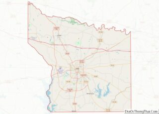
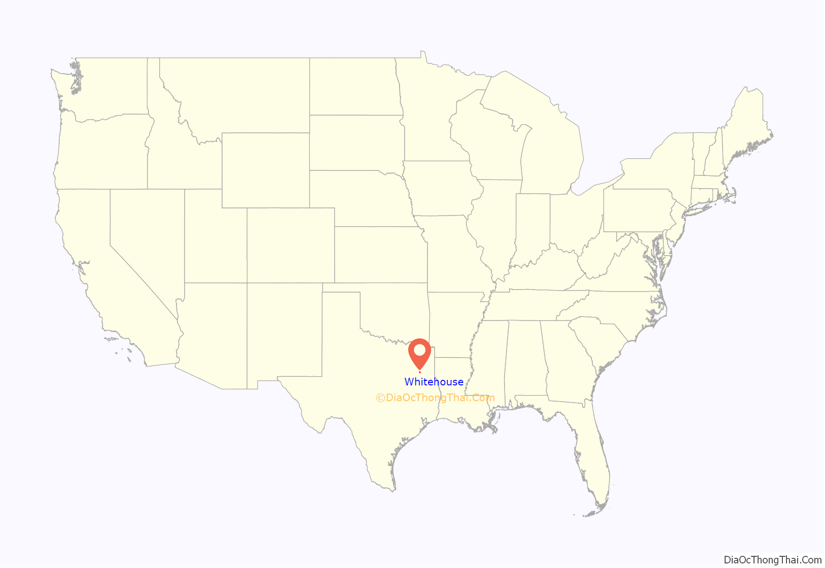
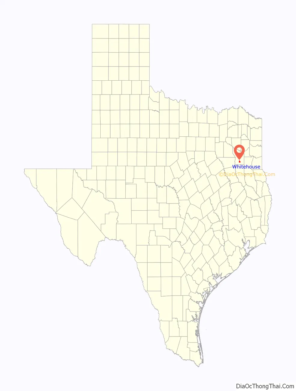
Whitehouse location map. Where is Whitehouse city?
History
Early history
The community was founded long before the city was officially incorporated by James Calhoun Hill (auctioneer in 1846 for Tyler land grants). The community was named in 1845, but was not incorporated until 1953. The school district (WISD) preceded incorporated municipal government, and was largely responsible for the eventual formation of the city.
Residents of Whitehouse were predominantly farmers or worked in support of agriculture until transportation innovations following World War II lead to other employment options. Many streets and subdivisions in the community are named for these early agricultural and commercial leaders.
According to oral tradition, the community was named “Whitehouse” by the railroad engineers who stopped near a white-washed community building during early settlement times. Several cherished historic resources include the various Works Progress Administration (WPA) projects located within the city. These projects, typically built with sandstone rockwork, are found throughout the city’s historic Town Center.
YesterYear Celebration
Civic leaders established the YesterYear Celebration to educate residents about the community’s history and heritage. The festival is held on the fourth weekend each June and includes activities such as parades, carnivals, historic battle reenactments, pageants, and trade days.
Historic reading
Several works documenting the community’s history have been published in the recent past. Shirley Smith wrote and/or edited several books including Homefolks, a collection of letters from important figures who lived in the community throughout the early 20th century. The Tri-County Leader published a series of articles by Acker Hanks called “Growing up in Whitehouse.” The articles recounted Mr. Hanks’ experience in the community starting in the early 1920s. The Whitehouse Vision 2020 Comprehensive Plan (see Planning and Development) also included a history section. This section was based on oral history interviews from prominent Whitehouse residents such at Nancy Shahan Coats, Joe Pat Hagan, Acker Hanks, Gaylon Shackelford, and Richard Waller. Many of these resources are available at the Whitehouse Community Library.
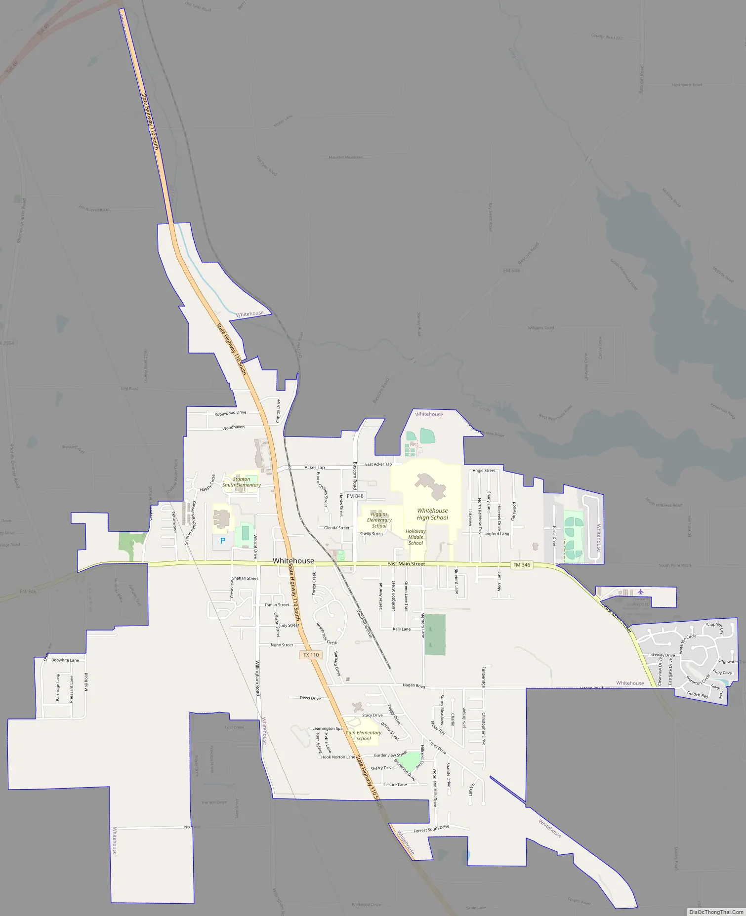
Whitehouse Road Map
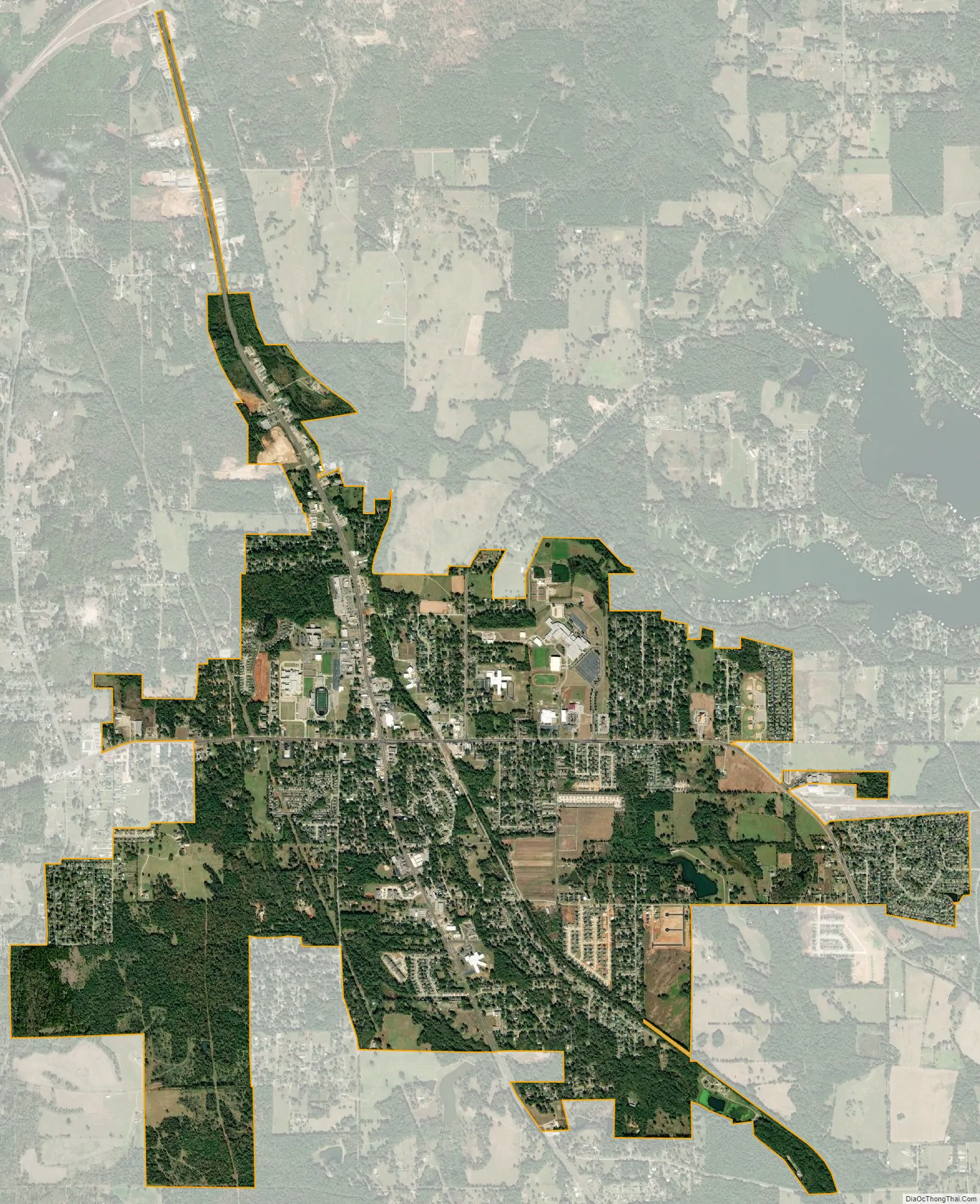
Whitehouse city Satellite Map
Geography
Whitehouse is located at 32°13′24″N 95°13′3″W / 32.22333°N 95.21750°W / 32.22333; -95.21750 (32.223443, –95.217579). The city is bisected by State Highway 110 and Farm to Market Road 346. The city of Tyler is located approximately seven miles (11 km) to the north, while the city of Troup lies roughly the same distance to the south.
According to the United States Census Bureau, the city has a total area that exceeds 3.8 square miles (9.8 km), all land. The city’s extra territorial jurisdiction includes land surrounding Lake Tyler, a large water body used for drinking water and recreation by East Texas residents.
Climate
The climate in this area is characterized by hot, humid summers and generally mild to cool winters. According to the Köppen Climate Classification system, Whitehouse has a humid subtropical climate, abbreviated “Cfa” on climate maps.
See also
Map of Texas State and its subdivision:- Anderson
- Andrews
- Angelina
- Aransas
- Archer
- Armstrong
- Atascosa
- Austin
- Bailey
- Bandera
- Bastrop
- Baylor
- Bee
- Bell
- Bexar
- Blanco
- Borden
- Bosque
- Bowie
- Brazoria
- Brazos
- Brewster
- Briscoe
- Brooks
- Brown
- Burleson
- Burnet
- Caldwell
- Calhoun
- Callahan
- Cameron
- Camp
- Carson
- Cass
- Castro
- Chambers
- Cherokee
- Childress
- Clay
- Cochran
- Coke
- Coleman
- Collin
- Collingsworth
- Colorado
- Comal
- Comanche
- Concho
- Cooke
- Coryell
- Cottle
- Crane
- Crockett
- Crosby
- Culberson
- Dallam
- Dallas
- Dawson
- Deaf Smith
- Delta
- Denton
- Dewitt
- Dickens
- Dimmit
- Donley
- Duval
- Eastland
- Ector
- Edwards
- El Paso
- Ellis
- Erath
- Falls
- Fannin
- Fayette
- Fisher
- Floyd
- Foard
- Fort Bend
- Franklin
- Freestone
- Frio
- Gaines
- Galveston
- Garza
- Gillespie
- Glasscock
- Goliad
- Gonzales
- Gray
- Grayson
- Gregg
- Grimes
- Guadalupe
- Hale
- Hall
- Hamilton
- Hansford
- Hardeman
- Hardin
- Harris
- Harrison
- Hartley
- Haskell
- Hays
- Hemphill
- Henderson
- Hidalgo
- Hill
- Hockley
- Hood
- Hopkins
- Houston
- Howard
- Hudspeth
- Hunt
- Hutchinson
- Irion
- Jack
- Jackson
- Jasper
- Jeff Davis
- Jefferson
- Jim Hogg
- Jim Wells
- Johnson
- Jones
- Karnes
- Kaufman
- Kendall
- Kenedy
- Kent
- Kerr
- Kimble
- King
- Kinney
- Kleberg
- Knox
- La Salle
- Lamar
- Lamb
- Lampasas
- Lavaca
- Lee
- Leon
- Liberty
- Limestone
- Lipscomb
- Live Oak
- Llano
- Loving
- Lubbock
- Lynn
- Madison
- Marion
- Martin
- Mason
- Matagorda
- Maverick
- McCulloch
- McLennan
- McMullen
- Medina
- Menard
- Midland
- Milam
- Mills
- Mitchell
- Montague
- Montgomery
- Moore
- Morris
- Motley
- Nacogdoches
- Navarro
- Newton
- Nolan
- Nueces
- Ochiltree
- Oldham
- Orange
- Palo Pinto
- Panola
- Parker
- Parmer
- Pecos
- Polk
- Potter
- Presidio
- Rains
- Randall
- Reagan
- Real
- Red River
- Reeves
- Refugio
- Roberts
- Robertson
- Rockwall
- Runnels
- Rusk
- Sabine
- San Augustine
- San Jacinto
- San Patricio
- San Saba
- Schleicher
- Scurry
- Shackelford
- Shelby
- Sherman
- Smith
- Somervell
- Starr
- Stephens
- Sterling
- Stonewall
- Sutton
- Swisher
- Tarrant
- Taylor
- Terrell
- Terry
- Throckmorton
- Titus
- Tom Green
- Travis
- Trinity
- Tyler
- Upshur
- Upton
- Uvalde
- Val Verde
- Van Zandt
- Victoria
- Walker
- Waller
- Ward
- Washington
- Webb
- Wharton
- Wheeler
- Wichita
- Wilbarger
- Willacy
- Williamson
- Wilson
- Winkler
- Wise
- Wood
- Yoakum
- Young
- Zapata
- Zavala
- Alabama
- Alaska
- Arizona
- Arkansas
- California
- Colorado
- Connecticut
- Delaware
- District of Columbia
- Florida
- Georgia
- Hawaii
- Idaho
- Illinois
- Indiana
- Iowa
- Kansas
- Kentucky
- Louisiana
- Maine
- Maryland
- Massachusetts
- Michigan
- Minnesota
- Mississippi
- Missouri
- Montana
- Nebraska
- Nevada
- New Hampshire
- New Jersey
- New Mexico
- New York
- North Carolina
- North Dakota
- Ohio
- Oklahoma
- Oregon
- Pennsylvania
- Rhode Island
- South Carolina
- South Dakota
- Tennessee
- Texas
- Utah
- Vermont
- Virginia
- Washington
- West Virginia
- Wisconsin
- Wyoming