| Name: | Gonzales County |
|---|---|
| FIPS code: | 48-177 |
| State: | Texas |
| Founded: | 1837 |
| Named for: | City of Gonzales |
| Seat: | Gonzales |
| Largest city: | Gonzales |
| Total Area: | 1,070 sq mi (2,800 km²) |
| Land Area: | 1,067 sq mi (2,760 km²) |
| Total Population: | 19,653 |
| Population Density: | 18/sq mi (7.1/km²) |
| Time zone: | UTC−6 (Central) |
| Summer Time Zone (DST): | UTC−5 (CDT) |
| Website: | www.co.gonzales.tx.us |
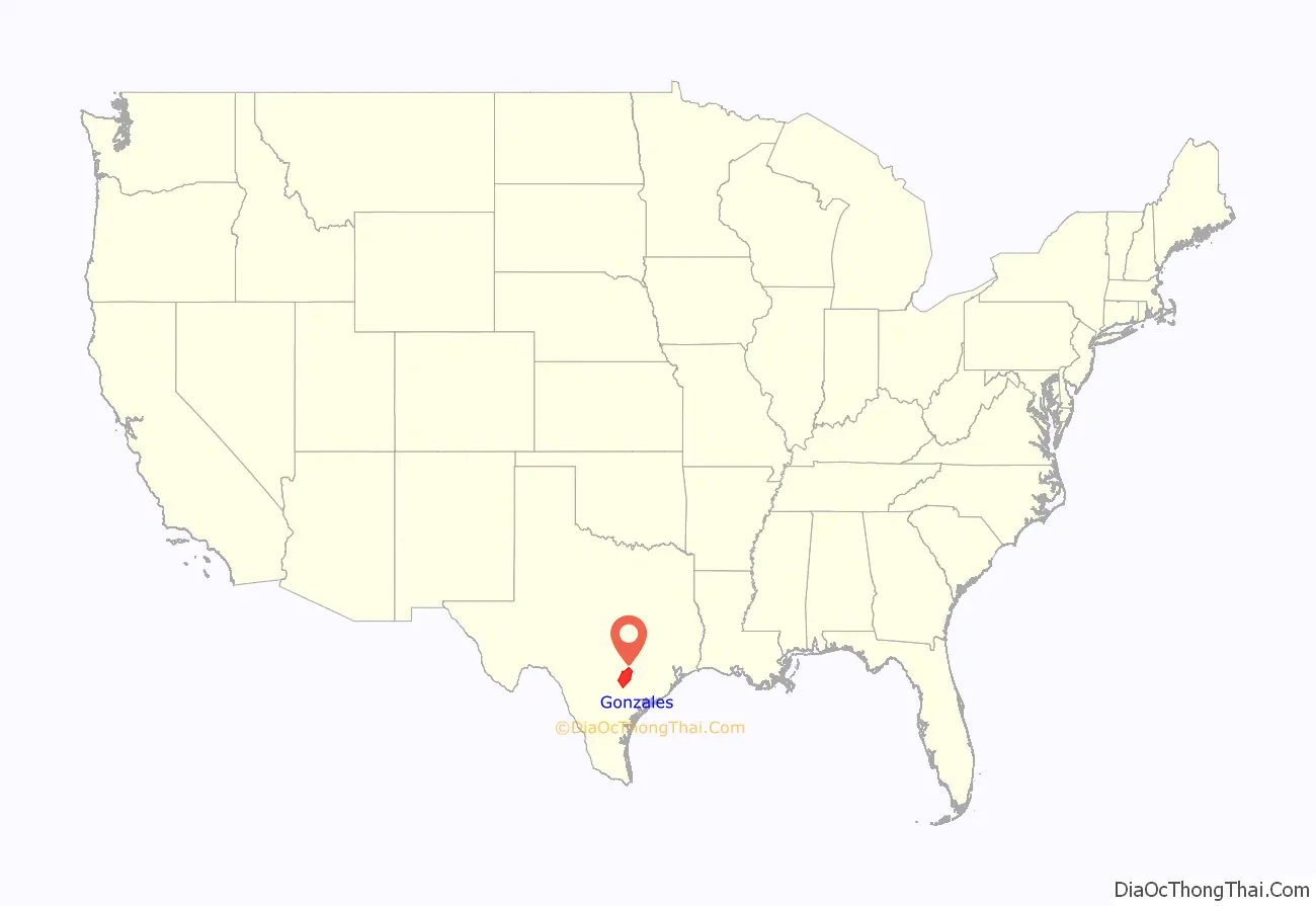
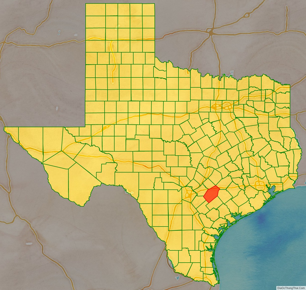
Gonzales County location map. Where is Gonzales County?
History
- Paleo-Indians Hunter-gatherers were here thousands of years ago; the later Coahuiltecan, Tonkawa, and Karankawa migrated into the area in the 14th century, but lost much of their population by the 18th century due to new infectious diseases contracted by contact with European explorers. The historic Comanche and Waco tribes later migrated into the area and competed most with European American settlers of the nineteenth century.
- 1519–1685 Hernando Cortez and Alonso Álvarez de Pineda claim Texas for Spain.
- 1685–1690 France plants its flag on Texas soil, but departs after only five years.
- 1821 Mexico won its independence from Spain. Citizens of the United States began to settle in Texas and were granted Mexican citizenship.
- 1825
- 1828 When Jean Louis Berlandier visits, he finds settler cabins, a fort-like barricade, agriculture and livestock, as well as nearby villages of Tonkawa and Karankawa.
- 1831 The Coahuila y Tejas government sends a six-pound cannon to Gonzales for settlers’ protection against Indian raids.
- 1835
- 1836
- 1838 Gonzales men found the town of Walnut Springs (later Seguin) in the northwest section of the county.
- 1840 Gonzales men join the Battle of Plum Creek against Buffalo Hump and his Comanches.
- 1850 Gonzales College is founded by slave-owning planters, and is the first institution in Texas to confer A.B. degrees on women.
- 1853 The Gonzales Inquirer begins publication.
- 1860 County population is 8,059, including 3,168 slaves.
- 1861
- 1866–1876 The Sutton–Taylor feud, which involves outlaw John Wesley Hardin, and is reportedly the bloodiest and longest in Texas history. Hardin’s men are known to have stayed in the community of Pilgrim.
- 1870, March 30 – The United States Congress readmits Texas into the Union.
- 1874 The Galveston, Harrisburg and San Antonio Railway is built through the eastern and northern part of the county.
- 1877 The Texas and New Orleans Railway comes to the county.
- 1881 The Gonzales Branch Railroad is chartered.
- 1885 The San Antonio and Aransas Pass Railway runs through the county.
- 1894 John Wesley Hardin is released from prison and returns to Gonzales, where he passes the bar exam and practices law.
- 1898 Twenty-three county men serve, with two casualties, during the Spanish–American War. Three serve with the Rough Riders.
- 1905 The Southern Pacific line bypasses the community of Rancho.
- World War I – 1,106 men from the county serve.
- 1935 – Governor James V. Allred dedicates a monument in the community of Cost, commemorating the first shot of the Texas Revolution. Sculptress is Waldine A. Tauch.
- 1936 Palmetto State Park opens to the public.
- 1939 The Gonzales Warm Springs Foundation opens for the treatment of polio.
- World War II – 3,000 men from Gonzales County serve, with 79 casualties.
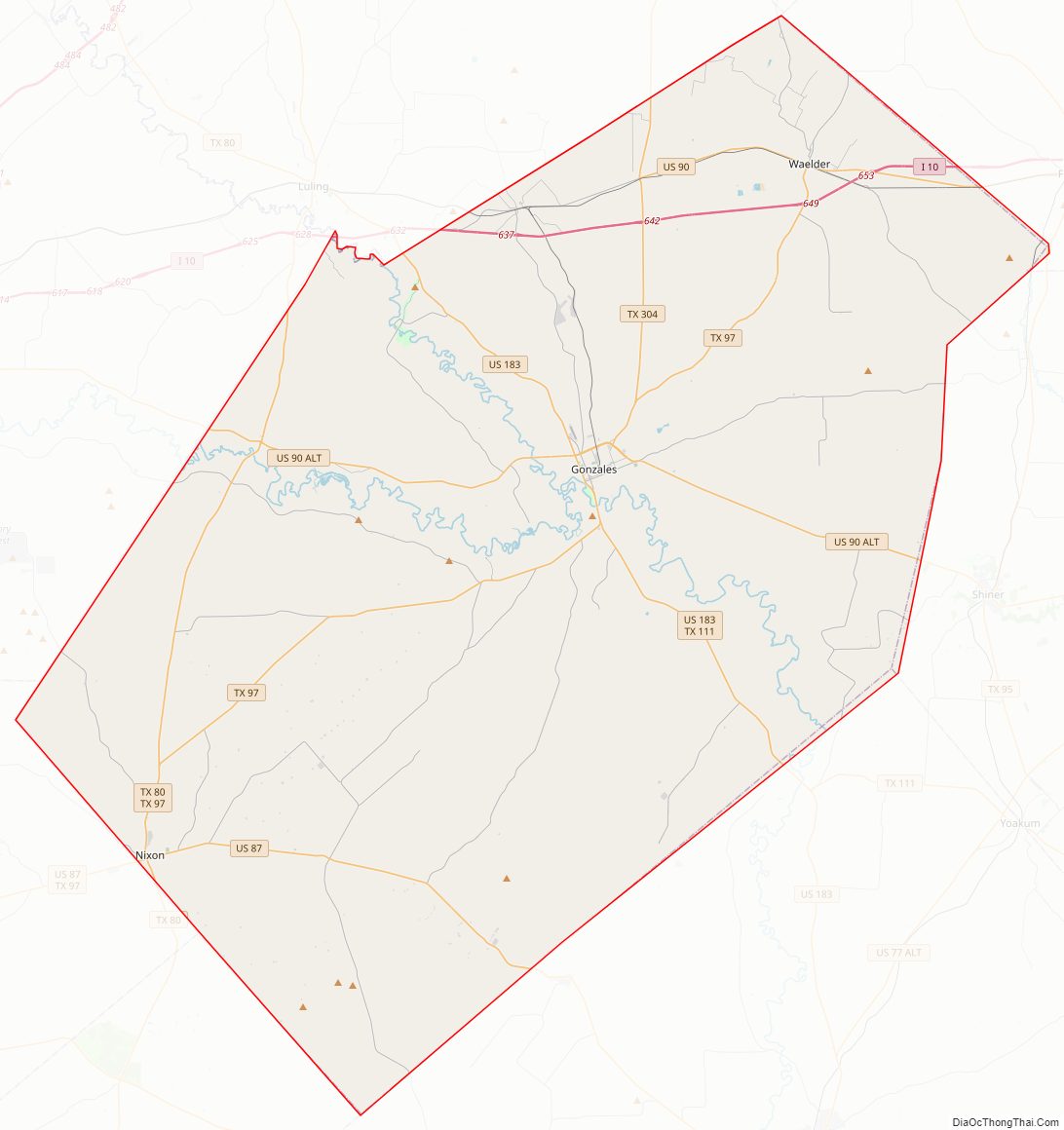
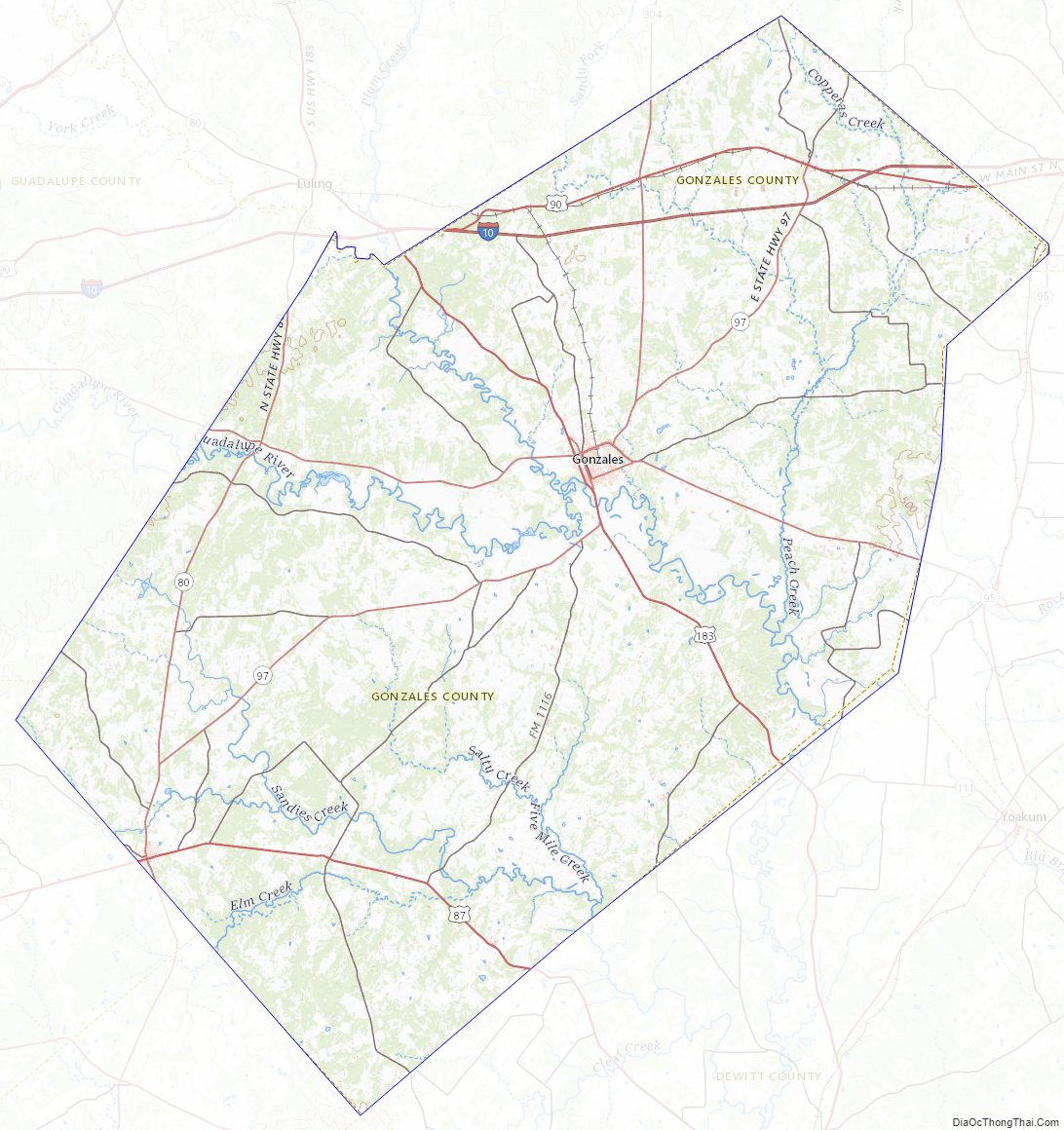
Gonzales County Road Map
Geography
According to the U.S. Census Bureau, the county has a total area of 1,070 square miles (2,800 km), of which 1,067 square miles (2,760 km) is land and 3.2 square miles (8.3 km) (0.3%) is water.
Directly connected to the US 183 / I-10 / SH 130 corridor, the Gonzales County areas support average annual daily traffic rated at over 100,000 vehicles by the Texas Department of Transportation; due to its direct adjacency to Greater Austin and Greater San Antonio.
River crossings
Gonzales County and the Texas Department of Transportation provide bridges across the Guadalupe River and the San Marcos River.
- North FM 466 / SH 80 bridge; Belmont, Extreme-West Gonzales County
- North FM 466 / Gonzales County Road 143 bridge; Monthalia, West Gonzales County
- North SH 97 / US 183 bridge; City of Gonzales, Texas
- East US 90A / FM 2091 bridge; San Marcos River, Ottine
Major highways
- I-10 / US 90, Belmont-Ottine-Waelder (San Antonio—Houston)
- US 183 / SH 80, Gonzales-to-Austin, Belmont-Leesville-Nixon
- U.S. Highway 87, Nixon–Smiley to Floresville
- State Highway 97, Waelder—City of Gonzales—Bebe-Leesville
- State Highway 304, Gonzales-to-Bastrop
U.S. Highway 90 Alternate, Belmont—City of Gonzales (I-10 auxiliary)
The majority of the county’s arterial roads have had their names removed and replaced by “County Road” numbered designations. Very few major roads remain properly named on record for Gonzales County, especially outside incorporated areas, including:
- Capote Road ( FM 466), Belmont-Leesville to Seguin
- Salt Lake Road (CR 266), North Ottine
- Harwood Road (CR 230), North Harwood to City-of-Gonzales
- Double Live Oak Lane ( FM 1115), North Waelder
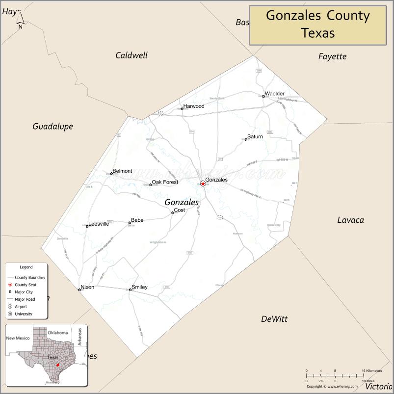
Adjacent counties
- Caldwell County (north)
- Fayette County (northeast)
- Lavaca County (east)
- Dewitt County (south)
- Karnes County (southwest)
- Wilson County (west)
- Guadalupe County (northwest)
Gonzales County Topographic Map
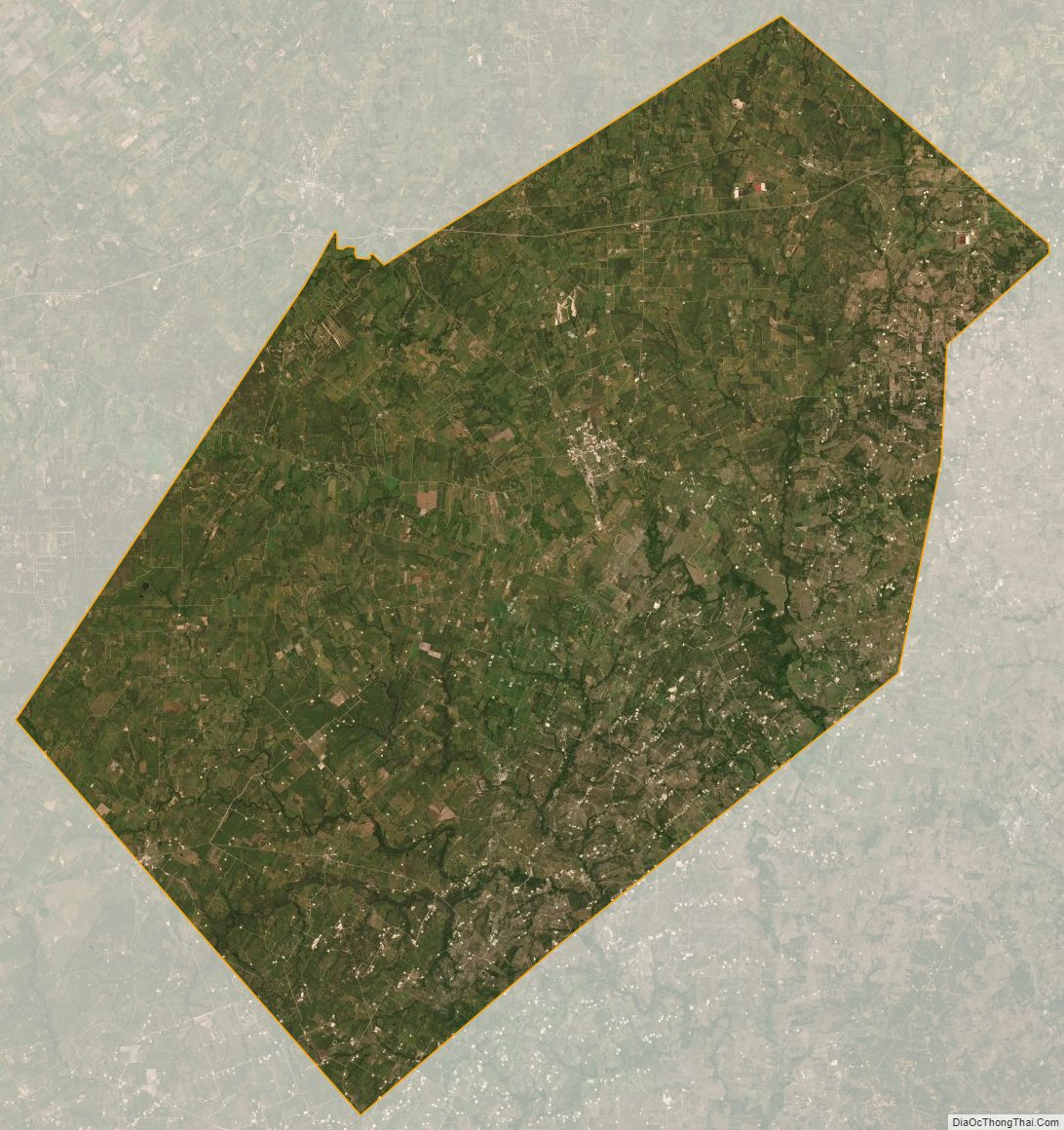
Gonzales County Satellite Map
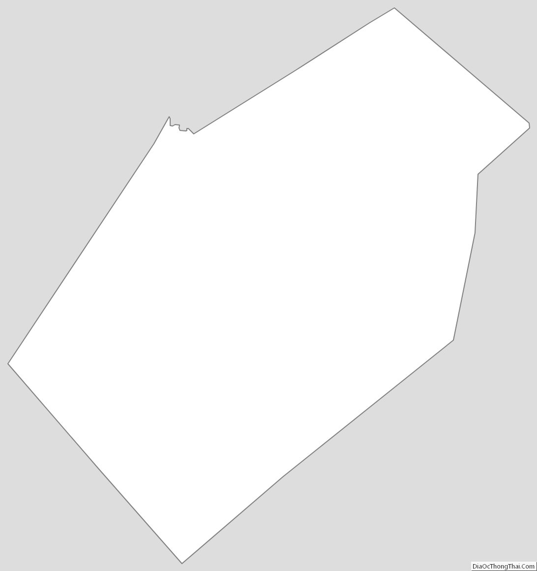
Gonzales County Outline Map
See also
Map of Texas State and its subdivision:- Anderson
- Andrews
- Angelina
- Aransas
- Archer
- Armstrong
- Atascosa
- Austin
- Bailey
- Bandera
- Bastrop
- Baylor
- Bee
- Bell
- Bexar
- Blanco
- Borden
- Bosque
- Bowie
- Brazoria
- Brazos
- Brewster
- Briscoe
- Brooks
- Brown
- Burleson
- Burnet
- Caldwell
- Calhoun
- Callahan
- Cameron
- Camp
- Carson
- Cass
- Castro
- Chambers
- Cherokee
- Childress
- Clay
- Cochran
- Coke
- Coleman
- Collin
- Collingsworth
- Colorado
- Comal
- Comanche
- Concho
- Cooke
- Coryell
- Cottle
- Crane
- Crockett
- Crosby
- Culberson
- Dallam
- Dallas
- Dawson
- Deaf Smith
- Delta
- Denton
- Dewitt
- Dickens
- Dimmit
- Donley
- Duval
- Eastland
- Ector
- Edwards
- El Paso
- Ellis
- Erath
- Falls
- Fannin
- Fayette
- Fisher
- Floyd
- Foard
- Fort Bend
- Franklin
- Freestone
- Frio
- Gaines
- Galveston
- Garza
- Gillespie
- Glasscock
- Goliad
- Gonzales
- Gray
- Grayson
- Gregg
- Grimes
- Guadalupe
- Hale
- Hall
- Hamilton
- Hansford
- Hardeman
- Hardin
- Harris
- Harrison
- Hartley
- Haskell
- Hays
- Hemphill
- Henderson
- Hidalgo
- Hill
- Hockley
- Hood
- Hopkins
- Houston
- Howard
- Hudspeth
- Hunt
- Hutchinson
- Irion
- Jack
- Jackson
- Jasper
- Jeff Davis
- Jefferson
- Jim Hogg
- Jim Wells
- Johnson
- Jones
- Karnes
- Kaufman
- Kendall
- Kenedy
- Kent
- Kerr
- Kimble
- King
- Kinney
- Kleberg
- Knox
- La Salle
- Lamar
- Lamb
- Lampasas
- Lavaca
- Lee
- Leon
- Liberty
- Limestone
- Lipscomb
- Live Oak
- Llano
- Loving
- Lubbock
- Lynn
- Madison
- Marion
- Martin
- Mason
- Matagorda
- Maverick
- McCulloch
- McLennan
- McMullen
- Medina
- Menard
- Midland
- Milam
- Mills
- Mitchell
- Montague
- Montgomery
- Moore
- Morris
- Motley
- Nacogdoches
- Navarro
- Newton
- Nolan
- Nueces
- Ochiltree
- Oldham
- Orange
- Palo Pinto
- Panola
- Parker
- Parmer
- Pecos
- Polk
- Potter
- Presidio
- Rains
- Randall
- Reagan
- Real
- Red River
- Reeves
- Refugio
- Roberts
- Robertson
- Rockwall
- Runnels
- Rusk
- Sabine
- San Augustine
- San Jacinto
- San Patricio
- San Saba
- Schleicher
- Scurry
- Shackelford
- Shelby
- Sherman
- Smith
- Somervell
- Starr
- Stephens
- Sterling
- Stonewall
- Sutton
- Swisher
- Tarrant
- Taylor
- Terrell
- Terry
- Throckmorton
- Titus
- Tom Green
- Travis
- Trinity
- Tyler
- Upshur
- Upton
- Uvalde
- Val Verde
- Van Zandt
- Victoria
- Walker
- Waller
- Ward
- Washington
- Webb
- Wharton
- Wheeler
- Wichita
- Wilbarger
- Willacy
- Williamson
- Wilson
- Winkler
- Wise
- Wood
- Yoakum
- Young
- Zapata
- Zavala
- Alabama
- Alaska
- Arizona
- Arkansas
- California
- Colorado
- Connecticut
- Delaware
- District of Columbia
- Florida
- Georgia
- Hawaii
- Idaho
- Illinois
- Indiana
- Iowa
- Kansas
- Kentucky
- Louisiana
- Maine
- Maryland
- Massachusetts
- Michigan
- Minnesota
- Mississippi
- Missouri
- Montana
- Nebraska
- Nevada
- New Hampshire
- New Jersey
- New Mexico
- New York
- North Carolina
- North Dakota
- Ohio
- Oklahoma
- Oregon
- Pennsylvania
- Rhode Island
- South Carolina
- South Dakota
- Tennessee
- Texas
- Utah
- Vermont
- Virginia
- Washington
- West Virginia
- Wisconsin
- Wyoming