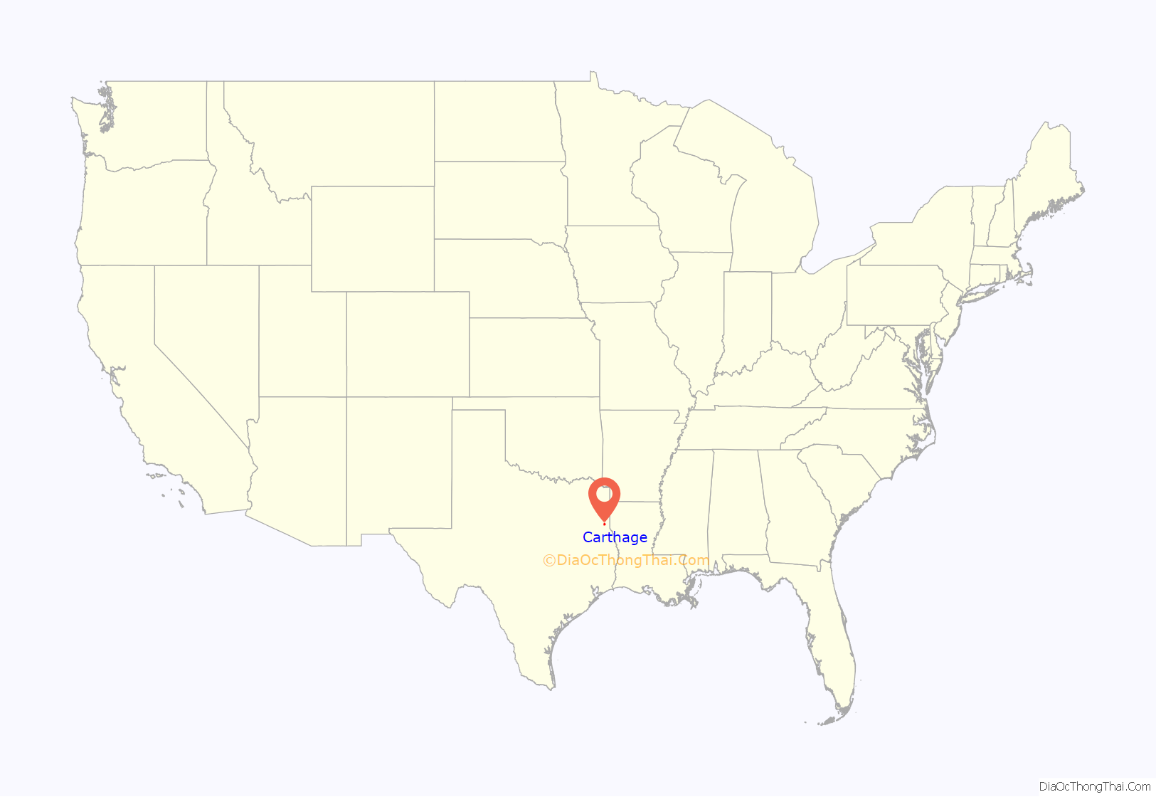
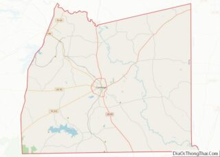
Carthage is a city and the county seat of Panola County, Texas, United States. This city is situated in deep East Texas, 20 miles west of the Louisiana state line. Its population was 6,569 at the 2020 census.
| Name: | Carthage city |
|---|---|
| LSAD Code: | 25 |
| LSAD Description: | city (suffix) |
| State: | Texas |
| County: | Panola County |
| Elevation: | 312 ft (95 m) |
| Total Area: | 10.68 sq mi (27.67 km²) |
| Land Area: | 10.66 sq mi (27.61 km²) |
| Water Area: | 0.02 sq mi (0.06 km²) |
| Total Population: | 6,569 |
| Population Density: | 603.28/sq mi (232.92/km²) |
| ZIP code: | 75633 |
| Area code: | 903 |
| FIPS code: | 4813108 |
| GNISfeature ID: | 1353900 |
| Website: | www.carthagetexas.com |
Online Interactive Map
Click on ![]() to view map in "full screen" mode.
to view map in "full screen" mode.
Carthage location map. Where is Carthage city?
History
Carthage was founded in 1847, two years after Texas was admitted to the United States. During the Civil War, men from Carthage and Panola County served as Confederate soldiers. African-American resident Milton M. Holland, formerly enslaved, served as a Union sergeant and earned a Medal of Honor.
Carthage, Mississippi was established in 1834, and became the county seat. The Harris family were early settlers, and named the town after their former home of Carthage, Tennessee. When Carthage, Texas established in 1848, it was named after Carthage, Mississippi.
After the Civil War, population growth was slow, but large amounts of cotton, corn, sweet potatoes, oats, and sugarcane were produced in the county. The city began to expand in 1888 when a railroad reached Carthage, along with telegraph and telephone lines.
During the Great Depression, a gas field was discovered near Carthage. After World War II, this gas field was developed and proved to be the largest in the United States. The city flourished, with the population increasing from about 1,300 to 5,000. During this period, a courthouse and a high school were built. In 1947 Panola County Junior College was established in Carthage and founded KGAS-AM 1590 which began broadcasting in 1955.
As a result of 19.6% population growth between 1970 and 1980, documented by U.S. Decennial Census; Panola General Hospital was established in 1997. Today the ETMC Carthage operates a 24-hour emergency department which is designated a Level IV trauma center by the state of Texas.
On August 22, 1998 the Tex Ritter Museum in Carthage was the site for the grand opening of the Texas Country Music Hall of Fame, honoring those who have made outstanding contributions to country music and born in the state of Texas.
On September 16, 1998 KGAS-FM began broadcasting a country music format in Carthage, and was featured in “Bernie”, the 2011 American biographical black comedy crime film directed by Richard Linklater.
1996 murder of Marjorie Nugent
After losing her husband, widow Marjorie Nugent, an 81-year-old resident of Carthage, became friends with Bernie Tiede, the assistant funeral director in town. In late 1996, townspeople did not see her, but thought perhaps she had moved to join her out-of-town family. When the family could not reach her, they filed a missing-person’s report. Nine months after her death, her friend and companion, 39-year-old Bernie Tiede, was brought in for questioning by police and confessed to killing her. He claimed she had emotionally abused him.
He shot her four times in the back with a .22 rifle in November 1996. A mortician, he cleaned her body and placed it in a freezer in her house, where it was not discovered until 1997. Tiede continued his community activities for several months after her death. He was convicted of first-degree murder and sentenced to life in prison. After a habeas corpus challenge, he was paroled on a $10,000 bond in 2014, but in 2016, Tiede had a resentencing hearing, and was sentenced to 99 years to life.
Panola County District Attorney Danny Buck Davidson said initially that few in the community questioned no longer seeing the elderly woman. He said, “That’s what you do when you’re a con guy and you move in. He had her cut all ties, so ultimately the only person she had to rely on was him. Mrs. Nugent was a human being. She didn’t deserve her fate at the hands of Bernie.” Tiede apparently killed the wealthy woman to get control of her money, spending an estimated $3 million of Nugent’s $10 million. Davidson said Tiede used some of it for philanthropy: “He sent people to college. He donated to musicals, plays and bought instruments at the college. That was all done with Mrs. Nugent’s money. After she was in the freezer, he really jumped out there as a benefactor.”
An article about these events in Texas Monthly by Skip Hollandsworth was adapted for Bernie, a 2011 dark comedy film which he co-wrote with director Richard Linklater. It starred Jack Black, Shirley MacLaine, Matthew McConaughey and was highly praised by Hollywood fans in the local community.
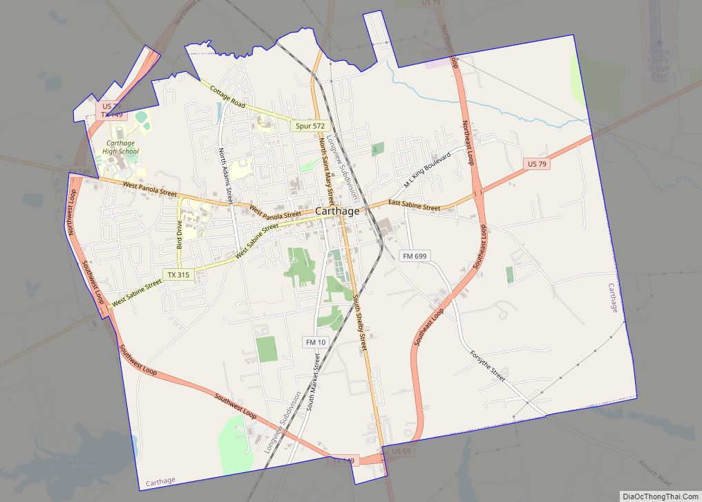
Carthage Road Map
Carthage city Satellite Map
Geography
According to the United States Census Bureau, Carthage has a total area of 10.5 square miles (27 km), of which 10.5 square miles (27 km) are land and 0.04 square miles (0.10 km) (0.4%) is covered by water.
The climate in this area is characterized by hot, humid summers and generally mild to cool winters. According to the Köppen climate classification, Carthage has a humid subtropical climate, Cfa on climate maps.
See also
Map of Texas State and its subdivision:- Anderson
- Andrews
- Angelina
- Aransas
- Archer
- Armstrong
- Atascosa
- Austin
- Bailey
- Bandera
- Bastrop
- Baylor
- Bee
- Bell
- Bexar
- Blanco
- Borden
- Bosque
- Bowie
- Brazoria
- Brazos
- Brewster
- Briscoe
- Brooks
- Brown
- Burleson
- Burnet
- Caldwell
- Calhoun
- Callahan
- Cameron
- Camp
- Carson
- Cass
- Castro
- Chambers
- Cherokee
- Childress
- Clay
- Cochran
- Coke
- Coleman
- Collin
- Collingsworth
- Colorado
- Comal
- Comanche
- Concho
- Cooke
- Coryell
- Cottle
- Crane
- Crockett
- Crosby
- Culberson
- Dallam
- Dallas
- Dawson
- Deaf Smith
- Delta
- Denton
- Dewitt
- Dickens
- Dimmit
- Donley
- Duval
- Eastland
- Ector
- Edwards
- El Paso
- Ellis
- Erath
- Falls
- Fannin
- Fayette
- Fisher
- Floyd
- Foard
- Fort Bend
- Franklin
- Freestone
- Frio
- Gaines
- Galveston
- Garza
- Gillespie
- Glasscock
- Goliad
- Gonzales
- Gray
- Grayson
- Gregg
- Grimes
- Guadalupe
- Hale
- Hall
- Hamilton
- Hansford
- Hardeman
- Hardin
- Harris
- Harrison
- Hartley
- Haskell
- Hays
- Hemphill
- Henderson
- Hidalgo
- Hill
- Hockley
- Hood
- Hopkins
- Houston
- Howard
- Hudspeth
- Hunt
- Hutchinson
- Irion
- Jack
- Jackson
- Jasper
- Jeff Davis
- Jefferson
- Jim Hogg
- Jim Wells
- Johnson
- Jones
- Karnes
- Kaufman
- Kendall
- Kenedy
- Kent
- Kerr
- Kimble
- King
- Kinney
- Kleberg
- Knox
- La Salle
- Lamar
- Lamb
- Lampasas
- Lavaca
- Lee
- Leon
- Liberty
- Limestone
- Lipscomb
- Live Oak
- Llano
- Loving
- Lubbock
- Lynn
- Madison
- Marion
- Martin
- Mason
- Matagorda
- Maverick
- McCulloch
- McLennan
- McMullen
- Medina
- Menard
- Midland
- Milam
- Mills
- Mitchell
- Montague
- Montgomery
- Moore
- Morris
- Motley
- Nacogdoches
- Navarro
- Newton
- Nolan
- Nueces
- Ochiltree
- Oldham
- Orange
- Palo Pinto
- Panola
- Parker
- Parmer
- Pecos
- Polk
- Potter
- Presidio
- Rains
- Randall
- Reagan
- Real
- Red River
- Reeves
- Refugio
- Roberts
- Robertson
- Rockwall
- Runnels
- Rusk
- Sabine
- San Augustine
- San Jacinto
- San Patricio
- San Saba
- Schleicher
- Scurry
- Shackelford
- Shelby
- Sherman
- Smith
- Somervell
- Starr
- Stephens
- Sterling
- Stonewall
- Sutton
- Swisher
- Tarrant
- Taylor
- Terrell
- Terry
- Throckmorton
- Titus
- Tom Green
- Travis
- Trinity
- Tyler
- Upshur
- Upton
- Uvalde
- Val Verde
- Van Zandt
- Victoria
- Walker
- Waller
- Ward
- Washington
- Webb
- Wharton
- Wheeler
- Wichita
- Wilbarger
- Willacy
- Williamson
- Wilson
- Winkler
- Wise
- Wood
- Yoakum
- Young
- Zapata
- Zavala
- Alabama
- Alaska
- Arizona
- Arkansas
- California
- Colorado
- Connecticut
- Delaware
- District of Columbia
- Florida
- Georgia
- Hawaii
- Idaho
- Illinois
- Indiana
- Iowa
- Kansas
- Kentucky
- Louisiana
- Maine
- Maryland
- Massachusetts
- Michigan
- Minnesota
- Mississippi
- Missouri
- Montana
- Nebraska
- Nevada
- New Hampshire
- New Jersey
- New Mexico
- New York
- North Carolina
- North Dakota
- Ohio
- Oklahoma
- Oregon
- Pennsylvania
- Rhode Island
- South Carolina
- South Dakota
- Tennessee
- Texas
- Utah
- Vermont
- Virginia
- Washington
- West Virginia
- Wisconsin
- Wyoming
