Clute is a city in Brazoria County, Texas, within the Houston metropolitan area. As of the 2020 U.S. Census, the city population was 10,604. The city gained some fame with the discovery of a fossilized mammoth named Asiel. There is now a restaurant/museum of the same name to honor this discovery.
| Name: | Clute city |
|---|---|
| LSAD Code: | 25 |
| LSAD Description: | city (suffix) |
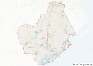
| State: | Texas |
| County: | Brazoria County |
| Incorporated: | May 1952 |
| Elevation: | 10 ft (3 m) |
| Total Area: | 5.69 sq mi (14.73 km²) |
| Land Area: | 5.32 sq mi (13.78 km²) |
| Water Area: | 0.37 sq mi (0.95 km²) |
| Total Population: | 10,604 |
| Population Density: | 2,197.78/sq mi (848.58/km²) |
| ZIP code: | 77531 |
| Area code: | 979 |
| FIPS code: | 4815652 |
| GNISfeature ID: | 1354690 |
| Website: | http://ci.clute.tx.us/ |
Online Interactive Map
Click on ![]() to view map in "full screen" mode.
to view map in "full screen" mode.
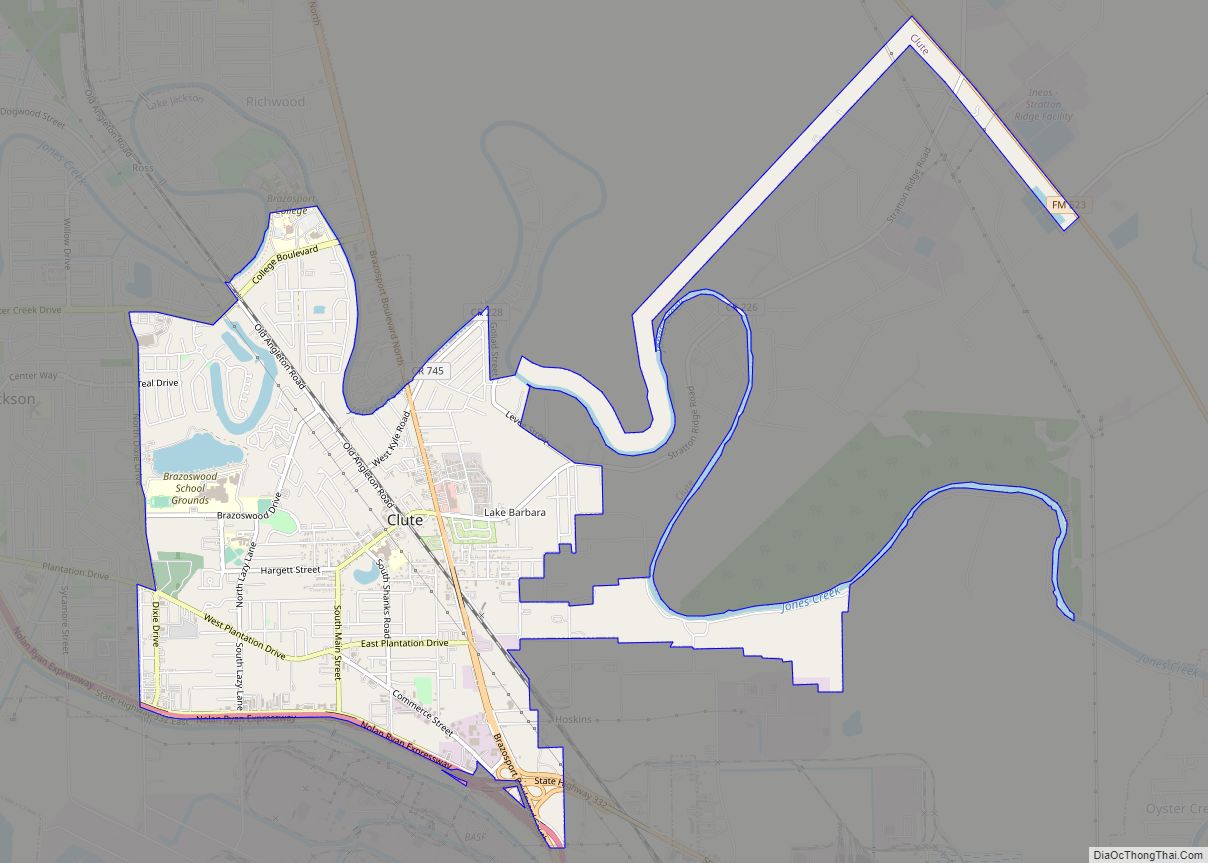
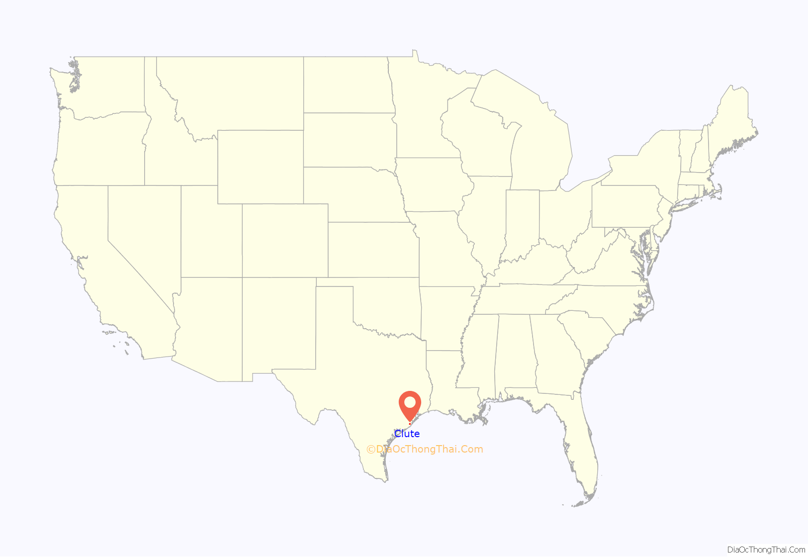
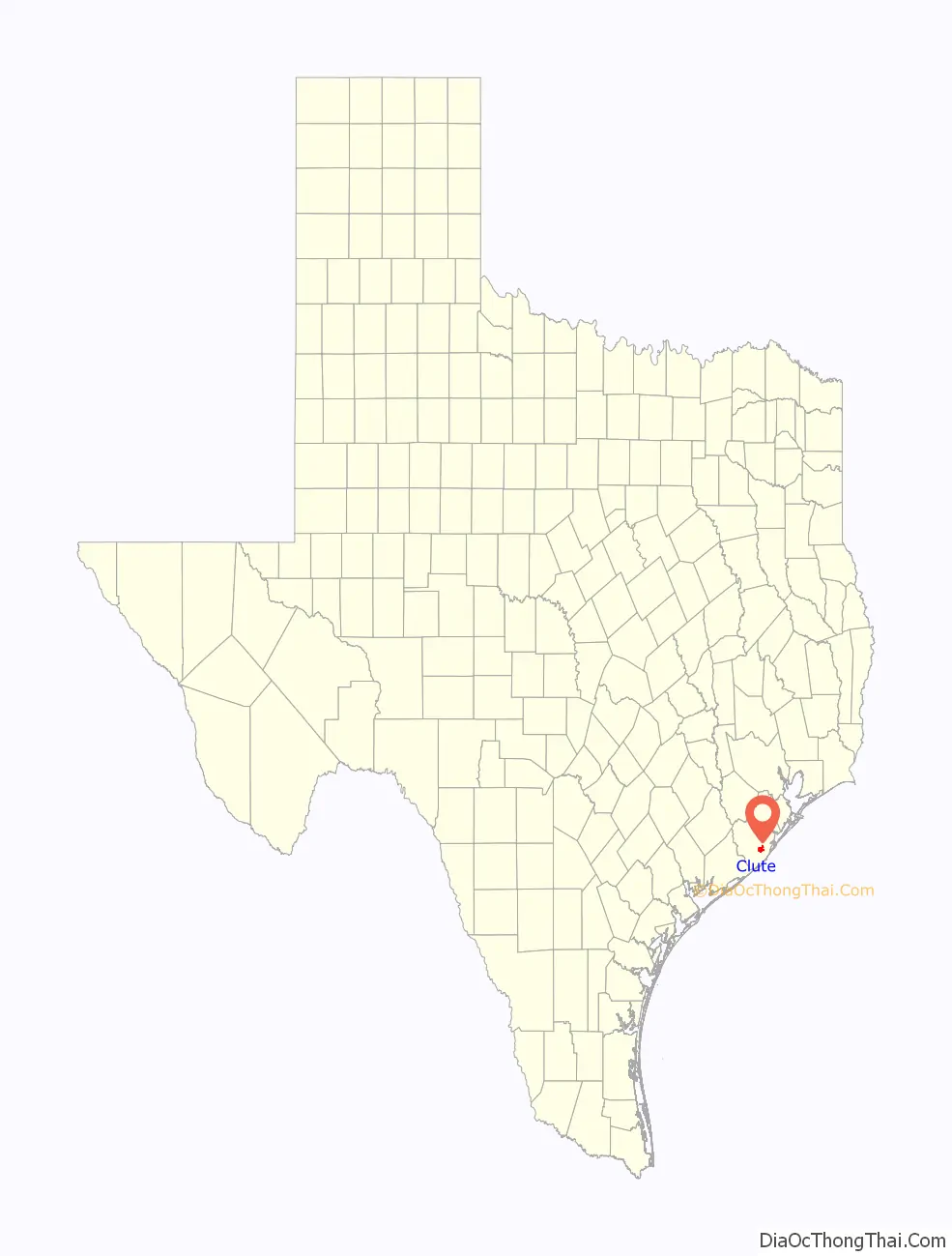
Clute location map. Where is Clute city?
History
Clute’s history began at the junction of the old Calvit and Eagle Island Plantations. Alexander Calvit, one of Stephen F. Austin’s Old Three Hundred, obtained title to the land in 1824. Eagle Island Plantation belonged to Jared Groce, the richest man in Austin’s Colony. Calvit’s plantation later became the Herndon sugar plantation, owned by John H. Herndon, who married Calvit’s only daughter.
After the American Civil War, Joseph Pegan, Soloman J. Clute, and several relatives including George and John Clute, founded a community near the plantation site. In 1881, the name Clute was adopted when both plantations were bought by Solomon J. Clute. George was described as, “a little Yankee from New York with a long, white beard.” The other founders of Clute have also been described as northerners. The Clutes acquired additional land from Herndon, who put it up for auction in the 1870s.
A deed dated March 17, 1886, transferred ownership from Soloman Clute to George Clute for property known as Clute’s Place. Soloman administered the community until 1888 or 1889, when it was sold. The Eagle Island Plantation of William H. Wharton occupied the site of present Restwood Memorial Park.
In 1933 Clute had only two businesses and a population of ten. By 1937 the town had a school for white children with two teachers and two schools for black children with one teacher each. In the early 1940s, Clute began to prosper with the advent of Dow Chemical and several large construction companies moving into Southern Brazoria County. A post office was established by 1943, and a new grade school was built in the 1950s.
In 1950 Clute had a population of 700 and thirty-six businesses; in 1954 the residents numbered 3,200 and the businesses forty-five. Clute was incorporated in May 1952 under the name Clute City, with a commission form of government; in 1955 the town changed its name back to Clute and adopted an alderman (city council) form of government.
Brazoswood High School opened in Clute in 1969 with grades 9–11. The first class graduated 356 students in May 1971. Brazoswood won the state championship in football in 1974.
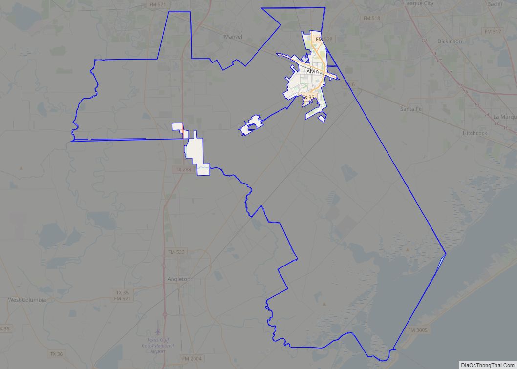
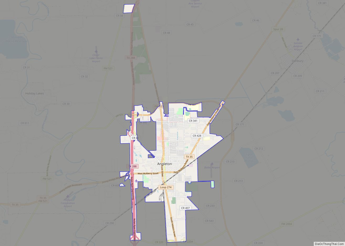
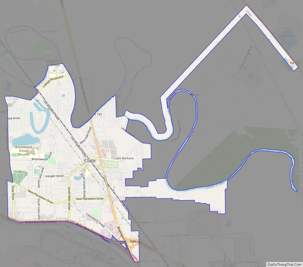
Clute Road Map
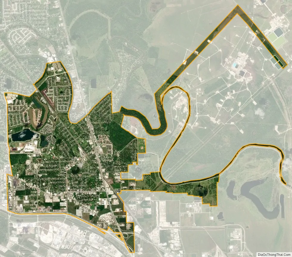
Clute city Satellite Map
Geography
Clute is located at 29°1′34″N 95°23′40″W / 29.02611°N 95.39444°W / 29.02611; -95.39444 (29.026060, –95.394539).
According to the United States Census Bureau, the city has a total area of 5.6 square miles (15 km), of which, 5.3 square miles (14 km) of it is land and 0.3 square miles (0.78 km) of it (5.14%) is water.
See also
Map of Texas State and its subdivision:- Anderson
- Andrews
- Angelina
- Aransas
- Archer
- Armstrong
- Atascosa
- Austin
- Bailey
- Bandera
- Bastrop
- Baylor
- Bee
- Bell
- Bexar
- Blanco
- Borden
- Bosque
- Bowie
- Brazoria
- Brazos
- Brewster
- Briscoe
- Brooks
- Brown
- Burleson
- Burnet
- Caldwell
- Calhoun
- Callahan
- Cameron
- Camp
- Carson
- Cass
- Castro
- Chambers
- Cherokee
- Childress
- Clay
- Cochran
- Coke
- Coleman
- Collin
- Collingsworth
- Colorado
- Comal
- Comanche
- Concho
- Cooke
- Coryell
- Cottle
- Crane
- Crockett
- Crosby
- Culberson
- Dallam
- Dallas
- Dawson
- Deaf Smith
- Delta
- Denton
- Dewitt
- Dickens
- Dimmit
- Donley
- Duval
- Eastland
- Ector
- Edwards
- El Paso
- Ellis
- Erath
- Falls
- Fannin
- Fayette
- Fisher
- Floyd
- Foard
- Fort Bend
- Franklin
- Freestone
- Frio
- Gaines
- Galveston
- Garza
- Gillespie
- Glasscock
- Goliad
- Gonzales
- Gray
- Grayson
- Gregg
- Grimes
- Guadalupe
- Hale
- Hall
- Hamilton
- Hansford
- Hardeman
- Hardin
- Harris
- Harrison
- Hartley
- Haskell
- Hays
- Hemphill
- Henderson
- Hidalgo
- Hill
- Hockley
- Hood
- Hopkins
- Houston
- Howard
- Hudspeth
- Hunt
- Hutchinson
- Irion
- Jack
- Jackson
- Jasper
- Jeff Davis
- Jefferson
- Jim Hogg
- Jim Wells
- Johnson
- Jones
- Karnes
- Kaufman
- Kendall
- Kenedy
- Kent
- Kerr
- Kimble
- King
- Kinney
- Kleberg
- Knox
- La Salle
- Lamar
- Lamb
- Lampasas
- Lavaca
- Lee
- Leon
- Liberty
- Limestone
- Lipscomb
- Live Oak
- Llano
- Loving
- Lubbock
- Lynn
- Madison
- Marion
- Martin
- Mason
- Matagorda
- Maverick
- McCulloch
- McLennan
- McMullen
- Medina
- Menard
- Midland
- Milam
- Mills
- Mitchell
- Montague
- Montgomery
- Moore
- Morris
- Motley
- Nacogdoches
- Navarro
- Newton
- Nolan
- Nueces
- Ochiltree
- Oldham
- Orange
- Palo Pinto
- Panola
- Parker
- Parmer
- Pecos
- Polk
- Potter
- Presidio
- Rains
- Randall
- Reagan
- Real
- Red River
- Reeves
- Refugio
- Roberts
- Robertson
- Rockwall
- Runnels
- Rusk
- Sabine
- San Augustine
- San Jacinto
- San Patricio
- San Saba
- Schleicher
- Scurry
- Shackelford
- Shelby
- Sherman
- Smith
- Somervell
- Starr
- Stephens
- Sterling
- Stonewall
- Sutton
- Swisher
- Tarrant
- Taylor
- Terrell
- Terry
- Throckmorton
- Titus
- Tom Green
- Travis
- Trinity
- Tyler
- Upshur
- Upton
- Uvalde
- Val Verde
- Van Zandt
- Victoria
- Walker
- Waller
- Ward
- Washington
- Webb
- Wharton
- Wheeler
- Wichita
- Wilbarger
- Willacy
- Williamson
- Wilson
- Winkler
- Wise
- Wood
- Yoakum
- Young
- Zapata
- Zavala
- Alabama
- Alaska
- Arizona
- Arkansas
- California
- Colorado
- Connecticut
- Delaware
- District of Columbia
- Florida
- Georgia
- Hawaii
- Idaho
- Illinois
- Indiana
- Iowa
- Kansas
- Kentucky
- Louisiana
- Maine
- Maryland
- Massachusetts
- Michigan
- Minnesota
- Mississippi
- Missouri
- Montana
- Nebraska
- Nevada
- New Hampshire
- New Jersey
- New Mexico
- New York
- North Carolina
- North Dakota
- Ohio
- Oklahoma
- Oregon
- Pennsylvania
- Rhode Island
- South Carolina
- South Dakota
- Tennessee
- Texas
- Utah
- Vermont
- Virginia
- Washington
- West Virginia
- Wisconsin
- Wyoming