Forsan is a city in Howard County, Texas, United States. The population was 210 at the 2010 census.
| Name: | Forsan city |
|---|---|
| LSAD Code: | 25 |
| LSAD Description: | city (suffix) |
| State: | Texas |
| County: | Howard County |
| Elevation: | 2,789 ft (850 m) |
| Total Area: | 0.29 sq mi (0.75 km²) |
| Land Area: | 0.29 sq mi (0.75 km²) |
| Water Area: | 0.00 sq mi (0.00 km²) |
| Total Population: | 210 |
| Population Density: | 786.94/sq mi (303.68/km²) |
| ZIP code: | 79733 |
| Area code: | 432 |
| FIPS code: | 4826640 |
| GNISfeature ID: | 1336045 |
Online Interactive Map
Click on ![]() to view map in "full screen" mode.
to view map in "full screen" mode.
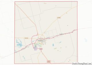
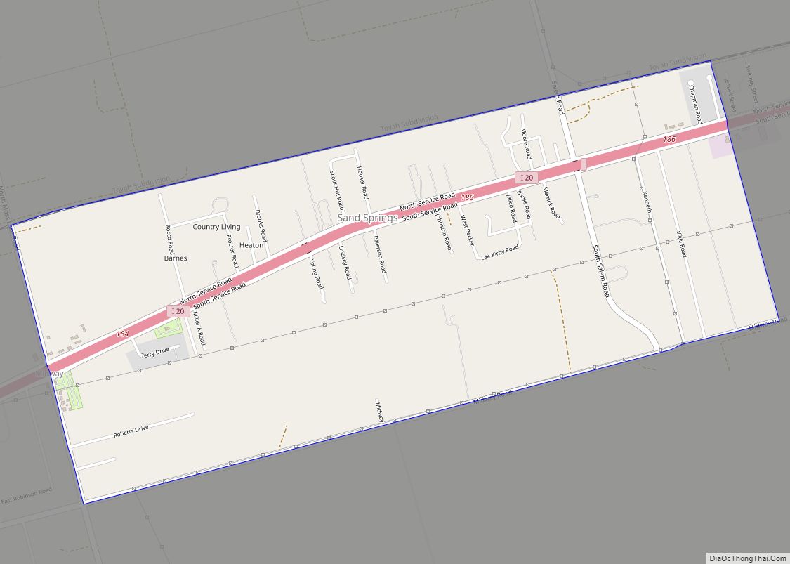
Forsan location map. Where is Forsan city?


History
Forsan’s development as a community dates back to the 1920s, when oil was discovered in the area. Oil companies began leasing local land and production from the first oil well began on November 9, 1925. On May 28, 1928, a town site on the ranch of Clayton Stewart was placed on the market. An office was set up and lots were sold at twenty-five dollars each. By December 1928, the growing community was known as Forsan. The name was derived from the fact that four paying oil sands were believed to be present in the area. Drillers would later discover that there were actually at least five sands present. A school and several businesses opened soon after. On March 5, 1929, Forsan’s post office began operating. A true oil boomtown, Forsan’s population had already reached 350 by 1931. The Great Depression’s impact on Forsan wasn’t as significant as in other rural Texas towns. The population grew to 400 by 1936. That figure remained constant through the mid-1950s, but there was a decline in the number of businesses. The Elbow Common School District, based in the community of Elbow, consolidated with Forsan schools in 1960. On March 25, 1961, the first mayor and city council were elected following an earlier decision to incorporate the community. Forsan’s population began to decline and by 1980, 239 people lived in the city. That number rose to 256 in 1990, but had declined to 226 in 2000.
Forsan Road Map

Forsan city Satellite Map

Geography
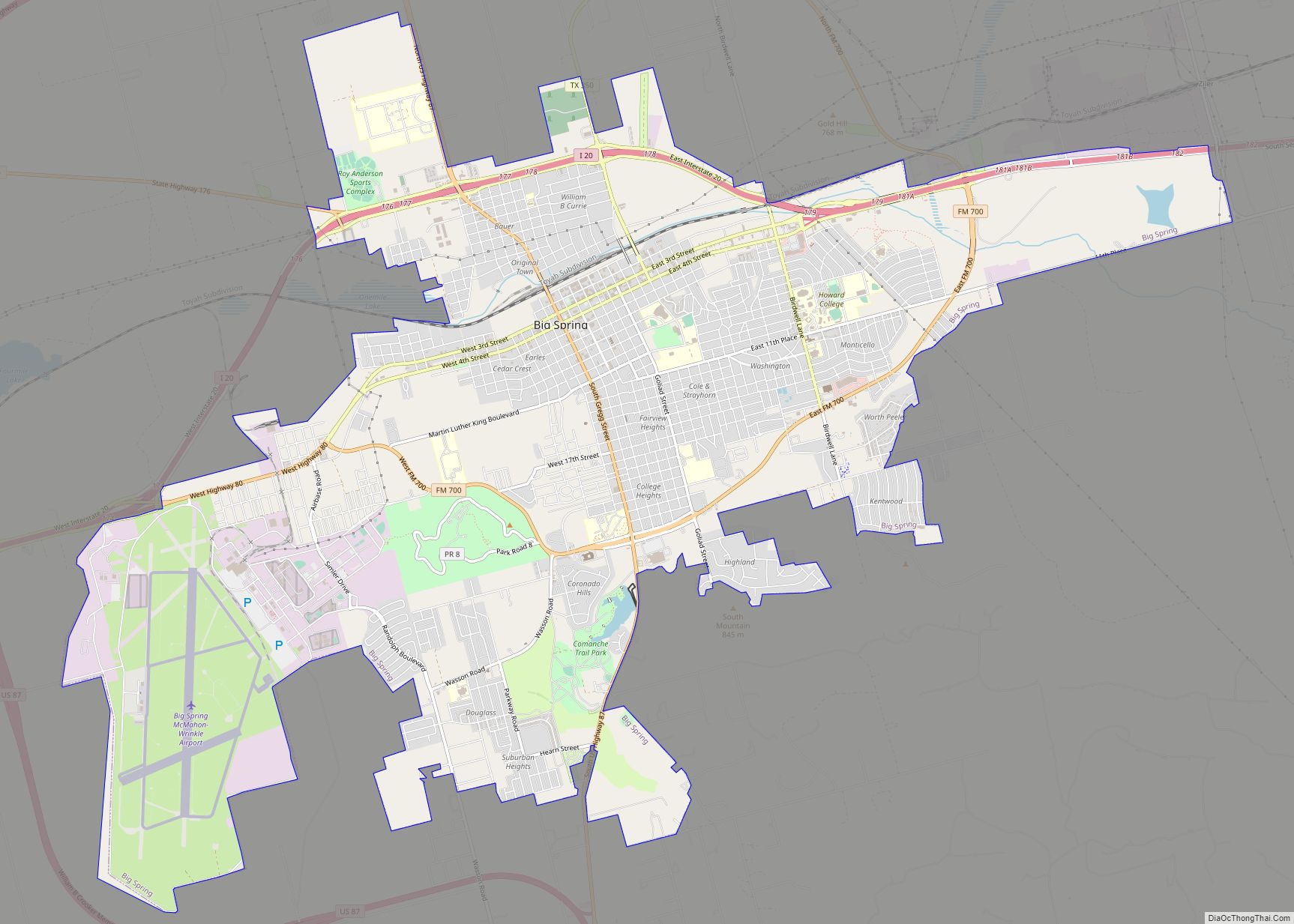
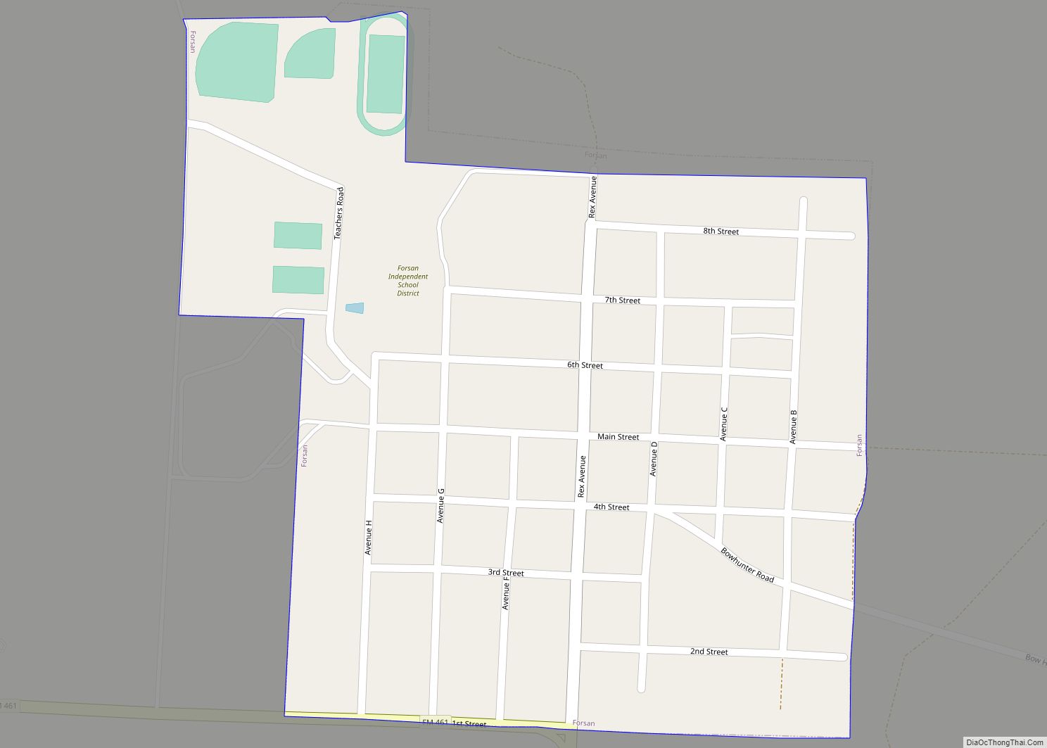
Forsan is located in southern Howard County at 32°6′34″N 101°21′56″W / 32.10944°N 101.36556°W / 32.10944; -101.36556 (32.109359, –101.365531). It is situated along FM 461 in southeastern Howard County, about 14 miles (23 km) southeast of Big Spring.
According to the United States Census Bureau, the city has a total area of 0.29 square miles (0.75 km), all of it land.
See also
Map of Texas State and its subdivision:- Anderson
- Andrews
- Angelina
- Aransas
- Archer
- Armstrong
- Atascosa
- Austin
- Bailey
- Bandera
- Bastrop
- Baylor
- Bee
- Bell
- Bexar
- Blanco
- Borden
- Bosque
- Bowie
- Brazoria
- Brazos
- Brewster
- Briscoe
- Brooks
- Brown
- Burleson
- Burnet
- Caldwell
- Calhoun
- Callahan
- Cameron
- Camp
- Carson
- Cass
- Castro
- Chambers
- Cherokee
- Childress
- Clay
- Cochran
- Coke
- Coleman
- Collin
- Collingsworth
- Colorado
- Comal
- Comanche
- Concho
- Cooke
- Coryell
- Cottle
- Crane
- Crockett
- Crosby
- Culberson
- Dallam
- Dallas
- Dawson
- Deaf Smith
- Delta
- Denton
- Dewitt
- Dickens
- Dimmit
- Donley
- Duval
- Eastland
- Ector
- Edwards
- El Paso
- Ellis
- Erath
- Falls
- Fannin
- Fayette
- Fisher
- Floyd
- Foard
- Fort Bend
- Franklin
- Freestone
- Frio
- Gaines
- Galveston
- Garza
- Gillespie
- Glasscock
- Goliad
- Gonzales
- Gray
- Grayson
- Gregg
- Grimes
- Guadalupe
- Hale
- Hall
- Hamilton
- Hansford
- Hardeman
- Hardin
- Harris
- Harrison
- Hartley
- Haskell
- Hays
- Hemphill
- Henderson
- Hidalgo
- Hill
- Hockley
- Hood
- Hopkins
- Houston
- Howard
- Hudspeth
- Hunt
- Hutchinson
- Irion
- Jack
- Jackson
- Jasper
- Jeff Davis
- Jefferson
- Jim Hogg
- Jim Wells
- Johnson
- Jones
- Karnes
- Kaufman
- Kendall
- Kenedy
- Kent
- Kerr
- Kimble
- King
- Kinney
- Kleberg
- Knox
- La Salle
- Lamar
- Lamb
- Lampasas
- Lavaca
- Lee
- Leon
- Liberty
- Limestone
- Lipscomb
- Live Oak
- Llano
- Loving
- Lubbock
- Lynn
- Madison
- Marion
- Martin
- Mason
- Matagorda
- Maverick
- McCulloch
- McLennan
- McMullen
- Medina
- Menard
- Midland
- Milam
- Mills
- Mitchell
- Montague
- Montgomery
- Moore
- Morris
- Motley
- Nacogdoches
- Navarro
- Newton
- Nolan
- Nueces
- Ochiltree
- Oldham
- Orange
- Palo Pinto
- Panola
- Parker
- Parmer
- Pecos
- Polk
- Potter
- Presidio
- Rains
- Randall
- Reagan
- Real
- Red River
- Reeves
- Refugio
- Roberts
- Robertson
- Rockwall
- Runnels
- Rusk
- Sabine
- San Augustine
- San Jacinto
- San Patricio
- San Saba
- Schleicher
- Scurry
- Shackelford
- Shelby
- Sherman
- Smith
- Somervell
- Starr
- Stephens
- Sterling
- Stonewall
- Sutton
- Swisher
- Tarrant
- Taylor
- Terrell
- Terry
- Throckmorton
- Titus
- Tom Green
- Travis
- Trinity
- Tyler
- Upshur
- Upton
- Uvalde
- Val Verde
- Van Zandt
- Victoria
- Walker
- Waller
- Ward
- Washington
- Webb
- Wharton
- Wheeler
- Wichita
- Wilbarger
- Willacy
- Williamson
- Wilson
- Winkler
- Wise
- Wood
- Yoakum
- Young
- Zapata
- Zavala
- Alabama
- Alaska
- Arizona
- Arkansas
- California
- Colorado
- Connecticut
- Delaware
- District of Columbia
- Florida
- Georgia
- Hawaii
- Idaho
- Illinois
- Indiana
- Iowa
- Kansas
- Kentucky
- Louisiana
- Maine
- Maryland
- Massachusetts
- Michigan
- Minnesota
- Mississippi
- Missouri
- Montana
- Nebraska
- Nevada
- New Hampshire
- New Jersey
- New Mexico
- New York
- North Carolina
- North Dakota
- Ohio
- Oklahoma
- Oregon
- Pennsylvania
- Rhode Island
- South Carolina
- South Dakota
- Tennessee
- Texas
- Utah
- Vermont
- Virginia
- Washington
- West Virginia
- Wisconsin
- Wyoming