Hearne (/hɜːrn/ hurn) is a city in Robertson County, Texas, United States. As of the 2020 census, the city population was 4,544. The city is named for a family that settled in the area in the 19th century and promoted the construction of rail lines through the city.
| Name: | Hearne city |
|---|---|
| LSAD Code: | 25 |
| LSAD Description: | city (suffix) |
| State: | Texas |
| County: | Robertson County |
| Elevation: | 295 ft (90 m) |
| Total Area: | 4.12 sq mi (10.68 km²) |
| Land Area: | 4.12 sq mi (10.67 km²) |
| Water Area: | 0.00 sq mi (0.01 km²) |
| Total Population: | 4,544 |
| Population Density: | 1,056.80/sq mi (408.01/km²) |
| ZIP code: | 77859 |
| Area code: | 979 |
| FIPS code: | 4832972 |
| GNISfeature ID: | 1358979 |
| Website: | www.cityofhearne.org |
Online Interactive Map
Click on ![]() to view map in "full screen" mode.
to view map in "full screen" mode.
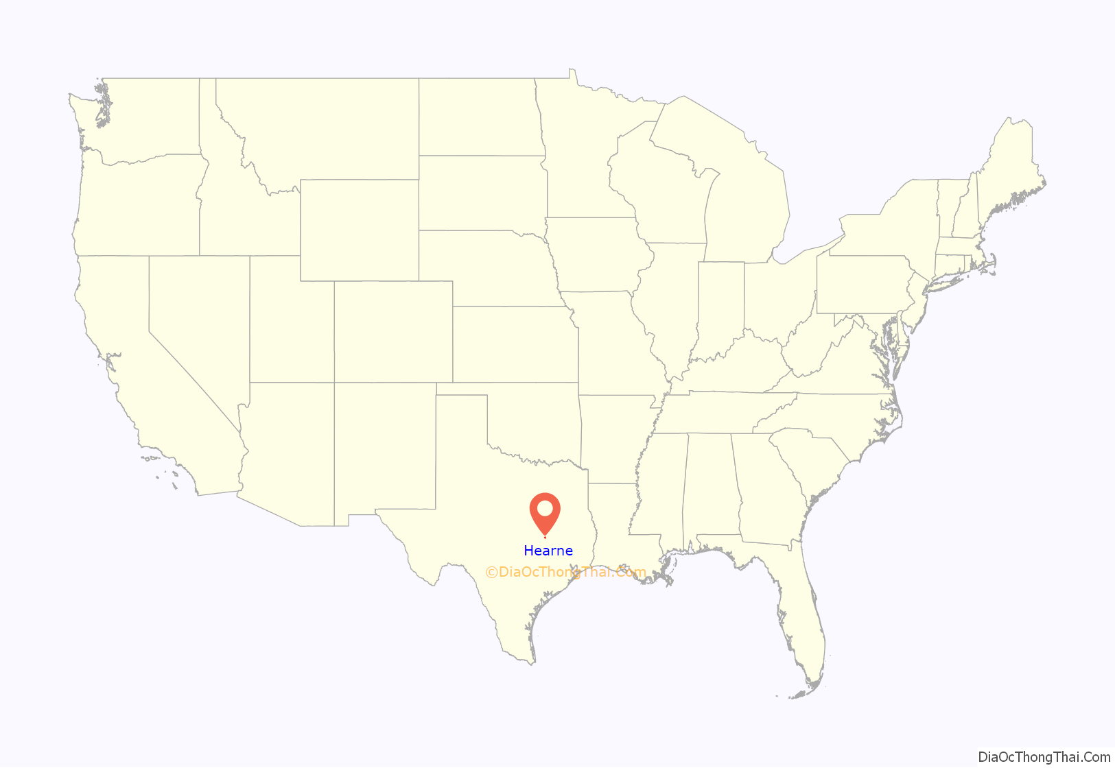
Hearne location map. Where is Hearne city?
History
Founding
Hearne is located on land that initially belonged to politician and soldier José Francisco Ruiz. By the 1840s, a tavern was located there and it also served as a general store and post office. The Hearne family moved to the area in the 1850s, purchasing 10,000 acres and operating cotton plantations. Christopher C. Hearne wanted a railroad line built through the area, but the Civil War started before the railroad could be constructed. His widow later gave 700 acres to the Houston and Texas Central Railway.
With the construction of a depot in Hearne in 1868, businesses began to open, including a hotel, saloons, churches and a cotton gin. Two rail lines met in Hearne by the 1870s. Hearne’s population was 2,129 in 1900 and 3,511 in 1940. Between 1943 and 1946, a prison camp operated near the city limits and held several thousand German prisoners of war. Agricultural and manufacturing businesses came to Hearne by the 1960s. By 1990, over 5,000 people lived in Hearne; the population was 4,690 in 2000.
Wal-Mart closure
On New Year’s Eve 1990, the Wal-Mart in Hearne closed. After closure, the store was converted into the current Hearne High School. Merchants in downtown Hearne by that time had already folded their businesses because they were unable to compete with Wal-Mart. The New York Times reported that out of more than 1,500 Wal-Mart stores in the nation, the Hearne store was one of six that had closed.
Drug sweeps and ACLU lawsuit
In November 2000, 15 African-American residents of Hearne, Texas, were indicted on drug charges after being arrested in a series of “drug sweeps”. The ACLU filed a class action lawsuit, Kelly v. Paschall, on their behalf, alleging that the arrests were unlawful. The ACLU contended that 15 percent of Hearne’s male African American population aged 18 to 34 (and at least one woman) were arrested based on the “uncorroborated word of a single unreliable confidential informant coerced by police to make cases.” The government had promised the informant leniency on a burglary charge and a hundred dollars in cash in exchange for each suspect he helped convict.
On May 11, 2005, the ACLU and Robertson County announced a confidential settlement of the lawsuit, an outcome which “both sides stated that they were satisfied with.” District Attorney John Paschall dismissed the charges against the plaintiffs of the suit. He also admitted that the witness had tampered with evidence and failed a polygraph test. A movie, American Violet, was made about the incident.
Shooting of Pearlie Golden
In May 2014, protesters demonstrated against the shooting of a 93-year-old woman named Pearlie Golden by the Hearne Police Department. After Officer Stephen Stem responded to a disturbance at Golden’s residence, police officials said that Golden had discharged a firearm into the ground twice. Stem shot Golden three times, resulting in Golden’s death.
The officer had been on the police force since 2012 and it was his second fatal shooting. Stem was placed on leave and Hearne mayor Ruben Gomez recommended Stem’s firing. He was terminated by a unanimous city council vote. Stem’s attorney said that some community members had turned a safety issue into one focused on age, race and gender.
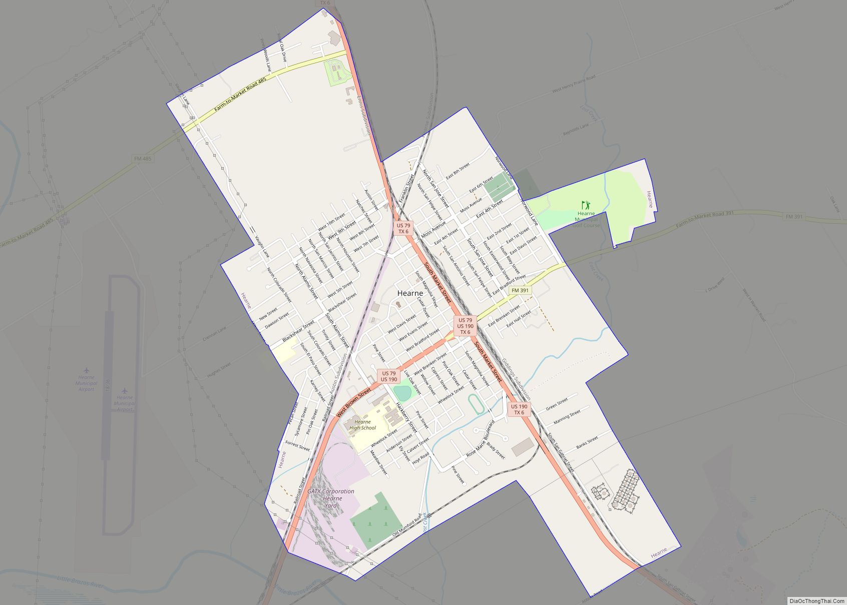
Hearne Road Map
Hearne city Satellite Map
Geography
Hearne is located at 30°52′41″N 96°35′44″W / 30.87806°N 96.59556°W / 30.87806; -96.59556 (30.877989, –96.595665). According to the United States Census Bureau, the city has a total area of 4.1 square miles (11 km), all of it land. General aviation service is provided by Hearne Municipal Airport.
Climate
The climate in this area is characterized by hot, humid summers and generally mild to cool winters. According to the Köppen Climate Classification system, Hearne has a humid subtropical climate, abbreviated “Cfa” on climate maps. Hearne was subject to heavy flooding on May 13, 2004 when 17 inches (430 mm) of rain fell in an hour.
See also
Map of Texas State and its subdivision:- Anderson
- Andrews
- Angelina
- Aransas
- Archer
- Armstrong
- Atascosa
- Austin
- Bailey
- Bandera
- Bastrop
- Baylor
- Bee
- Bell
- Bexar
- Blanco
- Borden
- Bosque
- Bowie
- Brazoria
- Brazos
- Brewster
- Briscoe
- Brooks
- Brown
- Burleson
- Burnet
- Caldwell
- Calhoun
- Callahan
- Cameron
- Camp
- Carson
- Cass
- Castro
- Chambers
- Cherokee
- Childress
- Clay
- Cochran
- Coke
- Coleman
- Collin
- Collingsworth
- Colorado
- Comal
- Comanche
- Concho
- Cooke
- Coryell
- Cottle
- Crane
- Crockett
- Crosby
- Culberson
- Dallam
- Dallas
- Dawson
- Deaf Smith
- Delta
- Denton
- Dewitt
- Dickens
- Dimmit
- Donley
- Duval
- Eastland
- Ector
- Edwards
- El Paso
- Ellis
- Erath
- Falls
- Fannin
- Fayette
- Fisher
- Floyd
- Foard
- Fort Bend
- Franklin
- Freestone
- Frio
- Gaines
- Galveston
- Garza
- Gillespie
- Glasscock
- Goliad
- Gonzales
- Gray
- Grayson
- Gregg
- Grimes
- Guadalupe
- Hale
- Hall
- Hamilton
- Hansford
- Hardeman
- Hardin
- Harris
- Harrison
- Hartley
- Haskell
- Hays
- Hemphill
- Henderson
- Hidalgo
- Hill
- Hockley
- Hood
- Hopkins
- Houston
- Howard
- Hudspeth
- Hunt
- Hutchinson
- Irion
- Jack
- Jackson
- Jasper
- Jeff Davis
- Jefferson
- Jim Hogg
- Jim Wells
- Johnson
- Jones
- Karnes
- Kaufman
- Kendall
- Kenedy
- Kent
- Kerr
- Kimble
- King
- Kinney
- Kleberg
- Knox
- La Salle
- Lamar
- Lamb
- Lampasas
- Lavaca
- Lee
- Leon
- Liberty
- Limestone
- Lipscomb
- Live Oak
- Llano
- Loving
- Lubbock
- Lynn
- Madison
- Marion
- Martin
- Mason
- Matagorda
- Maverick
- McCulloch
- McLennan
- McMullen
- Medina
- Menard
- Midland
- Milam
- Mills
- Mitchell
- Montague
- Montgomery
- Moore
- Morris
- Motley
- Nacogdoches
- Navarro
- Newton
- Nolan
- Nueces
- Ochiltree
- Oldham
- Orange
- Palo Pinto
- Panola
- Parker
- Parmer
- Pecos
- Polk
- Potter
- Presidio
- Rains
- Randall
- Reagan
- Real
- Red River
- Reeves
- Refugio
- Roberts
- Robertson
- Rockwall
- Runnels
- Rusk
- Sabine
- San Augustine
- San Jacinto
- San Patricio
- San Saba
- Schleicher
- Scurry
- Shackelford
- Shelby
- Sherman
- Smith
- Somervell
- Starr
- Stephens
- Sterling
- Stonewall
- Sutton
- Swisher
- Tarrant
- Taylor
- Terrell
- Terry
- Throckmorton
- Titus
- Tom Green
- Travis
- Trinity
- Tyler
- Upshur
- Upton
- Uvalde
- Val Verde
- Van Zandt
- Victoria
- Walker
- Waller
- Ward
- Washington
- Webb
- Wharton
- Wheeler
- Wichita
- Wilbarger
- Willacy
- Williamson
- Wilson
- Winkler
- Wise
- Wood
- Yoakum
- Young
- Zapata
- Zavala
- Alabama
- Alaska
- Arizona
- Arkansas
- California
- Colorado
- Connecticut
- Delaware
- District of Columbia
- Florida
- Georgia
- Hawaii
- Idaho
- Illinois
- Indiana
- Iowa
- Kansas
- Kentucky
- Louisiana
- Maine
- Maryland
- Massachusetts
- Michigan
- Minnesota
- Mississippi
- Missouri
- Montana
- Nebraska
- Nevada
- New Hampshire
- New Jersey
- New Mexico
- New York
- North Carolina
- North Dakota
- Ohio
- Oklahoma
- Oregon
- Pennsylvania
- Rhode Island
- South Carolina
- South Dakota
- Tennessee
- Texas
- Utah
- Vermont
- Virginia
- Washington
- West Virginia
- Wisconsin
- Wyoming
