Liverpool is a city in Brazoria County, Texas, United States, named after the city of Liverpool in England. It is located along the Union Pacific Railroad and County Road 171 northeast of Angleton and south of Alvin. The population was 482 at the 2010 census.
| Name: | Liverpool city |
|---|---|
| LSAD Code: | 25 |
| LSAD Description: | city (suffix) |
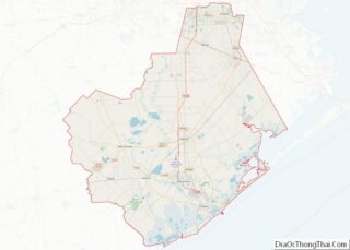
| State: | Texas |
| County: | Brazoria County |
| Elevation: | 20 ft (6 m) |
| Total Area: | 1.09 sq mi (2.83 km²) |
| Land Area: | 1.09 sq mi (2.83 km²) |
| Water Area: | 0.00 sq mi (0.00 km²) |
| Total Population: | 482 |
| Population Density: | 503.66/sq mi (194.42/km²) |
| ZIP code: | 77577 |
| Area code: | 281, 832 |
| FIPS code: | 4843120 |
| GNISfeature ID: | 1361569 |
| Website: | cityofliverpooltexas.com |
Online Interactive Map
Click on ![]() to view map in "full screen" mode.
to view map in "full screen" mode.
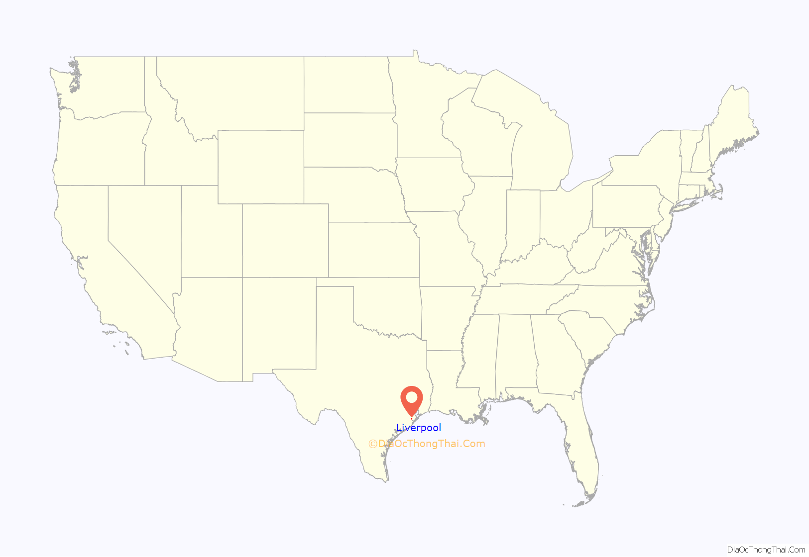
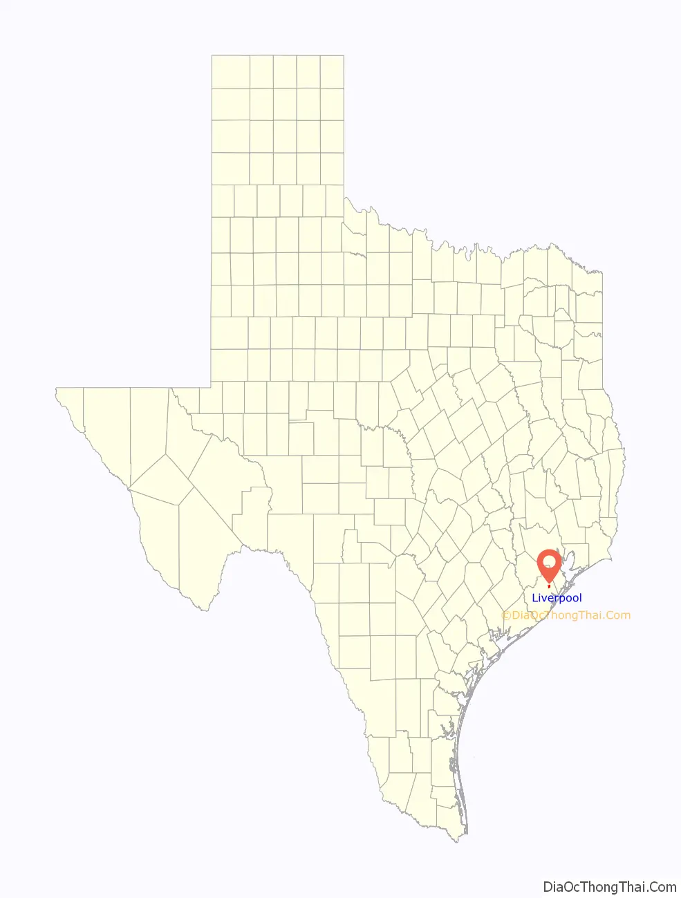
Liverpool location map. Where is Liverpool city?
History
In 1827, a trading post was set up at Liverpool. A settlement existed in 1834 and two years later a schoolteacher was hired. The town was formally established in 1837. It became a shipping point from Stephen F. Austin’s colony for wool, hides, and produce via Chocolate Bayou. A person called Commodore Nelson named the town after the English port Liverpool. A post office opened in the town in 1846, but closed in 1867. The population began to decline after the American Civil War until there were only 20 residents in 1884. Nevertheless, the post office reopened in 1879 and remained. By 1890 the population numbered 136. In 1906, the local whites-only schools counted three teachers and 48 students. By 1914, the town had grown to 400 residents and included a hotel and two general stores. The population decreased in the 1920s so that it was about 150 in 1966. By 1988 the population numbered 627, helped by the opening of a nearby Monsanto plant. The 1990 and 2000 censuses recorded around 400 residents each.
Historical marker at US Post Office
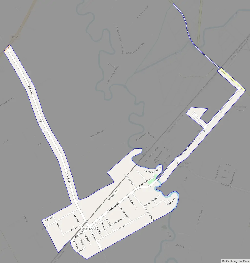
Liverpool Road Map
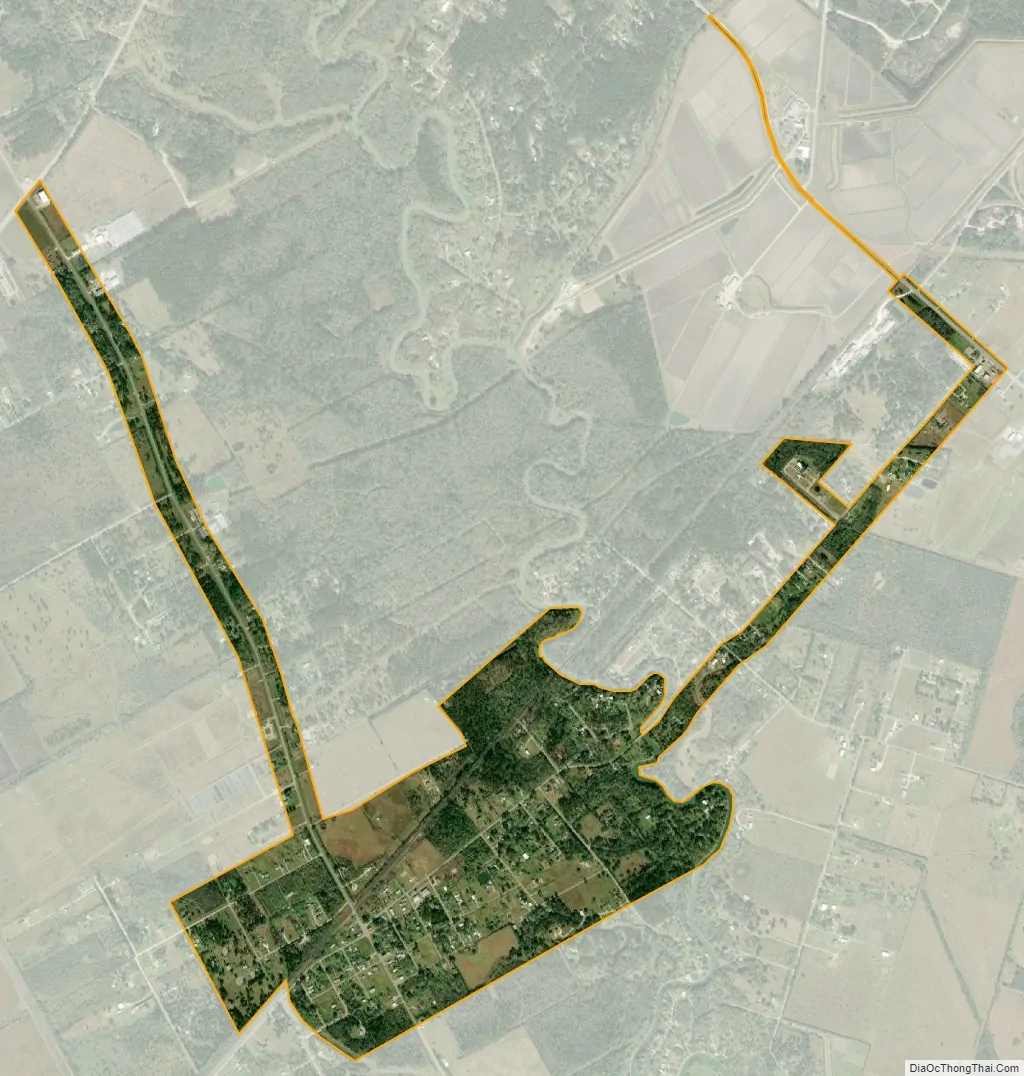
Liverpool city Satellite Map
Geography
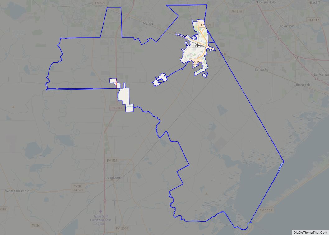
Liverpool is located in northeastern Brazoria County at 29°17′57″N 95°16′39″W / 29.29917°N 95.27750°W / 29.29917; -95.27750 (29.299272, –95.277470). It is bordered on the east by Chocolate Bayou. The city limits extend northwest on either side of Main Street for 2 miles (3 km) to reach Texas State Highway 35. From that point it is 14 miles (23 km) southwest to Angleton, the county seat, and 8 miles (13 km) northeast to the center of Alvin.
According to the United States Census Bureau, Liverpool has a total area of 1.1 square miles (2.8 km), all of it land.
CR 171 bridge over Chocolate Bayou
See also
Map of Texas State and its subdivision:- Anderson
- Andrews
- Angelina
- Aransas
- Archer
- Armstrong
- Atascosa
- Austin
- Bailey
- Bandera
- Bastrop
- Baylor
- Bee
- Bell
- Bexar
- Blanco
- Borden
- Bosque
- Bowie
- Brazoria
- Brazos
- Brewster
- Briscoe
- Brooks
- Brown
- Burleson
- Burnet
- Caldwell
- Calhoun
- Callahan
- Cameron
- Camp
- Carson
- Cass
- Castro
- Chambers
- Cherokee
- Childress
- Clay
- Cochran
- Coke
- Coleman
- Collin
- Collingsworth
- Colorado
- Comal
- Comanche
- Concho
- Cooke
- Coryell
- Cottle
- Crane
- Crockett
- Crosby
- Culberson
- Dallam
- Dallas
- Dawson
- Deaf Smith
- Delta
- Denton
- Dewitt
- Dickens
- Dimmit
- Donley
- Duval
- Eastland
- Ector
- Edwards
- El Paso
- Ellis
- Erath
- Falls
- Fannin
- Fayette
- Fisher
- Floyd
- Foard
- Fort Bend
- Franklin
- Freestone
- Frio
- Gaines
- Galveston
- Garza
- Gillespie
- Glasscock
- Goliad
- Gonzales
- Gray
- Grayson
- Gregg
- Grimes
- Guadalupe
- Hale
- Hall
- Hamilton
- Hansford
- Hardeman
- Hardin
- Harris
- Harrison
- Hartley
- Haskell
- Hays
- Hemphill
- Henderson
- Hidalgo
- Hill
- Hockley
- Hood
- Hopkins
- Houston
- Howard
- Hudspeth
- Hunt
- Hutchinson
- Irion
- Jack
- Jackson
- Jasper
- Jeff Davis
- Jefferson
- Jim Hogg
- Jim Wells
- Johnson
- Jones
- Karnes
- Kaufman
- Kendall
- Kenedy
- Kent
- Kerr
- Kimble
- King
- Kinney
- Kleberg
- Knox
- La Salle
- Lamar
- Lamb
- Lampasas
- Lavaca
- Lee
- Leon
- Liberty
- Limestone
- Lipscomb
- Live Oak
- Llano
- Loving
- Lubbock
- Lynn
- Madison
- Marion
- Martin
- Mason
- Matagorda
- Maverick
- McCulloch
- McLennan
- McMullen
- Medina
- Menard
- Midland
- Milam
- Mills
- Mitchell
- Montague
- Montgomery
- Moore
- Morris
- Motley
- Nacogdoches
- Navarro
- Newton
- Nolan
- Nueces
- Ochiltree
- Oldham
- Orange
- Palo Pinto
- Panola
- Parker
- Parmer
- Pecos
- Polk
- Potter
- Presidio
- Rains
- Randall
- Reagan
- Real
- Red River
- Reeves
- Refugio
- Roberts
- Robertson
- Rockwall
- Runnels
- Rusk
- Sabine
- San Augustine
- San Jacinto
- San Patricio
- San Saba
- Schleicher
- Scurry
- Shackelford
- Shelby
- Sherman
- Smith
- Somervell
- Starr
- Stephens
- Sterling
- Stonewall
- Sutton
- Swisher
- Tarrant
- Taylor
- Terrell
- Terry
- Throckmorton
- Titus
- Tom Green
- Travis
- Trinity
- Tyler
- Upshur
- Upton
- Uvalde
- Val Verde
- Van Zandt
- Victoria
- Walker
- Waller
- Ward
- Washington
- Webb
- Wharton
- Wheeler
- Wichita
- Wilbarger
- Willacy
- Williamson
- Wilson
- Winkler
- Wise
- Wood
- Yoakum
- Young
- Zapata
- Zavala
- Alabama
- Alaska
- Arizona
- Arkansas
- California
- Colorado
- Connecticut
- Delaware
- District of Columbia
- Florida
- Georgia
- Hawaii
- Idaho
- Illinois
- Indiana
- Iowa
- Kansas
- Kentucky
- Louisiana
- Maine
- Maryland
- Massachusetts
- Michigan
- Minnesota
- Mississippi
- Missouri
- Montana
- Nebraska
- Nevada
- New Hampshire
- New Jersey
- New Mexico
- New York
- North Carolina
- North Dakota
- Ohio
- Oklahoma
- Oregon
- Pennsylvania
- Rhode Island
- South Carolina
- South Dakota
- Tennessee
- Texas
- Utah
- Vermont
- Virginia
- Washington
- West Virginia
- Wisconsin
- Wyoming