Memphis is a city and the county seat of Hall County, Texas, United States. As of the 2010 census, the population was 2,290.
| Name: | Memphis city |
|---|---|
| LSAD Code: | 25 |
| LSAD Description: | city (suffix) |
| State: | Texas |
| County: | Hall County |
| Incorporated: | 1906 |
| Elevation: | 2,057 ft (627 m) |
| Total Area: | 2.24 sq mi (5.81 km²) |
| Land Area: | 2.24 sq mi (5.81 km²) |
| Water Area: | 0.00 sq mi (0.00 km²) |
| Total Population: | 2,290 |
| Population Density: | 896.61/sq mi (346.20/km²) |
| ZIP code: | 79245 |
| Area code: | 806 |
| FIPS code: | 4847616 |
| GNISfeature ID: | 1362609 |
Online Interactive Map
Click on ![]() to view map in "full screen" mode.
to view map in "full screen" mode.
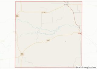
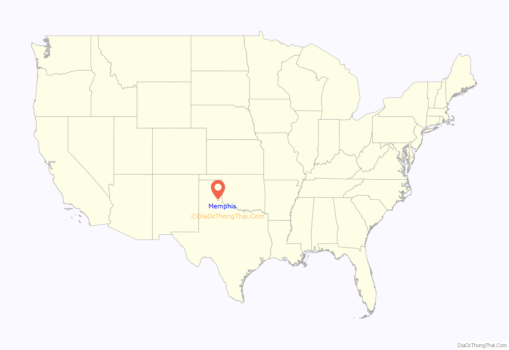
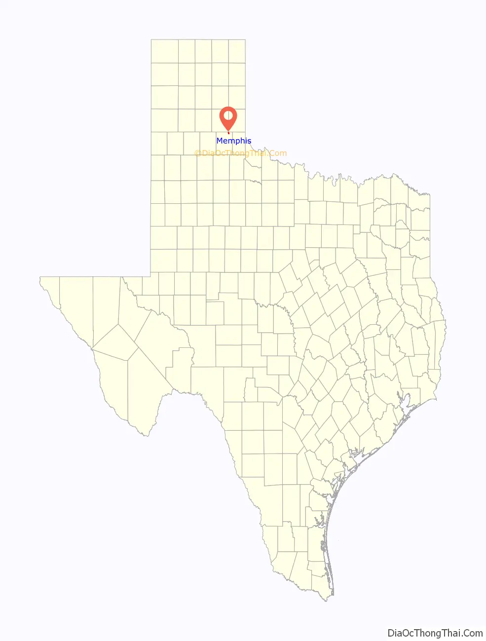
Memphis location map. Where is Memphis city?
History
Memphis, Texas, the county seat of Hall County, is at the junction of U.S. Highway 287, State Highway 256, and Farm Road 1547, in the northeastern part of the county. It started in 1889, when J. C. Montgomery purchased land for a townsite north of Salisbury on the Fort Worth and Denver City Railway. This land had been previously owned by W. H. Robertson, who had a dugout near Parker Creek. Montgomery and Robertson, with Rev. J. W. Brice and T. J. Woods, Jr., of Dallas, formed a townsite company and presented a plat early in January 1890. P. M. Kelly opened a law office. A rooming house (later the Memphis Hotel), a general store, a drugstore, and several residences were soon erected. For a time, the new town was without a name. Several suggestions were submitted to federal postal authorities, but with negative results. Finally, as the story goes, Reverend Brice, while in Austin, happened to see a letter addressed by accident to Memphis, Texas, rather than Tennessee, with the notation “no such town in Texas”. The name was submitted and accepted, and a post office was established on September 12, 1890, with Robertson as postmaster.
In the meantime, Hall County was being organized. Memphis was engaged in a heated county seat battle with neighboring Salisbury and Lakeview. Memphis won the election with a total of 84 votes. County officers were elected in June, and a school district was subsequently formed. Since Memphis was without a depot and trains did not stop there, certain citizens sought to remedy that situation by smearing the tracks with lye soap. A subsequent agreement was struck between town promoters and railroad officials. In 1891, a depot was built, and businesses were moved on wheels from Salisbury to the new county seat, where a courthouse of homemade bricks was constructed in 1892.
Memphis thus enjoyed a boom period. Two saloons, a bank, numerous stores, blacksmith shops, and livery stables attested to its role as a shipping and trading center for area ranchers and farmers. The Missionary Baptist Church was organized in Memphis; its minister Rev. J. L. Pyle began Baptist congregations throughout the county. Telephone service was first installed in 1901. In June 1906, the town was incorporated with a mayor-council form of city government. The Memphis Cotton Oil Mill was established in 1907. Memphis had at one time or another several newspapers, including the Hall County Record (1889–1893), the Hall County Herald (1890–1928), the Memphis Journal (1892–1894), the Memphis Times (1896), the Memphis Leader (1897–1899), the Hall County News (1897–1903), and the Memphis News (1928–1929). The only newspaper extant in 1986, the Memphis Democrat, was launched in 1908 and went through a succession of owners. By the 1920s, Memphis had a new brick-and-stone courthouse, modern utilities, a cotton compress, three hotels, brick school buildings, and a Carnegie Library. In 1922, the city’s Morning Side addition was founded east of the tracks as a residential area for blacks who labored in the cotton fields and mills. In 1935, E. M. Ewen and his wife formed the Hall County Old Settlers’ Reunion (later the Hall County Picnic Association). Four years later, they staged a rodeo as part of the annual two-day celebration.
Since the Great Depression era, Memphis has continued as a farm supply center. In 1986, the city had a cotton compress, gins, a grain elevator, two banks, eight churches, four public schools, a modern medical complex, two motels, several mercantile stores (including three wholesale houses), and a municipal airport northeast of town. In addition, Memphis is noted for its tree-lined streets, city park, one swimming pool, community center, and 50 blocks of brick paving laid in 1926. Brookhollow Country Club Lake, a private fishing lake with cabin sites, is six miles northeast of the city. Heritage Hall, which occupies the old First National Bank building on the square, contains local history displays and natural science exhibits. The population was 3,332 in 1960 and 3,352 in 1980. Memphis reported 81 businesses in 1984. United States Congressman Jack Hightower comes from Memphis. The route of the annual Cotton Boll Enduro, a 125-mile cross-country motorcycle event held in late October, begins and ends at Memphis. In 1990 Memphis had a population of 2,465. The population was 2,479 in 2000 and 2,290 in 2010.
The county was named after Warren D.C. Hall, who served as Secretary of War while Texas was a republic. He was a lawyer from North Carolina before coming to Texas.
A timeline of significant events in Memphis’ history:
1889: Land was bought along the Fort Worth and Denver City Railway
1890: Townsite platted, yet names were rejected by postal authorities until September of that year
1891: Memphis wins contested election for county seat against towns of Salisbury and Lakeview
1891: Depot built after Memphians kept putting soap on rails to stop trains
1892: Courthouse constructed
1901: Memphis gets telephone service
1906: Town is incorporated
1912: Memphis gets its own Carnegie Library
1923: New courthouse built
1926: 50 blocks of streets are paved with brick
2013 Civil rights case
In September 2013, a federal suit was filed by Laura Dutton, alleging that the cities of Estelline and Memphis, former Officer Jayson Fry and Memphis Police Chief Chris Jolly violated her Fourth Amendment rights against illegal search and seizure when she was arrested November 28, 2012, in Estelline on a felony money-laundering charge, seizing more than $29,000 from her pickup and illegally keeping $1,400 of her cash. The city of Estelline maintained no written records of past searches or seizures, yet traffic fines and forfeitures made up more than 89% of its gross revenues in fiscal year 2012. The cities and the officers denied her claims, but in July 2014, the city of Estelline and Hall County authorities settled with Dutton for $77,500.
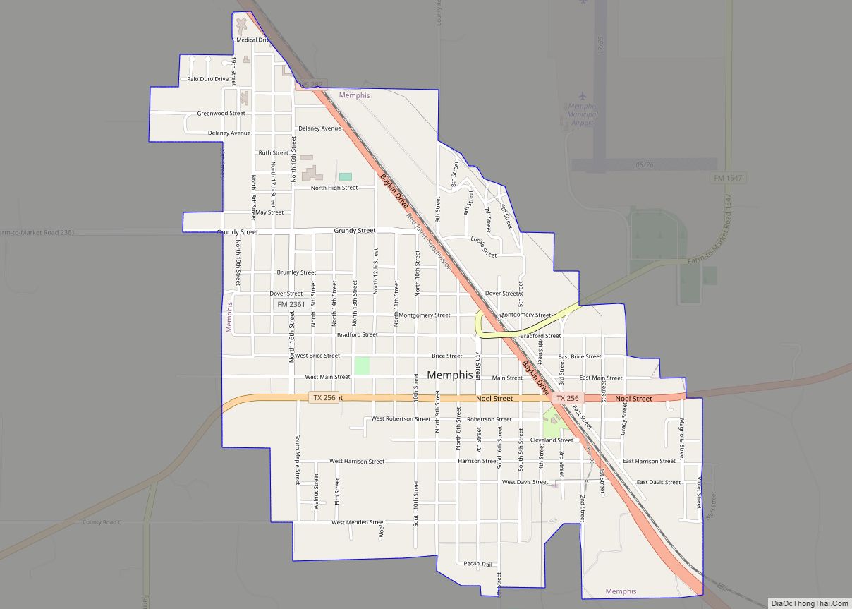
Memphis Road Map
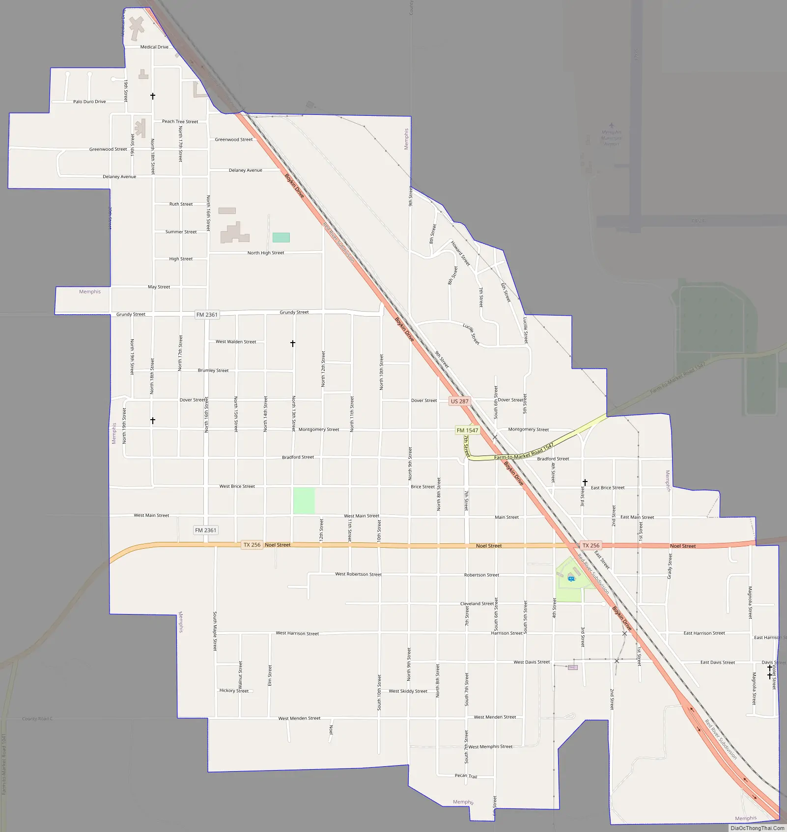
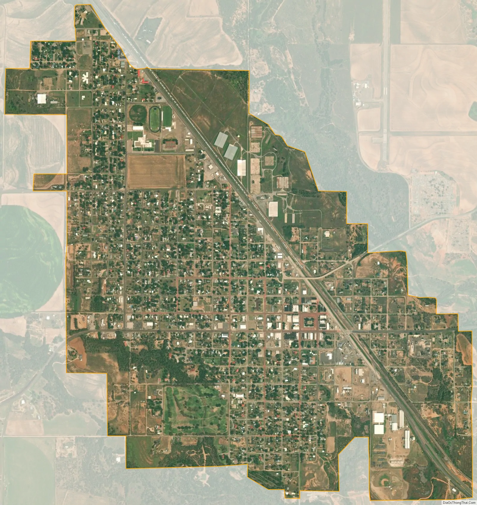
Memphis city Satellite Map
Geography
Memphis is located at 34°43′36″N 100°32′30″W / 34.72667°N 100.54167°W / 34.72667; -100.54167 (34.726716, –100.541560). According to the United States Census Bureau, the city has a total area of 2.2 square miles (5.7 km), all land.
Hall County Seat, Texas Panhandle
Hwy 287 and State Hwy 256,
28 miles SE of Clarendon
64 miles SE of Amarillo
29 miles NE of Childress
14 miles NE of Estelline,
Population: 2,290 (2010)
See also
Map of Texas State and its subdivision:- Anderson
- Andrews
- Angelina
- Aransas
- Archer
- Armstrong
- Atascosa
- Austin
- Bailey
- Bandera
- Bastrop
- Baylor
- Bee
- Bell
- Bexar
- Blanco
- Borden
- Bosque
- Bowie
- Brazoria
- Brazos
- Brewster
- Briscoe
- Brooks
- Brown
- Burleson
- Burnet
- Caldwell
- Calhoun
- Callahan
- Cameron
- Camp
- Carson
- Cass
- Castro
- Chambers
- Cherokee
- Childress
- Clay
- Cochran
- Coke
- Coleman
- Collin
- Collingsworth
- Colorado
- Comal
- Comanche
- Concho
- Cooke
- Coryell
- Cottle
- Crane
- Crockett
- Crosby
- Culberson
- Dallam
- Dallas
- Dawson
- Deaf Smith
- Delta
- Denton
- Dewitt
- Dickens
- Dimmit
- Donley
- Duval
- Eastland
- Ector
- Edwards
- El Paso
- Ellis
- Erath
- Falls
- Fannin
- Fayette
- Fisher
- Floyd
- Foard
- Fort Bend
- Franklin
- Freestone
- Frio
- Gaines
- Galveston
- Garza
- Gillespie
- Glasscock
- Goliad
- Gonzales
- Gray
- Grayson
- Gregg
- Grimes
- Guadalupe
- Hale
- Hall
- Hamilton
- Hansford
- Hardeman
- Hardin
- Harris
- Harrison
- Hartley
- Haskell
- Hays
- Hemphill
- Henderson
- Hidalgo
- Hill
- Hockley
- Hood
- Hopkins
- Houston
- Howard
- Hudspeth
- Hunt
- Hutchinson
- Irion
- Jack
- Jackson
- Jasper
- Jeff Davis
- Jefferson
- Jim Hogg
- Jim Wells
- Johnson
- Jones
- Karnes
- Kaufman
- Kendall
- Kenedy
- Kent
- Kerr
- Kimble
- King
- Kinney
- Kleberg
- Knox
- La Salle
- Lamar
- Lamb
- Lampasas
- Lavaca
- Lee
- Leon
- Liberty
- Limestone
- Lipscomb
- Live Oak
- Llano
- Loving
- Lubbock
- Lynn
- Madison
- Marion
- Martin
- Mason
- Matagorda
- Maverick
- McCulloch
- McLennan
- McMullen
- Medina
- Menard
- Midland
- Milam
- Mills
- Mitchell
- Montague
- Montgomery
- Moore
- Morris
- Motley
- Nacogdoches
- Navarro
- Newton
- Nolan
- Nueces
- Ochiltree
- Oldham
- Orange
- Palo Pinto
- Panola
- Parker
- Parmer
- Pecos
- Polk
- Potter
- Presidio
- Rains
- Randall
- Reagan
- Real
- Red River
- Reeves
- Refugio
- Roberts
- Robertson
- Rockwall
- Runnels
- Rusk
- Sabine
- San Augustine
- San Jacinto
- San Patricio
- San Saba
- Schleicher
- Scurry
- Shackelford
- Shelby
- Sherman
- Smith
- Somervell
- Starr
- Stephens
- Sterling
- Stonewall
- Sutton
- Swisher
- Tarrant
- Taylor
- Terrell
- Terry
- Throckmorton
- Titus
- Tom Green
- Travis
- Trinity
- Tyler
- Upshur
- Upton
- Uvalde
- Val Verde
- Van Zandt
- Victoria
- Walker
- Waller
- Ward
- Washington
- Webb
- Wharton
- Wheeler
- Wichita
- Wilbarger
- Willacy
- Williamson
- Wilson
- Winkler
- Wise
- Wood
- Yoakum
- Young
- Zapata
- Zavala
- Alabama
- Alaska
- Arizona
- Arkansas
- California
- Colorado
- Connecticut
- Delaware
- District of Columbia
- Florida
- Georgia
- Hawaii
- Idaho
- Illinois
- Indiana
- Iowa
- Kansas
- Kentucky
- Louisiana
- Maine
- Maryland
- Massachusetts
- Michigan
- Minnesota
- Mississippi
- Missouri
- Montana
- Nebraska
- Nevada
- New Hampshire
- New Jersey
- New Mexico
- New York
- North Carolina
- North Dakota
- Ohio
- Oklahoma
- Oregon
- Pennsylvania
- Rhode Island
- South Carolina
- South Dakota
- Tennessee
- Texas
- Utah
- Vermont
- Virginia
- Washington
- West Virginia
- Wisconsin
- Wyoming