Moore Station is a city in Henderson County, Texas, United States. The population was 160 at the 2020 census. It was founded in 1876 by Anderson Moore, a former “mulatto” slave.
| Name: | Moore Station city |
|---|---|
| LSAD Code: | 25 |
| LSAD Description: | city (suffix) |
| State: | Texas |
| County: | Henderson County |
| Elevation: | 420 ft (130 m) |
| Total Area: | 1.26 sq mi (3.27 km²) |
| Land Area: | 1.26 sq mi (3.27 km²) |
| Water Area: | 0.00 sq mi (0.00 km²) |
| Total Population: | 160 |
| Population Density: | 174.33/sq mi (67.32/km²) |
| ZIP code: | 75770 |
| Area code: | 903 |
| FIPS code: | 4849272 |
| GNISfeature ID: | 1341888 |
Online Interactive Map
Click on ![]() to view map in "full screen" mode.
to view map in "full screen" mode.
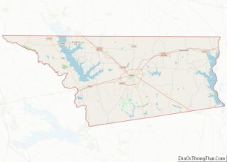
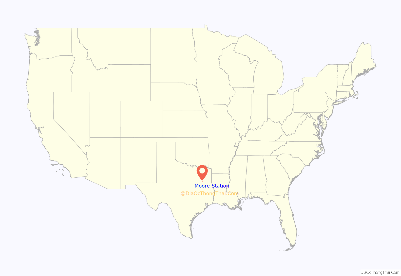
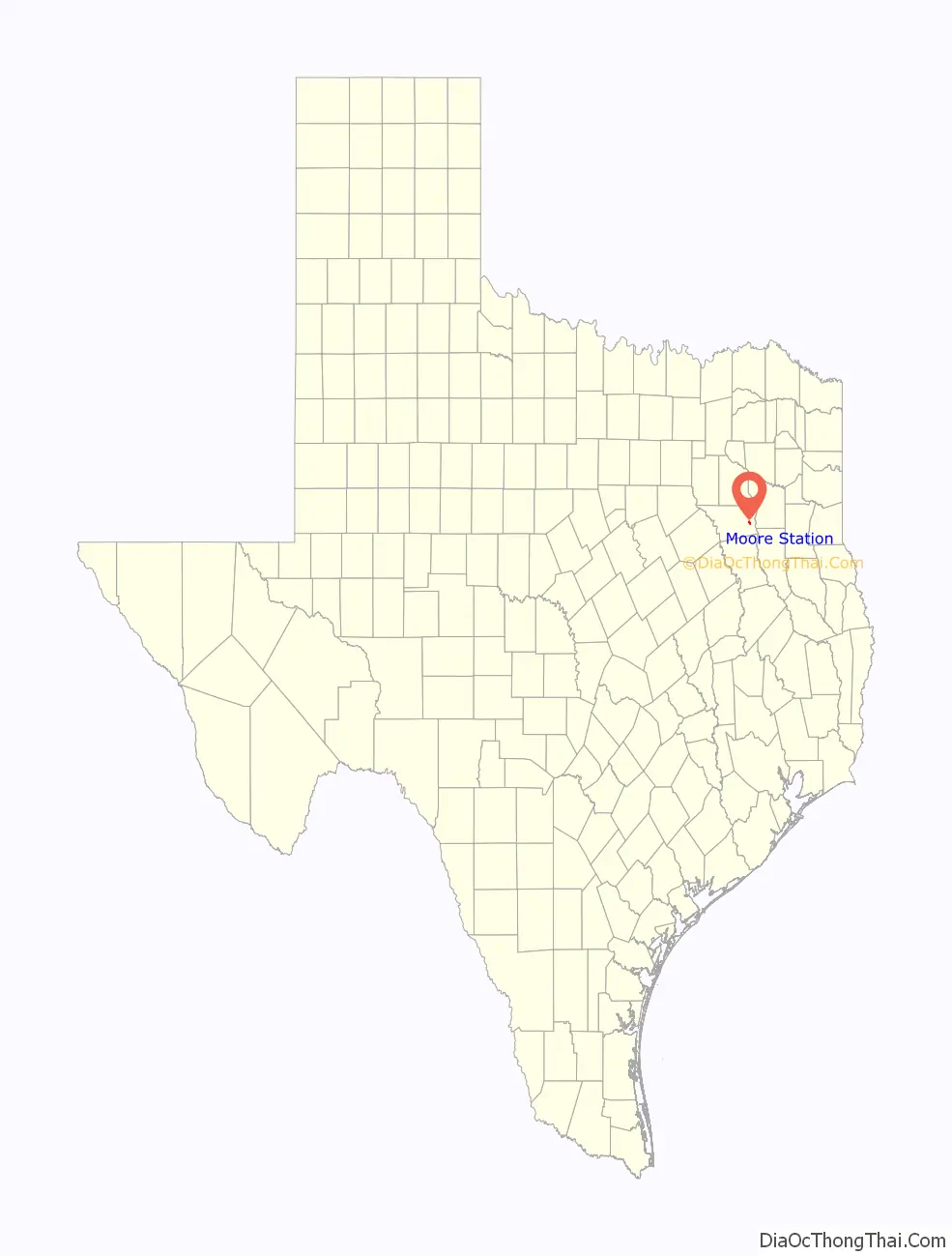
Moore Station location map. Where is Moore Station city?
History
Anderson and Lucinda Moore, for whom the town is believed to have been named, were a pioneer family in the area; according to one source, they were former slaves. In 1876 they donated a plot of land for a Methodist church and for a school. The church and school made up the original Moore Station. Many freed slaves moved to the area from nearby Fincastle after slavery to purchase land and enjoy their newfound freedom. From the 1870 census the following were residents of the area:
- Ralph Calhoun, Martha Calhoun, with children Harriath Calhoun, William Calhoun, Mahalia Calhoun, Sallie Calhoun
- Anderson Moore, Lucinda Moore, with children Rovana and Susan Moore
- Hannah Moore, grandchildren George Peet, John Mills, Alzera Mills
- Flora Dickinson, with children Joshua and Sara Dickinson
- James and Ghana Brownfield, with children Lucinda, Mattie and Nettie
- Addison Cofer and Mary Jane Larkin, with children Addison Cofer Jr. , Norton Cofer, and Omega Cofer
After emancipation freedman began to sharecrop with their former masters in communities like Fincastle, Pleasant Ridge and New York. Around 1872 they soon began to leave behind former plantations like Crossroads, Flat Creek, Stockard and such, and former masters such as Ratliff, Faulk, Wofford and Coleman. They began to purchase land in the Moore Station area, including the Andersons, Cofers, Douglases and Hightowers.
These slaves were brought into Texas from South Carolina, Alabama and Georgia by the pioneer families. These pioneer families were descendants of Huguenots who were escaping religious persecution in Europe. Some were descendants of the founding fathers, families like John O. Bullard, William Weatherford, Lachlan Durant, the Faulk brothers and others who migrated into the Deep South, which was Native American in the 1700s, to uproot tribes like the Creek and Seminole people.
In order to get a foothold into the deep South, some married into the tribes and began to raise families. They established outposts like Fort Mims and Little Tallassee in Alabama. This action later led to the infamous Trail of Tears. Most of the population of present-day Moore Station are descendants of their slaves such as Lousia Durant, Addison/Adderson Cofer and Ralph Calhoun.
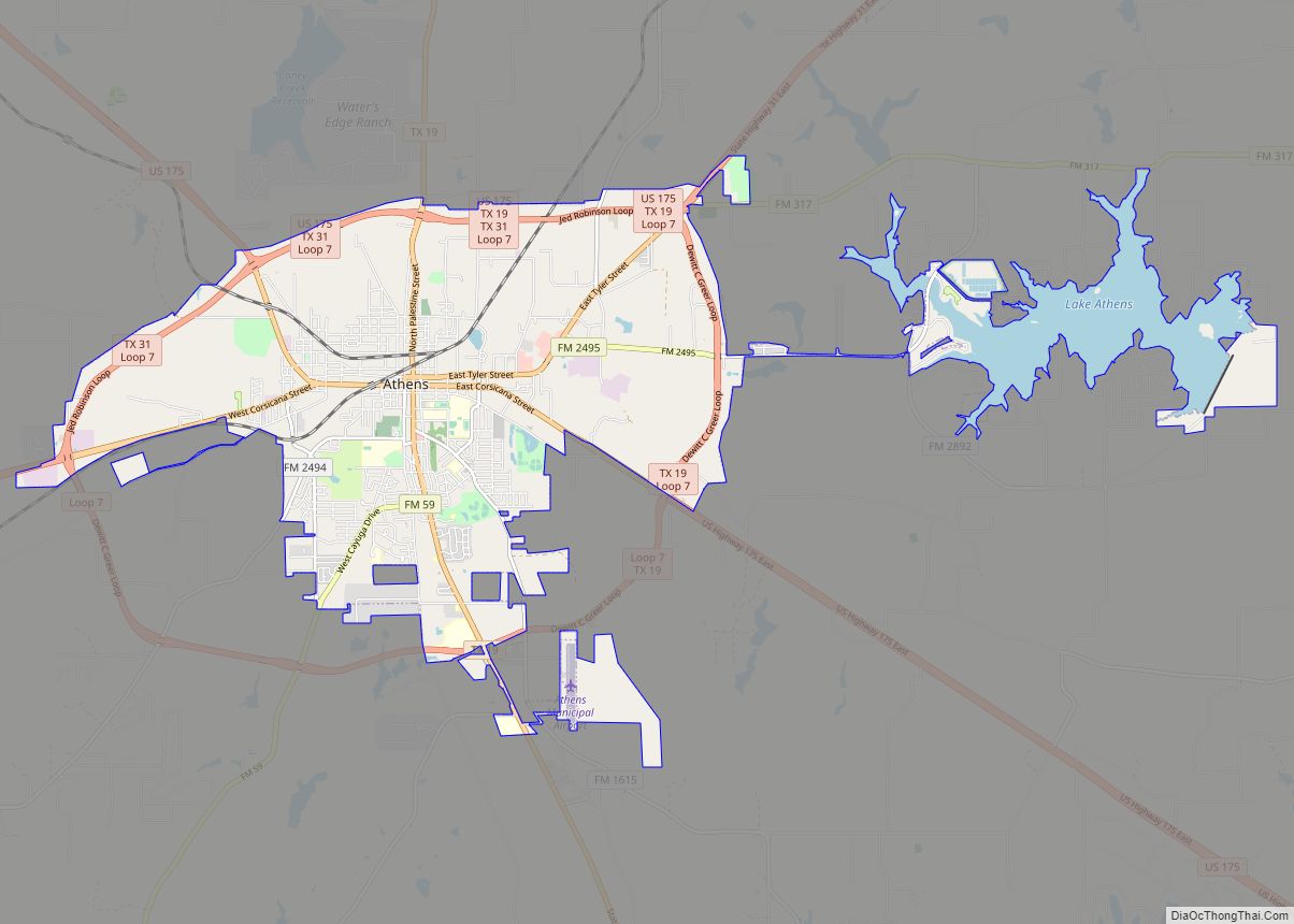
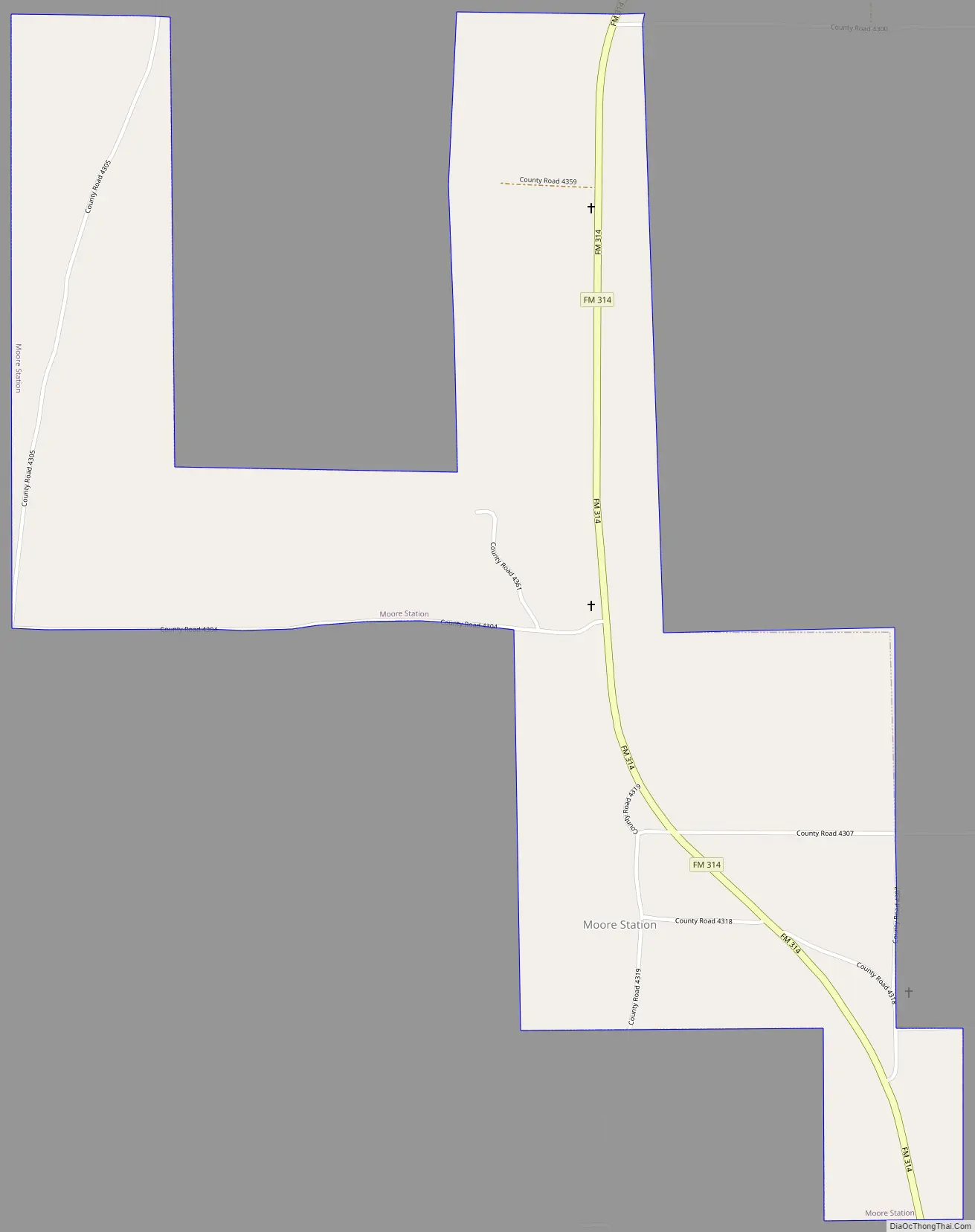
Moore Station Road Map
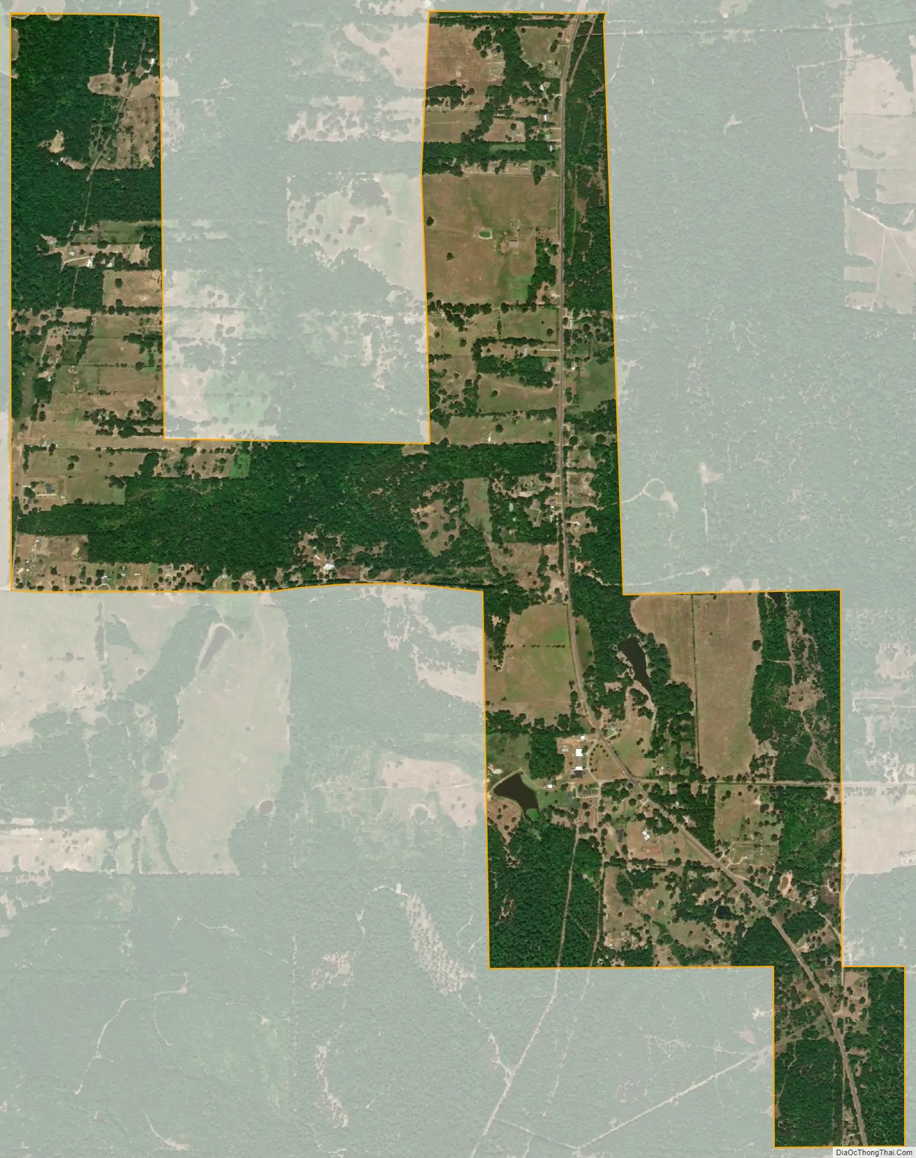
Moore Station city Satellite Map
Geography
Moore Station is located in eastern Henderson County at 32°11′14″N 95°33′47″W / 32.18722°N 95.56306°W / 32.18722; -95.56306 (32.187284, –95.562964), along Farm Road 314. It is 10 miles (16 km) south of Brownsboro and 9 miles (14 km) north of Poynor. Athens, the county seat, is 20 miles (32 km) to the west.
According to the United States Census Bureau, Moore Station has a total area of 1.3 square miles (3.3 km), all of it land.
See also
Map of Texas State and its subdivision:- Anderson
- Andrews
- Angelina
- Aransas
- Archer
- Armstrong
- Atascosa
- Austin
- Bailey
- Bandera
- Bastrop
- Baylor
- Bee
- Bell
- Bexar
- Blanco
- Borden
- Bosque
- Bowie
- Brazoria
- Brazos
- Brewster
- Briscoe
- Brooks
- Brown
- Burleson
- Burnet
- Caldwell
- Calhoun
- Callahan
- Cameron
- Camp
- Carson
- Cass
- Castro
- Chambers
- Cherokee
- Childress
- Clay
- Cochran
- Coke
- Coleman
- Collin
- Collingsworth
- Colorado
- Comal
- Comanche
- Concho
- Cooke
- Coryell
- Cottle
- Crane
- Crockett
- Crosby
- Culberson
- Dallam
- Dallas
- Dawson
- Deaf Smith
- Delta
- Denton
- Dewitt
- Dickens
- Dimmit
- Donley
- Duval
- Eastland
- Ector
- Edwards
- El Paso
- Ellis
- Erath
- Falls
- Fannin
- Fayette
- Fisher
- Floyd
- Foard
- Fort Bend
- Franklin
- Freestone
- Frio
- Gaines
- Galveston
- Garza
- Gillespie
- Glasscock
- Goliad
- Gonzales
- Gray
- Grayson
- Gregg
- Grimes
- Guadalupe
- Hale
- Hall
- Hamilton
- Hansford
- Hardeman
- Hardin
- Harris
- Harrison
- Hartley
- Haskell
- Hays
- Hemphill
- Henderson
- Hidalgo
- Hill
- Hockley
- Hood
- Hopkins
- Houston
- Howard
- Hudspeth
- Hunt
- Hutchinson
- Irion
- Jack
- Jackson
- Jasper
- Jeff Davis
- Jefferson
- Jim Hogg
- Jim Wells
- Johnson
- Jones
- Karnes
- Kaufman
- Kendall
- Kenedy
- Kent
- Kerr
- Kimble
- King
- Kinney
- Kleberg
- Knox
- La Salle
- Lamar
- Lamb
- Lampasas
- Lavaca
- Lee
- Leon
- Liberty
- Limestone
- Lipscomb
- Live Oak
- Llano
- Loving
- Lubbock
- Lynn
- Madison
- Marion
- Martin
- Mason
- Matagorda
- Maverick
- McCulloch
- McLennan
- McMullen
- Medina
- Menard
- Midland
- Milam
- Mills
- Mitchell
- Montague
- Montgomery
- Moore
- Morris
- Motley
- Nacogdoches
- Navarro
- Newton
- Nolan
- Nueces
- Ochiltree
- Oldham
- Orange
- Palo Pinto
- Panola
- Parker
- Parmer
- Pecos
- Polk
- Potter
- Presidio
- Rains
- Randall
- Reagan
- Real
- Red River
- Reeves
- Refugio
- Roberts
- Robertson
- Rockwall
- Runnels
- Rusk
- Sabine
- San Augustine
- San Jacinto
- San Patricio
- San Saba
- Schleicher
- Scurry
- Shackelford
- Shelby
- Sherman
- Smith
- Somervell
- Starr
- Stephens
- Sterling
- Stonewall
- Sutton
- Swisher
- Tarrant
- Taylor
- Terrell
- Terry
- Throckmorton
- Titus
- Tom Green
- Travis
- Trinity
- Tyler
- Upshur
- Upton
- Uvalde
- Val Verde
- Van Zandt
- Victoria
- Walker
- Waller
- Ward
- Washington
- Webb
- Wharton
- Wheeler
- Wichita
- Wilbarger
- Willacy
- Williamson
- Wilson
- Winkler
- Wise
- Wood
- Yoakum
- Young
- Zapata
- Zavala
- Alabama
- Alaska
- Arizona
- Arkansas
- California
- Colorado
- Connecticut
- Delaware
- District of Columbia
- Florida
- Georgia
- Hawaii
- Idaho
- Illinois
- Indiana
- Iowa
- Kansas
- Kentucky
- Louisiana
- Maine
- Maryland
- Massachusetts
- Michigan
- Minnesota
- Mississippi
- Missouri
- Montana
- Nebraska
- Nevada
- New Hampshire
- New Jersey
- New Mexico
- New York
- North Carolina
- North Dakota
- Ohio
- Oklahoma
- Oregon
- Pennsylvania
- Rhode Island
- South Carolina
- South Dakota
- Tennessee
- Texas
- Utah
- Vermont
- Virginia
- Washington
- West Virginia
- Wisconsin
- Wyoming