Mustang is a town in Navarro County, Texas, United States. The population was zero at the 2020 census. In December 2021, Mark Cuban, entrepreneur and owner of the Dallas Mavericks, purchased the 77-acre (31 ha) town for roughly $2 million.
| Name: | Mustang town |
|---|---|
| LSAD Code: | 43 |
| LSAD Description: | town (suffix) |
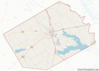
| State: | Texas |
| County: | Navarro County |
| Elevation: | 390 ft (119 m) |
| Total Area: | 0.13 sq mi (0.32 km²) |
| Land Area: | 0.12 sq mi (0.32 km²) |
| Water Area: | 0.00 sq mi (0.01 km²) |
| Total Population: | 0 |
| FIPS code: | 4850184 |
| GNISfeature ID: | 1388614 |
Online Interactive Map
Click on ![]() to view map in "full screen" mode.
to view map in "full screen" mode.
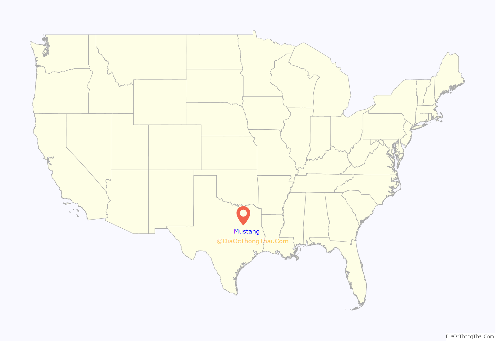
Mustang location map. Where is Mustang town?
History
Mustang was incorporated in 1973 for the purpose of selling alcohol in what was then a dry Navarro County. The incorporation effort was led by partners William “Bill” McKie, a former Corsicana city attorney, and Harold “Mack” McElhenney, a businessman. On October 30, 1973, the town approved beer sales. In a March 25, 1975, election, residents voted 20–0 in favor of selling hard liquor, as well as mixed beverages. Mustang had a population of 12 in the 1980 Census, which grew to 35 in 1990. By the mid-1990s, the town lost its status as the primary alcohol stop in the county, as other nearby communities began to repeal their blue laws.
The population of Mustang rose to 47 in 2000. Town founder Bill McKie negotiated a deal to sell Mustang to Tommy Sinclair, who leased a club in the community, on June 5, 2005, for $600,000. The transaction was not completed, however, and Sinclair filed a lawsuit in October 2005 for the right to buy the property. McKie died on November 11, 2005, and his wife Marsha took over legal proceedings on her late husband’s behalf. Since McKie’s death, legal wrangling over ownership of the town and financial issues have plagued Mustang. In November 2006, the city of Angus threatened to cut off water service to the community over an unpaid bill that totaled $3,400. Mrs. McKie, acting on the town’s behalf, personally paid the bill. The case over ownership went back to court in April 2007. Four months later, Sinclair was given possession of Mustang, but not the deed. He promptly evicted many of the town council, as well as the city secretary and fire chief. The evictions went to court in November 2007 and a majority of the council left town, but refused to resign their posts. In February 2008, the two council members living in residence called for an election to be held that coming May. The town’s disputed ownership status led to the holding of two separate council elections on May 10, 2008. The first election, endorsed by Tommy Sinclair, elected a mayor and five aldermen. The vote was canvassed on May 17. In the second called election, three aldermen positions were left open. Those results were canvassed on May 14. Eight votes were cast; six votes in one election and two in the other. Both governments claimed legitimacy.
Tommy Sinclair and two others were indicted on June 25, 2009, by a Navarro County grand jury in connection with the October 1, 2008, death of a Houston man after an alleged altercation at his cabaret in Mustang.
The Dallas Morning News reported in December 2021 that billionaire Mark Cuban purchased the entire town for around $2 million. The report indicated that a previous attempt to sell the town for $4 million failed to attract any buyers. Cuban stated that he had made the purchase to help a friend who needed to sell, and that he did not have any immediate plans for the property.
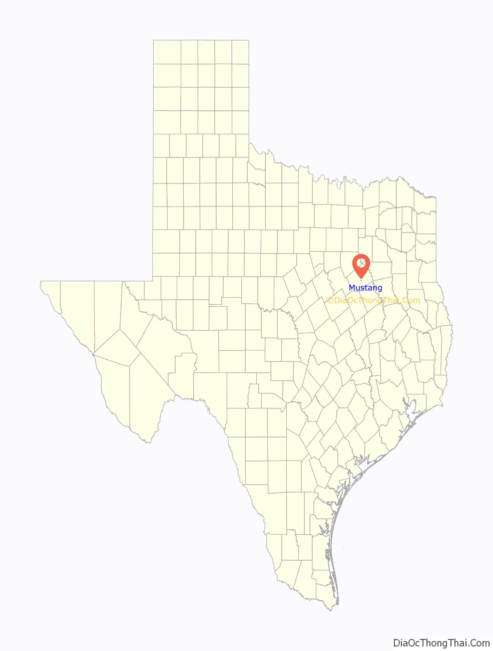
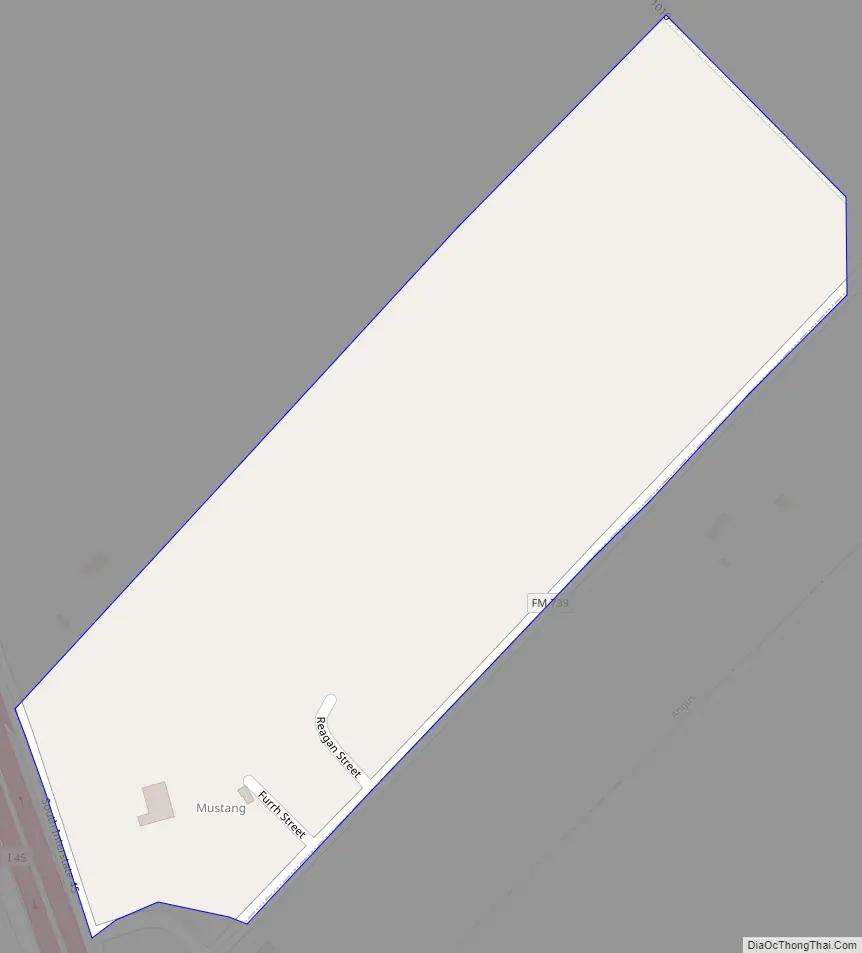
Mustang Road Map
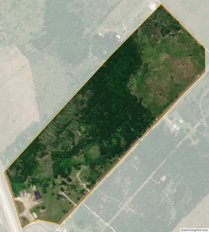
Mustang city Satellite Map
Geography
Mustang is located at 32°00′45″N 96°25′52″W / 32.012629°N 96.431178°W / 32.012629; -96.431178 (32.012629, –96.431178). It is situated at the northeast corner of the junction of Interstate 45 and FM 739 in central Navarro County.
According to the United States Census Bureau, the town has a total area of 0.1 square miles (0.26 km), all of it land.
See also
Map of Texas State and its subdivision:- Anderson
- Andrews
- Angelina
- Aransas
- Archer
- Armstrong
- Atascosa
- Austin
- Bailey
- Bandera
- Bastrop
- Baylor
- Bee
- Bell
- Bexar
- Blanco
- Borden
- Bosque
- Bowie
- Brazoria
- Brazos
- Brewster
- Briscoe
- Brooks
- Brown
- Burleson
- Burnet
- Caldwell
- Calhoun
- Callahan
- Cameron
- Camp
- Carson
- Cass
- Castro
- Chambers
- Cherokee
- Childress
- Clay
- Cochran
- Coke
- Coleman
- Collin
- Collingsworth
- Colorado
- Comal
- Comanche
- Concho
- Cooke
- Coryell
- Cottle
- Crane
- Crockett
- Crosby
- Culberson
- Dallam
- Dallas
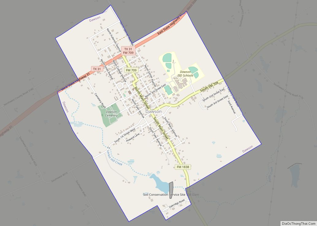
- Dawson
- Deaf Smith
- Delta
- Denton
- Dewitt
- Dickens
- Dimmit
- Donley
- Duval
- Eastland
- Ector
- Edwards
- El Paso
- Ellis
- Erath
- Falls
- Fannin
- Fayette
- Fisher
- Floyd
- Foard
- Fort Bend
- Franklin
- Freestone
- Frio
- Gaines
- Galveston
- Garza
- Gillespie
- Glasscock
- Goliad
- Gonzales
- Gray
- Grayson
- Gregg
- Grimes
- Guadalupe
- Hale
- Hall
- Hamilton
- Hansford
- Hardeman
- Hardin
- Harris
- Harrison
- Hartley
- Haskell
- Hays
- Hemphill
- Henderson
- Hidalgo
- Hill
- Hockley
- Hood
- Hopkins
- Houston
- Howard
- Hudspeth
- Hunt
- Hutchinson
- Irion
- Jack
- Jackson
- Jasper
- Jeff Davis
- Jefferson
- Jim Hogg
- Jim Wells
- Johnson
- Jones
- Karnes
- Kaufman
- Kendall
- Kenedy
- Kent
- Kerr
- Kimble
- King
- Kinney
- Kleberg
- Knox
- La Salle
- Lamar
- Lamb
- Lampasas
- Lavaca
- Lee
- Leon
- Liberty
- Limestone
- Lipscomb
- Live Oak
- Llano
- Loving
- Lubbock
- Lynn
- Madison
- Marion
- Martin
- Mason
- Matagorda
- Maverick
- McCulloch
- McLennan
- McMullen
- Medina
- Menard
- Midland
- Milam
- Mills
- Mitchell
- Montague
- Montgomery
- Moore
- Morris
- Motley
- Nacogdoches
- Navarro
- Newton
- Nolan
- Nueces
- Ochiltree
- Oldham
- Orange
- Palo Pinto
- Panola
- Parker
- Parmer
- Pecos
- Polk
- Potter
- Presidio
- Rains
- Randall
- Reagan
- Real
- Red River
- Reeves
- Refugio
- Roberts
- Robertson
- Rockwall
- Runnels
- Rusk
- Sabine
- San Augustine
- San Jacinto
- San Patricio
- San Saba
- Schleicher
- Scurry
- Shackelford
- Shelby
- Sherman
- Smith
- Somervell
- Starr
- Stephens
- Sterling
- Stonewall
- Sutton
- Swisher
- Tarrant
- Taylor
- Terrell
- Terry
- Throckmorton
- Titus
- Tom Green
- Travis
- Trinity
- Tyler
- Upshur
- Upton
- Uvalde
- Val Verde
- Van Zandt
- Victoria
- Walker
- Waller
- Ward
- Washington
- Webb
- Wharton
- Wheeler
- Wichita
- Wilbarger
- Willacy
- Williamson
- Wilson
- Winkler
- Wise
- Wood
- Yoakum
- Young
- Zapata
- Zavala
- Alabama
- Alaska
- Arizona
- Arkansas
- California
- Colorado
- Connecticut
- Delaware
- District of Columbia
- Florida
- Georgia
- Hawaii
- Idaho
- Illinois
- Indiana
- Iowa
- Kansas
- Kentucky
- Louisiana
- Maine
- Maryland
- Massachusetts
- Michigan
- Minnesota
- Mississippi
- Missouri
- Montana
- Nebraska
- Nevada
- New Hampshire
- New Jersey
- New Mexico
- New York
- North Carolina
- North Dakota
- Ohio
- Oklahoma
- Oregon
- Pennsylvania
- Rhode Island
- South Carolina
- South Dakota
- Tennessee
- Texas
- Utah
- Vermont
- Virginia
- Washington
- West Virginia
- Wisconsin
- Wyoming