Nazareth is a city in Castro County, Texas, United States. The population was 311 at the 2010 census, down from 356 at the 2000 census.
| Name: | Nazareth city |
|---|---|
| LSAD Code: | 25 |
| LSAD Description: | city (suffix) |
| State: | Texas |
| County: | Castro County |
| Elevation: | 3,760 ft (1,150 m) |
| Total Area: | 0.36 sq mi (0.94 km²) |
| Land Area: | 0.36 sq mi (0.94 km²) |
| Water Area: | 0.00 sq mi (0.00 km²) |
| Total Population: | 311 |
| Population Density: | 801.65/sq mi (309.36/km²) |
| ZIP code: | 79063 |
| Area code: | 806 |
| FIPS code: | 4850496 |
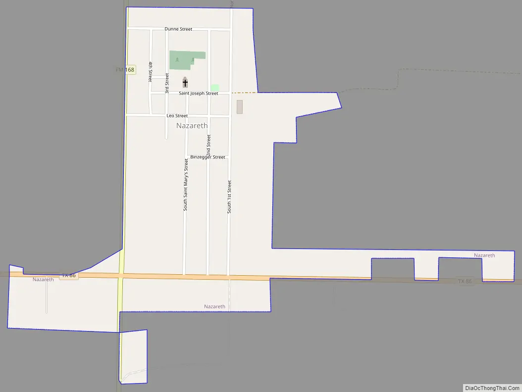
Online Interactive Map
Click on ![]() to view map in "full screen" mode.
to view map in "full screen" mode.
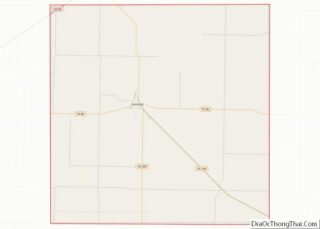
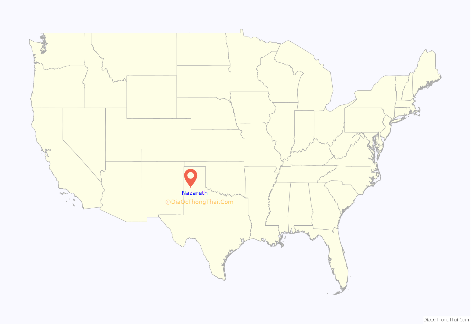
Nazareth location map. Where is Nazareth city?
History
The town of Nazareth was established through the efforts of a Catholic priest, Joseph Reisdorff, who moved to the site in 1902 with four farmers interested in purchasing land in the area. Father Reisdorff named his colony after the biblical Nazareth and advertised for settlers in several midwestern German Catholic newspapers. By September 1902 the first settlers had begun to arrive. A post office was established in 1903, and later that year the Catholic community finished building its first church. Nazareth had 71 residents by January 1904, and the town was platted latter that year. By 1905, in addition to the church, the settlement included a blacksmith shop, a store, and a school; when the community’s cemetery was consecrated in 1906, it became the only Catholic cemetery in the area. For many years local church officials supplied what little government the community desired.
In 1914 Nazareth had an estimated 50 residents, and about 150 people were living there by 1927. During the Dust Bowl of the 1930s the area was swept by huge dust storms that uprooted crops and made farming unprofitable; in 1933, the town was estimated to have only 50 residents. Agriculture in Castro County revived during the 1940s, however, and by 1941 about 200 people were living there. The population fluctuated during the 1950s and 1960, dropping to about 75 in 1955, then rising to an estimated 275 by 1964; the census found 274 people living in the town in 1970 and 299 in 1980. As late as the mid-1980s about 85 percent of the town’s residents were Catholics, and church activities helped to bond the community together. In 1990 the population stood at 293.
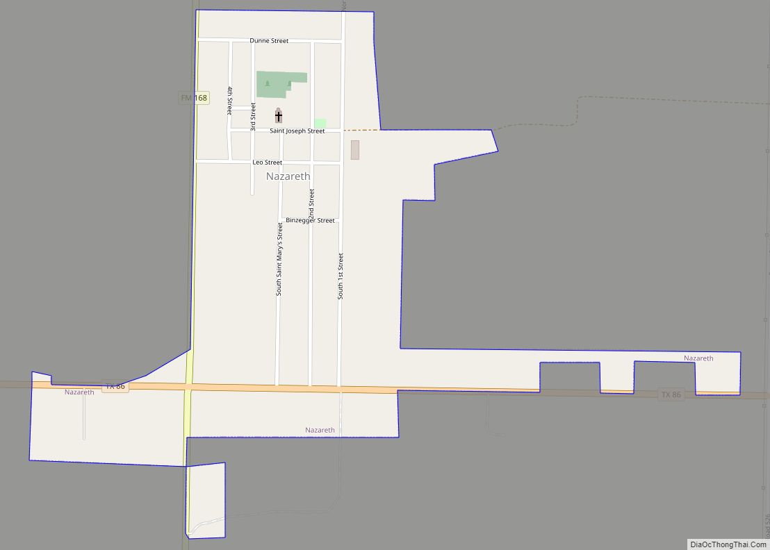
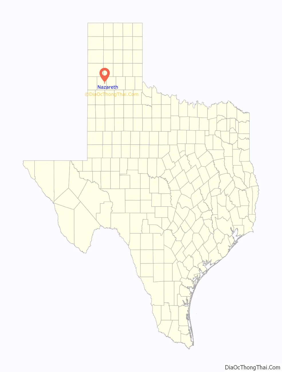
Nazareth Road Map
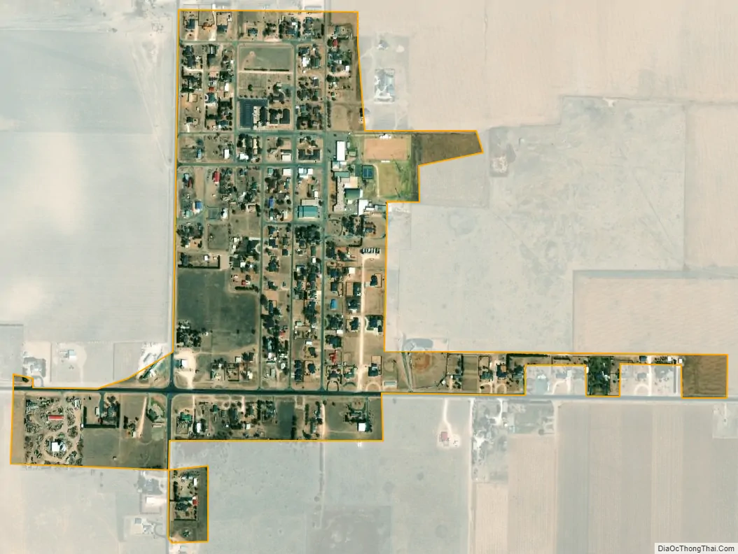
Nazareth city Satellite Map
Geography
Nazareth is located in eastern Castro County on the high plains of the Llano Estacado at 34°32′39″N 102°06′10″W / 34.54417°N 102.10278°W / 34.54417; -102.10278. It is 12 miles (19 km) east of Dimmitt, the county seat, and 20 miles (32 km) west of Tulia.
According to the United States Census Bureau, Nazareth has a total area of 0.36 square miles (0.94 km), all of it land.
See also
Map of Texas State and its subdivision:- Anderson
- Andrews
- Angelina
- Aransas
- Archer
- Armstrong
- Atascosa
- Austin
- Bailey
- Bandera
- Bastrop
- Baylor
- Bee
- Bell
- Bexar
- Blanco
- Borden
- Bosque
- Bowie
- Brazoria
- Brazos
- Brewster
- Briscoe
- Brooks
- Brown
- Burleson
- Burnet
- Caldwell
- Calhoun
- Callahan
- Cameron
- Camp
- Carson
- Cass
- Castro
- Chambers
- Cherokee
- Childress
- Clay
- Cochran
- Coke
- Coleman
- Collin
- Collingsworth
- Colorado
- Comal
- Comanche
- Concho
- Cooke
- Coryell
- Cottle
- Crane
- Crockett
- Crosby
- Culberson
- Dallam
- Dallas
- Dawson
- Deaf Smith
- Delta
- Denton
- Dewitt
- Dickens
- Dimmit
- Donley
- Duval
- Eastland
- Ector
- Edwards
- El Paso
- Ellis
- Erath
- Falls
- Fannin
- Fayette
- Fisher
- Floyd
- Foard
- Fort Bend
- Franklin
- Freestone
- Frio
- Gaines
- Galveston
- Garza
- Gillespie
- Glasscock
- Goliad
- Gonzales
- Gray
- Grayson
- Gregg
- Grimes
- Guadalupe
- Hale
- Hall
- Hamilton
- Hansford
- Hardeman
- Hardin
- Harris
- Harrison
- Hartley
- Haskell
- Hays
- Hemphill
- Henderson
- Hidalgo
- Hill
- Hockley
- Hood
- Hopkins
- Houston
- Howard
- Hudspeth
- Hunt
- Hutchinson
- Irion
- Jack
- Jackson
- Jasper
- Jeff Davis
- Jefferson
- Jim Hogg
- Jim Wells
- Johnson
- Jones
- Karnes
- Kaufman
- Kendall
- Kenedy
- Kent
- Kerr
- Kimble
- King
- Kinney
- Kleberg
- Knox
- La Salle
- Lamar
- Lamb
- Lampasas
- Lavaca
- Lee
- Leon
- Liberty
- Limestone
- Lipscomb
- Live Oak
- Llano
- Loving
- Lubbock
- Lynn
- Madison
- Marion
- Martin
- Mason
- Matagorda
- Maverick
- McCulloch
- McLennan
- McMullen
- Medina
- Menard
- Midland
- Milam
- Mills
- Mitchell
- Montague
- Montgomery
- Moore
- Morris
- Motley
- Nacogdoches
- Navarro
- Newton
- Nolan
- Nueces
- Ochiltree
- Oldham
- Orange
- Palo Pinto
- Panola
- Parker
- Parmer
- Pecos
- Polk
- Potter
- Presidio
- Rains
- Randall
- Reagan
- Real
- Red River
- Reeves
- Refugio
- Roberts
- Robertson
- Rockwall
- Runnels
- Rusk
- Sabine
- San Augustine
- San Jacinto
- San Patricio
- San Saba
- Schleicher
- Scurry
- Shackelford
- Shelby
- Sherman
- Smith
- Somervell
- Starr
- Stephens
- Sterling
- Stonewall
- Sutton
- Swisher
- Tarrant
- Taylor
- Terrell
- Terry
- Throckmorton
- Titus
- Tom Green
- Travis
- Trinity
- Tyler
- Upshur
- Upton
- Uvalde
- Val Verde
- Van Zandt
- Victoria
- Walker
- Waller
- Ward
- Washington
- Webb
- Wharton
- Wheeler
- Wichita
- Wilbarger
- Willacy
- Williamson
- Wilson
- Winkler
- Wise
- Wood
- Yoakum
- Young
- Zapata
- Zavala
- Alabama
- Alaska
- Arizona
- Arkansas
- California
- Colorado
- Connecticut
- Delaware
- District of Columbia
- Florida
- Georgia
- Hawaii
- Idaho
- Illinois
- Indiana
- Iowa
- Kansas
- Kentucky
- Louisiana
- Maine
- Maryland
- Massachusetts
- Michigan
- Minnesota
- Mississippi
- Missouri
- Montana
- Nebraska
- Nevada
- New Hampshire
- New Jersey
- New Mexico
- New York
- North Carolina
- North Dakota
- Ohio
- Oklahoma
- Oregon
- Pennsylvania
- Rhode Island
- South Carolina
- South Dakota
- Tennessee
- Texas
- Utah
- Vermont
- Virginia
- Washington
- West Virginia
- Wisconsin
- Wyoming