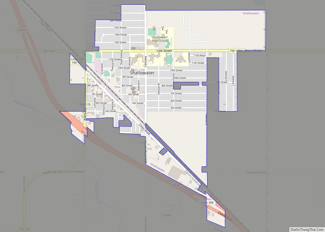
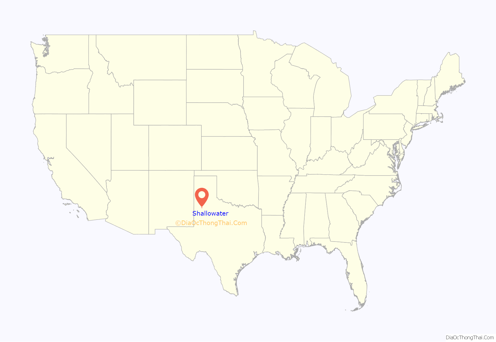
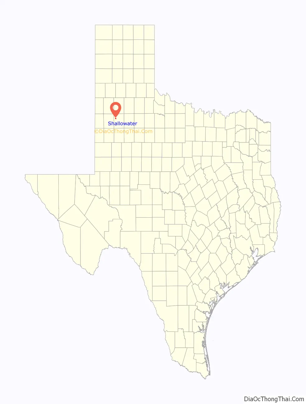
Shallowater is a city in Lubbock County, Texas, United States. Shallowater is on U.S. Route 84 and the Burlington Northern Santa Fe line, 12 miles (19 km) northwest of Lubbock. Its population was 2,484 at the 2010 census. It is part of the Lubbock metropolitan statistical area.
| Name: | Shallowater city |
|---|---|
| LSAD Code: | 25 |
| LSAD Description: | city (suffix) |
| State: | Texas |
| County: | Lubbock County |
| Elevation: | 3,294 ft (1,004 m) |
| Total Area: | 1.45 sq mi (3.76 km²) |
| Land Area: | 1.45 sq mi (3.75 km²) |
| Water Area: | 0.00 sq mi (0.00 km²) |
| Total Population: | 2,484 |
| Population Density: | 1,776.40/sq mi (685.76/km²) |
| ZIP code: | 79363 |
| Area code: | 806 |
| FIPS code: | 4867136 |
| Website: | http://www.shallowatertx.us/ |
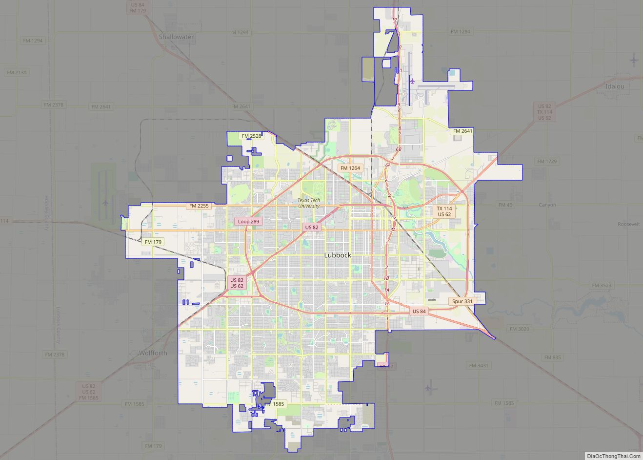
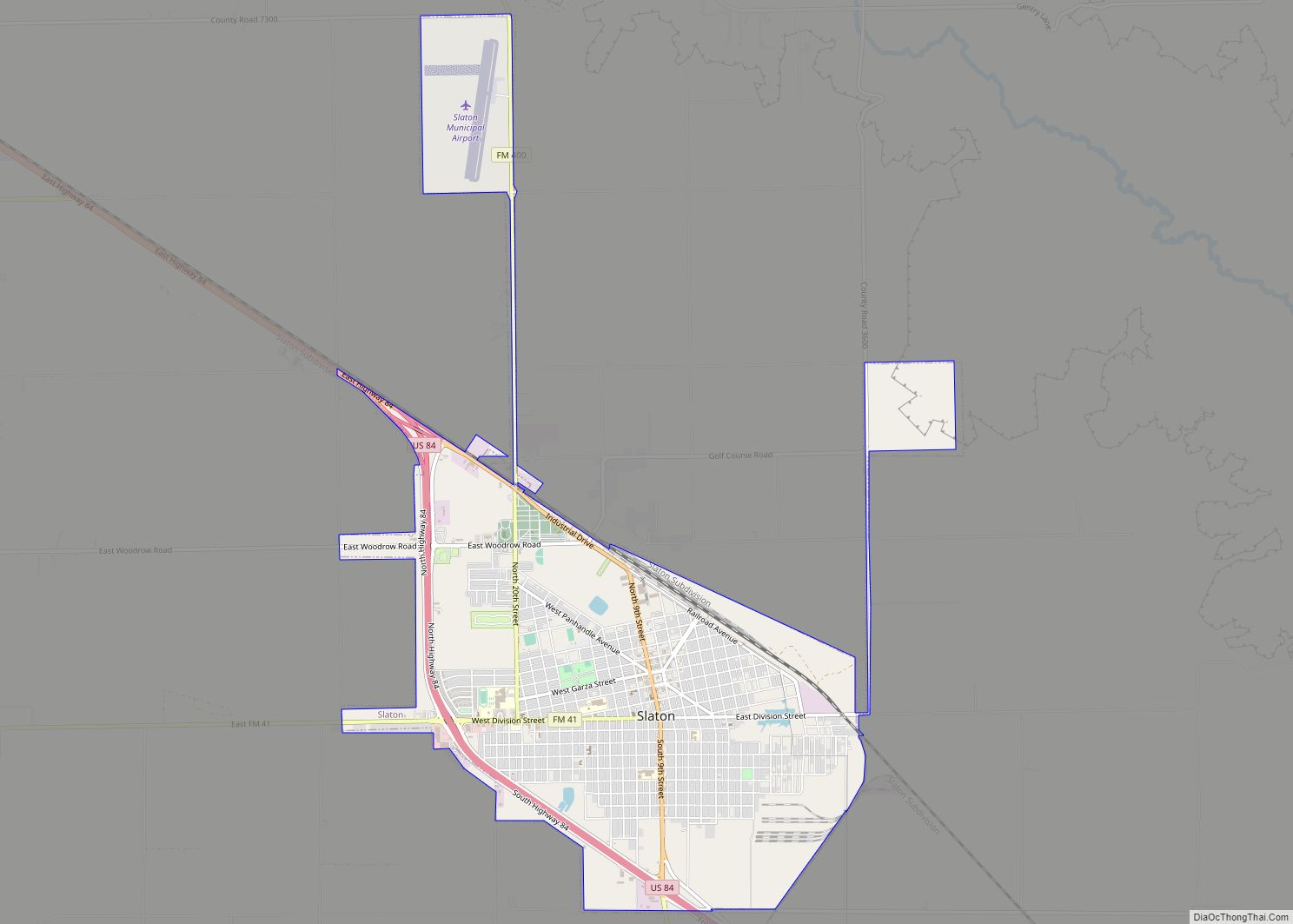
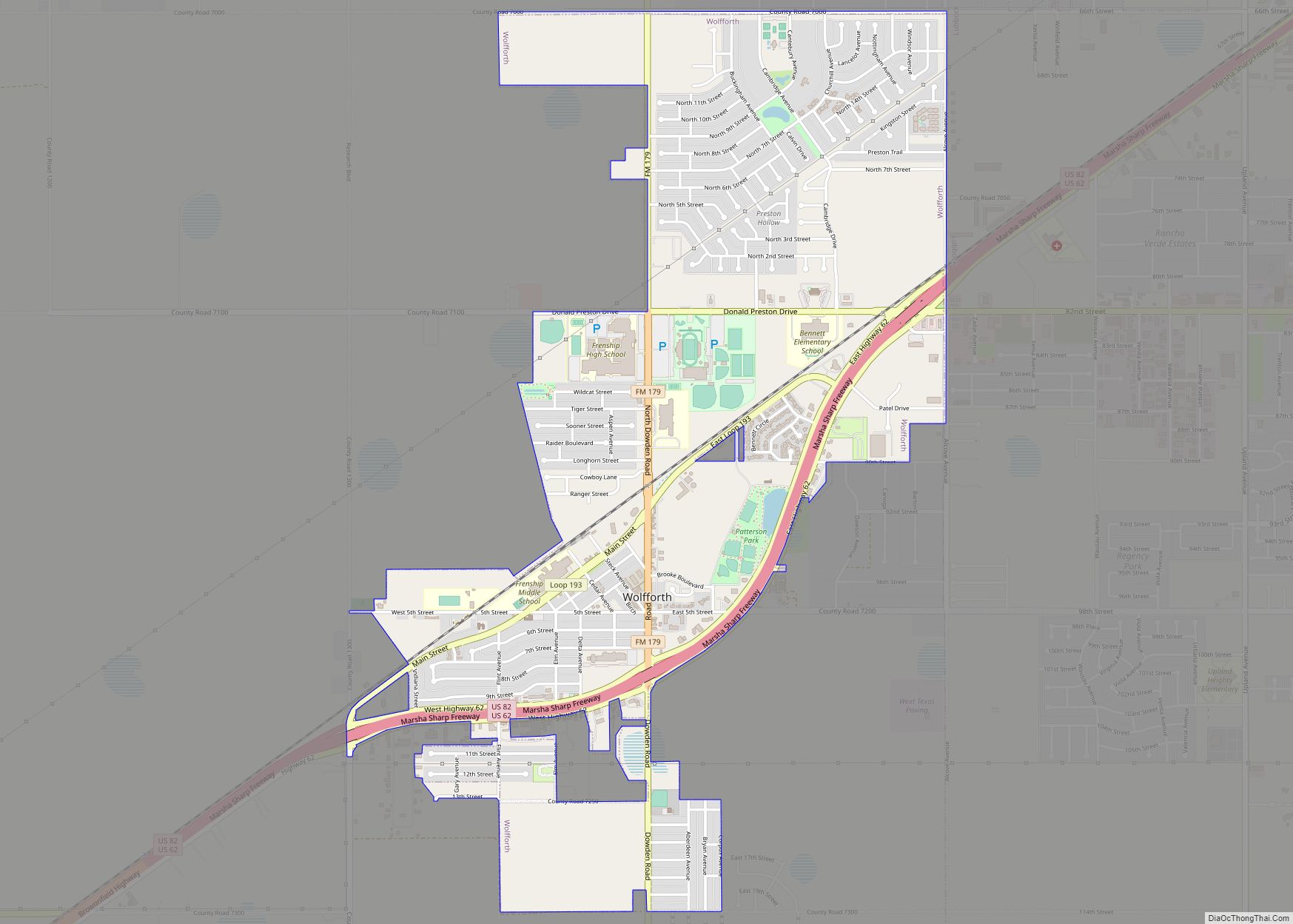
Online Interactive Map
Click on ![]() to view map in "full screen" mode.
to view map in "full screen" mode.
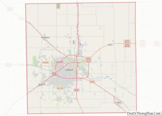
Shallowater location map. Where is Shallowater city?
History
As early as 1909 J. C. (Jim) Bowles, whose ranch was adjacent to the site of what is now Shallowater, persuaded Bob Crump, a member of a ranching family, to help form a townsite company and attract a railroad to go through the area. Land was purchased for the townsite on May 18, 1909. A school was built at that time. After Santa Fe railroad officials received a bonus from rancher George W. Littlefield of the Yellow House Ranch, negotiations were finally completed. The originators of the plan, and other interested individuals, formed the Ripley Townsite Company, which was named after a Santa Fe railroad official, and was incorporated on May 22, 1909. The company decided to name the new town Shallowater to attract settlers. On June 26, 1913, a celebration was held to note the founding of the town and completion of the railroad. By the time the town was established, the ranching industry in the area was waning, and many of the large ranches were being divided into smaller lots for farmers. Cotton became an important cash crop. During the 1920s, Shallowater grew rapidly, and the town had a hotel, a lumberyard, and various filling stations, grocery stores, cotton gins, drugstores, barbershops, garages, blacksmith shops, and other businesses. Several churches and schools were also built. A county park with a clubhouse was established, a public well was constructed, and a real depot building was built to replace the boxcar the town had been using for years. From 1920 to 1922, the railroad station was known as Pacita. In 1928, the town had an estimated population of 250. In 1955, Shallowater was incorporated with a mayor-council form of city government, and during the 1960s, the town had five churches, a school, a bank, a library, and a newspaper. The community in 1970 had 30 businesses, including one of the largest hatcheries in the county. The population of Shallowater was 1,001 in 1960 and 1,339 in 1970. In the late 1980s, Shallowater had a post office, 17 businesses, and a population of 2,107. It was a farm marketing center with processing and storing facilities. In 2010, the population was 2,484.
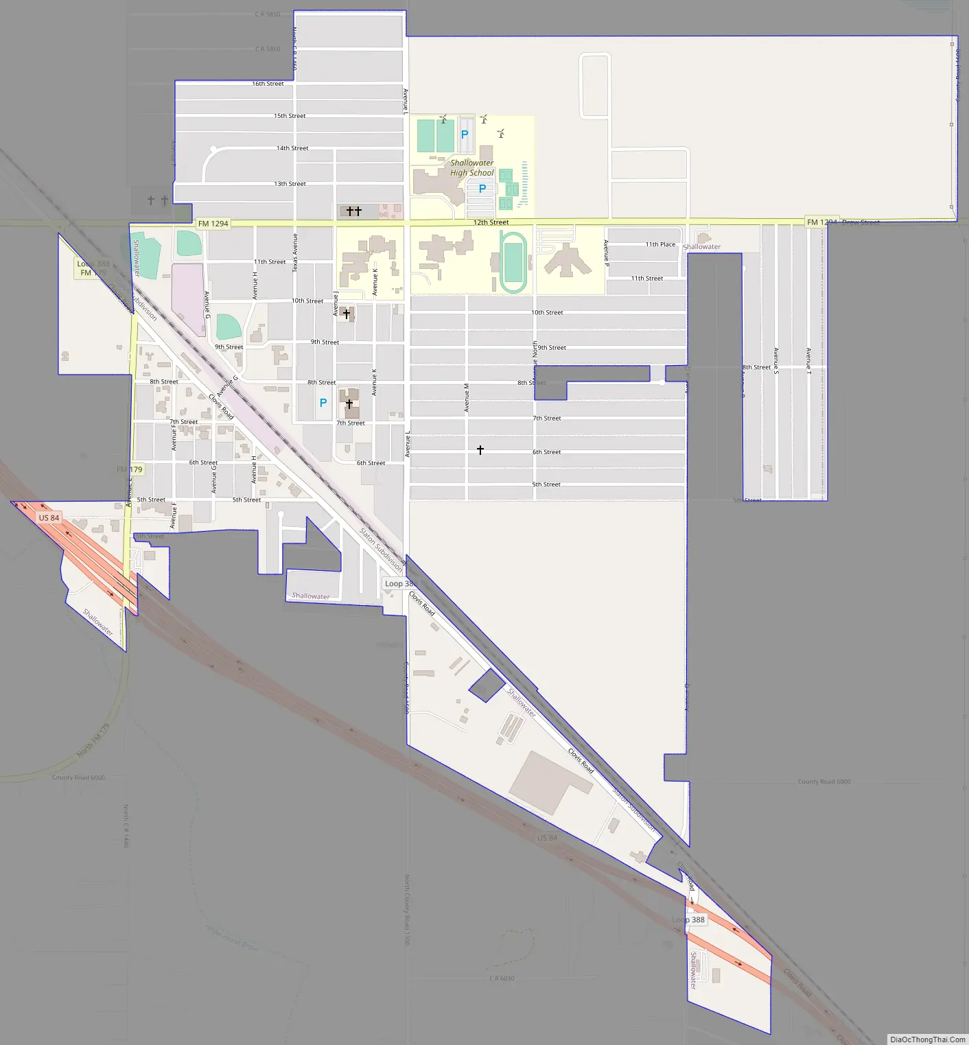
Shallowater Road Map
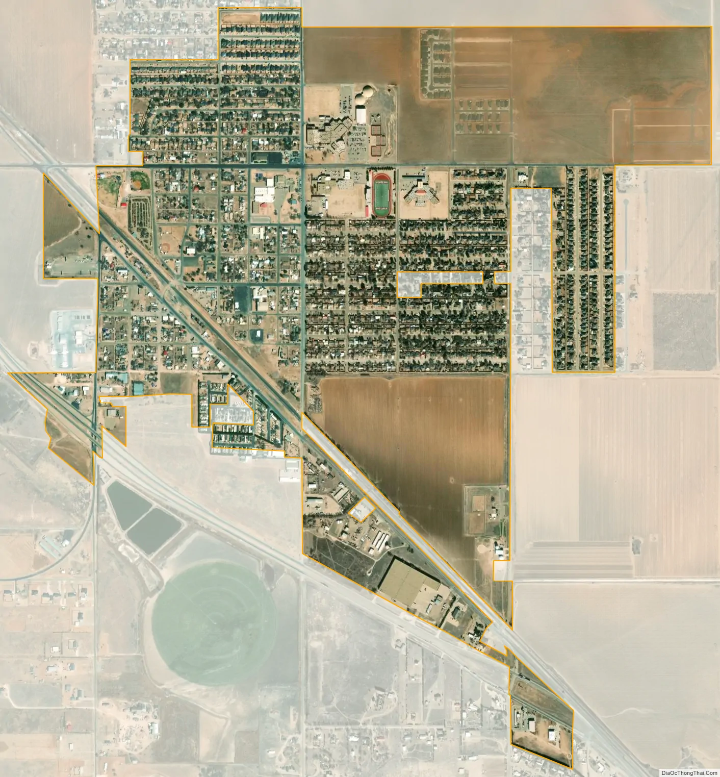
Shallowater city Satellite Map
Geography
Shallowater is located on the high plains of the Llano Estacado at 33°41′20″N 101°59′54″W / 33.68889°N 101.99833°W / 33.68889; -101.99833 (33.6889728, –101.9982275).
According to the United States Census Bureau, the city has a total area of 1.5 sq mi (4.0 km), all of it land.
Climate
According to the Köppen climate classification, Shallowater has a semiarid climate, BSk on climate maps.
See also
Map of Texas State and its subdivision:- Anderson
- Andrews
- Angelina
- Aransas
- Archer
- Armstrong
- Atascosa
- Austin
- Bailey
- Bandera
- Bastrop
- Baylor
- Bee
- Bell
- Bexar
- Blanco
- Borden
- Bosque
- Bowie
- Brazoria
- Brazos
- Brewster
- Briscoe
- Brooks
- Brown
- Burleson
- Burnet
- Caldwell
- Calhoun
- Callahan
- Cameron
- Camp
- Carson
- Cass
- Castro
- Chambers
- Cherokee
- Childress
- Clay
- Cochran
- Coke
- Coleman
- Collin
- Collingsworth
- Colorado
- Comal
- Comanche
- Concho
- Cooke
- Coryell
- Cottle
- Crane
- Crockett
- Crosby
- Culberson
- Dallam
- Dallas
- Dawson
- Deaf Smith
- Delta
- Denton
- Dewitt
- Dickens
- Dimmit
- Donley
- Duval
- Eastland
- Ector
- Edwards
- El Paso
- Ellis
- Erath
- Falls
- Fannin
- Fayette
- Fisher
- Floyd
- Foard
- Fort Bend
- Franklin
- Freestone
- Frio
- Gaines
- Galveston
- Garza
- Gillespie
- Glasscock
- Goliad
- Gonzales
- Gray
- Grayson
- Gregg
- Grimes
- Guadalupe
- Hale
- Hall
- Hamilton
- Hansford
- Hardeman
- Hardin
- Harris
- Harrison
- Hartley
- Haskell
- Hays
- Hemphill
- Henderson
- Hidalgo
- Hill
- Hockley
- Hood
- Hopkins
- Houston
- Howard
- Hudspeth
- Hunt
- Hutchinson
- Irion
- Jack
- Jackson
- Jasper
- Jeff Davis
- Jefferson
- Jim Hogg
- Jim Wells
- Johnson
- Jones
- Karnes
- Kaufman
- Kendall
- Kenedy
- Kent
- Kerr
- Kimble
- King
- Kinney
- Kleberg
- Knox
- La Salle
- Lamar
- Lamb
- Lampasas
- Lavaca
- Lee
- Leon
- Liberty
- Limestone
- Lipscomb
- Live Oak
- Llano
- Loving
- Lubbock
- Lynn
- Madison
- Marion
- Martin
- Mason
- Matagorda
- Maverick
- McCulloch
- McLennan
- McMullen
- Medina
- Menard
- Midland
- Milam
- Mills
- Mitchell
- Montague
- Montgomery
- Moore
- Morris
- Motley
- Nacogdoches
- Navarro
- Newton
- Nolan
- Nueces
- Ochiltree
- Oldham
- Orange
- Palo Pinto
- Panola
- Parker
- Parmer
- Pecos
- Polk
- Potter
- Presidio
- Rains
- Randall
- Reagan
- Real
- Red River
- Reeves
- Refugio
- Roberts
- Robertson
- Rockwall
- Runnels
- Rusk
- Sabine
- San Augustine
- San Jacinto
- San Patricio
- San Saba
- Schleicher
- Scurry
- Shackelford
- Shelby
- Sherman
- Smith
- Somervell
- Starr
- Stephens
- Sterling
- Stonewall
- Sutton
- Swisher
- Tarrant
- Taylor
- Terrell
- Terry
- Throckmorton
- Titus
- Tom Green
- Travis
- Trinity
- Tyler
- Upshur
- Upton
- Uvalde
- Val Verde
- Van Zandt
- Victoria
- Walker
- Waller
- Ward
- Washington
- Webb
- Wharton
- Wheeler
- Wichita
- Wilbarger
- Willacy
- Williamson
- Wilson
- Winkler
- Wise
- Wood
- Yoakum
- Young
- Zapata
- Zavala
- Alabama
- Alaska
- Arizona
- Arkansas
- California
- Colorado
- Connecticut
- Delaware
- District of Columbia
- Florida
- Georgia
- Hawaii
- Idaho
- Illinois
- Indiana
- Iowa
- Kansas
- Kentucky
- Louisiana
- Maine
- Maryland
- Massachusetts
- Michigan
- Minnesota
- Mississippi
- Missouri
- Montana
- Nebraska
- Nevada
- New Hampshire
- New Jersey
- New Mexico
- New York
- North Carolina
- North Dakota
- Ohio
- Oklahoma
- Oregon
- Pennsylvania
- Rhode Island
- South Carolina
- South Dakota
- Tennessee
- Texas
- Utah
- Vermont
- Virginia
- Washington
- West Virginia
- Wisconsin
- Wyoming