Smyer is a town in Hockley County, Texas, United States. The nickname it is known for is “The Pit Stop Town” since the town is between two big city areas. The population was 474 at the 2010 census. in 2023, the population declined to 433.
| Name: | Smyer town |
|---|---|
| LSAD Code: | 43 |
| LSAD Description: | town (suffix) |
| State: | Texas |
| County: | Hockley County |
| Founded: | 1924 |
| Incorporated: | 1963 |
| Elevation: | 3,389 ft (1,033 m) |
| Total Area: | 0.80 sq mi (2.06 km²) |
| Land Area: | 0.80 sq mi (2.06 km²) |
| Water Area: | 0.00 sq mi (0.00 km²) |
| Total Population: | 474 |
| Population Density: | 599.75/sq mi (231.63/km²) |
| ZIP code: | 79367 |
| Area code: | 806 |
| FIPS code: | 4868504 |
| GNISfeature ID: | 1368526 |
| Website: | https://www.smyer-isd.org |
Online Interactive Map
Click on ![]() to view map in "full screen" mode.
to view map in "full screen" mode.
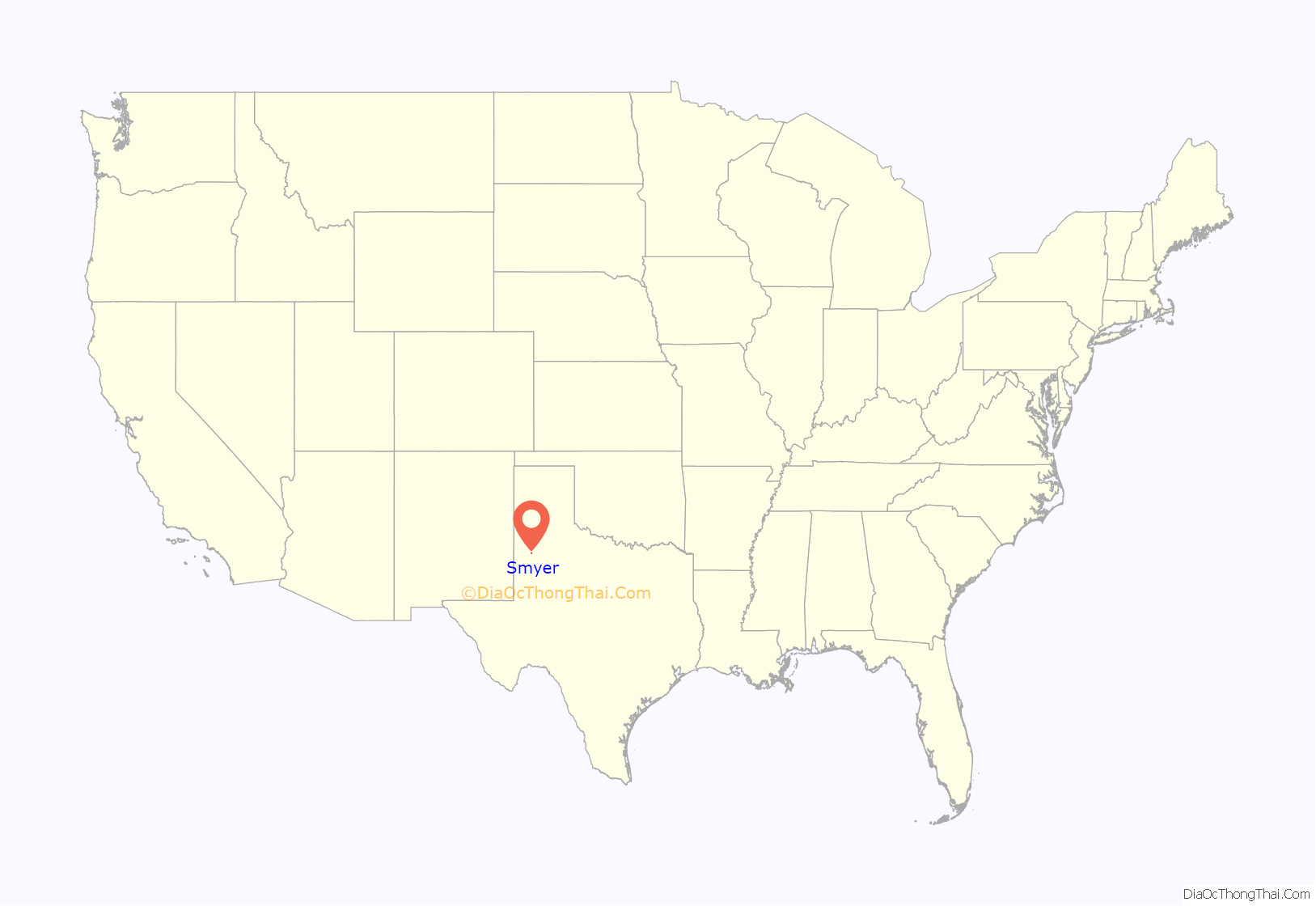
Smyer location map. Where is Smyer town?
History
Smyer was settled in 1917, when William L. Ellwood began selling portions of the Spade Ranch to farmers. The town was founded in 1924 and deemed platted in 1925 after construction was completed, which soon opened up the rail service to begin in Smyer. The town had many things to offer as a small town such as a school, a gin, two stores, a railway Depot, and a lumberyard. The school district was created in 1924 and organized in 1927 as the old school board and new board consolidated to form the present-day school board. In 1929, the town was hit by a heavy tornado and it destroyed many things in Smyer, but the farmers managed to get back up and rebuilt from the ground up and made it better. In 1951, a new elementary school was built and in 1957, newer additions of the buildings were made to improve the student’s time in school. In 1963, Smyer decided that with new plans for a school building they wouldn’t create and established a government body in the town and soon enough incorporated the same year. In 1980, the population was 455, and in 2000, the population was 480, the largest peak population ever in Smyer. In 2020, Smyer has remodeled, rebuilt, and sold different areas and certain criteria around the town’s functions. The town is predicted to grow in the coming years as western Lubbock continues to grow and impact other areas such as Ropesville.
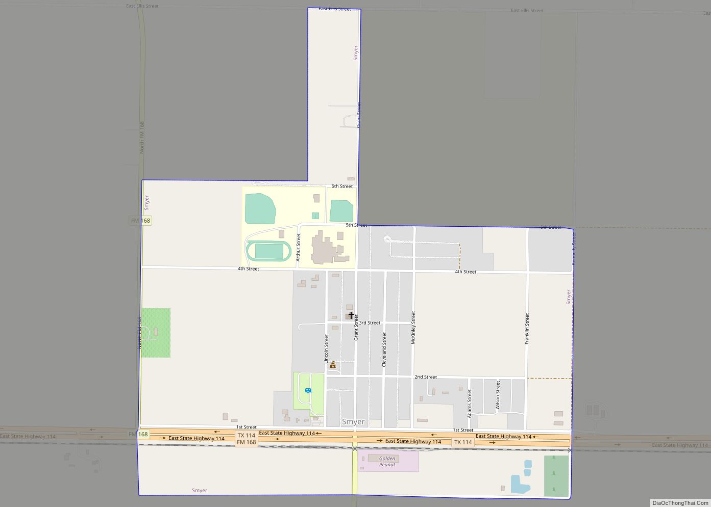
Smyer Road Map
Smyer city Satellite Map
Geography
Smyer is located on the high plains of the Llano Estacado at 33°35′03″N 102°09′48″W / 33.58417°N 102.16333°W / 33.58417; -102.16333 (33.5842563, –102.1632291), in eastern Hockley County. Texas State Highway 114 passes through the southern side of the town, leading west 16 miles (26 km) to Levelland, the county seat, and east 17 miles (27 km) to Lubbock.
According to the United States Census Bureau, Smyer has a total area of 0.81 square miles (2.1 km), all of it land.
See also
Map of Texas State and its subdivision:- Anderson
- Andrews
- Angelina
- Aransas
- Archer
- Armstrong
- Atascosa
- Austin
- Bailey
- Bandera
- Bastrop
- Baylor
- Bee
- Bell
- Bexar
- Blanco
- Borden
- Bosque
- Bowie
- Brazoria
- Brazos
- Brewster
- Briscoe
- Brooks
- Brown
- Burleson
- Burnet
- Caldwell
- Calhoun
- Callahan
- Cameron
- Camp
- Carson
- Cass
- Castro
- Chambers
- Cherokee
- Childress
- Clay
- Cochran
- Coke
- Coleman
- Collin
- Collingsworth
- Colorado
- Comal
- Comanche
- Concho
- Cooke
- Coryell
- Cottle
- Crane
- Crockett
- Crosby
- Culberson
- Dallam
- Dallas
- Dawson
- Deaf Smith
- Delta
- Denton
- Dewitt
- Dickens
- Dimmit
- Donley
- Duval
- Eastland
- Ector
- Edwards
- El Paso
- Ellis
- Erath
- Falls
- Fannin
- Fayette
- Fisher
- Floyd
- Foard
- Fort Bend
- Franklin
- Freestone
- Frio
- Gaines
- Galveston
- Garza
- Gillespie
- Glasscock
- Goliad
- Gonzales
- Gray
- Grayson
- Gregg
- Grimes
- Guadalupe
- Hale
- Hall
- Hamilton
- Hansford
- Hardeman
- Hardin
- Harris
- Harrison
- Hartley
- Haskell
- Hays
- Hemphill
- Henderson
- Hidalgo
- Hill
- Hockley
- Hood
- Hopkins
- Houston
- Howard
- Hudspeth
- Hunt
- Hutchinson
- Irion
- Jack
- Jackson
- Jasper
- Jeff Davis
- Jefferson
- Jim Hogg
- Jim Wells
- Johnson
- Jones
- Karnes
- Kaufman
- Kendall
- Kenedy
- Kent
- Kerr
- Kimble
- King
- Kinney
- Kleberg
- Knox
- La Salle
- Lamar
- Lamb
- Lampasas
- Lavaca
- Lee
- Leon
- Liberty
- Limestone
- Lipscomb
- Live Oak
- Llano
- Loving
- Lubbock
- Lynn
- Madison
- Marion
- Martin
- Mason
- Matagorda
- Maverick
- McCulloch
- McLennan
- McMullen
- Medina
- Menard
- Midland
- Milam
- Mills
- Mitchell
- Montague
- Montgomery
- Moore
- Morris
- Motley
- Nacogdoches
- Navarro
- Newton
- Nolan
- Nueces
- Ochiltree
- Oldham
- Orange
- Palo Pinto
- Panola
- Parker
- Parmer
- Pecos
- Polk
- Potter
- Presidio
- Rains
- Randall
- Reagan
- Real
- Red River
- Reeves
- Refugio
- Roberts
- Robertson
- Rockwall
- Runnels
- Rusk
- Sabine
- San Augustine
- San Jacinto
- San Patricio
- San Saba
- Schleicher
- Scurry
- Shackelford
- Shelby
- Sherman
- Smith
- Somervell
- Starr
- Stephens
- Sterling
- Stonewall
- Sutton
- Swisher
- Tarrant
- Taylor
- Terrell
- Terry
- Throckmorton
- Titus
- Tom Green
- Travis
- Trinity
- Tyler
- Upshur
- Upton
- Uvalde
- Val Verde
- Van Zandt
- Victoria
- Walker
- Waller
- Ward
- Washington
- Webb
- Wharton
- Wheeler
- Wichita
- Wilbarger
- Willacy
- Williamson
- Wilson
- Winkler
- Wise
- Wood
- Yoakum
- Young
- Zapata
- Zavala
- Alabama
- Alaska
- Arizona
- Arkansas
- California
- Colorado
- Connecticut
- Delaware
- District of Columbia
- Florida
- Georgia
- Hawaii
- Idaho
- Illinois
- Indiana
- Iowa
- Kansas
- Kentucky
- Louisiana
- Maine
- Maryland
- Massachusetts
- Michigan
- Minnesota
- Mississippi
- Missouri
- Montana
- Nebraska
- Nevada
- New Hampshire
- New Jersey
- New Mexico
- New York
- North Carolina
- North Dakota
- Ohio
- Oklahoma
- Oregon
- Pennsylvania
- Rhode Island
- South Carolina
- South Dakota
- Tennessee
- Texas
- Utah
- Vermont
- Virginia
- Washington
- West Virginia
- Wisconsin
- Wyoming
