Sunray is a city in northeast Moore County, Texas, United States. The population was 1,926 at the 2010 census.
| Name: | Sunray city |
|---|---|
| LSAD Code: | 25 |
| LSAD Description: | city (suffix) |
| State: | Texas |
| County: | Moore County |
| Elevation: | 3,507 ft (1,069 m) |
| Total Area: | 1.71 sq mi (4.42 km²) |
| Land Area: | 1.71 sq mi (4.42 km²) |
| Water Area: | 0.00 sq mi (0.00 km²) |
| Total Population: | 1,926 |
| Population Density: | 1,060.89/sq mi (409.69/km²) |
| ZIP code: | 79086 |
| Area code: | 806 |
| FIPS code: | 4871180 |
| GNISfeature ID: | 1369408 |
Online Interactive Map
Click on ![]() to view map in "full screen" mode.
to view map in "full screen" mode.
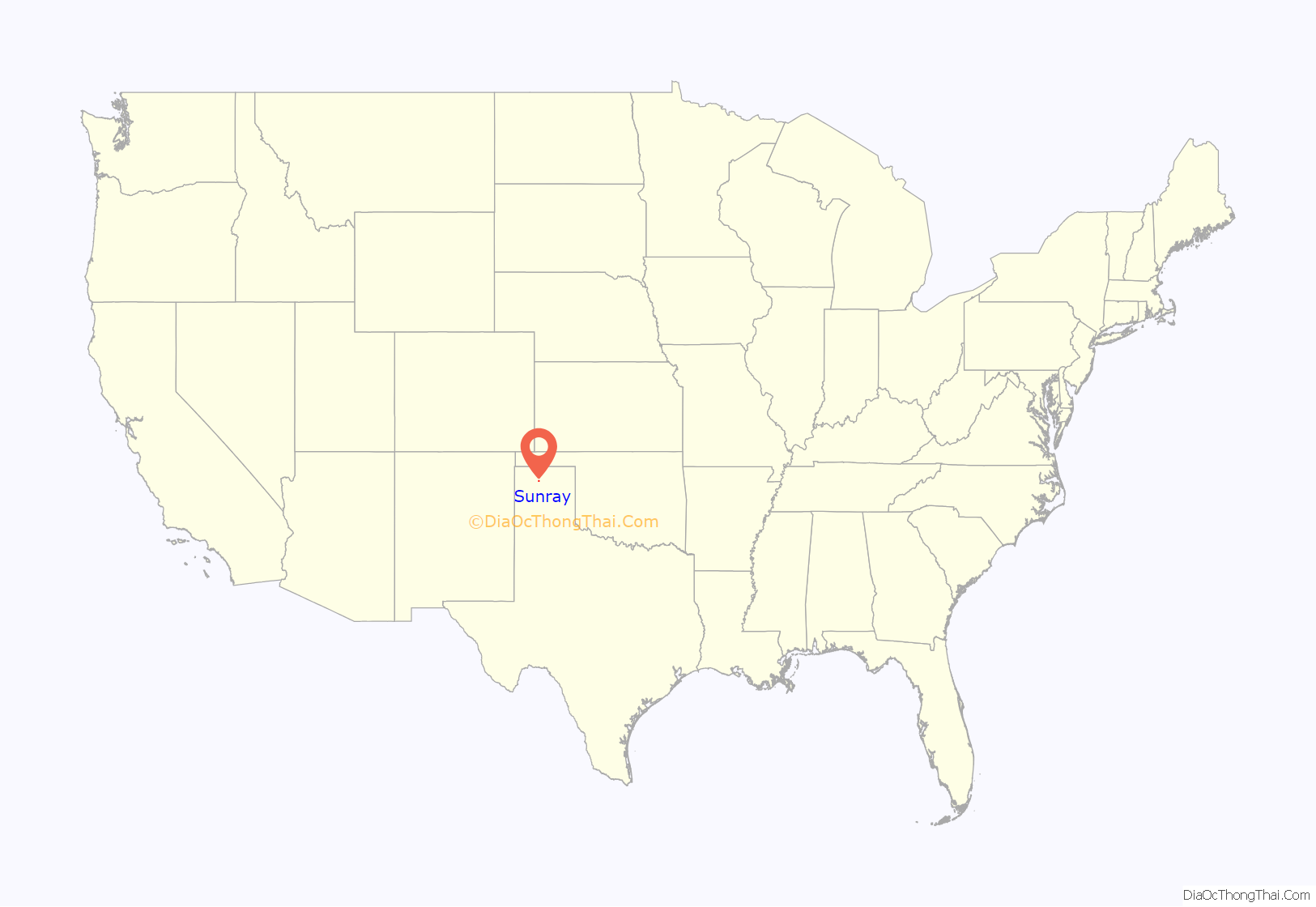
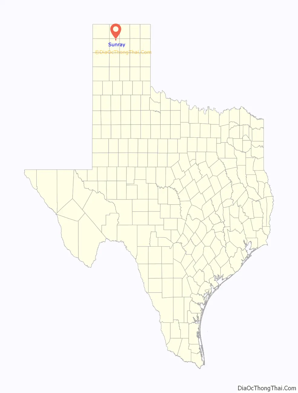
Sunray location map. Where is Sunray city?
History
Sunray, Texas, was founded by Jack Clarence Collins. He was born in Hartley, Texas, in 1893, and in 1902 moved to Channing, Texas, with his parents, Mr. and Mrs. E.S. Collins. Jack graduated from Channing High School and later, in 1916, from Texas A&M, where he was class valedictorian and class president in his senior year. Later, he served for several years as cashier of the First National Bank of Channing while extending his family’s ranch holdings. Mr. Collins was well-known and respected in ranching and financial circles, and was a ranking member of the Republican Party for several years.
Jack Collins did not call the town “Sunray” when he laid it out in 1930. The first lots were sold at $10 each under the name “Altman”, but it was discovered that a town in Rusk County had already appropriated that name, hence, the name “Sunray” was used. A post office was applied for on May 5, 1930, using the name “Altman”, but because of the duplication, “Sunray” was not approved until 1935.
The change to the name “Sunray” came because Sunray Oil Company (later Sunoco) set up a gas-oil refinery near the town on 10 acres (40,000 m) of land originally donated by Mr. Collins to Dana Oil & Gas Royalty Company. Sunray Oil Company bought the holdings of Dana in the early Jones Field in northeast Moore County, which was near the new town. The townsite location was determined by a new Rock Island Railroad route running from Dalhart to Morse along the northern edge of Mr. Collins’s townsite survey. At the time, the town was 3 miles (4.8 km) from the Jones Well and 6 miles (9.7 km) from the Morton oil well—both early oil-gas discoveries in Moore County.
On Sunday, 29 July 1956, the nearby industrial plant was the site of a major accident. The McKee refinery fire killed 19 firefighters when a storage tank suffered a vapor explosion.
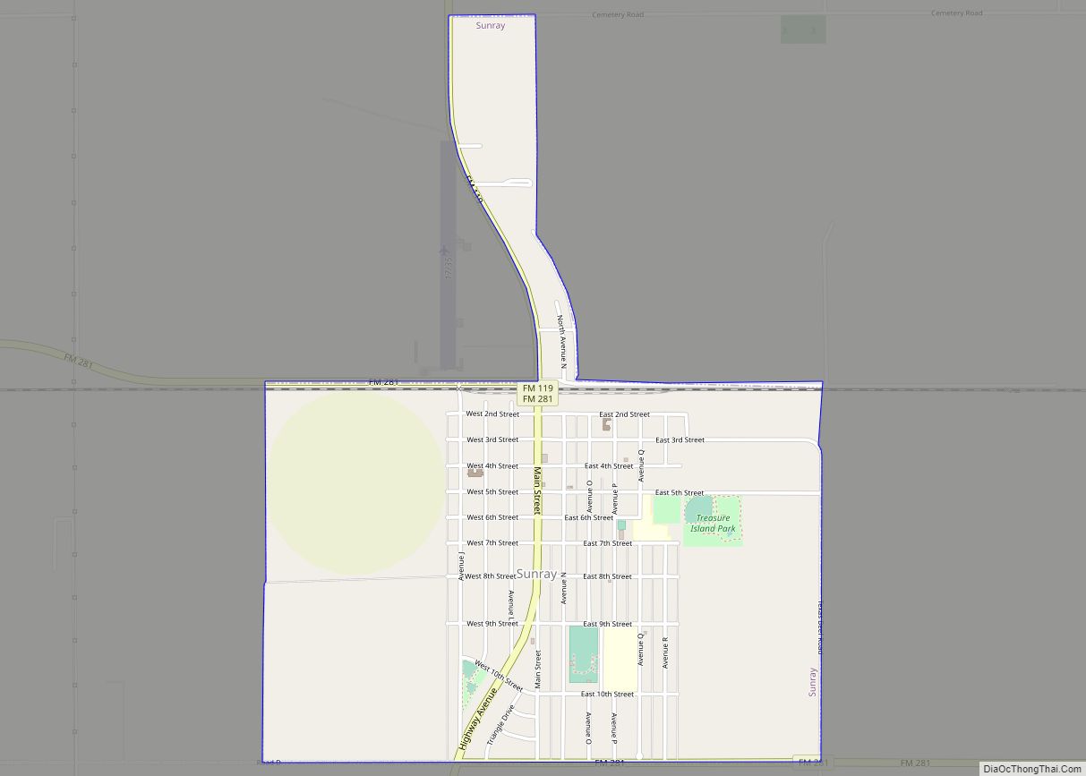
Sunray Road Map
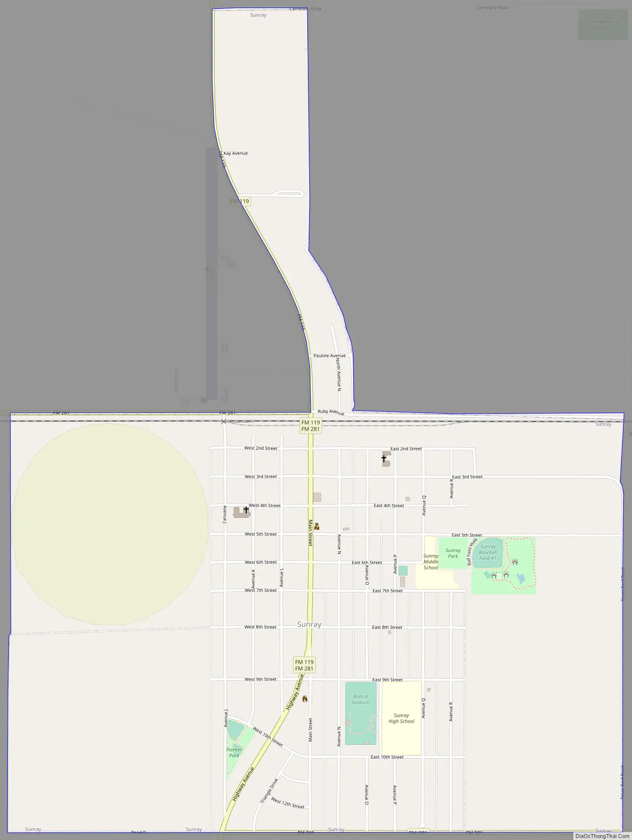
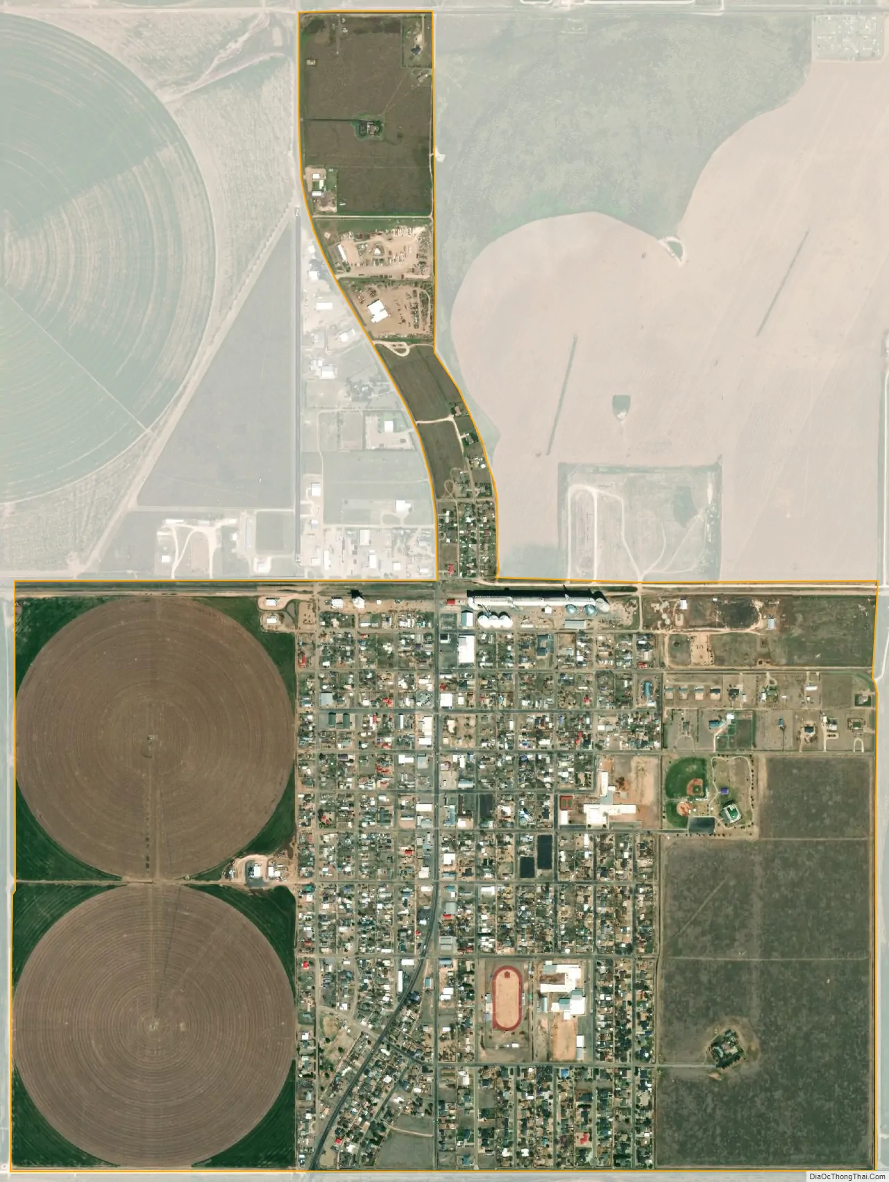
Sunray city Satellite Map
Geography
Sunray is located at 36°1′9″N 101°49′26″W / 36.01917°N 101.82389°W / 36.01917; -101.82389 (36.019280, –101.823860).
According to the United States Census Bureau, the city has a total area of 1.7 square miles (4.4 km), all of it land .
Climate
According to the Köppen climate classification system, Sunray has a semiarid climate, BSk on climate maps.
See also
Map of Texas State and its subdivision:- Anderson
- Andrews
- Angelina
- Aransas
- Archer
- Armstrong
- Atascosa
- Austin
- Bailey
- Bandera
- Bastrop
- Baylor
- Bee
- Bell
- Bexar
- Blanco
- Borden
- Bosque
- Bowie
- Brazoria
- Brazos
- Brewster
- Briscoe
- Brooks
- Brown
- Burleson
- Burnet
- Caldwell
- Calhoun
- Callahan
- Cameron
- Camp
- Carson
- Cass
- Castro
- Chambers
- Cherokee
- Childress
- Clay
- Cochran
- Coke
- Coleman
- Collin
- Collingsworth
- Colorado
- Comal
- Comanche
- Concho
- Cooke
- Coryell
- Cottle
- Crane
- Crockett
- Crosby
- Culberson
- Dallam
- Dallas
- Dawson
- Deaf Smith
- Delta
- Denton
- Dewitt
- Dickens
- Dimmit
- Donley
- Duval
- Eastland
- Ector
- Edwards
- El Paso
- Ellis
- Erath
- Falls
- Fannin
- Fayette
- Fisher
- Floyd
- Foard
- Fort Bend
- Franklin
- Freestone
- Frio
- Gaines
- Galveston
- Garza
- Gillespie
- Glasscock
- Goliad
- Gonzales
- Gray
- Grayson
- Gregg
- Grimes
- Guadalupe
- Hale
- Hall
- Hamilton
- Hansford
- Hardeman
- Hardin
- Harris
- Harrison
- Hartley
- Haskell
- Hays
- Hemphill
- Henderson
- Hidalgo
- Hill
- Hockley
- Hood
- Hopkins
- Houston
- Howard
- Hudspeth
- Hunt
- Hutchinson
- Irion
- Jack
- Jackson
- Jasper
- Jeff Davis
- Jefferson
- Jim Hogg
- Jim Wells
- Johnson
- Jones
- Karnes
- Kaufman
- Kendall
- Kenedy
- Kent
- Kerr
- Kimble
- King
- Kinney
- Kleberg
- Knox
- La Salle
- Lamar
- Lamb
- Lampasas
- Lavaca
- Lee
- Leon
- Liberty
- Limestone
- Lipscomb
- Live Oak
- Llano
- Loving
- Lubbock
- Lynn
- Madison
- Marion
- Martin
- Mason
- Matagorda
- Maverick
- McCulloch
- McLennan
- McMullen
- Medina
- Menard
- Midland
- Milam
- Mills
- Mitchell
- Montague
- Montgomery
- Moore
- Morris
- Motley
- Nacogdoches
- Navarro
- Newton
- Nolan
- Nueces
- Ochiltree
- Oldham
- Orange
- Palo Pinto
- Panola
- Parker
- Parmer
- Pecos
- Polk
- Potter
- Presidio
- Rains
- Randall
- Reagan
- Real
- Red River
- Reeves
- Refugio
- Roberts
- Robertson
- Rockwall
- Runnels
- Rusk
- Sabine
- San Augustine
- San Jacinto
- San Patricio
- San Saba
- Schleicher
- Scurry
- Shackelford
- Shelby
- Sherman
- Smith
- Somervell
- Starr
- Stephens
- Sterling
- Stonewall
- Sutton
- Swisher
- Tarrant
- Taylor
- Terrell
- Terry
- Throckmorton
- Titus
- Tom Green
- Travis
- Trinity
- Tyler
- Upshur
- Upton
- Uvalde
- Val Verde
- Van Zandt
- Victoria
- Walker
- Waller
- Ward
- Washington
- Webb
- Wharton
- Wheeler
- Wichita
- Wilbarger
- Willacy
- Williamson
- Wilson
- Winkler
- Wise
- Wood
- Yoakum
- Young
- Zapata
- Zavala
- Alabama
- Alaska
- Arizona
- Arkansas
- California
- Colorado
- Connecticut
- Delaware
- District of Columbia
- Florida
- Georgia
- Hawaii
- Idaho
- Illinois
- Indiana
- Iowa
- Kansas
- Kentucky
- Louisiana
- Maine
- Maryland
- Massachusetts
- Michigan
- Minnesota
- Mississippi
- Missouri
- Montana
- Nebraska
- Nevada
- New Hampshire
- New Jersey
- New Mexico
- New York
- North Carolina
- North Dakota
- Ohio
- Oklahoma
- Oregon
- Pennsylvania
- Rhode Island
- South Carolina
- South Dakota
- Tennessee
- Texas
- Utah
- Vermont
- Virginia
- Washington
- West Virginia
- Wisconsin
- Wyoming