Sweeny is a city in Brazoria County, Texas, United States, the westernmost incorporated town in the county. The population is 3,626 as of 2020. The city’s motto is “A City with Pride”. The city was once known as Adamston.
| Name: | Sweeny city |
|---|---|
| LSAD Code: | 25 |
| LSAD Description: | city (suffix) |
| State: | Texas |
| County: | Brazoria County |
| Elevation: | 30 ft (9 m) |
| Total Area: | 1.99 sq mi (5.15 km²) |
| Land Area: | 1.99 sq mi (5.15 km²) |
| Water Area: | 0.00 sq mi (0.00 km²) |
| Total Population: | 3,626 |
| Population Density: | 1,869.72/sq mi (721.86/km²) |
| ZIP code: | 77480 |
| Area code: | 979 |
| FIPS code: | 4871492 |
| GNISfeature ID: | 1369461 |
| Website: | www.sweenytx.gov |
Online Interactive Map
Click on ![]() to view map in "full screen" mode.
to view map in "full screen" mode.
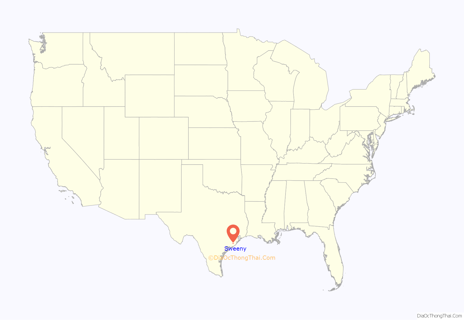
Sweeny location map. Where is Sweeny city?
History
Sweeny’s settlement, though not under this name, began before Texas was even a Republic. Imla Keep, a doctor and member of Stephen F. Austin’s Old Three Hundred colonists, received title to a league and labor of land that included the site of Sweeny on July 24, 1824. Keep eventually returned to Louisiana, and Martin Varner acquired the land. The land was named for John Sweeny, a Tennessee colonist who arrived with family members and 250 slaves in the area in 1833. He came after his sons, William Burrell and Thomas Jefferson Sweeny, had purchased land grants near the townsite. They purchased the land grants for the price of a load of mules, and came to examine their new land holdings in 1831. John Sweeny settled nearby, and in 1835, purchased the original Imla Keep League from Varner and constructed a house on the site. The home, today the Sweeny Plantation, a Recorded Texas Historic Landmark, was occupied by original family members through the 1990s. The original home was built in 1837 by slaves using only bricks, nails, and cypress and ash wood from the land. There were also 30 slave cabins made of cypress wood. The plantation had its own sawmill, sugar house, cotton gin, blacksmith shop, commissary, and a kiln for brick manufacture.
The town was named for John Sweeny.
The original town stood in a forest of hardwoods with soil twenty feet deep. Sweeny was briefly called Adamston when the St. Louis, Brownsville and Mexico Railway reached the area in 1905 and laid a side track lined with gardens to the community. A post office was established in 1895, closed in 1897, and was reestablished in 1909 as Sweeny. Sweeny’s cotton gin and general store were built by 1908, a school was organized in 1911 with eleven students, and church services were held in 1912, when a Civic Club was founded to promote civic and social improvements. Around 1910 the R. D. McDonald Bernard River Land Development Company, which later gave a plot of land to each church denomination, purchased acreage in the area, cut it into lots, and sold it.
Burton D. Hurd platted the townsite in 1911. His Burton D. Hurd Industrial Land Company promoted ten-acre suburban garden farms in the area with the slogan, “Soil Richer Than the Valley of the River Nile” to prospective settlers.
By 1914 the community had a hotel, a flour mill, three general stores, a cotton gin, a gristmill, a sawmill, and a population of 200. In the 1920s Sweeny shipped cotton, vegetables, live-oak parts for ships, and, for a time, bullfrogs raised by area farmers. In 1918 it had a brick factory and an orange orchard. Sweeny had an independent school system by 1912; school enrollment reached 236 by 1927, and by 1937 the community had three black schools and an all-grade white school with six teachers. The Ku Klux Klan operated briefly and held one cross-burning in the community.
In 1934, oil was discovered in Old Ocean, creating development which made Sweeny prosper. In 1942, a government carbon black plant was built which was taken over by Phillips Petroleum, which developed the facilities into a refinery, natural gas liquids center, and petrochemicals complex with pipelines to markets in the eastern United States. In 2000, Phillips Petroleum merged with Conoco Inc. to form ConocoPhillips. Sweeny’s population in the latter 20th century has fluctuated from 3,087 to 3,699.
Levi Jordan Plantation State Historic Site on FM 521
155 mm Howitzer at VFW Post 8551 on FM 1459
Sweeny Road Map
Sweeny city Satellite Map
Geography
Sweeny is 30 feet (9.1 m) above sea level and is 20 miles (32 km) from the Gulf of Mexico. The San Bernard River flows 1-mile (1.6 km) east of city limits. The town is in a dense forest on coastal plains.
Sweeny is at the intersections of Texas Farm to Market Roads 1459 and 524 along the Missouri Pacific Railroad twenty miles southwest of Angleton in west central Brazoria County.
The Union Pacific Railroad cuts a path through a small piece of the south side of Sweeny, with two grade crossings and a railyard. Train speeds through here usually range from 35 to 60 miles per hour (56 to 97 km/h).
See also
Map of Texas State and its subdivision:- Anderson
- Andrews
- Angelina
- Aransas
- Archer
- Armstrong
- Atascosa
- Austin
- Bailey
- Bandera
- Bastrop
- Baylor
- Bee
- Bell
- Bexar
- Blanco
- Borden
- Bosque
- Bowie
- Brazoria
- Brazos
- Brewster
- Briscoe
- Brooks
- Brown
- Burleson
- Burnet
- Caldwell
- Calhoun
- Callahan
- Cameron
- Camp
- Carson
- Cass
- Castro
- Chambers
- Cherokee
- Childress
- Clay
- Cochran
- Coke
- Coleman
- Collin
- Collingsworth
- Colorado
- Comal
- Comanche
- Concho
- Cooke
- Coryell
- Cottle
- Crane
- Crockett
- Crosby
- Culberson
- Dallam
- Dallas
- Dawson
- Deaf Smith
- Delta
- Denton
- Dewitt
- Dickens
- Dimmit
- Donley
- Duval
- Eastland
- Ector
- Edwards
- El Paso
- Ellis
- Erath
- Falls
- Fannin
- Fayette
- Fisher
- Floyd
- Foard
- Fort Bend
- Franklin
- Freestone
- Frio
- Gaines
- Galveston
- Garza
- Gillespie
- Glasscock
- Goliad
- Gonzales
- Gray
- Grayson
- Gregg
- Grimes
- Guadalupe
- Hale
- Hall
- Hamilton
- Hansford
- Hardeman
- Hardin
- Harris
- Harrison
- Hartley
- Haskell
- Hays
- Hemphill
- Henderson
- Hidalgo
- Hill
- Hockley
- Hood
- Hopkins
- Houston
- Howard
- Hudspeth
- Hunt
- Hutchinson
- Irion
- Jack
- Jackson
- Jasper
- Jeff Davis
- Jefferson
- Jim Hogg
- Jim Wells
- Johnson
- Jones
- Karnes
- Kaufman
- Kendall
- Kenedy
- Kent
- Kerr
- Kimble
- King
- Kinney
- Kleberg
- Knox
- La Salle
- Lamar
- Lamb
- Lampasas
- Lavaca
- Lee
- Leon
- Liberty
- Limestone
- Lipscomb
- Live Oak
- Llano
- Loving
- Lubbock
- Lynn
- Madison
- Marion
- Martin
- Mason
- Matagorda
- Maverick
- McCulloch
- McLennan
- McMullen
- Medina
- Menard
- Midland
- Milam
- Mills
- Mitchell
- Montague
- Montgomery
- Moore
- Morris
- Motley
- Nacogdoches
- Navarro
- Newton
- Nolan
- Nueces
- Ochiltree
- Oldham
- Orange
- Palo Pinto
- Panola
- Parker
- Parmer
- Pecos
- Polk
- Potter
- Presidio
- Rains
- Randall
- Reagan
- Real
- Red River
- Reeves
- Refugio
- Roberts
- Robertson
- Rockwall
- Runnels
- Rusk
- Sabine
- San Augustine
- San Jacinto
- San Patricio
- San Saba
- Schleicher
- Scurry
- Shackelford
- Shelby
- Sherman
- Smith
- Somervell
- Starr
- Stephens
- Sterling
- Stonewall
- Sutton
- Swisher
- Tarrant
- Taylor
- Terrell
- Terry
- Throckmorton
- Titus
- Tom Green
- Travis
- Trinity
- Tyler
- Upshur
- Upton
- Uvalde
- Val Verde
- Van Zandt
- Victoria
- Walker
- Waller
- Ward
- Washington
- Webb
- Wharton
- Wheeler
- Wichita
- Wilbarger
- Willacy
- Williamson
- Wilson
- Winkler
- Wise
- Wood
- Yoakum
- Young
- Zapata
- Zavala
- Alabama
- Alaska
- Arizona
- Arkansas
- California
- Colorado
- Connecticut
- Delaware
- District of Columbia
- Florida
- Georgia
- Hawaii
- Idaho
- Illinois
- Indiana
- Iowa
- Kansas
- Kentucky
- Louisiana
- Maine
- Maryland
- Massachusetts
- Michigan
- Minnesota
- Mississippi
- Missouri
- Montana
- Nebraska
- Nevada
- New Hampshire
- New Jersey
- New Mexico
- New York
- North Carolina
- North Dakota
- Ohio
- Oklahoma
- Oregon
- Pennsylvania
- Rhode Island
- South Carolina
- South Dakota
- Tennessee
- Texas
- Utah
- Vermont
- Virginia
- Washington
- West Virginia
- Wisconsin
- Wyoming
