Woodsboro is a town in Refugio County, Texas, United States. The population was 1,512 at the 2010 census.
| Name: | Woodsboro town |
|---|---|
| LSAD Code: | 43 |
| LSAD Description: | town (suffix) |
| State: | Texas |
| County: | Refugio County |
| Elevation: | 43 ft (13 m) |
| Total Area: | 0.76 sq mi (1.96 km²) |
| Land Area: | 0.76 sq mi (1.96 km²) |
| Water Area: | 0.00 sq mi (0.00 km²) |
| Total Population: | 1,512 |
| Population Density: | 1,862.62/sq mi (719.37/km²) |
| ZIP code: | 78393 |
| Area code: | 361 |
| FIPS code: | 4880176 |
| GNISfeature ID: | 1350565 |
| Website: | www.woodsborotx.net |
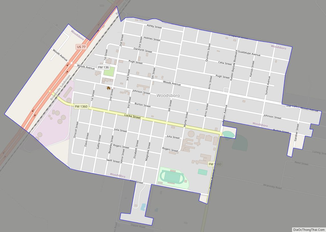
Online Interactive Map
Click on ![]() to view map in "full screen" mode.
to view map in "full screen" mode.
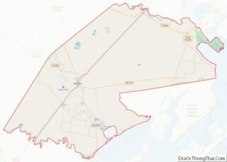
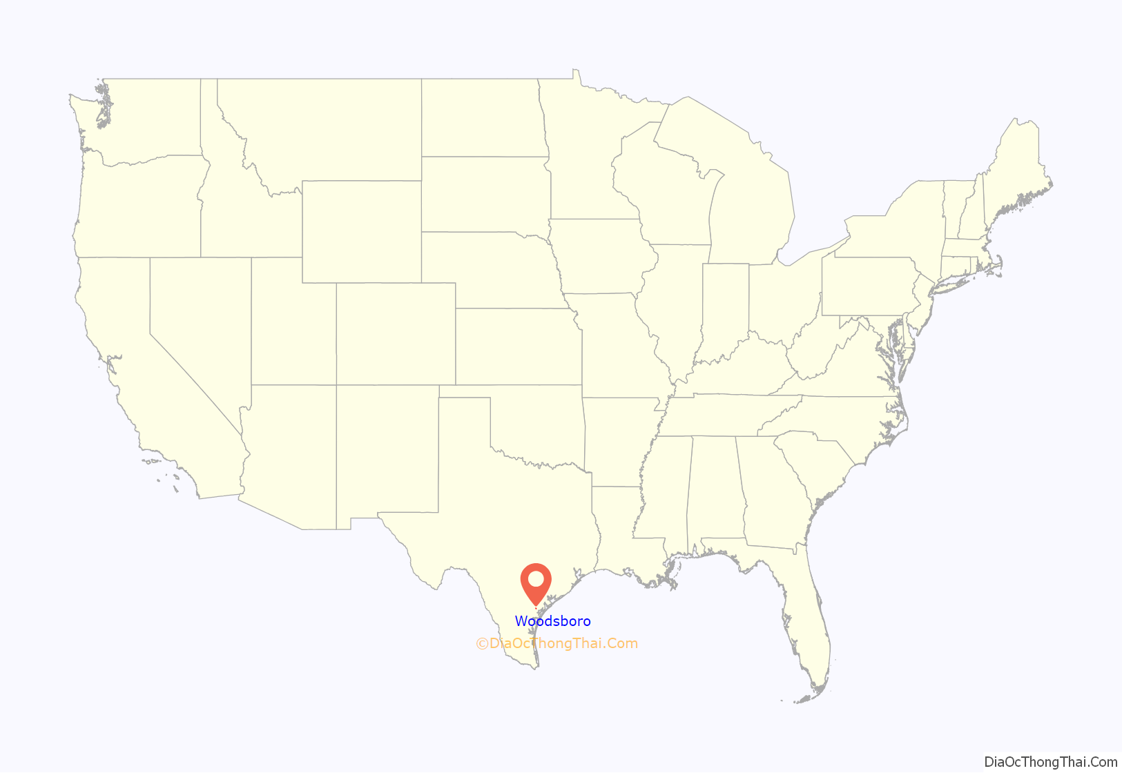
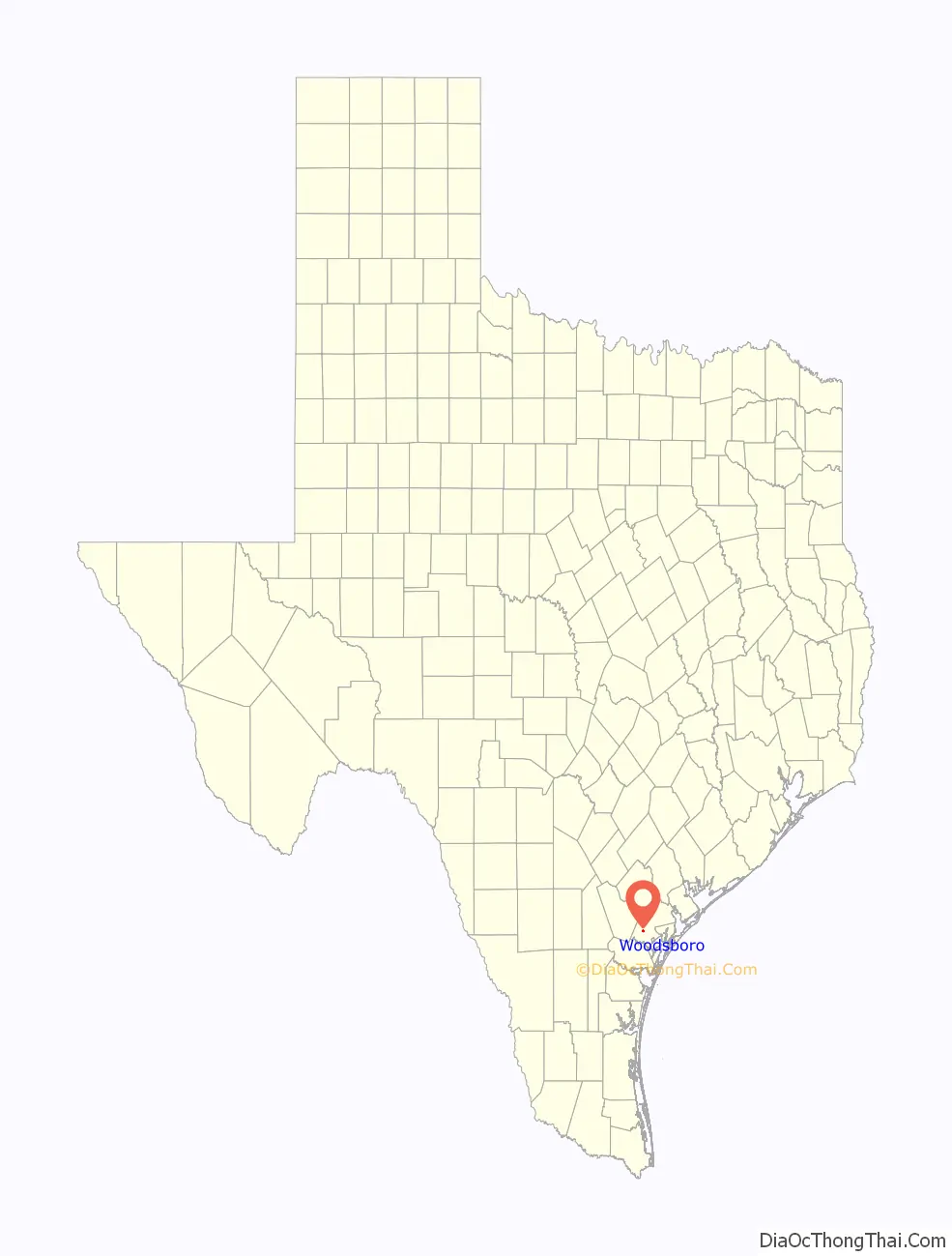
Woodsboro location map. Where is Woodsboro town?
History
Woodsboro is in southwestern Refugio County five miles southwest of the city of Refugio at the intersection of U.S. Highway 77 (Future Interstate 69E) and Farm-to-Market Road 2441. The town began as part of a land development project organized in 1906 by W. C. Johnson and George P. Pugh, experienced developers from Danville, Illinois. The town was originally called Church because it was located just north of the Church siding on the St. Louis, Brownsville and Mexico Railway, which built through the area in 1906. The town site was laid out in November and December 1906, and by February 1907 Johnson and Pugh had completed the town’s first structure, a wooden hotel built to house prospective land buyers. (“This is the Real Garden of the Lord,” a large sign painted on the side of the hotel advised visitors.) A post office was established in the hotel later that year, and the town’s name was changed to Woodsboro after Captain Tobias D. Wood, who had sold the Bonnie View Ranch to the developers. The surrounding farmlands were praised in advertisements distributed across Texas and midwestern states, and a number of settlers began to move into the area. By 1908, when Woodsboro was officially platted, a school had been established, and the town already had grown to include about twenty-five buildings, including the hotel, a cotton gin, a lumberyard, and a number of dwellings. Other stores and a Masonic temple were quickly added, and in 1910 the town’s first newspaper, the Woodsboro Hustler, began publication. The Bank of Refugio opened a branch in Woodsboro in 1912, and in 1913 a contract was awarded to install electrical power and lights in the community. By 1914 there were about 500 people living in Woodsboro. The Commercial Club, a group of local businessmen organized soon after the town’s creation, actively worked to improve the community. The club organized the town’s first water works, which were turned over to the local government when Woodsboro incorporated in 1928.
An estimated 450 people lived in Woodsboro in 1925, but the town experienced a small boom after 1928, when oil was discovered nearby. As construction and oilfield workers moved into the area, Woodsboro’s population rapidly increased, rising to 1,286 by 1930. Though the town was touched by the Great Depression in the early 1930s, by the late 1930s oil activity had revived in the area, and the town continued to grow. By 1941 Woodsboro had thirty-five businesses and a population of 1,426. Though the number of farms in the area surrounding the city declined after World War II, the oil and gas industry helped to sustain the local economy until the county’s petroleum production dropped significantly during the 1980s. Woodsboro’s population was 1,829 in 1950 and 2,081 in 1960, then declined to 1,839 in 1970 before rising slightly to 1,974 in 1980. Woodsboro had fifty-two businesses in 1980, but by 1988 only thirty-three were reported in the town. In 1990 there were 1,731 residents.
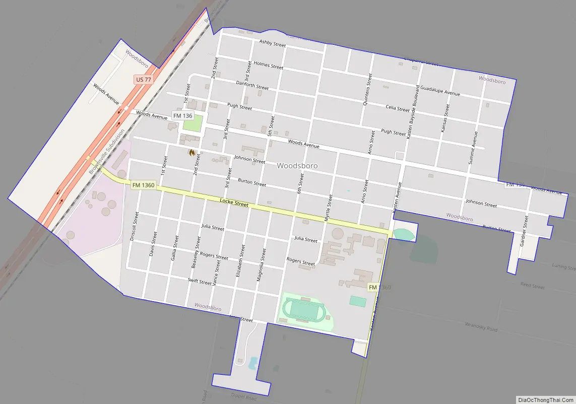
Woodsboro Road Map
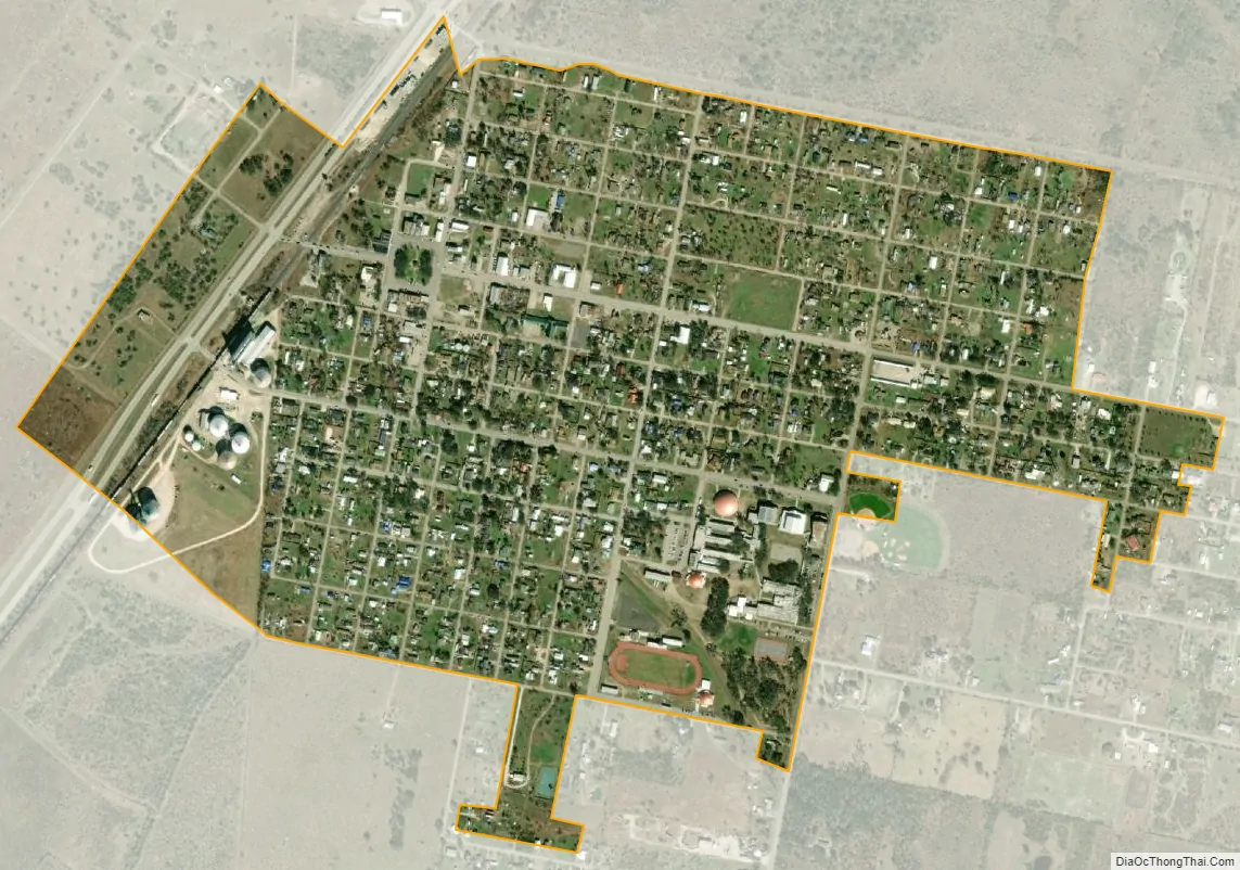
Woodsboro city Satellite Map
Geography
Woodsboro is located at 28°14′16″N 97°19′30″W / 28.23778°N 97.32500°W / 28.23778; -97.32500 (28.237826, –97.325068).
According to the United States Census Bureau, the town has a total area of 0.8 square miles (2.1 km), all of it land.
Climate
The climate in this area is characterized by hot, humid summers and generally mild to cool winters. According to the Köppen Climate Classification system, Woodsboro has a humid subtropical climate, abbreviated “Cfa” on climate maps.
See also
Map of Texas State and its subdivision:- Anderson
- Andrews
- Angelina
- Aransas
- Archer
- Armstrong
- Atascosa
- Austin
- Bailey
- Bandera
- Bastrop
- Baylor
- Bee
- Bell
- Bexar
- Blanco
- Borden
- Bosque
- Bowie
- Brazoria
- Brazos
- Brewster
- Briscoe
- Brooks
- Brown
- Burleson
- Burnet
- Caldwell
- Calhoun
- Callahan
- Cameron
- Camp
- Carson
- Cass
- Castro
- Chambers
- Cherokee
- Childress
- Clay
- Cochran
- Coke
- Coleman
- Collin
- Collingsworth
- Colorado
- Comal
- Comanche
- Concho
- Cooke
- Coryell
- Cottle
- Crane
- Crockett
- Crosby
- Culberson
- Dallam
- Dallas
- Dawson
- Deaf Smith
- Delta
- Denton
- Dewitt
- Dickens
- Dimmit
- Donley
- Duval
- Eastland
- Ector
- Edwards
- El Paso
- Ellis
- Erath
- Falls
- Fannin
- Fayette
- Fisher
- Floyd
- Foard
- Fort Bend
- Franklin
- Freestone
- Frio
- Gaines
- Galveston
- Garza
- Gillespie
- Glasscock
- Goliad
- Gonzales
- Gray
- Grayson
- Gregg
- Grimes
- Guadalupe
- Hale
- Hall
- Hamilton
- Hansford
- Hardeman
- Hardin
- Harris
- Harrison
- Hartley
- Haskell
- Hays
- Hemphill
- Henderson
- Hidalgo
- Hill
- Hockley
- Hood
- Hopkins
- Houston
- Howard
- Hudspeth
- Hunt
- Hutchinson
- Irion
- Jack
- Jackson
- Jasper
- Jeff Davis
- Jefferson
- Jim Hogg
- Jim Wells
- Johnson
- Jones
- Karnes
- Kaufman
- Kendall
- Kenedy
- Kent
- Kerr
- Kimble
- King
- Kinney
- Kleberg
- Knox
- La Salle
- Lamar
- Lamb
- Lampasas
- Lavaca
- Lee
- Leon
- Liberty
- Limestone
- Lipscomb
- Live Oak
- Llano
- Loving
- Lubbock
- Lynn
- Madison
- Marion
- Martin
- Mason
- Matagorda
- Maverick
- McCulloch
- McLennan
- McMullen
- Medina
- Menard
- Midland
- Milam
- Mills
- Mitchell
- Montague
- Montgomery
- Moore
- Morris
- Motley
- Nacogdoches
- Navarro
- Newton
- Nolan
- Nueces
- Ochiltree
- Oldham
- Orange
- Palo Pinto
- Panola
- Parker
- Parmer
- Pecos
- Polk
- Potter
- Presidio
- Rains
- Randall
- Reagan
- Real
- Red River
- Reeves
- Refugio
- Roberts
- Robertson
- Rockwall
- Runnels
- Rusk
- Sabine
- San Augustine
- San Jacinto
- San Patricio
- San Saba
- Schleicher
- Scurry
- Shackelford
- Shelby
- Sherman
- Smith
- Somervell
- Starr
- Stephens
- Sterling
- Stonewall
- Sutton
- Swisher
- Tarrant
- Taylor
- Terrell
- Terry
- Throckmorton
- Titus
- Tom Green
- Travis
- Trinity
- Tyler
- Upshur
- Upton
- Uvalde
- Val Verde
- Van Zandt
- Victoria
- Walker
- Waller
- Ward
- Washington
- Webb
- Wharton
- Wheeler
- Wichita
- Wilbarger
- Willacy
- Williamson
- Wilson
- Winkler
- Wise
- Wood
- Yoakum
- Young
- Zapata
- Zavala
- Alabama
- Alaska
- Arizona
- Arkansas
- California
- Colorado
- Connecticut
- Delaware
- District of Columbia
- Florida
- Georgia
- Hawaii
- Idaho
- Illinois
- Indiana
- Iowa
- Kansas
- Kentucky
- Louisiana
- Maine
- Maryland
- Massachusetts
- Michigan
- Minnesota
- Mississippi
- Missouri
- Montana
- Nebraska
- Nevada
- New Hampshire
- New Jersey
- New Mexico
- New York
- North Carolina
- North Dakota
- Ohio
- Oklahoma
- Oregon
- Pennsylvania
- Rhode Island
- South Carolina
- South Dakota
- Tennessee
- Texas
- Utah
- Vermont
- Virginia
- Washington
- West Virginia
- Wisconsin
- Wyoming