Woodson is a town in Throckmorton County, Texas, United States. As of 2014, the population was estimated to be 258.
| Name: | Woodson town |
|---|---|
| LSAD Code: | 43 |
| LSAD Description: | town (suffix) |
| State: | Texas |
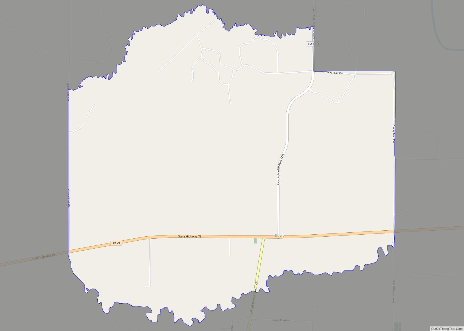
| County: | Throckmorton County |
| Elevation: | 1,227 ft (374 m) |
| Total Area: | 0.65 sq mi (1.68 km²) |
| Land Area: | 0.65 sq mi (1.68 km²) |
| Water Area: | 0.00 sq mi (0.00 km²) |
| Total Population: | 264 |
| Population Density: | 371.34/sq mi (143.33/km²) |
| ZIP code: | 76491 |
| Area code: | 940 |
| FIPS code: | 4880188 |
| GNISfeature ID: | 1350567 |
Online Interactive Map
Click on ![]() to view map in "full screen" mode.
to view map in "full screen" mode.
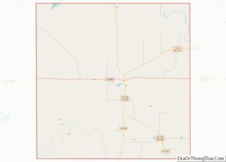
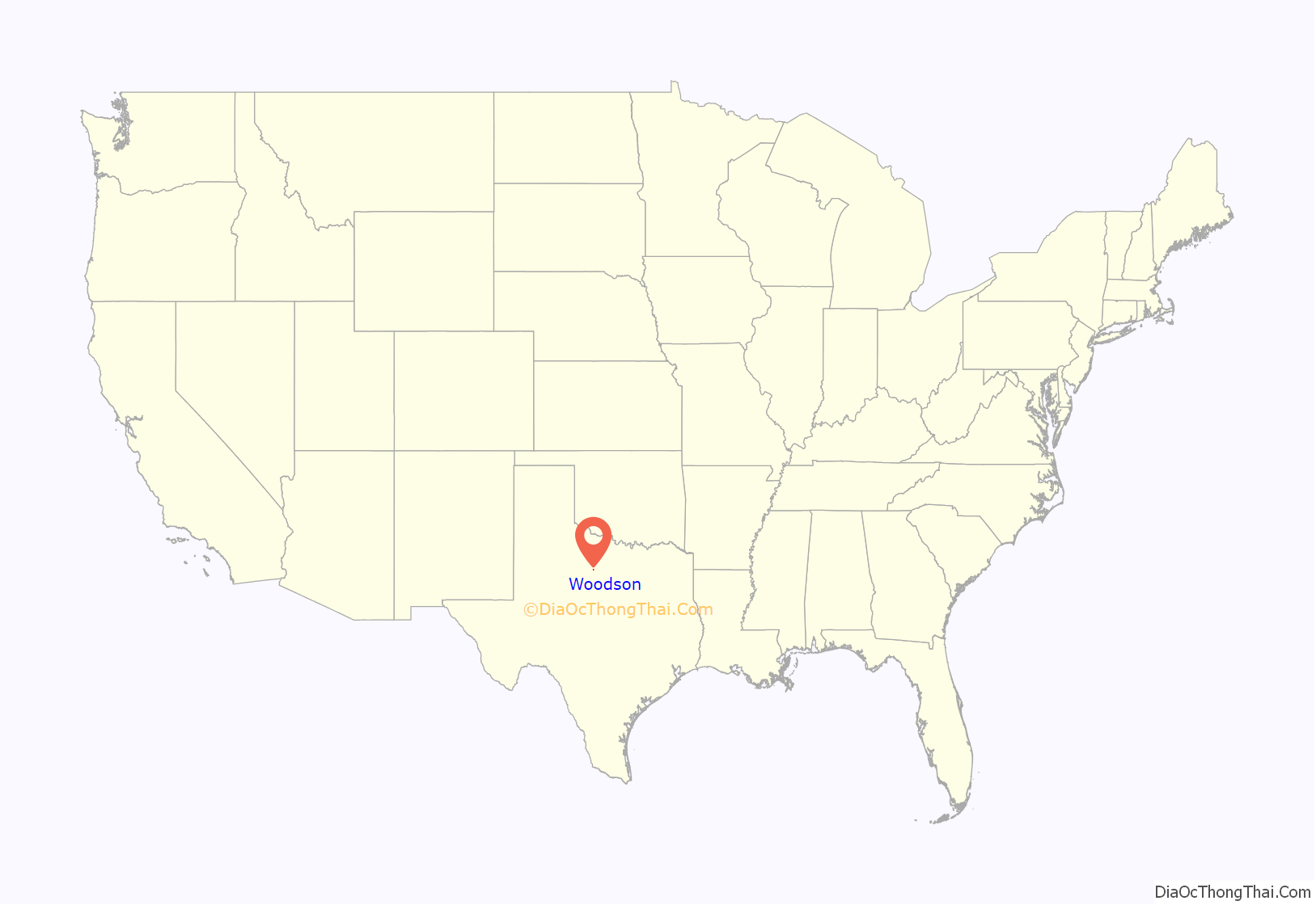
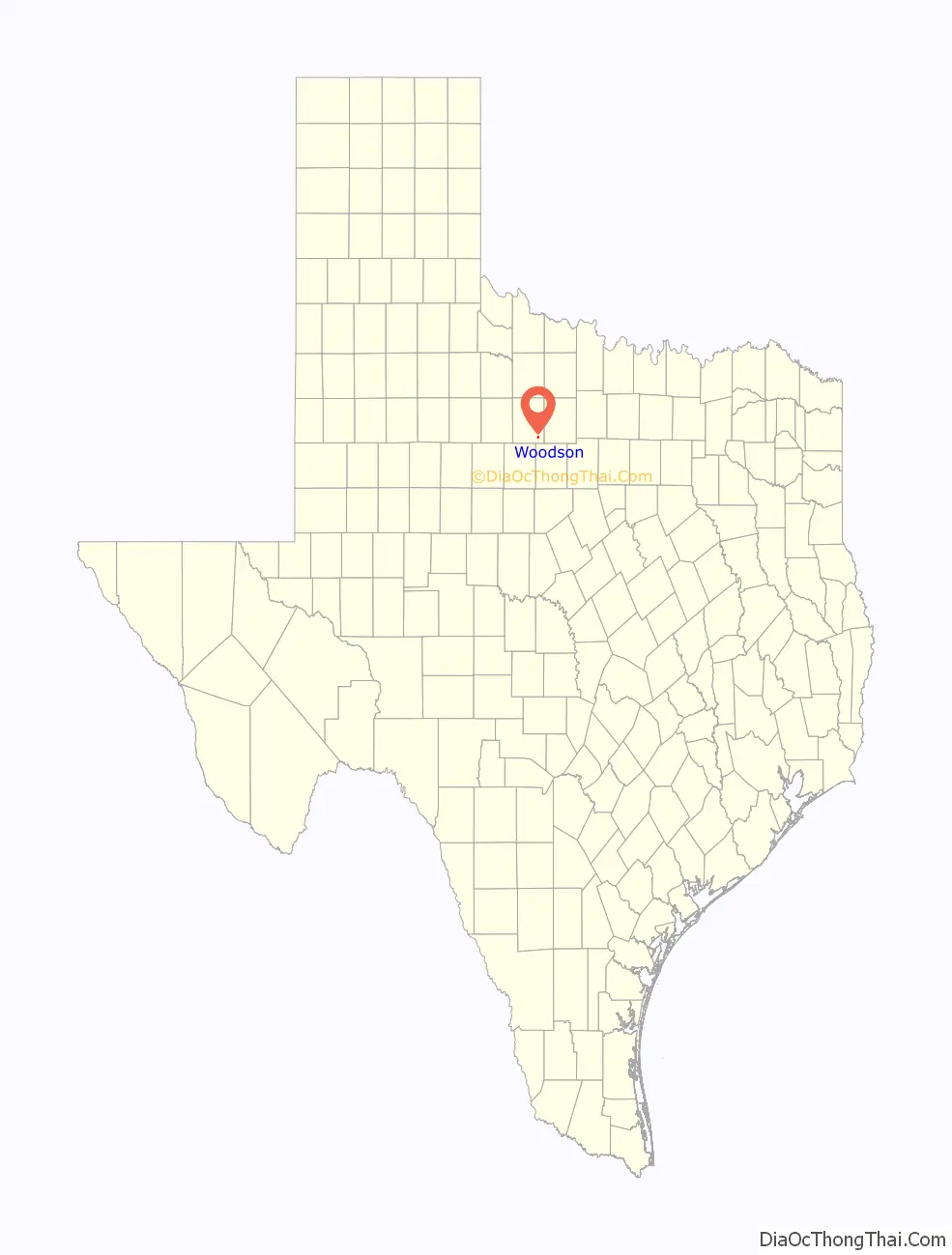
Woodson location map. Where is Woodson town?
History
The area was initially settled in 1875 by J.O. Wood and Henry McClintick. Wood’s son, O.J. Wood, played a leading role in the shaping of the community and its economics. Woodson was originally called Jom, when it was established around a cotton gin built so that the ranchers could get cottonseed to feed to cattle. After Jom was established, O.J. Wood deeded lots measuring 100 by 190 ft (30 by 58 m) to anyone who would build a residence there, free of charge. This caused businesses to start popping up, as a post office and Wood and Sons grocery were established.
Since J.O. Wood and his son built the first schoolhouse in town, the town was decided to be called Wood and Son, to honor the two. Throughout time, it was changed to Woodson, which has become the official name. Woodson eventually became a booming town, with an official start date in 1903. The first highway to Breckenridge was built in 1920.
Wood and his son also reportedly built the First Christian Church, located in the center of town on Highway 183, in the 1900s. When the original schoolhouse grew too small to hold all of Woodson’s students, the First Christian Church was used as an additional educational space.
Another result of the increase in people was the building of a railroad that came through Woodson. According to Big Country: People, Events and Places, Volume V, the line was owned and operated by the Texas and Pacific Railroad. The land for the right-of-way was obtained in three ways; some was bought outright from the owners. If the owners refused to sell, the Texas and Pacific took it by easement. Some landowners gave the land for the right-of-way; for instance, the Dickie family gave land through the East Woods to the company. Local men helped build the roadbed and lay the tracks. Once the train was built, it made one run from Cisco to Throckmorton each day.
Due to the railroad and the oil-field boom, Woodson grew for a long time. The town had three gasoline service stations, two cotton gins, two barber shops, and a lumber yard. T
At one point, Woodson also had a movie theater (next to the Woodson Inn), a Chevrolet dealer, a drugstore, and a feed store, next to which a local physician, Doctor Turner, ran a practice.
Woodson originally received its water from the city lake (south of town, on Highway 183, which is now known as Dickie Lake).
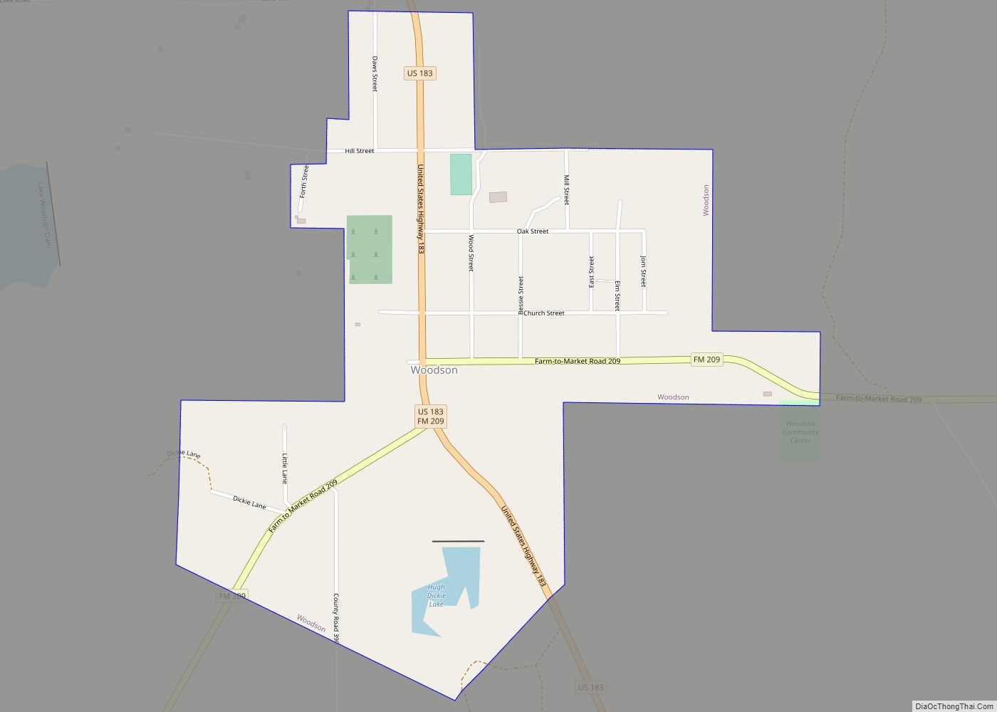
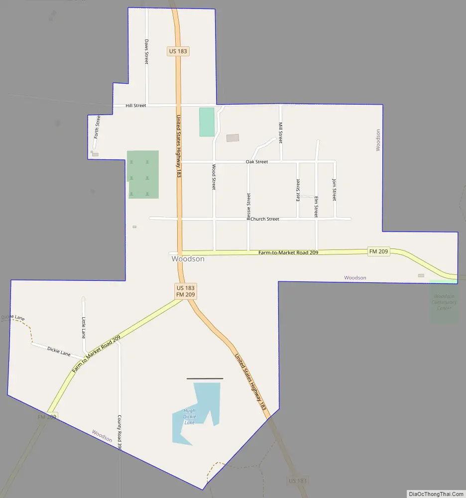
Woodson Road Map
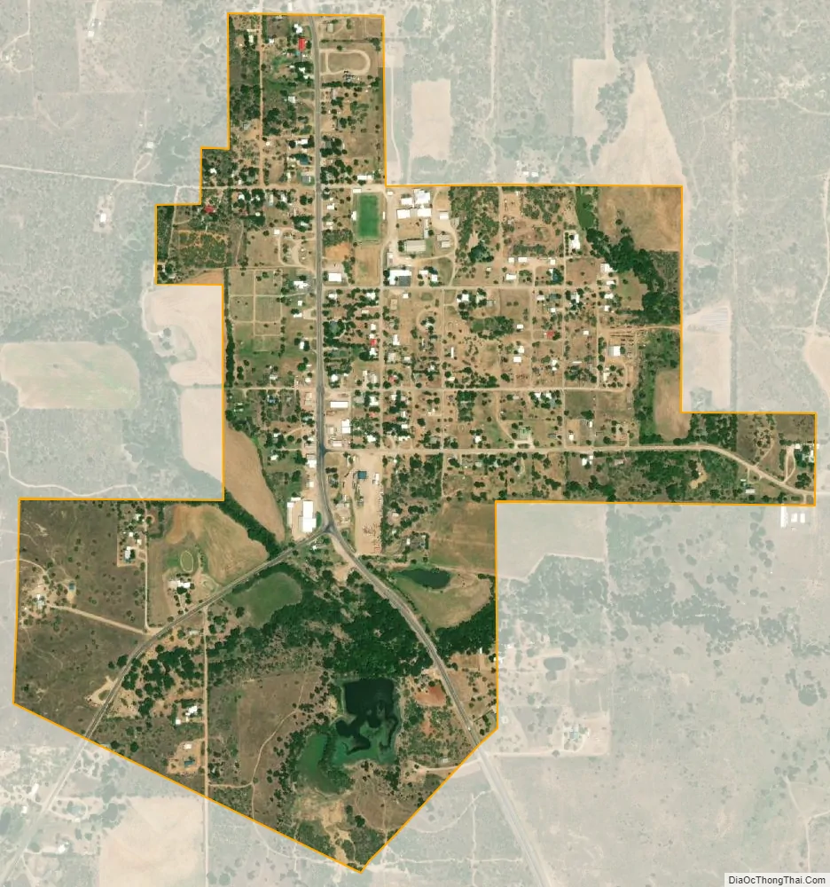
Woodson city Satellite Map
Geography
Woodson is located at 33°0′56″N 99°3′8″W / 33.01556°N 99.05222°W / 33.01556; -99.05222 (33.015517, –99.052276) in north-central Texas. It is situated at the junction of U.S. Highway 183 and Farm Roads 209 and 1710 in southeastern Throckmorton County, about 15 miles (24 km) southeast of Throckmorton.
According to the United States Census Bureau, the town has a total area of 0.6 square miles (1.7 km), all of it land.
Climate
The climate in this area is characterized by hot, humid summers and generally mild to cool winters. According to the Köppen climate classification system, Woodson has a humid subtropical climate, Cfa on climate maps.
See also
Map of Texas State and its subdivision:- Anderson
- Andrews
- Angelina
- Aransas
- Archer
- Armstrong
- Atascosa
- Austin
- Bailey
- Bandera
- Bastrop
- Baylor
- Bee
- Bell
- Bexar
- Blanco
- Borden
- Bosque
- Bowie
- Brazoria
- Brazos
- Brewster
- Briscoe
- Brooks
- Brown
- Burleson
- Burnet
- Caldwell
- Calhoun
- Callahan
- Cameron
- Camp
- Carson
- Cass
- Castro
- Chambers
- Cherokee
- Childress
- Clay
- Cochran
- Coke
- Coleman
- Collin
- Collingsworth
- Colorado
- Comal
- Comanche
- Concho
- Cooke
- Coryell
- Cottle
- Crane
- Crockett
- Crosby
- Culberson
- Dallam
- Dallas
- Dawson
- Deaf Smith
- Delta
- Denton
- Dewitt
- Dickens
- Dimmit
- Donley
- Duval
- Eastland
- Ector
- Edwards
- El Paso
- Ellis
- Erath
- Falls
- Fannin
- Fayette
- Fisher
- Floyd
- Foard
- Fort Bend
- Franklin
- Freestone
- Frio
- Gaines
- Galveston
- Garza
- Gillespie
- Glasscock
- Goliad
- Gonzales
- Gray
- Grayson
- Gregg
- Grimes
- Guadalupe
- Hale
- Hall
- Hamilton
- Hansford
- Hardeman
- Hardin
- Harris
- Harrison
- Hartley
- Haskell
- Hays
- Hemphill
- Henderson
- Hidalgo
- Hill
- Hockley
- Hood
- Hopkins
- Houston
- Howard
- Hudspeth
- Hunt
- Hutchinson
- Irion
- Jack
- Jackson
- Jasper
- Jeff Davis
- Jefferson
- Jim Hogg
- Jim Wells
- Johnson
- Jones
- Karnes
- Kaufman
- Kendall
- Kenedy
- Kent
- Kerr
- Kimble
- King
- Kinney
- Kleberg
- Knox
- La Salle
- Lamar
- Lamb
- Lampasas
- Lavaca
- Lee
- Leon
- Liberty
- Limestone
- Lipscomb
- Live Oak
- Llano
- Loving
- Lubbock
- Lynn
- Madison
- Marion
- Martin
- Mason
- Matagorda
- Maverick
- McCulloch
- McLennan
- McMullen
- Medina
- Menard
- Midland
- Milam
- Mills
- Mitchell
- Montague
- Montgomery
- Moore
- Morris
- Motley
- Nacogdoches
- Navarro
- Newton
- Nolan
- Nueces
- Ochiltree
- Oldham
- Orange
- Palo Pinto
- Panola
- Parker
- Parmer
- Pecos
- Polk
- Potter
- Presidio
- Rains
- Randall
- Reagan
- Real
- Red River
- Reeves
- Refugio
- Roberts
- Robertson
- Rockwall
- Runnels
- Rusk
- Sabine
- San Augustine
- San Jacinto
- San Patricio
- San Saba
- Schleicher
- Scurry
- Shackelford
- Shelby
- Sherman
- Smith
- Somervell
- Starr
- Stephens
- Sterling
- Stonewall
- Sutton
- Swisher
- Tarrant
- Taylor
- Terrell
- Terry
- Throckmorton
- Titus
- Tom Green
- Travis
- Trinity
- Tyler
- Upshur
- Upton
- Uvalde
- Val Verde
- Van Zandt
- Victoria
- Walker
- Waller
- Ward
- Washington
- Webb
- Wharton
- Wheeler
- Wichita
- Wilbarger
- Willacy
- Williamson
- Wilson
- Winkler
- Wise
- Wood
- Yoakum
- Young
- Zapata
- Zavala
- Alabama
- Alaska
- Arizona
- Arkansas
- California
- Colorado
- Connecticut
- Delaware
- District of Columbia
- Florida
- Georgia
- Hawaii
- Idaho
- Illinois
- Indiana
- Iowa
- Kansas
- Kentucky
- Louisiana
- Maine
- Maryland
- Massachusetts
- Michigan
- Minnesota
- Mississippi
- Missouri
- Montana
- Nebraska
- Nevada
- New Hampshire
- New Jersey
- New Mexico
- New York
- North Carolina
- North Dakota
- Ohio
- Oklahoma
- Oregon
- Pennsylvania
- Rhode Island
- South Carolina
- South Dakota
- Tennessee
- Texas
- Utah
- Vermont
- Virginia
- Washington
- West Virginia
- Wisconsin
- Wyoming