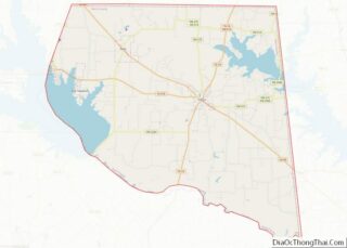
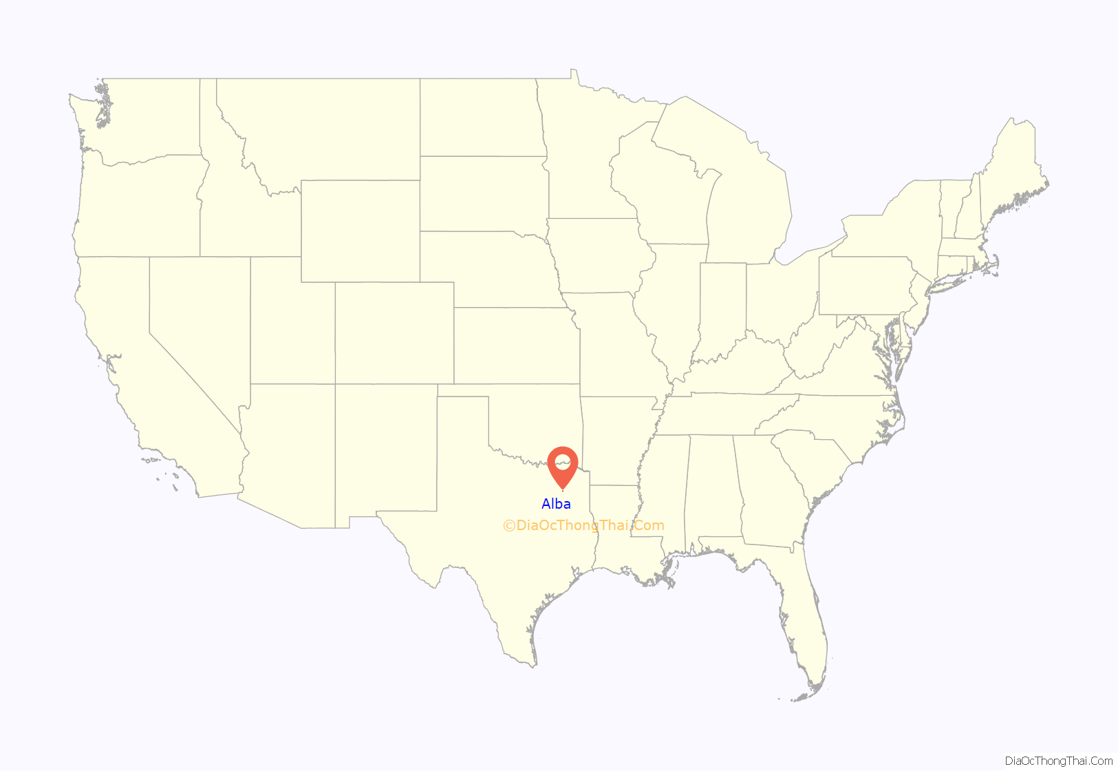
Alba (/ˈælbə/ AL-bə) is a town located at the intersection of U.S. Highway 69 and Farm To Market Road 17 on the western edge of Wood County, Texas south of Lake Fork and approximately ten miles west of Quitman. The population was 473 in the 2020 U.S. Census.
| Name: | Alba town |
|---|---|
| LSAD Code: | 43 |
| LSAD Description: | town (suffix) |
| State: | Texas |
| County: | Rains County, Wood County |
| Elevation: | 449 ft (137 m) |
| Total Area: | 1.06 sq mi (2.74 km²) |
| Land Area: | 1.05 sq mi (2.73 km²) |
| Water Area: | 0.01 sq mi (0.02 km²) |
| Total Population: | 504 |
| Population Density: | 517.57/sq mi (199.87/km²) |
| ZIP code: | 75410 |
| Area code: | 903 |
| FIPS code: | 4801636 |
| GNISfeature ID: | 1329324 |
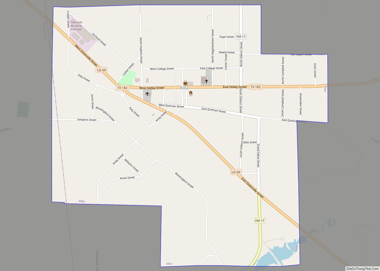
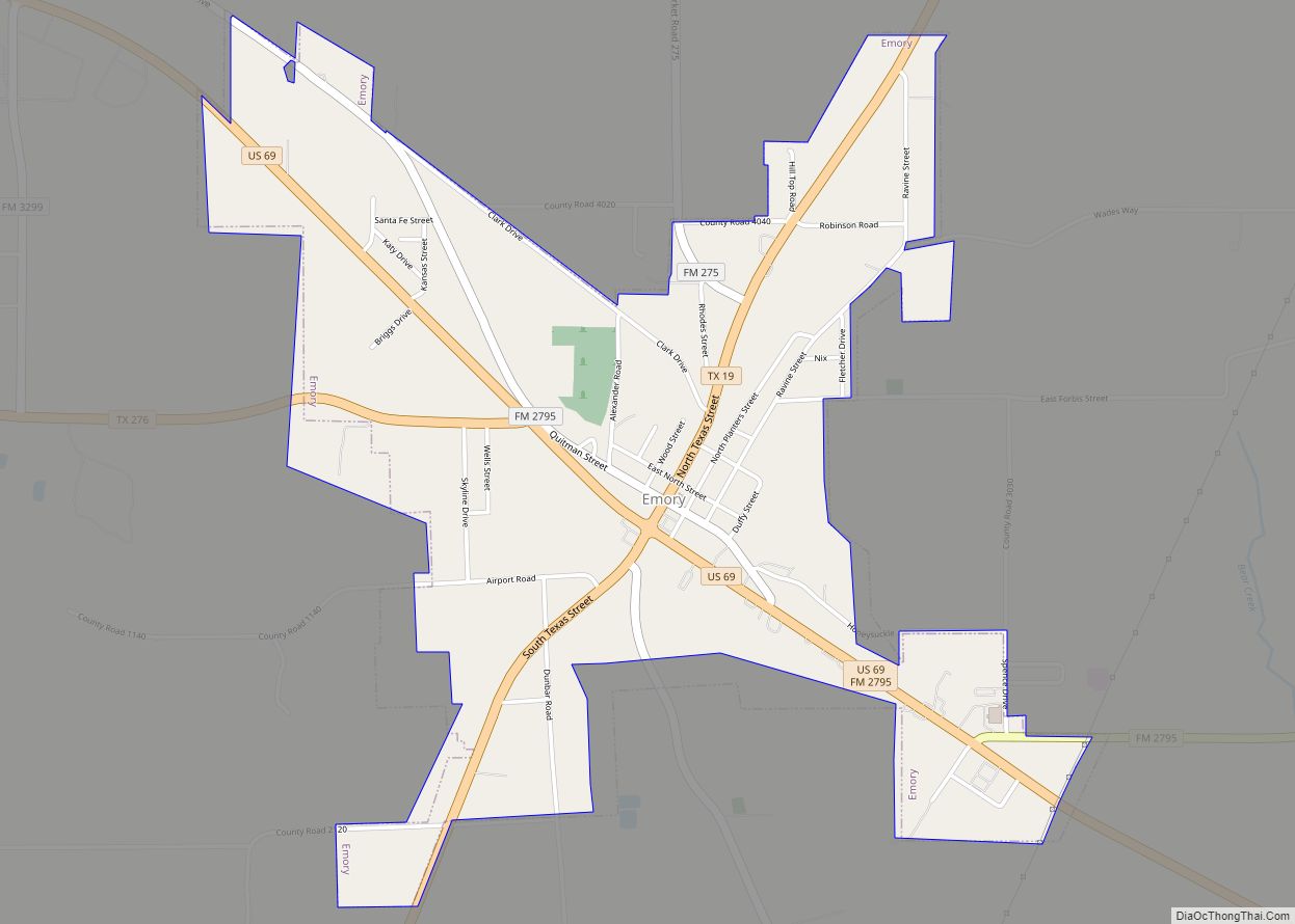
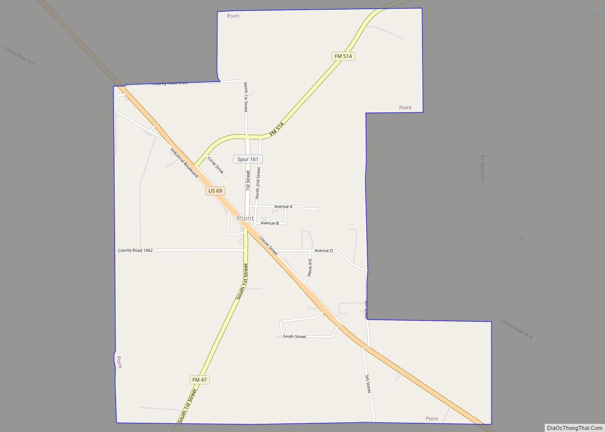
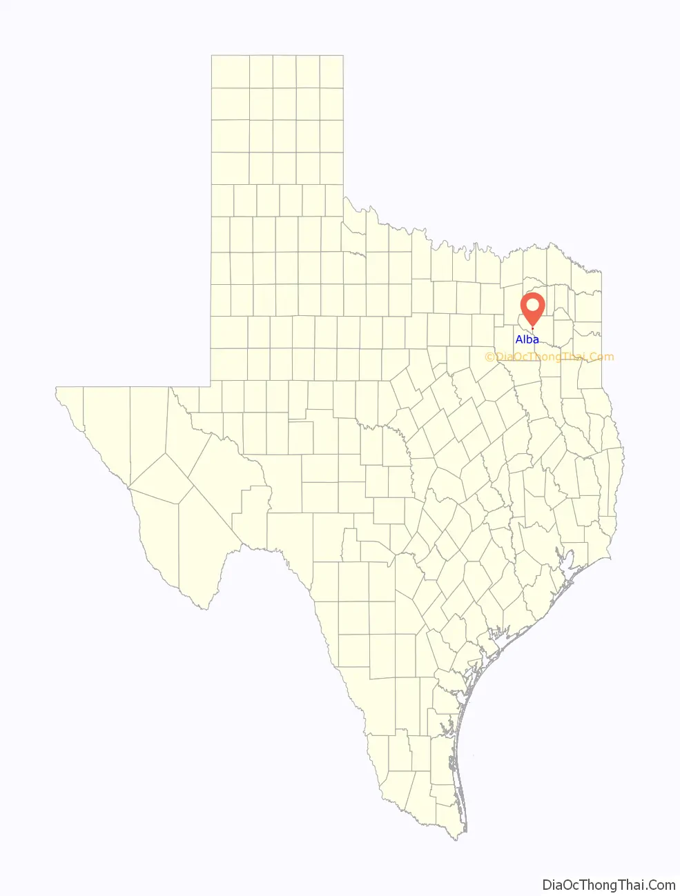
Online Interactive Map
Click on ![]() to view map in "full screen" mode.
to view map in "full screen" mode.
Alba location map. Where is Alba town?
History
A gunsmith named Joseph Simpkins was likely the first to settle the area, arriving here with his family from Missouri around 1843. The area was previously alternately known as Albia and Simpkins’ Prairie. Theories on how the community got its name differ; one claims it was because the town had been intended for white settlers only while another claims it was named for the son of a railroad official.
The Alba Oilfield was discovered just south of Alba in 1848 by F.R. Jackson.
The Missouri, Kansas and Texas Railroad came through Alba in 1881. One of the earliest shipments to Alba is reported to have been a telegraph office and, reportedly one of the first telegraphs received told details of the assassination of President James Garfield. Later that year, Alba also received a post office. It closed briefly in 1882 but reopened that same year.
By 1882, a townsite had been laid out and a number of merchants were opened in the area to serve the influx of railroad-tie cutters; population was 50 by 1884 and 300 by 1896.
A lignite coal deposit was discovered near Alba around 1900 and in 1902 and 1903, the Texas Short Line Railway was constructed to ship coal from Alba and nearby Hoyt to Grand Saline in Van Zandt County. By 1911, five area mines produced about 40,000 tons of coal per month. Population was around 1,500 by this year. Unlike other coal mines in the state, those at Alba were forced to use convict labor, because Alba was a sundown town that banned African Americans and Hispanics from living or working there.
By 1990, the boundaries of Alba had expanded in to nearby Rains County, and the city had a population of 489, which dropped to 430 in 2000.
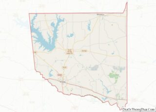
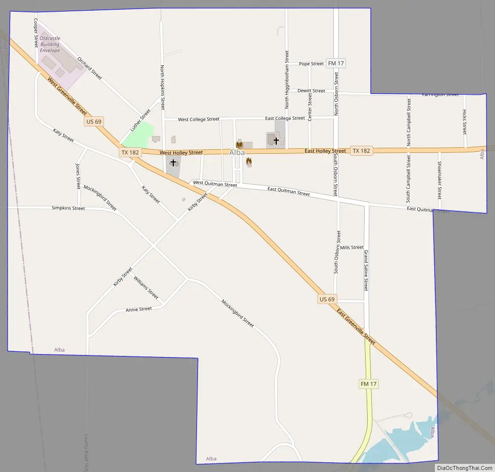
Alba Road Map
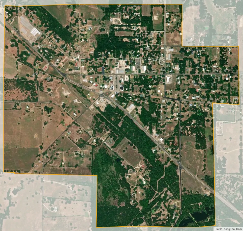
Alba city Satellite Map
Geography
Alba is located at 32°47′31″N 95°38′4″W / 32.79194°N 95.63444°W / 32.79194; -95.63444 (32.792069, –95.634532).
According to the United States Census Bureau, the town has a total area of 1.1 square miles (2.9 km), all land.
It is approximately 60 miles (97 km) northeast of Dallas.
See also
Map of Texas State and its subdivision:- Anderson
- Andrews
- Angelina
- Aransas
- Archer
- Armstrong
- Atascosa
- Austin
- Bailey
- Bandera
- Bastrop
- Baylor
- Bee
- Bell
- Bexar
- Blanco
- Borden
- Bosque
- Bowie
- Brazoria
- Brazos
- Brewster
- Briscoe
- Brooks
- Brown
- Burleson
- Burnet
- Caldwell
- Calhoun
- Callahan
- Cameron
- Camp
- Carson
- Cass
- Castro
- Chambers
- Cherokee
- Childress
- Clay
- Cochran
- Coke
- Coleman
- Collin
- Collingsworth
- Colorado
- Comal
- Comanche
- Concho
- Cooke
- Coryell
- Cottle
- Crane
- Crockett
- Crosby
- Culberson
- Dallam
- Dallas
- Dawson
- Deaf Smith
- Delta
- Denton
- Dewitt
- Dickens
- Dimmit
- Donley
- Duval
- Eastland
- Ector
- Edwards
- El Paso
- Ellis
- Erath
- Falls
- Fannin
- Fayette
- Fisher
- Floyd
- Foard
- Fort Bend
- Franklin
- Freestone
- Frio
- Gaines
- Galveston
- Garza
- Gillespie
- Glasscock
- Goliad
- Gonzales
- Gray
- Grayson
- Gregg
- Grimes
- Guadalupe
- Hale
- Hall
- Hamilton
- Hansford
- Hardeman
- Hardin
- Harris
- Harrison
- Hartley
- Haskell
- Hays
- Hemphill
- Henderson
- Hidalgo
- Hill
- Hockley
- Hood
- Hopkins
- Houston
- Howard
- Hudspeth
- Hunt
- Hutchinson
- Irion
- Jack
- Jackson
- Jasper
- Jeff Davis
- Jefferson
- Jim Hogg
- Jim Wells
- Johnson
- Jones
- Karnes
- Kaufman
- Kendall
- Kenedy
- Kent
- Kerr
- Kimble
- King
- Kinney
- Kleberg
- Knox
- La Salle
- Lamar
- Lamb
- Lampasas
- Lavaca
- Lee
- Leon
- Liberty
- Limestone
- Lipscomb
- Live Oak
- Llano
- Loving
- Lubbock
- Lynn
- Madison
- Marion
- Martin
- Mason
- Matagorda
- Maverick
- McCulloch
- McLennan
- McMullen
- Medina
- Menard
- Midland
- Milam
- Mills
- Mitchell
- Montague
- Montgomery
- Moore
- Morris
- Motley
- Nacogdoches
- Navarro
- Newton
- Nolan
- Nueces
- Ochiltree
- Oldham
- Orange
- Palo Pinto
- Panola
- Parker
- Parmer
- Pecos
- Polk
- Potter
- Presidio
- Rains
- Randall
- Reagan
- Real
- Red River
- Reeves
- Refugio
- Roberts
- Robertson
- Rockwall
- Runnels
- Rusk
- Sabine
- San Augustine
- San Jacinto
- San Patricio
- San Saba
- Schleicher
- Scurry
- Shackelford
- Shelby
- Sherman
- Smith
- Somervell
- Starr
- Stephens
- Sterling
- Stonewall
- Sutton
- Swisher
- Tarrant
- Taylor
- Terrell
- Terry
- Throckmorton
- Titus
- Tom Green
- Travis
- Trinity
- Tyler
- Upshur
- Upton
- Uvalde
- Val Verde
- Van Zandt
- Victoria
- Walker
- Waller
- Ward
- Washington
- Webb
- Wharton
- Wheeler
- Wichita
- Wilbarger
- Willacy
- Williamson
- Wilson
- Winkler
- Wise
- Wood
- Yoakum
- Young
- Zapata
- Zavala
- Alabama
- Alaska
- Arizona
- Arkansas
- California
- Colorado
- Connecticut
- Delaware
- District of Columbia
- Florida
- Georgia
- Hawaii
- Idaho
- Illinois
- Indiana
- Iowa
- Kansas
- Kentucky
- Louisiana
- Maine
- Maryland
- Massachusetts
- Michigan
- Minnesota
- Mississippi
- Missouri
- Montana
- Nebraska
- Nevada
- New Hampshire
- New Jersey
- New Mexico
- New York
- North Carolina
- North Dakota
- Ohio
- Oklahoma
- Oregon
- Pennsylvania
- Rhode Island
- South Carolina
- South Dakota
- Tennessee
- Texas
- Utah
- Vermont
- Virginia
- Washington
- West Virginia
- Wisconsin
- Wyoming