Brady is a city in McCulloch County, Texas, United States. Brady refers to itself as the “Heart of Texas”, as it is the city closest to the geographical center of the state, which is about 15 miles northeast of Brady. Its population was 5,528 at the 2010 census. It is the county seat of McCulloch County.
| Name: | Brady city |
|---|---|
| LSAD Code: | 25 |
| LSAD Description: | city (suffix) |
| State: | Texas |
| County: | McCulloch County |
| Elevation: | 1,677 ft (511 m) |
| Total Area: | 11.44 sq mi (29.63 km²) |
| Land Area: | 8.94 sq mi (23.16 km²) |
| Water Area: | 2.50 sq mi (6.47 km²) |
| Total Population: | 5,528 |
| Population Density: | 592.87/sq mi (228.92/km²) |
| ZIP code: | 76825 |
| Area code: | 325 |
| FIPS code: | 4809916 |
| GNISfeature ID: | 1352814 |
| Website: | www.bradytx.us |
Online Interactive Map
Click on ![]() to view map in "full screen" mode.
to view map in "full screen" mode.
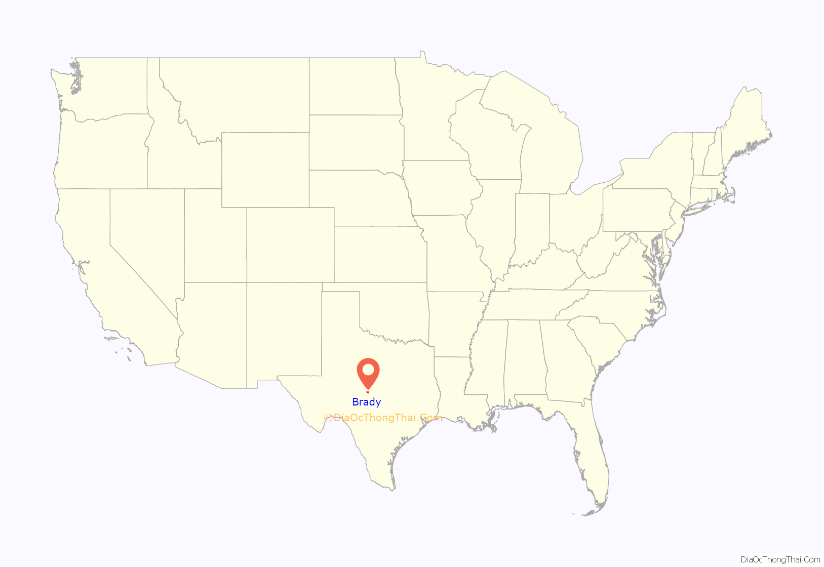
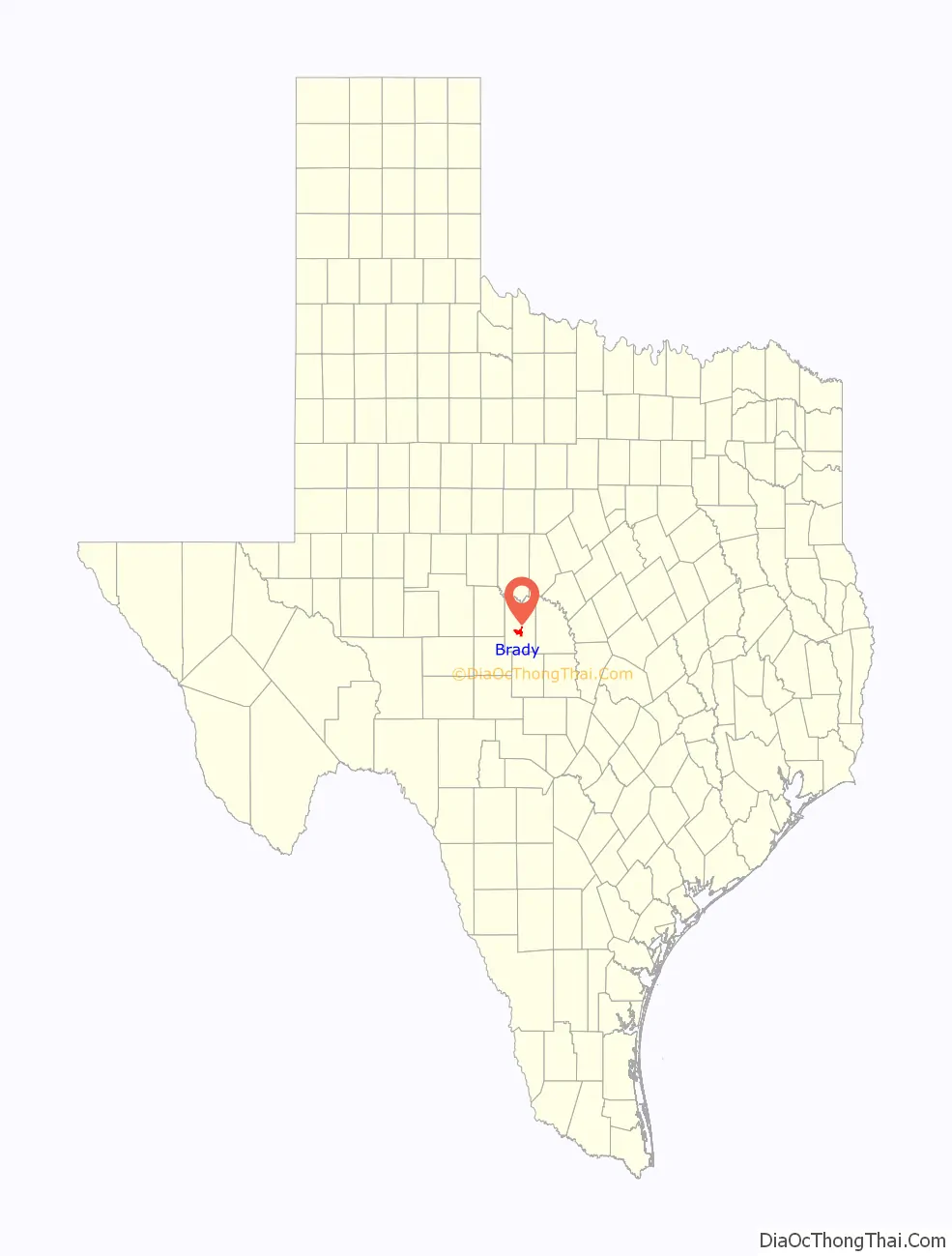
Brady location map. Where is Brady city?
History
When the area was settled in the 1870s, the community was named Brady City after Brady Creek, which runs through town. The name was shortened to Brady when the town was incorporated in 1906. In 1787–1788, Spanish explorer José Mares crossed the creek near the site of present Brady. Henry and Nancy Fulcher, the first settlers on Brady Creek, donated land for the townsite in the mid-1870s. Allison Ogden and his father-in-law, Ben Henton, built a store in 1875. A post office opened in 1876. After residents of McCulloch County chose Brady as county seat on May 15, 1876, the town grew fairly quickly. Brady had about 50 residents in 1877, and a stone courthouse was completed in 1878.
Thomas Maples began weekly publication of The Brady Sentinel in 1880; by 1884, Brady had two churches, a district school, three stores, two hotels, and 300 residents.
Stock raising was the primary occupation in the Brady area before 1900. In the 1870s and 1880s, local ranchers drove their cattle to markets in Kansas. Most other trade was with Brownwood and Lampasas. The number of farms and fences increased with the influx of immigrants in the late 1880s and 1890s. Poultry, sheep, goats, cotton, and pecans joined cattle as important sources of income for area residents.
When the Fort Worth and Rio Grande Railway arrived in 1903, Brady became a principal shipping point for Central Texas. The Gulf, Colorado and Santa Fe came to Brady in 1912. By 1914, the town had grown to include four churches, two schools, two banks, several processing plants, manufacturing and supply outlets, and 2,669 residents. In 1926, Brady residents celebrated the building of 42-acre Richards Park by holding a two-day barbecue on the Fourth of July weekend; it was such a success that the celebration was labeled the “July Jubilee” and became an annual event.
Curtis Field opened just north of Brady in 1942 as a pilot-training school. Also during World War II, a German prisoner-of-war camp was built 3 miles east of the town; it housed more than 300 Germans, most of them members of Rommel’s Afrika Korps.
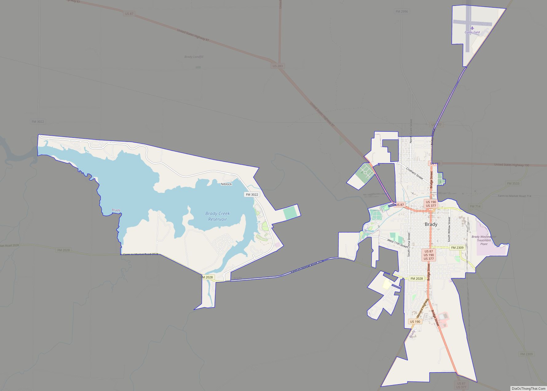
Brady grew slowly from the 1920s through the 1950s, with population estimates reaching a peak of 6,800 in 1958. In 1959, the Gulf, Colorado and Santa Fe Railway abandoned the section of track between Brownwood and Brady, thereby reducing Brady’s access to outside markets. The population fell to 5,338 by 1961, and subsequently stabilized. Brady Reservoir was completed in 1963 for flood control, municipal and industrial water needs, and recreation. The Atchison, Topeka and Santa Fe abandoned the track between Brady and Eden in 1972, leaving the town with only a branch track to connect it with the main line at Lometa, in Lampasas County.
Brady had 5,925 residents and 142 businesses in 1988. It was principally a farming and ranching community. Its industry included a mohair-combing plant and sand-mining operations. The Francis King Art Gallery and Museum houses works by King, a painter and sculptor, and a collection of restored antique cars. The stone courthouse, built in 1900, was renovated in 2009. A horse racetrack, G. Rollie White Downs, opened in 1989 and closed in 1990. Brady’s population in 1990 was 5,946, but dropped to 5,528 in 2010.
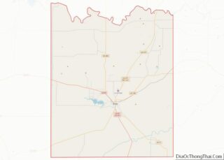
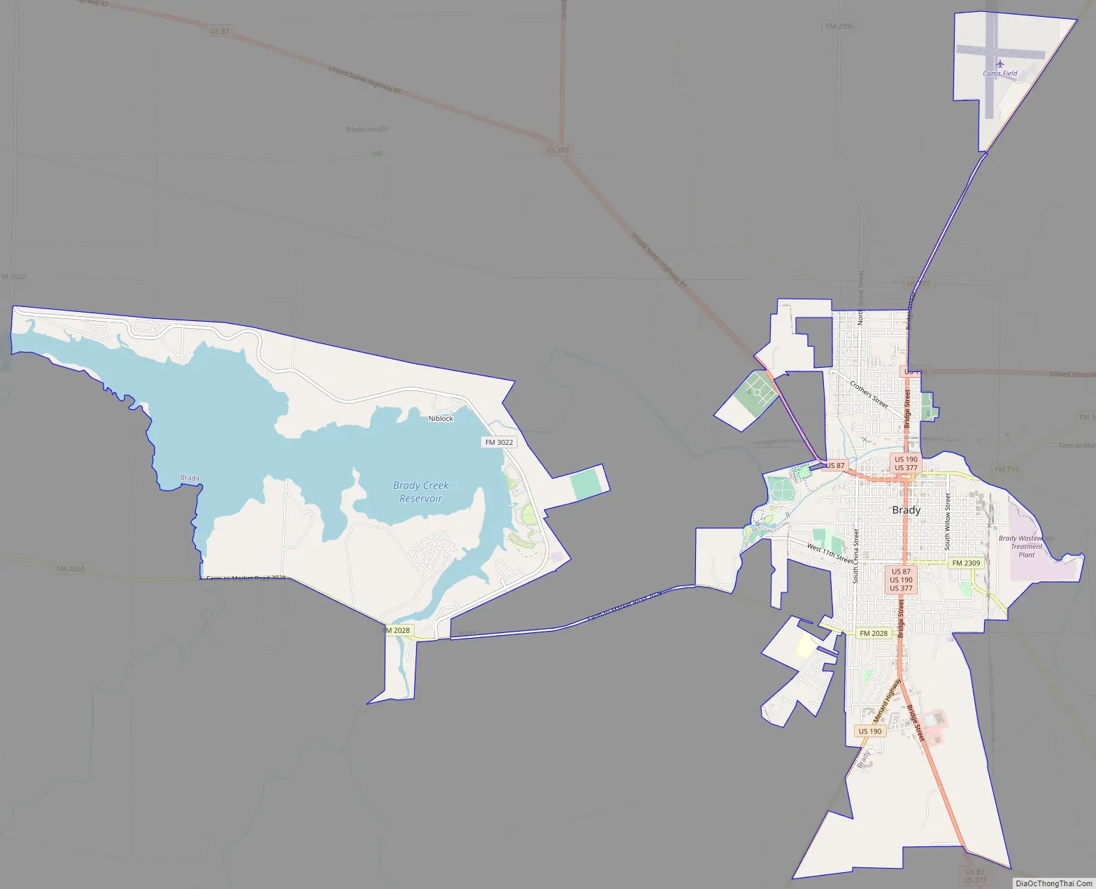
Brady Road Map
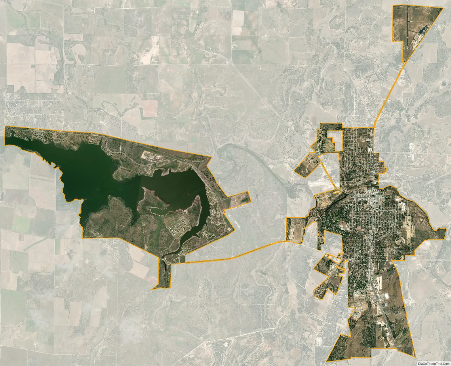
Brady city Satellite Map
Geography
According to the United States Census Bureau, Brady has a total area of 11.5 square miles (30 km), of which, 9.2 sq mi (24 km) are land and 2.3 sq mi (6.0 km) (20.16%) are covered by water.
Major highways
- U.S. Highway 87
- U.S. Highway 190
- U.S. Highway 283
- U.S. Highway 377
- State Highway 71
See also
Map of Texas State and its subdivision:- Anderson
- Andrews
- Angelina
- Aransas
- Archer
- Armstrong
- Atascosa
- Austin
- Bailey
- Bandera
- Bastrop
- Baylor
- Bee
- Bell
- Bexar
- Blanco
- Borden
- Bosque
- Bowie
- Brazoria
- Brazos
- Brewster
- Briscoe
- Brooks
- Brown
- Burleson
- Burnet
- Caldwell
- Calhoun
- Callahan
- Cameron
- Camp
- Carson
- Cass
- Castro
- Chambers
- Cherokee
- Childress
- Clay
- Cochran
- Coke
- Coleman
- Collin
- Collingsworth
- Colorado
- Comal
- Comanche
- Concho
- Cooke
- Coryell
- Cottle
- Crane
- Crockett
- Crosby
- Culberson
- Dallam
- Dallas
- Dawson
- Deaf Smith
- Delta
- Denton
- Dewitt
- Dickens
- Dimmit
- Donley
- Duval
- Eastland
- Ector
- Edwards
- El Paso
- Ellis
- Erath
- Falls
- Fannin
- Fayette
- Fisher
- Floyd
- Foard
- Fort Bend
- Franklin
- Freestone
- Frio
- Gaines
- Galveston
- Garza
- Gillespie
- Glasscock
- Goliad
- Gonzales
- Gray
- Grayson
- Gregg
- Grimes
- Guadalupe
- Hale
- Hall
- Hamilton
- Hansford
- Hardeman
- Hardin
- Harris
- Harrison
- Hartley
- Haskell
- Hays
- Hemphill
- Henderson
- Hidalgo
- Hill
- Hockley
- Hood
- Hopkins
- Houston
- Howard
- Hudspeth
- Hunt
- Hutchinson
- Irion
- Jack
- Jackson
- Jasper
- Jeff Davis
- Jefferson
- Jim Hogg
- Jim Wells
- Johnson
- Jones
- Karnes
- Kaufman
- Kendall
- Kenedy
- Kent
- Kerr
- Kimble
- King
- Kinney
- Kleberg
- Knox
- La Salle
- Lamar
- Lamb
- Lampasas
- Lavaca
- Lee
- Leon
- Liberty
- Limestone
- Lipscomb
- Live Oak
- Llano
- Loving
- Lubbock
- Lynn
- Madison
- Marion
- Martin
- Mason
- Matagorda
- Maverick
- McCulloch
- McLennan
- McMullen
- Medina
- Menard
- Midland
- Milam
- Mills
- Mitchell
- Montague
- Montgomery
- Moore
- Morris
- Motley
- Nacogdoches
- Navarro
- Newton
- Nolan
- Nueces
- Ochiltree
- Oldham
- Orange
- Palo Pinto
- Panola
- Parker
- Parmer
- Pecos
- Polk
- Potter
- Presidio
- Rains
- Randall
- Reagan
- Real
- Red River
- Reeves
- Refugio
- Roberts
- Robertson
- Rockwall
- Runnels
- Rusk
- Sabine
- San Augustine
- San Jacinto
- San Patricio
- San Saba
- Schleicher
- Scurry
- Shackelford
- Shelby
- Sherman
- Smith
- Somervell
- Starr
- Stephens
- Sterling
- Stonewall
- Sutton
- Swisher
- Tarrant
- Taylor
- Terrell
- Terry
- Throckmorton
- Titus
- Tom Green
- Travis
- Trinity
- Tyler
- Upshur
- Upton
- Uvalde
- Val Verde
- Van Zandt
- Victoria
- Walker
- Waller
- Ward
- Washington
- Webb
- Wharton
- Wheeler
- Wichita
- Wilbarger
- Willacy
- Williamson
- Wilson
- Winkler
- Wise
- Wood
- Yoakum
- Young
- Zapata
- Zavala
- Alabama
- Alaska
- Arizona
- Arkansas
- California
- Colorado
- Connecticut
- Delaware
- District of Columbia
- Florida
- Georgia
- Hawaii
- Idaho
- Illinois
- Indiana
- Iowa
- Kansas
- Kentucky
- Louisiana
- Maine
- Maryland
- Massachusetts
- Michigan
- Minnesota
- Mississippi
- Missouri
- Montana
- Nebraska
- Nevada
- New Hampshire
- New Jersey
- New Mexico
- New York
- North Carolina
- North Dakota
- Ohio
- Oklahoma
- Oregon
- Pennsylvania
- Rhode Island
- South Carolina
- South Dakota
- Tennessee
- Texas
- Utah
- Vermont
- Virginia
- Washington
- West Virginia
- Wisconsin
- Wyoming