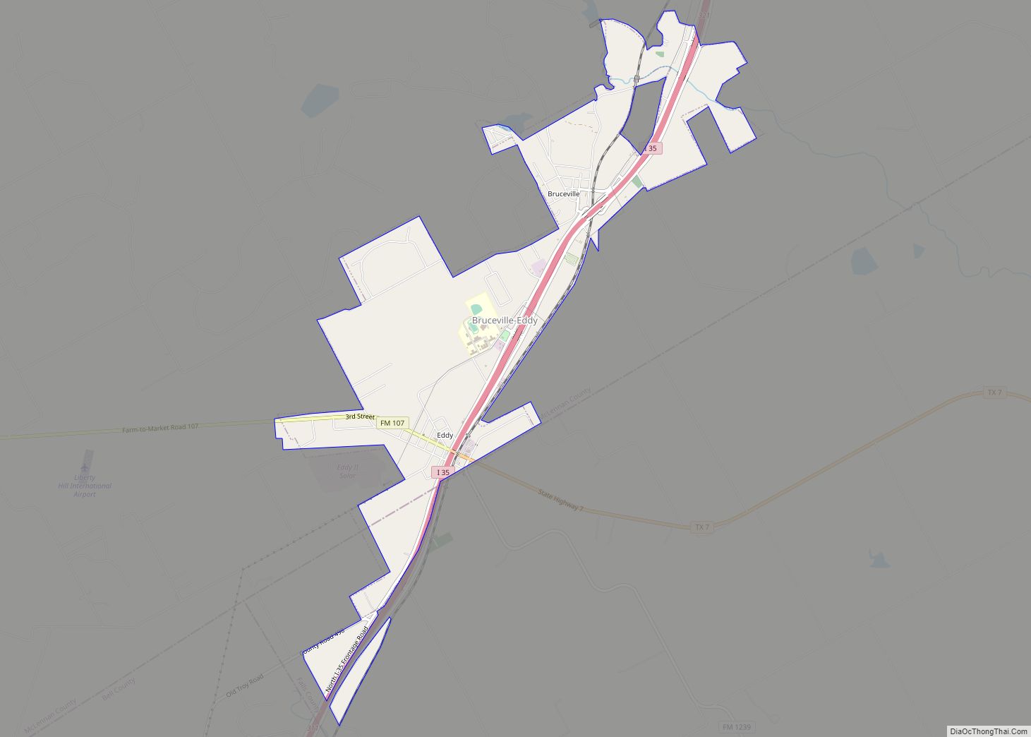
Bruceville-Eddy is a city in McLennan and Falls Counties in the U.S. state of Texas. Its population was 1,413 at the 2020 census.
Most of the city is in McLennan County and is part of the Waco metropolitan statistical area. A small southern portion is in Falls County.
| Name: | Bruceville-Eddy city |
|---|---|
| LSAD Code: | 25 |
| LSAD Description: | city (suffix) |
| State: | Texas |
| County: | Falls County, McLennan County |
| Elevation: | 692 ft (211 m) |
| Total Area: | 4.12 sq mi (10.67 km²) |
| Land Area: | 4.11 sq mi (10.65 km²) |
| Water Area: | 0.01 sq mi (0.02 km²) |
| Total Population: | 1,413 |
| Population Density: | 412.79/sq mi (159.36/km²) |
| ZIP code: | 76630 (Bruceville), 76524 (Eddy) |
| Area code: | 254 |
| FIPS code: | 4810828 |
| GNISfeature ID: | 1690857 |
| Website: | bruceville-eddy.us |
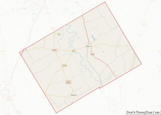
Online Interactive Map
Click on ![]() to view map in "full screen" mode.
to view map in "full screen" mode.
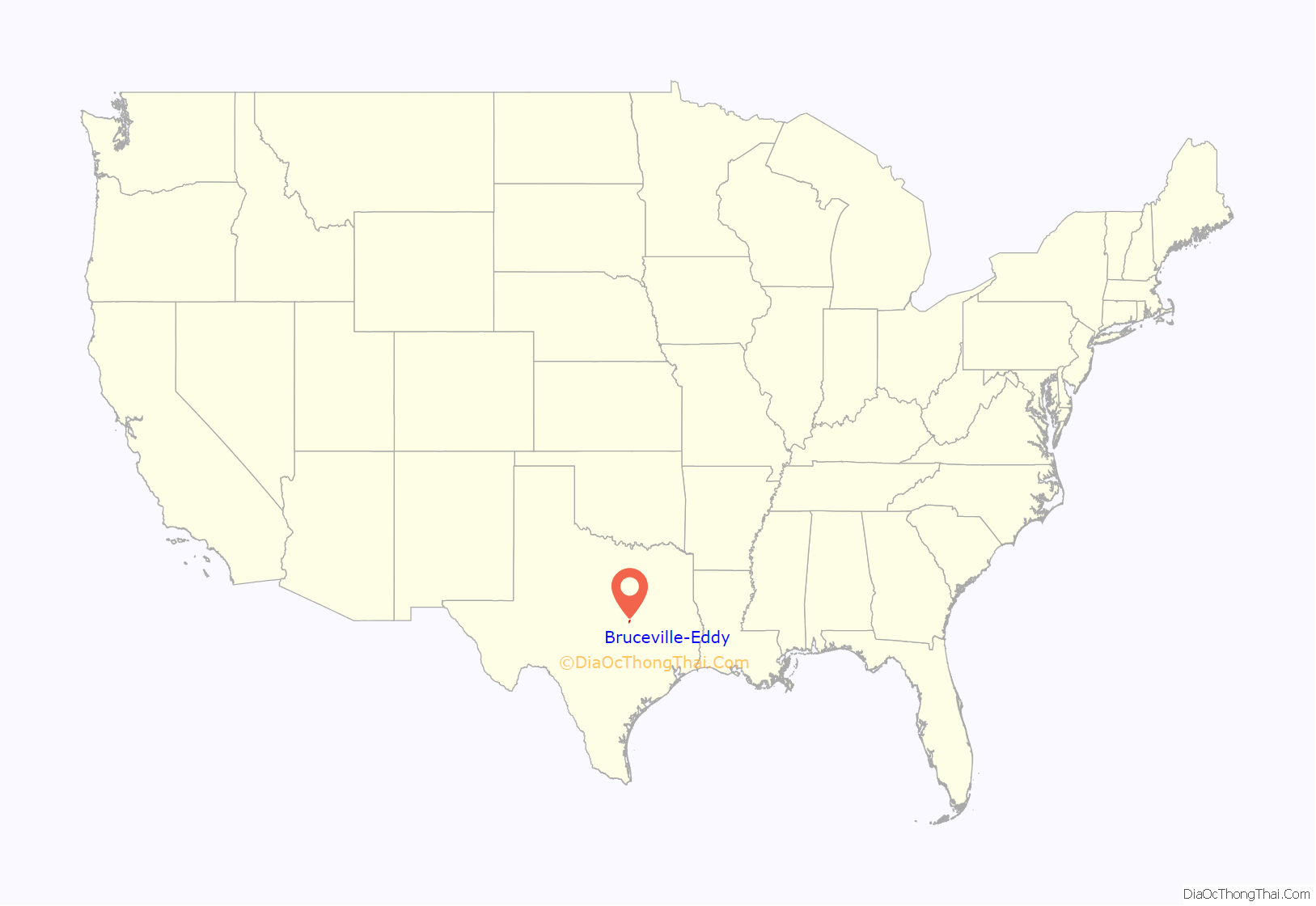
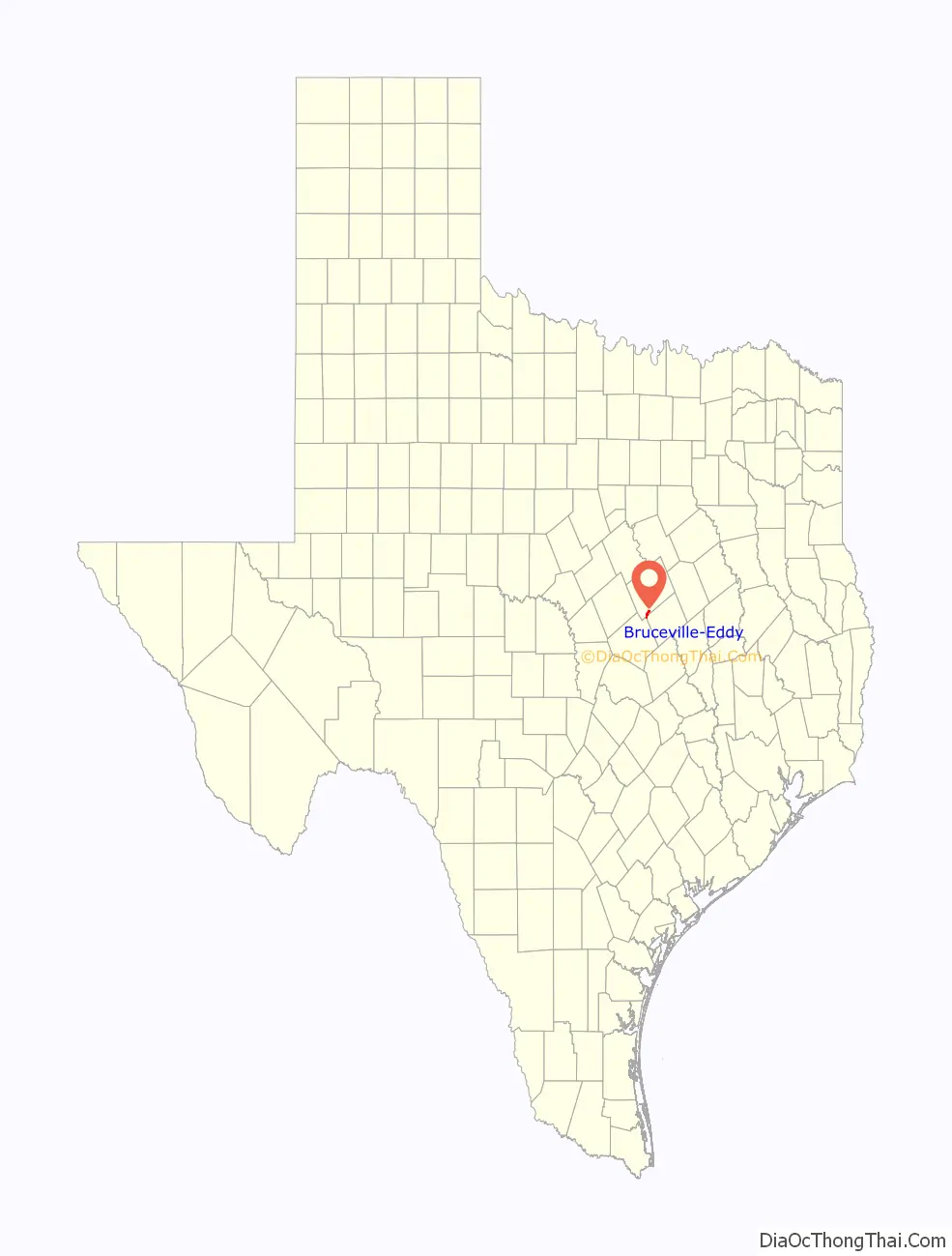
Bruceville-Eddy location map. Where is Bruceville-Eddy city?
History
The community of Bruceville-Eddy began as two separate settlements: Bruceville and Eddy. Both communities became stations on the Missouri–Kansas–Texas Railroad (Katy Railroad) in 1882.
Bruceville
Bruceville was named for Lucien N. Bruce, who donated land for the railroad station. Most of Bruceville’s residents came from the community of Mastersville, located 2 miles to the north, that the railroad had bypassed. By 1900, Bruceville had around 289 residents and several businesses. An independent school district was formed in 1904. A bank operated in Bruceville from 1907 to 1927. The community had a population around 500 during the 1930s and 1940s, but began to decline in the postwar years. By 1964, the number of inhabitants had fallen to 175 and decreased to just 25 in 1970.
Eddy
Initially known as “Marvin”, the community was renamed after the railroad arrived in 1882, to honor rail division superintendent Everett B. Eddy. By the mid-1880s, the community was home to 150 people, three general stores, two churches, a school, and a gristmill. Throughout the 1890s, Eddy continued to experience rapid growth, with some estimates placing the total population as high as 700. A bank opened in 1901 and received a national charter in 1915. In 1928, the schools in Bruceville and Eddy were consolidated, the first such merger in McLennan County. By the late 1920s, Eddy had roughly 450 residents. The population declined to 350 by the mid-1940s, but rose to around 600 in the 1960s as road improvements made commuting easier for locals.
Incorporation
In April 1974, the communities of Bruceville and Eddy incorporated as a single entity known as Bruceville-Eddy. The population stood at 1,038 in 1980 and grew slightly to 1,075 by 1990. That figure rose further, to 1,490, by 2000.
Owing to its unique history, Bruceville-Eddy operated two separate post offices after it was incorporated. Eddy’s post office, located at 100 Franklin Road, operates under the ZIP code 76524. The post office in Bruceville was located at 203 First Street and had the ZIP code 76630. On June 1, 2009, it was closed due to foundation problems that caused the building to be deemed unsafe. All postal operations were transferred to Eddy.
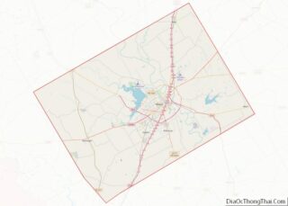
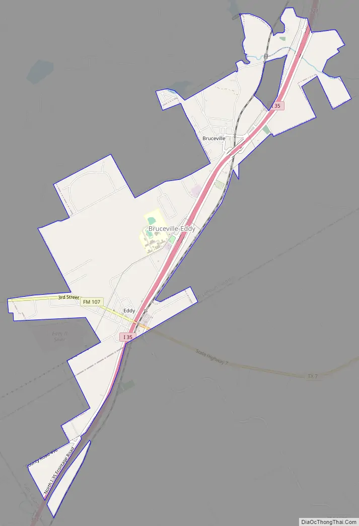
Bruceville-Eddy Road Map
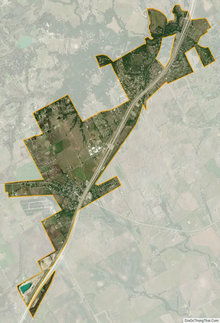
Bruceville-Eddy city Satellite Map
Geography
Bruceville-Eddy is located in southwestern McLennan County at 31°18′20″N 97°14′53″W / 31.30556°N 97.24806°W / 31.30556; -97.24806 (31.305554, –97.247919). It is situated along Interstate 35, 18 miles (29 km) south of Waco and 16 miles (26 km) north of Temple. Access is available from Exit 315 (the Eddy or southern end of town) and Exit 318 (the Bruceville or northern end). Texas State Highway 7 leads east from Exit 315 22 miles (35 km) to Marlin.
According to the United States Census Bureau, the city has a total area of 3.2 square miles (8.3 km), all of it land.
See also
Map of Texas State and its subdivision:- Anderson
- Andrews
- Angelina
- Aransas
- Archer
- Armstrong
- Atascosa
- Austin
- Bailey
- Bandera
- Bastrop
- Baylor
- Bee
- Bell
- Bexar
- Blanco
- Borden
- Bosque
- Bowie
- Brazoria
- Brazos
- Brewster
- Briscoe
- Brooks
- Brown
- Burleson
- Burnet
- Caldwell
- Calhoun
- Callahan
- Cameron
- Camp
- Carson
- Cass
- Castro
- Chambers
- Cherokee
- Childress
- Clay
- Cochran
- Coke
- Coleman
- Collin
- Collingsworth
- Colorado
- Comal
- Comanche
- Concho
- Cooke
- Coryell
- Cottle
- Crane
- Crockett
- Crosby
- Culberson
- Dallam
- Dallas
- Dawson
- Deaf Smith
- Delta
- Denton
- Dewitt
- Dickens
- Dimmit
- Donley
- Duval
- Eastland
- Ector
- Edwards
- El Paso
- Ellis
- Erath
- Falls
- Fannin
- Fayette
- Fisher
- Floyd
- Foard
- Fort Bend
- Franklin
- Freestone
- Frio
- Gaines
- Galveston
- Garza
- Gillespie
- Glasscock
- Goliad
- Gonzales
- Gray
- Grayson
- Gregg
- Grimes
- Guadalupe
- Hale
- Hall
- Hamilton
- Hansford
- Hardeman
- Hardin
- Harris
- Harrison
- Hartley
- Haskell
- Hays
- Hemphill
- Henderson
- Hidalgo
- Hill
- Hockley
- Hood
- Hopkins
- Houston
- Howard
- Hudspeth
- Hunt
- Hutchinson
- Irion
- Jack
- Jackson
- Jasper
- Jeff Davis
- Jefferson
- Jim Hogg
- Jim Wells
- Johnson
- Jones
- Karnes
- Kaufman
- Kendall
- Kenedy
- Kent
- Kerr
- Kimble
- King
- Kinney
- Kleberg
- Knox
- La Salle
- Lamar
- Lamb
- Lampasas
- Lavaca
- Lee
- Leon
- Liberty
- Limestone
- Lipscomb
- Live Oak
- Llano
- Loving
- Lubbock
- Lynn
- Madison
- Marion
- Martin
- Mason
- Matagorda
- Maverick
- McCulloch
- McLennan
- McMullen
- Medina
- Menard
- Midland
- Milam
- Mills
- Mitchell
- Montague
- Montgomery
- Moore
- Morris
- Motley
- Nacogdoches
- Navarro
- Newton
- Nolan
- Nueces
- Ochiltree
- Oldham
- Orange
- Palo Pinto
- Panola
- Parker
- Parmer
- Pecos
- Polk
- Potter
- Presidio
- Rains
- Randall
- Reagan
- Real
- Red River
- Reeves
- Refugio
- Roberts
- Robertson
- Rockwall
- Runnels
- Rusk
- Sabine
- San Augustine
- San Jacinto
- San Patricio
- San Saba
- Schleicher
- Scurry
- Shackelford
- Shelby
- Sherman
- Smith
- Somervell
- Starr
- Stephens
- Sterling
- Stonewall
- Sutton
- Swisher
- Tarrant
- Taylor
- Terrell
- Terry
- Throckmorton
- Titus
- Tom Green
- Travis
- Trinity
- Tyler
- Upshur
- Upton
- Uvalde
- Val Verde
- Van Zandt
- Victoria
- Walker
- Waller
- Ward
- Washington
- Webb
- Wharton
- Wheeler
- Wichita
- Wilbarger
- Willacy
- Williamson
- Wilson
- Winkler
- Wise
- Wood
- Yoakum
- Young
- Zapata
- Zavala
- Alabama
- Alaska
- Arizona
- Arkansas
- California
- Colorado
- Connecticut
- Delaware
- District of Columbia
- Florida
- Georgia
- Hawaii
- Idaho
- Illinois
- Indiana
- Iowa
- Kansas
- Kentucky
- Louisiana
- Maine
- Maryland
- Massachusetts
- Michigan
- Minnesota
- Mississippi
- Missouri
- Montana
- Nebraska
- Nevada
- New Hampshire
- New Jersey
- New Mexico
- New York
- North Carolina
- North Dakota
- Ohio
- Oklahoma
- Oregon
- Pennsylvania
- Rhode Island
- South Carolina
- South Dakota
- Tennessee
- Texas
- Utah
- Vermont
- Virginia
- Washington
- West Virginia
- Wisconsin
- Wyoming