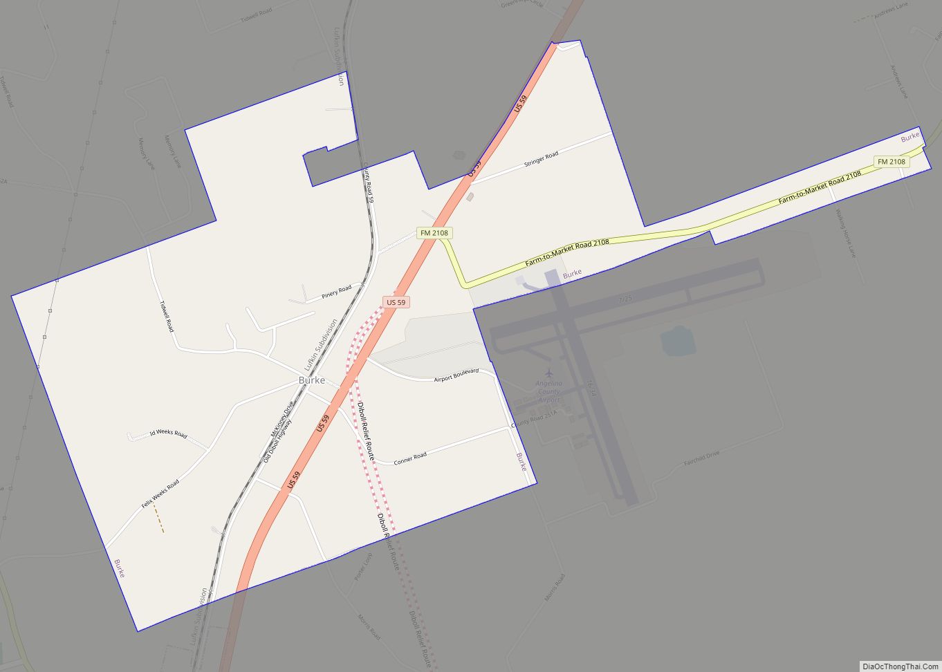
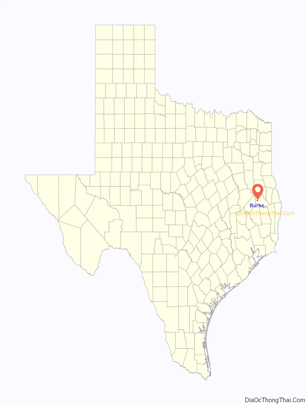
Burke is a city in southwestern Angelina County, Texas, United States. The population was 737 at the 2010 census.
| Name: | Burke city |
|---|---|
| LSAD Code: | 25 |
| LSAD Description: | city (suffix) |
| State: | Texas |
| County: | Angelina County |
| Elevation: | 272 ft (83 m) |
| Total Area: | 2.85 sq mi (7.37 km²) |
| Land Area: | 2.82 sq mi (7.29 km²) |
| Water Area: | 0.03 sq mi (0.08 km²) |
| Total Population: | 737 |
| Population Density: | 258.17/sq mi (99.69/km²) |
| Area code: | 936 |
| FIPS code: | 4811380 |
| GNISfeature ID: | 1381555 |
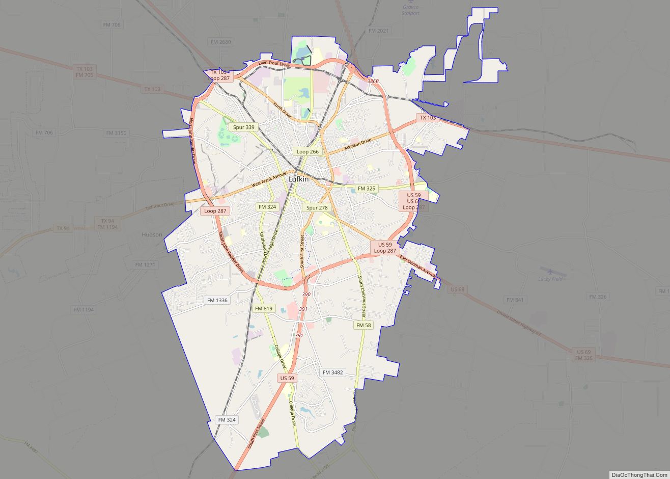
Online Interactive Map
Click on ![]() to view map in "full screen" mode.
to view map in "full screen" mode.
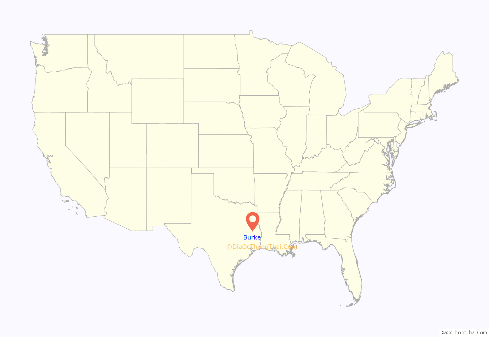
Burke location map. Where is Burke city?
History
Burke was founded in 1881 when construction of the Houston, East and West Texas Railway reached the western edge of Bradley Prairie. The town was originally named Rhodes for general store owner W. R. Rhodes and postmaster H. R. Rhodes, but about 1885 it was renamed for Edmund L. Burke, a railroad employee who directed the railroad survey.
By 1885 Burke had three sawmills, three cotton gins, a church, and a school. In 1886 it received a post office, which remained there until 1955. By 1888 it had a larger school, three general stores, a drugstore, a sawmill, a dentist and watchmaker, and a Farmers’ Alliance store. In 1897 Burke had an estimated population of 650. By 1904 Burke’s population had declined to 161, due to the rise of Lufkin, eight miles north, as an industrial center for the county. However, by 1915 the population had risen to 200, and by 1925 it reached 300. The Burke Methodist Church was organized in 1899–1900, and the First Baptist Church of Burke in 1905.
Education was a priority at Burke. The first school, a one-room structure, was enlarged to three rooms within a few years. Voters approved a bond in 1910 to erect a brick schoolhouse for grades one through seven. The brick building was torn down in 1935 and replaced with a larger schoolhouse built with Works Progress Administration funds. The Burke Independent School District consolidated with the Diboll schools in 1964.
Burke was incorporated as a city in 1966, and a municipal water system was constructed. Burke had a population of 322 in 1980 and 314 in 1990.
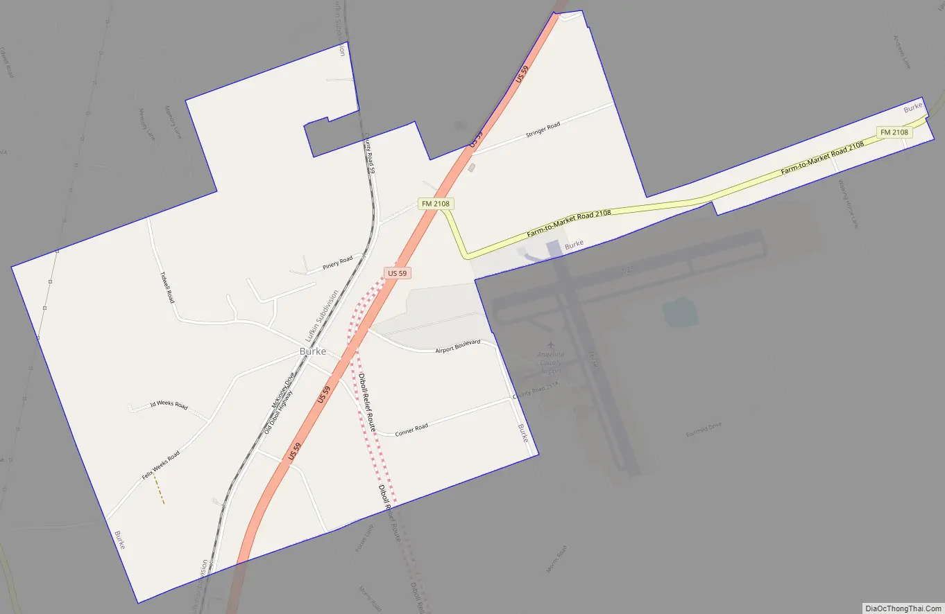
Burke Road Map
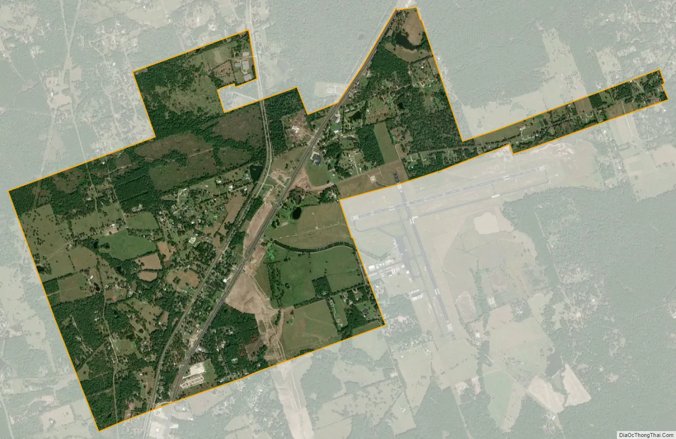
Burke city Satellite Map
Geography
Burke is located at 31°14′9″N 94°45′54″W / 31.23583°N 94.76500°W / 31.23583; -94.76500 (31.235704, –94.764849). According to the United States Census Bureau, the city has a total area of 2.8 square miles (7.3 km), of which, 2.77 square miles (7.2 km) of it is land and 0.03 square miles (0.078 km) is water.
See also
Map of Texas State and its subdivision:- Anderson
- Andrews
- Angelina
- Aransas
- Archer
- Armstrong
- Atascosa
- Austin
- Bailey
- Bandera
- Bastrop
- Baylor
- Bee
- Bell
- Bexar
- Blanco
- Borden
- Bosque
- Bowie
- Brazoria
- Brazos
- Brewster
- Briscoe
- Brooks
- Brown
- Burleson
- Burnet
- Caldwell
- Calhoun
- Callahan
- Cameron
- Camp
- Carson
- Cass
- Castro
- Chambers
- Cherokee
- Childress
- Clay
- Cochran
- Coke
- Coleman
- Collin
- Collingsworth
- Colorado
- Comal
- Comanche
- Concho
- Cooke
- Coryell
- Cottle
- Crane
- Crockett
- Crosby
- Culberson
- Dallam
- Dallas
- Dawson
- Deaf Smith
- Delta
- Denton
- Dewitt
- Dickens
- Dimmit
- Donley
- Duval
- Eastland
- Ector
- Edwards
- El Paso
- Ellis
- Erath
- Falls
- Fannin
- Fayette
- Fisher
- Floyd
- Foard
- Fort Bend
- Franklin
- Freestone
- Frio
- Gaines
- Galveston
- Garza
- Gillespie
- Glasscock
- Goliad
- Gonzales
- Gray
- Grayson
- Gregg
- Grimes
- Guadalupe
- Hale
- Hall
- Hamilton
- Hansford
- Hardeman
- Hardin
- Harris
- Harrison
- Hartley
- Haskell
- Hays
- Hemphill
- Henderson
- Hidalgo
- Hill
- Hockley
- Hood
- Hopkins
- Houston
- Howard
- Hudspeth
- Hunt
- Hutchinson
- Irion
- Jack
- Jackson
- Jasper
- Jeff Davis
- Jefferson
- Jim Hogg
- Jim Wells
- Johnson
- Jones
- Karnes
- Kaufman
- Kendall
- Kenedy
- Kent
- Kerr
- Kimble
- King
- Kinney
- Kleberg
- Knox
- La Salle
- Lamar
- Lamb
- Lampasas
- Lavaca
- Lee
- Leon
- Liberty
- Limestone
- Lipscomb
- Live Oak
- Llano
- Loving
- Lubbock
- Lynn
- Madison
- Marion
- Martin
- Mason
- Matagorda
- Maverick
- McCulloch
- McLennan
- McMullen
- Medina
- Menard
- Midland
- Milam
- Mills
- Mitchell
- Montague
- Montgomery
- Moore
- Morris
- Motley
- Nacogdoches
- Navarro
- Newton
- Nolan
- Nueces
- Ochiltree
- Oldham
- Orange
- Palo Pinto
- Panola
- Parker
- Parmer
- Pecos
- Polk
- Potter
- Presidio
- Rains
- Randall
- Reagan
- Real
- Red River
- Reeves
- Refugio
- Roberts
- Robertson
- Rockwall
- Runnels
- Rusk
- Sabine
- San Augustine
- San Jacinto
- San Patricio
- San Saba
- Schleicher
- Scurry
- Shackelford
- Shelby
- Sherman
- Smith
- Somervell
- Starr
- Stephens
- Sterling
- Stonewall
- Sutton
- Swisher
- Tarrant
- Taylor
- Terrell
- Terry
- Throckmorton
- Titus
- Tom Green
- Travis
- Trinity
- Tyler
- Upshur
- Upton
- Uvalde
- Val Verde
- Van Zandt
- Victoria
- Walker
- Waller
- Ward
- Washington
- Webb
- Wharton
- Wheeler
- Wichita
- Wilbarger
- Willacy
- Williamson
- Wilson
- Winkler
- Wise
- Wood
- Yoakum
- Young
- Zapata
- Zavala
- Alabama
- Alaska
- Arizona
- Arkansas
- California
- Colorado
- Connecticut
- Delaware
- District of Columbia
- Florida
- Georgia
- Hawaii
- Idaho
- Illinois
- Indiana
- Iowa
- Kansas
- Kentucky
- Louisiana
- Maine
- Maryland
- Massachusetts
- Michigan
- Minnesota
- Mississippi
- Missouri
- Montana
- Nebraska
- Nevada
- New Hampshire
- New Jersey
- New Mexico
- New York
- North Carolina
- North Dakota
- Ohio
- Oklahoma
- Oregon
- Pennsylvania
- Rhode Island
- South Carolina
- South Dakota
- Tennessee
- Texas
- Utah
- Vermont
- Virginia
- Washington
- West Virginia
- Wisconsin
- Wyoming