Celina (/sɪˈlaɪnə/ sil-EYE-nə) is a city in Collin and Denton counties in the U.S. state of Texas. Celina is part of the Dallas–Fort Worth metroplex and is nestled between the major arteries of Texas State Highway 289 (Preston Road) to the east and the future Dallas North Tollway to the west; Celina is approximately 40 miles north of Dallas.
According to the 2020 U.S. census, the population of Celina was 16,739. The Dallas Business Journal has ranked Celina as the fastest-growing city in the Dallas–Fort Worth metroplex for three consecutive years (2019-2021). The population growth rate of Celina was 50.8% from 2015 to 2019. Celina’s maximum project buildout population is approximately 378,000.
Celina is the 1st gigabit city in the State of Texas and was recognized by Texas Governor Greg Abbott in May 2022. In 2017, Celina passed a gigabit city ordinance, which was an innovative initiative to provide fiber, gigabit internet sped to all of its residential homes. As of 2021, approximately 9,300 homes have high speed fiber internet, and residents have pure fiber network with unlimited bandwidth and speeds of 1,000 megabits per second.
| Name: | Celina city |
|---|---|
| LSAD Code: | 25 |
| LSAD Description: | city (suffix) |
| State: | Texas |
| County: | Collin County, Denton County |
| Elevation: | 673 ft (205 m) |
| Total Area: | 31.21 sq mi (80.83 km²) |
| Land Area: | 30.93 sq mi (80.10 km²) |
| Water Area: | 0.28 sq mi (0.73 km²) |
| Total Population: | 16,739 |
| Population Density: | 527.03/sq mi (203.49/km²) |
| ZIP code: | 75009 |
| Area code: | 972 |
| FIPS code: | 4813684 |
| GNISfeature ID: | 2409421 |
Online Interactive Map
Click on ![]() to view map in "full screen" mode.
to view map in "full screen" mode.
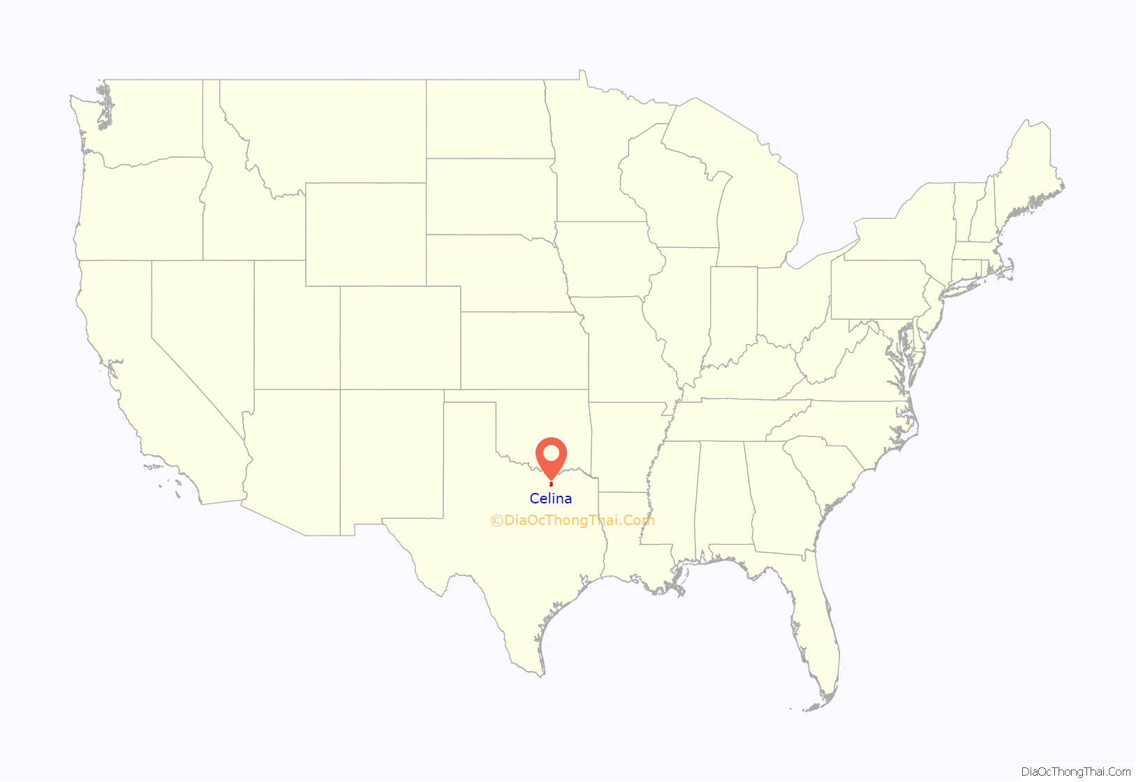
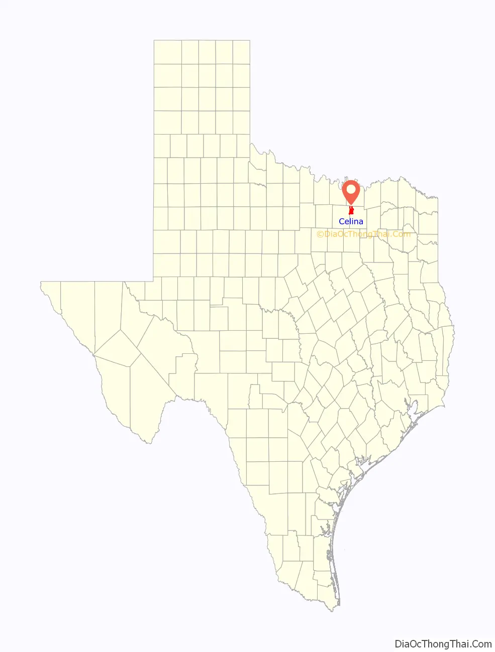
Celina location map. Where is Celina city?
History
Although Celina was not established until 1876, settlers came into the area at a much earlier date. In October 1879, a settlement formed 1 mi (1.6 km) south of its current location. A Methodist church was built in 1880, and it doubled as a schoolhouse for a short time. Celina’s first postmaster John T. Mulkey renamed the town after his hometown – Celina, Tennessee. By 1884, Celina a gristmill, cotton gin, school, several general stores, and a drug store that has been opened in “Old Celina.”
In 1902, news had reached Celina that the St. Louis, San Francisco, and Texas Railway would be constructed and extended to reach the area. Shortly thereafter, the merchants of the town made the decision to move the entire town closer to the railway. When the time came to move, the businesses and houses were loaded onto rollers and moved 1 mi (1.6 km) north to be closer to the railway. The town coined itself “Rollertown.” The move was completed in February 1902.
A town site company secured land for the new “Celina,” which was part of a pasture belonging to the late William Willock. The company had taken fences down, marked off streets, and placed lots for sale. Originally, it was intended that the current Main Street would be the Main Street of the town so it was made wider than the other streets and the price of lots were higher. Because of the higher price, the merchants began locating north of Main Street and west of the railroad. In 1907, the town was officially incorporated with Will Newsom serving as the first mayor.
In 1910, Celina resident J. Fred Smith (who later became the first mayor of University Park in Dallas) had the business section rebuilt from a row of frame buildings facing the railroad tracks to uniform brick buildings around a square. By July 1911, Smith’s effort had paid off as several new buildings were ready for use and gravel streets were constructed, which gave Celina the appearance of a wide-awake, growing little city. Businesses began to relocate from their wooden structures into the new brick buildings, and many of the wooden structures moved into a residential section and transformed into homes. This was a pivotal moment in Celina’s character as it marked the shift towards the brick features that define the Downtown Square today.
Celina Pike, the first road in the county built exclusively for automobiles, opened in Celina in 1915. At that time, Celina had a newspaper, two banks, and municipal water works. In 1921, Lone Star Gas organized Farmers Gas Company to provide natural gas to Celina and other small rural towns. In 1924, Texas Power and Light began supplying electricity to Celina then replaced by Grayson-Collin Electric Cooperative in 1937.
By 1937, Celina had a variety of businesses and professional services, including a dry good store, seven gas stations, three cotton gins, two drug stores, two grain elevators, two ice houses, flour mill, laundry, lumber yard, shoe and harness shop, jewelry store, blacksmith, movie theatre, and a modern brick school building. During World War II, the diversification of commerce in the Downtown Square continued as it served as a collection points for scrap iron.
An excerpt from the Celina Record in 1937 states: If you are casting about for a good place to make your home you should visit Celina and see for yourself what it has to offer. Some here occasionally say the grass is greener elsewhere and move away, but most of them decide there is no use trying to find a better place in which to live and rear their families, come back, and settle down firmly fixed in their belief that trying is a waste of time.
Fast forward to 2000, there were 135 businesses and 1,861 residents residing in Celina. Today, the Historic Downtown Square still houses a number of the original buildings that are either adjacent or around the Square from over a century ago. These original structures serve as an excellent representation of the historic charm of Celina. The Huddleston Building, which is located on the Downtown Square, is an example of how a building can be modernized while also retaining the historic, rural feel. This renovation project received the “Best New Construction in Cities under 50,000 Award” from the Texas Downtown Association.
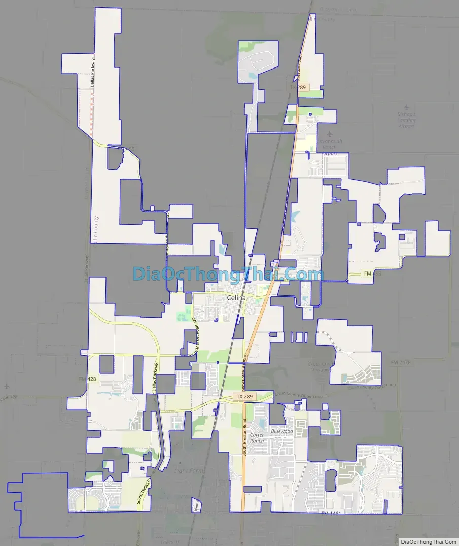
Celina Road Map
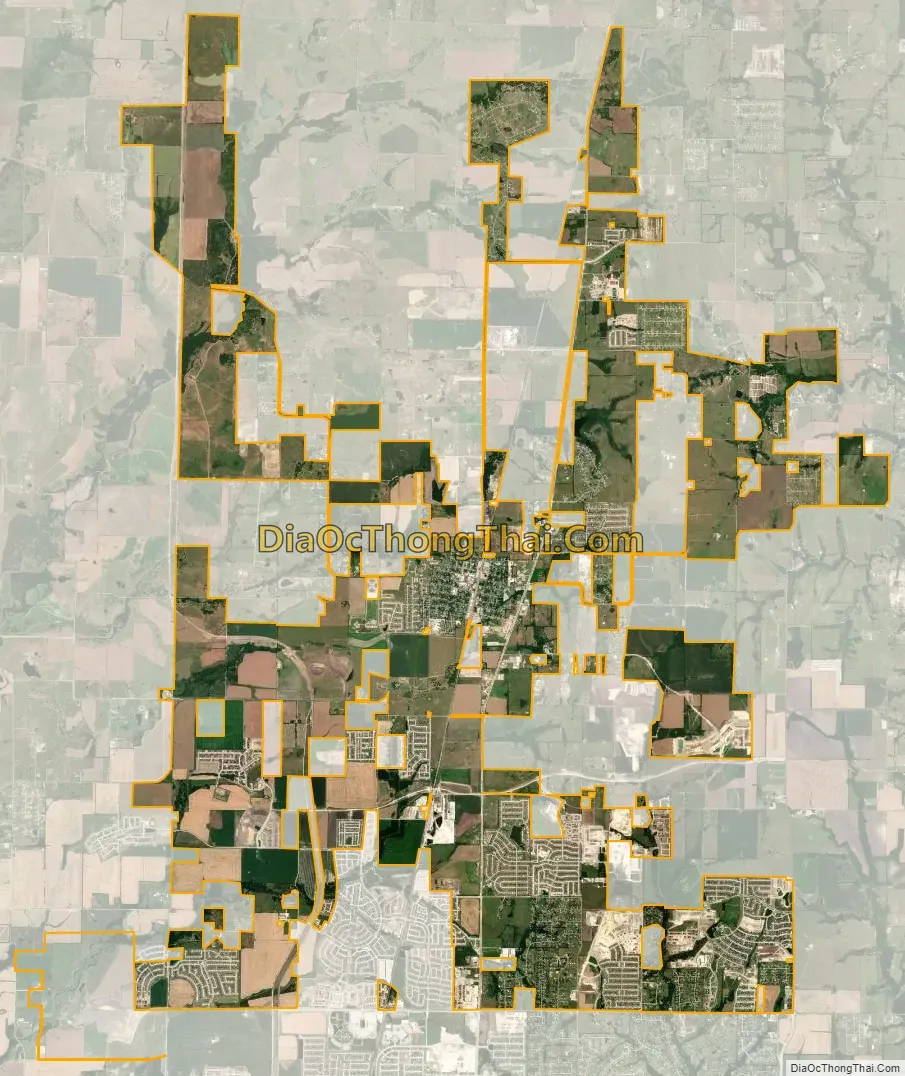
Celina city Satellite Map
Geography
Celina is located in Collin County and Denton County. Celina is centered mostly on State Highway 289 with its downtown located west of the state highway. The Dallas North Tollway will be located to the west of the city. According to the 2020 U.S. Census Bureau, Celina has a total area of 42 sq mi (110 km), which includes 41.72 sq mi (108.1 km) of land and 0.28 sq mi (0.73 km) of water. The total boundary of the city, including parts of the city that are not in its limits, is 78 sq mi (200 km).
Climate
The climate in this area is characterized by hot, humid summers and generally mild to cool winters. According to the Koppen Climate Classification System, Celina has a humid subtropical climate, abbreviated “Cfa” on climate maps.
See also
Map of Texas State and its subdivision:- Anderson
- Andrews
- Angelina
- Aransas
- Archer
- Armstrong
- Atascosa
- Austin
- Bailey
- Bandera
- Bastrop
- Baylor
- Bee
- Bell
- Bexar
- Blanco
- Borden
- Bosque
- Bowie
- Brazoria
- Brazos
- Brewster
- Briscoe
- Brooks
- Brown
- Burleson
- Burnet
- Caldwell
- Calhoun
- Callahan
- Cameron
- Camp
- Carson
- Cass
- Castro
- Chambers
- Cherokee
- Childress
- Clay
- Cochran
- Coke
- Coleman
- Collin
- Collingsworth
- Colorado
- Comal
- Comanche
- Concho
- Cooke
- Coryell
- Cottle
- Crane
- Crockett
- Crosby
- Culberson
- Dallam
- Dallas
- Dawson
- Deaf Smith
- Delta
- Denton
- Dewitt
- Dickens
- Dimmit
- Donley
- Duval
- Eastland
- Ector
- Edwards
- El Paso
- Ellis
- Erath
- Falls
- Fannin
- Fayette
- Fisher
- Floyd
- Foard
- Fort Bend
- Franklin
- Freestone
- Frio
- Gaines
- Galveston
- Garza
- Gillespie
- Glasscock
- Goliad
- Gonzales
- Gray
- Grayson
- Gregg
- Grimes
- Guadalupe
- Hale
- Hall
- Hamilton
- Hansford
- Hardeman
- Hardin
- Harris
- Harrison
- Hartley
- Haskell
- Hays
- Hemphill
- Henderson
- Hidalgo
- Hill
- Hockley
- Hood
- Hopkins
- Houston
- Howard
- Hudspeth
- Hunt
- Hutchinson
- Irion
- Jack
- Jackson
- Jasper
- Jeff Davis
- Jefferson
- Jim Hogg
- Jim Wells
- Johnson
- Jones
- Karnes
- Kaufman
- Kendall
- Kenedy
- Kent
- Kerr
- Kimble
- King
- Kinney
- Kleberg
- Knox
- La Salle
- Lamar
- Lamb
- Lampasas
- Lavaca
- Lee
- Leon
- Liberty
- Limestone
- Lipscomb
- Live Oak
- Llano
- Loving
- Lubbock
- Lynn
- Madison
- Marion
- Martin
- Mason
- Matagorda
- Maverick
- McCulloch
- McLennan
- McMullen
- Medina
- Menard
- Midland
- Milam
- Mills
- Mitchell
- Montague
- Montgomery
- Moore
- Morris
- Motley
- Nacogdoches
- Navarro
- Newton
- Nolan
- Nueces
- Ochiltree
- Oldham
- Orange
- Palo Pinto
- Panola
- Parker
- Parmer
- Pecos
- Polk
- Potter
- Presidio
- Rains
- Randall
- Reagan
- Real
- Red River
- Reeves
- Refugio
- Roberts
- Robertson
- Rockwall
- Runnels
- Rusk
- Sabine
- San Augustine
- San Jacinto
- San Patricio
- San Saba
- Schleicher
- Scurry
- Shackelford
- Shelby
- Sherman
- Smith
- Somervell
- Starr
- Stephens
- Sterling
- Stonewall
- Sutton
- Swisher
- Tarrant
- Taylor
- Terrell
- Terry
- Throckmorton
- Titus
- Tom Green
- Travis
- Trinity
- Tyler
- Upshur
- Upton
- Uvalde
- Val Verde
- Van Zandt
- Victoria
- Walker
- Waller
- Ward
- Washington
- Webb
- Wharton
- Wheeler
- Wichita
- Wilbarger
- Willacy
- Williamson
- Wilson
- Winkler
- Wise
- Wood
- Yoakum
- Young
- Zapata
- Zavala
- Alabama
- Alaska
- Arizona
- Arkansas
- California
- Colorado
- Connecticut
- Delaware
- District of Columbia
- Florida
- Georgia
- Hawaii
- Idaho
- Illinois
- Indiana
- Iowa
- Kansas
- Kentucky
- Louisiana
- Maine
- Maryland
- Massachusetts
- Michigan
- Minnesota
- Mississippi
- Missouri
- Montana
- Nebraska
- Nevada
- New Hampshire
- New Jersey
- New Mexico
- New York
- North Carolina
- North Dakota
- Ohio
- Oklahoma
- Oregon
- Pennsylvania
- Rhode Island
- South Carolina
- South Dakota
- Tennessee
- Texas
- Utah
- Vermont
- Virginia
- Washington
- West Virginia
- Wisconsin
- Wyoming


